Embed Size (px)
Citation preview
June 2014
Coastal Zone Management Act Section 309 Program Guidance
2016 to 2020 Enhancement Cycle
National Oceanic and Atmospheric Administration
National Ocean Service
Office of Ocean and Coastal Resource Management

Table of Contents
1. Overview of Section 309 Enhancement Program and Guidance ......................................... 1
About the Section 309 Enhancement Program .................................................................................................. 1 About This Guidance ........................................................................................................................................... 1
2. Timeline for 2016-2020 Program Enhancement Cycle ........................................................ 2
3. Allowable Uses for Section 309 Enhancement Program Funds ........................................... 3
Eligible States ...................................................................................................................................................... 3 Eligible Activities ................................................................................................................................................. 3 Allowable Costs ................................................................................................................................................... 4 Use of Sections 306 and 310 and Other Funding to Support Section 309 Strategies ......................................... 5
4. National Priorities for Section 309 Enhancement Program ................................................. 5
5. Allocation of Section 309 Funds ......................................................................................... 6
Weighted Formula Funding ................................................................................................................................ 6 Projects of Special Merit ..................................................................................................................................... 7 Determining the Annual Set-Aside for Projects of Special Merit ........................................................................ 7
6. Assessment and Strategy Development Process ................................................................ 8
Phase I (High-Level) Assessment ......................................................................................................................... 8 Phase II (In-Depth) Assessment .......................................................................................................................... 9 Strategy ............................................................................................................................................................. 11
7. Stakeholder and Public Engagement ................................................................................ 11
Stakeholder Engagement .................................................................................................................................. 12 Public Participation ........................................................................................................................................... 12
8. Section 309 Assessment and Strategy Format .................................................................. 13
Introduction ...................................................................................................................................................... 13 Summary of Recent Section 309 Achievements ............................................................................................... 13 Assessment ....................................................................................................................................................... 13 Strategy ............................................................................................................................................................. 13 Summary of Stakeholder and Public Comment ................................................................................................ 13
9. Submission and Review of Section 309 Assessment and Strategy .................................... 14
Submission of Section 309 Assessment and Strategy ....................................................................................... 14 OCRM Review of Section 309 Assessment and Strategy .................................................................................. 14
10. Process for Revising Approved Section 309 Assessment and Strategies ........................... 16
Appendix A: Phase I Assessment Templates .......................................................................... 18
Wetlands ........................................................................................................................................................... 19 Coastal Hazards ................................................................................................................................................. 23 Public Access ..................................................................................................................................................... 29 Marine Debris ................................................................................................................................................... 33 Cumulative and Secondary Impacts .................................................................................................................. 36
Special Area Management Planning ................................................................................................................. 42 Ocean and Great Lakes Resources .................................................................................................................... 44 Energy and Government Facility Siting ............................................................................................................. 49 Aquaculture…………………………………………………………………………………………………………………………………………….53
Appendix B: Phase II Assessment Templates ......................................................................... 55
Wetlands ........................................................................................................................................................... 56 Coastal Hazards ................................................................................................................................................. 59 Public Access ..................................................................................................................................................... 63 Marine Debris ................................................................................................................................................... 66 Cumulative and Secondary Impacts .................................................................................................................. 69 Special Area Management Planning ................................................................................................................. 72 Ocean and Great Lakes Resources .................................................................................................................... 75 Energy and Government Facility Siting ............................................................................................................. 78 Aquaculture ...................................................................................................................................................... 81
Appendix C: Strategy Template ............................................................................................. 84
Appendix D: Types of Program Changes ................................................................................ 88
Wetlands ........................................................................................................................................................... 88 Coastal Hazards ................................................................................................................................................. 89 Public Access ..................................................................................................................................................... 90 Marine Debris ................................................................................................................................................... 92 Cumulative and Secondary Impacts .................................................................................................................. 92 Special Area Management Planning ................................................................................................................. 93 Ocean and Great Lakes Resources .................................................................................................................... 93 Energy and Government Facility Siting ............................................................................................................. 94 Aquaculture ...................................................................................................................................................... 95
Appendix E: Example Program Changes ................................................................................. 96
Introduction ...................................................................................................................................................... 96 Status and Trends of Inland Wetlands and Aquatic Habitats ........................................................................... 96 Adoption of Refined Coastal Goals ................................................................................................................... 97 Significant Coastal Fish and Wildlife Habitats ................................................................................................... 98 Beneficial Use of Dredge Material Contribution Fund ...................................................................................... 99 Model Post Disaster Redevelopment Plans .................................................................................................... 100 Metro Bay SAMP Urban Coastal Greenway .................................................................................................... 100 Guidance Document on Coordinated Aquaculture Permitting ....................................................................... 101 Implementing Legislative Changes to the Shoreline Master Program Guidelines .......................................... 102
Appendix F: Example Stakeholder Questions ....................................................................... 104

1. Overview of Section 309 Enhancement Program and Guidance
About the Section 309 Enhancement Program The Coastal Zone Enhancement Program encourages state and territorial coastal management programs to strengthen and improve their federally approved coastal management programs in one or more of nine areas. These “enhancement areas” include wetlands, coastal hazards, public access, marine debris, cumulative and secondary impacts, special area management plans, ocean and Great Lakes resources, energy and government facility siting, and aquaculture. The enhancement program was established under Section 309 of the Coastal Zone Management Act (CZMA), as amended.
Every five years, states and territories are encouraged to conduct self-assessments of their coastal management programs to determine problems and enhancement opportunities within each of the nine enhancement areas—and to assess the effectiveness of existing management efforts to address identified problems. Each coastal management program identifies high priority management issues as well as important needs and information gaps the program must fill to address these issues.
Following this self-assessment, NOAA’s Office of Ocean and Coastal Resource Management (OCRM), works closely with each coastal management program to further identify the high priority needs for improvement within one or more of the nine areas. The coastal management program then develops strategies, consulting with OCRM, to improve its operations to address these management needs. The strategies provide a stepwise approach to reach a stated goal and lead to enhancement in the state’s or territory’s federally approved coastal management program.
OCRM reviews and approves the Section 309 “assessment and strategy” document for each state and territory and, after approval, provides funding under Section 309 to help them carry out those strategies.
About This Guidance This document provides guidance to state and territorial coastal management programs about the Section 309 Enhancement Program for the fiscal year (FY) 2016-2020 assessment and strategy cycle and complements the Section 309 regulations (15 C.F.R. sec. 923, subpart K). The guidance includes information on these areas:
• Timeline for developing the next round of assessment and strategy reports • Activities eligible for Section 309 funding • National priorities for the Section 309 Enhancement Program • Allocation of Section 309 funding • Process, format, and content for an assessment and strategy report • Public and stakeholder engagement process • Submission and approval process for assessments and strategies • Revision process for approved assessments and strategies
This guidance supersedes previously issued Section 309 Enhancement Program guidance.
1

CZMA Section 309 Program Guidance: 2016 to 2020 Cycle
2. Timeline for 2016-2020 Program Enhancement Cycle The table below outlines the schedule used in finalizing this guidance and in carrying out the FY 2016-2020 assessment and strategy process. If circumstances prevent OCRM or the coastal management programs from being able to meet any of these deadlines—such as significantly delayed appropriations—OCRM will adjust the timeline and send notice.
Timeline for Completion of Section 309 Guidance and Assessment and Strategy Development
July 1 States October 1 States
OCRM issues draft Section 309 guidance Week of January 20, 2014
Comments on draft Section 309 guidance due March 14, 2014
OCRM issues final Section 309 guidance June 30, 2014
Coastal management programs (CMPs) begin developing their assessment and strategy:
• CMPs engage key stakeholders • OCRM and CMPs work together to
identify high priority enhancement areas and develop strategies
July 1, 2014 October 1, 2014
Draft assessment and strategy due February 1, 2015 May 1, 2015
OCRM provides comments to CMPs on draft assessment and strategy April 1, 2015 July 1, 2015
Final assessment and strategy due June 1, 2015 September 1, 2015
OCRM approves final assessment and strategy August 1, 2015 November 1, 2015
OCRM issues federal funding opportunity for FY 2016 Project of Special Merit (PSM) Competition (tentative)
Late summer or fall 2015
Proposals for FY 2016 PSM Competition due (tentative) Late fall 2015 (not before November 1, 2015)
CMPs begin carrying out FY 2016-2020 strategies July 1, 2016 October 1, 2016
OCRM issues FY 2016 PSM awards October 1, 2016
2

CZMA Section 309 Program Guidance: 2016 to 2020 Cycle
3. Allowable Uses for Section 309 Enhancement Program Funds
Eligible States While participation in the Section 309 Enhancement Program is voluntary, OCRM strongly encourages all states and territories to develop an assessment and strategy to improve and strengthen their federally approved coastal management program (CMP). Only CMPs that successfully develop an approved FY 2016-2020 assessment and strategy will be eligible to receive Section 309 funding in FY 2016-2020.
Eligible Activities The following activities are eligible for Section 309 funding:
1. Development of the Assessment and Strategy CMPs may use Section 309 funds to develop their Section 309 assessment and strategy. This funding may also be used to revise the assessment and strategy, as needed, during the five-year cycle.
2. Carrying out Strategies and Development and Submission of Program Changes CMPS may use Section 309 funding to carry out federally approved Section 309 strategies that are designed to lead to a program change. However, the program change does not necessarily need to be achieved during the five-year assessment and strategy cycle because various political and other factors may be outside the CMP’s control. When appropriate, program changes should be submitted for incorporation into the state’s or territory’s federally approved CMP (in accordance with regulations at 15 CFR part 923, subpart H). Section 309 funding can be used to submit a program change to OCRM for review and approval if the change was achieved through the assessment and strategy process. A program change is a change to a state’s or territory’s federally-approved coastal management program. Defined in 15 CFR 923.123, program changes include the following:
• A change to coastal zone boundaries that will improve a state’s ability to achieve one or more of the enhancement objectives.
• New or revised authorities, including statutes, regulations, enforceable policies, administrative decisions, executive orders, and memoranda of agreement or understanding, that will improve a state’s ability to achieve one or more of the enhancement objectives.
• New or revised local coastal programs and implementing ordinances that will improve a state’s ability to achieve one or more of the enhancement objectives.
• New or revised coastal land acquisition, management, and restoration programs that improve a state’s ability to attain one or more of the enhancement objectives.
• New or revised special area management plans or plans for areas of particular concern (APC), including enforceable policies and other necessary implementing mechanisms or criteria and procedures for designating and managing APCs that will improve a state’s ability to achieve one or more of the enhancement objectives.
• New or revised guidelines, procedures, and policy documents that are formally adopted by a state and provide specific interpretations of enforceable coastal policies to applicants, local governments, and other agencies that will result in meaningful improvements in coastal
3

CZMA Section 309 Program Guidance: 2016 to 2020 Cycle
resource management and that will improve a state’s ability to attain one or more of the enhancement objectives.
OCRM does not consider the following types of state or territorial actions to be program changes:
• Increased staffing or staff reassignments that will not support or result in a program change as defined above.
• Administrative or organizational changes that do not change or improve the state’s coastal management program.
• Educational and outreach materials that are not part of a larger strategy to achieve a program change as defined above.
• Research or mapping efforts that are not part of a larger strategy to achieve a program change as defined above.
• Participation in coordination groups that are not part of a larger strategy to achieve a program change as defined above.
• Technical or financial assistance to local governments that is not part of a focused strategy to develop new or revised local coastal programs or implementing ordinances to achieve a specified enhancement objective.
• Actual land acquisition or low-cost construction projects. (These activities are only eligible for funding under Section 306A.)
Upon completion of an enhancement area strategy, CMPs must provide a summary of the accomplishments to OCRM in the semiannual performance progress report. CMPs must also report on all program changes achieved under Section B of the performance progress report.
3. Implementation of Program Changes Section 309 funds can also be used to implement Section 309 program changes for up to two years after the program change was achieved. Implementation activities include administrative actions to carry out and enforce program change policies, authorities, and other management techniques, including the development, collection, and analysis of measurable management objectives and performance measures. After the initial two-year implementation period, CMPs must use Section 306 funding or other funds to support continued implementation of the program change. All implementation activities need to be described in the strategy (see “Strategy Template,” Appendix C) and must meet the following general requirements:
• Advance the objectives of a high priority 309 enhancement area for the CMP • Relate to at least one 309 program change identified in an approved strategy • Demonstrate cost effectiveness and technical soundness
Allowable Costs Section 309 funds can be used for any of the following uses that support the attainment of a program change and carry out one or more of the eligible Section 309 activities described in the “Eligible Activities” section above:
• Personnel costs • Supplies and overhead • Travel
4
CZMA Section 309 Program Guidance: 2016 to 2020 Cycle
• Equipment (as described in 15 CFR part 24) • Projects, studies, and reports • Contractual costs including subcontracts, subawards, personal service contracts with individuals,
memoranda of agreement or understanding, and other forms of pass-through funding
As with all CZMA funding, Section 309 funding must adhere to OMB-Circular A-87, “Cost Principles for State, Local, and Indian Tribal Governments,” and all other applicable grant and cooperative agreement guidance that the Department of Commerce, NOAA, or OCRM issues. Task descriptions that continue a previous year’s work must describe how the current task is different from and builds on activities funded under the prior year’s award so that it is clear the exact same activities are not being funded two years in a row. Please note that acquisition and low-cost construction projects are not allowable costs for Section 309 funding.
Use of Sections 306 and 310 and Other Funding to Support Section 309 Strategies CZMA Sections 306 and 310 funds, or other non-CZMA funds, may be used to carry out and implement Section 309 strategies. However, activities supported with other funding sources must be distinct from those conducted with Section 309 funding. Task descriptions, milestones, and deliverables must be written clearly to reflect the distinct activities and outcomes that will be achieved under each section of funding in a CMPs annual CZMA cooperative agreement.
4. National Priorities for Section 309 Enhancement Program While the Section 309 Enhancement Program establishes nine enhancement areas, OCRM can choose to designate one or more enhancement areas as “areas of national importance.” Designating areas of national importance helps to further focus Section 309 funding and demonstrate a national impact for the National Coastal Zone Management Program by aligning resources to address one or more critical coastal management issues across the county. While not required to do so, CMPs are strongly encouraged to develop one or more strategies to improve the effectiveness of their program in designated areas of national importance. For the FY 2016-2020 assessment and strategy cycle, “coastal hazards” is designated as the enhancement area of national importance. Therefore, competitive “projects of special merit” funding will be focused on projects that will further the approved strategies related to the coastal hazards enhancement area. The annual federal funding opportunity, or FFO, announcement for the projects of special merit competition may describe how some or all of this funding would be further focused each year to address one or more specific coastal hazards issues, such as supporting hazards resilient planning. OCRM decided to designate coastal hazards as an enhancement area of national importance to align with the “resilient coastal communities” emphasis contained in the office’s new 2014-2019 strategic plan. The strategic plan was developed with feedback from various coastal management stakeholders,
5

CZMA Section 309 Program Guidance: 2016 to 2020 Cycle
including state CMPs. The state Section 309 work group that helped to develop this guidance also identified coastal hazards as the highest priority enhancement area. In addition to coastal hazards, OCRM may choose to designate additional enhancement areas of national importance during the FY 2016-2020 assessment and strategy cycle to address new or emerging issues that may arise. OCRM will work with the Coastal States Organization (CSO) and state CMPs to reevaluate the designated areas of national importance, as needed. Additional enhancement areas may be considered because of feedback from state CMPs or the CSO, changes in the strategic direction of the office or NOAA, or other unforeseen circumstances, including changes in other federal funding programs that may affect the niche the National Coastal Zone Management Program would like to fill with the competitive projects of special merit funding. Any new enhancement areas of national importance would be added to the list of eligible enhancement area strategies that this funding could support. Additional areas of national importance will be announced in the annual federal funding opportunity for the projects of special merit competition.
5. Allocation of Section 309 Funds As required by statute, OCRM must allocate at least 10 percent of the appropriated CZMA Section 306/306A funding to Section 309, although this amount cannot exceed 20 percent of Section 306/306A funding or $10 million, whichever is less. There are two types of Section 309 funding: weighted formula and competitive projects of special merit. Each year, OCRM determines how much Section 309 funding will be set aside for projects of special merit.
Weighted Formula Funding Weighted formula (or base funding) is intended to provide a predictable level of funding over the multi-year strategy period to achieve core milestones. Because weighted formula funding is more predictable than competitively awarded projects of special merit funding, basic functions necessary to achieve the core strategy milestones, such as hiring full-time staff, should use weighted formula funding. Activities supported using weighted formula funding must be critical to meeting the enhancement area strategy milestones and goals and meet the following requirements:
• The project is consistent with the approved assessment and strategy and advances the goals of the strategy;
• Costs are reasonable and necessary to achieve the objectives of both the project and the strategy (see “Allowable Costs” in Section 3);
• The project is technically sound; and • The CMP has an effective work plan to ensure proper and efficient administration of the project
(see “Strategy Template,” Appendix C). OCRM allocates weighted formula funding to CMPs according to the size of their coastal population and length of shoreline, and whether they have an approved assessment and strategy. Weighted formula funding is determined by multiplying the CMP’s base allocation, determined by the formula at Section 923.110(c), by a weighting factor derived from OCRM’s evaluation of the quality of the assessment and strategy. OCRM will assign a weighting factor of zero (0) to CMPs whose assessment and strategy is not acceptable and a weighting factor of one (1) to CMPs with an acceptable, approved assessment and
6

CZMA Section 309 Program Guidance: 2016 to 2020 Cycle
strategy. See “OCRM Review of Section 309 Assessment and Strategies” in Section 9 for a more detailed discussion on the criteria OCRM will use in determining each CMP’s weighting factor.
Projects of Special Merit Funding for projects of special merit is intended to offer CMPs the opportunity to develop innovative projects that will further the approved enhancement area strategies within identified areas of national importance. Projects of special merit funding is awarded competitively and shall not be dependent on long-term levels of funding to succeed. Projects shall further the objectives of an approved enhancement area strategy but shall not be essential to meeting specific milestones in the strategy; therefore, these projects are not expected to, by themselves, accomplish a program change. These projects will be evaluated and ranked equally on merit using criteria identified within the published federal funding opportunity notice. In general, the projects will be scored on merit, technical, and financial criteria, such as the following:
• Likelihood the project would help to make substantial progress toward achieving the program changes and strategy goals of an approved strategy for an enhancement area of national importance;
• Likelihood that the project would result in improved management of ocean and coastal resources and uses and provide public benefit;
• Level of innovativeness; • Transferability of the results to solve coastal management issues in other coastal states and
territories; and • Past performance under Section 309; OCRM will notify any CMPs of findings of poor past
performance that may significantly affect the evaluation of projects of special merit proposals. In the past, funding for projects of special merit was not intended to exceed 18 months. For the FY 2016-2020 assessment and strategy cycle, OCRM is exploring whether multi-year awards could be offered. If multi-year project awards end up being feasible, competition for multi-year projects likely would not begin until FY 2017 (the second year of the FY 2016-2020 strategy cycle). CMPs would still compete for the usual one-year (not to exceed 18 months) projects of special merit funding in FY 2016. Beginning in FY 2017, OCRM would hold annual competitions where CMPs would be able to submit proposals for two-year funding. For multi-year proposals, applicants would be required to include project plans and budgets for each year of the project. OCRM will issue additional guidance for the projects of special merit competition annually in a federal funding opportunity announcement. However, OCRM generally anticipates CMPs would be eligible to submit two proposals per funding competition and would likely be able to request approximately $75,000 to $250,000 per project each year. The federal funding opportunity will provide more detailed information on the specific amount of funding available, availability of multi-year funding, eligible projects, submission guidelines, selection criteria, and deadlines.
Determining the Annual Set-Aside for Projects of Special Merit OCRM expects to consistently allocate approximately 85 percent of Section 309 funds to weighted formula funding for each year of the FY 2016-2020 assessment and strategy cycle. While OCRM would like to increase the amount of projects of special merit funding from approximately 10 percent of Section 309 funding (general funding level for FY 2011-2015 cycle) to around 15 percent, the office will
7

CZMA Section 309 Program Guidance: 2016 to 2020 Cycle
carefully consider the total amount of appropriated CZMA funding when deciding how much to set aside for these projects each year. Preserving as much Section 306 funding and core CMP activities as possible remains a high priority for OCRM. Therefore, if significant cuts to the overall CZMA appropriation occur, such as in FY 2013, increasing the set-aside for projects of special merit funding will need to be reconsidered. OCRM also recognizes that states with traditionally lower base funding require a minimum allocation to support the goals and requirements of Section 309. Therefore, reductions for projects of special merit may not be applied equally. OCRM will set a minimum weighted formula base funding of $75,000.1
6. Assessment and Strategy Development Process The assessment and strategy is a public document, prepared by CMPs, in consultation with OCRM and key stakeholders. OCRM approves the assessment and strategy in accordance with this guidance. The assessment must (1) determine the extent to which problems and opportunities for program enhancement exist within each of the enhancement area objectives; (2) determine the effectiveness of existing management efforts to address identified problems; and (3) identify high priority needs for program enhancement. The assessment provides the facts for the CMP and OCRM to determine what program improvements are needed. For this assessment and strategy cycle, the assessment process is being broken down into two phases to enable CMPs to more easily target their assessments to high priority enhancement areas for the program: Phase I (high-level) and Phase II (in-depth). The strategy is a comprehensive, multi-year statement of goals to address high priority needs, identified in the assessment, for improving a state’s or territory’s CMP. In addition to stating clear goals, the strategy also lays out methods for achieving those goals that are designed to lead toward one or more program changes (as defined by 15 CFR 923.123a ‒ see “Eligible Activities” in Section 3). The subsections below describe the process CMPs should employ when developing their FY 2016-2020 assessment and strategy (Figure 1).
Phase I (High-Level) Assessment CMPs will complete a Phase I (or high-level) assessment of their program in all nine enhancement areas using the Phase I assessment templates provided in Appendix A. At the beginning of the assessment development process, CMPs should carefully review the objectives of each enhancement area and how the program assessed and ranked each objective during the previous assessment. The CMP should also sit down with its OCRM program specialist to discuss potential issues and priorities for the program, review the basic assessment process, and discuss how the CMP plans to engage stakeholders and the public during the assessment process (see Section 9 for in-depth discussion of stakeholder and public engagement). New for this assessment cycle, the templates provide a variety of resources and tools to help CMPs more easily respond to the assessment questions. A “Recommended Resources” section at the back of
1 Note that mandatory across-the-board funding cuts, such as the sequester in FY 2013, may necessitate OCRM establishing a minimum weighted formula base funding of less than $75,000.
8

CZMA Section 309 Program Guidance: 2016 to 2020 Cycle
each Phase I assessment template includes resources that may be useful to the CMPs when conducting their assessments. In addition, many of the questions point to national-level data sets or tools that provide quantitative information that can help inform the assessments. While this national data provides informative baseline information, it can also be at a coarser scale or may not reflect the most current information available in a specific state or territory. Therefore, CMPs should feel free to use more recent state- or territory-specific data, if available, to respond to the questions. If CMPs choose to use alternative data, they should cite the source of the data. Some of the national data sets and tools are not available for all states and territories. If no data are available for a specific state or territory, the CMP can delete the question from the assessment or choose to respond in a more qualitative way using the best available information. If the data are only available for part of a state or territory, respond to the question using what data are available, but note in the response what areas are (or are not) reflected by the information reported. Each assessment question provides additional instruction on how to respond. Using their responses to the Phase I assessment questions, key stakeholder input, and their own knowledge of the issue, CMPs shall rank the enhancement area as a high, medium, or low priority for their program. While there is no clear “threshold” for what is deserving of a high, medium, or low ranking, it should be able to pass the “red face test”; does it seem like a reasonable ranking given the known problems and controversial issues, etc. related to that enhancement area? The priority ranking should also reflect the suitability of Section 309, with its emphasis on program changes, for addressing the underlying issues identified for each enhancement area. CMPs will work closely with their OCRM specialists to determine the appropriate ranking for each enhancement area. According to section 309(d)(1), the final determination of each program’s high priority enhancement areas rests with OCRM. However, this determination will be made in full consultation with CMPs during development of the draft assessment and with due consideration of stakeholder and public comment. If the enhancement area is ranked a medium or low priority, the CMP has completed its assessment of this issue. For enhancement areas ranked a high priority, the CMP must continue their assessment by completing an in-depth Phase II assessment.
Phase II (In-Depth) Assessment For any enhancement areas ranked as a high priority after the Phase I assessment, CMPs shall conduct a Phase II (in-depth) assessment using the appropriate Phase II assessment templates provided in Appendix B to further explore potential problems, opportunities for improvement, and specific needs. OCRM recommends CMPs select two to three enhancement areas for more in-depth assessment. However, CMPs should work closely with their OCRM specialist to determine what would be most appropriate for their program given their high priority needs and available resources. CMPs should keep in mind that the high priority needs identified in the Phase II assessment will not only be helpful for informing Section 309 strategies but will be used for other purposes as well. OCRM will rely on the needs identified to inform annual and strategic planning for NOAA’s new integrated coastal office and also plans to share CMP high priority needs with other NOAA offices and programs. Therefore, CMPs should be as specific as possible when identifying needs.
9

CZMA Section 309 Program Guidance: 2016 to 2020 Cycle
Figure 1. Section 309 Assessment and Strategy Development Process
ASSE
SSM
ENT
STRA
TEG
Y
10

CZMA Section 309 Program Guidance: 2016 to 2020 Cycle
After completing the Phase II assessment questions, the CMP identifies, in consultation with OCRM, which enhancement areas it will develop a strategy for. There is no requirement to develop a strategy for every enhancement area that was designated as a high priority. CMPs may choose to further focus their strategies on the greatest opportunity for improvement and likely resources available to achieve the strategy goals.
Strategy As noted above, the strategy must address high priority needs for program enhancement within one or more enhancement areas that were identified through the CMP’s self-assessment. The strategy establishes clear goals and a pathway and method to reach those goals during the next five years. CMPs should only develop strategies for activities the state intends to fund and work on given their anticipated level of Section 309 funding. CMPs shall use the strategy template provided in Appendix C for developing their strategies to ensure they include task descriptions, cost estimates, and milestones, as appropriate. Strategies could either address a single high priority enhancement area or cut across several high priority enhancement areas. If the strategy will address more than one enhancement area, use the strategy template to indicate the enhancement areas that apply. The strategy template also includes an evaluation component to help assess the overall success of the strategy at achieving its goals. Strategies must be designed to lead to a program change (see Item 3 in “Eligible Activities” in Section 3 for more in-depth discussion of what constitutes a program change). However, because of various political and other factors that may be outside the CMP’s control, the program change does not necessarily need to be achieved during the five-year assessment and strategy cycle. If the program change will likely be achieved outside of the assessment period, the strategy needs to include an alternative goal statement of what will be achieved over the next five years to gauge the strategy’s success (See “Strategy Template,” Appendix C, for additional clarification on what a suitable alternative goal statement would be). Appendix D provides additional guidance on the types of program changes that could be pursued through a Section 309 strategy, and Appendix E provides examples of past program changes and key steps used to achieve those changes through the Section 309 Enhancement Program. Enhancement area strategies must include estimated costs, a schedule, and a general work plan listing necessary steps for achieving the strategy goals. Detailed information on annual tasks, budgets, and work products will be determined through the annual award negotiation process. Detailed descriptions of potential projects of special merit should not be included in enhancement area strategies. However, CMPs should keep in mind the differing criteria for weighted formula projects and projects of special merit in developing their strategy and when submitting projects for projects of special merit funding.
7. Stakeholder and Public Engagement The CZMA places a strong emphasis on public participation and encourages the participation, coordination, and cooperation with and among appropriate local, state, federal, and regional groups to help carry out the goals of the CZMA. In keeping with the intent of the CZMA, the assessment and strategy is a public document. CMPs should provide opportunities for key stakeholders and the public to be engaged in and help inform the development of the assessment and strategy.
11
CZMA Section 309 Program Guidance: 2016 to 2020 Cycle
Stakeholder Engagement At the beginning of the assessment and strategy development process, the CMP should identify a few key stakeholder groups to engage. The stakeholders should provide feedback on what they feel are the high priority enhancement areas for the state’s or territory’s coastal zone, the critical problems related to those priority areas, and the greatest opportunities for the CMP to strengthen and enhance its program to more effectively address those problems. This would ensure that the priorities and needs proposed in the assessment and strategy reflect more than just CMP staff opinions. The CMP knows its stakeholder groups best and how to effectively engage them in the assessment and strategy development process, so CMPs have great latitude in how they would like to engage key stakeholders and who those key stakeholders should be. Stakeholder engagement could be done informally through individual conversations or meetings or more formally through a specific questionnaire the CMP sends to stakeholder groups. For example, the CMP could piggy-back onto existing meetings with different stakeholder groups to ask partners about coastal management priorities and needs. Regardless of how the stakeholder input is captured, the CMP must document the groups or individuals they engaged and briefly summarize the relevant feedback received that is useful for informing the development of the assessment and strategy. For example, a brief one-page summary of stakeholder input would be appropriate noting which stakeholder groups the CMP engaged, how the program engaged them, and any common (or perhaps some divergent) ideas and priorities that emerged. The CMP can then use the stakeholder feedback to support assessment conclusions, why or why not a particular enhancement area should (or should not) be a priority for the state, and why a particular strategy is needed. It is likely that feedback from different stakeholder groups may conflict with one another or with the CMP’s final identification of priority needs and enhancement areas. That is okay. As the assessment templates note, the CMP should simply include an explanation as to why the enhancement area received the priority ranking it did and why the CMP chose (or did not choose) to develop a strategy for any high priority enhancement areas. (See “Summary of Stakeholder and Public Comment” in Section 8 and assessment templates in Appendixes A and B for additional discussion of how stakeholder feedback should be captured in the assessment document.) Appendix F provides examples of some questions the CMP may wish to ask stakeholders.
Public Participation General public participation in the assessment and strategy process can take many forms. However, at a minimum, the public must have an opportunity to review and comment on the document. CMPs should provide adequate public notice, make the assessment and strategy document publically available, and ensure that a minimum 30-day public comment period is provided. CMPs may hold the public review period concurrently with OCRM’s review of the draft submission. The public review process does not require formal public hearings and may occur in many ways, including public comment websites, advisory committees, commission meetings, or informal public workshops. CMPs are encouraged to use the Internet to make the document widely available for public comments. A brief (1-2 page) summary of all relevant public comments must be included with the final assessment and strategy. (See also “Summary of Stakeholder and Public Comment” in Section 8.) For example, the CMP could list who provided comments and note some general themes that emerged from the commenters. OCRM recognizes that comments received during a public comment period may be wide-ranging and may not always be relevant to the specific focus and goal of the Section 309 assessment and strategy. Therefore, the CMP only needs to include a brief summary of those comments that are relevant to the assessment and strategy development process.
12

CZMA Section 309 Program Guidance: 2016 to 2020 Cycle
8. Section 309 Assessment and Strategy Format The assessment and strategy shall be submitted as a single document and contain the following sections.
Introduction The assessment and strategy is a public document. Therefore, the introduction should include a brief description of the National Coastal Zone Management Program and Section 309 Enhancement Program, including the purpose of the assessment and strategy. It should also summarize how the CMP developed the assessment and strategy, engaged stakeholders, and allowed the public to review and comment.
Summary of Recent Section 309 Achievements CMPs should provide a brief summary of completed efforts under the Section 309 Enhancement Program since the last assessment and strategy. This section should clearly identify and summarize program changes and other major accomplishments completed under previous strategies that may have come to fruition during the past five years. While most accomplishments will likely be from the 2011-2015 assessment cycle, there could be program changes from earlier assessment periods that were finally achieved during the past five years. For program changes that were formally submitted to OCRM in accordance with the program change regulations at 15 CFR part 923, subpart H, note the date that the change was approved by OCRM. If the program intends to submit a formal program change for OCRM’s review and approval, identify the expected submission date.
Assessment The assessment section responds to the Phase I assessment questions for each of the nine enhancement areas and the Phase II assessment questions for the high priority enhancement areas (see Appendixes A and B and discussion of the assessment development process in Section 6). CMPs should rely on existing data and information, when possible, to complete the enhancement area assessment. Answers should be succinct and can include provided tables, figures, and bulleted text as long as sufficient information is provided to respond to each question. Additional reports or studies that support the responses should be cited and web links included, as appropriate.
Strategy This section establishes a clear strategy (or strategies) the CMP plans to pursue during the five-year strategy period based on the management needs identified in the assessment for one or more of its high priority enhancement areas. The CMPs must use the strategy template provided in Appendix C. Enhancement area strategies should include enough information for OCRM to determine whether (1) the proposed program change or implementation activity adequately addresses the needs identified in the assessment, and (2) the program’s work plan to achieve the program change is appropriate and cost-effective.
Summary of Stakeholder and Public Comment This section provides a list of the stakeholder groups or individuals engaged during the assessment development process and a brief summary of their feedback. It also provides a summary of the public comments received during the public comment period and how the CMP responded to those comments.
13

CZMA Section 309 Program Guidance: 2016 to 2020 Cycle
9. Submission and Review of Section 309 Assessment and Strategy
Submission of Section 309 Assessment and Strategy CMPs shall submit the assessment and strategy electronically by email to their OCRM program specialists (See Section 2 for submission dates). It should be submitted as a single document using the format and templates provided in this guidance. While CMPs should be working closely with their program specialists throughout the development of the assessment and strategy, CMPs are asked to submit a draft assessment and strategy for OCRM to review. OCRM will recommend how the assessment and strategy could be strengthened and identify any concerns that may result in a ranking of “not acceptable” to allow the program an opportunity to make revisions before final submission.
OCRM Review of Section 309 Assessment and Strategy OCRM will review the final assessment and strategy for compliance with this guidance and rank it as either “acceptable” or “not acceptable.” CMPs that receive an acceptable ranking will receive funding under the standard allocation formula described at 15 C.F.R. 927.1(c) and be eligible to compete for additional project of special merit funding. CMPs that receive a ranking of “not acceptable” will not be eligible to receive weighted formula Section 309 funding or compete for project of special merit funding. CMPs that receive a “not acceptable” ranking will have the opportunity to submit a revised assessment and strategy for approval during the following fiscal year. The CMP would be eligible for Section 309 funding once its assessment and strategy is ranked “acceptable.” OCRM will evaluate each assessment and strategy individually using the criteria identified below. This evaluation will occur solely within the context of the state’s or territory’s existing CMP and governance structure, as well as its coastal management needs. Assessment Evaluation Criteria:
• Have Phase I (high-level) assessments been completed for all nine enhancement areas using the templates provided in Appendix A, and have all applicable questions been answered satisfactorily?
• Have one or more high-priority enhancement areas been identified for more in-depth (Phase II) assessments? Are the high-priority enhancement areas warranted according to available information, including knowledge of the CMP, coastal issues in the state or territory, and stakeholder feedback?
• Have Phase II (In-depth) assessments been completed for all high priority enhancement areas using the templates provided in Appendix B, and have all applicable questions been answered satisfactorily?
• Has the assessment identified which enhancement areas the CMP will develop a strategy for and provided a reasonable explanation as to why a strategy will or will not be developed?
• Does the assessment and strategy briefly describe the stakeholder groups engaged and provide a summary of key stakeholder and public feedback received?
Strategy Evaluation Criteria:
14

CZMA Section 309 Program Guidance: 2016 to 2020 Cycle
1. Scope and Value In evaluating the scope and value of a strategy, OCRM will consider the following factors:
• Has the strategy identified a clear goal(s)? • Does the strategy provide tangible benefits and quantifiable improvements to coastal resource
management to address priority needs identified in the assessment? Examples are: increases in wetland protection and restoration, increases in public access ways and site improvements, etc.
• Does the strategy provide qualitative coastal resource management improvements to address priority needs identified in the assessment?
In applying these criteria, OCRM recognizes that it may be difficult to determine the quantitative and qualitative values of some strategies, particularly in cases where broad institutional improvements are proposed. CMPs should provide the best possible descriptions of the benefits of the proposed activities. 2. Technical Merit In reviewing the strategy work plan component, OCRM will consider the following questions:
• Is the strategy work plan an appropriate means for effectively and efficiently achieving the strategy goals and addressing priority needs identified in the assessment? Are the appropriate tools or mechanisms (planning, regulation, management) being applied at the right level of government (state, regional, local) to address the need?
• Is the work plan comprehensive in overall design, personnel, funding, and organization? Does it include appropriate activities related to data collection and synthesis, issue development, and public involvement? Does the work plan include sufficient information to gauge progress toward attaining the proposed program change and strategy goals?
• Does the work plan schedule reflect the most effective and logical approach to enacting or implementing the program change? Does the work plan include suitable milestones and outcomes for assessing progress?
• Is the work plan cost-effective? Are the costs of developing or implementing the strategy commensurate with the value of the proposed improvement in coastal resources or management?
3. Likelihood of Success In evaluating the likelihood of attaining or implementing the program change and strategy goals, OCRM will consider the following factors:
• What is the nature and degree of existing support for the strategy? • How well does the strategy maintain and build future support and consensus for the proposed
program change? • What is the CMP’s past performance under Section 309?
4. Technical and Fiscal Need OCRM will consider the technical and fiscal needs described in the strategy. When providing information about technical needs, CMPs should describe the extent to which a state lacks trained personnel or equipment to complete a project. CMPs should also adequately describe fiscal needs, including the extent to which a state must rely solely on federal funds to complete a project because state funds are not otherwise available.
15

CZMA Section 309 Program Guidance: 2016 to 2020 Cycle
10. Process for Revising Approved Section 309 Assessment and Strategies
State and territory CMPs should strive to identify high priority needs and well-thought out strategies to address those needs over the next five years. However, OCRM recognizes that unforeseen circumstances can arise that may require a CMP to revise its approved Section 309 assessment and strategy. Any change to an enhancement area priority ranking and substantive changes to the strategy, including strategy work plans, must be submitted for OCRM approval before Section 309 funds can be used for these revised activities. Substantive changes include:
• A change in the priority ranking of an enhancement area; • A significant change to the final goal, milestones, products, or program change originally
proposed in an existing strategy2; or • An addition of a new strategy.
CMPs should consult with their program specialist when the need for a change arises to determine if it is necessary to submit a revised assessment and strategy. Minor changes to projected annual activities, outcomes, or budget do not need to be submitted for approval if the intended program change, final strategy goal, or work products will still be achieved. If a CMP will not be able to complete a planned strategy (or major milestone within the strategy) because of unforeseen circumstances, the CMP should notify its program specialist as soon as that fact is clear and report the reasons. If the CMP will be able to scale back the strategy to achieve an alternative goal or a subset of the originally proposed milestones or products, the CMP should submit a revised strategy for OCRM approval outlining these changes. However, if the CMP will not be able to complete any work on a proposed strategy, it does not need to submit a revised strategy but should notify its program specialist of its inability to work on the strategy. If a CMP needs to revise its Section 309 assessment and strategy, it must send an email to its program specialist that includes the following:
• A brief explanation of why the change is needed; • The revised (or new) strategy template, including updated work plan and budget; and • A revised assessment (if an adjustment in an enhancement area ranking or priority needs must
be made). OCRM will review proposed changes to determine if the CMP continues to meet the needs identified in the assessment and approval criteria as described in this guidance (or if the new ranking and needs identified make sense given the current circumstances). Within a month of receiving the CMP’s request to revise its assessment and strategy, OCRM will send a letter to the CMP notifying them if the change
2 For example, the ultimate goal or program change of the strategy has changed from developing a new state sea-level-rise policy to working with local governments to develop their own sea-level-rise policies and adaptation plans. In another example, a core element of a strategy originally called for conducting extensive seafloor mapping to inform the development of an ocean plan. However, another group is now undertaking the mapping piece. Therefore, the strategy will undertake more stakeholder engagement work for the new ocean plan instead of the mapping work.
16
CZMA Section 309 Program Guidance: 2016 to 2020 Cycle
was approved. Any changes to a specific Section 309 task approved in an annual cooperative agreement must be submitted through NOAA Grants Online.
17

CZMA Section 309 Program Guidance: 2016 to 2020 Cycle
Appendix A: Phase I Assessment Templates Phase I assessments, using templates in this appendix, must be completed by all states. Use these Phase I templates to quickly determine whether the enhancement area is a high priority enhancement objective for the CMP that warrants a more in-depth assessment. Note: The more in-depth assessments of Phase II will help the CMP understand key problems and opportunities that exist for program enhancement and determine the effectiveness of existing management efforts to address those problems.
18

CZMA Section 309 Program Guidance: 2016 to 2020 Cycle
Wetlands
Section 309 Enhancement Objective: Protection, restoration, or enhancement of the existing coastal wetlands base, or creation of new coastal wetlands. §309(a)(1)
Note: For the purposes of the Wetlands Assessment, wetlands are “those areas that are inundated or saturated at a frequency and duration sufficient to support, and that under normal circumstances do support, a prevalence of vegetation typically adapted for life in saturated soil conditions.” [33 CFR 328.3(b)]. See also pg. 17 of the CZMA Performance Measurement Guidance3 for a more in-depth discussion of what should be considered a wetland.
PHASE I (HIGH-LEVEL) ASSESSMENT: (Must be completed by all states.) Purpose: To quickly determine whether the enhancement area is a high priority enhancement objective for the CMP that warrants a more in-depth assessment. The more in-depth assessments of Phase II will help the CMP understand key problems and opportunities that exist for program enhancement and determine the effectiveness of existing management efforts to address those problems. Resource Characterization: 1. Using provided reports from NOAA’s Land Cover Atlas4 or high-resolution C-CAP data5 (Pacific and
Caribbean Islands only), please indicate the extent, status, and trends of wetlands in the state’s coastal counties. You can provide additional or alternative information or use graphs or other visuals to help illustrate or replace the table entirely if better data are available. Note that the data available for the islands may be for a different time frame than the time periods reflected below. In that case, please specify the time period the data represents. Also note that Puerto Rico and the Commonwealth of the Northern Mariana Islands (CNMI) currently only have data for one time point so will not be able to report trend data. Instead, Puerto Rico and CNMI should just report current land use cover for all wetlands and each wetlands type.
Coastal Wetlands Status and Trends
Current state of wetlands in 2011 (acres)
Percent net change in total wetlands (% gained or lost)*
from 1996-2011 from 2006-2011
Percent net change in freshwater (palustrine wetlands) (% gained or lost)*
from 1996-2011 from 2006-2011
Percent net change in saltwater (estuarine) wetlands (% gained or lost)*
from 1996-2011 from 2006-2011
3 http://coastalmanagement.noaa.gov/backmatter/media/czmapmsguide11.pdf 4 http://www.csc.noaa.gov/ccapatlas/. Summary reports compiling each state’s coastal county data are provided on the ftp site. 5 http://www.csc.noaa.gov/digitalcoast/data/ccaphighres
19

CZMA Section 309 Program Guidance: 2016 to 2020 Cycle
How Wetlands Are Changing*
Land Cover Type Area of Wetlands Transformed to
Another Type of Land Cover between 1996-2011 (Sq. Miles)
Area of Wetlands Transformed to Another Type of Land Cover
between 2006-2011 (Sq. Miles) Development
Agriculture Barren Land
Water * Note: Islands likely have data for another time period and may only have one time interval to report. If so, only report the change in wetlands for the time period for which high-resolution C-CAP data are available. Puerto Rico and CNMI do not report.
2. If available, briefly list and summarize the results of any additional state- or territory-specific data or reports on the status and trends of coastal wetlands since the last assessment to augment the national data sets.
Management Characterization: 1. Indicate if there have been any significant changes at the state or territory level (positive or
negative) that could impact the future protection, restoration, enhancement, or creation of coastal wetlands since the last assessment.
Management Category Significant Changes Since Last Assessment
(Y or N) Statutes, regulations, policies, or case law interpreting these
Wetlands programs (e.g., regulatory, mitigation, restoration, acquisition)
2. For any management categories with significant changes, briefly provide the information below. If
this information is provided under another enhancement area or section of the document, please provide a reference to the other section rather than duplicate the information:
a. Describe the significance of the changes; b. Specify if they were 309 or other CZM-driven changes; and c. Characterize the outcomes or likely future outcomes of the changes.
Enhancement Area Prioritization: 1. What level of priority is the enhancement area for the coastal management program?
High _____ Medium _____ Low _____
2. Briefly explain the reason for this level of priority. Include input from stakeholder engagement,
including the types of stakeholders engaged.
****************************************************
20

CZMA Section 309 Program Guidance: 2016 to 2020 Cycle
RESOURCES AND TOOLS: Below are a few national resources and tools that may be useful in conducting your assessment or developing wetlands strategies. States likely have other state-specific resources, tools, and data that would be useful as well. NOAA C-CAP Coastal Land Atlas Online data viewer provides user-friendly access to regional land cover and land cover change information developed through NOAA’s Coastal Change Analysis Program (C-CAP). The tool summarizes wetland change trends and can highlight specific changes of interest (salt marsh losses to open water, for instance). Users can investigate how land cover changed between 1996, 2001, 2006, and 2011. Although data are provided by county, NOAA staff members are able to help states and territories easily aggregate county data into a statewide summary.
Geographic Scope: Contiguous United States and Hawaii Website: www.csc.noaa.gov/digitalcoast/tools/lca
NOAA Environmental Sensitivity Index Maps Environmental Sensitivity Index (ESI) maps are designed to provide a concise summary of coastal resources at risk in case of an oil spill or other disaster. They characterize coastal and estuarine shorelines for several wetlands classes, and may be useful for resource characterization and assessment. ESI maps are periodically updated on a state-by-state basis, and are generally available in multiple formats (pdf maps, GIS layers, etc.)
Geographic Scope: All coastal states and territories Website: http://response.restoration.noaa.gov/maps-and-spatial-data/environmental-sensitivity-index-esi-maps.html
NOAA High-Resolution C-CAP Data Nationally standardized database of land cover information (developed using remotely sensed imagery) for the coastal regions of the United States. C-CAP products provide inventories of coastal intertidal areas, wetlands, and adjacent uplands. High-resolution C-CAP products focus on bringing NOAA’s national mapping framework to the local level by providing data relevant for addressing site-specific management decisions. Although this product requires desktop GIS and some GIS technical skills, NOAA staff are able to help states analyze data to support wetlands assessment.
Geographic Scope: Targeted watershed and other hotspots in the Caribbean, Pacific Islands, and Monterey Bay, California Website: www.csc.noaa.gov/digitalcoast/data/ccaphighres
CZMA Performance Measurement System Data Annual CZMA performance measurement data for government coordination and habitat measures. Online database can be used to synthesize existing state and territory data reported during the assessment period.
Geographic Scope: All coastal states and territories Website: www8.nos.noaa.gov/PMD/Login.aspx?ReturnUrl=%2fPMD%2fdefault.aspx
Coastal Wetland Review Reports The Environmental Protection Agency-led Interagency Coastal Wetlands Workgroup organized seven Coastal Wetland Review meetings with stakeholders in coastal watersheds throughout the Mid-Atlantic, South Atlantic, North Atlantic, and Gulf of Mexico regions to collect information regarding stressors on
21

CZMA Section 309 Program Guidance: 2016 to 2020 Cycle
coastal wetlands, local protection strategies, and key gaps that, if addressed, could help reverse the trend of wetland loss.
Geographic Scope: Select watersheds in the North Atlantic (Cape Cod Watershed); Mid-Atlantic (Delaware Bay, York River Watershed); South Atlantic (Middle/Lower Neuse River, Indiana River Lagoon); and Gulf Coast (East and West Galveston Bay, Mississippi Coastal Watershed) Website: http://water.epa.gov/type/wetlands/cwt.cfm#reports (navigate to the “Coastal Wetlands Initiative” tab and scroll to the bottom of the page)
National Wetlands Inventory The National Wetlands Inventory (NWI) is a series of topical maps that show wetlands and deepwater habitats. The goal of the NWI is to provide current geospatially referenced information on the status, extent, characteristics, and functions of wetland, riparian, deepwater, and related aquatic habitats in priority areas in order to promote the understanding and conservation of these resources.
Geographic Scope: Contains information for approximately 82 percent of the conterminous United States, 31 percent of Alaska, 100 percent of the windward islands of Hawaii, 62 percent of Puerto Rico and the U.S. Virgin Islands, and 100 percent of Guam and Saipan. Requires desktop GIS and some GIS technical skills. Website: www.csc.noaa.gov/digitalcoast/data/nwi
National Wetlands Status and Trends Report In 2013, the U.S Fish and Wildlife Service and NOAA released an updated report, Status and Trends of Wetlands in the Coastal Watersheds of the Conterminous United States, to document trends in coastal wetland acreage from 2004 to 2009. The analysis concluded that more than 80,000 acres of coastal wetlands are being lost on average each year, up from about 59,000 acres lost per year in the previous study covering 1998 to 2004. A majority of this loss occurred in freshwater wetlands. Geographic Scope: Coastal watersheds of the Atlantic, Great Lakes, Gulf of Mexico and Pacific Website: www.fws.gov/wetlands/Documents/Status-and-Trends-of-Wetlands-In-the-Coastal-
Watersheds-of-the-Conterminous-US-2004-to-2009.pdf NOAA Habitat Priority Planner The Habitat Priority Planner can be used in any geography to inventory specific habitat relevant to a study area. It assesses target habitat conditions with prepackaged spatial analysis. Analyzes “what if” scenarios, such as the impact of new development or how restoration might change habitat function. The tool creates maps, reports, and data tables to enhance communication and the decision-making process. Although it requires desktop GIS and some GIS technical skills, NOAA staff members are available to provide technical assistance.
Geographic Scope: Appropriate geographic scope should be based on the resolution and complexity of the data. The tool is built upon Esri’s ArcGIS, so it will only run as fast as allowed within that software. Website: www.csc.noaa.gov/digitalcoast/tools/hpp
NOAA Sea Level Rise Viewer Displays potential future sea levels and provides simulations of sea level rise at local landmarks, including modeling potential marsh migration due to sea level rise. Overlays social and economic data onto potential sea level rise. Examines how tidal flooding will become more frequent with sea level rise.
Geographic Scope: Select regions currently available. More coming soon so check back. Website: www.csc.noaa.gov/digitalcoast/tools/slrviewer
22
CZMA Section 309 Program Guidance: 2016 to 2020 Cycle
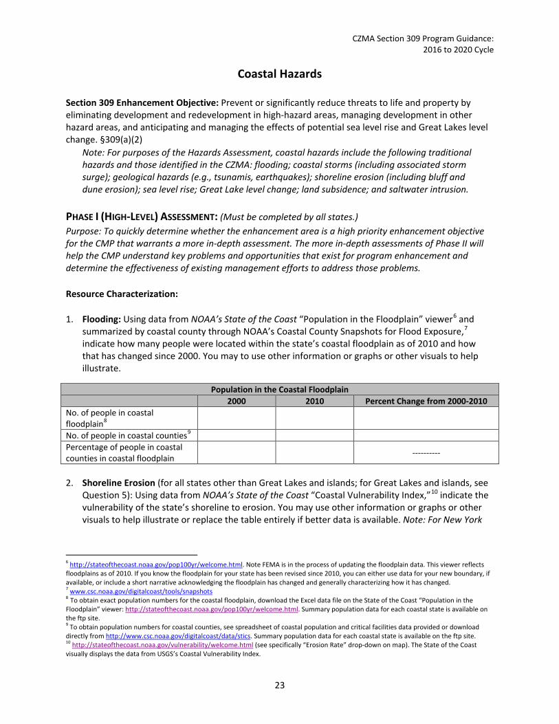
Coastal Hazards Section 309 Enhancement Objective: Prevent or significantly reduce threats to life and property by eliminating development and redevelopment in high-hazard areas, managing development in other hazard areas, and anticipating and managing the effects of potential sea level rise and Great Lakes level change. §309(a)(2)
Note: For purposes of the Hazards Assessment, coastal hazards include the following traditional hazards and those identified in the CZMA: flooding; coastal storms (including associated storm surge); geological hazards (e.g., tsunamis, earthquakes); shoreline erosion (including bluff and dune erosion); sea level rise; Great Lake level change; land subsidence; and saltwater intrusion.
PHASE I (HIGH-LEVEL) ASSESSMENT: (Must be completed by all states.) Purpose: To quickly determine whether the enhancement area is a high priority enhancement objective for the CMP that warrants a more in-depth assessment. The more in-depth assessments of Phase II will help the CMP understand key problems and opportunities that exist for program enhancement and determine the effectiveness of existing management efforts to address those problems. Resource Characterization: 1. Flooding: Using data from NOAA’s State of the Coast “Population in the Floodplain” viewer6 and
summarized by coastal county through NOAA’s Coastal County Snapshots for Flood Exposure,7 indicate how many people were located within the state’s coastal floodplain as of 2010 and how that has changed since 2000. You may to use other information or graphs or other visuals to help illustrate.
Population in the Coastal Floodplain 2000 2010 Percent Change from 2000-2010
No. of people in coastal floodplain8
No. of people in coastal counties9 Percentage of people in coastal counties in coastal floodplain
----------
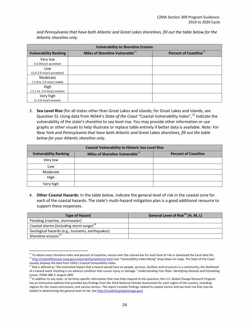
2. Shoreline Erosion (for all states other than Great Lakes and islands; for Great Lakes and islands, see
Question 5): Using data from NOAA’s State of the Coast “Coastal Vulnerability Index,”10 indicate the vulnerability of the state’s shoreline to erosion. You may use other information or graphs or other visuals to help illustrate or replace the table entirely if better data is available. Note: For New York
6 http://stateofthecoast.noaa.gov/pop100yr/welcome.html. Note FEMA is in the process of updating the floodplain data. This viewer reflects floodplains as of 2010. If you know the floodplain for your state has been revised since 2010, you can either use data for your new boundary, if available, or include a short narrative acknowledging the floodplain has changed and generally characterizing how it has changed. 7 www.csc.noaa.gov/digitalcoast/tools/snapshots 8 To obtain exact population numbers for the coastal floodplain, download the Excel data file on the State of the Coast “Population in the Floodplain” viewer: http://stateofthecoast.noaa.gov/pop100yr/welcome.html. Summary population data for each coastal state is available on the ftp site. 9 To obtain population numbers for coastal counties, see spreadsheet of coastal population and critical facilities data provided or download directly from http://www.csc.noaa.gov/digitalcoast/data/stics. Summary population data for each coastal state is available on the ftp site. 10 http://stateofthecoast.noaa.gov/vulnerability/welcome.html (see specifically “Erosion Rate” drop-down on map). The State of the Coast visually displays the data from USGS’s Coastal Vulnerability Index.
23
CZMA Section 309 Program Guidance: 2016 to 2020 Cycle
and Pennsylvania that have both Atlantic and Great Lakes shorelines, fill out the table below for the Atlantic shoreline only.
Vulnerability to Shoreline Erosion Vulnerability Ranking Miles of Shoreline Vulnerable11 Percent of Coastline11
Very low (>2.0m/yr) accretion
Low (1.0-2.0 m/yr) accretion)
Moderate (-1.0 to 1.0 m/yr) stable
High (-1.1 to -2.0 m/yr) erosion
Very high (<-2.0 m/yr) erosion
3. Sea Level Rise (for all states other than Great Lakes and islands; for Great Lakes and islands, see
Question 5): Using data from NOAA’s State of the Coast “Coastal Vulnerability Index”,12 indicate the vulnerability of the state’s shoreline to sea level rise. You may provide other information or use graphs or other visuals to help illustrate or replace table entirely if better data is available. Note: For New York and Pennsylvania that have both Atlantic and Great Lakes shorelines, fill out the table below for your Atlantic shoreline only.
Coastal Vulnerability to Historic Sea Level Rise Vulnerability Ranking Miles of Shoreline Vulnerable11 Percent of Coastline
Very low
Low Moderate
High
Very high
4. Other Coastal Hazards: In the table below, indicate the general level of risk in the coastal zone for each of the coastal hazards. The state’s multi-hazard mitigation plan is a good additional resource to support these responses.
Type of Hazard General Level of Risk13 (H, M, L) Flooding (riverine, stormwater) Coastal storms (including storm surge)14 Geological hazards (e.g., tsunamis, earthquakes) Shoreline erosion15
11 To obtain exact shoreline miles and percent of coastline, mouse over the colored bar for each level of risk or download the Excel data file. 12 http://stateofthecoast.noaa.gov/vulnerability/welcome.html (see “Vulnerability Index Rating” drop-down on map). The State of the Coast visually displays the data from USGS’s Coastal Vulnerability Index. 13 Risk is defined as “the estimated impact that a hazard would have on people, services, facilities and structures in a community; the likelihood of a hazard event resulting in an adverse condition that causes injury or damage.” Understanding Your Risks: Identifying Hazards and Estimating Losses. FEMA 386-2. August 2001 14 In addition to any state- or territory-specific information that may help respond to this question, the U.S. Global Change Research Program has an interactive website that provides key findings from the 2014 National Climate Assessment for each region of the country, including regions for the coasts and oceans, and various sectors. The report includes findings related to coastal storms and sea level rise that may be helpful in determining the general level of risk. See http://nca2014.globalchange.gov/.
24

CZMA Section 309 Program Guidance: 2016 to 2020 Cycle
Type of Hazard General Level of Risk13 (H, M, L) Sea level rise13,14,15 Great Lake level change14 Land subsidence Saltwater intrusion Other (please specify)
5. If available, briefly list and summarize the results of any additional data or reports on the level of
risk and vulnerability to coastal hazards within your state since the last assessment. The state’s multi-hazard mitigation plan or climate change risk assessment or plan may be a good resource to help respond to this question.
Management Characterization: 1. Indicate if the approach is employed by the state or territory and if significant state- or territory-
level changes (positive or negative) have occurred that could impact the CMP’s ability to prevent or significantly reduce coastal hazards risk since the last assessment.
Management Category Employed by State
or Territory (Y or N)
CMP Provides Assistance to Locals
that Employ (Y or N)
Significant Changes Since Last
Assessment (Y or N)
Statutes, regulations, policies, or case law interpreting these that address: elimination of
development/redevelopment in high-hazard areas16
management of development/redevelopment
in other hazard areas
climate change impacts, including sea level rise or Great Lake level change
Hazards planning programs or initiatives that address: hazard mitigation
climate change impacts, including sea level rise or Great Lake level change
Hazards mapping or modeling programs or initiatives for: sea level rise or Great Lake level change
other hazards 2. Briefly state how “high-hazard areas” are defined in your coastal zone.
3. For any management categories with significant changes, briefly provide the information below. If
this information is provided under another enhancement area or section of the document, please provide a reference to the other section rather than duplicate the information:
a. Describe the significance of the changes;
15 See NOAA State of the Coastal Vulnerability to Sea Level Rise Tool (select “Erosion Rate” from drop-down box) http://stateofthecoast.noaa.gov/vulnerability/welcome.html. The State of the Coast visually displays the data from USGS’s Coastal Vulnerability Index. 16 Use state’s definition of high-hazard areas.
25

CZMA Section 309 Program Guidance: 2016 to 2020 Cycle
b. Specify if they were 309 or other CZM-driven changes; and c. Characterize the outcomes or likely future outcomes of the changes.
Enhancement Area Prioritization: 1. What level of priority is the enhancement area for the coastal management program?
High _____ Medium _____ Low _____
2. Briefly explain the reason for this level of priority. Include input from stakeholder engagement,
including the types of stakeholders engaged.
****************************************************
RESOURCES AND TOOLS: Below are a few national resources and tools that may be useful in conducting your assessment or developing coastal hazards strategies. States likely have other state-specific resources, tools, and data that would be useful as well. Climate.gov NOAA’s Climate.gov provides science and information for a climate-smart nation. The “Supporting Decisions” is a clearinghouse of reports, resources, and decision-support tools for planners and policy leaders who want authoritative climate science information to help them understand and manage climate-related risks and opportunities. Geographic Scope: Various by resource Website: www.climate.gov CZMA Performance Management System Data Annual CZMA performance measurement data for coastal hazards measures. Online database can be used to synthesize existing state and territory data reported during the assessment period.
Geographic Scope: All coastal states and territories Website: www8.nos.noaa.gov/PMD/Login.aspx?ReturnUrl=%2fPMD%2fdefault.aspx
National Climate Assessment Web Tool The U.S. Global Change Research Program provides an interactive web tool to quickly view key findings from the 2014 National Climate Assessment. Data are summarized by region (including ones for oceans and coasts) and sector.
Geographic Scope: Entire United States (including territories) Website: http://nca2014.globalchange.gov/
NOAA C-CAP Coastal Land Atlas Online data viewer provides user-friendly access to regional land cover and land cover change information developed through NOAA’s Coastal Change Analysis Program (C-CAP). Users can investigate
26
CZMA Section 309 Program Guidance: 2016 to 2020 Cycle
how land cover changed between 1996, 2001, 2006, and 2011. Although data are provided by county, NOAA staff members are able to help states easily aggregate county data into statewide summary.
Geographic Scope: Contiguous United States and Hawaii Website: www.csc.noaa.gov/digitalcoast/tools/lca
NOAA Coastal County Snapshots: Flood Exposure Assesses a county’s exposure and resilience to flooding. Analyzes a county’s dependence on the ocean or Great Lakes for a healthy economy. Examines the benefits a county receives from its wetlands. Compares counties to each other or for regional analysis. Allows users to download a PDF report for the snapshot of their choice.
Geographic Scope: Coastal states only. Currently not available for territories. Website: www.csc.noaa.gov/digitalcoast/tools/snapshots NOAA High-Resolution C-CAP Data Nationally standardized database of land cover information (developed using remotely sensed imagery) for the coastal regions of the United States. C-CAP products provide inventories of coastal intertidal areas, wetlands, and adjacent uplands. High-resolution C-CAP products focus on bringing NOAA’s national mapping framework to the local level by providing data relevant for addressing site-specific management decisions. Although the data require desktop GIS and some GIS technical skills, NOAA staff members are able to help states analyze data to support wetlands assessment.
Geographic Scope: Targeted watershed and other hotspots in the Caribbean, Pacific Islands, and Monterey Bay, California Website: www.csc.noaa.gov/digitalcoast/data/ccaphighres
NOAA Sea Level Rise Viewer Displays potential future sea levels and provides simulations of sea level rise at local landmarks, including modeling potential marsh migration due to sea level rise. Overlays social and economic data onto potential sea level rise. Examines how tidal flooding will become more frequent with sea level rise.
Geographic Scope: Select regions currently available. More coming soon so check back. Website: www.csc.noaa.gov/digitalcoast/tools/slrviewer
NOAA Spatial Trends in Coastal Socioeconomics The Spatial Trends in Coastal Socioeconomics recompiles socioeconomic data to estimate demographic and economic attributes for a variety of important coastal management jurisdictions like watersheds, floodplains, coastal counties, and place-based coastal management programs. Currently available data sets include Demographics Trends (1970-2011) from the U.S. Census Bureau; Economic Trends (1990-2011) from the Bureau of Labor Statistics and Bureau of Economic Analysis; Demographic Projections (1970-2040) from Woods and Poole Economics, Inc.; and Critical Facilities (2012) from the Federal Emergency Management Agency.
Geographic Scope: Varies by data Website: http://csc.noaa.gov/digitalcoast/data/stics
NOAA State of the Coast The State of the Coast website fosters an increased awareness of the crucial importance of healthy coastal ecosystems to a robust U.S. economy, a safe population, and a sustainable quality of life for coastal residents. The site offers quick facts and more detailed statistics through interactive indicator
27
CZMA Section 309 Program Guidance: 2016 to 2020 Cycle
visualizations. Visualizations focused on coastal hazards issues include Coastal Vulnerability to Sea Level Rise, Coastal Population in the Floodplain, and Federally Insured Assets in the Coastal Floodplain.
Geographic Scope: Generally all coastal states and territories but a few viewers may have more limited coverage Website: http://stateofthecoast.noaa.gov/
Spatial Hazards Events and Loss Database for the United States (SHELDUS) SHELDUS is a county-level hazard data set for the United States for 18 different natural hazard event types such as thunderstorms, hurricanes, floods, wildfires, and tornados. For each event, the database includes the beginning date, location (county and state), property losses, crop losses, injuries, and fatalities that affected each county.
Geographic Scope: All states (does not include territories) Website: http://webra.cas.sc.edu/hvri/products/sheldus.aspx
Social Vulnerability Index The Social Vulnerability Index (SoVI) 2006-2010 measures the social vulnerability of U.S. counties to environmental hazards. The index is a comparative metric that facilitates the examination of the differences in social vulnerability among counties. It shows where there is uneven capacity for preparedness and response and where resources might be used most effectively to reduce the pre-existing vulnerability. SoVI also is useful as an indicator in determining the differential recovery from disasters.
Geographic Scope: All states (does not include territories) Website: http://webra.cas.sc.edu/hvri/products/sovi.aspx
U.S. Global Change Research Program Scenarios for Climate Assessment and Adaptation The U.S. Global Change Research Program has developed several interactive scenario maps. Scenarios are ways to help understand what future conditions might be, with each scenario an example of what might happen under different assumptions. Scenarios are not predictions or forecasts, and no probabilities are associated with them. Instead, they provide a range of future conditions to bound uncertainty. Scenarios displayed include climate, sea level change, land use, and socioeconomic conditions. They are based on peer-reviewed, published sources, including materials prepared by the Intergovernmental Panel on Climate Change.
Geographic Scope: National Website: http://scenarios.globalchange.gov/content/scenarios
28

CZMA Section 309 Program Guidance: 2016 to 2020 Cycle
Public Access Section 309 Enhancement Objective: Attain increased opportunities for public access, taking into account current and future public access needs, to coastal areas of recreational, historical, aesthetic, ecological, or cultural value. §309(a)(3) PHASE I (HIGH-LEVEL) ASSESSMENT: (Must be completed by all states.) Purpose: To quickly determine whether the enhancement area is a high priority enhancement objective for the CMP that warrants a more in-depth assessment. The more in-depth assessments of Phase II will help the CMP understand key problems and opportunities that exist for program enhancement and determine the effectiveness of existing management efforts to address those problems. Resource Characterization: 1. Use the table below to provide data on public access availability within the coastal zone.
Public Access Status and Trends
Type of Access Current number17
Changes or Trends Since Last Assessment18 (↑, ↓, −, unkwn) Cite data source
Beach access sites
Shoreline (other than beach) access
sites
Recreational boat (power or
nonmotorized) access sites
Number of designated scenic vistas or overlook
points
Number of fishing access points (i.e.
piers, jetties)
Coastal trails/ boardwalks
No. of Trails/ boardwalks
Miles of Trails/boardwalks
17 Be as specific as possible. For example, if you have data on many access sites but know it is not an exhaustive list, note “more than” before the number. If information is unknown, note that and use the narrative section below to provide a brief qualitative description based on the best information available. 18 If you know specific numbers, please provide. However, if specific numbers are unknown but you know that the general trend was increasing or decreasing or relatively stable or unchanged since the last assessment, note that with a ↑ (increased), ↓ (decreased), − (unchanged). If the trend is completely unknown, simply put “unkwn.”
29

CZMA Section 309 Program Guidance: 2016 to 2020 Cycle
Public Access Status and Trends
Type of Access Current number17
Changes or Trends Since Last Assessment18 (↑, ↓, −, unkwn) Cite data source
Number of acres parkland/open
space
Total sites
Sites per miles of shoreline
Other (please specify)
2. Briefly characterize the demand for coastal public access and the process for periodically assessing
demand. Include a statement on the projected population increase for your coastal counties.19 There are several additional sources of statewide information that may help inform this response, such as the Statewide Comprehensive Outdoor Recreation Plan,20 the National Survey on Fishing, Hunting, and Wildlife Associated Recreation,21 and your state’s tourism office.
The population within the state’s coastal shoreline counties is projected to increase (or decrease) by ____ percent between 2010 and 2020.
3. If available, briefly list and summarize the results of any additional data or reports on the status or
trends for coastal public access since the last assessment.
Management Characterization: 1. Indicate if the approach is employed by the state or territory and if there have been any significant
state- or territory-level management changes (positive or negative) that could impact the future provision of public access to coastal areas of recreational, historical, aesthetic, ecological, or cultural value.
Management Category Employed by State or Territory
(Y or N)
CMP Provides Assistance to Locals
that Employ (Y or N)
Significant Changes Since Last Assessment
(Y or N)
Statutes, regulations, policies, or case law interpreting these
Operation/maintenance of existing facilities
Acquisition/enhancement programs
19 See NOAA’s Coastal Population Report: 1970-2020 (Table 5, pg. 9): http://stateofthecoast.noaa.gov/coastal-population-report.pdf 20 Most states routinely develop “Statewide Comprehensive Outdoor Recreation Plans”, or SCROPs, that include an assessment of demand for public recreational opportunities. Although not focused on coastal public access, SCORPs could be useful to get some sense of public outdoor recreation preferences and demand. Download state SCROPs at www.recpro.org/scorps. 21 The National Survey on Fishing, Hunting, and Wildlife Associated Recreation produces state-specific reports on fishing, hunting, and wildlife associated recreational use for each state. While not focused on coastal areas, the reports do include information on saltwater and Great Lakes fishing, and some coastal wildlife viewing that may be informative and compares 2011 data to 2006 and 2001 information to understand how usage has changed. See www.census.gov/prod/www/fishing.html.
30

CZMA Section 309 Program Guidance: 2016 to 2020 Cycle
2. For any management categories with significant changes, briefly provide the information below. If
this information is provided under another enhancement area or section of the document, please provide a reference to the other section rather than duplicate the information:
a. Describe the significance of the changes; b. Specify if they were 309 or other CZM-driven changes; and c. Characterize the outcomes or likely future outcomes of the changes.
3. Indicate if your state or territory has a publically available public access guide. How current is the
publication and how frequently it is updated?22 Public Access Guide Printed Online Mobile App
State or territory has? (Y or N)
Web address (if applicable)
Date of last update Frequency of update
Enhancement Area Prioritization: 1. What level of priority is the enhancement area for the coastal management program?
High _____ Medium _____ Low _____
2. Briefly explain the reason for this level of priority. Include input from stakeholder engagement,
including the types of stakeholders engaged.
****************************************************
RESOURCES AND TOOLS: Below are a few national resources and tools that may be useful in conducting your assessment or developing public access strategies. States likely have other state-specific resources, tools, and data that would be useful as well. CZMA Performance Measurement System Data Annual CZMA performance measurement data for public access. Online database can be used to synthesize existing state or territory data reported during the assessment period.
Geographic Scope: All coastal states and territories Website: www8.nos.noaa.gov/PMD/Login.aspx?ReturnUrl=%2fPMD%2fdefault.aspx
22 Note some states may have regional or local guides in addition to state public access guides. Unless you want to list all local guides as well, there is no need to list additional guides beyond the state access guide. However, you may choose to note that the local guides do exist and may provide additional information that expands upon the state guides.
31

CZMA Section 309 Program Guidance: 2016 to 2020 Cycle
EPA Swimming Season Statistics The Environmental Protection agency (EPA) tracks annual beach monitoring and closure information through its beach program. The most recent data available is for the 2012 season.
Geographic Scope: All coastal states and territories Website: http://water.epa.gov/type/oceb/beaches/2012_season.cfm
National Survey on Fishing, Hunting, and Wildlife Associated Recreation The U.S. Census partners with the U.S. Fish and Wildlife Service to present information on individuals involved in fishing, hunting, and other wildlife-associated recreation, such as wildlife observation, photography, and feeding. Data include states in which these activities occurred; number of trips taken; days of participation; and expenditures for food, lodging, transportation, and equipment. While not focused on coastal areas, the reports do include information on saltwater and Great Lakes fishing and some coastal wildlife viewing. The 2011 reports compare 2011 data to 2006 and 2001 survey results to understand how usage has changed.
Geographic Scope: All states (territories not included) Website: www.census.gov/prod/www/fishing.html
Outdoor Recreation Trends and Futures The U.S. Forest Service routinely conducts a national study of outdoor recreation trends as part of the Renewable Resources Planning Act Assessment. The 2010 study (released in 2012) reviews past trends in outdoor recreation participation by Americans, describes current outdoor recreation participation patterns, compares patterns across regional and demographic strata, describes recreation activity participation on public and private lands, and provides projections of outdoor recreation participation out to the year 2060.
Geographic Scope: National summaries only (no state-specific data provided) Website: www.srs.fs.usda.gov/pubs/gtr/gtr_srs150.pdf
Outdoor Recreation for Northern United States Presents more regionally-specific data from the Outdoor Recreation Trends and Futures survey but also compares to other regions.
Geographic Scope: Focused on Northeast, Mid-Atlantic (Maryland north), and Great Lakes, although includes information on entire country as well. Website: www.fs.fed.us/nrs/pubs/gtr/gtr_nrs100.pdf
Statewide Comprehensive Outdoor Recreation Plans Most states regularly develop Statewide Comprehensive Outdoor Recreation Plans (SCORPs). While each SCORP varies by state, at a minimum, the plan must (1) identify outdoor recreation issues of statewide importance; (2) evaluate demand, i.e., public outdoor recreation preferences; and (3) evaluate the supply of outdoor recreation resources and facilities.
Geographic Scope: All states (territories not included) Website: http://www.recpro.org/scorps
TrailLink The Rails-to-Trails Conservancy includes an interactive map interface that identifies rail trails, including mileage, for each state. While not limited to the coastal zone, or even coastal counties, this information could be useful to get a sense of the other types of trails and walkways that exist in the coastal zone.
Geographic Scope: All states (territories not included) Website: www.traillink.com/
32

CZMA Section 309 Program Guidance: 2016 to 2020 Cycle
Marine Debris Section 309 Enhancement Objective: Reducing marine debris entering the nation’s coastal and ocean environment by managing uses and activities that contribute to the entry of such debris. §309(a)(4) PHASE I (HIGH-LEVEL) ASSESSMENT: (Must be completed by all states.) Purpose: To quickly determine whether the enhancement area is a high priority enhancement objective for the CMP that warrants a more in-depth assessment. The more in-depth assessments of Phase II will help the CMP understand key problems and opportunities that exist for program enhancement and determine the effectiveness of existing management efforts to address those problems. Resource Characterization: 1. In the table below, characterize the existing status and trends of marine debris in the state’s coastal
zone based on the best available data.
Source of Marine Debris
Existing Status and Trends of Marine Debris in Coastal Zone
Significance of Source (H, M, L, unknwn)
Type of Impact23 (aesthetic, resource damage,
user conflicts, other)
Change Since Last Assessment
(↑, ↓, −, unkwn) Land-based
Beach/shore litter Dumping
Storm drains and runoff Fishing (e.g., fishing
line, gear)
Other (please specify) Ocean or Great Lake-based
Fishing (e.g., derelict fishing gear)
Derelict vessels Vessel-based (e.g.,
cruise ship, cargo ship, general vessel)
Hurricane/Storm Tsunami
Other (please specify) 2. If available, briefly list and summarize the results of any additional state- or territory-specific data or
reports on the status and trends or potential impacts from marine debris in the coastal zone since the last assessment.
23 You can select more than one, if applicable.
33

CZMA Section 309 Program Guidance: 2016 to 2020 Cycle
Management Characterization: 1. Indicate if the approach is employed by the state or territory and if there have been any significant
state- or territory-level management changes (positive or negative) for how marine debris is managed in the coastal zone.
Management Category Employed by
State/Territory (Y or N)
CMP Provides Assistance to Locals
that Employ (Y or N)
Significant Changes Since Last Assessment
(Y or N)
Marine debris statutes, regulations, policies, or case law interpreting these
Marine debris removal programs
2. For any management categories with significant changes, briefly provide the information below. If
this information is provided under another enhancement area or section of the document, please provide a reference to the other section rather than duplicate the information:
a. Describe the significance of the changes; b. Specify if they were 309 or other CZM-driven changes; and c. Characterize the outcomes and likely future outcomes of the changes.
Enhancement Area Prioritization: 1. What level of priority is the enhancement area for the coastal management program?
High _____ Medium _____ Low _____
2. Briefly explain the reason for this level of priority. Include input from stakeholder engagement,
including the types of stakeholders engaged.
*********************************************
RESOURCES AND TOOLS: Below are a few national resources and tools that may be useful in conducting your assessment or developing marine debris strategies. States likely have other state-specific resources, tools, and data that would be useful as well. CZMA Performance Measurement System Data Annual CZMA performance measurement data for marine debris. Online database can be used to synthesize existing state or territory data reported during the assessment period.
Geographic Scope: All coastal states and territories Website: www8.nos.noaa.gov/PMD/Login.aspx?ReturnUrl=%2fPMD%2fdefault.aspx
34

CZMA Section 309 Program Guidance: 2016 to 2020 Cycle
NOAA Marine Debris Program The NOAA Marine Debris Program supports national and international efforts to research, prevent, and reduce the impacts of marine debris. The program coordinates and supports marine debris activities within NOAA and with other federal agencies, and uses partnerships to support projects carried out by state and local agencies, tribes, nongovernmental organizations, academia, and industry. The program also provides funding opportunities for projects that address marine debris.
Geographic Coverage: National and international Website: http://marinedebris.noaa.gov/
Ocean Conservancy Marine Debris Monitoring Program Final Report The National Marine Debris Monitoring Program, conducted by Ocean Conservancy and funded by the Environmental Protection Agency, was designed to standardize marine debris data collection in the United States using a scientifically valid protocol to determine marine debris status and trends. The study analyzed marine debris from three specific sources: land-based, ocean-based, and general (marine debris that cannot be distinguished as a land-based or ocean-based source). The study was conducted over a five-year period between September 2001 and September 2006.
Geographic Coverage: Regional (except for Great Lakes and Pacific territories) Website: http://act.oceanconservancy.org/site/DocServer/NMDMP_Report_April_2008.pdf?docID=4601
West Coast Marine Debris Database The West Coast Marine Debris Database provides comprehensive access to information on West Coast marine debris including beach cleanups and derelict gear removal.
Geographic Coverage: Washington, Oregon, and California Website: http://debris-db.westcoastoceans.org/
35
CZMA Section 309 Program Guidance: 2016 to 2020 Cycle
Cumulative and Secondary Impacts Section 309 Enhancement Objective: Development and adoption of procedures to assess, consider, and control cumulative and secondary impacts of coastal growth and development, including the collective effect on various individual uses or activities on coastal resources, such as coastal wetlands and fishery resources. §309(a)(5) PHASE I (HIGH-LEVEL) ASSESSMENT: (Must be completed by all states.) Purpose: To quickly determine whether the enhancement area is a high priority enhancement objective for the CMP that warrants a more in-depth assessment. The more in-depth assessments of Phase II will help the CMP understand key problems and opportunities that exist for program enhancement and determine the effectiveness of existing management efforts to address those problems. Resource Characterization: 1. Using National Ocean Economics Program Data on population and housing,24 please indicate the
change in population and housing units in the state’s coastal counties between 2012 and 2007. You may wish to add additional trend comparisons to look at longer time horizons as well (data available back to 1970), but at a minimum, please show change over the most recent five year period (2012-2007) to approximate current assessment period.
Trends in Coastal Population and Housing Units
Year Population Housing Total
(# of people) % Change
(compared to 2002) Total
(# of housing units) % Change
(compared to 2002) 2007 2012
2. Using provided reports from NOAA’s Land Cover Atlas25 or high-resolution C-CAP data26 (Pacific and
Caribbean Islands only), please indicate the status and trends for various land uses in the state’s coastal counties between 2006 and 2011. You may use other information and include graphs and figures, as appropriate, to help illustrate the information. Note that the data available for the islands may be for a different time frame than the time periods reflected below. In that case, please specify the time period the data represents. Also note that Puerto Rico and the Commonwealth of the Northern Mariana Islands (CNMI) currently only have data for one time point so will not be able to report trend data. Instead, Puerto Rico and CNMI should just report current land use cover for developed areas and impervious surfaces.
24 www.oceaneconomics.org/. Enter “Population and Housing” section. From drop-down boxes, select your state, and “all counties.” Select the year (2012) and the year to compare it to (2007). Then select “coastal zone counties.” Finally, be sure to check the “include density” box under the “Other Options” section. 25 www.csc.noaa.gov/ccapatlas/. Summary data on land use trends for each coastal state is available on the ftp site. 26 www.csc.noaa.gov/digitalcoast/data/ccaphighres. Summary data on land use trends for each coastal state is available on the ftp site.
36

CZMA Section 309 Program Guidance: 2016 to 2020 Cycle
Distribution of Land Cover Types in Coastal Counties Land Cover Type Land Area Coverage in 2011
(Acres) Gain/Loss Since 2006
(Acres) Developed, High Intensity Developed, Low Intensity Developed, Open Space
Grassland Scrub/Shrub Barren Land Open Water Agriculture
Forested Woody Wetland
Emergent Wetland
3. Using provided reports from NOAA’s Land Cover Atlas27 or high-resolution C-CAP data28 (Pacific and Caribbean Islands only), please indicate the status and trends for developed areas in the state’s coastal counties between 2006 and 2011 in the two tables below. You may use other information and include graphs and figures, as appropriate, to help illustrate the information. Note that the data available for the islands may be for a different time frame than the time periods reflected below. In that case, please specify the time period the data represents. Also note that Puerto Rico and CNMI currently only have data for one time point so will not be able to report trend data. Unless Puerto Rico and CNMI have similar trend data to report on changes in land use type, they should just report current land use cover for developed areas and impervious surfaces.
Development Status and Trends for Coastal Counties
2006 2011 Percent Net Change Percent land area developed
Percent impervious surface area * Note: Islands likely have data for another time period and may only have one time interval to report. If so, only report the change in development and impervious surface area for the time period for which high-resolution C-CAP data are available. Puerto Rico and CNMI do not need to report trend data.
How Land Use Is Changing in Coastal Counties
Land Cover Type Areas Lost to Development Between 2006-2011 (Acres) Barren Land
Emergent Wetland Woody Wetland
Open Water Agriculture
Scrub/Shrub Grassland Forested
* Note: Islands likely have data for another time period and may only have one time interval to report. If so, only report the change in land use for the time period for which high-resolution C-CAP data are available. Puerto Rico and CNMI do not report.
27 www.csc.noaa.gov/ccapatlas/. Summary data on land use trends for each coastal state is available on the ftp site. 28 www.csc.noaa.gov/digitalcoast/data/ccaphighres. Summary data on land use trends for each coastal state is available on the ftp site.
37

CZMA Section 309 Program Guidance: 2016 to 2020 Cycle
4. Using data from NOAA’s State of the Coast “Shoreline Type” viewer,29 indicate the percent of shoreline that falls into each shoreline type.30 You may provide other information or use graphs or other visuals to help illustrate.
Shoreline Types Surveyed Shoreline Type Percent of Shoreline
Armored Beaches
Flats Rocky
Vegetated
5. If available, briefly list and summarize the results of any additional state- or territory-specific data or reports on the cumulative and secondary impacts of coastal growth and development, such as water quality and habitat fragmentation, since the last assessment to augment the national data sets.
Management Characterization: 1. Indicate if the approach is employed by the state or territory and if there have been any significant
state-level changes (positive or negative) in the development and adoption of procedures to assess, consider, and control cumulative and secondary impacts of coastal growth and development, including the collective effect on various individual uses or activities on coastal resources, such as coastal wetlands and fishery resources, since the last assessment.
Management Category Employed by State or
Territory (Y or N)
CMP Provides Assistance to Locals that
Employ (Y or N)
Significant Changes Since Last Assessment
(Y or N)
Statutes, regulations, policies, or case law interpreting these
Guidance documents Management plans (including SAMPs)
2. For any management categories with significant changes, briefly provide the information below. If
this information is provided under another enhancement area or section of the document, please provide a reference to the other section rather than duplicate the information:
a. Describe the significance of the changes; b. Specify if they were 309 or other CZM-driven changes; and c. Characterize the outcomes or likely future outcomes of the changes.
29 http://stateofthecoast.noaa.gov/shoreline/welcome.html 30 Note: Data are from NOAA’s Environmental Sensitivity Index (ESI) Maps. Data from each state was collected in different years and some data may be over ten years old now. However, it can still provide a useful reference point absent more recent statewide data. Feel free to use more recent state data, if available, in place of ESI map data. Use a footnote to convey data’s age and source (if other than ESI maps).
38

CZMA Section 309 Program Guidance: 2016 to 2020 Cycle
Enhancement Area Prioritization: 1. What level of priority is the enhancement area for the coastal management program?
High _____ Medium _____ Low _____
2. Briefly explain the reason for this level of priority. Include input from stakeholder engagement,
including the types of stakeholders engaged.
*********************************************
RESOURCES AND TOOLS: Below are a few national resources and tools that may be useful in conducting your assessment or developing strategies for cumulative and secondary impacts of development. States likely have other state-specific resources, tools, and data that would be useful as well. EPA National Coastal Condition Report IV The report describes and rates the ecological and environmental conditions in U.S. coastal waters. Information is summarized on a national and regional basis. The latest report, released in 2012, reports on data collected from 2003 to 2006.
Geographic Scope: National and regional Website: http://water.epa.gov/type/oceb/assessmonitor/nccr/index.cfm
NOAA C-CAP Coastal Land Atlas Online data viewer provides user-friendly access to regional land cover and land cover change information developed through NOAA’s Coastal Change Analysis Program (C-CAP). The tool summarizes land use change trends. Users can investigate how land cover changed between 1996, 2001, 2006, and 2011. Although data are provided by county, NOAA staff members are able to help states easily aggregate county data into statewide summary.
Geographic Scope: Contiguous United States and Hawaii Website: www.csc.noaa.gov/digitalcoast/tools/lca
NOAA High-Resolution C-CAP Data Nationally standardized database of land cover information (developed using remotely sensed imagery) for the coastal regions of the U.S. C-CAP products provide inventories of coastal intertidal areas, wetlands, and adjacent uplands. High-resolution C-CAP products focus on bringing NOAA’s national mapping framework to the local level by providing data relevant for addressing site-specific management decisions. Although the data require desktop GIS and some GIS technical skills, NOAA staff members are able to help states analyze data to support wetlands assessment.
Geographic Scope: Targeted watershed and other hotspots in the Caribbean, Pacific Islands region, and Monterey Bay, California Website: www.csc.noaa.gov/digitalcoast/data/ccaphighres
39
CZMA Section 309 Program Guidance: 2016 to 2020 Cycle
NOAA Environmental Sensitivity Index Maps Environmental Sensitivity Index (ESI) maps are designed to provide a concise summary of coastal resources at risk in case of an oil spill or other disaster. They characterize the type of shoreline (armored, vegetated, beach, etc.) and may be useful for resource characterization and assessment. ESI maps are periodically updated on a state-by-state basis, and are generally available in multiple formats (pdf maps, GIS layers, etc.)
Geographic Scope: All coastal states and territories Website: http://response.restoration.noaa.gov/maps-and-spatial-data/environmental-sensitivity-index-esi-maps.html
NOAA Impervious Surface Analysis Tool The Impervious Surface Analysis Tool (ISAT), a custom suite of easy-to-use scripts for ArcGIS, is used to calculate the percentage of impervious surface area within user-selected geographic areas, such as watersheds, municipalities, and subdivisions. ISAT uses imperviousness values to categorize areas as having good, fair, or poor water quality. A correlation between an increase in impervious surfaces and a decrease in water quality has been well established, and ISAT users may find the information derived from ISAT helpful in predicting how different management scenarios might impact local water quality. The tool calculates the percent impervious area and total impervious surface area of each selected polygon, categorizes polygons to represent conditions of good, fair, and poor water quality based on calculated imperviousness, and incorporates land cover change scenarios to examine how changes influence impervious surfaces. Although it requires desktop GIS and some GIS technical skills, NOAA staff members are able to help states analyze data to support wetlands assessment.
Geographic Scope: Appropriate geographic scope should be based upon the resolution and complexity of the data. The tool is built on Esri’s ArcGIS, so it will only run as fast as allowed within that software. Website: www.csc.noaa.gov/digitalcoast/tools/isat
NOAA OpenNSPECT Data OpenNSPECT is the open-source version of the Nonpoint Source Pollution and Erosion Comparison Tool to investigate potential water quality impacts from development, other land uses, and climate change. OpenNSPECT was designed to be broadly applicable. When applied to coastal and noncoastal areas alike, the tool simulates erosion, pollution, and their accumulation from overland flow. The tool provides estimates and maps of surface water runoff volumes, pollutant loads, pollutant concentrations, and total sediment loads, helps users identify areas that might benefit from changes to proposed development strategies, and provides a means to analyze “what if” land use change scenarios. Although it requires desktop GIS and some GIS technical skills, NOAA staff members are available to provide technical assistance.
Geographic Scope: Appropriate geographic scope should be based upon the resolution and complexity of the data. The tool is a plugin for open source MapWindow GIS. Website: www.csc.noaa.gov/digitalcoast/tools/opennspect
CZMA Performance Measurement System Data Annual CZMA performance measurement data for coastal community development. Online database can be used to synthesize existing state and territory data reported during the assessment period.
Geographic Scope: All coastal states and territories Website: www8.nos.noaa.gov/PMD/Login.aspx?ReturnUrl=%2fPMD%2fdefault.aspx
40

CZMA Section 309 Program Guidance: 2016 to 2020 Cycle
NOAA State of the Coast The State of the Coast website fosters an increased awareness of the crucial importance of healthy coastal ecosystems to a robust U.S. economy, a safe population, and a sustainable quality of life for coastal residents. The site offers quick facts and more detailed statistics through interactive indicator visualizations. Visualizations focused on coastal population, overall coastal health, shoreline type, and nutrient pollution, and others may help inform the cumulative and secondary impacts assessment.
Geographic Scope: Generally all coastal states and territories but a few viewers may have more limited coverage. Website: http://stateofthecoast.noaa.gov/
41

CZMA Section 309 Program Guidance: 2016 to 2020 Cycle
Special Area Management Planning Section 309 Enhancement Objective: Preparing and implementing special area management plans for important coastal areas. §309(a)(6) The Coastal Zone Management Act defines a Special Area Management Plan (SAMP) as “a comprehensive plan providing for natural resource protection and reasonable coastal-dependent economic growth containing a detailed and comprehensive statement of policies; standards and criteria to guide public and private uses of lands and waters; and mechanisms for timely implementation in specific geographic areas within the coastal zone. In addition, SAMPs provide for increased specificity in protecting natural resources, reasonable coastal-dependent economic growth, improved protection of life and property in hazardous areas, including those areas likely to be affected by land subsidence, sea level rise, or fluctuating water levels of the Great Lakes, and improved predictability in governmental decision making.” PHASE I (HIGH-LEVEL) ASSESSMENT: (Must be completed by all states and territories.) Purpose: To quickly determine whether the enhancement area is a high priority enhancement objective for the CMP that warrants a more in-depth assessment. The more in-depth assessments of Phase II will help the CMP understand key problems and opportunities that exist for program enhancement and determine the effectiveness of existing management efforts to address those problems. Resource Characterization: 1. In the table below, identify geographic areas in the coastal zone subject to use conflicts that may be
able to be addressed through a special area management plan (SAMP). This can include areas that are already covered by a SAMP but where new issues or conflicts have emerged that are not addressed through the current SAMP.
Geographic Area Opportunities for New or Updated Special Area Management Plans Major conflicts/issues
2. If available, briefly list and summarize the results of any additional state- or territory-specific data or reports on the status and trends of SAMPs since the last assessment.
Management Characterization: 1. Indicate if the approach is employed by the state or territory and if there have been any significant
state- or territory-level management changes (positive or negative) that could help prepare and implement SAMPs in the coastal zone.
42
CZMA Section 309 Program Guidance: 2016 to 2020 Cycle
Management Category Employed by State or
Territory (Y or N)
CMP Provides Assistance to Locals
that Employ (Y or N)
Significant Changes Since Last Assessment
(Y or N)
SAMP policies, or case law interpreting these
SAMP plans 2. For any management categories with significant changes, briefly provide the information below. If
this information is provided under another enhancement area or section of the document, please provide a reference to the other section rather than duplicate the information:
a. Describe the significance of the changes; b. Specify if they were 309 or other CZM-driven changes; and c. Characterize the outcomes or likely future outcomes of the changes.
Enhancement Area Prioritization: 1. What level of priority is the enhancement area for the coastal management program?
High _____ Medium _____ Low _____
2. Briefly explain the reason for this level of priority. Include input from stakeholder engagement,
including the types of stakeholders engaged.
*********************************************
RESOURCES AND TOOLS: Below are a few national resources and tools that may be useful in conducting your assessment or developing SAMP strategies. States likely have other state-specific resources, tools, and data that would be useful as well. Davis, Braxton. 2004. “Regional Planning in the U.S. Coastal Zone: A Comparative Analysis of 15 Special Area Plans.” Ocean and Coastal Management. Volume 47, Pages 79 to 94.
Geographic Scope: National Website: www.sciencedirect.com/science/article/pii/S0964569104000225
Imperial, Mark. 1999. “Analyzing Institutional Arrangements for Ecosystem-Based Management: Lessons from the Rhode Island Salt Ponds SAM Plan.” Coastal Management. Volume 27. Pages 31 to 56.
Geographic Scope: Rhode Island, but lessons broadly applicable Website: www.ingentaconnect.com/content/tandf/ucmg/1999/00000027/00000001/art00002?crawler=true
Lane Council of Governments. 1992. “Hints on Preparing a Comprehensive Wetland Management Plan.” Lane Council of Governments, Lane, Oregon.
Geographic Scope: National Website: www.rice.edu/wetlands/Reports/R12_1.html
43

CZMA Section 309 Program Guidance: 2016 to 2020 Cycle
Ocean and Great Lakes Resources Section 309 Enhancement Objective: Planning for the use of ocean [and Great Lakes] resources. §309(a)(7) PHASE I (HIGH-LEVEL) ASSESSMENT: (Must be completed by all states and territories.) Purpose: To quickly determine whether the enhancement area is a high priority enhancement objective for the CMP that warrants a more in-depth assessment. The more in-depth assessments of Phase II will help the CMP understand key problems and opportunities that exist for program enhancement and determine the effectiveness of existing management efforts to address those problems. Resource Characterization: 1. Understanding the ocean and Great Lakes economy can help improve management of the resources
it depends on. Using Economics: National Ocean Watch (ENOW),31 indicate the status of the ocean and Great Lakes economy as of 2010, as well as the change since 2005, in the tables below. Include graphs and figures, as appropriate, to help illustrate the information. Note ENOW data are not available for the territories. The territories can provide alternative data, if available, or a general narrative, to capture the value of their ocean economy.
Status of Ocean and Great Lakes Economy for Coastal Counties (2010) Establishments
(# of Establishments) Employment
(# of Jobs) Wages
(Millions of Dollars) GDP
(Millions of Dollars) Living Resources Marine Construction
Marine Transportation
Offshore Mineral Extraction
Tourism & Recreation
All Ocean Sectors
Change in Ocean and Great Lakes Economy for Coastal Counties (2005-2010) Establishments
(% change) Employment
(% change) Wages
(% change) GDP
(% change) Living Resources Marine Construction
Marine Transportation
Offshore Mineral Extraction
Tourism & Recreation
All Ocean Sectors
31 www.csc.noaa.gov/enow/explorer/. If you select any coastal county for your state, you receive a table comparing county data to state coastal county, regional, and national information. Use the state column for your responses.
44

CZMA Section 309 Program Guidance: 2016 to 2020 Cycle
2. In the table below, characterize how the threats to and use conflicts over ocean and Great Lakes
resources in the state’s or territory’s coastal zone have changed since the last assessment.
Significant Changes to Ocean and Great Lakes Resources and Uses
Resource/Use Change in the Threat to the Resource or Use Conflict
Since Last Assessment (↑, ↓, −, unkwn)
Resource Benthic habitat (including coral reefs)
Living marine resources (fish, shellfish, marine mammals, birds, etc.)
Sand/gravel Cultural/historic
Other (please specify) Use
Transportation/navigation Offshore development32
Energy production Fishing (commercial and recreational)
Recreation/tourism Sand/gravel extraction
Dredge disposal Aquaculture
Other (please specify) 3. For the ocean and Great Lakes resources and uses in Table 2 (above) that had an increase in threat
to the resource or increased use conflict in the state’s or territory’s coastal zone since the last assessment, characterize the major contributors to that increase.
Major Contributors to an Increase in Threat or Use Conflict to Ocean and Great Lakes Resources
Resource
Major Reasons Contributing to Increased Resource Threat or Use Conflict (Note All that Apply with “X”)
Land
-bas
ed
deve
lopm
ent
Offs
hore
de
velo
pmen
t
Pollu
ted
runo
ff
Inva
sive
spec
ies
Fish
ing
(Com
m
& R
ec)
Aqua
cultu
re
Recr
eatio
n
Mar
ine
Tran
spor
tatio
n
Dred
ging
Sand
/Min
eral
Ex
trac
tion
Oce
an
Acid
ifica
tion
Oth
er (S
peci
fy)
Example: Living marine resources X X X X X X X [Resource or Use from Table 2] [Resource or Use from Table 2]
32 Offshore development includes underwater cables and pipelines, although any infrastructure specifically associated with the energy industry should be captured under the “energy production” category.
45

CZMA Section 309 Program Guidance: 2016 to 2020 Cycle
4. If available, briefly list and summarize the results of any additional state- or territory-specific data or reports on the status and trends of ocean and Great Lakes resources or threats to those resources since the last assessment to augment the national data sets.
Management Characterization: 1. Indicate if the approach is employed by the state or territory and if any significant state- or territory-
level changes (positive or negative) in the management of ocean and Great Lakes resources have occurred since the last assessment?
Management Category Employed by State
or Territory (Y or N)
CMP Provides Assistance to Locals
that Employ (Y or N)
Significant Changes Since Last Assessment
(Y or N)
Statutes, regulations, policies, or case law interpreting these
Regional comprehensive ocean/Great Lakes management plans
State comprehensive ocean/Great Lakes management plans
Single-sector management plans
2. For any management categories with significant changes, briefly provide the information below. If
this information is provided under another enhancement area or section of the document, please provide a reference to the other section rather than duplicate the information:
a. Describe the significance of the changes; b. Specify if they were 309 or other CZM-driven changes; and c. Characterize the outcomes or likely future outcomes of the changes.
3. Indicate if your state or territory has a comprehensive ocean or Great Lakes management plan. Comprehensive Ocean/Great Lakes
Management Plan State Plan Regional Plan
Completed plan (Y/N) (If yes, specify year completed)
Under development (Y/N) Web address (if available) Area covered by plan Enhancement Area Prioritization: 1. What level of priority is the enhancement area for the coastal management program?
High _____ Medium _____ Low _____
46

CZMA Section 309 Program Guidance: 2016 to 2020 Cycle
2. Briefly explain the reason for this level of priority. Include input from stakeholder engagement,
including the types of stakeholders engaged.
*********************************************
RESOURCES AND TOOLS: Below are a few national resources and tools that may be useful in conducting your assessment or developing strategies for ocean and Great Lakes Resources. States likely have other state-specific resources, tools, and data that would be useful as well. BOEM Environmental Studies Program The Bureau of Ocean and Energy Management’s (BOEM) Environmental Studies Program develops, conducts, and oversees world-class scientific research specifically to inform policy decisions regarding development of Outer Continental Shelf energy and mineral resources. Research covers physical oceanography, atmospheric sciences, biology, protected species, social sciences and economics, submerged cultural resources, and environmental fates and effects.
Geographic Scope: Specific to each study Website: www.boem.gov/Studies/
MarineCadastre.gov Viewer This data viewer provides the baseline information needed for ocean planning efforts, particularly those that involve finding the best location for renewable energy projects. Users pick the ocean geography of their choosing and quickly see the applicable jurisdictional boundaries, restricted areas, laws, critical habitat locations, and other important features. With the national viewer, potential conflicts can be identified and avoided early in the planning process, and users can visually analyze and explore geospatial data for marine spatial planning activities and find direct access to authoritative marine cadastral data from federal and state sources.
Geographic Scope: National Website: www.csc.noaa.gov/digitalcoast/tools/mmc
NOAA Assessment of Existing Information on Atlantic Coastal Fish Habitats This project reviewed over 500 published sources of information on habitat condition indicators, threats, and conservation actions for U.S. Atlantic coastal waters and watersheds. Results are available via web query tools and a published NOAA technical memo.
Geographic Scope: Atlantic coastal waters, from Maine to Florida Websites (query tools): www8.nos.noaa.gov/bhv/spatbibindex.html; tech memo: http://ccma.nos.noaa.gov/publications/nccostechmemo103.pdf
NOAA Coastal County Snapshots: Ocean Jobs Provides a snapshot of the economic value of ocean and Great Lakes jobs within a coastal county.
Geographic Scope: Coastal states only. Currently not available for territories. Website: www.csc.noaa.gov/digitalcoast/tools/snapshots
47

CZMA Section 309 Program Guidance: 2016 to 2020 Cycle
NOAA Economics: National Ocean Watch Data (ENOW) The effective management of coastal resources requires an understanding of the ocean and Great Lakes economy. This tool allows users to interact with ENOW data, which describe six economic sectors that depend on the oceans and Great Lakes: living resources; marine construction; marine transportation; offshore mineral resources; ship and boat building; and tourism and recreation. Users can discover which sectors are the largest in various parts of the county, which sectors are growing and declining, and which account for the most jobs, wages, and gross domestic product. They can view up to four counties, states, or regions to compare trends or the makeup of their ocean and Great Lakes economies. The ENOW Explorer’s interface is designed to allow users who are familiar with economic data to interact with and view data and trends. The tool provides the highest level of interaction with ENOW data short of downloading the full data set.
Geographic Scope: National and regional Website: www.csc.noaa.gov/digitalcoast/tools/enow
NOAA Essential Fish Habitat Mapper The Essential Fish Habitat Mapper is an online tool that displays essential fish habitat, and habitat areas of particular concern, established under provisions in the Magnuson-Stevens Fishery Conservation and Management Act. The tool also includes areas where steps have been taken to minimize the impact that fisheries have on essential fish habitat, including anchoring restrictions, required fishing gear modifications, and bans on certain types of gear. Users can query information from multiple fishery management plans at once to view habitat maps and lists of species for a specific location. The tool displays habitat maps and species lists for specific locations, queries spatial information from multiple fishery management plans at once, and provides links to text descriptions and data inventories, including related fishery management plans, federal regulations, and data and metadata download.
Geographic Scope: National and regional Website: www.csc.noaa.gov/digitalcoast/tools/efhmapper
OceanData.gov The National Ocean Council’s portal for data, information, and decision tools to support people engaged in regional marine planning for the future use of the ocean, coasts, and Great Lakes.
Geographic Scope: National and regional Website: http://www.data.gov/ocean/community/ocean
U.S. Marine Protected Areas Mapping Tool The U.S. Marine Protected Areas (MPAs) mapping tool is an online application designed to help users visualize MPA boundaries and provide access to MPA Inventory data. This mapping tool provides data on over 1,600 MPAs nationwide, offering easy access to spatial boundaries, conservation-based classification data, and site management information. Managers, scientists, and the public will find a detailed picture of the type, abundance, and distribution of MPAs throughout the United States, gaining an increased understanding and technical capacity for ocean resource protection, management, and stewardship. The tool visualizes patterns and characteristics of MPAs throughout the United States and filters the MPA Inventory in various ways to show only certain MPAs with specific attributes.
Geographic Scope: National and regional Website: www.csc.noaa.gov/digitalcoast/tools/mpaviewer
48

CZMA Section 309 Program Guidance: 2016 to 2020 Cycle
Energy and Government Facility Siting Section 309 Enhancement Objective: Adoption of procedures and enforceable policies to help facilitate the siting of energy facilities and Government facilities and energy-related activities and Government activities which may be of greater than local significance. §309(a)(8)33 PHASE I (HIGH-LEVEL) ASSESSMENT: (Must be completed by all states and territories.) Purpose: To quickly determine whether the enhancement area is a high priority enhancement objective for the CMP that warrants a more in-depth assessment. The more in-depth assessments of Phase II will help the CMP understand key problems and opportunities that exist for program enhancement and determine the effectiveness of existing management efforts to address those problems. Resource Characterization: 1. In the table below, characterize the status and trends of different types of energy facilities and
activities in the state’s or territory’s coastal zone based on best available data. If available, identify the approximate number of facilities by type. The MarineCadastre.gov may be helpful in locating many types of energy facilities in the coastal zone.
Status and Trends in Energy Facilities and Activities in the Coastal Zone
Type of Energy Facility/Activity
Exists in CZ Proposed in CZ
(# or Y/N) Change Since Last Assessment
(↑, ↓, −, unkwn) (# or Y/N) Change Since Last Assessment
(↑, ↓, −, unkwn) Energy Transport
Pipelines34 Electrical grid
(transmission cables)
Ports Liquid natural gas (LNG)35
Other (please specify) Energy Facilities
Oil and gas Coal
Nuclear36 Wind
Wave37 Tidal36
33 CZMA § 309(a)(8) is derived from program approval requirements in CZMA § 306(d)(8), which states: “The management program provides for adequate consideration of the national interest involved in planning for, and managing the coastal zone, including the siting of facilities such as energy facilities which are of greater than local significance. In the case of energy facilities, the Secretary shall find that the State has given consideration to any applicable national or interstate energy plan or program.”
NOAA regulations at 15 C.F.R. § 923.52 further describe what states need to do regarding national interest and consideration of interests that are greater than local interests. 34 For approved pipelines (1997-present): www.ferc.gov/industries/gas/indus-act/pipelines/approved-projects.asp 35 For approved FERC jurisdictional LNG import/export terminals: www.ferc.gov/industries/gas/indus-act/lng/exist-term.asp 36 The Nuclear Regulatory Commission provides a coarse national map of where nuclear power reactors are located as well as a list that reflects there general locations: www.nrc.gov/reactors/operating/map-power-reactors.html 37 For FERC hydrokinetic projects: www.ferc.gov/industries/hydropower/gen-info/licensing/hydrokinetics.asp
49

CZMA Section 309 Program Guidance: 2016 to 2020 Cycle
Status and Trends in Energy Facilities and Activities in the Coastal Zone
Type of Energy Facility/Activity
Exists in CZ Proposed in CZ
(# or Y/N) Change Since Last Assessment
(↑, ↓, −, unkwn) (# or Y/N) Change Since Last Assessment
(↑, ↓, −, unkwn) Current (ocean, lake,
river) 36
Hydropower Ocean thermal energy
conversion
Solar Biomass
Other (please specify)
2. If available, briefly list and summarize the results of any additional state- or territory-specific
information, data, or reports on the status and trends for energy facilities and activities of greater than local significance in the coastal zone since the last assessment.
3. Briefly characterize the existing status and trends for federal government facilities and activities of greater than local significance38 in the state’s coastal zone since the last assessment.
Management Characterization: 1. Indicate if the approach is employed by the state or territory and if significant state- or territory-
level changes (positive or negative) that could facilitate or impede energy and government facility siting and activities have occurred since the last assessment.
Management Category Employed by State or
Territory (Y or N)
CMP Provides Assistance to Locals
that Employ (Y or N)
Significant Changes Since Last Assessment
(Y or N)
Statutes, regulations, policies, or case law interpreting these
State comprehensive siting plans or procedures
2. For any management categories with significant changes, briefly provide the information below. If
this information is provided under another enhancement area or section of the document, please provide a reference to the other section rather than duplicate the information:
a. Describe the significance of the changes; b. Specify if they were 309 or other CZM-driven changes; and c. Characterize the outcomes or likely future outcomes of the changes.
38 The CMP should make its own assessment of what Government facilities may be considered “greater than local significance” in its coastal zone, but these facilities could include military installations or a significant federal government complex. An individual federal building may not rise to a level worthy of discussion here beyond a very cursory (if any at all) mention).
50

CZMA Section 309 Program Guidance: 2016 to 2020 Cycle
Enhancement Area Prioritization: 1. What level of priority is the enhancement area for the coastal management program?
High _____ Medium _____ Low _____
2. Briefly explain the reason for this level of priority. Include input from stakeholder engagement,
including the types of stakeholders engaged.
*********************************************
RESOURCES AND TOOLS: Below are a few national resources and tools that may be useful in conducting your assessment or developing energy and federal government facilities strategies. States likely have other state-specific resources, tools, and data that would be useful as well. BOEM Environmental Studies Program The Bureau of Ocean and Energy Management’s (BOEM) Environmental Studies Program develops, conducts, and oversees world-class scientific research specifically to inform policy decisions regarding development of Outer Continental Shelf energy and mineral resources. Research covers physical oceanography, atmospheric sciences, biology, protected species, social sciences and economics, submerged cultural resources, and environmental fates and effects.
Geographic Scope: Specific to each study Website: www.boem.gov/Studies/
U.S. Energy Information Administration The U.S. Energy Information Administration collects, analyzes, and disseminates independent and impartial energy information to promote sound policy making, efficient markets, and public understanding of energy and its interaction with the economy and the environment. The site includes a wealth of information on energy demand, use, and production (nationally, by region, and by energy sector).
Geographic Scope: National and regional Website: www.eia.gov
FERC Projects The Federal Energy and Regulatory Commission (FERC) has authority over electricity, natural gas (including LNG), and hydropower and hydrokinetic projects. The site has information on current and pending projects as well as market demands.
Geographic scope: National Website: www.ferc.gov/for-citizens/projectsearch/SearchProjects.aspx
GSA Lists of Federally Owned and Leased Facilities The Government Services Agency (GSA) maintains a national list of all federally owned and leased facilities in each state.
Geographic scope: National Website: www.iolp.gsa.gov/iolp/NationalMap.asp
51
CZMA Section 309 Program Guidance: 2016 to 2020 Cycle
MarineCadastre.gov Viewer This data viewer provides the baseline information needed for ocean planning efforts, particularly those that involve finding the best location for renewable energy projects. Users choose an ocean geography and quickly see the applicable jurisdictional boundaries, restricted areas, laws, critical habitat locations, and other important features. With the national viewer, potential conflicts can be identified and avoided early in the planning process, and users can visually analyze and explore geospatial data for marine spatial planning activities and find direct access to authoritative marine cadastral data from federal and state sources.
Geographic Scope: National Website: www.csc.noaa.gov/digitalcoast/tools/mmc
NOAA Economics: National Ocean Watch Data (ENOW) The effective management of coastal resources requires an understanding of the ocean and Great Lakes economy. This tool allows users to interact with ENOW data, which describe six economic sectors that depend on the oceans and Great Lakes: living resources; marine construction; marine transportation; offshore mineral resources; ship and boat building; and tourism and recreation. Users can discover which sectors are the largest in various parts of the county, which sectors are growing and declining, and which account for the most jobs, wages, and gross domestic product. They can view up to four counties, states, or regions to compare trends or the makeup of their ocean and Great Lakes economies. The ENOW Explorer’s interface is designed to allow users who are familiar with economic data to interact with and view data and trends. The tool provides the highest level of interaction with ENOW data short of downloading the full data set.
Geographic Scope: National and regional Website: http://www.csc.noaa.gov/digitalcoast/data/enow
52

CZMA Section 309 Program Guidance: 2016 to 2020 Cycle
Aquaculture Section 309 Enhancement Objective: Adoption of procedures and policies to evaluate and facilitate the siting of public and private aquaculture facilities in the coastal zone, which will enable states to formulate, administer, and implement strategic plans for marine aquaculture. §309(a)(9) PHASE I (HIGH-LEVEL) ASSESSMENT: (Must be completed by all states and territories.) Purpose: To quickly determine whether the enhancement area is a high priority enhancement objective for the CMP that warrants a more in-depth assessment. The more in-depth assessments of Phase II will help the CMP understand key problems and opportunities that exist for program enhancement and determine the effectiveness of existing management efforts to address those problems. Resource Characterization: 1. In the table below, characterize the existing status and trends of aquaculture facilities in the state’s
coastal zone based on the best available data. Your state Sea Grant Program may have information to help with this assessment.39
Type of Facility/Activity
Status and Trends of Aquaculture Facilities and Activities
# of Facilities40 Approximate Economic Value
Change Since Last Assessment (↑, ↓, −, unkwn)
2. If available, briefly list and summarize the results of any additional state- or territory-specific data or
reports on the status and trends or potential impacts from aquaculture activities in the coastal zone since the last assessment.
Management Characterization: 1. Indicate if the approach is employed by the state or territory and if there have been any state- or
territory-level changes (positive or negative) that could facilitate or impede the siting of public or private aquaculture facilities in the coastal zone.
Management Category Employed by State or
Territory (Y or N)
CMP Provides Assistance to Locals
that Employ (Y or N)
Significant Changes Since Last Assessment
(Y or N)
Aquaculture comprehensive siting plans or procedures
39 While focused on statewide aquaculture data rather than just within the coastal zone, the Census of Aquaculture (www.agcensus.usda.gov/Publications/2002/Aquaculture/) may help in developing your aquaculture assessment. The 2002 report, updated in 2005, provides a variety of state-specific aquaculture data for 2005 and 1998 to understand current status and recent trends. The next census is scheduled to come out late 2014 and will provide 2013 data. 40 Be as specific as possible. For example, if you have specific information of the number of each type of facility or activity, note that. If you only have approximate figures, note “more than” or “approximately” before the number. If information is unknown, note that and use the narrative section below to provide a brief qualitative description based on the best information available.
53

CZMA Section 309 Program Guidance: 2016 to 2020 Cycle
Other aquaculture statutes, regulations, policies, or case law interpreting these
2. For any management categories with significant changes, briefly provide the information below. If
this information is provided under another enhancement area or section of the document, please provide a reference to the other section rather than duplicate the information:
a. Describe the significance of the changes; b. Specify if they were 309 or other CZM-driven changes; and c. Characterize the outcomes or likely future outcomes of the changes.
Enhancement Area Prioritization:
1. What level of priority is the enhancement area for the coastal management program? High _____ Medium _____ Low _____
2. Briefly explain the reason for this level of priority. Include input from stakeholder engagement,
including the types of stakeholders engaged.
****************************************************
RESOURCES AND TOOLS: Below are a few national resources and tools that may be useful in conducting your assessment or developing aquaculture strategies. States likely have other state-specific resources, tools, and data that would be useful as well. NOAA Office of Aquaculture The Office of Aquaculture fosters sustainable aquaculture that will create employment and business opportunities in coastal communities; provide safe, sustainable seafood; and complement NOAA’s comprehensive strategy for maintaining healthy and productive marine populations, species, and ecosystems and vibrant coastal communities.
Geographic Coverage: National and regional Website: www.nmfs.noaa.gov/aquaculture/index.htm
USDA Census of Aquaculture The U.S. Department of Agriculture publishes the Census of Aquaculture. The census provides a variety of state-specific aquaculture data for 2005 and 1998 to understand current status and recent trends. The next census is scheduled to come out late 2014 and will provide 2013 data.
Geographic Coverage: National Website: www.agcensus.usda.gov/Publications/2002/Aquaculture/
54

CZMA Section 309 Program Guidance: 2016 to 2020 Cycle
Appendix B: Phase II Assessment Templates Complete Phase II assessments, using the templates in this section, only for enhancement areas that are identified as high priority for the CMP after the Phase I (high-level) assessments. Note: Identifying an enhancement area as a high priority does not necessarily mean the CMP would be required to develop a strategy for the enhancement area given other priority enhancement areas and available resources.
55
CZMA Section 309 Program Guidance: 2016 to 2020 Cycle
Wetlands In-Depth Resource Characterization: Purpose: To determine key problems and opportunities to improve the CMP’s ability to protect, restore, and enhance wetlands. 1. What are the three most significant existing or emerging physical stressors or threats to wetlands
within the coastal zone? Indicate the geographic scope of the stressor, i.e., is it prevalent throughout the coastal zone or specific areas that are most threatened? Stressors can be development/fill; hydrological alteration/channelization; erosion; pollution; invasive species; freshwater input; sea level rise/Great Lake level change; or other (please specify). When selecting significant stressors, also consider how climate change may exacerbate each stressor. Stressor/Threat Geographic Scope
(throughout coastal zone or specific areas most threatened) Stressor 1 Stressor 2 Stressor 3
2. Briefly explain why these are currently the most significant stressors or threats to wetlands within the coastal zone. Cite stakeholder input and/or existing reports or studies to support this assessment.
3. Are there emerging issues of concern but which lack sufficient information to evaluate the level of the potential threat? If so, please list. Include additional lines if needed.
Emerging Issue Information Needed
In-Depth Management Characterization: Purpose: To determine the effectiveness of management efforts to address identified problems related to the wetlands enhancement objective. 1. For each additional wetland management category below that was not already discussed as part of
the Phase I assessment, indicate if the approach is employed by the state or territory and if significant state- or territory-level changes (positive or negative) have occurred since the last assessment.
56

CZMA Section 309 Program Guidance: 2016 to 2020 Cycle
Management Category Employed By State or
Territory (Y or N)
CMP Provides Assistance to Locals
that Employ (Y or N)
Significant Changes Since Last Assessment
(Y or N)
Wetland assessment methodologies
Wetland mapping and GIS Watershed or special area management plans addressing wetlands
Wetland technical assistance, education, and outreach
Other (please specify) 2. For management categories with significant changes since the last assessment, briefly provide the
information below. If this information is provided under another enhancement area or section of the document, please provide a reference to the other section rather than duplicate the information.
a. Describe significant changes since the last assessment; b. Specify if they were 309 or other CZM-driven changes; and c. Characterize the outcomes or likely future outcomes of the changes.
3. Identify and describe the conclusions of any studies that have been done that illustrate the
effectiveness of the state’s or territory’s management efforts in protecting, restoring, and enhancing coastal wetlands since the last assessment. If none, is there any information that you are lacking to assess the effectiveness of the state’s or territory’s management efforts?
Identification of Priorities: 1. Considering changes in wetlands and wetland management since the last assessment and
stakeholder input, identify and briefly describe the top one to three management priorities where there is the greatest opportunity for the CMP to improve its ability to more effectively respond to significant wetlands stressors. (Approximately 1-3 sentences per management priority.) Management Priority 1: _________________________________________________ Description: Management Priority 2: ________________________________________________ Description: Management Priority 3: ________________________________________________ Description:
57

CZMA Section 309 Program Guidance: 2016 to 2020 Cycle
2. Identify and briefly explain priority needs and information gaps the CMP has to help it address the management priorities identified above. The needs and gaps identified here do not need to be limited to those items that will be addressed through a Section 309 strategy but should include any items that will be part of a strategy.
Priority Needs Need? (Y or N) Brief Explanation of Need/Gap
Research Mapping/GIS
Data and information management
Training/capacity building
Decision-support tools
Communication and outreach
Other (Specify) Enhancement Area Strategy Development: 1. Will the CMP develop one or more strategies for this enhancement area?
Yes ______ No ______
2. Briefly explain why a strategy will or will not be developed for this enhancement area.
58
CZMA Section 309 Program Guidance: 2016 to 2020 Cycle
Coastal Hazards In-Depth Resource Characterization: Purpose: To determine key problems and opportunities to improve the CMP’s ability to prevent or significantly reduce coastal hazard risks by eliminating development and redevelopment in high-hazard areas and managing the effects of potential sea level rise and Great Lakes level change. 1a. Flooding In-depth (for all states besides territories): Using data from NOAA’s State of the Coast
“Population in the Floodplain” viewer41 and summarized by coastal county through NOAA’s Coastal County Snapshots for Flood Exposure,42 indicate how many people at potentially elevated risk were located within the state’s coastal floodplain as of 2010. These data only reflect two types of vulnerable populations. You can provide additional or alternative information or use graphs or other visuals to help illustrate or replace the table entirely if better data are available. Note: National data are not available for territories. Territories can omit this question unless they have similar alternative data or include a brief qualitative narrative description as a substitute.
2010 Populations in Coastal Counties at Potentially Elevated Risk to Coastal Flooding43 Under 5 and Over 65 years old In Poverty
# of people % Under 5/Over 65 # of people % in Poverty Inside Floodplain Outside Floodplain
1b. Flooding In-depth (for all states besides territories): Using summary data provided for critical
facilities, derived from FEMA’s HAZUS44 and displayed by coastal county through NOAA’s Coastal County Snapshots for Flood Exposure,45 indicate how many different establishments (businesses or employers) and critical facilities are located in the FEMA floodplain. You can provide more information or use graphs or other visuals to help illustrate or replace the table entirely if better information is available.
Critical Facilities in the FEMA Floodplain44 Schools Police
Stations Fire Stations Emergency Centers
Medical Facilities
Communication Towers
Inside Floodplain
Coastal Counties
2. Based on the characterization of coastal hazard risk, what are the three most significant coastal
hazards46 within the coastal zone? Also indicate the geographic scope of the hazard, i.e., is it prevalent throughout the coastal zone or are specific areas most at risk?
41 http://stateofthecoast.noaa.gov/pop100yr/welcome.html 42 http://www.csc.noaa.gov/digitalcoast/tools/snapshots 43 To obtain exact population numbers for the coastal floodplain, download the excel data file from the State of the Coast’s “Population in Floodplain” viewer. 44 http://www.fema.gov/hazus; can also download data from NOAA STICS http://www.csc.noaa.gov/digitalcoast/data/stics. Summary data on critical facilities for each coastal state is available on the ftp site. 45 http://www.csc.noaa.gov/digitalcoast/tools/snapshots 46 See list of coastal hazards at the beginning of this assessment template.
59
CZMA Section 309 Program Guidance: 2016 to 2020 Cycle
Type of Hazard Geographic Scope
(throughout coastal zone or specific areas most threatened) Hazard 1 Hazard 2 Hazard 3
3. Briefly explain why these are currently the most significant coastal hazards within the coastal zone.
Cite stakeholder input and/or existing reports or studies to support this assessment.
4. Are there emerging issues of concern, but which lack sufficient information to evaluate the level of the potential threat? If so, please list. Include additional lines if needed.
Emerging Issue Information Needed
In-Depth Management Characterization: Purpose: To determine the effectiveness of management efforts to address identified problems related to the coastal hazards enhancement objective. 1. For each coastal hazard management category below, indicate if the approach is employed by the
state or territory and if there has been a significant change since the last assessment.
Management Category Employed by
State/Territory (Y or N)
CMP Provides Assistance to Locals
that Employ (Y or N)
Significant Change Since
the Last Assessment
(Y or N) Statutes, Regulations, and Policies:
Shorefront setbacks/no build areas Rolling easements
Repair/rebuilding restrictions Hard shoreline protection structure restrictions Promotion of alternative shoreline stabilization
methodologies (i.e., living shorelines/green infrastructure)
Repair/replacement of shore protection structure restrictions
Inlet management Protection of important natural resources for
hazard mitigation benefits (e.g., dunes, wetlands, barrier islands, coral reefs) (other than setbacks/no
build areas)
Repetitive flood loss policies (e.g., relocation, buyouts)
Freeboard requirements Real estate sales disclosure requirements
Restrictions on publicly funded infrastructure Infrastructure protection (e.g., considering hazards
60
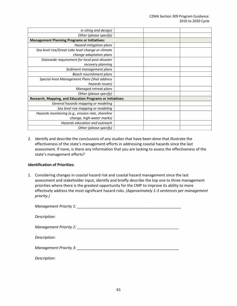
CZMA Section 309 Program Guidance: 2016 to 2020 Cycle
in siting and design) Other (please specify)
Management Planning Programs or Initiatives: Hazard mitigation plans
Sea level rise/Great Lake level change or climate change adaptation plans
Statewide requirement for local post-disaster recovery planning
Sediment management plans Beach nourishment plans
Special Area Management Plans (that address hazards issues)
Managed retreat plans Other (please specify)
Research, Mapping, and Education Programs or Initiatives: General hazards mapping or modeling
Sea level rise mapping or modeling Hazards monitoring (e.g., erosion rate, shoreline
change, high-water marks)
Hazards education and outreach Other (please specify)
2. Identify and describe the conclusions of any studies that have been done that illustrate the
effectiveness of the state’s management efforts in addressing coastal hazards since the last assessment. If none, is there any information that you are lacking to assess the effectiveness of the state’s management efforts?
Identification of Priorities: 1. Considering changes in coastal hazard risk and coastal hazard management since the last
assessment and stakeholder input, identify and briefly describe the top one to three management priorities where there is the greatest opportunity for the CMP to improve its ability to more effectively address the most significant hazard risks. (Approximately 1-3 sentences per management priority.) Management Priority 1: _________________________________________________ Description: Management Priority 2: ________________________________________________ Description: Management Priority 3: ________________________________________________ Description:
61
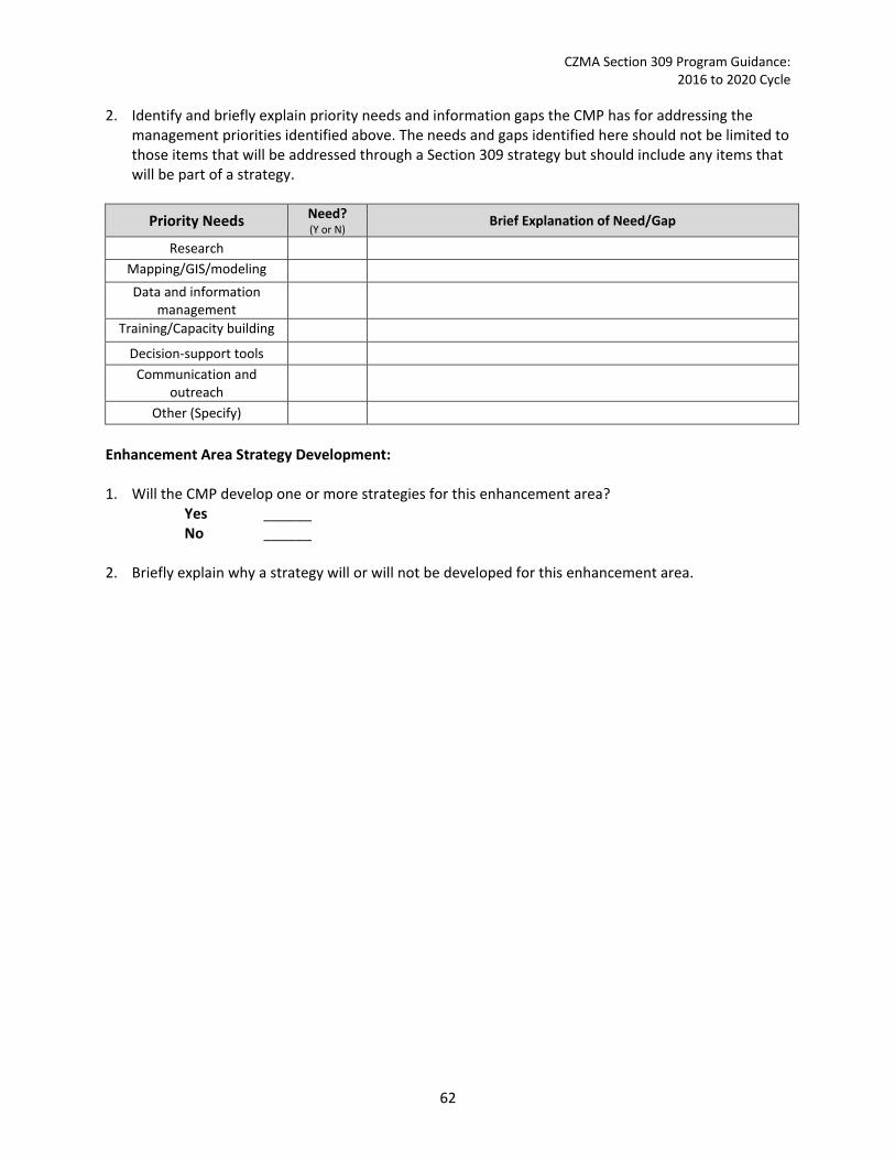
CZMA Section 309 Program Guidance: 2016 to 2020 Cycle
2. Identify and briefly explain priority needs and information gaps the CMP has for addressing the management priorities identified above. The needs and gaps identified here should not be limited to those items that will be addressed through a Section 309 strategy but should include any items that will be part of a strategy.
Priority Needs Need? (Y or N) Brief Explanation of Need/Gap
Research Mapping/GIS/modeling Data and information
management
Training/Capacity building Decision-support tools
Communication and outreach
Other (Specify) Enhancement Area Strategy Development: 1. Will the CMP develop one or more strategies for this enhancement area?
Yes ______ No ______
2. Briefly explain why a strategy will or will not be developed for this enhancement area.
62

CZMA Section 309 Program Guidance: 2016 to 2020 Cycle
Public Access In-Depth Resource Characterization: Purpose: To determine key problems and opportunities to improve the CMP’s ability to increase and enhance public access opportunities to coastal areas. 1. Use the table below to provide additional data on public access availability within the coastal zone
not reported in the Phase I assessment.
Public Access Status and Trends
Type of Access Current number47
Changes or Trends Since Last Assessment48 (↑, ↓, −, unkwn) Cite data source
Access sites that are ADA
compliant49
No. of Sites
Percent of Sites
2. What are the three most significant existing or emerging threats or stressors to creating or
maintaining public access within the coastal zone? Indicate the geographic scope of the stressor, i.e., is it prevalent throughout the coastal zone or are specific areas most threatened? Stressors can be private development (including conversion of public facilities to private); non-water-dependent commercial or industrial uses of the waterfront; increased demand; erosion; sea level rise or Great Lakes level change; natural disasters; national security; encroachment on public land; or other (please specify). When selecting significant stressors, also consider how climate change may exacerbate each stressor.
Stressor/Threat Geographic Scope
(throughout coastal zone or specific areas most threatened) Stressor 1 Stressor 2 Stressor 3
3. Briefly explain why these are currently the most significant stressors or threats to public access within the coastal zone. Cite stakeholder input and/or existing reports or studies to support this assessment.
4. Are there emerging issues of concern, but which lack sufficient information to evaluate the level of the potential threat? If so, please list. Include additional lines if needed.
47 Be as specific as possible. For example, if you have data on many access sites but know it is not an exhaustive list, note “more than” before the number. If information is unknown, note that and use the narrative section below to provide a brief qualitative description based on the best information available. 48 If you know specific numbers, please provide. However, if specific numbers are unknown but you know that the general trend was increasing or decreasing or relatively stable/unchanged since the last assessment, note that with a ↑ (increased), ↓ (decreased), − (unchanged). If the trend is completely unknown, simply put “unkwn.” 49 For more information on ADA see www.ada.gov.
63

CZMA Section 309 Program Guidance: 2016 to 2020 Cycle
Emerging Issue Information Needed
In-Depth Management Characterization: Purpose: To determine the effectiveness of management efforts to address identified problems related to the public access enhancement objective. 1. For each additional public access management category below that was not already discussed as
part of the Phase I assessment, indicate if the approach is employed by the state or territory and if significant changes (positive or negative) have occurred at the state- or territory-level since the last assessment.
Management Category Employed by
State/Territory (Y or N)
CMP Provides Assistance to Locals
that Employ (Y or N)
Significant Changes Since Last
Assessment (Y or N)
Comprehensive access management planning
GIS mapping/database of access sites
Public access technical assistance, education, and outreach (including access point and interpretive signage, etc.)
Other (please specify) 2. For management categories with significant changes since the last assessment, briefly provide the
information below. If this information is provided under another enhancement area or section of the document, please provide a reference to the other section rather than duplicate the information.
a. Describe significant changes since the last assessment; b. Specify if they were 309 or other CZM-driven changes; and c. Characterize the outcomes or likely future outcomes of the changes.
3. Identify and describe the conclusions of any studies that have been done that illustrate the
effectiveness of the state’s management efforts in providing public access since the last assessment. If none, is there any information that you are lacking to assess the effectiveness of the state’s management efforts?
Identification of Priorities: 1. Considering changes in public access and public access management since the last assessment and
stakeholder input, identify and briefly describe the top one to three management priorities where there is the greatest opportunity for the CMP to improve the effectiveness of its management effort to better respond to the most significant public access stressors. (Approximately 1-3 sentences per management priority.)
64
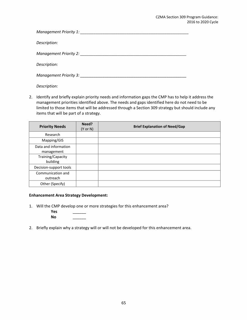
CZMA Section 309 Program Guidance: 2016 to 2020 Cycle
Management Priority 1: _________________________________________________ Description: Management Priority 2: ________________________________________________ Description: Management Priority 3: ________________________________________________ Description:
2. Identify and briefly explain priority needs and information gaps the CMP has to help it address the management priorities identified above. The needs and gaps identified here do not need to be limited to those items that will be addressed through a Section 309 strategy but should include any items that will be part of a strategy.
Priority Needs Need? (Y or N) Brief Explanation of Need/Gap
Research Mapping/GIS
Data and information management
Training/Capacity building
Decision-support tools Communication and
outreach
Other (Specify) Enhancement Area Strategy Development: 1. Will the CMP develop one or more strategies for this enhancement area?
Yes ______ No ______
2. Briefly explain why a strategy will or will not be developed for this enhancement area.
65

CZMA Section 309 Program Guidance: 2016 to 2020 Cycle
Marine Debris In-Depth Resource Characterization: Purpose: To determine key problems and opportunities to improve the CMP’s ability to effectively management marine debris in the coastal zone. 1. What are the three most significant existing or emerging challenges related to marine debris within
the coastal zone? Indicate the geographic scope of the challenge, i.e., is it prevalent throughout the coastal zone or are specific areas most threatened? Challenges can be land or ocean-based marine debris reduction (e.g., behavior change to reduce waste, increase recycling, or litter less); catastrophic event related debris; marine debris identification and removal; research and monitoring; education and outreach; or other (please specify). When selecting significant challenges, also consider how climate change may exacerbate each challenge.
Challenges Geographic Scope
(throughout coastal zone or specific areas most threatened) Challenge 1 Challenge 2 Challenge 3
2. Briefly explain why these are currently the most significant challenges related to marine debris in
the coastal zone. Cite stakeholder input and/or existing reports or studies to support this assessment.
3. Are there emerging issues of concern, but which lack sufficient information to evaluate the level of the potential threat? If so, please list. Include additional lines if needed.
Emerging Issue Information Needed
In-Depth Management Characterization: Purpose: To determine the effectiveness of management efforts to address identified problems related to the marine debris enhancement objective. 1. For each additional marine debris management category below that was not already discussed as
part of the Phase I assessment, indicate if the approach is employed by the state or territory and indicate if significant state- or territory-level changes (positive or negative) have occurred since the last assessment.
Management Category Employed by State or
Territory (Y or N)
CMP Provides Assistance to Locals
that Employ (Y or N)
Significant Changes Since Last Assessment
(Y or N)
Marine debris research, assessment, monitoring
Marine debris GIS mapping/database Marine debris technical assistance,
66
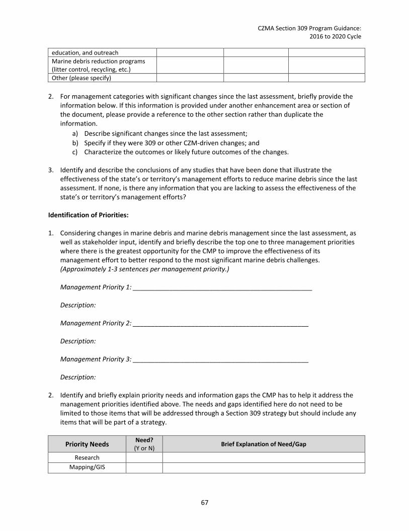
CZMA Section 309 Program Guidance: 2016 to 2020 Cycle
education, and outreach Marine debris reduction programs (litter control, recycling, etc.)
Other (please specify) 2. For management categories with significant changes since the last assessment, briefly provide the
information below. If this information is provided under another enhancement area or section of the document, please provide a reference to the other section rather than duplicate the information.
a) Describe significant changes since the last assessment; b) Specify if they were 309 or other CZM-driven changes; and c) Characterize the outcomes or likely future outcomes of the changes.
3. Identify and describe the conclusions of any studies that have been done that illustrate the
effectiveness of the state’s or territory’s management efforts to reduce marine debris since the last assessment. If none, is there any information that you are lacking to assess the effectiveness of the state’s or territory’s management efforts?
Identification of Priorities: 1. Considering changes in marine debris and marine debris management since the last assessment, as
well as stakeholder input, identify and briefly describe the top one to three management priorities where there is the greatest opportunity for the CMP to improve the effectiveness of its management effort to better respond to the most significant marine debris challenges. (Approximately 1-3 sentences per management priority.) Management Priority 1: _________________________________________________ Description: Management Priority 2: ________________________________________________ Description: Management Priority 3: ________________________________________________ Description:
2. Identify and briefly explain priority needs and information gaps the CMP has to help it address the management priorities identified above. The needs and gaps identified here do not need to be limited to those items that will be addressed through a Section 309 strategy but should include any items that will be part of a strategy.
Priority Needs Need? (Y or N) Brief Explanation of Need/Gap
Research Mapping/GIS
67

CZMA Section 309 Program Guidance: 2016 to 2020 Cycle
Data and information management
Training/Capacity building
Decision-support tools Communication and
outreach
Other (Specify) Enhancement Area Strategy Development: 1. Will the CMP develop one or more strategies for this enhancement area?
Yes ______ No ______
2. Briefly explain why a strategy will or will not be developed for this enhancement area.
68

CZMA Section 309 Program Guidance: 2016 to 2020 Cycle
Cumulative and Secondary Impacts
In-Depth Resource Characterization: Purpose: To determine key problems and opportunities to improve the CMP’s ability to address cumulative and secondary impacts of coastal growth and development. 1. What are the three most significant existing or emerging cumulative and secondary stressors or
threats within the coastal zone? Indicate the geographic scope of the stressor, i.e., is it prevalent throughout the coastal zone or are there specific areas that are most threatened? Stressors can be coastal development and impervious surfaces; polluted runoff; agriculture activities; forestry activities; shoreline modification; or other (please specify). Coastal resources and uses can be habitat (wetland or shoreline, etc.); water quality; public access; or other (please specify). When selecting significant stressors, also consider how climate change may exacerbate each stressor.
Stressor/Threat Coastal Resource(s)/Use(s) Most Threatened
Geographic Scope (throughout coastal zone or specific areas
most threatened) Stressor 1 Stressor 2 Stressor 3
2. Briefly explain why these are currently the most significant cumulative and secondary stressors or threats from coastal growth and development within the coastal zone. Cite stakeholder input and/or existing reports or studies to support this assessment.
3. Are there emerging issues of concern, but which lack sufficient information to evaluate the level of the potential threat? If so, please list. Include additional lines if needed.
Emerging Issue Information Needed
In-Depth Management Characterization: Purpose: To determine the effectiveness of management efforts to address identified problems related to the cumulative and secondary impacts enhancement objective. 1. For each additional cumulative and secondary impact management category below that is not
already discussed as part of the Phase I assessment, indicate if the approach is employed by the state or territory and if significant state- or territory-level changes (positive or negative) have occurred since the last assessment.
Management Category Employed by State or
Territory (Y or N)
CMP Provides Assistance to Locals
that Employ (Y or N)
Significant Changes Since Last Assessment
(Y or N)
Methodologies for determining CSI impacts
CSI research, assessment,
69

CZMA Section 309 Program Guidance: 2016 to 2020 Cycle
monitoring CSI GIS mapping/database CSI technical assistance, education and outreach
Other (please specify) 2. For management categories with significant changes since the last assessment, briefly provide the
information below. If this information is provided under another enhancement area or section of the document, please provide a reference to the other section rather than duplicate the information.
a. Describe significant changes since the last assessment; b. Specify if they were 309 or other CZM-driven changes; and c. Characterize the outcomes or likely future outcomes of the changes.
3. Identify and describe the conclusions of any studies that have been done that illustrate the
effectiveness of the state’s or territory’s management efforts in addressing cumulative and secondary impacts of development since the last assessment. If none, is there any information that you are lacking to assess the effectiveness of the state and territory’s management efforts?
Identification of Priorities: 1. Considering changes in cumulative and secondary impact threats and management since the last
assessment and stakeholder input, identify and briefly describe the top one to three management priorities where there is the greatest opportunity for the CMP to improve the effectiveness of its management effort to better assess, consider, and control the most significant threats from cumulative and secondary impacts of coastal growth and development. (Approximately 1-3 sentences per management priority.) Management Priority 1: _________________________________________________ Description: Management Priority 2: ________________________________________________ Description: Management Priority 3: ________________________________________________ Description:
2. Identify and briefly explain priority needs and information gaps the CMP has to help it address the management priorities identified above. The needs and gaps identified here do not need to be limited to those items that will be addressed through a Section 309 strategy but should include any items that will be part of a strategy.
70

CZMA Section 309 Program Guidance: 2016 to 2020 Cycle
Priority Needs Need? (Y or N) Brief Explanation of Need/Gap
Research Mapping/GIS
Data and information management
Training/Capacity building
Decision-support tools
Communication and outreach
Other (Specify) Enhancement Area Strategy Development: 1. Will the CMP develop one or more strategies for this enhancement area?
Yes ______ No ______
2. Briefly explain why a strategy will or will not be developed for this enhancement area.
71
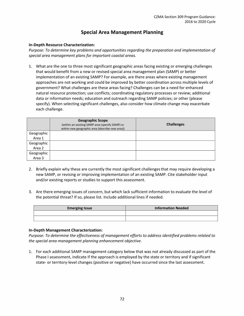
CZMA Section 309 Program Guidance: 2016 to 2020 Cycle
Special Area Management Planning In-Depth Resource Characterization: Purpose: To determine key problems and opportunities regarding the preparation and implementation of special area management plans for important coastal areas. 1. What are the one to three most significant geographic areas facing existing or emerging challenges
that would benefit from a new or revised special area management plan (SAMP) or better implementation of an existing SAMP? For example, are there areas where existing management approaches are not working and could be improved by better coordination across multiple levels of government? What challenges are these areas facing? Challenges can be a need for enhanced natural resource protection; use conflicts; coordinating regulatory processes or review; additional data or information needs; education and outreach regarding SAMP policies; or other (please specify). When selecting significant challenges, also consider how climate change may exacerbate each challenge.
Geographic Scope
(within an existing SAMP area (specify SAMP) or within new geographic area (describe new area))
Challenges
Geographic Area 1
Geographic Area 2
Geographic Area 3
2. Briefly explain why these are currently the most significant challenges that may require developing a
new SAMP, or revising or improving implementation of an existing SAMP. Cite stakeholder input and/or existing reports or studies to support this assessment.
3. Are there emerging issues of concern, but which lack sufficient information to evaluate the level of the potential threat? If so, please list. Include additional lines if needed.
Emerging Issue Information Needed
In-Depth Management Characterization: Purpose: To determine the effectiveness of management efforts to address identified problems related to the special area management planning enhancement objective. 1. For each additional SAMP management category below that was not already discussed as part of the
Phase I assessment, indicate if the approach is employed by the state or territory and if significant state- or territory-level changes (positive or negative) have occurred since the last assessment.
72

CZMA Section 309 Program Guidance: 2016 to 2020 Cycle
Management Category Employed by State
or Territory (Y or N)
CMP Provides Assistance to Locals
that Employ (Y or N)
Significant Changes Since Last Assessment
(Y or N)
SAMP research, assessment, monitoring
SAMP GIS mapping/database SAMP technical assistance, education, and outreach
Other (please specify) 2. For management categories with significant changes since the last assessment, briefly provide the
information below. If this information is provided under another enhancement area or section of the document, please provide a reference to the other section rather than duplicate the information.
a. Describe significant changes since the last assessment; b. Specify if they were 309 or other CZM-driven changes; and c. Characterize the outcomes or likely future outcomes of the changes.
3. Identify and describe the conclusions of any studies that have been done that illustrate the
effectiveness of the state’s or territory’s special area management planning efforts since the last assessment. If none, is there any information that you are lacking to assess the effectiveness of the state’s or territory’s management efforts?
Identification of Priorities: 1. Considering changes with coastal resource protection or coastal use conflicts within defined
geographic areas, special area management planning activities since the last assessment, and stakeholder input, identify and briefly describe the top one to three management priorities where there is the greatest opportunity for the CMP to improve their ability to prepare and implement special area management plans to effectively manage important coastal areas. (Approximately 1-3 sentences per management priority.) Management Priority 1: _________________________________________________ Description: Management Priority 2: ________________________________________________ Description: Management Priority 3: ________________________________________________ Description:
73

CZMA Section 309 Program Guidance: 2016 to 2020 Cycle
2. Identify and briefly explain priority needs and information gaps the CMP has to help it address the management priorities identified above. The needs and gaps identified here do not need to be limited to those items that will be addressed through a Section 309 strategy but should include any items that will be part of a strategy.
Priority Needs Need? (Y or N) Brief Explanation of Need/Gap
Research Mapping/GIS
Data and information management
Training/Capacity building
Decision-support tools Communication and
outreach
Other (Specify) Enhancement Area Strategy Development: 1. Will the CMP develop one or more strategies for this enhancement area?
Yes ______ No ______
2. Briefly explain why a strategy will or will not be developed for this enhancement area.
74

CZMA Section 309 Program Guidance: 2016 to 2020 Cycle
Ocean and Great Lakes Resources In-Depth Resource Characterization: Purpose: To determine key problems and opportunities to enhance the state CMP to better address cumulative and secondary impacts of coastal growth and development. 1. What are the three most significant existing or emerging stressors or threats to ocean and Great
Lakes resources within the coastal zone? Indicate the geographic scope of the stressor, i.e., is it prevalent throughout the coastal zone or are specific areas most threatened? Stressors can be land-based development; offshore development (including pipelines, cables); offshore energy production; polluted runoff; invasive species; fishing (commercial and/or recreational); aquaculture; recreation; marine transportation; dredging; sand or mineral extraction; ocean acidification; or other (please specify). When selecting significant stressors, also consider how climate change may exacerbate each stressor.
Stressor/Threat Geographic Scope
(throughout coastal zone or specific areas most threatened) Stressor 1 Stressor 2 Stressor 3
2. Briefly explain why these are currently the most significant stressors or threats to ocean and Great Lakes resources within the coastal zone. Cite stakeholder input and/or existing reports or studies to support this assessment.
3. Are there emerging issues of concern, but which lack sufficient information to evaluate the level of the potential threat? If so, please list. Include additional lines if needed.
Emerging Issue Information Needed
In-Depth Management Characterization: Purpose: To determine the effectiveness of management efforts to address identified problems related to the ocean and Great Lakes resources enhancement objective. 1. For each of the additional ocean and Great Lakes resources management categories below that
were not already discussed as part of the Phase I assessment, indicate if the approach is employed by the state or territory and if significant state- or territory-level changes (positive or negative) have occurred since the last assessment.
Management Category Employed by State
or Territory (Y or N)
CMP Provides Assistance to
Locals that Employ (Y or N)
Significant Changes Since Last Assessment
(Y or N)
Ocean and Great Lakes research, assessment, monitoring
Ocean and Great Lakes GIS
75

CZMA Section 309 Program Guidance: 2016 to 2020 Cycle
mapping/database Ocean and Great Lakes technical assistance, education, and outreach
Other (please specify) 2. For management categories with significant changes since the last assessment, briefly provide the
information below. If this information is provided under another enhancement area or section of the document, please provide a reference to the other section rather than duplicate the information.
a. Describe significant changes since the last assessment; b. Specify if they were 309 or other CZM-driven changes; and c. Characterize the outcomes or likely future outcomes of the changes.
3. Identify and describe the conclusions of any studies that have been done that illustrate the
effectiveness of the state’s or territory’s management efforts in planning for the use of ocean and Great Lakes resources since the last assessment. If none, is there any information that you are lacking to assess the effectiveness of the state’s or territory’s management efforts?
Identification of Priorities: 1. Considering changes in threats to ocean and Great Lakes resources and management since the last
assessment and stakeholder input, identify and briefly describe the top one to three management priorities where there is the greatest opportunity for the CMP to improve its ability to effectively plan for the use of ocean and Great Lakes resources. (Approximately 1-3 sentences per management priority.) Management Priority 1: _________________________________________________ Description: Management Priority 2: ________________________________________________ Description: Management Priority 3: ________________________________________________ Description:
2. Identify and briefly explain priority needs and information gaps the CMP has to help it address the management priorities identified above. The needs and gaps identified here do not need to be limited to those items that will be addressed through a Section 309 strategy but should include any items that will be part of a strategy.
76
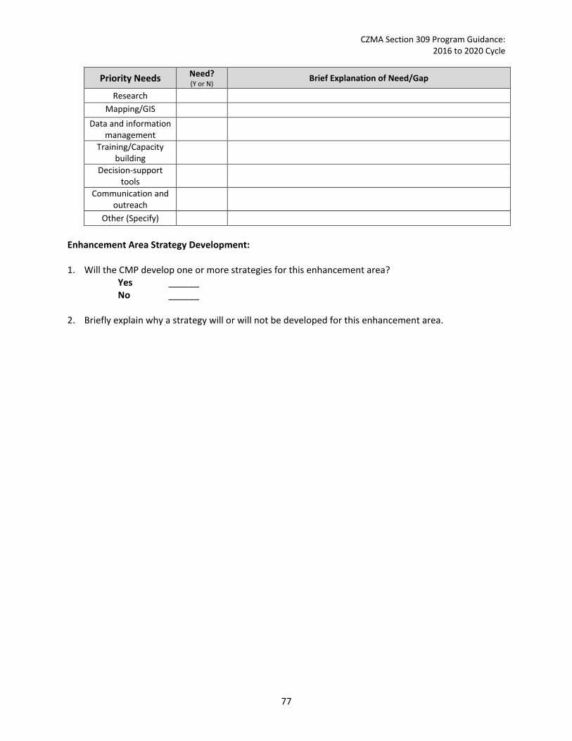
CZMA Section 309 Program Guidance: 2016 to 2020 Cycle
Priority Needs Need? (Y or N) Brief Explanation of Need/Gap
Research Mapping/GIS
Data and information management
Training/Capacity building
Decision-support tools
Communication and outreach
Other (Specify) Enhancement Area Strategy Development: 1. Will the CMP develop one or more strategies for this enhancement area?
Yes ______ No ______
2. Briefly explain why a strategy will or will not be developed for this enhancement area.
77

CZMA Section 309 Program Guidance: 2016 to 2020 Cycle
Energy and Government Facility Siting In-Depth Resource Characterization: Purpose: To determine key problems and opportunities relating to the siting of energy and government facility siting and activities that may be of greater than local significance. 1. What are the three most significant existing or emerging challenges to facilitating energy and
government facility siting and activities within the coastal zone? Indicate the geographic scope of the challenge, i.e., is it prevalent throughout the coastal zone or are specific areas most threatened? Challenges can be conflicting uses; coastal resource impacts; coordinating regulatory processes or review; insufficient data; natural disasters; national security; or other (please specify). When selecting significant challenges, also consider how climate change may exacerbate each challenge.
Challenges Geographic Scope
(throughout coastal zone or specific areas most threatened) Challenge 1 Challenge 2 Challenge 3
2. Briefly explain why these are currently the most significant challenges to facilitating energy and
government facility siting and activities within the coastal zone. Cite stakeholder input and/or existing reports or studies to support this assessment.
3. Are there emerging issues of concern, but which lack sufficient information to evaluate the level of the potential threat? If so, please list. Include additional lines if needed.
Emerging Issue Information Needed
In-Depth Management Characterization: Purpose: To determine the effectiveness of management efforts to address identified problems related to the energy and Government facilities enhancement objective. 1. For each additional energy and government facilities management category below that was not
already discussed as part of the Phase I assessment, indicate if the approach is employed by the state or territory and if significant state- or territory-level changes (positive or negative) have occurred since the last assessment.
Management Category Employed by State
or Territory (Y or N)
CMP Provides Assistance to Locals
that Employ (Y or N)
Significant Changes Since Last Assessment
(Y or N)
Energy and government facility/activity research, assessment, monitoring
Energy and government facility/activity GIS mapping/database
78

CZMA Section 309 Program Guidance: 2016 to 2020 Cycle
Energy and government facility siting technical assistance, education, and outreach
Other (please specify) 2. For management categories with significant changes since the last assessment, briefly provide the
information below. If this information is provided under another enhancement area or section of the document, please provide a reference to the other section rather than duplicate the information.
a. Describe significant changes since the last assessment; b. Specify if they were 309 or other CZM-driven changes; and c. Characterize the outcomes or likely future outcomes of the changes.
3. Identify and describe the conclusions of any studies that have been done that illustrate the
effectiveness of the state’s or territory’s management efforts in facilitating energy and government facility siting and activities since the last assessment. If none, is there any information that you are lacking to assess the effectiveness of the state’s or territory’s management efforts?
Identification of Priorities: 1. Considering changes in energy and government facility siting and activities, the management of
these facilities and activities since the last assessment, and stakeholder input, identify and briefly describe the top one to three management priorities where there is the greatest opportunity for the CMP to improve its ability to facilitate the siting of energy and government facilities and activities to address the most significant energy and government facility siting and activity challenges identified. (Approximately 1-3 sentences per management priority.) Management Priority 1: _________________________________________________ Description: Management Priority 2: ________________________________________________ Description: Management Priority 3: ________________________________________________ Description:
2. Identify and briefly explain priority needs and information gaps the CMP has to help it address the management priorities identified above. The needs and gaps identified here do not need to be limited to those items that will be addressed through a Section 309 strategy but should include any items that will be part of a strategy.
79

CZMA Section 309 Program Guidance: 2016 to 2020 Cycle
Priority Needs Need? (Y or N) Brief Explanation of Need/Gap
Research Mapping/GIS
data and information management
Training/Capacity building
Decision-support tools Communication and
outreach
Other (Specify) Enhancement Area Strategy Development: 1. Will the CMP develop one or more strategies for this enhancement area?
Yes ______ No ______
2. Briefly explain why a strategy will or will not be developed for this enhancement area.
80

CZMA Section 309 Program Guidance: 2016 to 2020 Cycle
Aquaculture In-Depth Resource Characterization: Purpose: To determine key problems and opportunities for facilitating the siting of aquaculture facilities in the coastal zone. 1. What are the three most significant existing or emerging challenges to facilitating the siting of
aquaculture facilities within the coastal zone? Indicate the geographic scope of the challenge, i.e., is it prevalent throughout the coastal zone or are specific areas most threatened? Challenges can be conflicting uses; coastal resource impacts; coordinating regulatory processes or review; insufficient data; natural disasters; or other (please specify). When selecting significant challenges, also consider how climate change may exacerbate each challenge.
Challenges Geographic Scope
(throughout coastal zone or specific areas most threatened) Challenge 1 Challenge 2 Challenge 3
2. Briefly explain why these are currently the most significant challenges to facilitating the siting of
aquaculture facilities in the coastal zone. Cite stakeholder input and/or existing reports or studies to support this assessment.
3. Are there emerging issues of concern, but which lack sufficient information to evaluate the level of the potential threat? If so, please list. Include additional lines if needed.
Emerging Issue Information Needed
In-Depth Management Characterization: Purpose: To determine the effectiveness of management efforts to address identified problems related to the aquaculture enhancement objective. 1. For each additional aquaculture management category below that was not already discussed as part
of the Phase I assessment, indicate if it is employed by the state and if significant state- or territory-level changes (positive or negative) have occurred since the last assessment.
Management Category Employed by the
State (Y or N)
CMP Provides Assistance to Locals
that Employ (Y or N)
Significant Changes Since Last Assessment
(Y or N)
Aquaculture research, assessment, monitoring
Aquaculture GIS mapping/database Aquaculture technical assistance, education, and outreach
Other (please specify)
81

CZMA Section 309 Program Guidance: 2016 to 2020 Cycle
2. For management categories with significant changes since the last assessment, briefly provide the
information below. If this information is provided under another enhancement area or section of the document, please provide a reference to the other section rather than duplicate the information.
a. Describe significant changes since the last assessment; b. Specify if they were 309 or other CZM-driven changes; and c. Characterize the outcomes or likely future outcomes of the changes.
3. Identify and describe the conclusions of any studies that have been done that illustrate the
effectiveness of the state’s or territory’s management efforts to facilitate the siting of aquaculture facilities since the last assessment. If none, is there any information that you are lacking to assess the effectiveness of the state’s or territory’s management efforts?
Identification of Priorities: 1. Considering changes in aquaculture activities, the management of these activities since the last
assessment, and stakeholder input, identify and briefly describe the top one to three management priorities where there is the greatest opportunity for the CMP to improve the effectiveness of its management effort to better respond to the most significant aquaculture challenges. (Approximately 1-3 sentences per management priority.) Management Priority 1: _________________________________________________ Description: Management Priority 2: ________________________________________________ Description: Management Priority 3: ________________________________________________ Description:
2. Identify and briefly explain priority needs and information gaps the CMP has to help it address the management priorities identified above. The needs and gaps identified here do not need to be limited to those items that will be addressed through a Section 309 strategy but should include any items that will be part of a strategy.
Priority Needs Need? (Y or N) Brief Explanation of Need/Gap
Research Mapping/GIS
Data and information management
Training/Capacity building
82

CZMA Section 309 Program Guidance: 2016 to 2020 Cycle
Decision-support tools Communication and
outreach
Other (Specify) Enhancement Area Strategy Development: 1. Will the CMP develop one or more strategies for this enhancement area?
Yes ______ No ______
2. Briefly explain why a strategy will or will not be developed for this enhancement area.
83
CZMA Section 309 Program Guidance: 2016 to 2020 Cycle
Appendix C: Strategy Template
84

CZMA Section 309 Program Guidance: 2016 to 2020 Cycle
[Strategy Title] I. Issue Area(s)
The proposed strategy or implementation activities will support the following high-priority enhancement areas (check all that apply):
Aquaculture Cumulative and Secondary Impacts Energy & Government Facility Siting Wetlands Coastal Hazards Marine Debris Ocean/Great Lakes Resources Public Access Special Area Management Planning
II. Strategy Description
A. The proposed strategy will lead to, or implement, the following types of program changes (check all that apply):
A change to coastal zone boundaries; New or revised authorities, including statutes, regulations, enforceable policies,
administrative decisions, executive orders, and memoranda of agreement/understanding; New or revised local coastal programs and implementing ordinances; New or revised coastal land acquisition, management, and restoration programs; New or revised special area management plans (SAMP) or plans for areas of
particular concern (APC) including enforceable policies and other necessary implementation mechanisms or criteria and procedures for designating and managing APCs; and,
New or revised guidelines, procedures, and policy documents which are formally adopted by a state or territory and provide specific interpretations of enforceable CZM program policies to applicants, local government, and other agencies that will result in meaningful improvements in coastal resource management.
B. Strategy Goal: _________________________________________________. State the goal of the strategy for the five-year assessment period. The goal should be the specific program change to be achieved or be a statement describing the results of the project with the expectation that achieving the goal would eventually lead to a program change. For strategies that implement an existing program change, the goal should be a specific implementation milestone. For example, work with three communities to develop revised draft comprehensive plans that consider future sea level rise or, based on research and policy analysis, present proposed legislation on wetland buffers to state legislature or consideration. Rather than a lofty statement, the goal should be achievable within the time frame of the strategy.
C. Describe the proposed strategy and how the strategy will lead to and/or implement the program
changes selected above. If the strategy will only involve implementation activities, briefly describe the program change that has already been adopted, and how the proposed activities will further that program change. (Note that implementation strategies are not to exceed two years.)
III. Needs and Gaps Addressed
Identify what priority needs and gaps the strategy addresses and explain why the proposed program change or implementation activities are the most appropriate means to address the
85
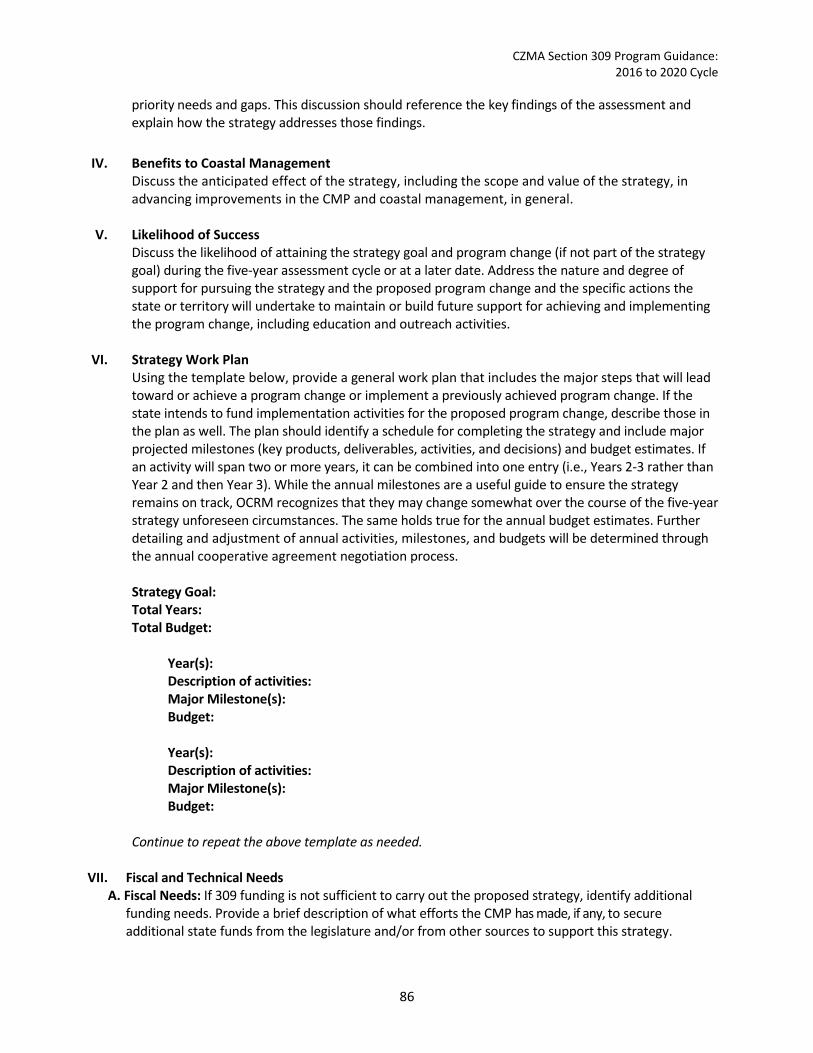
CZMA Section 309 Program Guidance: 2016 to 2020 Cycle
priority needs and gaps. This discussion should reference the key findings of the assessment and explain how the strategy addresses those findings.
IV. Benefits to Coastal Management
Discuss the anticipated effect of the strategy, including the scope and value of the strategy, in advancing improvements in the CMP and coastal management, in general.
V. Likelihood of Success Discuss the likelihood of attaining the strategy goal and program change (if not part of the strategy goal) during the five-year assessment cycle or at a later date. Address the nature and degree of support for pursuing the strategy and the proposed program change and the specific actions the state or territory will undertake to maintain or build future support for achieving and implementing the program change, including education and outreach activities.
VI. Strategy Work Plan
Using the template below, provide a general work plan that includes the major steps that will lead toward or achieve a program change or implement a previously achieved program change. If the state intends to fund implementation activities for the proposed program change, describe those in the plan as well. The plan should identify a schedule for completing the strategy and include major projected milestones (key products, deliverables, activities, and decisions) and budget estimates. If an activity will span two or more years, it can be combined into one entry (i.e., Years 2-3 rather than Year 2 and then Year 3). While the annual milestones are a useful guide to ensure the strategy remains on track, OCRM recognizes that they may change somewhat over the course of the five-year strategy unforeseen circumstances. The same holds true for the annual budget estimates. Further detailing and adjustment of annual activities, milestones, and budgets will be determined through the annual cooperative agreement negotiation process. Strategy Goal: Total Years: Total Budget:
Year(s): Description of activities: Major Milestone(s): Budget: Year(s): Description of activities: Major Milestone(s): Budget:
Continue to repeat the above template as needed.
VII. Fiscal and Technical Needs A. Fiscal Needs: If 309 funding is not sufficient to carry out the proposed strategy, identify additional
funding needs. Provide a brief description of what efforts the CMP has made, if any, to secure additional state funds from the legislature and/or from other sources to support this strategy.
86
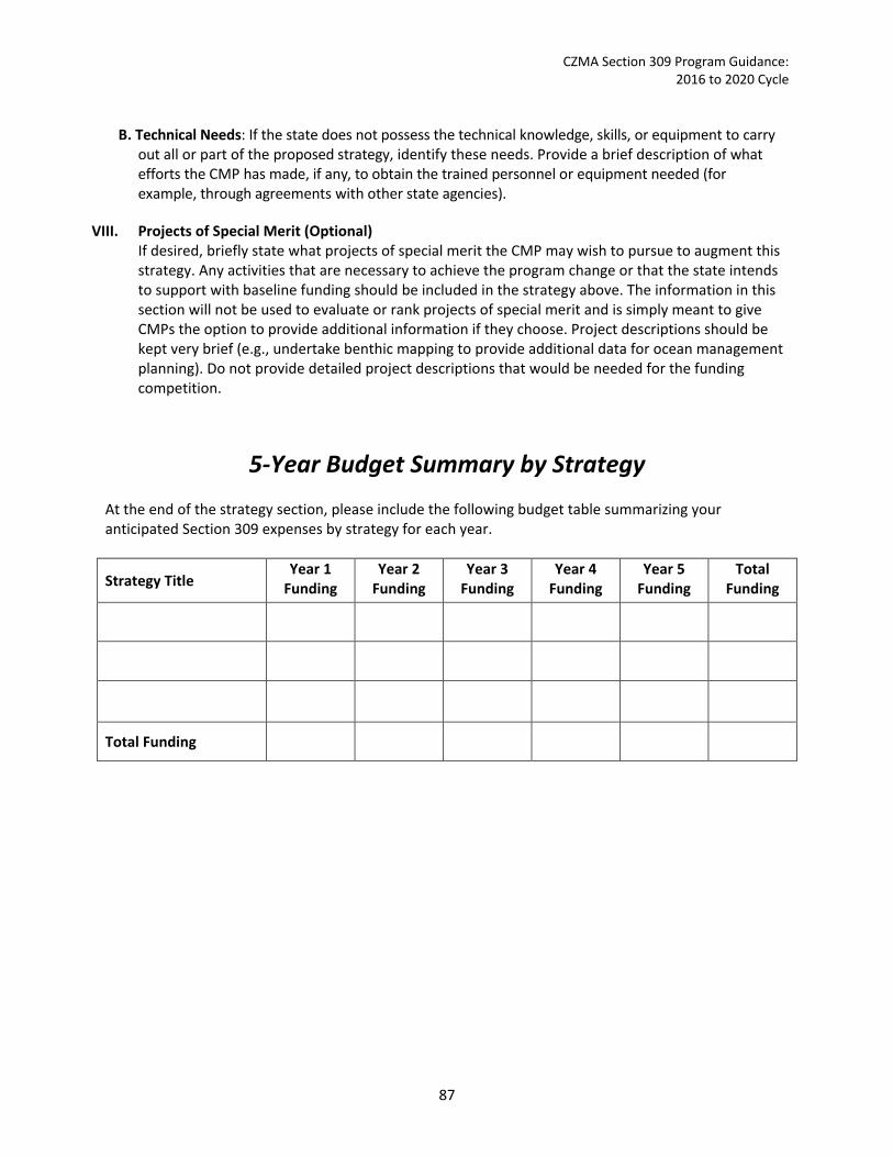
CZMA Section 309 Program Guidance: 2016 to 2020 Cycle
B. Technical Needs: If the state does not possess the technical knowledge, skills, or equipment to carry
out all or part of the proposed strategy, identify these needs. Provide a brief description of what efforts the CMP has made, if any, to obtain the trained personnel or equipment needed (for example, through agreements with other state agencies).
VIII. Projects of Special Merit (Optional)
If desired, briefly state what projects of special merit the CMP may wish to pursue to augment this strategy. Any activities that are necessary to achieve the program change or that the state intends to support with baseline funding should be included in the strategy above. The information in this section will not be used to evaluate or rank projects of special merit and is simply meant to give CMPs the option to provide additional information if they choose. Project descriptions should be kept very brief (e.g., undertake benthic mapping to provide additional data for ocean management planning). Do not provide detailed project descriptions that would be needed for the funding competition.
5-Year Budget Summary by Strategy At the end of the strategy section, please include the following budget table summarizing your anticipated Section 309 expenses by strategy for each year.
Strategy Title Year 1
Funding Year 2
Funding Year 3
Funding Year 4
Funding Year 5
Funding Total
Funding
Total Funding
87
CZMA Section 309 Program Guidance: 2016 to 2020 Cycle
Appendix D: Types of Program Changes Examples of some types of program changes that would be appropriate to aim for as the ultimate goal of a Section 309 strategy are provided below. This is not an exhaustive list. There are likely many suitable program changes not listed here, but hopefully the examples provided here spark ideas.
Wetlands
Legislative Objective: Protection, restoration, or enhancement of existing coastal wetlands base or creation of new coastal wetlands.§309(a)(1)
Programmatic Objectives: 1. Develop or improve regulatory programs to protect and preserve existing wetland acreage and
function from direct, indirect, and cumulative adverse impacts.
Examples include: • Develop or enhance sequenced mitigation decision-making policies which strive to first avoid
wetland impacts, then minimize those impacts, and finally, properly mitigate any impacts that cannot be avoided or minimized.
• Incorporate a practical alternatives analysis or cumulative and secondary impacts analysis into the regulatory review process for projects impacting wetlands.
• Develop or enhance a comprehensive wetland mitigation policy and program. • Develop or enhance enforcement, surveillance, or monitoring programs for wetland permits
to measure gains and losses of wetlands acreage and function. • Develop or enhance policies that require siting development away from wetlands or other
critical areas where development is likely to lead to indirect impacts to wetlands (e.g., creating of vegetated buffer or setback policies).
• Develop or enhance a memorandum of understanding or other formal agreement between other state agencies, federal or local governments to create a more streamlined and coordinated wetland permit application and review process.
2. Develop or improve programs and policies to protect and restore wetland function.
Examples include: • Develop or enhance public wetland restoration programs to restore degraded wetlands and
areas that were previously wetlands. Programs could include the following elements: o Identify degraded wetlands sites, o Establish and implement best practices for wetland restoration and technical
assistance programs, o Identify sites were restoration has the greatest likelihood of success considering
climate change and other factors, o Identify permanent funding sources to support restoration activities such as through a
state bond fund or public-private partnership, and o Establish programs to monitor restoration sites.
• Establish fee simple or less than fee simple wetlands acquisition programs.
88

CZMA Section 309 Program Guidance: 2016 to 2020 Cycle
• Develop or update wetland restoration or acquisition plans that are formally adopted by the state to identify priority sites for wetland restoration or acquisition.
• Develop or enhance policies to: o Promote wetlands restoration and acquisition in areas that are likely to achieve the
greatest nonpoint source pollution reduction benefits, o Promote wetlands restoration and acquisition in areas that are likely to provide
greatest climate change adaptation benefits (e.g., where wetlands have room to migrate inland as sea levels rise or provide greatest protection from storm surge and flooding),
o Provide incentives to landowners to sell or donate wetlands to states or local government (e.g., conservation easement tax-incentive programs), or
o Provide disincentives to development in or near wetlands through restricted capital expenditures, taxes, etc.
Coastal Hazards
Legislative Objective: Preventing or significantly reducing threats to life and destruction of property by eliminating development and redevelopment in high-hazard areas, managing development in other hazard areas, and anticipating and managing the effects of potential sea level rise and Great Lakes level rise [or change].§309(a)(2)
Programmatic Objectives: 1. Direct future public and private development and redevelopment away from hazardous areas,
including the high-hazard areas delineated as FEMA v-zones and areas vulnerable to inundation from sea level rise. Examples include:
• Develop or enhance policies that eliminate development and redevelopment in high-hazard areas and restrict development in other hazardous areas, such as: o Prohibit new development and redevelopment in high-hazard areas. o Establish or update shoreline-setback lines based on annual erosion rates. o Require that future sea level and other climate-related changes and impacts be
considered when siting structures and infrastructure. Restrict the use of public funds for infrastructure or other projects that would allow or encourage development in hazardous areas.
o Revise state or local building codes to require structures be designed to withstand higher winds or more frequent/higher flooding (e.g., require freeboard, require V Zone standards in Coastal A Zones).
• Develop or enhance programs that eliminate development and redevelopment in high-hazard areas and restrict development in other hazardous areas, such as: o Develop land acquisition programs to acquire high-risk parcels. o Develop relocation assistance and buy-out programs. o Develop transfer or purchase of development rights programs to promote lower
development densities in hazardous areas.
89
CZMA Section 309 Program Guidance: 2016 to 2020 Cycle
2. Preserve and restore the protective functions of natural shoreline features such as beaches, dunes, and wetlands.
Examples Include: • Develop or enhance policies to minimize the degradation of protective functions of natural
shoreline features, such as: o Restrict or prevent the use of hard erosion control structures, such as sea walls and
bulkheads that may impact natural shoreline features. o Require building setbacks from beaches, dunes, wetlands, and other protective features.
• Develop or enhance policies and permitting processes to facilitate the use of green
infrastructure, such as living shorelines, where appropriate, to provide protective functions and other habitat values.
• Develop or enhance programs or plans to preserve and restore the protective functions of natural shorelines, such as: o Enhance land acquisition or restoration programs to prioritize lands for acquisition or
restoration that would provide greatest hazards protection. o Develop a statewide beach renourishment plan, including long-term funding
mechanisms and methods, to establish priority projects. o Develop a statewide beach monitoring program and use data to identify and prioritize
beaches in need of erosion control efforts.
3. Prevent or minimize threats to existing populations, property, and infrastructure from both episodic and chronic coastal hazards.
Examples Include:
• Develop or update hazard mitigation plans. • Develop pre-disaster recovery plans to identify how to strategically rebuild after a storm. • Develop climate change adaptation plans that include conducting vulnerability assessments
and identifying actions to minimize risks or incorporate adaptation into other plans, such as hazard mitigation and natural resource protection plans.
• Revise land use plans and other management plans to consider climate change and sea and lake-level change.
• Adopt managed retreat policies or plans. • Develop a cost-share or low-interest loan program to help retrofit buildings to improve their
hazard resiliency. • Establish a grants program to support local risk reduction efforts. • Establish a technical assistance program to support local risk reduction efforts.
Public Access
Legislative Objective: Attaining increased opportunities for public access, taking into account current and future public access needs to coastal areas of recreational, historical, aesthetic, ecological, or cultural value. §306(a)(3)
90

CZMA Section 309 Program Guidance: 2016 to 2020 Cycle
Programmatic Objectives: 1. Improve public access through regulatory, statutory, legal, and financial mechanisms.
Examples Include: • Develop and revise state and local statutes and regulations to better provide public access,
including ensuring or enhancing public access through permit conditions. • Support local governments in revising local zoning ordinances to provide for additional
public access. • Develop legal strategies based on the public trust doctrine and other public interest
doctrines to protect and enhance opportunities for public access, such as establishing a rights-of-way program to ensure established public rights-of-way are maintained and used as public access sites.
• Create a long-term funding mechanism to support public access creation, improvement, and maintenance projects, such as through a specialized license plate fee, special assessments, bond initiatives, or other mechanisms.
• Develop or enhance programs to encourage landowners to dedicate property and easements for public access.
2. Provide a strategic approach to providing adequate public access to coastal areas.
Examples Include:
• Integrate public access opportunities into land use plans and waterfront redevelopment plans.
• Develop or enhance a coastal Public Access Management Plan which provides public access to all users of coastal areas of recreational, historical, aesthetic, ecological, and cultural value. The plan should have adequate implementation mechanisms and could include sections that:
o Develop or update public access inventory, including maps of and guide to existing and potential public access sites.
o Assess current and future demand for public access. o Identify site selection and design criteria, management, and maintenance issues for
each type of public access. o Incorporate pertinent sections of the State Comprehensive outdoor Recreation Plan
into the Coastal Public Access Management Plan. o Update or designate public access sites as areas of particular concern, areas for
preservation or enhancement, or special management areas. o Ensure that signage is provided for all public access sites. o Ensure that all users of the coast, including handicapped individuals and all socio-
economic classes, are afforded the same public access opportunities. o Increase community support and cooperation through public education and
involvement. o Incorporate existing public access policies.
91

CZMA Section 309 Program Guidance: 2016 to 2020 Cycle
Marine Debris
Legislative Objective: Reduce marine debris entering the Nation’s coastal and ocean environment by managing uses and activities that contribute to the entry of such debris. §309(a)4
Programmatic Objective: 1. Develop or revise programs, policies, and plans to reduce the amount of marine debris in the
coastal zone.
Examples Include: • Develop or enhance state and local programs that require recycling and reduce littering and
wasteful packaging in the coastal zone. • Establish state and local regulations consistent with the Marine Plastic Pollution Research
and Control Act of 1987 and develop enforcement strategies and programs. • Incorporate marine debris concerns into harbor, port, marina, and coastal solid waste
management plans.
Cumulative and Secondary Impacts
Legislative Objective: Development and adoption of procedures to assess, consider, and control cumulative and secondary impacts of coastal growth and development, including the collective effect on various individual uses or activities on coastal resources, such as coastal wetlands and fishery resources, coastal access, or other issues. §309(a)(5)
Programmatic Objectives: 1. Develop or revise procedures and policies to minimize cumulative and secondary impacts of
coastal growth and development.
Examples Include: • Establish or improve coastal planning processes to address the cumulative and secondary
impacts of future growth, for example, by identifying areas of rapid growth which contain sensitive coastal resources or implement coastal uses, assessing anticipated cumulative and secondary impacts, and establishing appropriate land use controls and mitigation measures to protect valuable coastal resources and uses.
• Establish or improve procedures for the consideration of cumulative and secondary effects in project and permit review decisions and infrastructure and land acquisition programs.
• Develop defensible methodologies to assess cumulative and secondary impacts, such as visual impact assessments, to use in planning and permitting decisions.
• Establish impervious surface or building density limits for sensitive areas. • Develop management plans or special area management plans that take a comprehensive
look at cumulative and secondary impacts within a specific management area and identify actions and policies to minimize impacts.
• Establish programs or policies to support implementation of the state’s Coastal Nonpoint Program, such as regular inspection programs for existing onsite disposal systems.
92

CZMA Section 309 Program Guidance: 2016 to 2020 Cycle
Special Area Management Planning
Legislative Objective: Preparing and implementing special area management plans for important coastal areas. §309(a)(6)
Programmatic Objective: 1. Develop or enhance special area management plans (SAMPs) for identified coastal areas subject
to use conflicts. The following criteria can be used to help identify where SAMPs may be appropriate:
• The need for more geographically specific policies. • The area includes significant coastal resources that are being severely affected by
cumulative or secondary impacts from coastal growth. • There are multiple local, state, and federal authorities that necessitate effective
coordination and cooperation to compressively address coastal development and use issues on an ecosystem basis.
• There is a history of long-standing disputes between local, state, or federal agencies over certain coastal resources which have resulted in protracted negotiations over the acceptability of proposed uses.
• There is strong commitment at all levels of government to enter into a collaborative planning process to produce definitive regulatory products.
• A strong state or regional entity exists which is willing and able to sponsor the planning program.
Examples Include:
• Develop a SAMP to establish policies to protect cultural, historic, and aesthetic resources within a specific embayment, such as developing specific standards for residential docks and other uses within the embayment and riparian buffer requirements.
• Develop a SAMP to revitalize an urban waterfront area. • Develop a SAMP to comprehensively protect habitat and water quality while promoting
sustainable aquaculture and eco-tourism within a particular watershed. • Update an existing SAMP to address new or emerging issues within the SAMP management
area, such as sea level rise, invasive species, or increased development.
Ocean and Great Lakes Resources
Legislative Objective: Planning for the use of ocean resources. §309(a)(7)
Programmatic Objective: 1. Develop and enhance comprehensive or sector-specific ocean resource management plans,
policies, and programs, to balance development and protection of ocean resources, coordinate existing authorities, and minimize use conflicts.
Examples Include:
• Develop or update comprehensive state or regional ocean management plans and policies. • Develop invasive specifies management plans and policies.
93

CZMA Section 309 Program Guidance: 2016 to 2020 Cycle
• Develop new submerged lands leasing programs to assess a fee for the use of public lands for private purposes.
• Work with federal and state agencies to develop a dredge material disposal plan for the state or a specific region.
Energy and Government Facility Siting
Legislative Objective: Adoption of procedures and enforceable policies to help facilitate the siting of energy facilities and Government facilities and energy-related activities and government activities which may be of greater than local significance. §309(a)(8)
Programmatic Objectives: 1. Develop and improve procedures, policies, and standards to facilitate the siting of energy and
Government facilities and related activities.
Examples Include: • Develop MOUs or MOAs to coordinate and streamline regulatory review programs and
procedures for energy or Government facility siting and related activities across different levels of government and government agencies.
• Coordinate with federal agencies to use administrative efficiencies in NOAA’s federal consistency regulations to facilitate and streamline federal consistency reviews. These administrative efficiencies could include:
o Creating thresholds for when a federal action would be subject to state CZMA review;
o Using a “general consistency determination” that would cover multiple occurrences of a federal action, or
o Eliminating certain federal actions from consistency reviews (beneficial coastal effects, de minimis coastal effects).
• Develop or revise effects-based enforceable policies that address new information on the effects from new or emerging energy technologies.
• Update federal consistency lists to refine which federal actions the coastal management program would like to review or develop a geographic location description for specific federal actions occurring outside of the state’s coastal zone, including interstate areas.
2. Develop or enhance long-term planning processes or programs to consider the needs of energy and Government facilities and activities of greater-than-local significance.
Examples Include:
• Develop new or revised existing land use or ocean plans to include policies and standards to facilitate the siting of energy and Government facilities while protecting coastal resources and other coastal uses.
• Develop long-term monitoring programs, including the creation of a finance mechanism, to assess long-term impacts of energy facility siting or Government uses in the coastal zone to inform future planning and policy decisions.
94
CZMA Section 309 Program Guidance: 2016 to 2020 Cycle
Aquaculture
Legislative Objective: Adoption of procedures and policies to evaluate and facilitate the siting of public and private aquaculture facilities in the coastal zone, which will enable States to formulate, administer, and implement strategic plans for marine aquaculture. §309(a)(9)
Programmatic Objective: 1. Develop and improve procedures, policies, and standards for aquaculture in the coastal zone.
Examples include: • Create new policies and standards for the siting and design of aquaculture facilities, such
as co-locating aquaculture with other coastal uses, such as offshore energy facilities. • Revise the aquaculture permitting review process to streamline and improve coordination
among federal, local, and state authorities.
2. Develop or enhance planning processes to promote aquaculture and balance aquaculture activities with other uses.
Examples include:
• Update land use, ocean management, or other plans, as appropriate, to identify priority areas for aquaculture activities.
• Assess the vulnerability of shellfish aquaculture to the impacts of climate change, such as ocean acidification, and develop a strategic approach and recommendations to improve the resiliency of the industry.
95

CZMA Section 309 Program Guidance: 2016 to 2020 Cycle
Appendix E: Example Program Changes
Introduction This appendix contains examples of program changes from previous Section 309 assessment cycles. The examples demonstrate eligible activities coming together into comprehensive strategies that are designed to lead to program changes or implement already-achieved program changes. The example program changes listed here do not include complete strategies or work plans. Please refer to the Section 309 program guidance and Appendix B for detailed guidance on development, organization, and format of the strategy.
Status and Trends of Inland Wetlands and Aquatic Habitats Program Change Categories:
• New or revised coastal land acquisition, management, and restoration programs; and • New or revised guidelines, procedures, and policy documents which are formally adopted by a
state or territory and provide specific interpretations of enforceable coastal management program policies to applicants, local government, and other agencies that will result in meaningful improvements in coastal resource management.
This project builds upon an ongoing, coast-wide effort to study the status and trends of wetlands and aquatic habitats on barrier islands by extending that effort to inland environments on the Texas coast. Inland wetland status and trends data are of particular importance since palustrine or freshwater wetlands are no longer protected by regulations under the CWA. The loss of regulatory protection for these wetlands highlights the need to provide up-to-date information to local, state, and federal restoration and acquisition programs to ensure adequate protection for the resource. This project will provide regional characterizations for inland wetlands that will inform individual program priorities and/or strategies for restoration and acquisition. Data from this strategy will be used to:
• Update the following required elements of the Texas CELCP plan: a map or description of the geographic extent of coastal and estuarine areas within the state; identification of “project areas” that represent the state’s priority areas for conservation; and a description of existing plans, or elements thereof, that are incorporated into the plan;
• Assess the relative merit of these types of projects nominated for The Coastal Impacts Assistance Program (CIAP) funding over the course of its implementation;
• Prioritize CMP grant program projects proposed in areas of identified need or as specific requests for proposals;
• Update to the Texas Coastwide Erosion Response and Assessment (CEPRA) Program Plan and other state acquisition and restoration programs;
• Update the Resource Management Codes (RMC) for state-owned tracts in bays and estuaries. RMC are assigned by state and federal resource agencies (including the GLO for seismic activities) and represent regulatory guidelines;
96

CZMA Section 309 Program Guidance: 2016 to 2020 Cycle
• Inform other state agencies with wetland regulatory management programs for potential use, such as a wetland monitoring strategy to inventory surface water quality, the Permit Assistance Group mitigation guidelines; and
• Promote an understanding of the results to city and county officials, relevant state and federal agencies, NGOs, non-profit organizations, universities and other public and private interests.
Coastal managers often lack accurate, up-to-date data from which to base their decisions. This project will not only provide an update of the current status of inland wetlands but will also forecast future changes. It is anticipated that this information will identify those inland wetlands and other aquatic habitats most threatened by erosion, subsidence, development and other processes and will facilitate the adoption of proactive measures, either regulatory or non-regulatory in nature, by state and local authorities and coastal programs to protect, restore and maintain those resources. Activities: The following outlines the general tasks for data collection and analysis at each proposed study area. One study area will be undertaken each year in the following order: year 1, Corpus Christi-Coastal Bend; year 2, Beaumont-Port Arthur; year 3, Matagorda Bay; year 4, Brownsville-Harlingen; and year 5, Freeport-San Antonio Bay.
1. Interpret and map wetlands and aquatic habitats on historical and recent aerial photographs, using and revising existing historical data where acceptable;
2. Process habitat delineations and enter into GIS; 3. Field-check mapped wetlands; 4. Conduct detailed quality control analysis of all (historical and current) GIS databases; 5. Analyze wetland trends, determine probable causes, and present write up results; and 6. Complete final manuscript and update the follow programs through guidance the implementation
policies: • Texas Coastal and Estuarine Land Conservation Plan • Coastal Impacts Assistance Program Guidance • Texas Coastal Management Program Grant Program Guidance • Coastwide Erosion Response and Assessment Program Plan • Coastal Bends and Bay Estuary Program • Texas Resource Management Codes and Guidelines • Interagency Permit Assistance Group • Sea Grant Extension Program • Council of Applied Coastal Research Community • Workshops to city and county officials
Adoption of Refined Coastal Goals Type of Program Change:
• New or revised authorities, including statutes, regulations, enforceable policies, administrative decisions, executive orders, and memoranda of agreement or understanding.
New Jersey’s federally approved Coastal Management Program and the Coastal Zone Management rules at N.J.A.C. 7:7E were founded on broad coastal goals. These goals, referred to in the current rules as the
97

CZMA Section 309 Program Guidance: 2016 to 2020 Cycle
“eight basic coastal policies,” have essentially remained unchanged since the Coastal Zone Management rules were promulgated in 1978.
Based on substantial evidence, there is acute national concern that the health of our oceans is seriously compromised as a result of nonpoint and point source pollution, climate change, overfishing and coastal development. Two national Commissions, the Pew Oceans Commission and the U.S. Commission on Ocean Policy issued similar conclusions in 2003 and 2004 respectively, that our oceans and coastal areas are in crisis and that a national ocean policy is needed. As a result of both the Commissions’ conclusions and the Department’s 26 years of experience implementing the existing coastal goals through the Coastal Management Program and Coastal Zone Management rules, NJCMP concluded that revision of the eight original coastal policies is warranted. A draft of the refined goals that accurately reflects current conditions and trends relevant to comprehensive coastal management in New Jersey is complete. Shortly, NJDEP plans to propose the refined coastal goals as regulations and adopt the regulations as enforceable policies soon thereafter. Activities:
• Update and modify the eight basic NJCMP policies as coastal goals with operational policies clearly articulated.
• Propose as regulations. • Adopt regulations as enforceable policies of the NJCMP. • Submit refined NJCMP Goals to NOAA as a Program Change.
Significant Coastal Fish and Wildlife Habitats Type of Program Change:
• New or revised authorities, including statutes, regulations, enforceable policies, administrative decisions, executive orders, and memoranda of agreement/understanding;
Strengthen the State’s enforceable policy regarding designated Significant Coastal Fish and Wildlife Habitats by completing updates for the south shore of Long Island and Hudson River region, and initiating the updates for the Great Lakes region and the Long Island Sound portion of Westchester County. These Significant Coastal Fish and Wildlife Habitats were originally designated in 1987. The enforceable policy states that Significant Coastal Fish and Wildlife Habitats will be protected, preserved, and where practical, restored so as to maintain their viability as habitats. Significant Coastal Fish and Wildlife Habitat narratives and boundaries are used by the Coastal Management Program as well as by Department of Environmental Conservation permit reviewers, municipal governments, consultants, educators, and others. Updating the Significant Coastal Fish and Wildlife Habitat documentation and boundaries for the south shore of Long Island, Hudson River, Great Lakes and Westchester County contributes to wetlands management by ensuring that up-to-date data and impact assessments are used in making management decisions, improving New York’s ability to protect listed species, rare communities, and important human uses associated with the state’s wetland resources. Activities:
• Coordinate with Department of Environmental Conservation staff to compile existing biological survey data and review habitat. Revise narratives and boundaries for habitats to include updated
98

CZMA Section 309 Program Guidance: 2016 to 2020 Cycle
and new biological information and impact assessments. As part of this process, consider the need to designate new and repeal existing habitats.
• Revise boundary information in the Division GIS system and produce updated habitat maps. • Conduct public information hearings and public meetings. • Submit Routine Program Change.
Beneficial Use of Dredge Material Contribution Fund Type of Program Change:
• New or revised authorities, including statutes, regulations, enforceable policies, administrative decisions, executive orders, and memoranda of agreement or understanding.
According to La. Rev. Stat. 43:214.30, whenever a proposed use or activity requires a CUP for the dredging or disposal of from 25,000 to 500,000 cubic yards of any water bottoms or wetland within the LCZ, the secretary of LDNR may require the beneficial use of the dredge material. Beneficial use of dredge material is required in circumstances where it is deemed economically feasible, but is not required in those cases when it is not economically feasible. Over the years, many CUPs were issued which did not require that dredged material excavated as a result of the permitted activities be used beneficially. As a result, in order for the state to fulfill its obligation under the public policy provisions of SLCRMA LDNR/CMD is proposing to investigate the cost effectiveness of beneficial placement of dredged material in those cases deemed economically infeasible. The ultimate outcome for those cases where it is not economically feasible to dispose of the dredge material beneficially in the LCZ, is for the CUP applicant to pay into a dedicated fund based on a fair cost. The fund will be used by the State for beneficial use projects (e.g., wetland and habitat restoration) such as the Dedicated Dredge Program. Based on the results of the study, the LDNR/CMD will propose new legislation/rule making requiring applicants (possibly both state and federal) to pay a fee to the Beneficial Use of Dredge Material Mitigation Account in those cases when it is determined not to be cost effective to dispose of dredge material beneficially. The CMD will build a GIS database which will allow for the tracking of contributions made to the fund. Activities:
• Work with CRD and CED staff to determine the cut-off for cost effectiveness of using dredge materially beneficially. As much as possible LDNR/OCRM staff will use already existing information such as Dedicated Dredge Program data. LDNR/CMD staff will determine a fee based on cost/cubic yard of dredge material that will be required in those cases where the beneficial use of dredge material is not cost effective.
• Establish a Division Policy requiring applicants to pay a fee to the Beneficial Use of Dredge Material Mitigation Account in those cases when it is determined not to be cost effective to dispose of dredge material beneficially.
• Build a GIS database which will allow for the tracking of contributions made to the fund. • Propose new legislation/rule making requiring applicants to pay a fee to the Beneficial Use of
Dredged Material Mitigation Account.
99

CZMA Section 309 Program Guidance: 2016 to 2020 Cycle
Model Post Disaster Redevelopment Plans Program Change Categories:
• New or revised authorities, including statutes, regulations, enforceable policies, administrative decisions, executive orders, and memoranda of agreement or understanding.
• New or revised local coastal programs and implementing ordinances. FDCA-DEM proposes to facilitate the development of post-disaster redevelopment plans (PDRP) statewide. Model plans will be produced as examples for all coastal communities and a “Best Practices Guide” will be revised to help with PDRP development. FDCA-DEM will also propose legislation to require communities to develop a PDRP as part of the local government comprehensive plan. Post-disaster redevelopment planning would improve the state’s ability to recover from disasters and guide redevelopment in an appropriate manner. All Florida communities must adopt, regularly evaluate and update their comprehensive growth management plans. The plans prepared by the 197 communities that abut the Atlantic Ocean and Gulf of Mexico must also include a separate coastal management element. While PDRPs are a recommended component of the coastal management element, few local governments have adopted them. In addition, all Florida communities would benefit from a PDRP, not just the coastal communities. While the required comprehensive plans and coastal management elements have all been adopted, information regarding the number of communities with PDRPs is not available. The best information, a survey conducted as part of the 1995 Hurricane Opal Case Study, indicates that 65 of the 113 communities that responded to the survey believed that they were required to prepare a PDRP. Of those 65 communities, only 27 stated that they had actually prepared the plan. An inspection of the 27 plan documents revealed that 13 of these plans included a separate recovery plan that exceeded the policies that should be included in the coastal management element of the comprehensive plan. Anecdotal information suggests that the situation has not improved since 1995. Activities:
• Identify communities with current PDRPs and evaluate their effectiveness. • Complete model PDRPs for four communities. • Revise Best Practices Guide to aid in the development of PDRPs. • Propose legislation requiring local governments to adopt PDRPs as part of their local government
comprehensive plan.
Metro Bay SAMP Urban Coastal Greenway Program Change Categories:
• New or revised coastal land acquisition, management, and restoration programs; and • New or revised special area management plans (SAMP) or plans for areas of particular concern
(APC) including enforceable policies and other necessary implementation mechanisms or criteria and procedures for designating and managing APCs.
The purpose of this program change is to establish a new Urban Coastal Greenway Policy for the Metro Bay Special Are Management Plan (SAMP). This policy will allow for coastal redevelopment within the Metro Bay Special Area Management Plan (SAMP) region, while also increasing public access to the
100
CZMA Section 309 Program Guidance: 2016 to 2020 Cycle
coast, improving water quality via on-site vegetative stormwater treatment, and preserving and restoring the aesthetic value, including natural habitats, of Rhode Island’s urban shoreline. As part of this program change, CRMC staff will also work with the state legislature to establish an Urban Coastal Greenways Program fund for the Metro Bay Region (currently purposed in Rhode Island senate bill.) Funds collected under the Urban Coastal Greenways Program would be placed into a trust to be used for coastal habitat restoration and/or habitat conservation of a designated high priority restoration or conservation area within the Metro Bay Region. The state’s existing buffer rules are not designed for the specific challenges of urban environments, specifically in the Metro Narragansett Bay Region (Cranston, East Providence, Pawtucket, and Providence). These original buffer regulations were not designed to accommodate the large-scale, coastal redevelopment that is currently being proposed for the Metro Bay Region. Specifically, the current coastal buffer regulations require that buffer zones be undisturbed and allowed to grow naturally in order to gain the maximum wildlife habitat and water quality benefits possible. While it is still desirable to achieve the maximum habitat and water quality benefits possible within urban areas, the design of vegetative buffers must also acknowledge and cultivate the need for increased public access to the shoreline. In addition, urban buffers require thoughtful design and maintenance if they are to achieve water quality goals in areas dominated by impervious cover. Activities:
• Complete development of an urban coastal greenway policy; implement the policy; go out to public notice with new policy.
• Develop changes to policy, as needed based on assessments and public comments; undertake rule-making process to incorporate revisions; adopt revised Urban Coastal Green Policy as part of the Metro Bay SAMP.
• Work with Legislature to create an Urban Coastal Greenway fund.
Guidance Document on Coordinated Aquaculture Permitting Program Change Categories:
• New or revised authorities, including statutes, regulations, enforceable policies, administrative decisions, executive orders, and memoranda of agreement/understanding; and
• New or revised guidelines, procedures and policy documents which are formally adopted by a state or territory and provide specific interpretations of enforceable coastal management program policies to applicants, local government and other agencies that will result in meaningful improvements in coastal resource management.
OLISP intends to develop a guidance document for aquaculture permitting with associated instruction forms and FAQ documents as needed. OLISP will formally propose this guidance document as regulations under CGS §22a-361(c), or as a formal amendment to the Department’s published coastal permit application documents. While OLISP no longer has direct regulatory jurisdiction over many aquaculture activities, efforts at clarifying the several inconsistent and confusing statutes governing aquaculture regulation have been unsuccessful to date. Since the law was first changed in 1999, OLISP has received many applications for aquaculture operations, both large and small, making it a higher priority to develop a means through which to explain the current legal framework as it relates to aquaculture and to clarify the permitting
101

CZMA Section 309 Program Guidance: 2016 to 2020 Cycle
requirements to the regulated community. A guidance document will be necessary to explain the laws and to specify what regulatory procedures apply in what circumstances. The reissuance of the Corps’ PGP allows many aquaculture applicants to obtain an expedited review from the Corps. However, the agencies will need to provide additional guidance to highlight which regulated actives are still subject to the OLISP permitting process (i.e., those activities which do not meet the exemption). The proposed regulations will assist both potential applicants and staff of the various agencies by clarifying the jurisdictional and regulatory requirements for specific types of aquaculture proposals. In addition, the regulations are expected to include siting and design suggestions so as to render aquaculture applications consistent with the relevant enforceable policies of the Connecticut Coastal Management Program. Developing this guidance document will also improve effective interagency coordination in regulating aquaculture projects in the state. Activities:
• Participate interagency workgroup meetings to review current aquaculture policies and application process; develop draft guidance.
• Participate in additional interagency workgroup meetings to finalize Aquaculture Permitting Guidance.
• Formally adopt the guidance either through regulation or amendment to Department’s coastal permit application documents.
Implementing Legislative Changes to the Shoreline Master Program Guidelines Program Change Categories:
• New or revised authorities, including statutes, regulations, enforceable policies, administrative decisions, executive orders, and memoranda of agreement or understanding; and
• New or revised local coastal programs and implementing ordinances. The purpose of this strategy is to provide policy and technical assistance to local governments, engaged in development of updated Shoreline Master Programs (SMPs). The new Shoreline Master Program Guidelines rule, direct the update of every SMP in the coastal zone over the next decade. Although the new Guidelines rule is now in effect, significant technical and policy issues must still be addressed in order for local governments to properly implement the Guidelines and address the cumulative impacts of anticipated growth. With the on-going presence of endangered species as an issue, technical considerations are even greater than previously expected. Continuing development of a wide variety of guidance and technical assistance materials will be essential. An on-going program for disseminating such information through outreach and training of local government shoreline planners and others will also be critical to success. Each local government must consider the options and tradeoffs inherent in the program. The Guidelines require local government to inventory the resources and characteristics of their shorelines and address the direct and cumulative impacts of development on the shorelines in a manner that preserves and restores the natural character of the shoreline. For this strategy, approximately 30 local governments will develop and adopt updated local SMPs. The Department of Ecology will review and approve all SMPs. These SMPs, once approved by the federal Office of Ocean and Coastal Resource Management (OCRM), will become an approved part of Washington’s Coastal Management Program. Full implementation in the coastal counties will not occur under the legislatively mandated schedule until 2014.
102

CZMA Section 309 Program Guidance: 2016 to 2020 Cycle
Activities:
• Prepare policy and technical guidance, presentations, and related materials that send a consistent message and establish the foundation for building capacity at all levels.
• Develop “good examples” that we can reference and others may replicate. • Provide training and outreach to other related interest groups (i.e. realtors, shoreline property
owners, general citizenry, other state resource agencies, etc.). • In the near term, prepare outcome-based, general guidance describing new Guidelines
requirements, suggested methods, and steps in developing Guidelines compliant SMPs. • Use Ecology’s web-based guidance as the method for organizing existing and future training
materials. The web site will contain a different page for each major step in SMP development: a general description of the topic and what is required; links to statutory and Guidelines rule language; available state level information; and links to good local SMP examples where they exist.
• Host local government coordination meetings on at least a quarterly basis with the dual purpose of: o Providing Ecology with a consistent and predictable conduit for presenting the latest
information to local grant recipients, and o Providing local government planners with a regular Guidelines-specific venue for person-to-
person networking as new SMP updates are being developed. • Organize guidance and outreach using a web-based approach with direct links to available
websites addressing: o The latest scientific and technical information o Contact information for others doing SMP updates o Funding opportunities o Training opportunities
103

CZMA Section 309 Program Guidance: 2016 to 2020 Cycle
Appendix F: Example Stakeholder Questions Q1. Which of the nine enhancement areas do you feel are the highest priority for the state’s coastal management program? (Rank your top three in order of priority.) Briefly explain why. Q2. What do you feel are the greatest problems regarding those priority enhancement areas?
Enhancement Area A: Enhancement Area B: Enhancement Area C:
Q3. What are the greatest opportunities for enhancing the state’s coastal management program to more effectively address those problems?
Enhancement Area A: Enhancement Area B: Enhancement Area C:
104