Embed Size (px)
Citation preview
Assessing Spatial Vulnerability for
Landslide Threat in Hilly Areas of
The Nilgiris, Tamil Nadu, India
G.P.Ganapathy, Centre for Disaster Mitigation and Management, VIT
University, Vellore 632014, India, E-mail: [email protected]
Dharma Rao, Director-National Intelligence Grid, Ministry of Home Affairs,
Govt. of India, New Delhi - 110 011, India,
Sekar S.K, Centre for Disaster Mitigation and Management, VIT University,
Vellore 632014, India
by
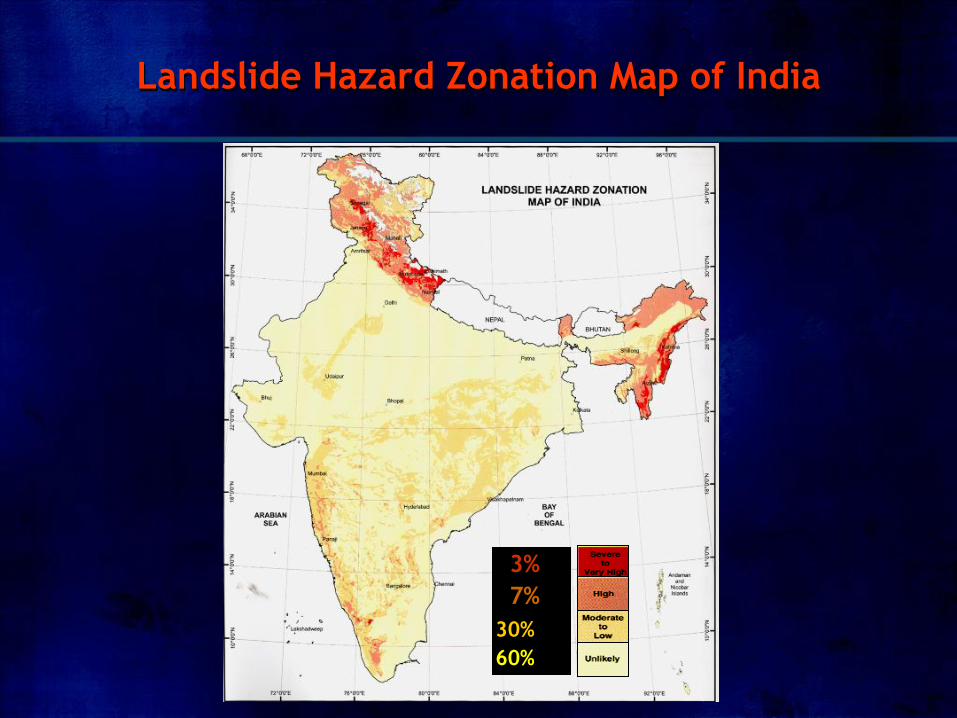
Landslide Hazard Zonation Map of India
3%
7%
30%
60%
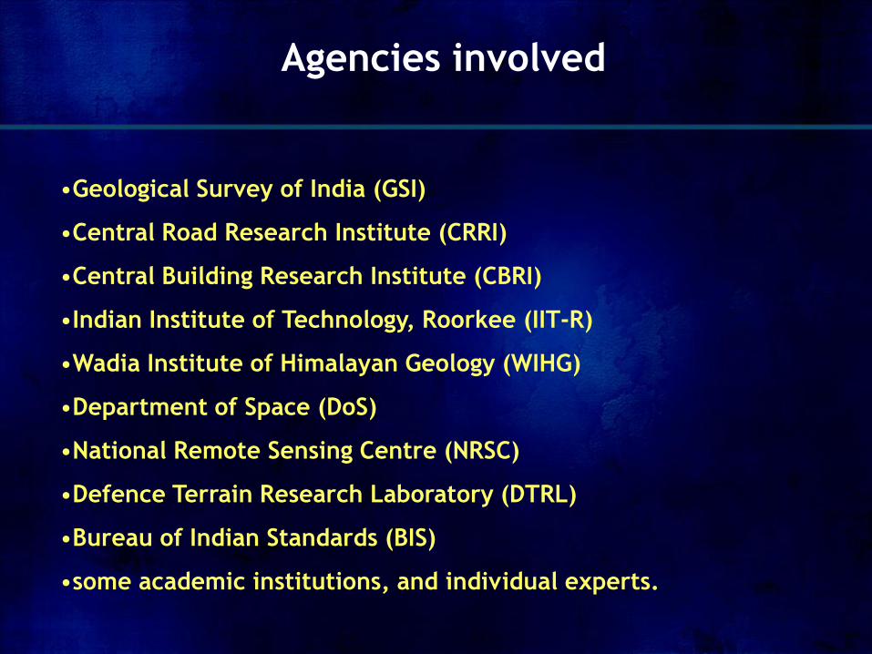
•Geological Survey of India (GSI)
•Central Road Research Institute (CRRI)
•Central Building Research Institute (CBRI)
•Indian Institute of Technology, Roorkee (IIT-R)
•Wadia Institute of Himalayan Geology (WIHG)
•Department of Space (DoS)
•National Remote Sensing Centre (NRSC)
•Defence Terrain Research Laboratory (DTRL)
•Bureau of Indian Standards (BIS)
•some academic institutions, and individual experts.
Agencies involved
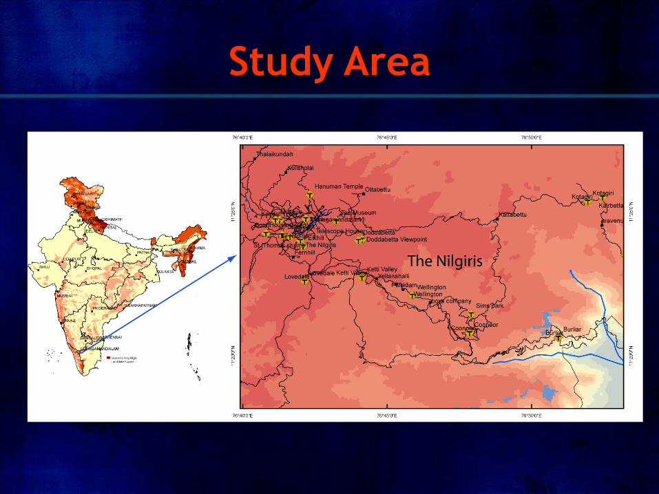
Study Area

The Nilgiri’s Revenue Taluks
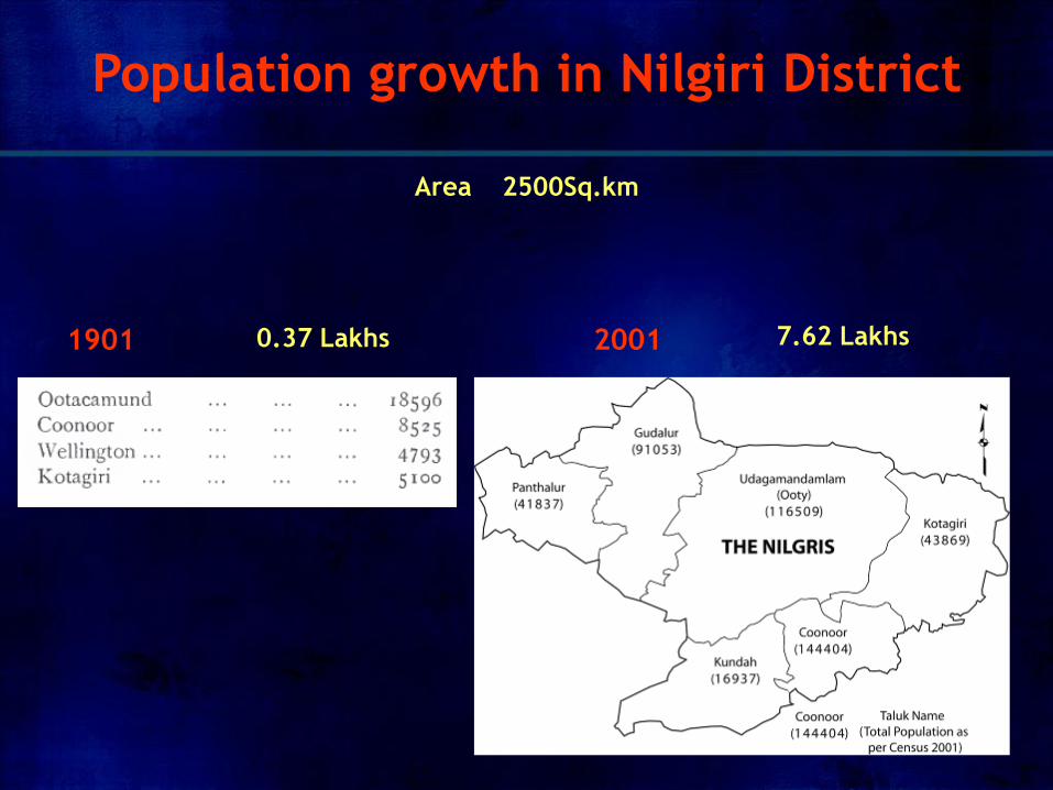
2001 1901
Population growth in Nilgiri District
Area 2500Sq.km
0.37 Lakhs 7.62 Lakhs
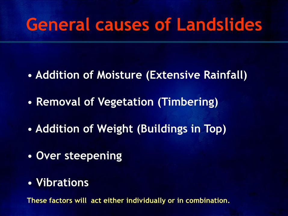
• Addition of Moisture (Extensive Rainfall)
• Removal of Vegetation (Timbering)
• Addition of Weight (Buildings in Top)
• Over steepening
• Vibrations
General causes of Landslides
These factors will act either individually or in combination.
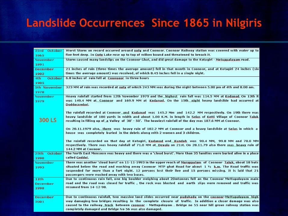
Landslide Occurrences Since 1865 in Nilgiris
300 LS
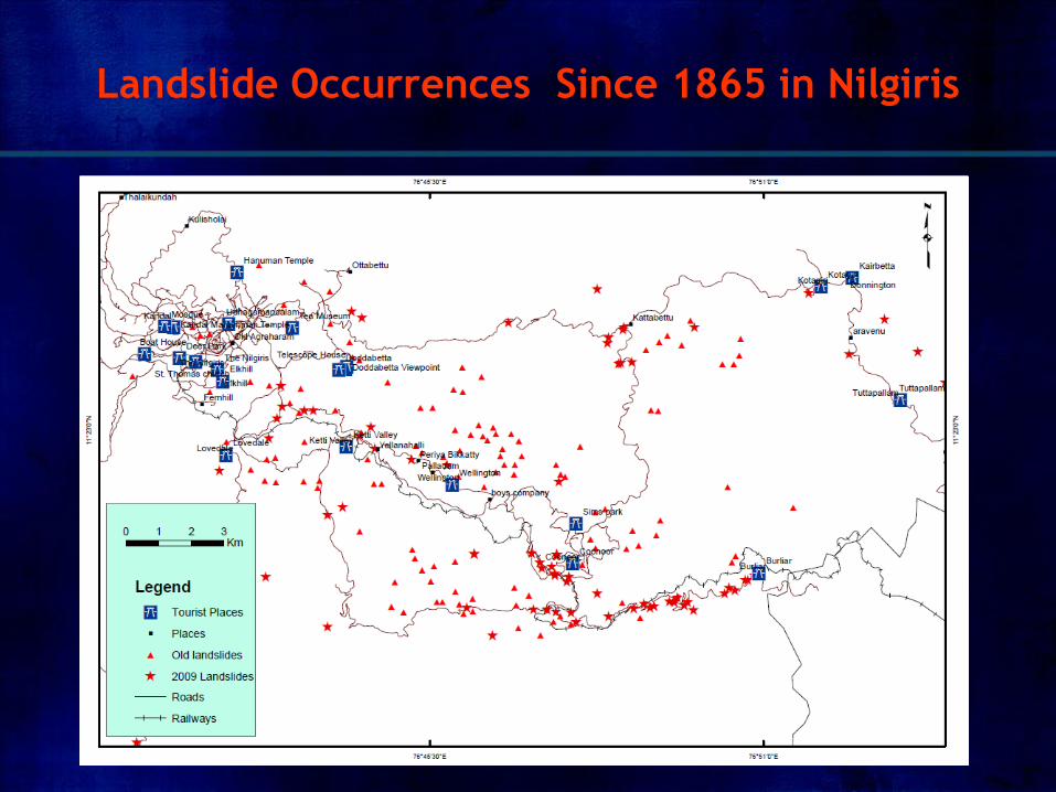
Landslide Occurrences Since 1865 in Nilgiris
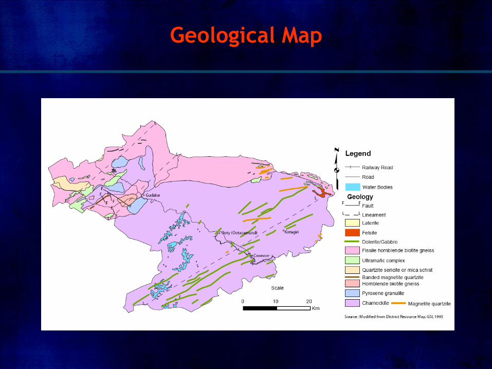
Geological Map
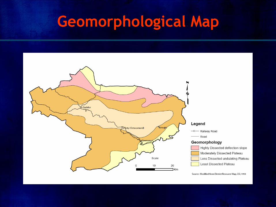
Geomorphological Map
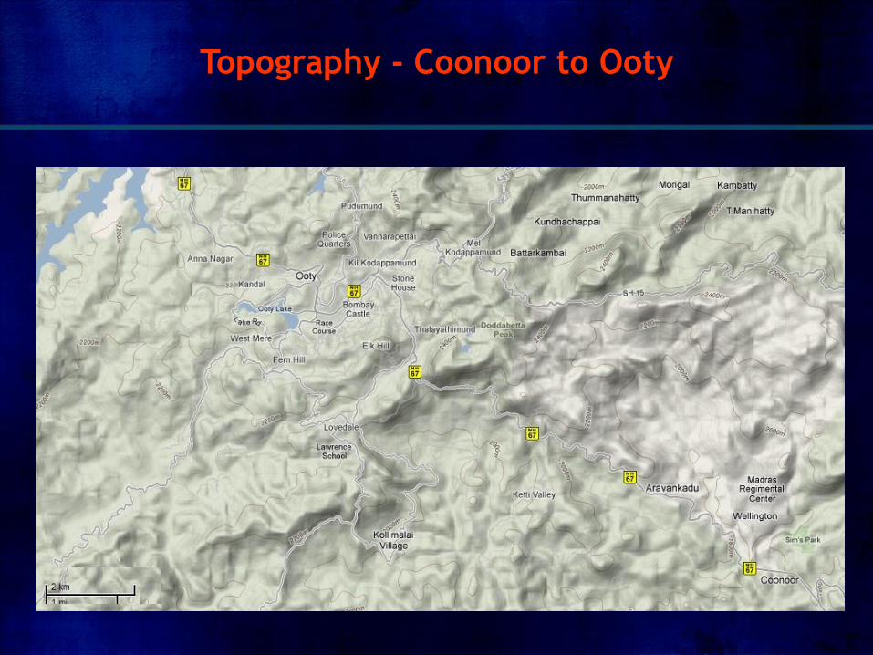
Topography - Coonoor to Ooty
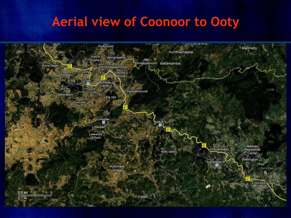
Aerial view of Coonoor to Ooty
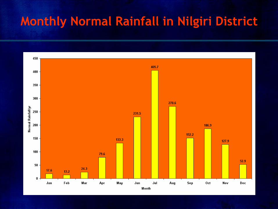
Monthly Normal Rainfall in Nilgiri District
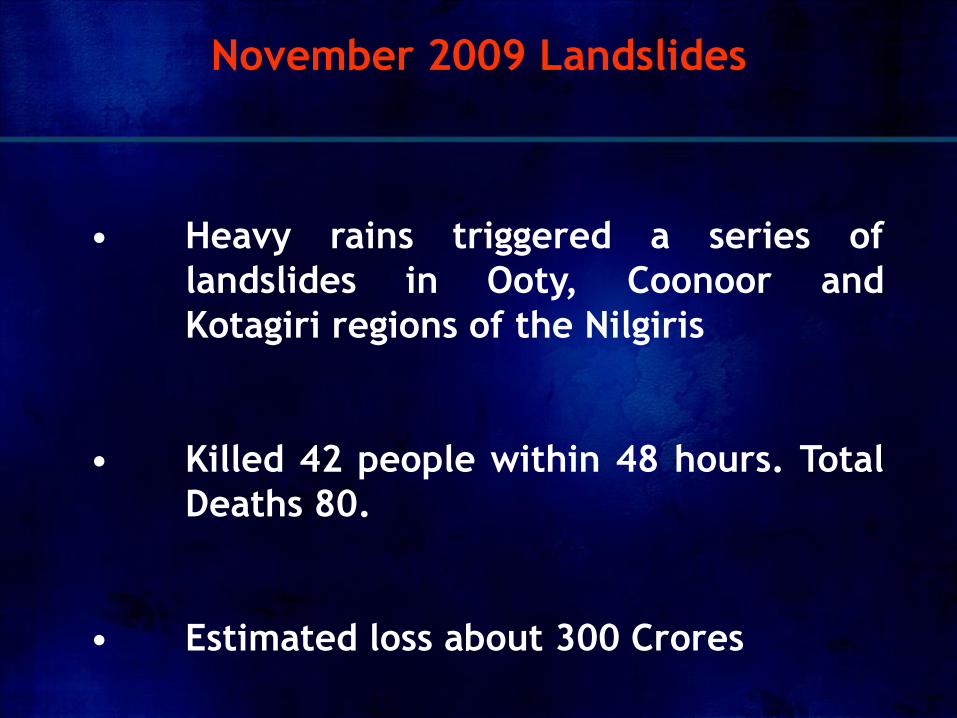
• Heavy rains triggered a series of
landslides in Ooty, Coonoor and
Kotagiri regions of the Nilgiris
• Killed 42 people within 48 hours. Total
Deaths 80.
• Estimated loss about 300 Crores
November 2009 Landslides
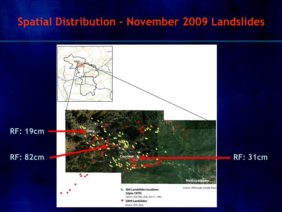
Spatial Distribution - November 2009 Landslides
RF: 19cm
RF: 82cm RF: 31cm
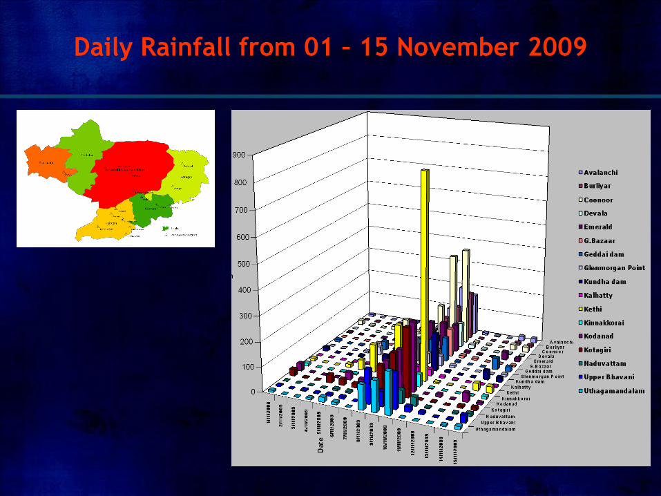
Daily Rainfall from 01 – 15 November 2009
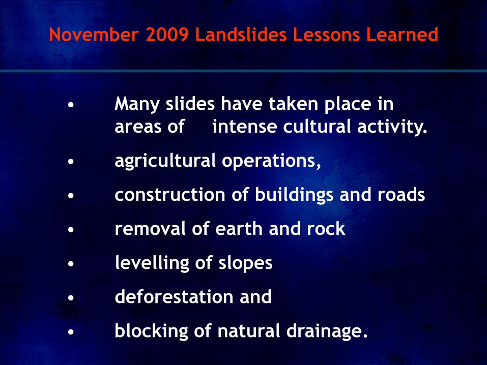
• Many slides have taken place in
areas of intense cultural activity.
• agricultural operations,
• construction of buildings and roads
• removal of earth and rock
• levelling of slopes
• deforestation and
• blocking of natural drainage.
November 2009 Landslides Lessons Learned
Considering all these evidences the following factors
appear to have been involved, singly or in
combination, in inducing the landslides.
• Water (Heavy rainfall)
• Toe Removal
• Increase of Head Load
November 2009 Landslides Lessons Learned
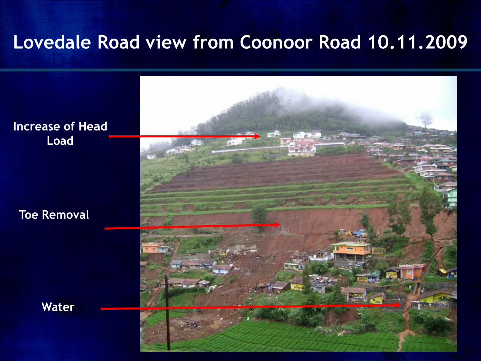
Lovedale Road view from Coonoor Road 10.11.2009
Toe Removal
Increase of Head
Load
Water
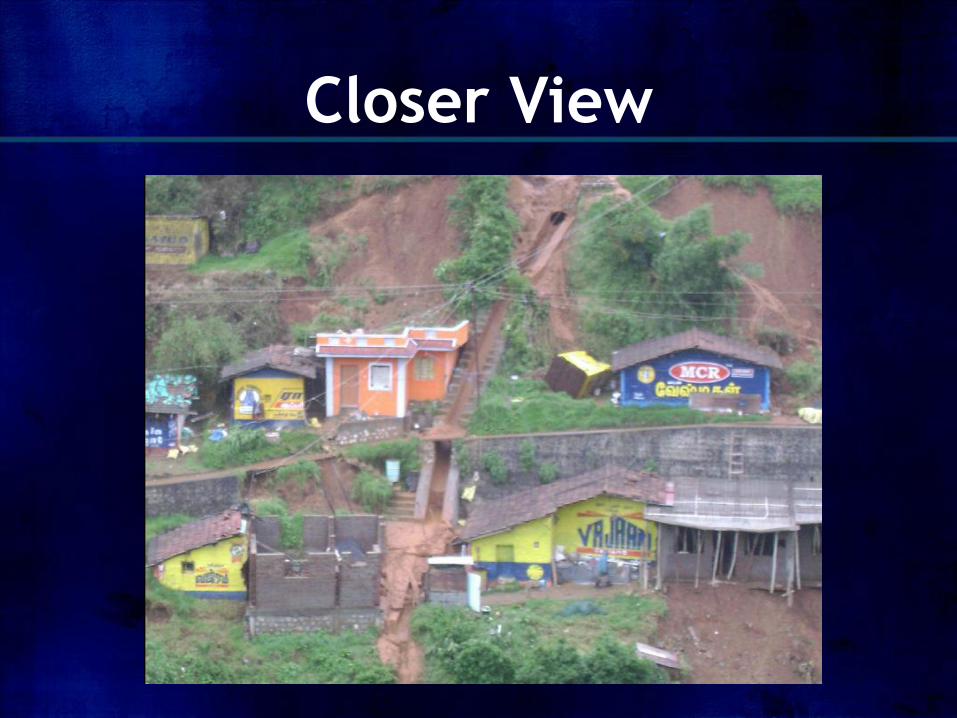
Closer View
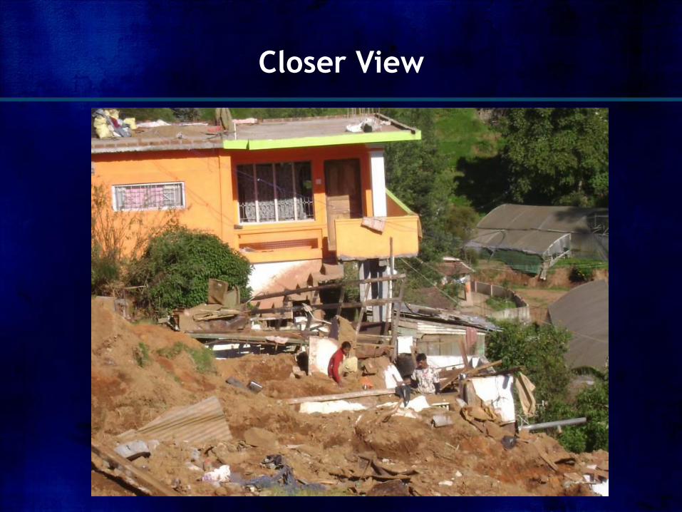
Closer View
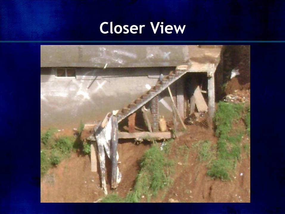
Closer View
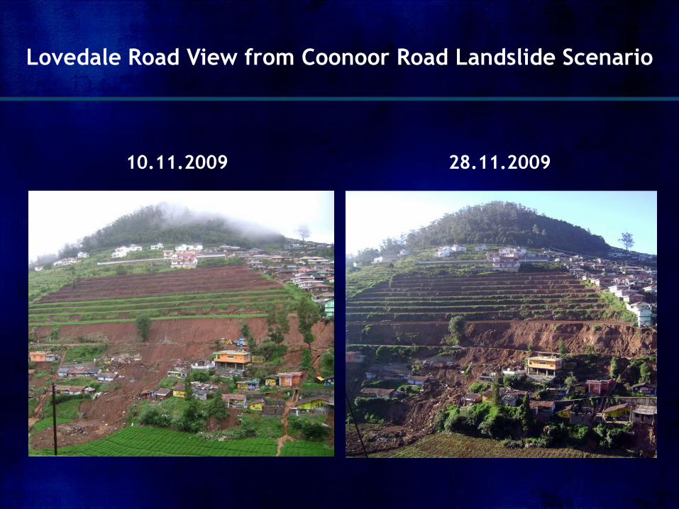
Lovedale Road View from Coonoor Road Landslide Scenario
28.11.2009 10.11.2009
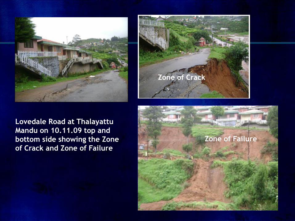
Lovedale Road at Thalayattu
Mandu on 10.11.09 top and
bottom side showing the Zone
of Crack and Zone of Failure
Zone of Crack
Zone of Failure
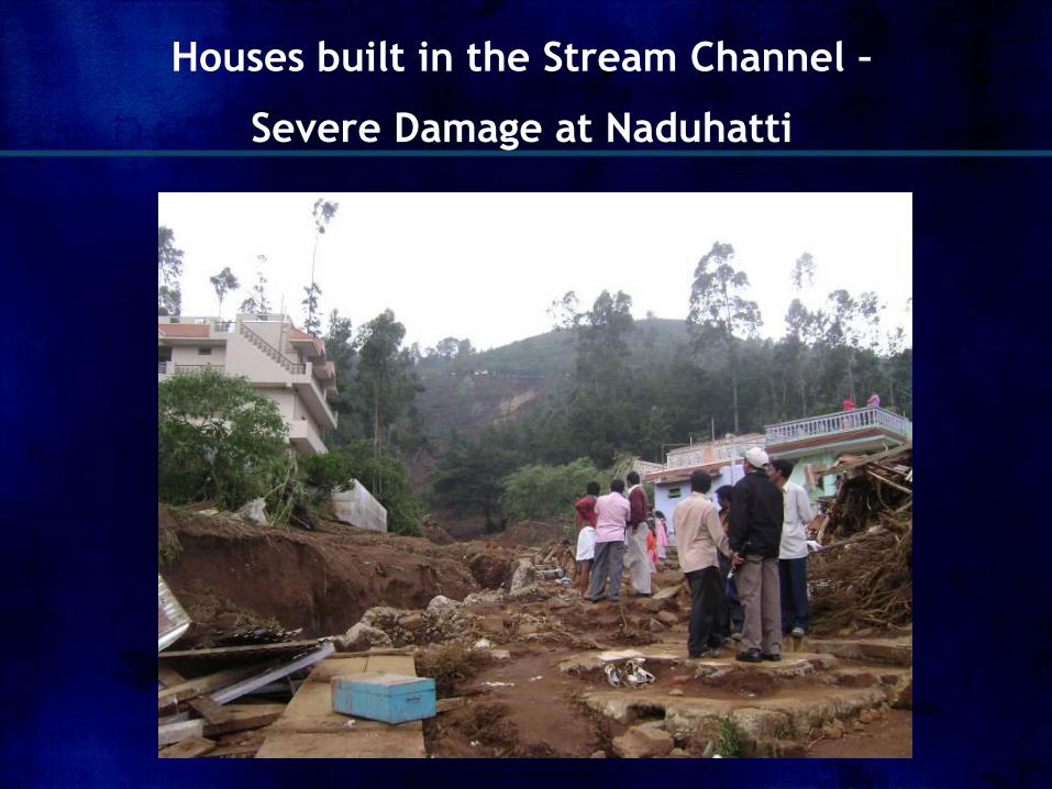
Houses built in the Stream Channel –
Severe Damage at Naduhatti
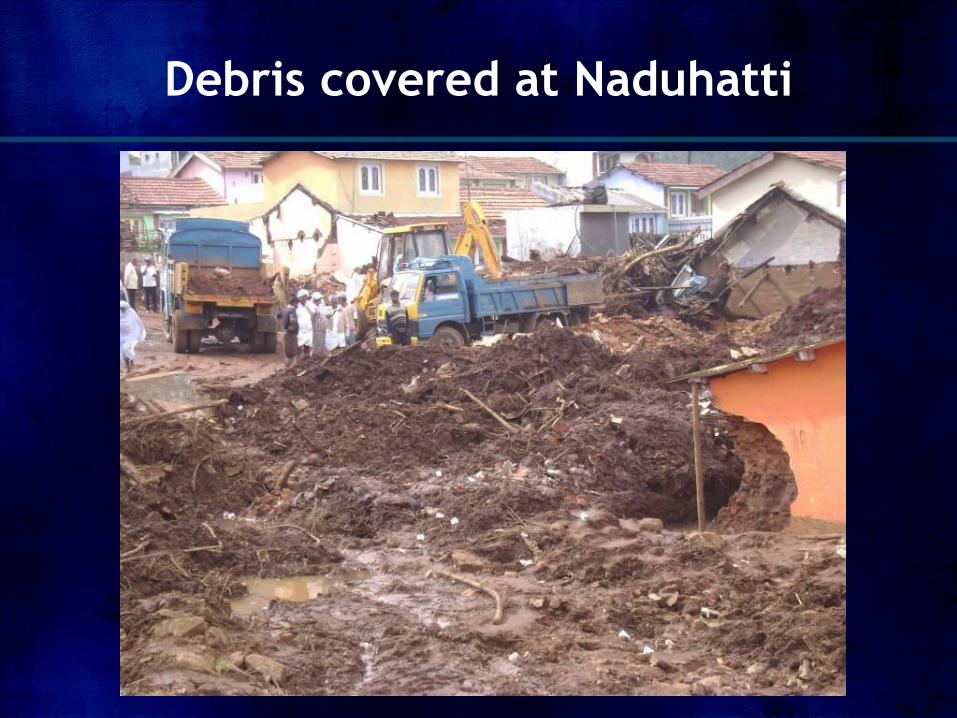
Debris covered at Naduhatti
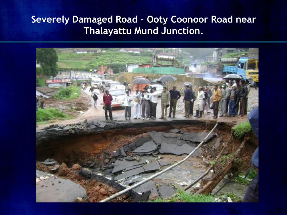
Severely Damaged Road - Ooty Coonoor Road near
Thalayattu Mund Junction.
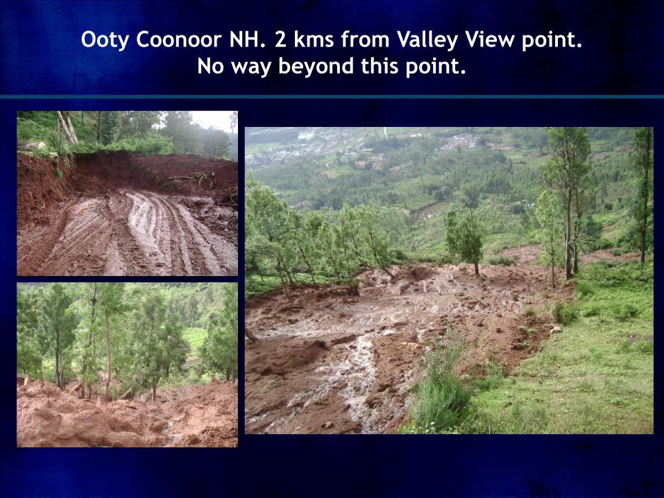
Ooty Coonoor NH. 2 kms from Valley View point.
No way beyond this point.
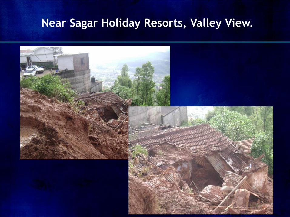
Near Sagar Holiday Resorts, Valley View.
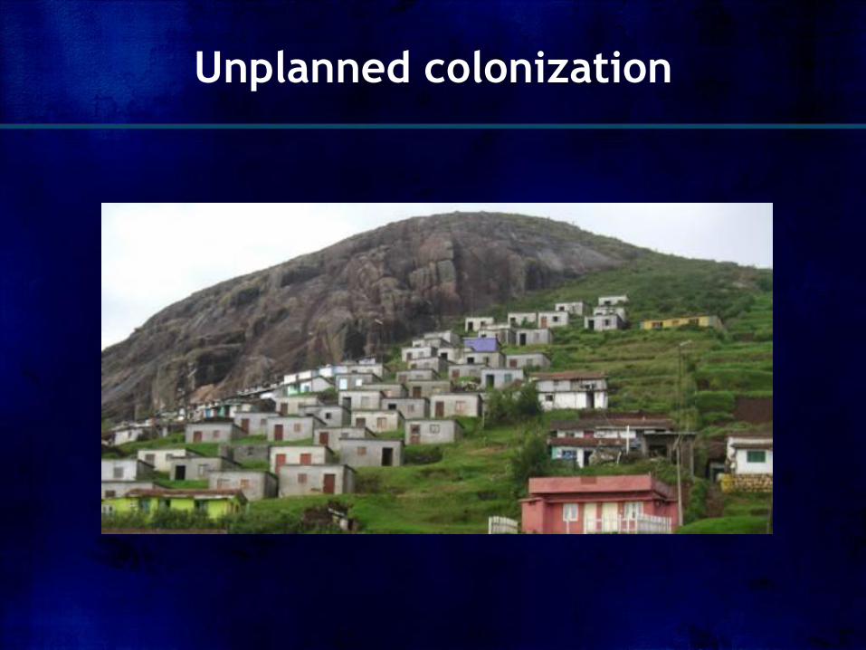
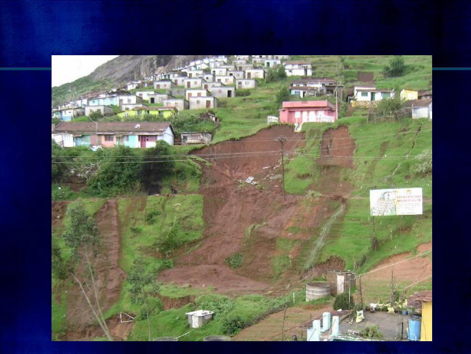
Unplanned colonization
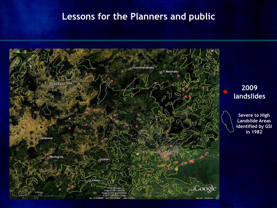
Lessons for the Planners and public
2009
landslides
Severe to High
Landslide Areas
identified by GSI
in 1982
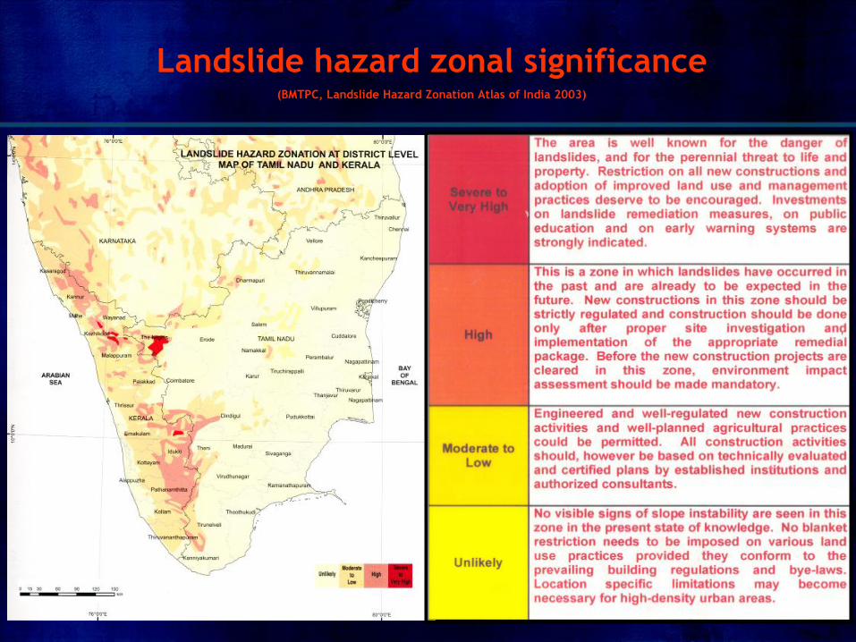
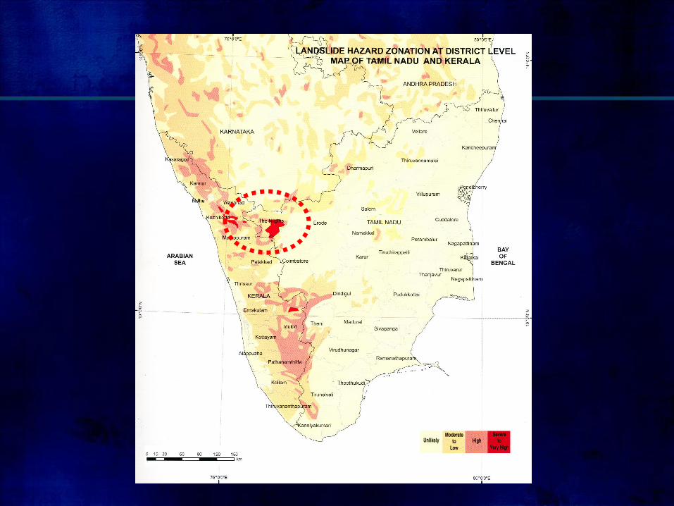
Landslide hazard zonal significance (BMTPC, Landslide Hazard Zonation Atlas of India 2003)
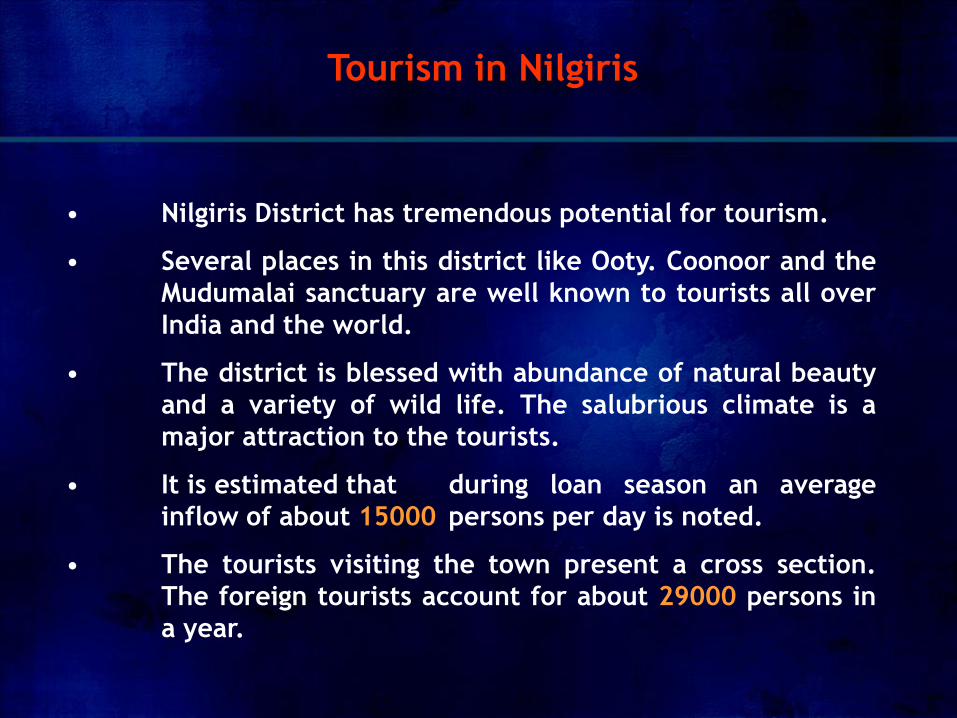
• Nilgiris District has tremendous potential for tourism.
• Several places in this district like Ooty. Coonoor and the
Mudumalai sanctuary are well known to tourists all over
India and the world.
• The district is blessed with abundance of natural beauty
and a variety of wild life. The salubrious climate is a
major attraction to the tourists.
• It is estimated that during loan season an average
inflow of about 15000 persons per day is noted.
• The tourists visiting the town present a cross section.
The foreign tourists account for about 29000 persons in
a year.
Tourism in Nilgiris
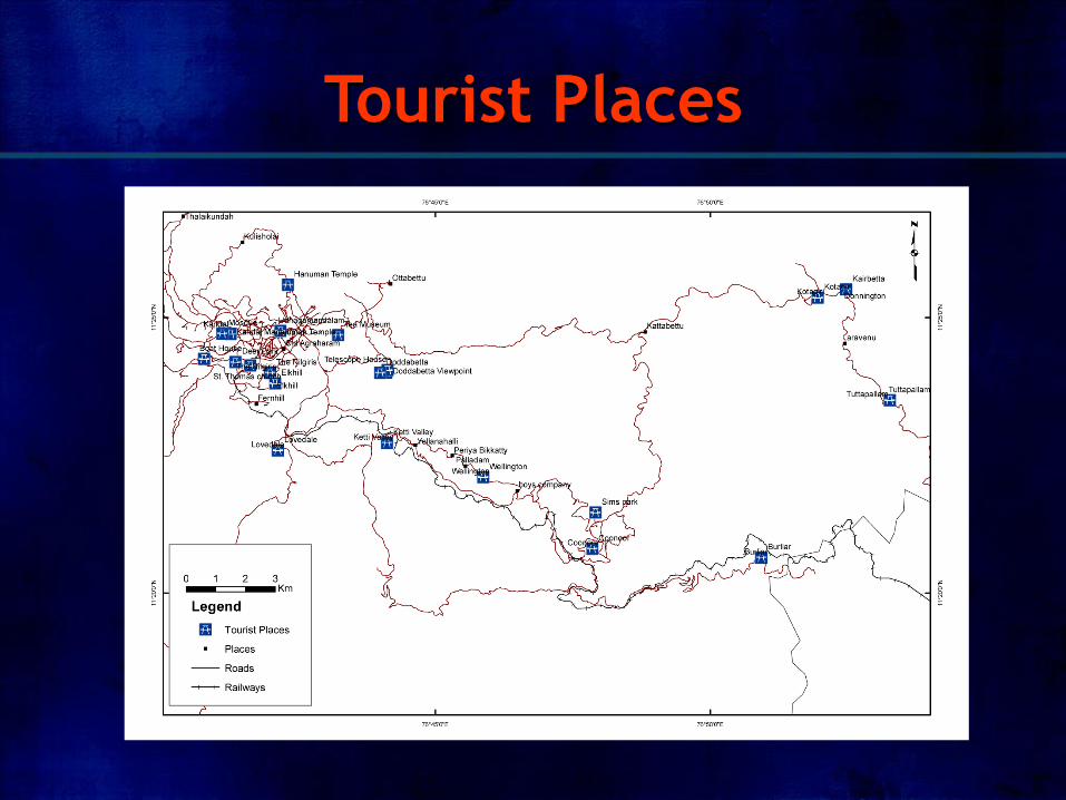
Tourist Places
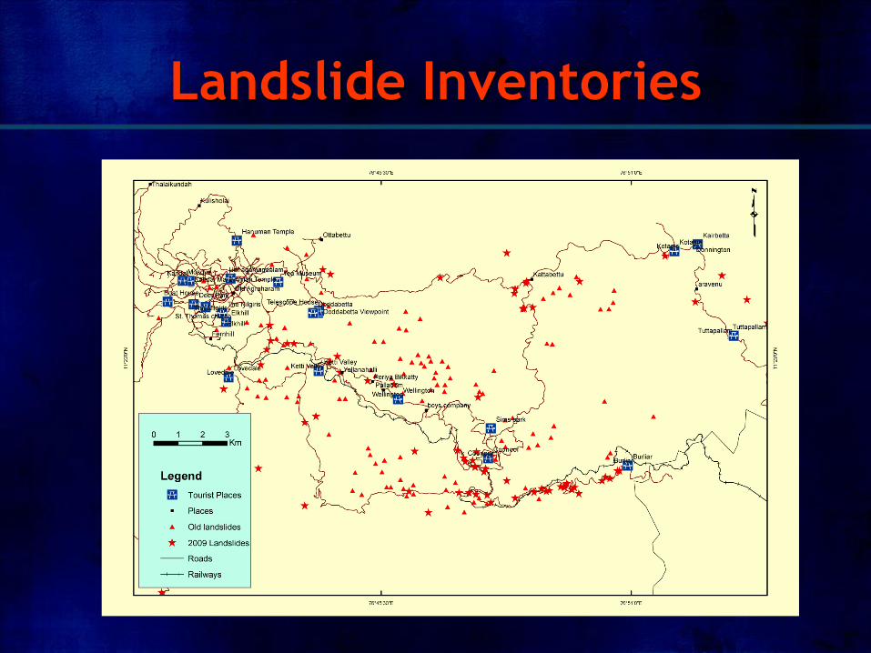
Landslide Inventories
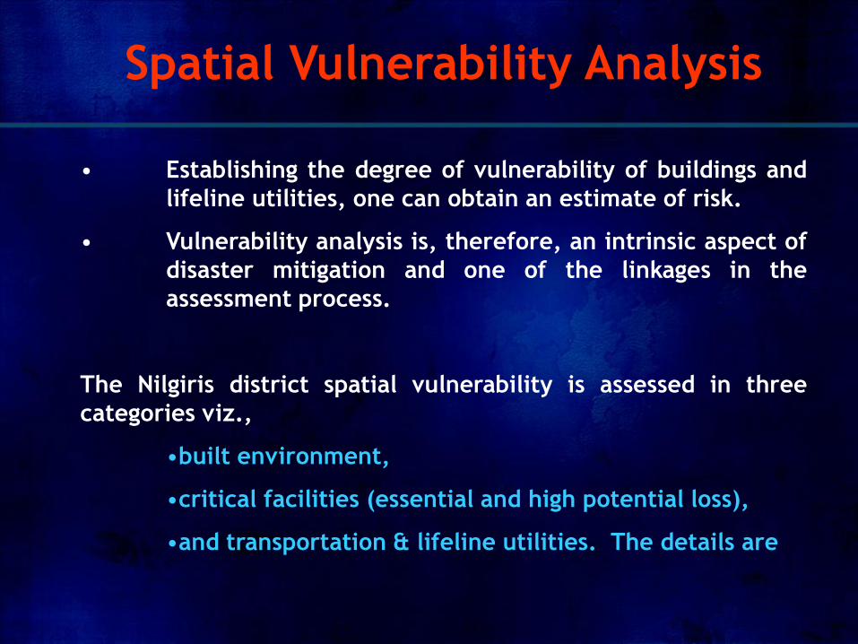
• Establishing the degree of vulnerability of buildings and
lifeline utilities, one can obtain an estimate of risk.
• Vulnerability analysis is, therefore, an intrinsic aspect of
disaster mitigation and one of the linkages in the
assessment process.
The Nilgiris district spatial vulnerability is assessed in three
categories viz.,
•built environment,
•critical facilities (essential and high potential loss),
•and transportation & lifeline utilities. The details are
Spatial Vulnerability Analysis
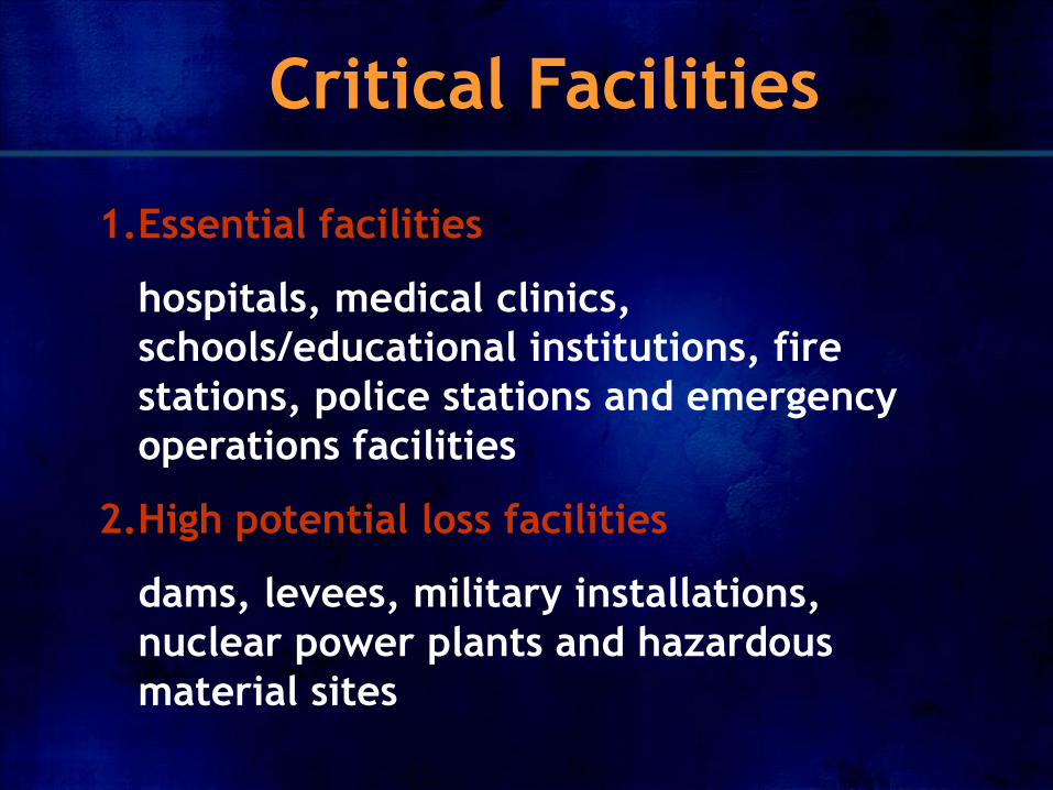
Critical Facilities
1.Essential facilities
hospitals, medical clinics,
schools/educational institutions, fire
stations, police stations and emergency
operations facilities
2.High potential loss facilities
dams, levees, military installations,
nuclear power plants and hazardous
material sites
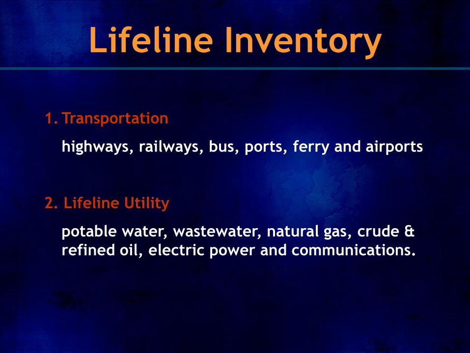
Lifeline Inventory
1. Transportation
highways, railways, bus, ports, ferry and airports
2. Lifeline Utility
potable water, wastewater, natural gas, crude &
refined oil, electric power and communications.
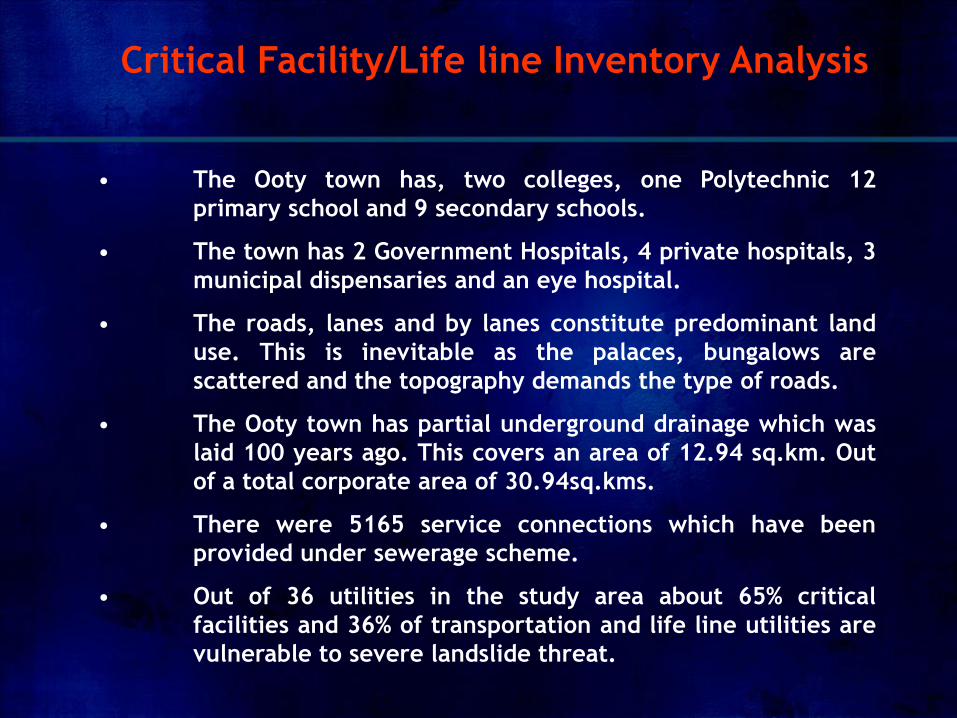
• The Ooty town has, two colleges, one Polytechnic 12
primary school and 9 secondary schools.
• The town has 2 Government Hospitals, 4 private hospitals, 3
municipal dispensaries and an eye hospital.
• The roads, lanes and by lanes constitute predominant land
use. This is inevitable as the palaces, bungalows are
scattered and the topography demands the type of roads.
• The Ooty town has partial underground drainage which was
laid 100 years ago. This covers an area of 12.94 sq.km. Out
of a total corporate area of 30.94sq.kms.
• There were 5165 service connections which have been
provided under sewerage scheme.
• Out of 36 utilities in the study area about 65% critical
facilities and 36% of transportation and life line utilities are
vulnerable to severe landslide threat.
Critical Facility/Life line Inventory Analysis
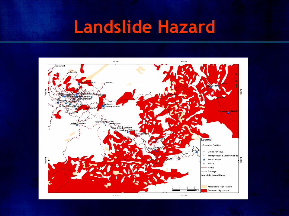
Landslide Hazard
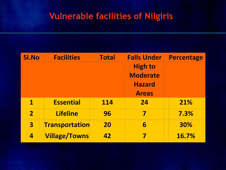
Sl.No Facilities Total Falls Under High to
Moderate Hazard Areas
Percentage
1 Essential 114 24 21%
2 Lifeline 96 7 7.3%
3 Transportation 20 6 30%
4 Village/Towns 42 7 16.7%
Vulnerable facilities of Nilgiris
Recommendations/
Conclusions
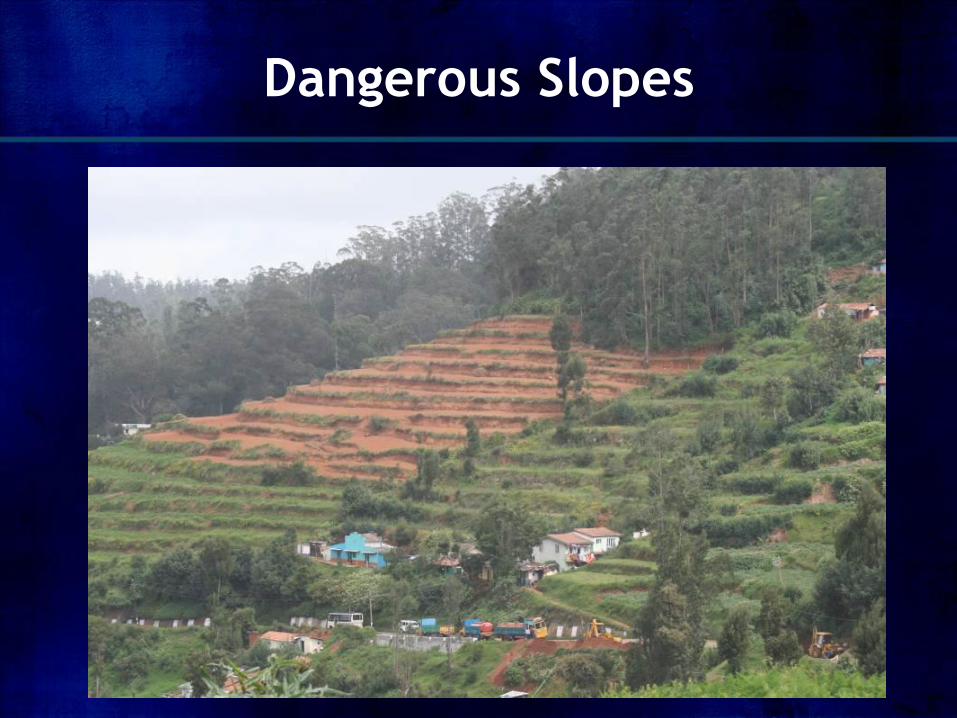
Dangerous Slopes
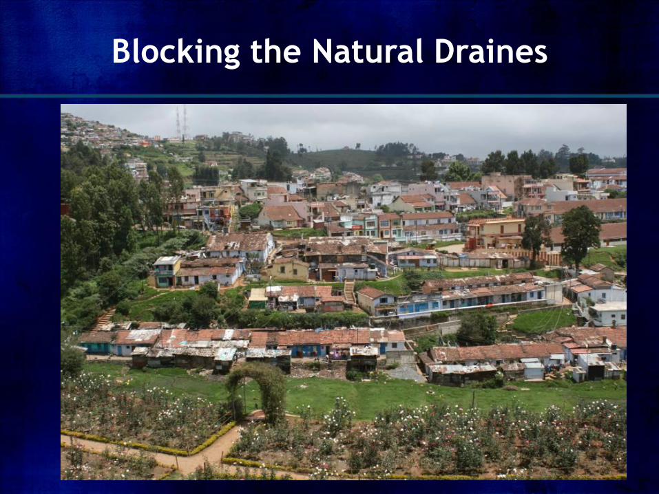
Blocking the Natural Draines
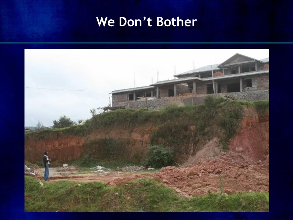
We Don’t Bother
1. In order to reduce the enormous destructive potential of
landslides and to minimise the consequential losses, it is
necessary that Risk should be calculated.
2. Most of the topographic maps of hilly terrain of Nilgiris
which are used as base maps for carrying out various
studies including landslide investigation and mapping are
available in small scale of 1:50,000 and a very few in
1:25,000.
3. Small scale maps typically represent extensive areas, but
they offer only a gross perspective on details.
Recommendations/Conclusions
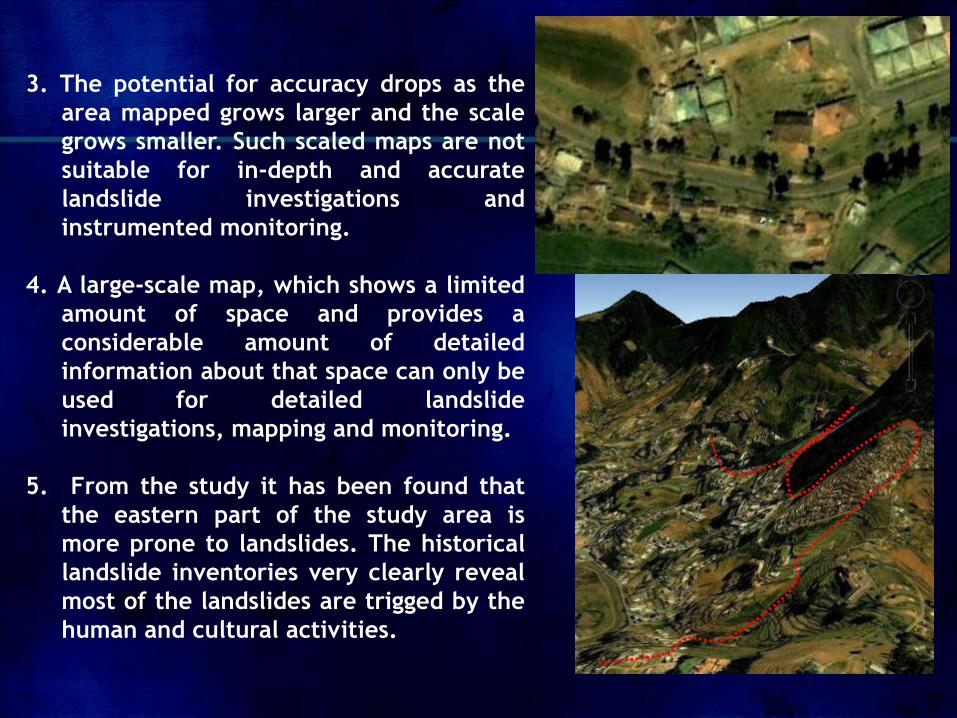
3. The potential for accuracy drops as the
area mapped grows larger and the scale
grows smaller. Such scaled maps are not
suitable for in-depth and accurate
landslide investigations and
instrumented monitoring.
4. A large-scale map, which shows a limited
amount of space and provides a
considerable amount of detailed
information about that space can only be
used for detailed landslide
investigations, mapping and monitoring.
5. From the study it has been found that
the eastern part of the study area is
more prone to landslides. The historical
landslide inventories very clearly reveal
most of the landslides are trigged by the
human and cultural activities.
6. Strengthening of buildings and infrastructure should lead to
reduction in Vulnerability. The vulnerability of the buildings,
critical facilities, lifeline structures should be studied
thoroughly for further planning purposes.
7. The present vulnerability study is based in spatial distribution
and relative risk based. However the likely damage to
structures should be categorised in different grades
depending on their impact and landslide types.
8. The out put of the present study can be used as first hand
information for the decision makers and planners and also
helpful for the further developmental activities in the
landslide prone areas of Nilgiris District of India.
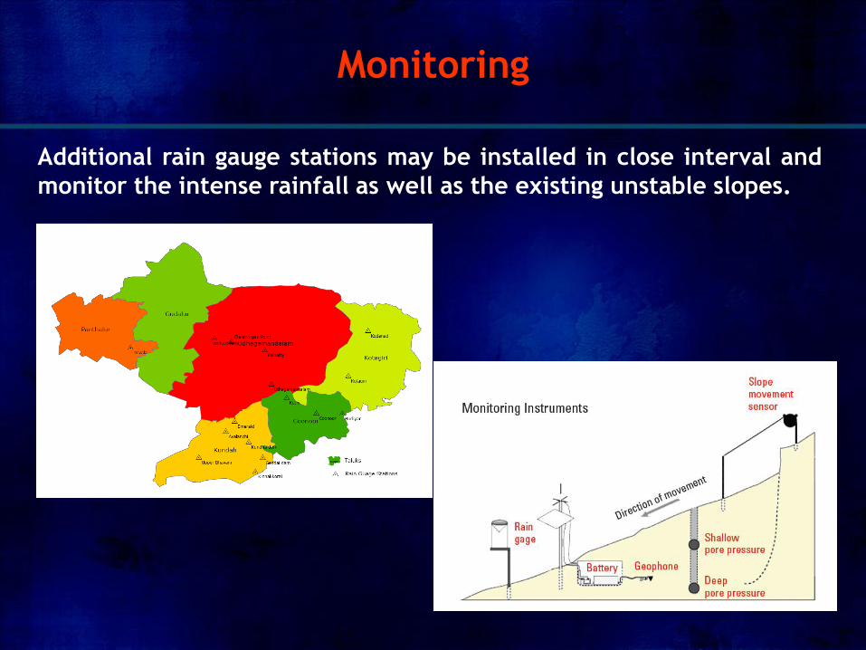
Additional rain gauge stations may be installed in close interval and
monitor the intense rainfall as well as the existing unstable slopes.
Monitoring

Destination- Disaster Free India