Embed Size (px)
Citation preview
Florida’s Future Transportation Corridors
APA Florida Public Policy WorkshopPatricia M. Steed, Central Florida Regional Planning Council
Bob Romig, Florida Department of TransportationJohn Kaliski, Cambridge Systematics, Inc.
Ana Richmond, Florida Department of Economic Opportunity
February 5, 2014

Transportation Planning
2
3500 BC Fixed wheels on carts are invented - the first wheeled vehicles in history.
1662 Blaise Pascal invents the first public bus - horse-drawn, regular route, schedule, and fare system
1862 Jean Lenoir makes agasoline engine automobile
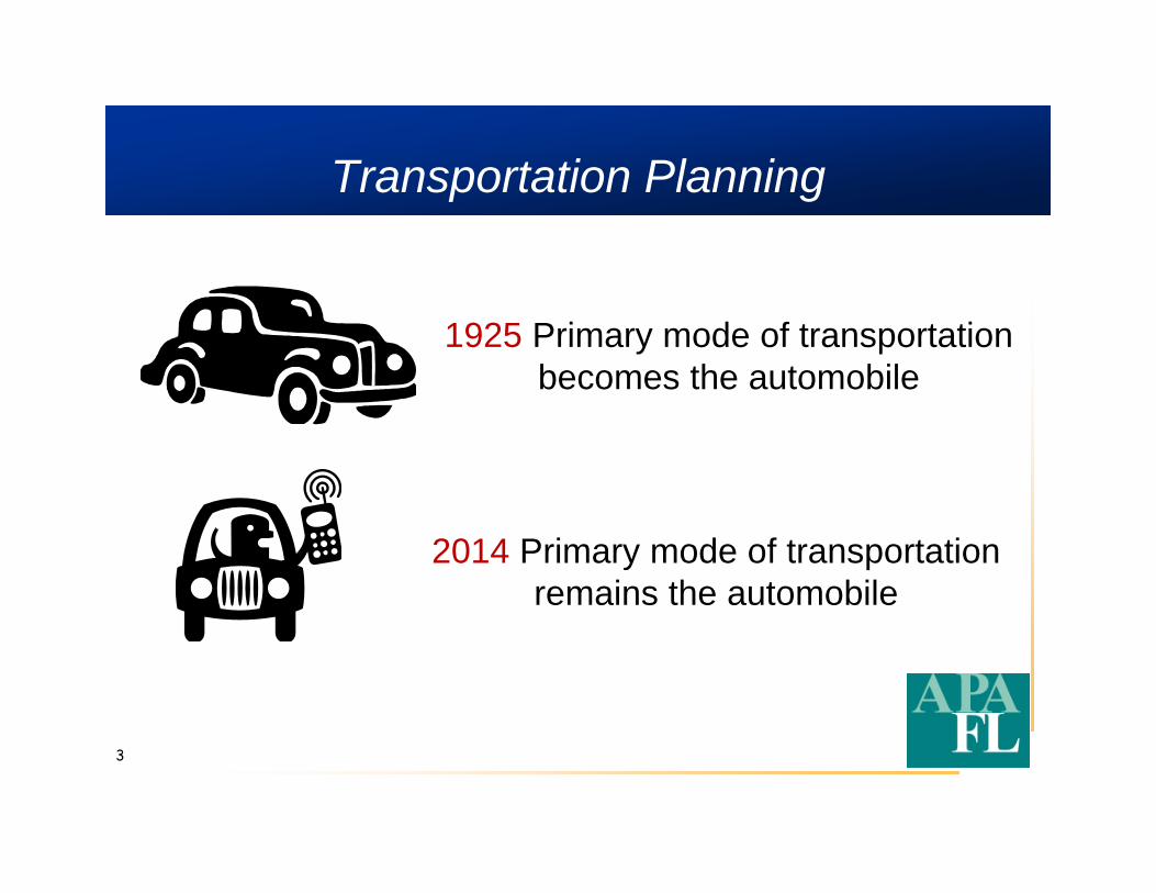
Transportation Planning
3
1925 Primary mode of transportationbecomes the automobile
2014 Primary mode of transportationremains the automobile
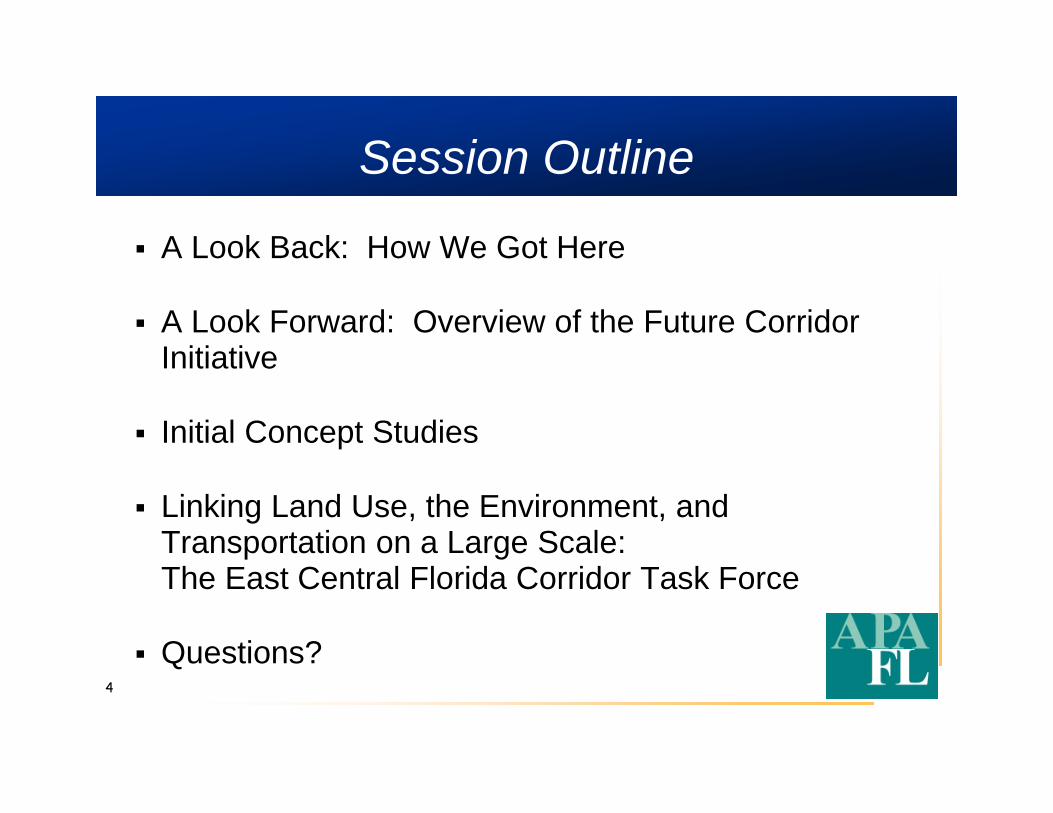
Session Outline
4
A Look Back: How We Got Here
A Look Forward: Overview of the Future Corridor Initiative
Initial Concept Studies
Linking Land Use, the Environment, and Transportation on a Large Scale: The East Central Florida Corridor Task Force
Questions?
5
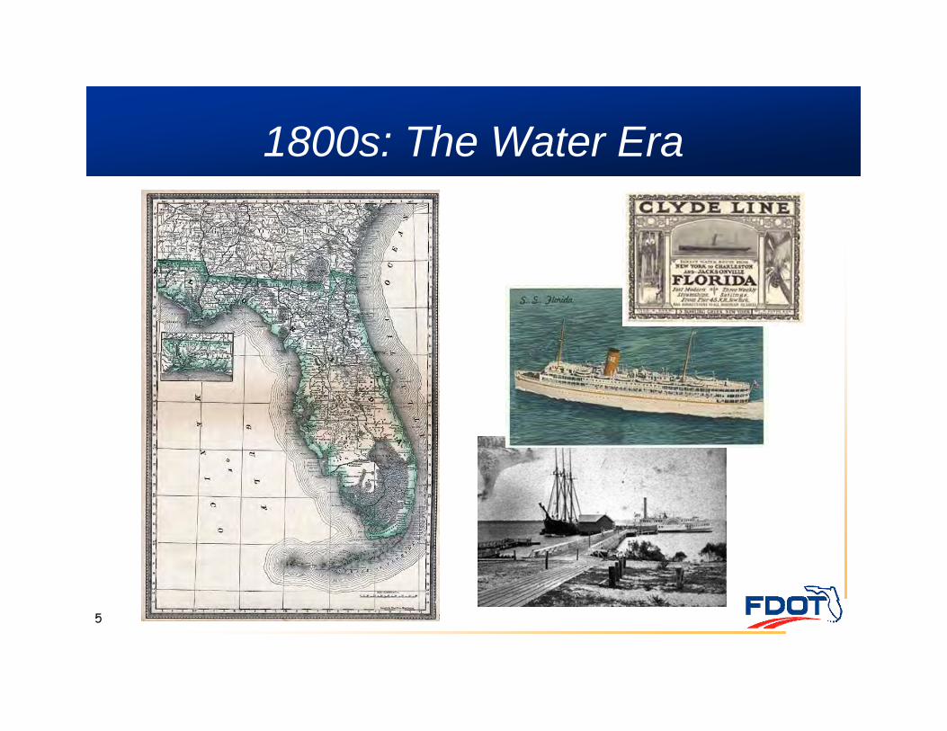
1800s: The Water Era
6
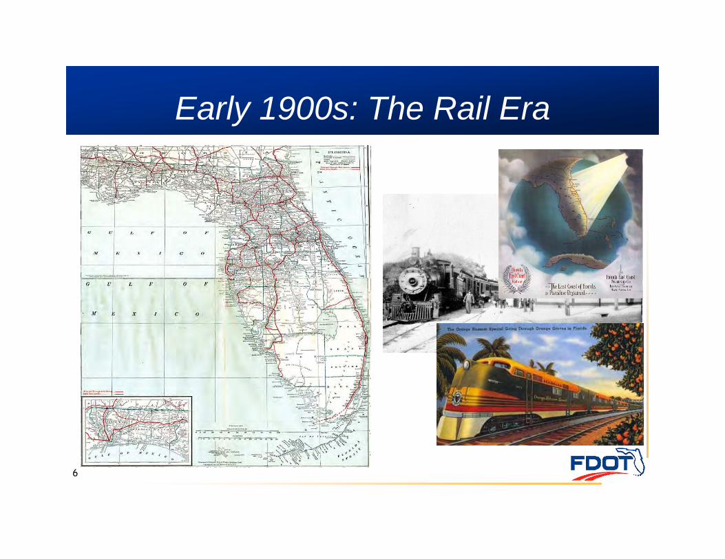
Early 1900s: The Rail Era
7
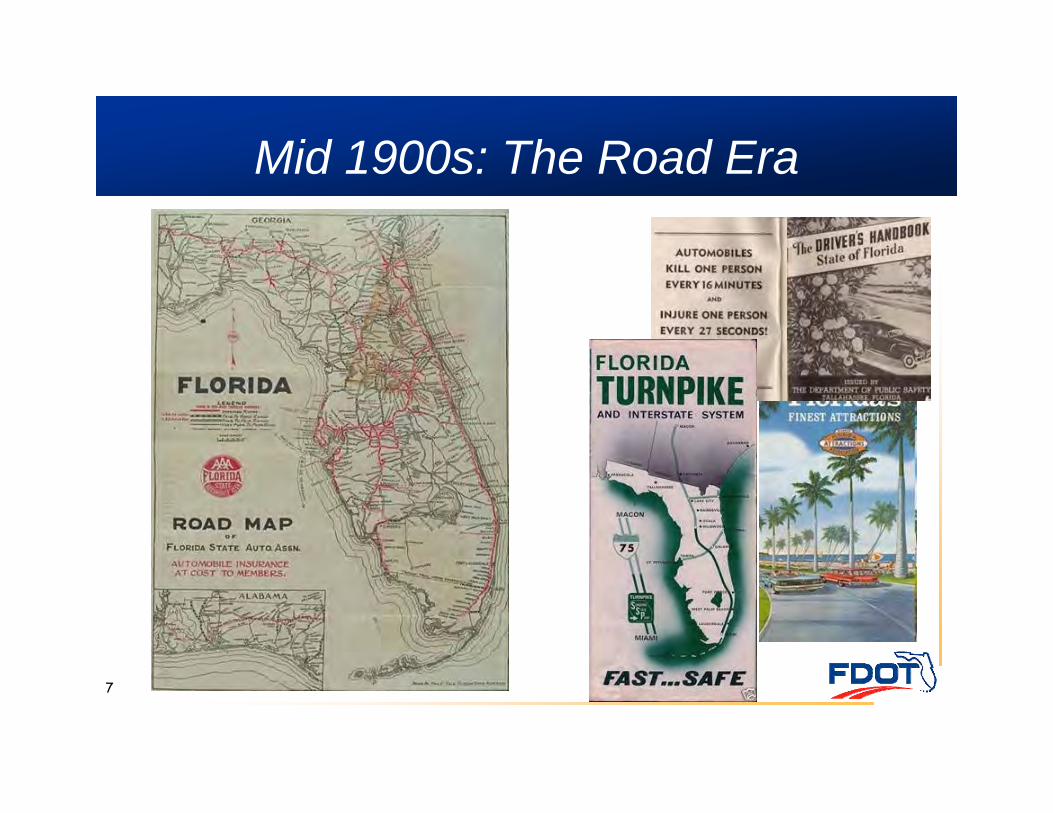
Mid 1900s: The Road Era
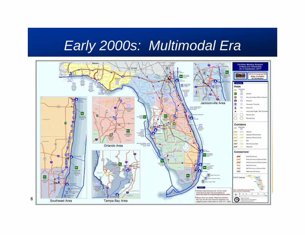
Early 2000s: Multimodal Era
8
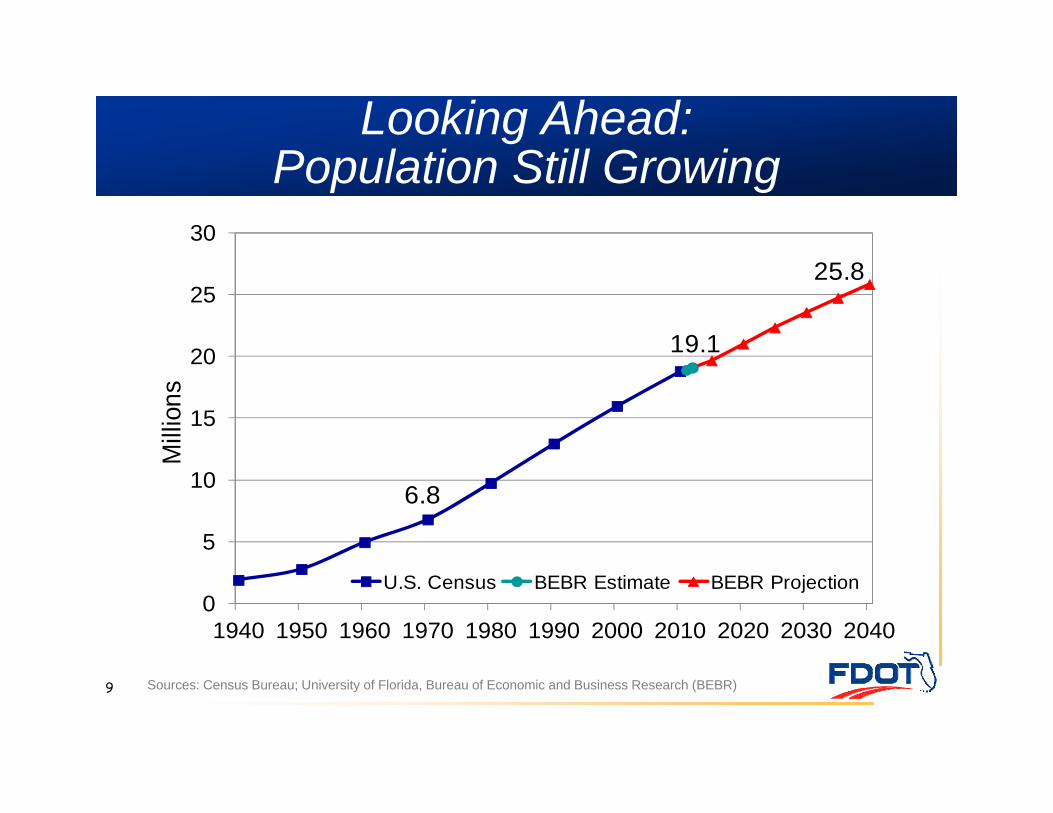
Looking Ahead: Population Still Growing
9 Sources: Census Bureau; University of Florida, Bureau of Economic and Business Research (BEBR)
6.8
19.1
25.8
0
5
10
15
20
25
30
1940 1950 1960 1970 1980 1990 2000 2010 2020 2030 2040
Mill
ions
U.S. Census BEBR Estimate BEBR Projection
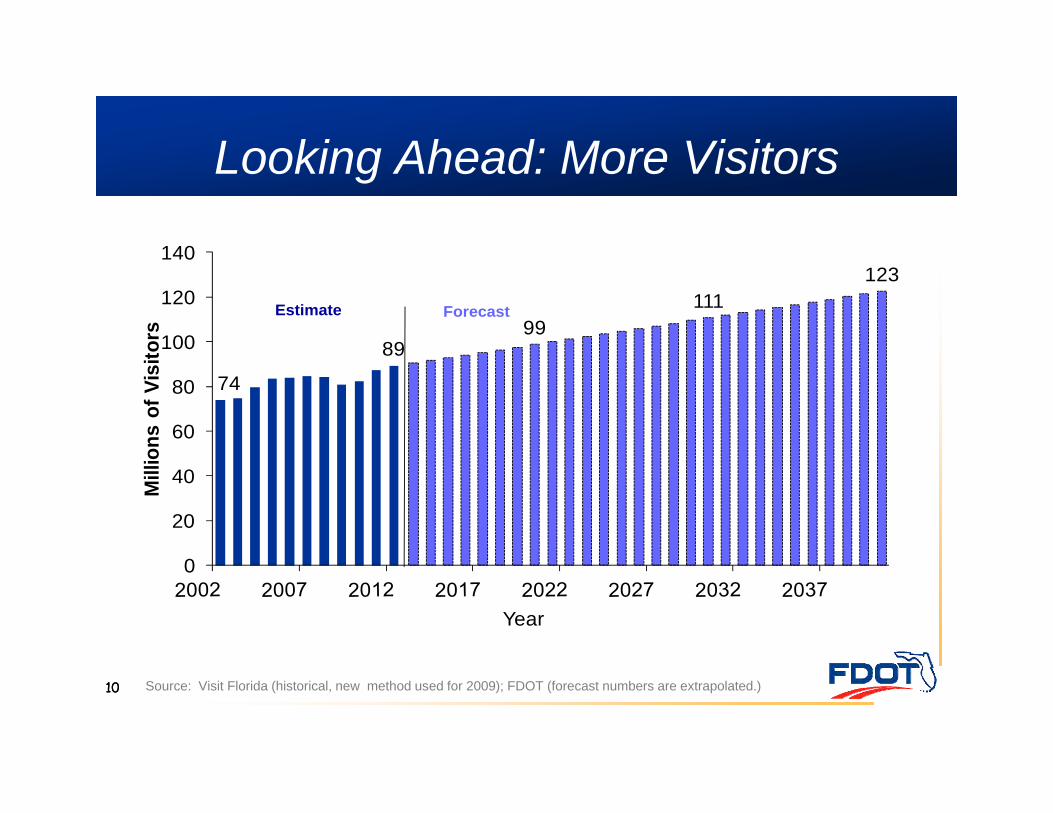
Looking Ahead: More Visitors
10 Source: Visit Florida (historical, new method used for 2009); FDOT (forecast numbers are extrapolated.)
74
8999
111123
0
20
40
60
80
100
120
140
Mill
ions
of V
isito
rs
Year
Estimate Forecast
10
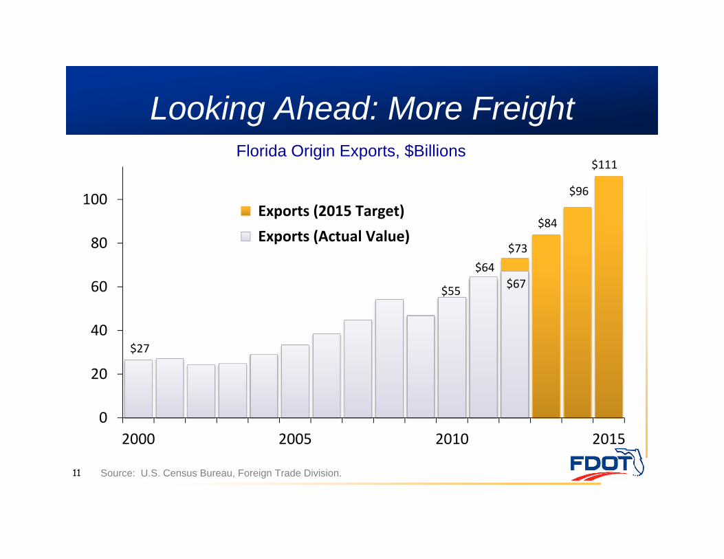
Looking Ahead: More Freight
11 Source: U.S. Census Bureau, Foreign Trade Division.
Florida Origin Exports, $Billions
$55
$64 $73
$84
$96
$111
$27
$67
0
20
40
60
80
100
2000 2005 2010 2015
Exports (2015 Target) Exports (Actual Value)
12
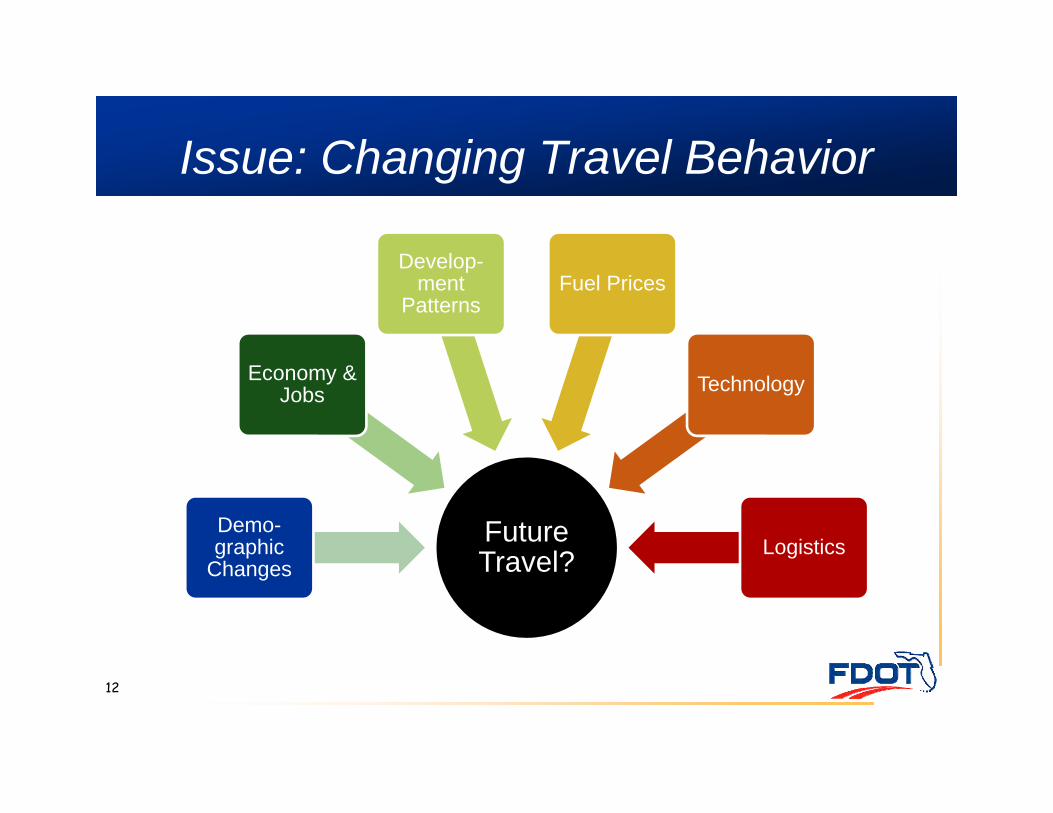
Future Travel?
Demo-graphic
Changes
Economy & Jobs
Develop-ment
PatternsFuel Prices
Technology
Logistics
Issue: Changing Travel Behavior
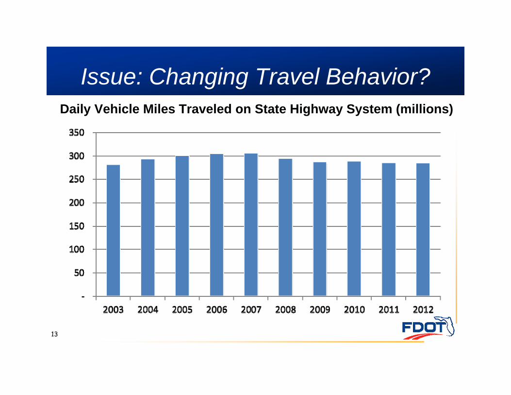
Issue: Changing Travel Behavior?
13
Daily Vehicle Miles Traveled on State Highway System (millions)
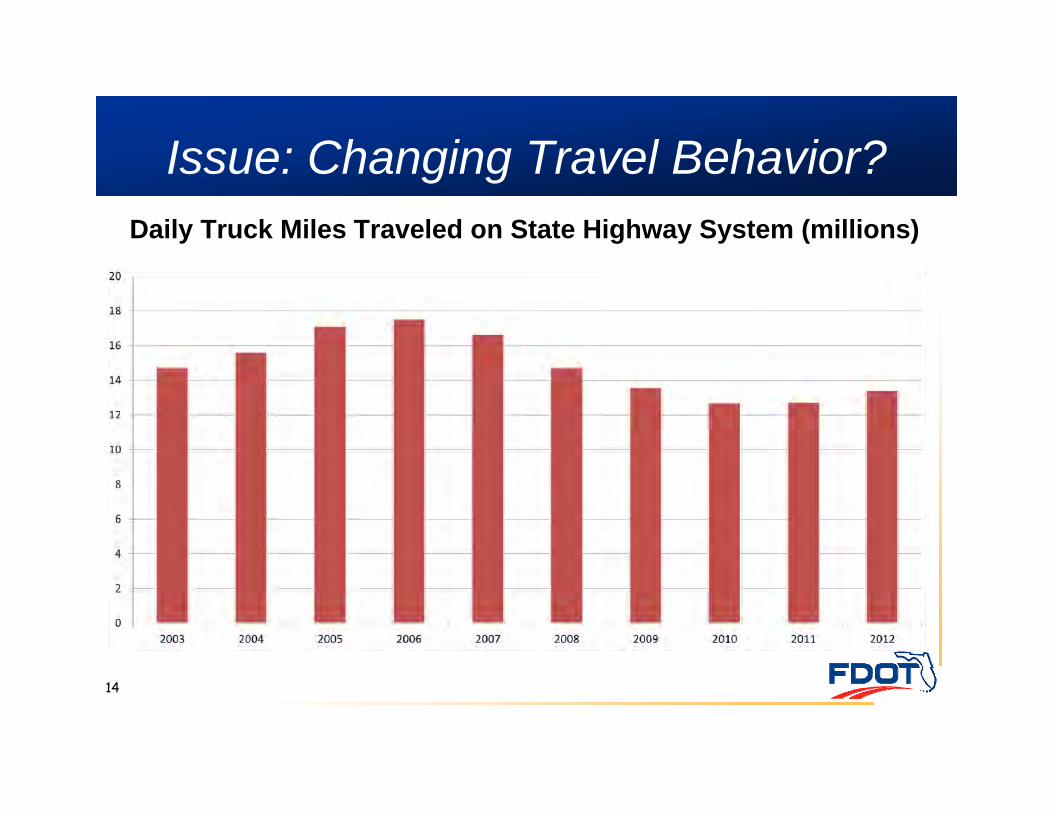
Issue: Changing Travel Behavior?Daily Truck Miles Traveled on State Highway System (millions)
14
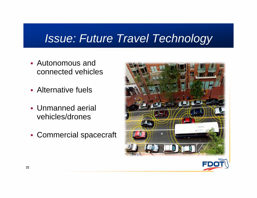
15
Autonomous and connected vehicles
Alternative fuels
Unmanned aerial vehicles/drones
Commercial spacecraft
Issue: Future Travel Technology
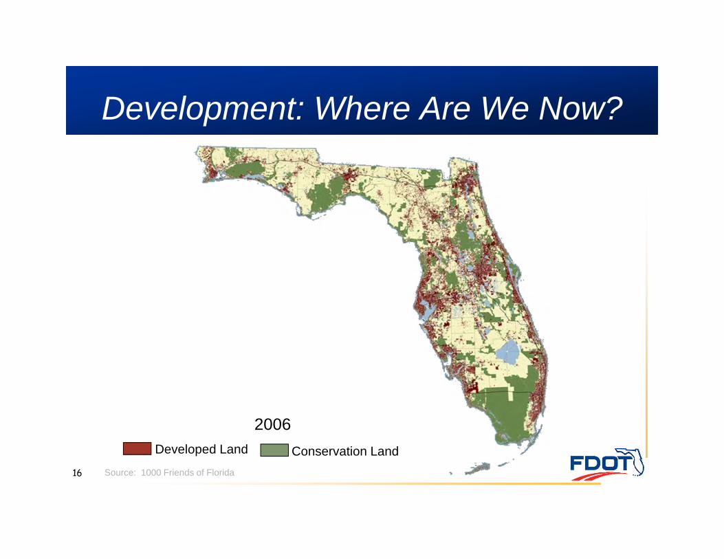
Development: Where Are We Now?
16
Developed Land Conservation Land
2006
Source: 1000 Friends of Florida
17
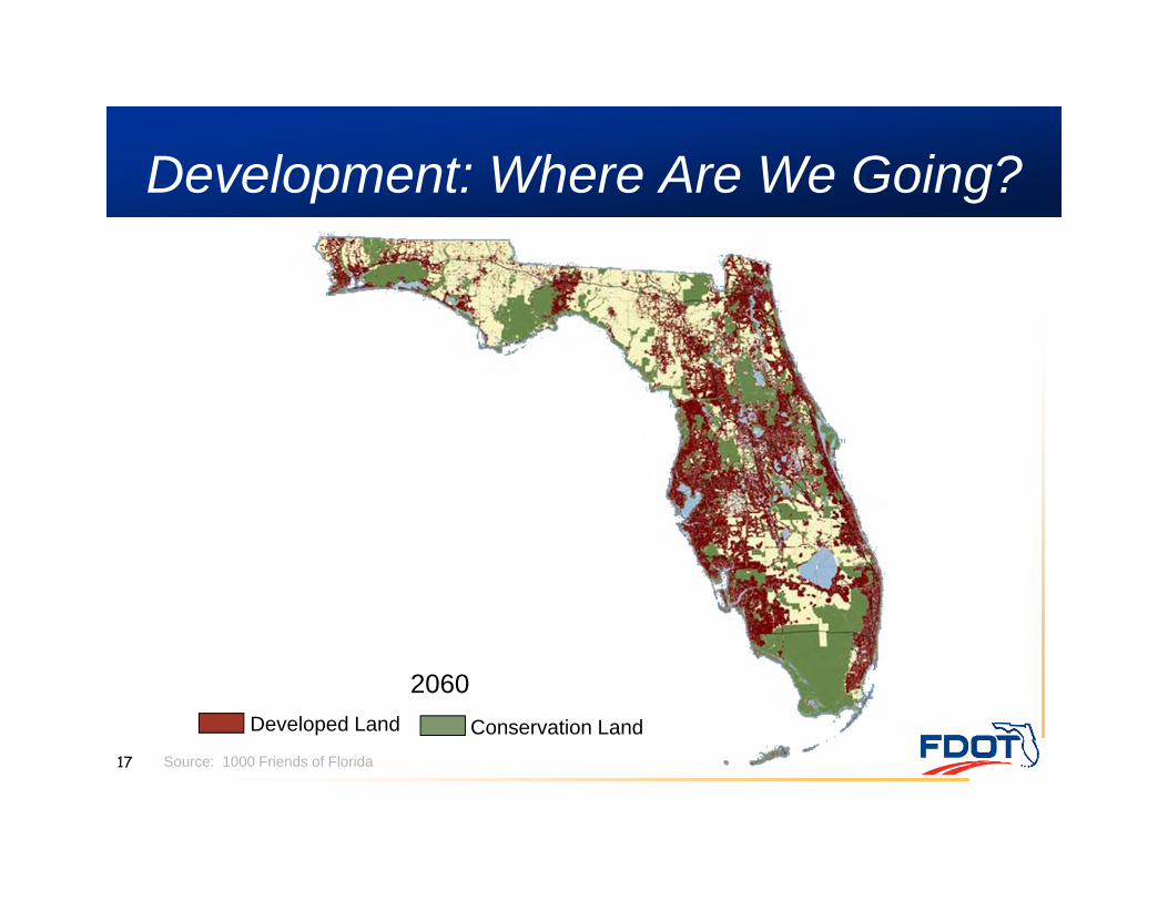
Development: Where Are We Going?
Source: 1000 Friends of Florida
Developed Land Conservation Land
2060
18
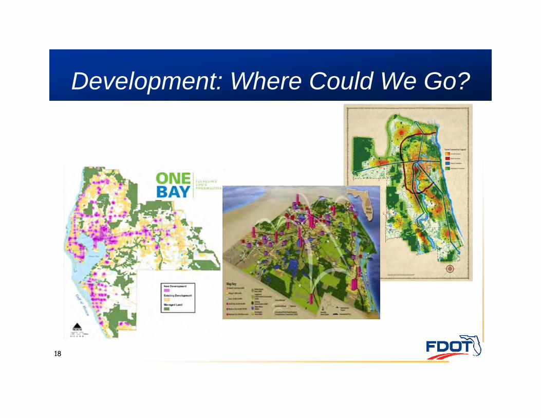
Development: Where Could We Go?
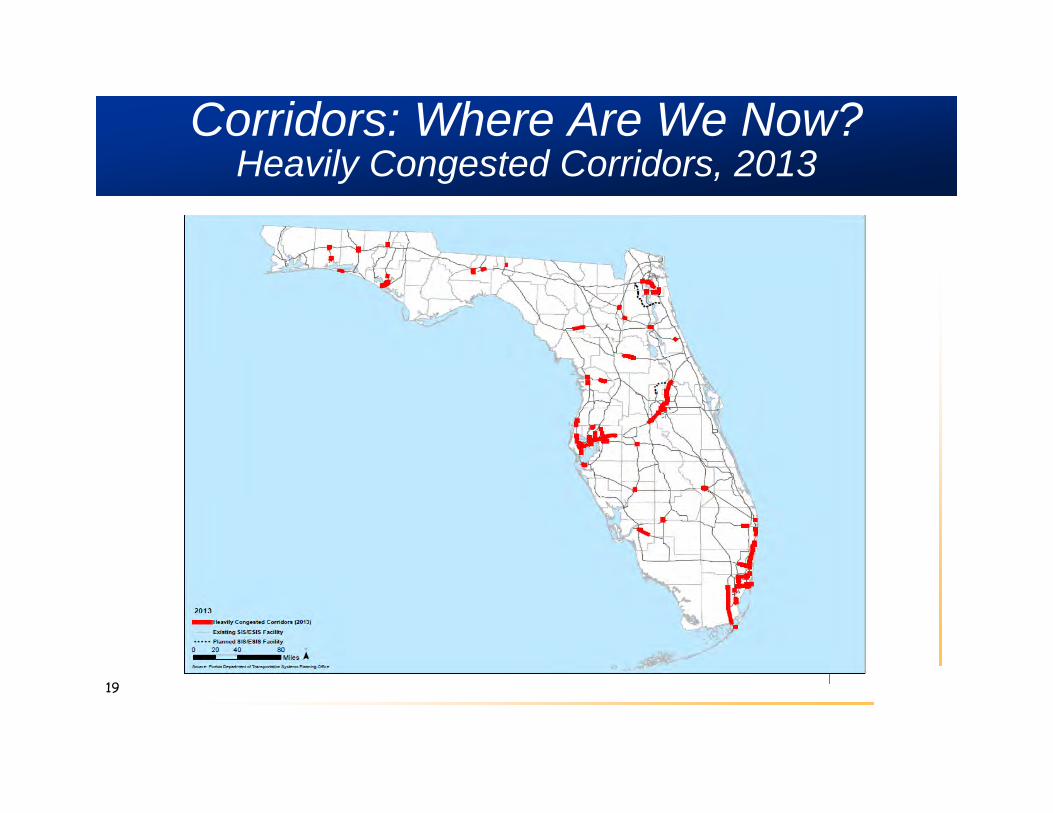
Corridors: Where Are We Now?Heavily Congested Corridors, 2013
19
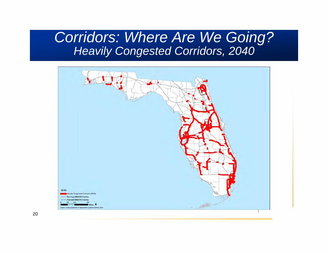
Corridors: Where Are We Going?Heavily Congested Corridors, 2040
20
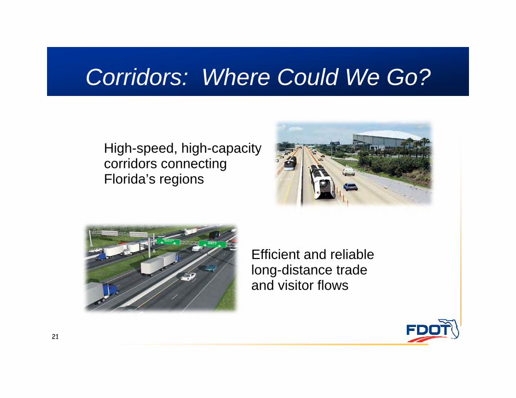
Corridors: Where Could We Go?
High-speed, high-capacity corridors connecting Florida’s regions
21
Efficient and reliable long-distance trade and visitor flows
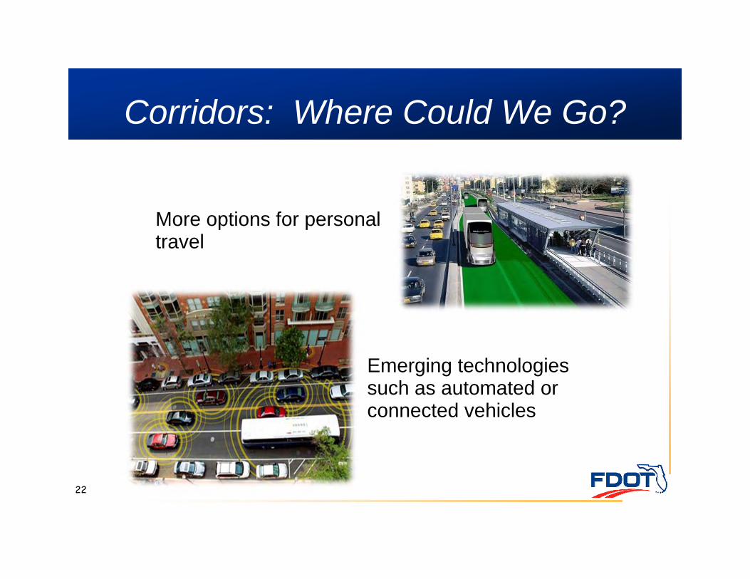
Corridors: Where Could We Go?
More options for personal travel
22
Emerging technologies such as automated or connected vehicles
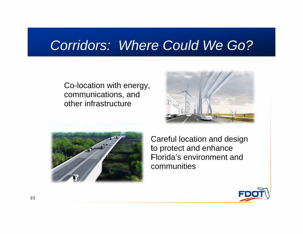
Corridors: Where Could We Go?
Careful location and design to protect and enhance Florida’s environment and communities
23
Co-location with energy, communications, and other infrastructure
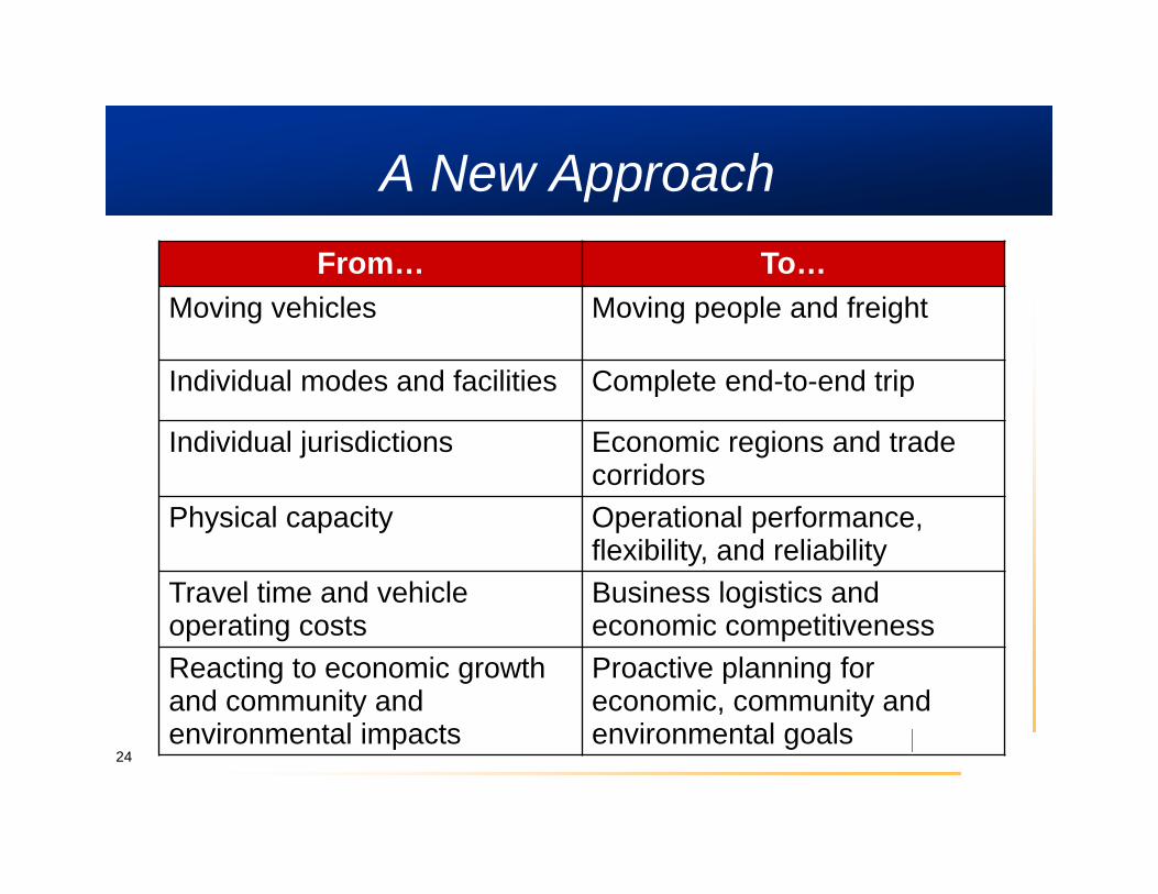
A New ApproachFrom… To…
Moving vehicles Moving people and freight
Individual modes and facilities Complete end-to-end trip
Individual jurisdictions Economic regions and trade corridors
Physical capacity Operational performance, flexibility, and reliability
Travel time and vehicle operating costs
Business logistics and economic competitiveness
Reacting to economic growth and community and environmental impacts
Proactive planning for economic, community and environmental goals
24
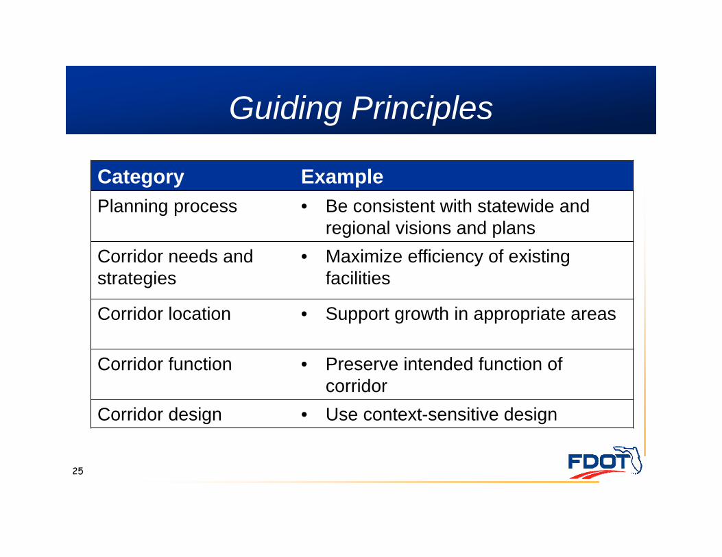
Guiding Principles
25
Category ExamplePlanning process • Be consistent with statewide and
regional visions and plans Corridor needs and strategies
• Maximize efficiency of existing facilities
Corridor location • Support growth in appropriate areas
Corridor function • Preserve intended function of corridor
Corridor design • Use context-sensitive design
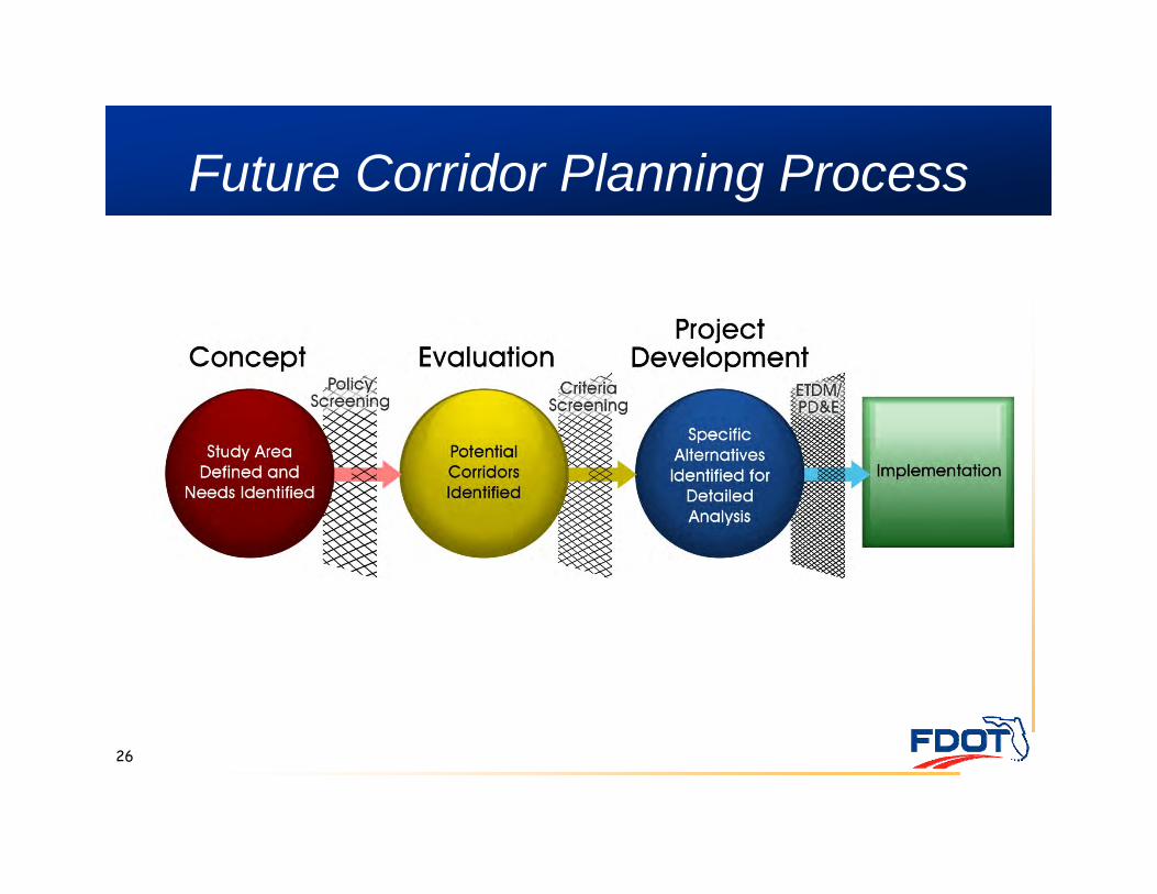
Future Corridor Planning Process
26

Future Corridor Study Areas
27
Concept Study Complete• Tampa Bay-Central Florida• Tampa Bay-Northeast Florida
Future Study• Southeast Florida-Heartland-Central Florida• Southwest Florida-Heartland-Central Florida• Northwest Florida
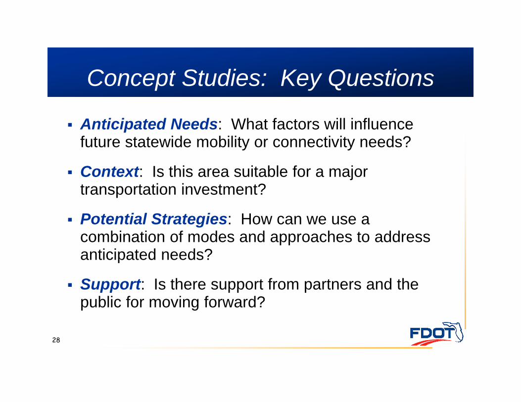
Concept Studies: Key Questions
28
Anticipated Needs: What factors will influence future statewide mobility or connectivity needs?
Context: Is this area suitable for a major transportation investment?
Potential Strategies: How can we use a combination of modes and approaches to address anticipated needs?
Support: Is there support from partners and the public for moving forward?
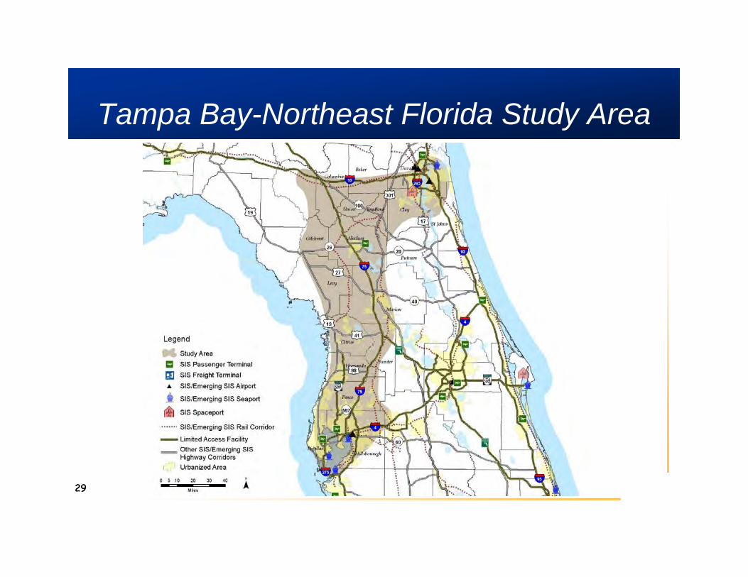
Tampa Bay-Northeast Florida Study Area
2929
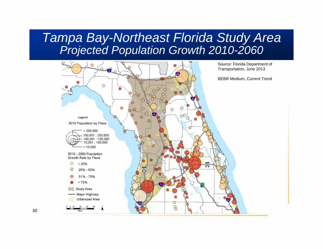
Tampa Bay-Northeast Florida Study AreaProjected Population Growth 2010-2060
30
Source: Florida Department of Transportation, June 2013
BEBR Medium, Current Trend
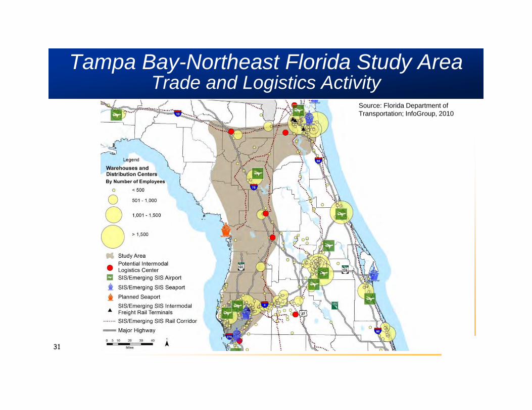
Tampa Bay-Northeast Florida Study AreaTrade and Logistics Activity
31
Source: Florida Department of Transportation; InfoGroup, 2010
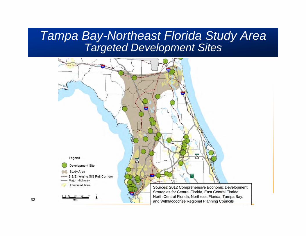
Tampa Bay-Northeast Florida Study Area Targeted Development Sites
32
Sources: 2012 Comprehensive Economic Development Strategies for Central Florida, East Central Florida, North Central Florida, Northeast Florida, Tampa Bay, and Withlacoochee Regional Planning Councils
Sources: 2012 Comprehensive Economic Development Strategies for Central Florida, East Central Florida, North Central Florida, Northeast Florida, Tampa Bay, and Withlacoochee Regional Planning Councils

Tampa Bay-Northeast Florida Study AreaIncreasing Safety Concerns
33
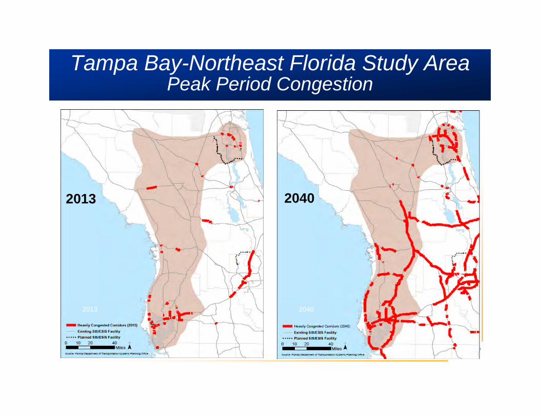
Tampa Bay-Northeast Florida Study AreaPeak Period Congestion
Source: FDOT Systems Planning Office
2013 2040
2013 2040
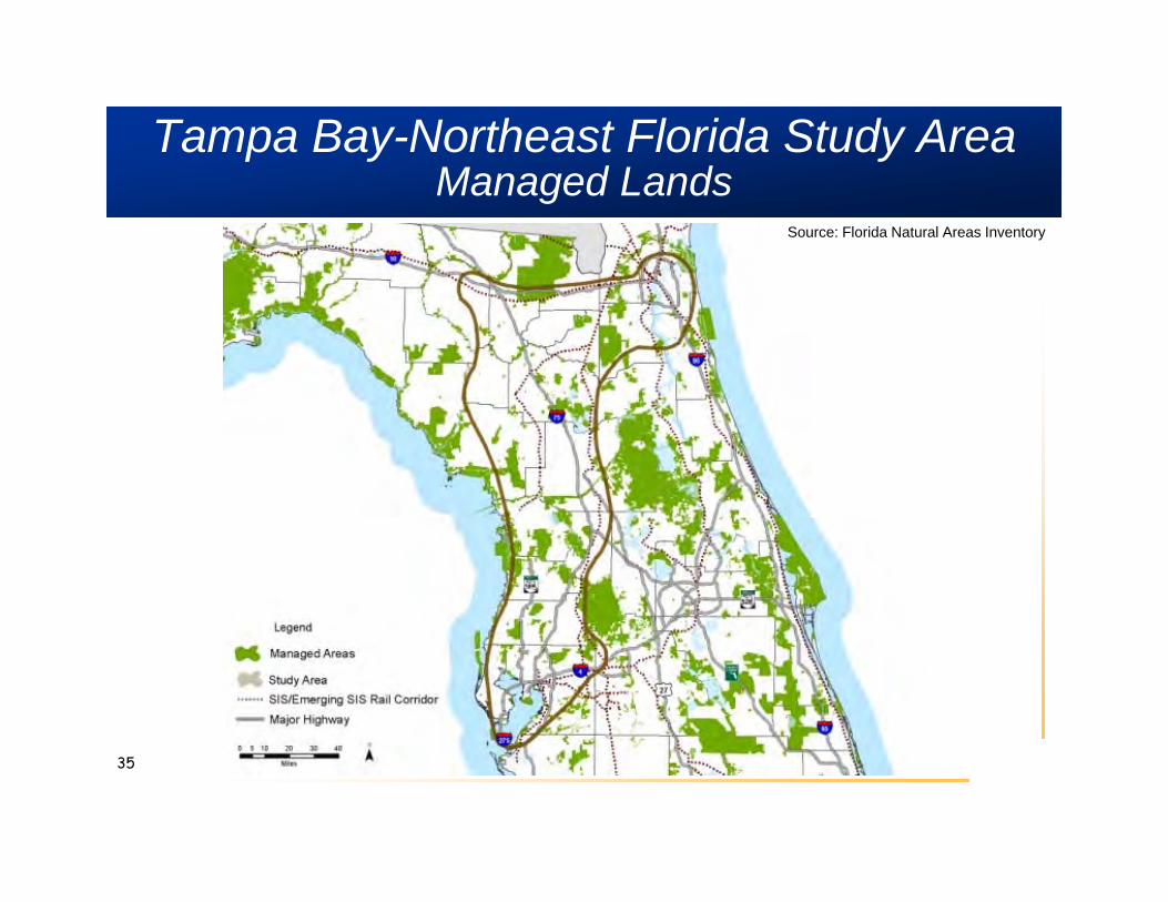
Tampa Bay-Northeast Florida Study AreaManaged Lands
35
Source: Florida Natural Areas Inventory
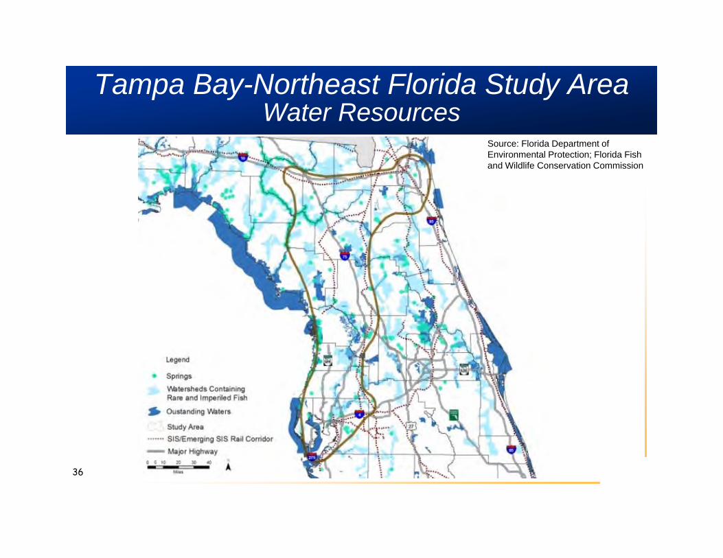
Tampa Bay-Northeast Florida Study AreaWater Resources
36
Source: Florida Department of Environmental Protection; Florida Fish and Wildlife Conservation Commission
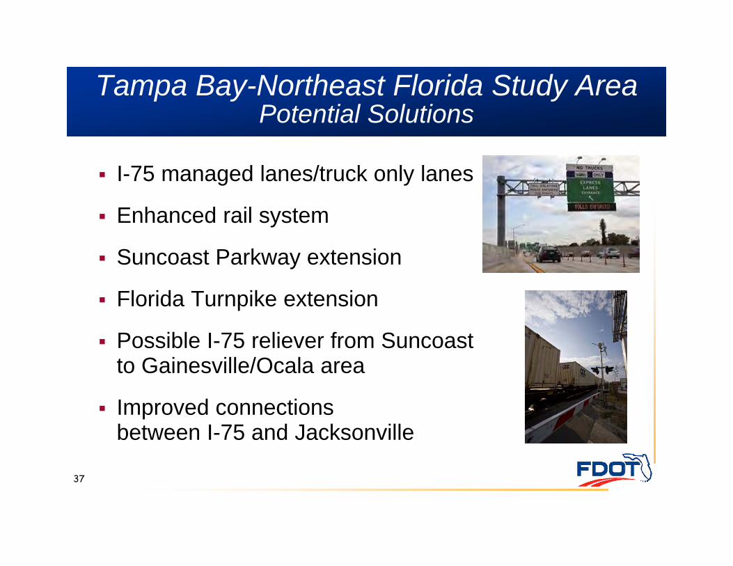
Tampa Bay-Northeast Florida Study AreaPotential Solutions
I-75 managed lanes/truck only lanes
Enhanced rail system
Suncoast Parkway extension
Florida Turnpike extension
Possible I-75 reliever from Suncoast to Gainesville/Ocala area
Improved connections between I-75 and Jacksonville
37
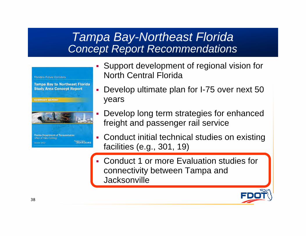
Tampa Bay-Northeast Florida Concept Report Recommendations
Support development of regional vision for North Central Florida
Develop ultimate plan for I-75 over next 50 years
Develop long term strategies for enhanced freight and passenger rail service
Conduct initial technical studies on existing facilities (e.g., 301, 19)
Conduct 1 or more Evaluation studies for connectivity between Tampa and Jacksonville
38
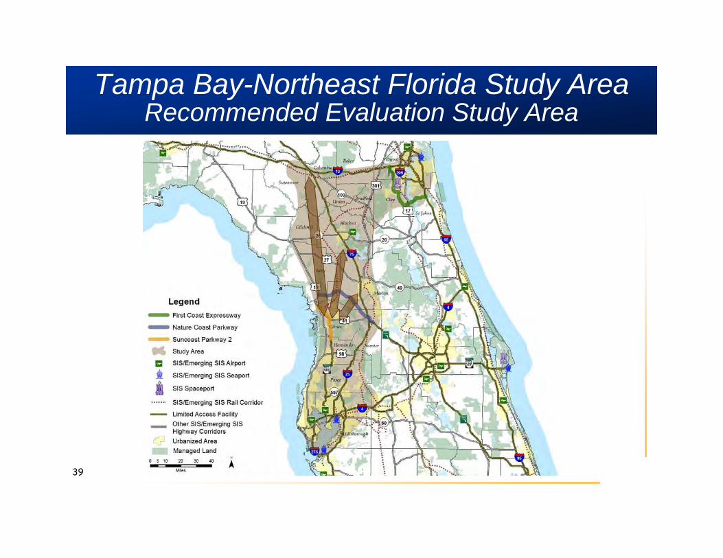
Tampa Bay-Northeast Florida Study AreaRecommended Evaluation Study Area
39
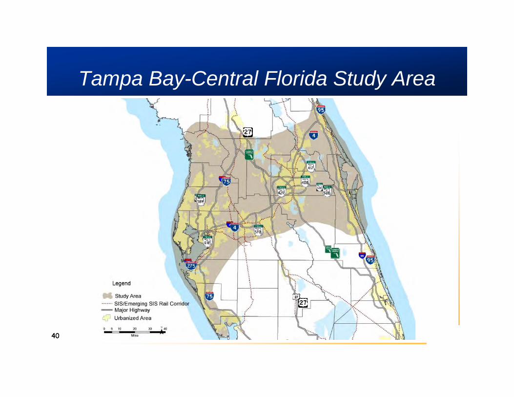
Tampa Bay-Central Florida Study Area
4040
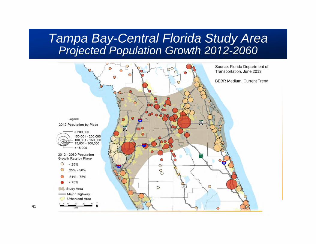
Tampa Bay-Central Florida Study AreaProjected Population Growth 2012-2060
41
Source: Florida Department of Transportation, June 2013
BEBR Medium, Current Trend
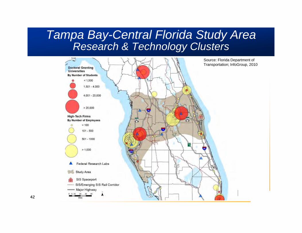
Tampa Bay-Central Florida Study AreaResearch & Technology Clusters
42
Source: Florida Department of Transportation; InfoGroup, 2010
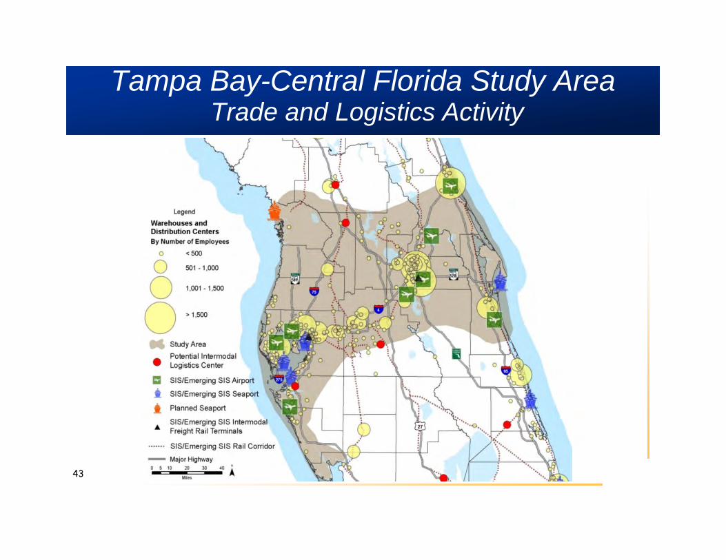
Tampa Bay-Central Florida Study AreaTrade and Logistics Activity
43
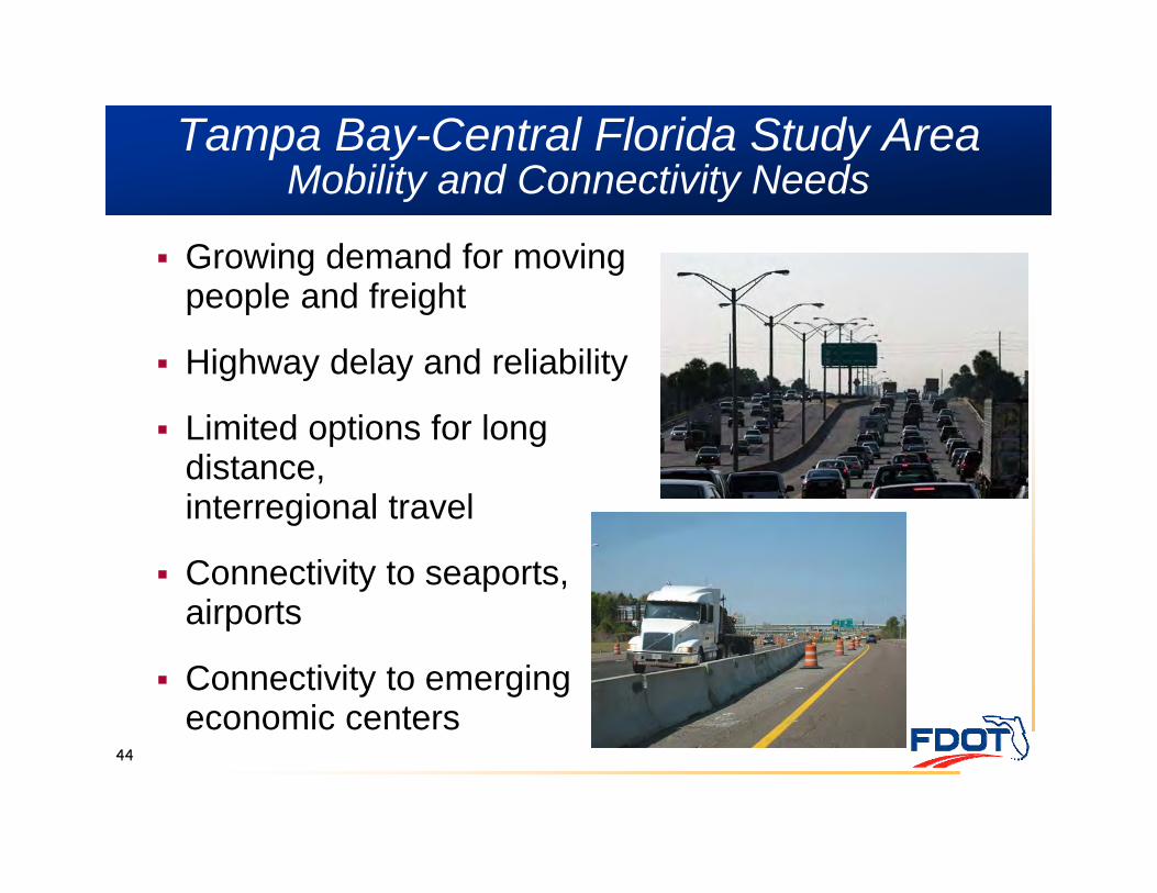
Tampa Bay-Central Florida Study Area Mobility and Connectivity Needs
44
Growing demand for moving people and freight
Highway delay and reliability
Limited options for longdistance, interregional travel
Connectivity to seaports, airports
Connectivity to emerging economic centers
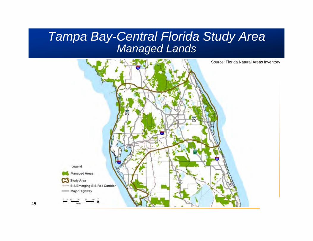
Tampa Bay-Central Florida Study AreaManaged Lands
45
Source: Florida Natural Areas Inventory
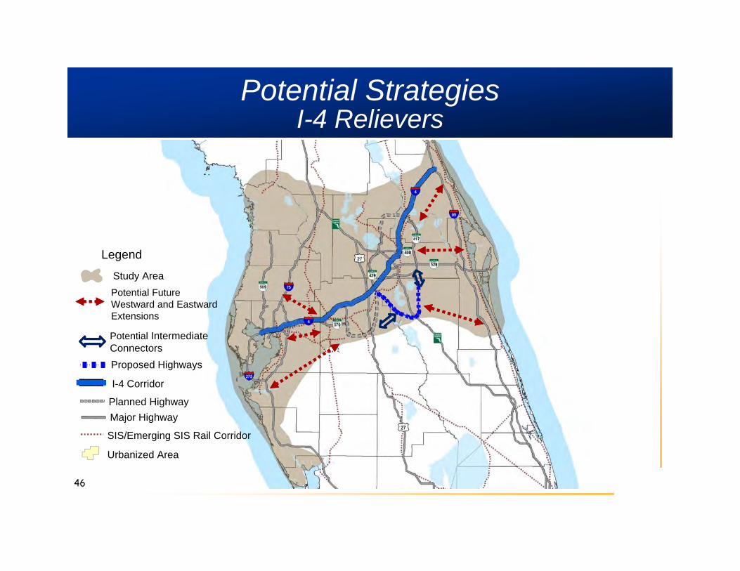
Potential Strategies I-4 Relievers
Potential Future Westward and Eastward Extensions
Potential Intermediate Connectors
I-4 Corridor
Legend
Major Highway
Urbanized Area
Study Area
Planned Highway
! ! ! ! ! ! 1Proposed Highways
SIS/Emerging SIS Rail Corridor
46

Potential StrategiesClosing Regional Connectivity Gaps
SIS/Emerging SIS Rail Corridor
Potential Connectivity Gaps
!Businesses >100 Employees
0 10 20 30 405
Miles¯
Legend
Major Highway
Urbanized Area
Study Area
Sector Plans
Targeted Development Sites Identified in Regional Plans
DRI's
5 Mile Buffer Around ExistingLimited Access Highways
47
Tampa Bay-Central Florida Study AreaConcept Report Recommendations
Develop strategy for I-4 transformation over next 50 years
Develop long-term strategies for enhanced passenger and freight rail service
Assess benefits and costs of developing one or more parallel multimodal corridors to help relieve I-4
Convene collaborative process to assess development patterns and mobility needs in one subarea
48
www.FLFutureCorridors.org
49
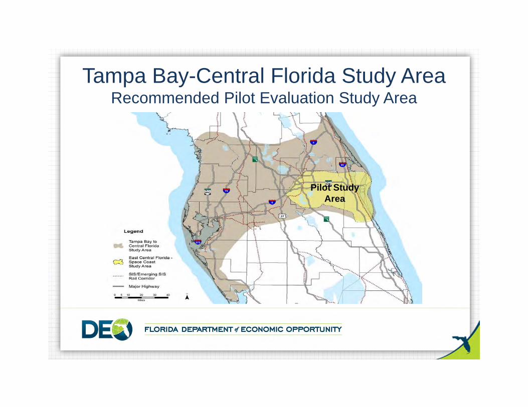
Tampa Bay-Central Florida Study AreaRecommended Pilot Evaluation Study Area
Pilot StudyArea
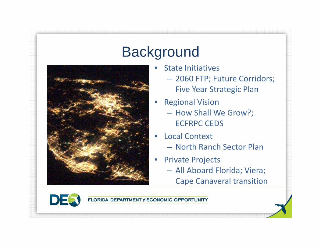
Background• State Initiatives
– 2060 FTP; Future Corridors; Five Year Strategic Plan
• Regional Vision– How Shall We Grow?; ECFRPC CEDS
• Local Context– North Ranch Sector Plan
• Private Projects– All Aboard Florida; Viera; Cape Canaveral transition
• The Task Force will facilitate input from key stakeholders and allow the coordination of competing views, with the goal of obtaining buy‐in and preventing future conflicts
Why the Task Force?
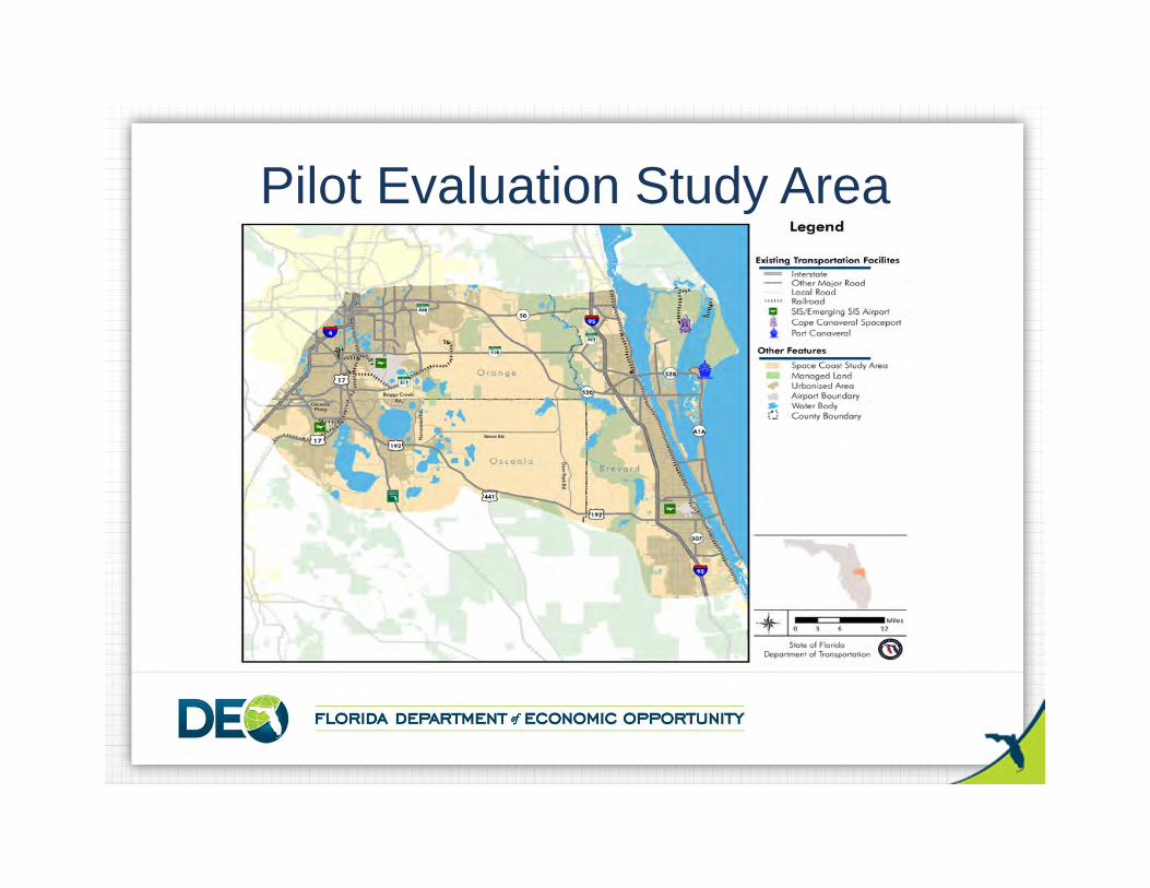
Pilot Evaluation Study Area

54
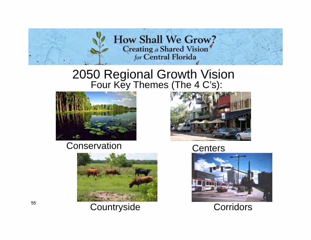
Countryside
Conservation
Corridors
2050 Regional Growth Vision
Centers
Four Key Themes (The 4 C’s):
55
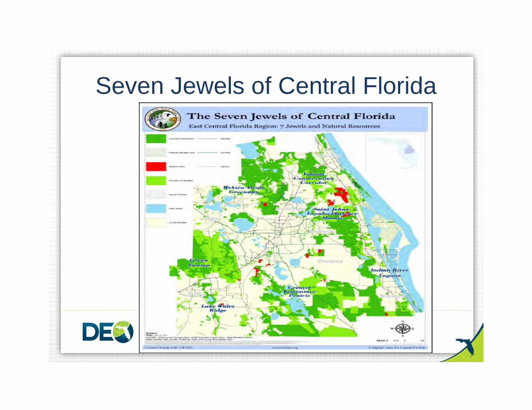
Seven Jewels of Central Florida
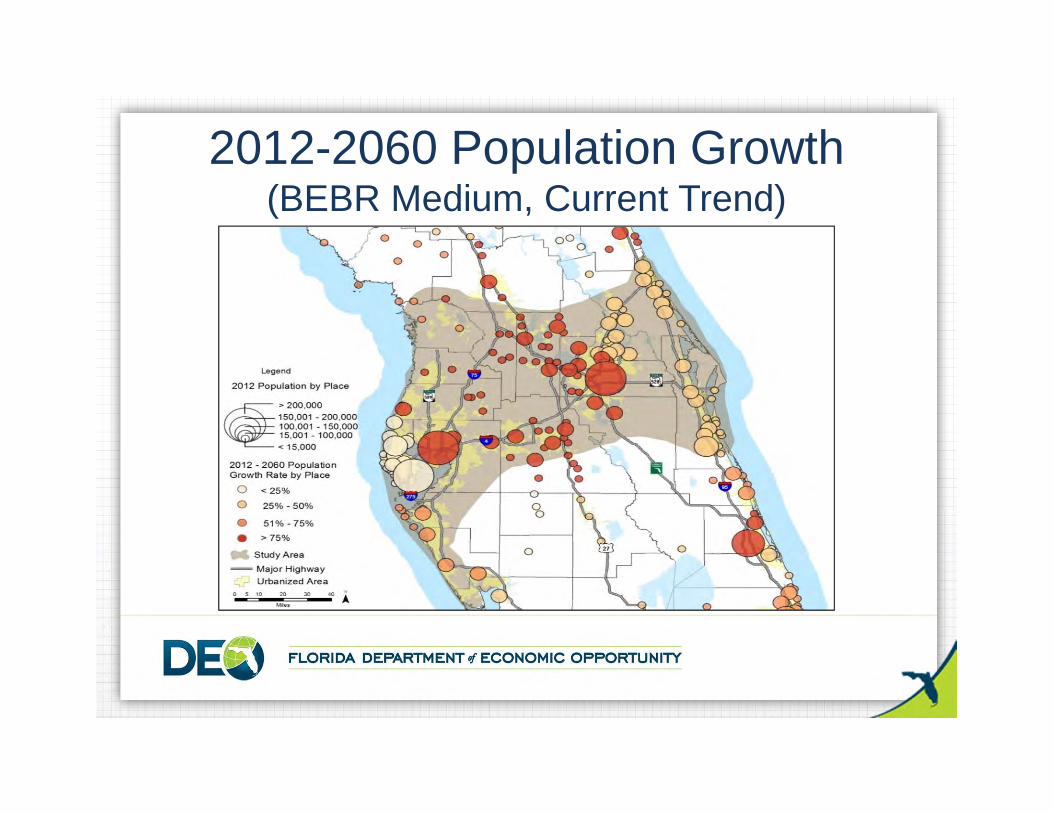
2012-2060 Population Growth (BEBR Medium, Current Trend)
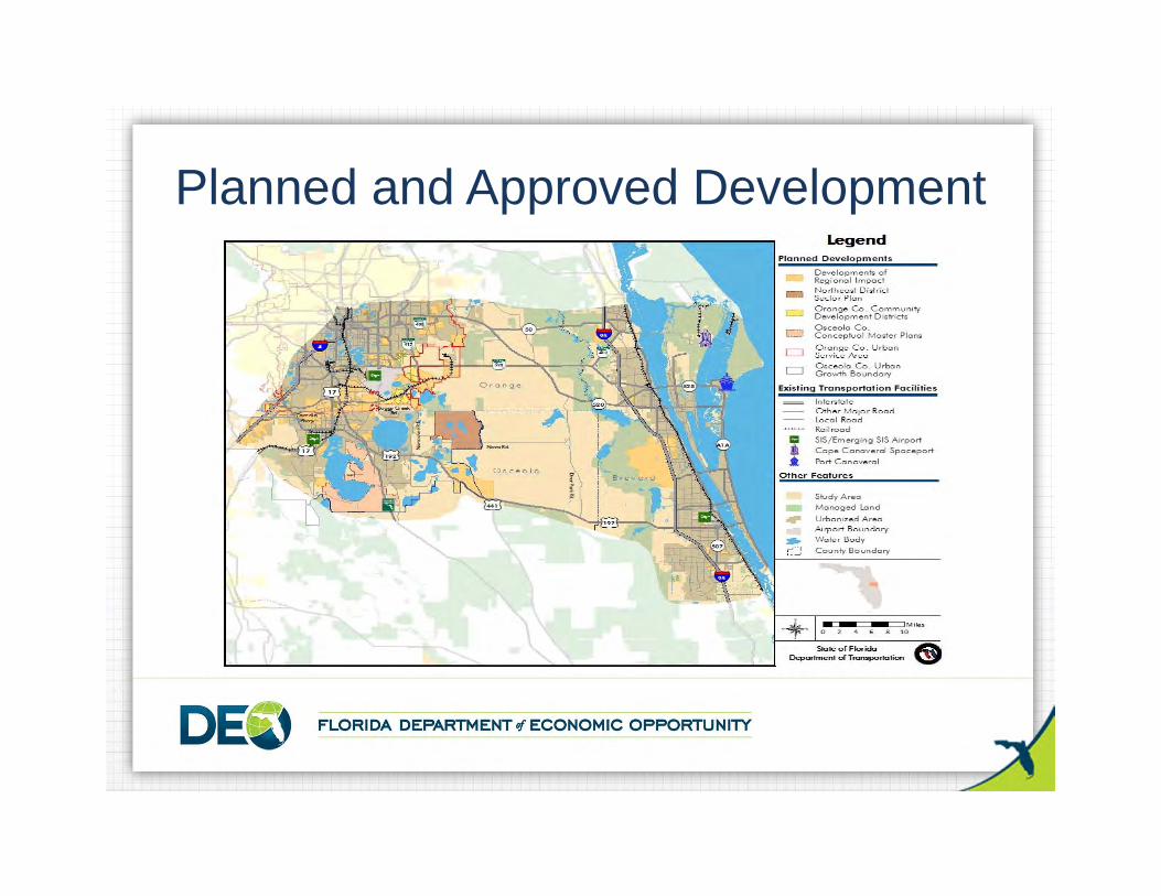
Planned and Approved Development
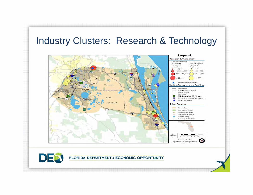
Industry Clusters: Research & Technology
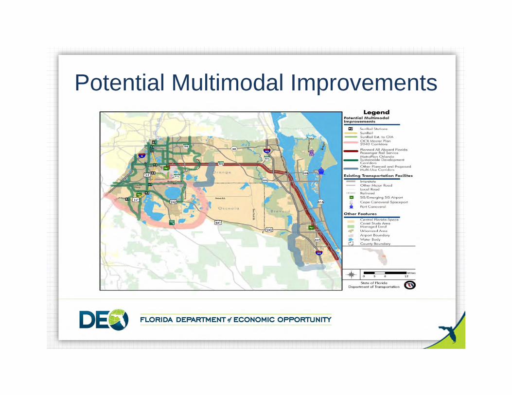
Potential Multimodal Improvements
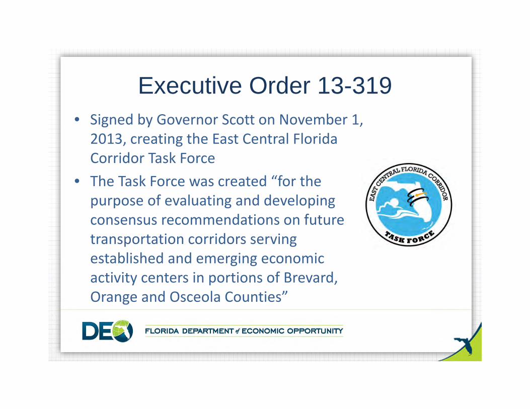
• Signed by Governor Scott on November 1, 2013, creating the East Central Florida Corridor Task Force
• The Task Force was created “for the purpose of evaluating and developing consensus recommendations on future transportation corridors serving established and emerging economic activity centers in portions of Brevard, Orange and Osceola Counties”
Executive Order 13-319
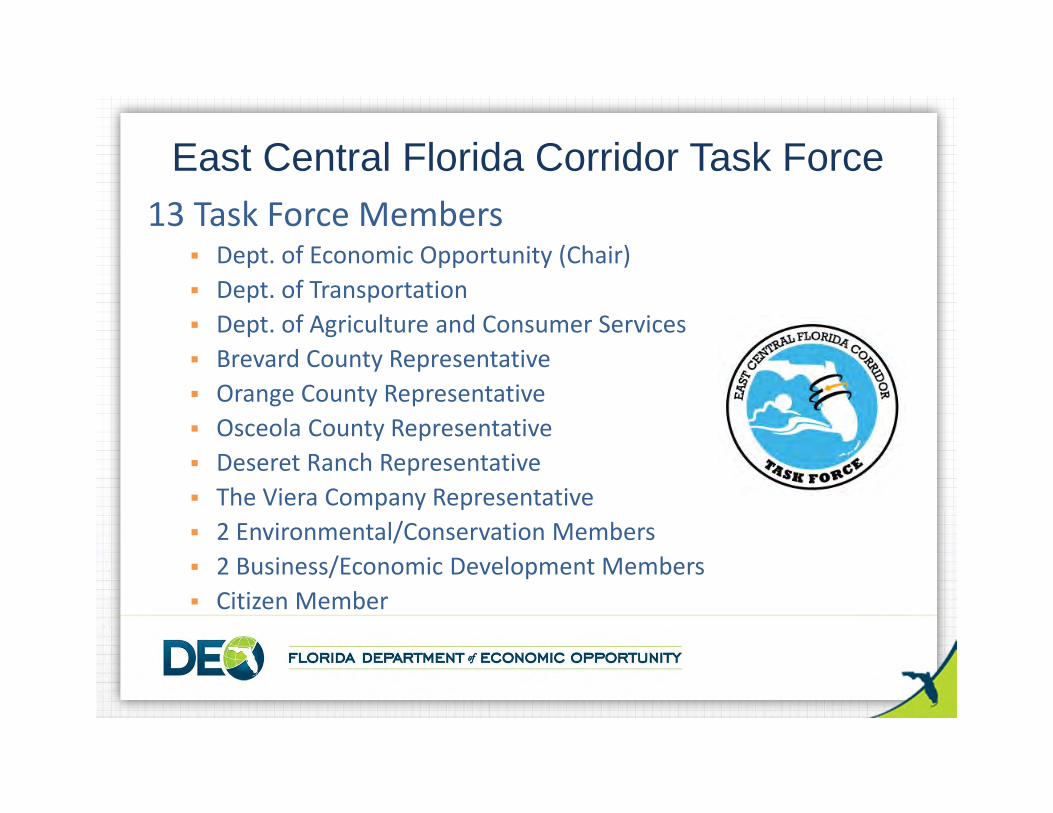
13 Task Force Members Dept. of Economic Opportunity (Chair) Dept. of Transportation Dept. of Agriculture and Consumer Services Brevard County Representative Orange County Representative Osceola County Representative Deseret Ranch Representative The Viera Company Representative 2 Environmental/Conservation Members 2 Business/Economic Development Members Citizen Member
East Central Florida Corridor Task Force
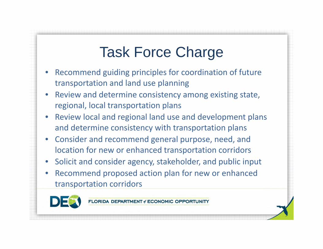
• Recommend guiding principles for coordination of future transportation and land use planning
• Review and determine consistency among existing state, regional, local transportation plans
• Review local and regional land use and development plans and determine consistency with transportation plans
• Consider and recommend general purpose, need, and location for new or enhanced transportation corridors
• Solicit and consider agency, stakeholder, and public input• Recommend proposed action plan for new or enhanced
transportation corridors
Task Force Charge
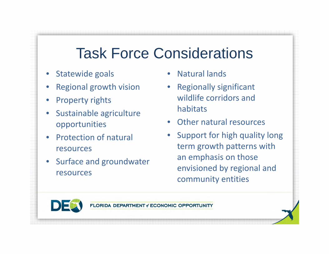
• Statewide goals• Regional growth vision• Property rights• Sustainable agriculture
opportunities• Protection of natural
resources• Surface and groundwater
resources
Task Force Considerations• Natural lands• Regionally significant
wildlife corridors and habitats
• Other natural resources• Support for high quality long
term growth patterns with an emphasis on those envisioned by regional and community entities
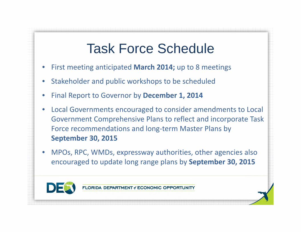
• First meeting anticipated March 2014; up to 8 meetings
• Stakeholder and public workshops to be scheduled
• Final Report to Governor by December 1, 2014
• Local Governments encouraged to consider amendments to Local Government Comprehensive Plans to reflect and incorporate Task Force recommendations and long‐term Master Plans by September 30, 2015
• MPOs, RPC, WMDs, expressway authorities, other agencies also encouraged to update long range plans by September 30, 2015
Task Force Schedule
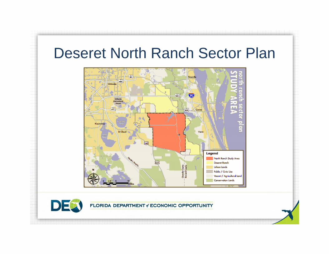
Deseret North Ranch Sector Plan
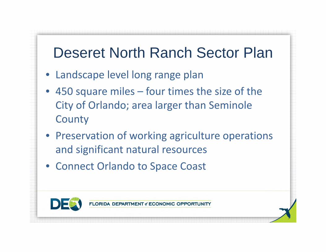
• Landscape level long range plan• 450 square miles – four times the size of the City of Orlando; area larger than Seminole County
• Preservation of working agriculture operations and significant natural resources
• Connect Orlando to Space Coast
Deseret North Ranch Sector Plan
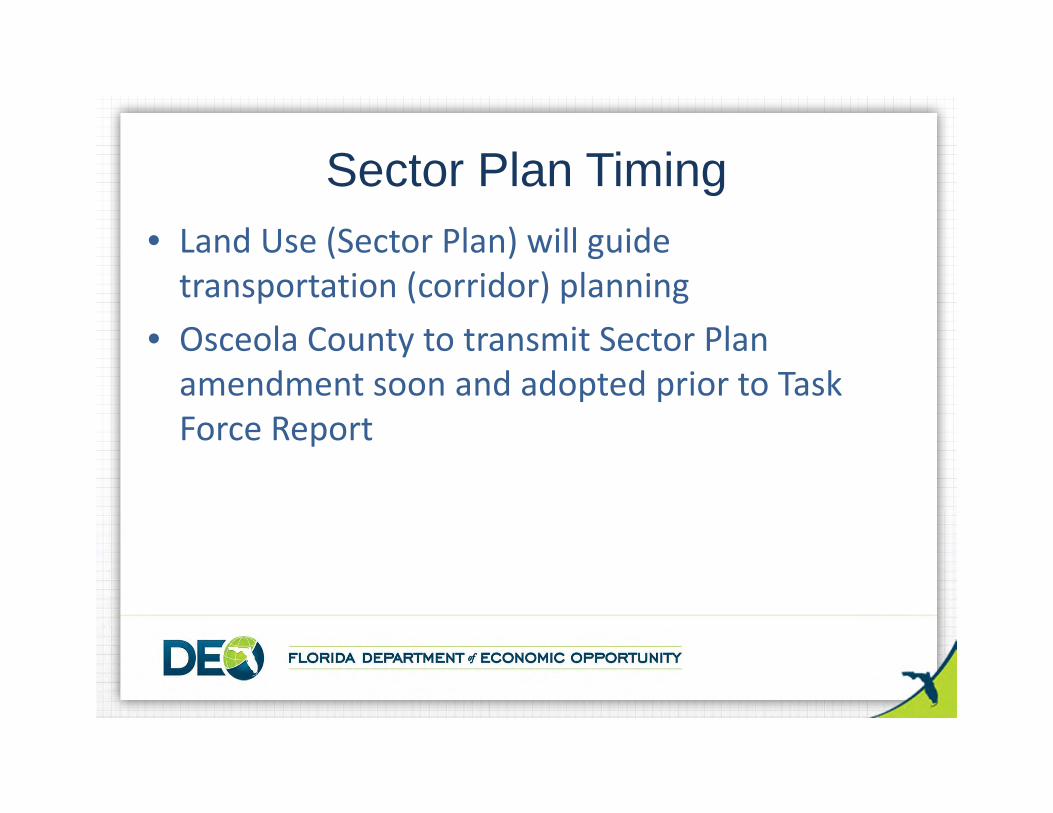
• Land Use (Sector Plan) will guide transportation (corridor) planning
• Osceola County to transmit Sector Plan amendment soon and adopted prior to Task Force Report
Sector Plan Timing
• The Task Force will solicit and consider input from local, regional, state, and federal agencies; stakeholders, including property owners, agricultural interests, business interests, environmental interests; residents; and the public
• Input via public meetings, workshops and website (www.ecfcorridortaskforce.org)
Stakeholder Input
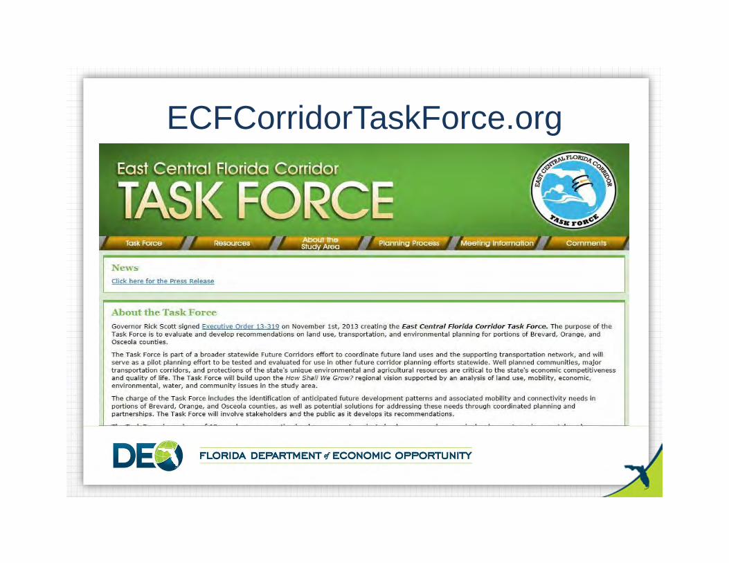
ECFCorridorTaskForce.org