Embed Size (px)
Citation preview
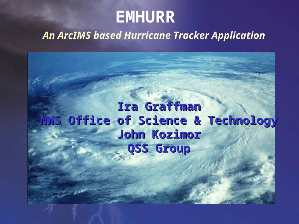
An ArcIMS based Hurricane Tracker Application
EMHURR
Ira GraffmanIra GraffmanNWS Office of Science & TechnologyNWS Office of Science & Technology
John KozimorJohn KozimorQSS GroupQSS Group
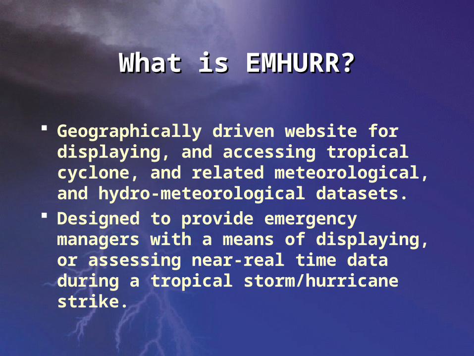
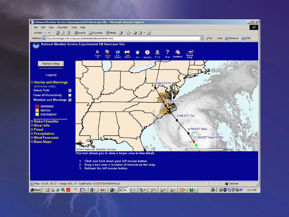
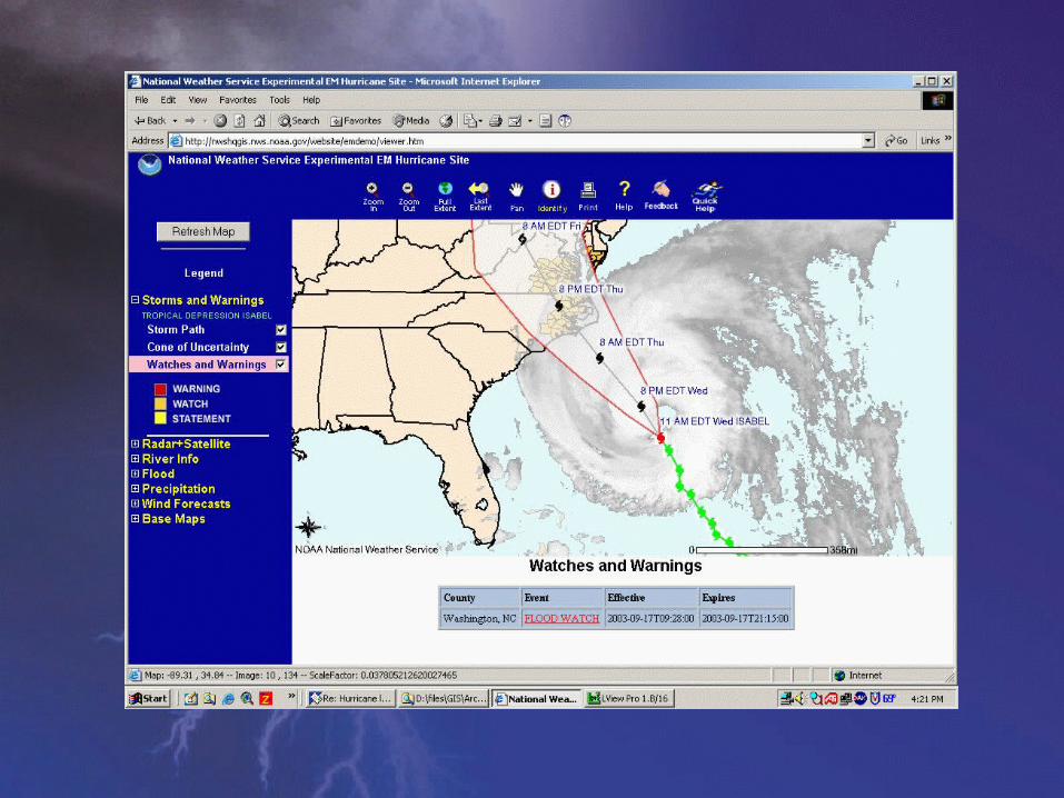
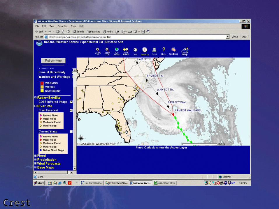
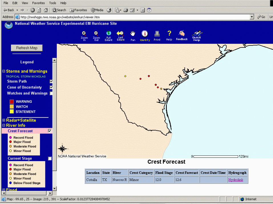
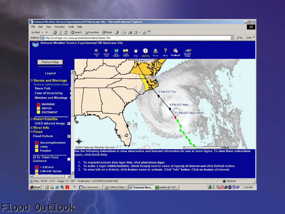
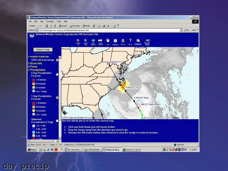
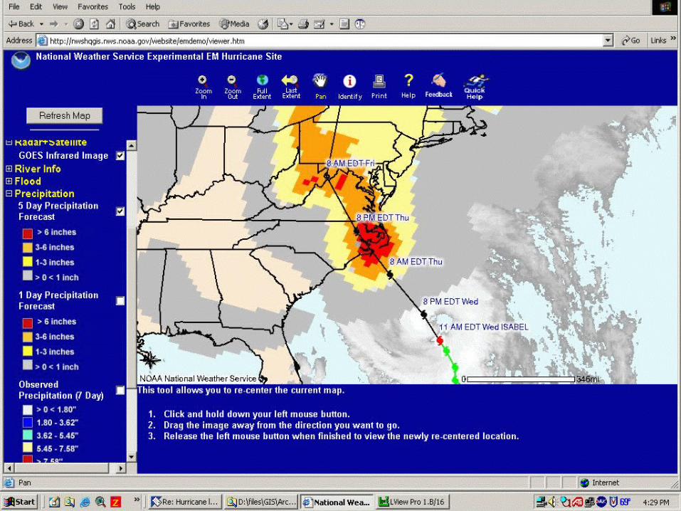
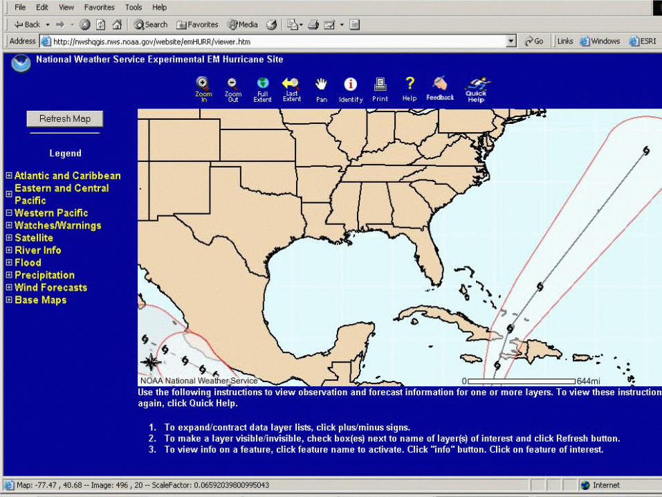
Geographically driven website for displaying, and accessing tropical cyclone, and related meteorological, and hydro-meteorological datasets.
Designed to provide emergency managers with a means of displaying, or assessing near-real time data during a tropical storm/hurricane strike.
What is EMHURR?What is EMHURR?
Water Resources Internet Mapping Team – Sept 2001
Internet Mapping Team – August 2002 EMHURR version 1 Developed – Sept 2003 EMHURR version 2 in Development
HistoryHistory
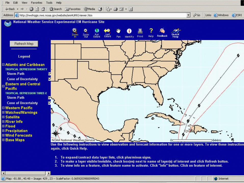
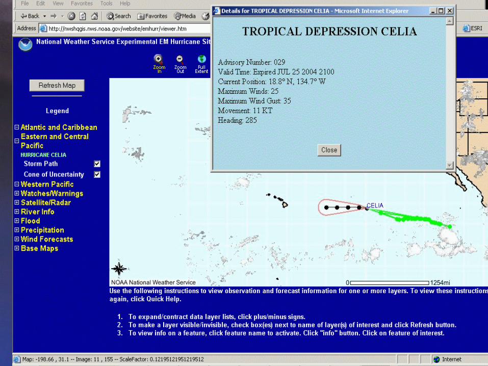
Provides the ability to selectively access and
interact with data.
Provides users with tools to access data as a web
map service to allow integration with local GIS
data via GIS software and viewers.
Allows users to have the ability to download
source data.
What Does EMHURR Do?What Does EMHURR Do?
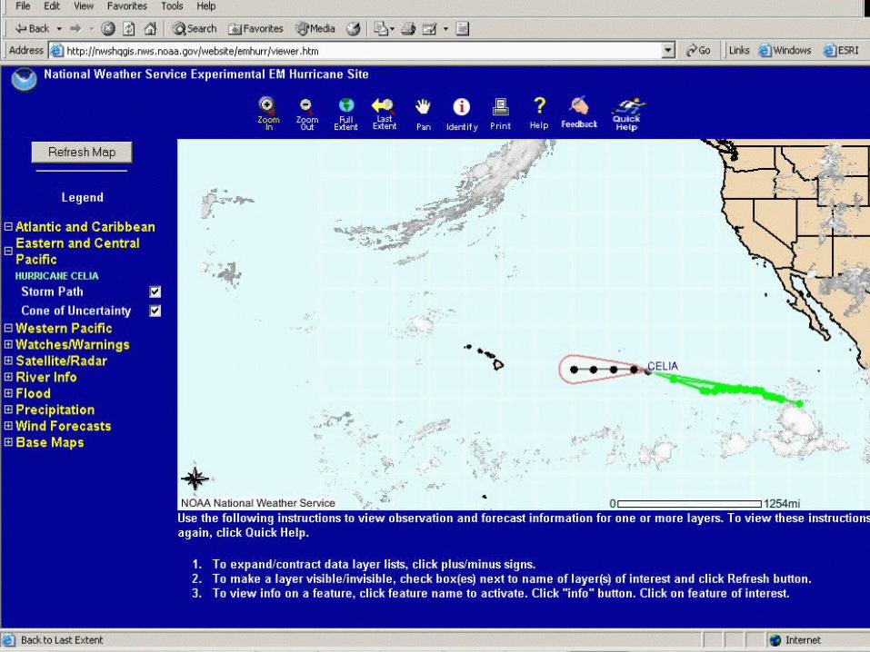
SCOPESCOPE Information associated with hurricanes
– Hurricane track/cone of uncertainty
– Watches/warnings
– Satellite
– Wind
– Precipitation
– Flooding
– Limited reference information
Southeastern U.S. September-November, 2003 Primary audience: emergency management community
Internet Map Services (IMS)Internet Map Services (IMS)
What Is It? Allows users to access and interact with spatial
data using only a web browser.
How will IMS Benefit NOAA? Provides a means of viewing NOAA data
resources in a natural map based fashion. Provides a foundation for integrating and
distributing NOAA’s vast data resources using multiple or distributed databases..
Encourages enterprise collaboration among NOAA line offices and programs.
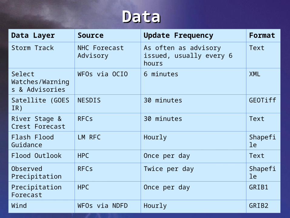
DataDataData Layer Source Update Frequency Format
Storm Track NHC Forecast Advisory
As often as advisory issued, usually every 6 hours
Text
Select Watches/Warnings & Advisories
WFOs via OCIO 6 minutes XML
Satellite (GOES IR) NESDIS 30 minutes GEOTiff
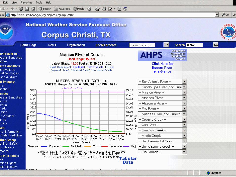
River Stage & Crest Forecast
RFCs 30 minutes Text
Flash Flood Guidance
LM RFC Hourly Shapefile
Flood Outlook HPC Once per day Text
Observed Precipitation
RFCs Twice per day Shapefile
Precipitation Forecast
HPC Once per day GRIB1
Wind WFOs via NDFD Hourly GRIB2
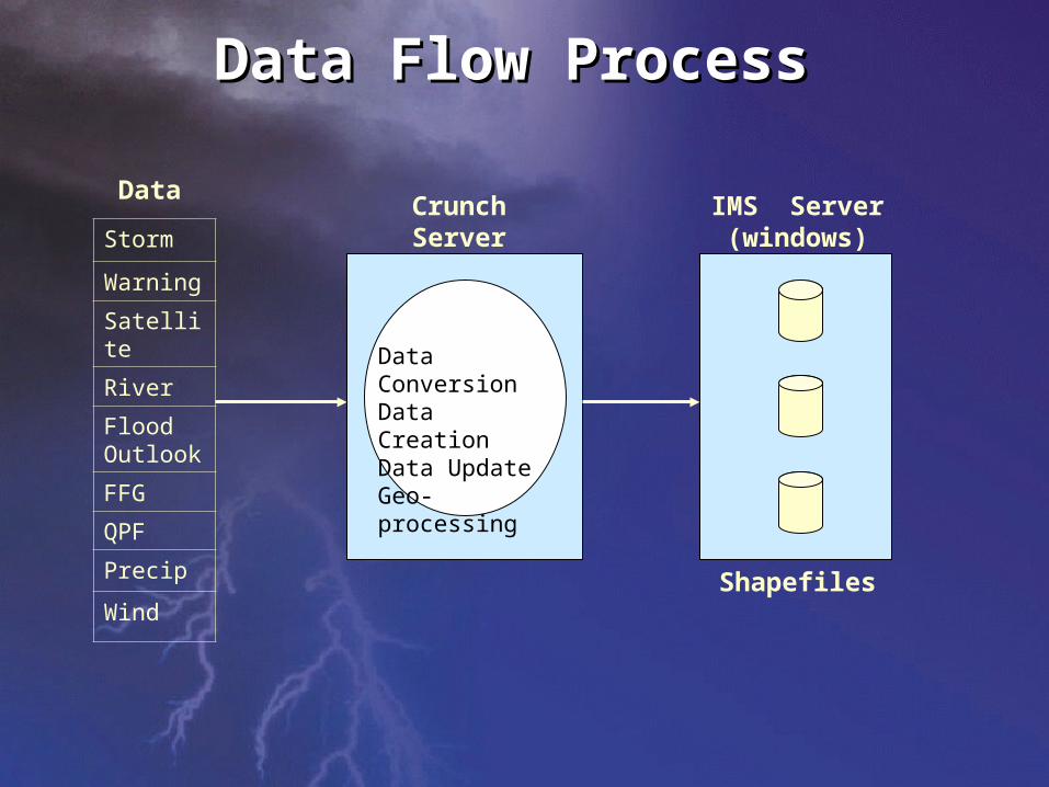
Storm
Warning
Satellite
River
Flood Outlook
FFG
QPF
Precip
Wind
Crunch Server(windows)
Data ConversionData CreationData UpdateGeo-processing
Data
Data Flow ProcessData Flow Process
IMS Server(windows)
Shapefiles
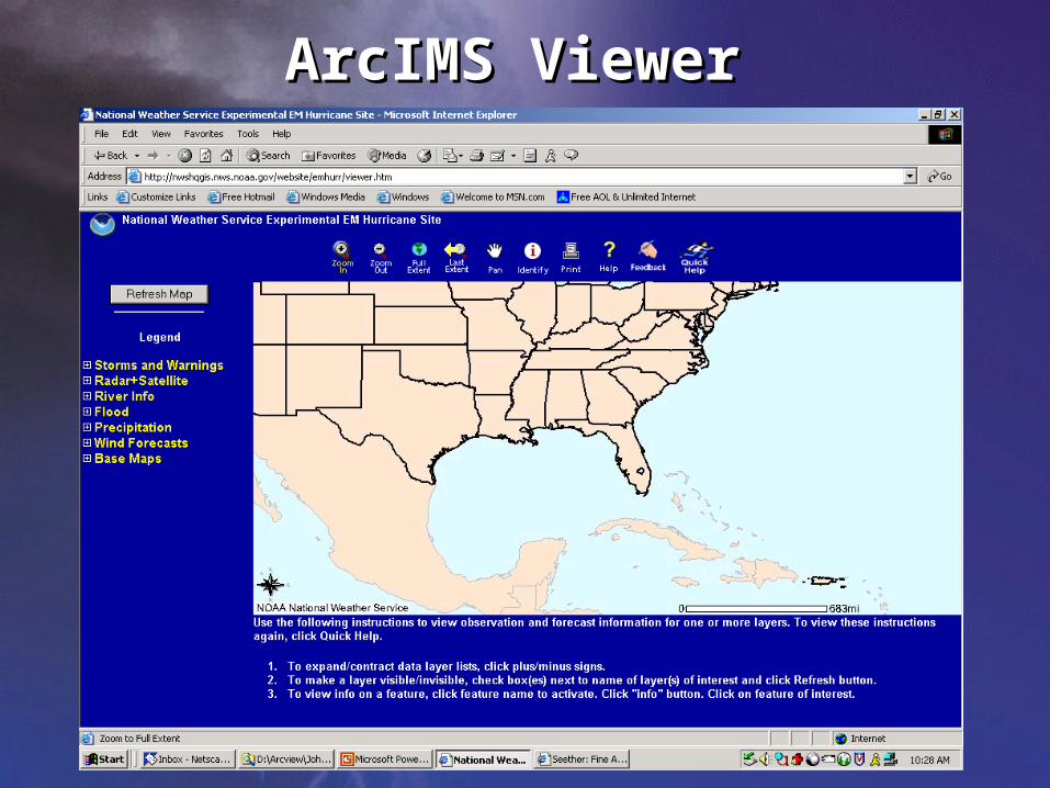
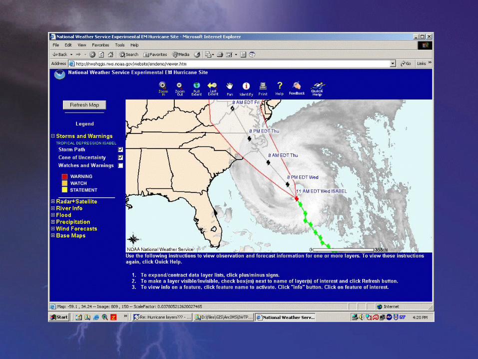
ArcIMS ViewerArcIMS Viewer
Crest fcstCrest fcst
Flood OutlookFlood Outlook
1 day precip1 day precip
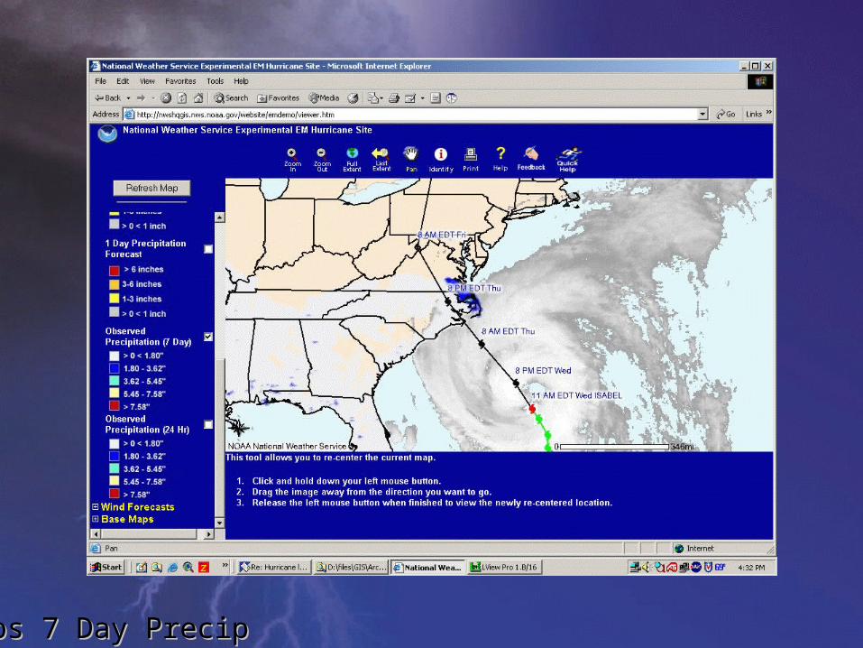
Obs 7 Day PrecipObs 7 Day Precip
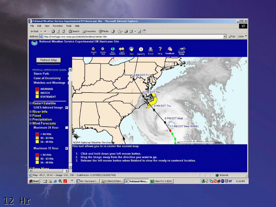
12 Hr Wind12 Hr Wind
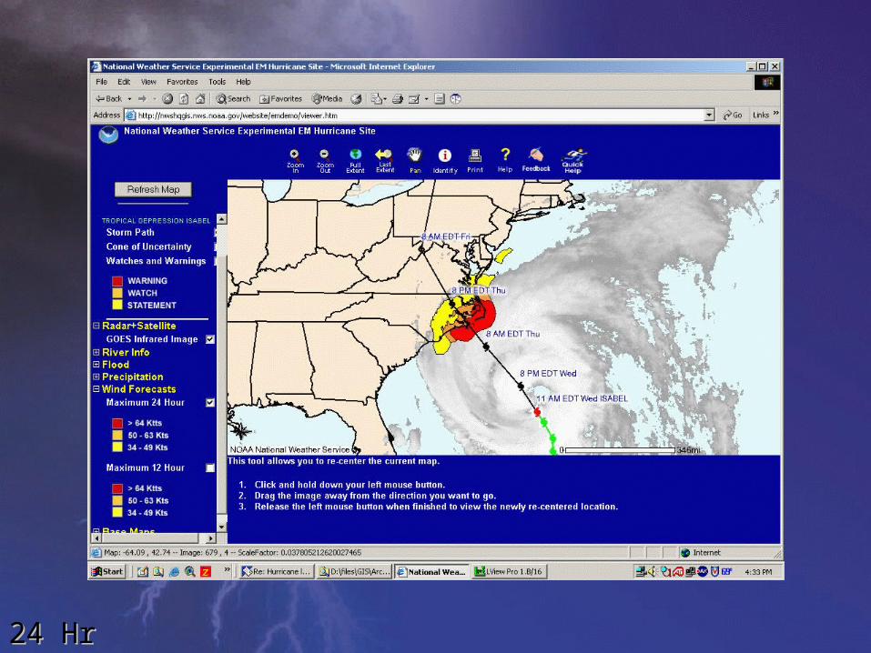
24 Hr Wind24 Hr Wind
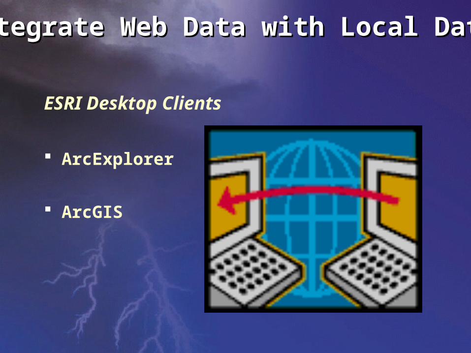
Integrate Web Data with Local DataIntegrate Web Data with Local Data
ESRI Desktop Clients
ArcExplorer
ArcGIS
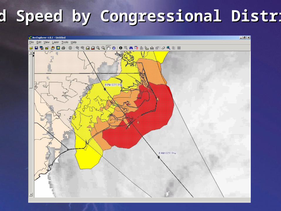
Wind Speed by Congressional DistrictWind Speed by Congressional District
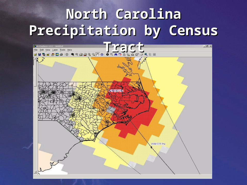
North Carolina Precipitation by North Carolina Precipitation by Census TractCensus Tract
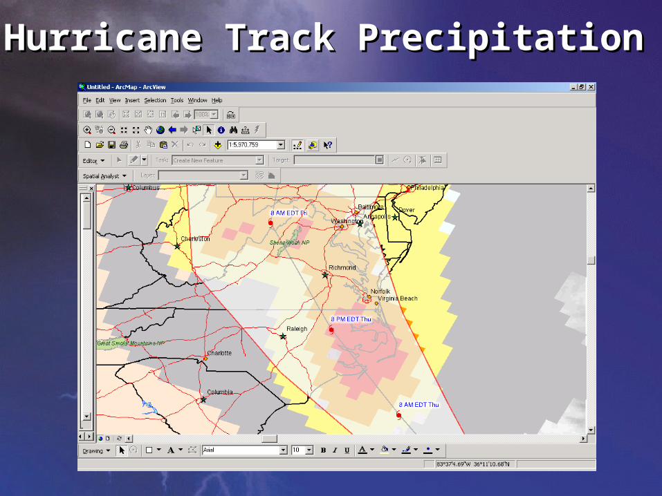
Hurricane Track PrecipitationHurricane Track Precipitation
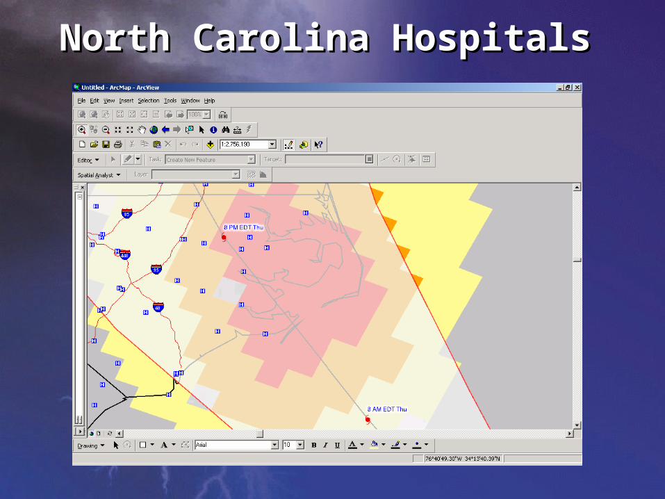
North Carolina HospitalsNorth Carolina Hospitals
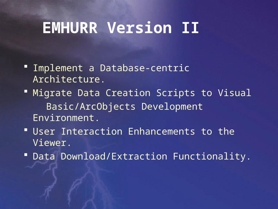
Implement a Database-centric Architecture. Migrate Data Creation Scripts to Visual
Basic/ArcObjects Development Environment. User Interaction Enhancements to the Viewer. Data Download/Extraction Functionality.
EMHURR Version II
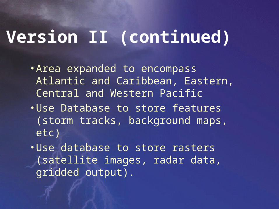
Version II (continued)
• Area expanded to encompass Atlantic and Caribbean, Eastern, Central and Western Pacific
• Use Database to store features (storm tracks, background maps, etc)
• Use database to store rasters (satellite images, radar data, gridded output).
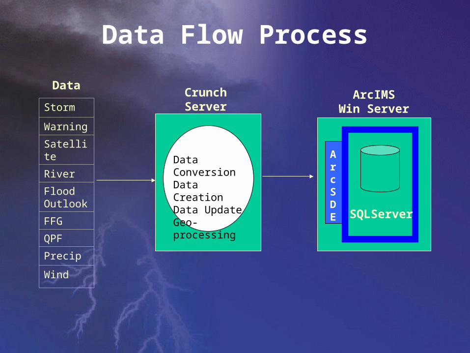
Data Flow Process
Crunch Server(windows)
Data ConversionData CreationData UpdateGeo-processing
ArcIMSWin Server
Data
ArcSDE SQLServer
Storm
Warning
Satellite
River
Flood Outlook
FFG
QPF
Precip
Wind
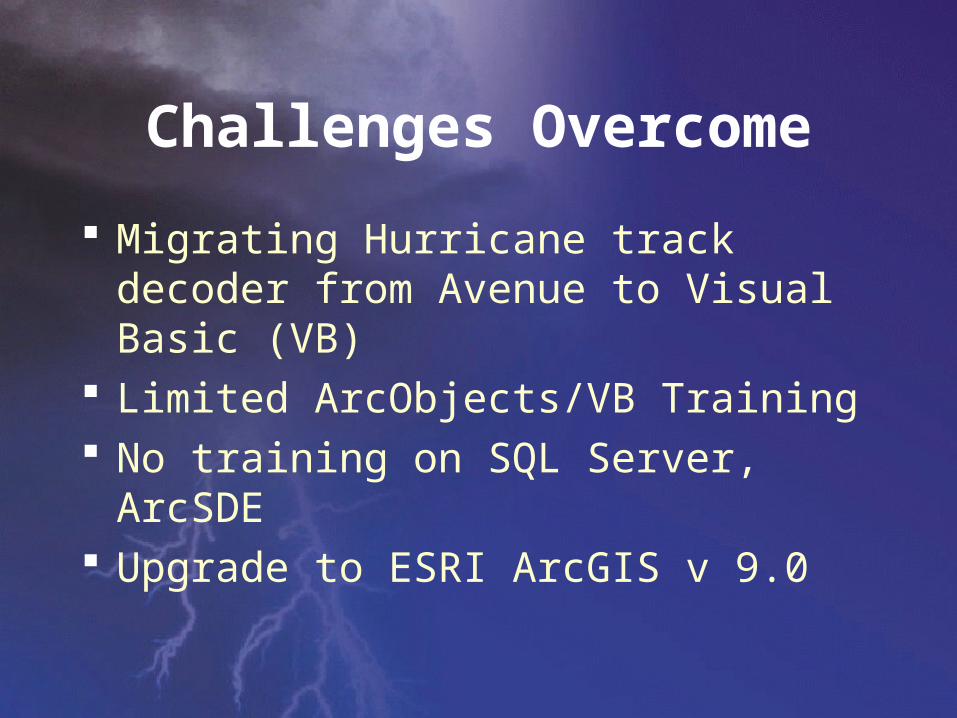
Challenges Overcome
Migrating Hurricane track decoder from Avenue to Visual Basic (VB)
Limited ArcObjects/VB Training No training on SQL Server, ArcSDE Upgrade to ESRI ArcGIS v 9.0
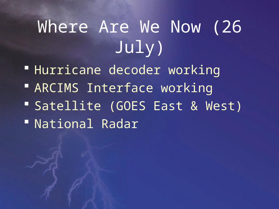
Where Are We Now (26 July)
Hurricane decoder working ARCIMS Interface working Satellite (GOES East & West) National Radar
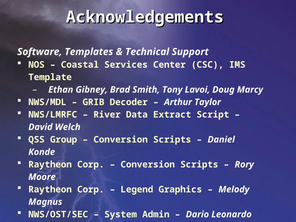
AcknowledgementsAcknowledgements
Software, Templates & Technical Support NOS – Coastal Services Center (CSC), IMS Template
– Ethan Gibney, Brad Smith, Tony Lavoi, Doug Marcy NWS/MDL – GRIB Decoder – Arthur Taylor NWS/LMRFC – River Data Extract Script – David Welch QSS Group – Conversion Scripts – Daniel Konde Raytheon Corp. – Conversion Scripts – Rory Moore Raytheon Corp. – Legend Graphics – Melody Magnus NWS/OST/SEC – System Admin – Dario Leonardo ESRI – Tech Support – Simon Evans
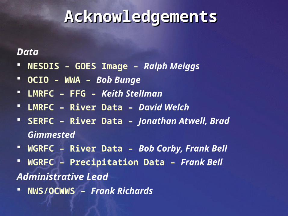
AcknowledgementsAcknowledgements
Data NESDIS – GOES Image – Ralph Meiggs
OCIO – WWA – Bob Bunge
LMRFC – FFG – Keith Stellman
LMRFC – River Data – David Welch
SERFC – River Data – Jonathan Atwell, Brad
Gimmested
WGRFC – River Data – Bob Corby, Frank Bell
WGRFC – Precipitation Data – Frank Bell
Administrative Lead
NWS/OCWWS – Frank Richards
Weather DataWeather DataIsIs
GeospatialGeospatial