Embed Size (px)
Citation preview
Using MAGIC to Access Spatial Imagery:
Putting ER Mapper Image Web Server,
ArcIMS and MrSID to work in your Library
Patrick McGlamery
Shirley Quintero
University of Connecticut Libraries
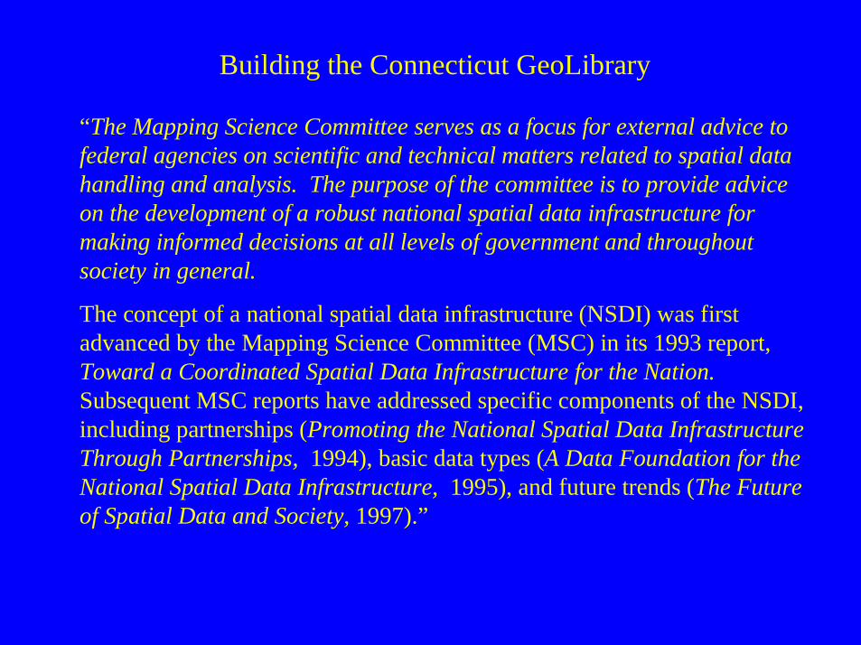
“The Mapping Science Committee serves as a focus for external advice to federal agencies on scientific and technical matters related to spatial data handling and analysis. The purpose of the committee is to provide advice on the development of a robust national spatial data infrastructure for making informed decisions at all levels of government and throughout society in general.
The concept of a national spatial data infrastructure (NSDI) was first advanced by the Mapping Science Committee (MSC) in its 1993 report, Toward a Coordinated Spatial Data Infrastructure for the Nation.Subsequent MSC reports have addressed specific components of the NSDI, including partnerships (Promoting the National Spatial Data Infrastructure Through Partnerships, 1994), basic data types (A Data Foundation for the National Spatial Data Infrastructure, 1995), and future trends (The Future of Spatial Data and Society, 1997).”
Building the Connecticut GeoLibrary
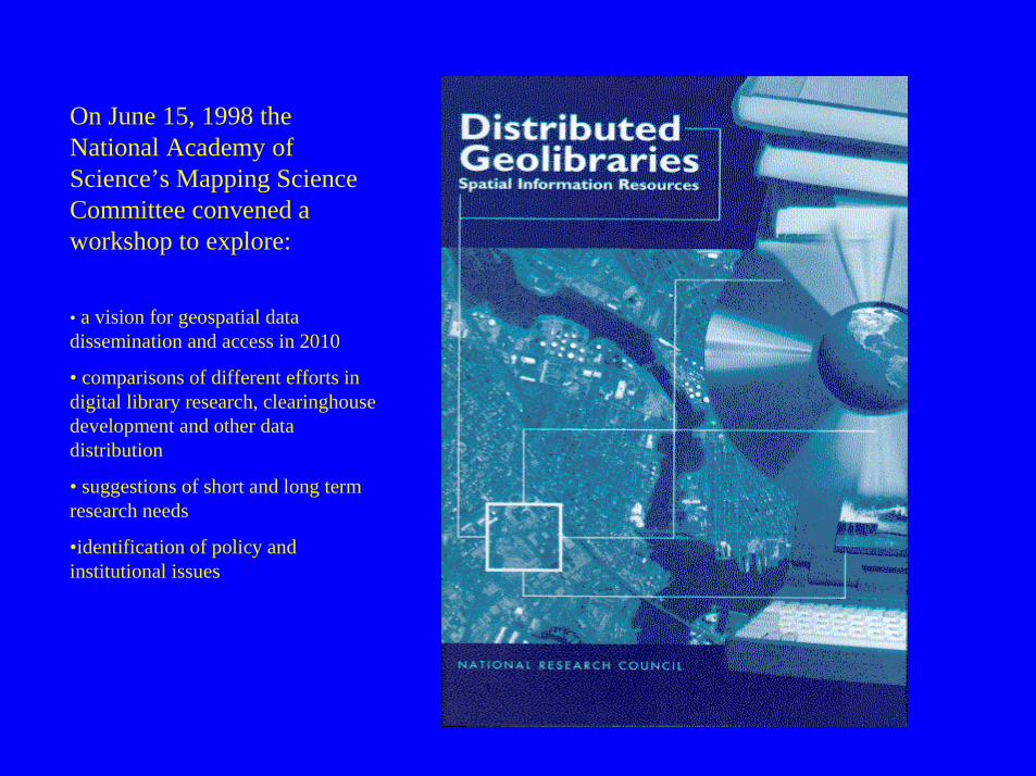
On June 15, 1998 the National Academy of Science’s Mapping Science Committee convened a workshop to explore:
• a vision for geospatial data dissemination and access in 2010
• comparisons of different efforts in digital library research, clearinghouse development and other data distribution
• suggestions of short and long term research needs
•identification of policy and institutional issues
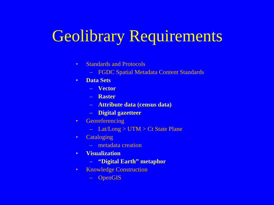
Geolibrary Requirements
• Standards and Protocols– FGDC Spatial Metadata Content Standards
• Data Sets– Vector– Raster– Attribute data (census data)– Digital gazetteer
• Georeferencing– Lat/Long > UTM > Ct State Plane
• Cataloging– metadata creation
• Visualization– “Digital Earth” metaphor
• Knowledge Construction– OpenGIS
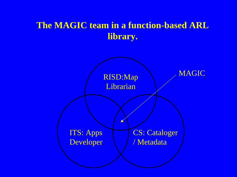
The MAGIC team in a function-based ARL library.
RISD:Map Librarian
ITS: Apps Developer
CS: Cataloger / Metadata
MAGIC
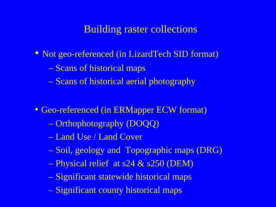
Building raster collections
• Not geo-referenced (in LizardTech SID format)
– Scans of historical maps
– Scans of historical aerial photography
• Geo-referenced (in ERMapper ECW format)
– Orthophotography (DOQQ)
– Land Use / Land Cover
– Soil, geology and Topographic maps (DRG)
– Physical relief at s24 & s250 (DEM)
– Significant statewide historical maps
– Significant county historical maps
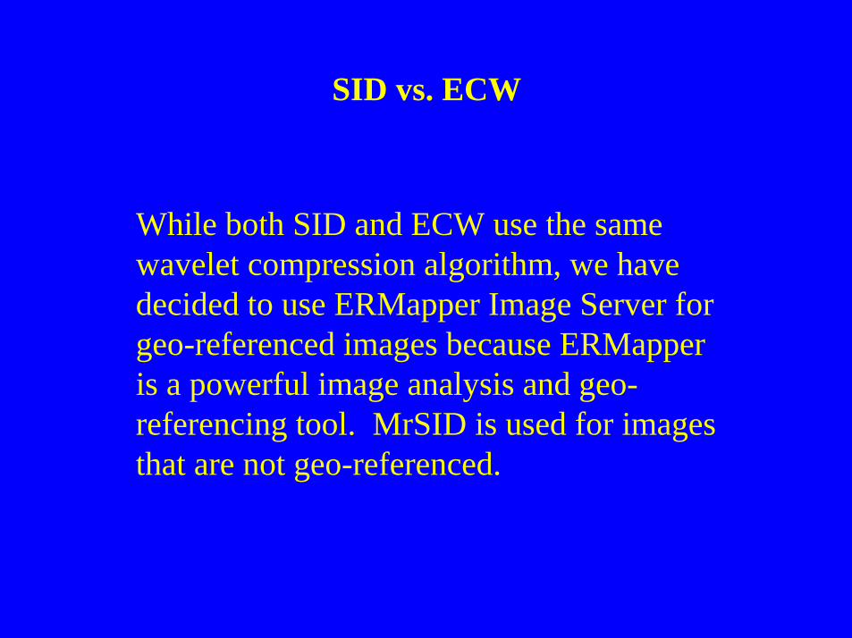
SID vs. ECW
While both SID and ECW use the same wavelet compression algorithm, we have decided to use ERMapper Image Server for geo-referenced images because ERMapper is a powerful image analysis and geo-referencing tool. MrSID is used for images that are not geo-referenced.
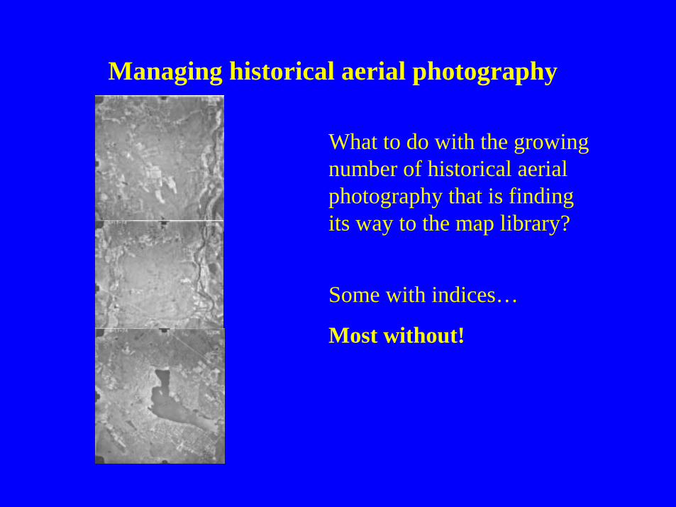
Managing historical aerial photography
What to do with the growing number of historical aerial photography that is finding its way to the map library?
Some with indices…
Most without!
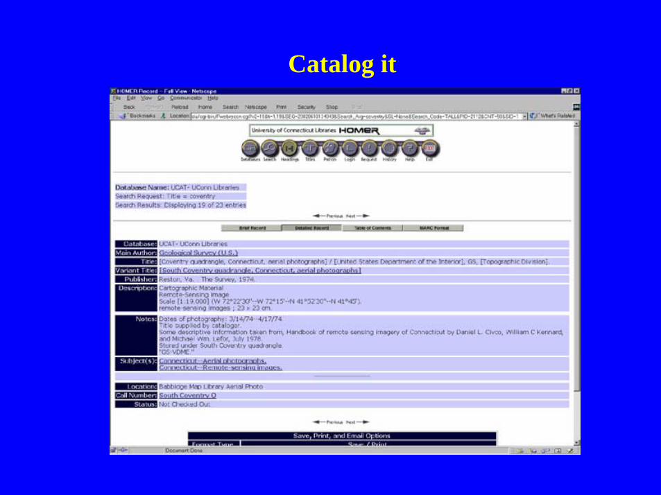
Catalog it
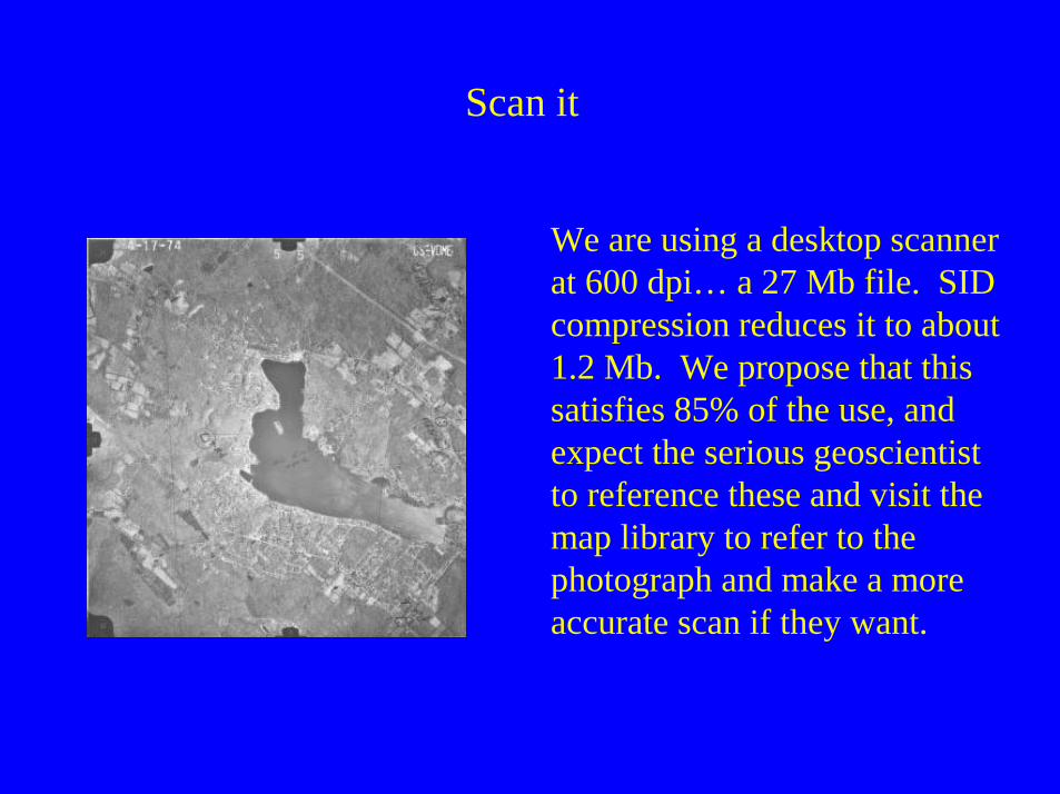
Scan it
We are using a desktop scanner at 600 dpi… a 27 Mb file. SID compression reduces it to about 1.2 Mb. We propose that this satisfies 85% of the use, and expect the serious geoscientist to reference these and visit the map library to refer to the photograph and make a more accurate scan if they want.
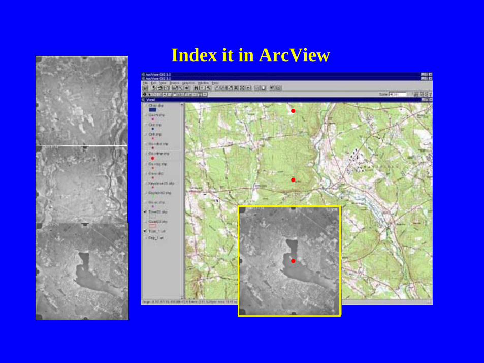
Index it in ArcView
Make it Accessible Using ArcIMS
• What is ArcIMS?
• Creating an ArcIMS site?
• Customizing a site – what’s required?
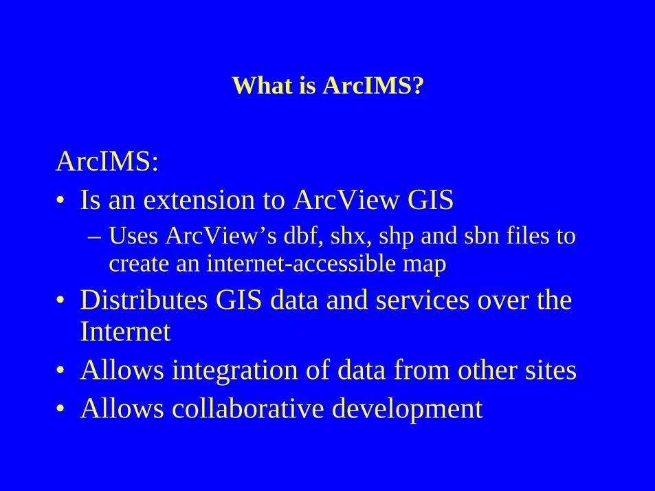
What is ArcIMS?
ArcIMS:• Is an extension to ArcView GIS
– Uses ArcView’s dbf, shx, shp and sbn files to create an internet-accessible map
• Distributes GIS data and services over the Internet
• Allows integration of data from other sites• Allows collaborative development
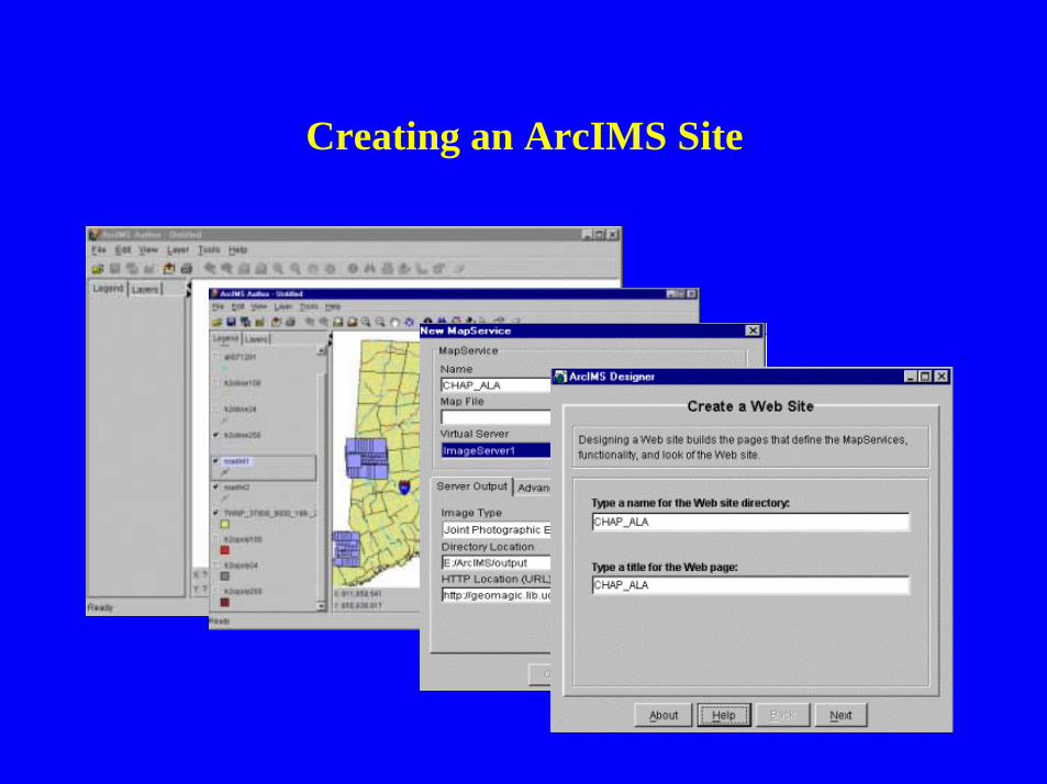
Creating an ArcIMS Site
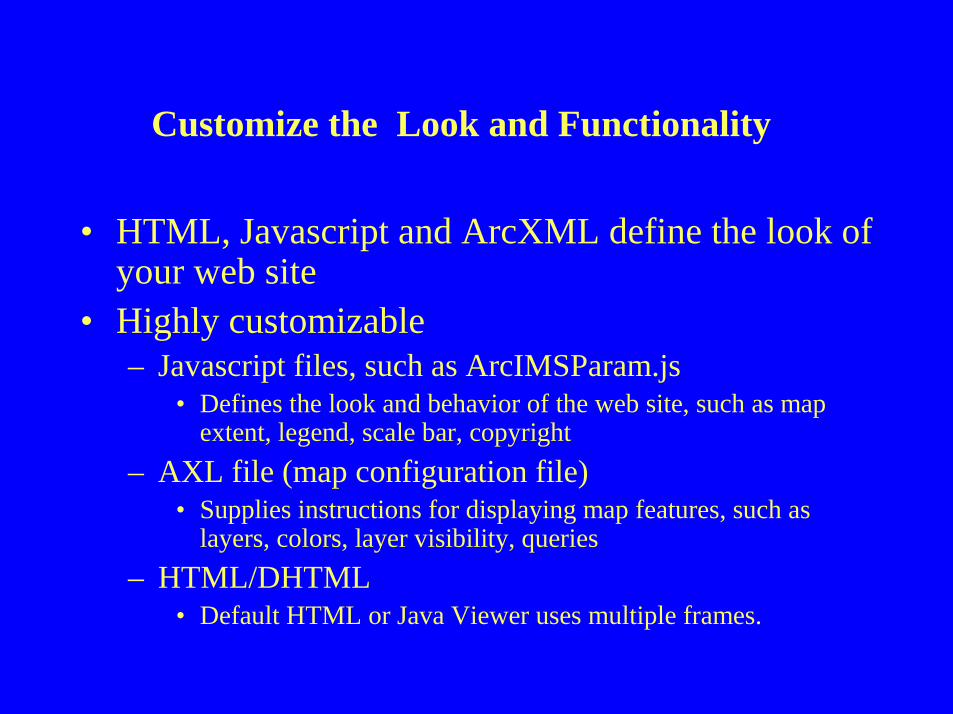
Customize the Look and Functionality
• HTML, Javascript and ArcXML define the look of your web site
• Highly customizable– Javascript files, such as ArcIMSParam.js
• Defines the look and behavior of the web site, such as map extent, legend, scale bar, copyright
– AXL file (map configuration file)• Supplies instructions for displaying map features, such as
layers, colors, layer visibility, queries
– HTML/DHTML• Default HTML or Java Viewer uses multiple frames.
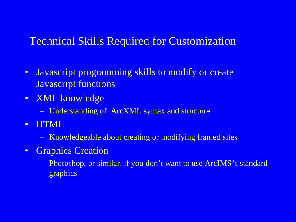
Technical Skills Required for Customization
• Javascript programming skills to modify or create Javascript functions
• XML knowledge– Understanding of ArcXML syntax and structure
• HTML– Knowledgeable about creating or modifying framed sites
• Graphics Creation– Photoshop, or similar, if you don’t want to use ArcIMS’s standard
graphics
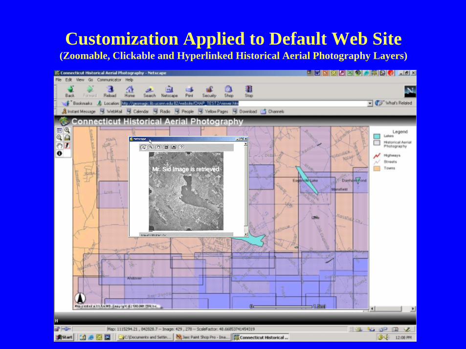
Customization Applied to Default Web Site(Zoomable, Clickable and Hyperlinked Historical Aerial Photography Layers)
Mr. Sid Image is retrievedMr. Sid Image is retrievedMr. Sid Image is retrievedMr. Sid Image is retrieved
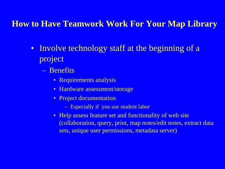
How to Have Teamwork Work For Your Map Library
• Involve technology staff at the beginning of a project– Benefits
• Requirements analysis
• Hardware assessment/storage
• Project documentation– Especially if you use student labor
• Help assess feature set and functionality of web site (collaboration, query, print, map notes/edit notes, extract datasets, unique user permissions, metadata server)
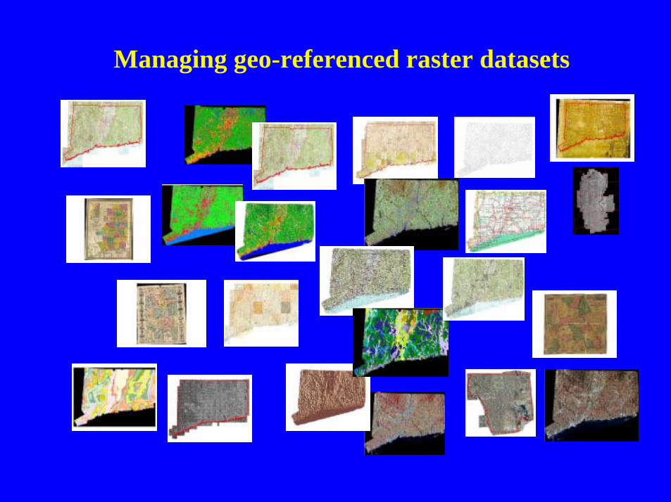
Managing geo-referenced raster datasets
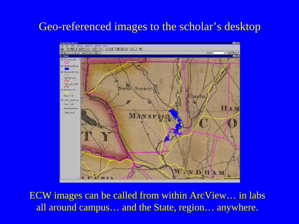
Geo-referenced images to the scholar’s desktop
ECW images can be called from within ArcView… in labs all around campus… and the State, region… anywhere.