Embed Size (px)
Citation preview
3,100,000
3,100,000
3,105,000
3,105,000
3,110,000
3,110,000
3,115,000
3,115,000
3,120,000
3,120,000
10,06
5,000
10,07
0,000
10,07
5,000
10,08
0,000
415
415
405
400
395
420
405
400
410
410
410
410
420
415
400
405
415
420
410
415
400
410
415
400
405
420
415415
400
425
410
420
410
415
415
410405
400
415
410
405
410
415
415
405
410
410
415
420
400
410
400
400
415
405
415
420
415
405
420
425
405
415
410
410
415
410
420
405
425420
420
405
415
TEXA
SWA
TER DEVELOPMENTB OARD
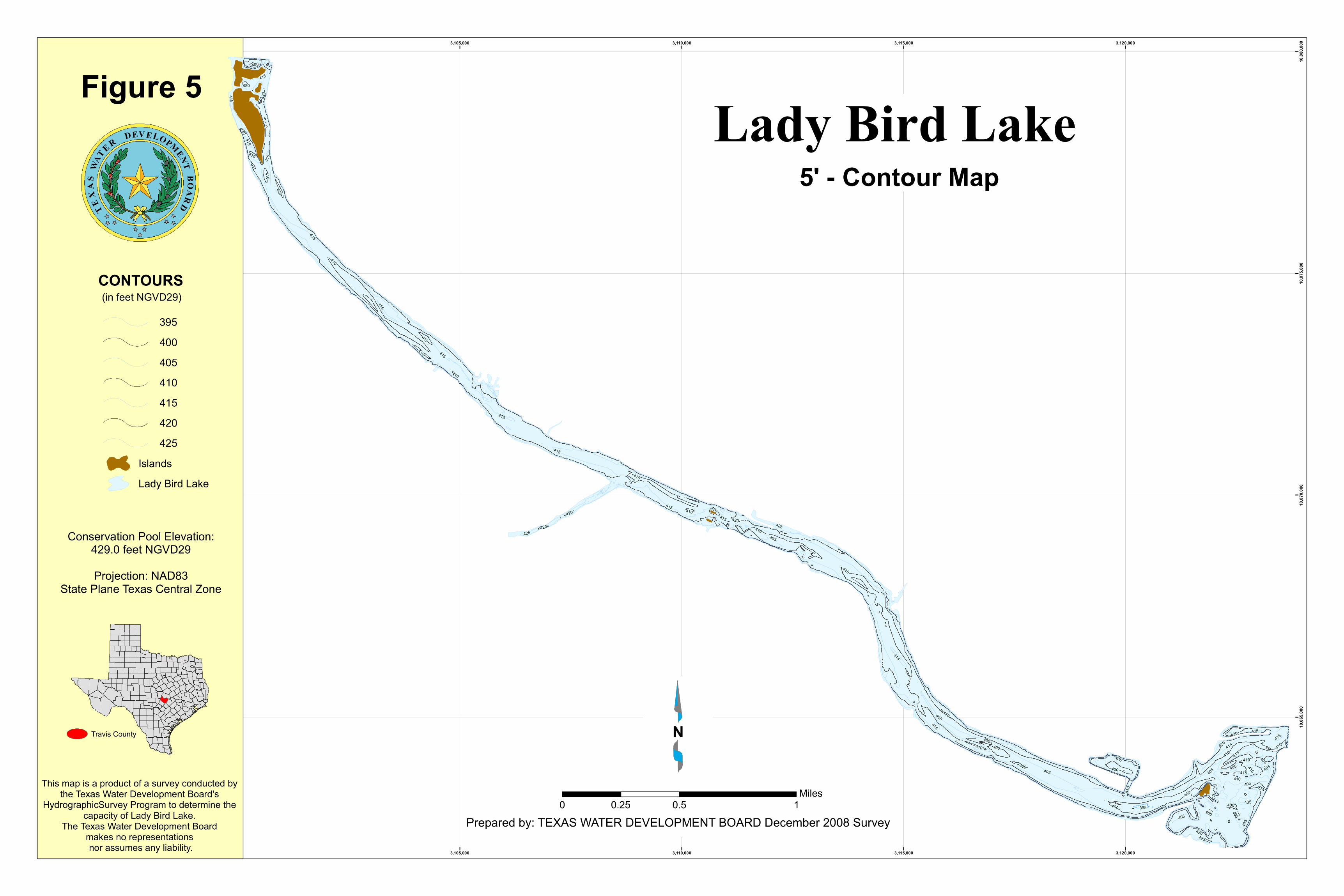
This map is a product of a survey conducted by the Texas Water Development Board's
HydrographicSurvey Program to determine the capacity of Lady Bird Lake.
The Texas Water Development Board makes no representations nor assumes any liability.
Figure 5
N
Prepared by: TEXAS WATER DEVELOPMENT BOARD December 2008 Survey0 0.5 10.25
Miles
Travis County
Lady Bird Lake5' - Contour Map
CONTOURS
Islands
(in feet NGVD29)
395400405410415420425
Lady Bird Lake
Conservation Pool Elevation:429.0 feet NGVD29Projection: NAD83
State Plane Texas Central Zone