Embed Size (px)
Citation preview

2009 Baltic Sea Scorecard
WWF Baltic Ecoregion Programme 2009
2009 Baltic Sea Scorecard
WWF Baltic Ecoregion Programme 2009

Some could say that the Baltic Sea is experiencing a renaissance. Recently there has been some long awaited good news to report – fish stocks are showing signs of recovery and nutrient pollution entering the sea is slowly decreasing for the first time in decades.
This, coupled with the fact that the Baltic Sea is now the subject of the EU’s very first internal strategy for a specific geographic macro-region – the EU Strategy for the Baltic Sea Region – means that the Baltic Sea could well become a model for regional problem-solving and identity-building for the entire European Union.
So the attention of the region, and indeed of the EU, is now on the Baltic Sea – and for good reason. This region has grown faster than the EU average – demands for resources and nature values in and around the Baltic Sea are increasing as is the desire to protect and conserve the quality of life of the region and the natural resource base upon which this growth and development depends. How to do this effectively, however, is fast becom-ing the paramount question.
For, despite the good news, the Baltic Sea remains one of the most threatened marine ecosystems on the planet. Increas-ing competition for use of the sea – including from fishing, shipping, industry, resource ex-traction, wind and wave power generation, energy transmission, recreation as well as the ever present need to protect and secure biodiversity and wildlife – makes it even more urgent for us to move beyond the cur-
rent fragmented patchwork of governance approaches and regulatory frameworks that still predominate in our approach to the management of the Baltic Sea on the local, national and international level. As the sea becomes increasingly busy, con-flicts within human uses, among uses, and between human uses and nature increase inevitably.
We could manage differently – through an integrated management approach for the entire Baltic Sea. On land we never question the need to use spatial planning to decide how to best use the land and its resources and how to resolve conflicts between com-peting interests. Well in advance, decisions are made on what part of the land will be used for housing, agriculture, industry, transport or recreation and what parts should be set aside for nature conservation.
There is no reason why we shouldn’t use the same approach for managing the sea. And, in doing so, we could better safeguard ecological processes, ecosystem services and overall resilience to ensure that the Baltic Sea has the capacity to support the social and economic benefits on which we depend, in-cluding those goods and services that can be derived directly from marine ecosystems.
This can be achieved through the application of a more holistic and integrated approach to planning and managing the unique and valuable resources of the Baltic Sea. An approach that can identify, safeguard, and where necessary and appropriate, recover or restore important components of marine ecosystems and allocate space to different kinds of human uses in a rational manner that minimizes conflict of interest and maximizes synergy among sectors. This new approach is called Integrated Sea Use Management – a process that aims to manage the resources of the Baltic Sea in a comprehensive way, based on the limits of the ecosystem, and integrates all countries, sectors and admin-istrative levels.
The need is great and the time is ripe to launch this new approach. The Baltic Sea provides a great opportunity to showcase a truly integrated sea use management ap-proach to conservation and sustainable de-velopment – an idea whose time has come. Many of the necessary pieces are in place to make this change. What is needed now is honest commitment, strong leadership, and bold action.
The Baltic Sea – a sea to be proud of!
2009 Baltic Sea Scorecard – WWF Baltic Ecoregion Programme | 3

2009 Baltic Sea Scorecard – WWF Baltic Ecoregion Programme | 54 | WWF Baltic Ecoregion Programme – 2009 Baltic Sea Scorecard 2009 Baltic Sea Scorecard – WWF Baltic Ecoregion Programme | 54 | WWF Baltic Ecoregion Programme – 2009 Baltic Sea Scorecard
The 2007 Scorecard focused on the efforts of countries to ratify and im-plement existing international agree-ments and conventions to protect and restore the Baltic Sea. The indicators provided a snapshot that let readers see the performance of each of the nine countries and whether existing politi-cal commitments were being met un-der five separate areas: biodiversity, fisheries, hazardous substances, mar-itime transports and eutrophication. It showed which countries took the problems surrounding the Baltic Sea seriously and made the best efforts to fulfil their promises. Less than half the Baltic Sea States (4) passed the mini-mum level in the test, only scoring a “C” grade overall. One of the key con-clusions from the 2007 report was that the low level of implementation was largely due to poor political leadership and poor integration between sectors, both nationally and internationally, and that concrete actions were ham-pered by uncoordinated and contra-dicting interests.
The 2008 Scorecard focused on as-sessing whether concrete actions, nec-essary to achieve good environmental status for the Baltic Sea, had been ac-complished. The countries were again graded on how well they were doing in the five separate areas used in 2007, however an additional area was add-ed based on the key conclusions from 2007, namely how well the countries had developed an integrated approach to sea use management. Unfortunate-ly, the results were again extremely disappointing, demonstrating that all countries were failing to deliver neces-sary actions to protect and restore the Baltic Sea. One of the key conclusions of the 2008 report was that there was a growing discrepancy between the statements and commitments made by governments about the urgent need
for bold leadership to ‘Save the Sea’ and their lack of corresponding ac-tions to actually deliver the needed re-sults. Importantly, the 2008 Scorecard demonstrated, yet again, how critical an accelerated pace of integrated and concerted actions was needed to turn the tide in the Baltic Sea and how, without stronger political leadership and commitment, these efforts were doomed to fail.
The 2009 Baltic Sea ScorecardBased on these findings, and as a step further compared to the last two years, the 2009 Scorecard takes a more ho-listic perspective – focusing on an evaluation of the overall approach of countries to planning and managing the Baltic Sea. The question that this year’s scorecard seeks to answer is “do the ‘enabling conditions’ for a more integrated approach to planning and management in the Baltic Sea exist?” The reason for this focus is that after analyzing the poor results of the last two years, it is clear that, without an
Is there enough political will to ‘Save the Baltic Sea’?
integrated approach to sea use man-agement, countries are simply poorly equipped to adequately address the complex challenges facing the Baltic Sea. For this reason, this year’s score-card is not divided up into separate areas as in past years but instead has a more singular focus, which is ‘what is the current status of, and progress towards, Integrated Sea Use Manage-ment in the region?’
As in past years the results of the 2009 analysis is illustrated in grade levels. The grades are expressed from the top grade of A to the weakest of F. WWF hopes that this year’s score-card will help shed light on how coun-tries around the region currently plan and manage the Baltic Sea’s resources as well as highlight some good exam-ples of steps being taken in the right direction. In doing so, it will hopefully encourage governments, communities and individuals to take bolder steps to ensure that a more holistic, integrated and ecosystem-based approach is taken in the future.
This is the third year that WWF’s Baltic Ecoregion Programme1 has published a ‘Scorecard Report’ – to assess and measure a range of indicators about how the nine countries bordering the Baltic Sea are performing with respect to their efforts to protect and manage their joint sea.
The question that this year’s scorecard seeks to answer is “do the ‘enabling conditions’ for a more integrated approach to planning and management in the Baltic Sea exist?”

2009 Baltic Sea Scorecard – WWF Baltic Ecoregion Programme | 76 | WWF Baltic Ecoregion Programme – 2009 Baltic Sea Scorecard 2009 Baltic Sea Scorecard – WWF Baltic Ecoregion Programme | 76 | WWF Baltic Ecoregion Programme – 2009 Baltic Sea Scorecard
What is Integrated Sea Use Management?
ous, iterative and adaptive process. Key elements of Integrated Sea Use Management include government and public support, planning and analysis, monitoring and evaluation, geospatial mapping, stakeholder in-volvement, etc. A full list of key ele-ments of Integrated Sea Use Manage-ment is listed on page 8–9.
Integrated Sea Use Management in the Baltic Sea Despite the fact that the Baltic Sea is one of the busiest maritime areas in the world no Baltic Sea nation has ful-ly applied an integrated sea use man-agement approach. The coverage and intensity of initiatives towards a more integrated sea use management var-ies widely among the nine Baltic Sea countries. From an ecosystem per-spective, such a relatively small sea like the Baltic cannot be treated as simply a collection of national marine areas. It constitutes, in almost all re-spects, one single marine ecosystem and should be managed as a whole.
There are, however, some current and evolving approaches in the Baltic Sea region such as “Maritime Spatial Planning” which are moving manage-ment activities in the right direction. But these evolving approaches still have their limits. For example, very few countries have relevant legisla-tion and management organisations in place to efficiently carry out spa-tial planning in their entire sea area, including in their Exclusive Econom-ic Zone. Also, very few of the current integrated management or maritime spatial planning initiatives in the Bal-tic Sea include fish and/or fishing man-agement measures. In an integrated approach, fish should be considered components of the ecosystem and not only as a resource to be managed on a single-sector basis.
Works toward sustainable deve lop ment, rather than simply conservation or environmental protection, and in doing so contributes to more general social and governmental objectives;
Provides a strategic, inte grated and forward-looking framework of all uses of the sea to help achieve sustainable development, taking into account environmental, as well as social and economic goals and objectives;
Applies an ecosystem approach to the regulation and management of development and human activities in the marine environment by
safeguarding ecological processes and overall resilience to ensure the environment has the capacity to support social and economic benefits (including those benefits derived directly from ecosystems);
Identifies, safeguards, or where necessary and appropriate, recovers or restores important components of marine eco systems including natural heritage and nature conservation resources; and
Allocates space in a rational manner that minimizes conflict of interest and, where possible, maximizes synergy among sectors.
The underlying principle for Inte-grated Sea Use Management is that it applies an ecosystem approach to planning, management and regula-tion of all human activities in a sea area to ensure long term sustainable development where the marine envi-ronment has the capacity to support social and economic benefits now and in the future.
To achieve this, Integrated Sea Use Management works towards vertical integration among different regulat-
ing frameworks and governance lev-els and horizontal integration among countries and sectors as well as among ministries and agencies with different mandates.
One important component of Inte-grated Sea Use Management is Spatial Planning, aiming at allocating space (and resources) in a rational manner that minimizes conflict of interest and maximizes synergy among sectors.
Integrated Sea Use Management needs to be conducted as a continu-
The Role of Maritime Spatial Planning in Advancing Integrated Sea Use Management
Maritime Spatial Planning (MSP) (some-times called Marine Spatial Planning) is an important part of Integrated Sea Use Management. Maritime spatial planning is one of the pillars of the EU’s Maritime Policy and is already being anticipated or applied in many European states, in-cluding those in the Baltic Sea. Maritime spatial planning deals with the analysis and allocation of human uses or non-uses (e.g., marine protected areas) in time and space within specified marine areas or ecosystems3.
It uses spatial and temporal manage-ment measures to achieve ecological, economic, or social goals and objectives. Other management measures are also needed to manage human uses of the sea through a more comprehensive and integrated approach.
In November 2008, the European Com-mission published its “Roadmap for Mari-time Spatial Planning: achieving common principles in the EU”4. The Roadmap views the ecosystem approach as the overarch-ing principle for maritime spatial planning and identifies ten additional principles for its implementation including:
1. Using MSP according to area and type of activity
2. Defining objectives to guide MSP
3. Developing MSP in a transparent manner
4. Stakeholder participation
5. Coordination within Member States – simplifying decision processes
6. Ensuring the legal effect of national MSP
Instead of the “patchwork approach” we have today, Integrated Sea Use Management is an approach that provides a strategic, integrated and forward-looking framework to help achieve both sustainable development and nature conservation.
7. Cross-border cooperation and consultation
8. Incorporating monitoring and evaluation in the planning process
9. Achieving coherence between terrestrial and maritime spatial planning – relation with Integrated Coastal Zone Management (ICZM)
10. A strong data and knowledge base
While new maritime spatial planning ini-tiatives in Baltic Sea nations may not be truly Integrated Sea Use Management for different reasons, the “perfect should not be the enemy of the good”. Many of these initiatives are moving governments in the Baltic Sea region toward ecosystem-based, Integrated Use Management and should be encouraged.
Integrated Sea Use Management22
2009 Baltic Sea Scorecard – WWF Baltic Ecoregion Programme | 98 | WWF Baltic Ecoregion Programme – 2009 Baltic Sea Scorecard 2009 Baltic Sea Scorecard – WWF Baltic Ecoregion Programme | 98 | WWF Baltic Ecoregion Programme – 2009 Baltic Sea Scorecard
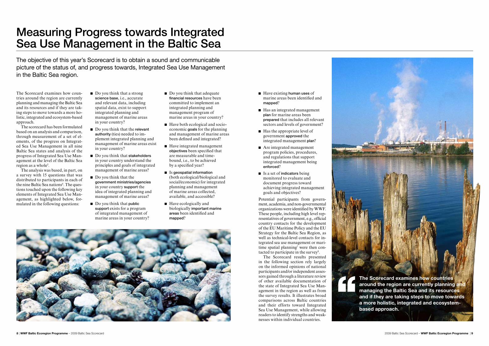
The Scorecard examines how coun-tries around the region are currently planning and managing the Baltic Sea and its resources and if they are tak-ing steps to move towards a more ho-listic, integrated and ecosystem-based approach.
The scorecard has been formulated based on an analysis and comparison, through measurement of a set of el-ements, of the progress on Integrat-ed Sea Use Management in all nine Baltic Sea states and analysis of the progress of Integrated Sea Use Man-agement at the level of the Baltic Sea region as a whole5.
The analysis was based, in part, on a survey with 15 questions that was distributed to participants in each of the nine Baltic Sea nations6. The ques-tions touched upon the following key elements of Integrated Sea Use Man-agement, as highlighted below, for-mulated in the following questions:
Do you think that a strong science base, i.e., accurate and relevant data, including spatial data, exist to support integrated planning and management of marine areas in your country?
Do you think that the relevant authority (ties) needed to im-plement integrated planning and management of marine areas exist in your country?
Do you think that stakeholders in your country understand the principles and goals of integrated management of marine areas?
Do you think that the government ministries/agencies in your country support the idea of integrated planning and management of marine areas?
Do you think that public support exists for a program of integrated management of marine areas in your country?
Do you think that adequate financial resources have been committed to implement an integrated planning and management program of marine areas in your country?
Have both ecological and socio-economic goals for the planning and management of marine areas been defined and integrated?
Have integrated management objectives been specified that are measurable and time- bound, i.e., to be achieved by a specified year?
Is geospatial information (both ecological/biological and social/economic) for integrated planning and management of marine areas collected, available, and accessible?
Have ecologically and biologically important marine areas been identified and mapped?
Measuring Progress towards Integrated Sea Use Management in the Baltic Sea
Have existing human uses of marine areas been identified and mapped?
Has an integrated management plan for marine areas been prepared that includes all relevant sectors and levels of government?
Has the appropriate level of government approved the integrated management plan?
Are integrated management program policies, procedures, and regulations that support integrated management being enforced?
Is a set of indicators being monitored to evaluate and document progress toward achieving integrated management goals and objectives?
Potential participants from govern-ment, academia, and non-governmental organizations were identified by WWF. These people, including high level rep-resentatives of government, e.g., official country contacts for the development of the EU Maritime Policy and the EU Strategy for the Baltic Sea Region, as well as technical-level contacts for in-tegrated sea use management or mari-time spatial planning7 were then con-tacted to participate in the survey8.
The Scorecard results presented in the following section rely largely on the informed opinions of national participants and/or independent asses-sors gained through a literature review of other available documentation of the state of Integrated Sea Use Man-agement in the region as well as from the survey results. It illustrates broad comparisons across Baltic countries and their efforts toward Integrated Sea Use Management, while allowing readers to identify strengths and weak-nesses within individual countries.
The objective of this year’s Scorecard is to obtain a sound and communicable picture of the status of, and progress towards, Integrated Sea Use Management in the Baltic Sea region.
The Scorecard examines how countries around the region are currently planning and managing the Baltic Sea and its resources and if they are taking steps to move towards a more holistic, integrated and ecosystem-based approach.

2009 Baltic Sea Scorecard – WWF Baltic Ecoregion Programme | 1110 | WWF Baltic Ecoregion Programme – 2009 Baltic Sea Scorecard 2009 Baltic Sea Scorecard – WWF Baltic Ecoregion Programme | 1110 | WWF Baltic Ecoregion Programme – 2009 Baltic Sea Scorecard
Decision-makers around the Baltic Sea know a great deal about the chal-lenges facing the sea. They also know what needs to be done to address these challenges and may even have decided to do something about them. But do they have the tools to ‘save the Baltic Sea’? How well are efforts to save the sea integrated and how much is still being done in a fragmented and sector-by-sector way? This year’s scorecard illustrates that the struggle to build the toolbox is, unfortunately, progressing very slowly.
This analysis attempts to scruti-nize the efforts of countries to de-velop a more integrated approach to tackling the problems of the Bal-tic Sea and examines how well each country has adopted measures related to fifteen elements of Integrated Sea Use Management. The highest score possible is 45 (15 elements, each with a maximum score of 3 on each). The scores are translated into grades as per the chart below.
The ScoresThe Baltic Sea countries still have a long way to go to achieve a truly integrated management of their use of the sea. No country received the top grade, an A, and only Germany received a B.
The total unadjusted scores per country were graded according to the table above. Scores were rounded up. *These countries later had their grades adjusted based on a literature review of other available documentation on the state of Integrated Sea Use Management in each country which resulted in the final grades shown in the ‘Final adjusted grades for each country’ table listed above.
Several countries had their grades ad-justed based on a literature review of other available documentation on the state of Integrated Sea Use Manage-ment in each country. For example, Poland’s grade was raised from D to C because of its efforts to learn about Maritime Spatial Planning through a pilot project in the Gulf of Gdansk and the potential for its new National
No country received a grade of A, in-dicating that the Baltic Sea region as a whole, and all its countries, have a lot of work to do to achieve a truly Integrated Sea Use Management.
Germany received the highest score of B mainly because of its experience in already developing maritime spatial plans for the waters of its territorial sea
and exclusive economic zone, includ-ing those in the Baltic Sea. Germany is followed by a group of four coun-tries that received a grade of C, either because of existing initiatives to de-velop maritime spatial plans (Poland and Denmark) or the promise and poli tical commitment to develop, through new legislation or regulation,
Spatial Development Concept to in-clude marine areas for the first time.
The grades of Lithuania and Rus-sia were reduced from C to D because of a lack of evidence that either In-tegrated Sea Use Management or Maritime Spatial Planning has been initiated in legislation, regulation, or practice.
The final grades for each coun-try are shown in the following table (within each grade, countries are list-ed alphabetically):
Integrated Sea Use Management or Maritime Spatial Planning (Sweden and Finland). A third group of four countries received a grade of D (Es-tonia, Latvia, Lithuania, and Russia) because of the lack of evidence of any real results toward Integrated Sea Use Management.
No country received a grade of A, indicating that the Baltic Sea region as a whole, and all its countries, have a lot of work to do to achieve a truly Integrated Sea Use Management.
A 37–45 C 19–27B 28–36 D 11–18 F <11
GERMANy B
DENMARk C
FINlAND C
PolAND C
SWEDEN C
ESToNIA D
lATvIA D
lIThUANIA D
RUSSIA D
Final adjusted grades for each country
Germany 2.0 2.3 1.5 2.8 2.3 1.8 3.0 1.5 2.0 2.8 2.0 1.8 1.0 1.8 0.3 28.5*
Denmark 1.5 1.5 1.5 2.5 2.5 2.0 1.0 1.5 2.0 2.5 1.0 1.0 0.0 1.5 1.0 23.0*
Sweden 2.0 1.0 2.0 3.0 3.0 1.0 1.5 1.0 1.0 2.0 3.0 1.0 0.0 0.0 0.0 21.5*
Finland 1.0 2.0 1.0 3.0 1.0 1.0 1.0 1.0 2.0 1.0 1.0 1.0 2.0 2.0 2.0 21.0*
lithuania* 2.0 1.5 1.0 2.0 1.5 1.5 1.5 1.0 1.0 2.5 1.0 1.0 0.5 1.0 1.5 20.5*
Russia* 2.5 0.5 2.0 1.5 1.5 0.5 2.0 2.0 1.5 2.0 1.5 0.0 0.0 1.0 1.5 20.0*
latvia 1.5 1.5 2.0 2.0 1.5 0.5 0.5 1.0 1.0 1.5 1.0 1.0 1.0 1.5 0.5 18.0*
Poland* 1.9 1.9 1.1 2.3 1.5 1.2 0.8 0.3 1.4 1.4 1.1 1.0 0.0 0.4 0.4 16.5*
Estonia 1.0 1.0 1.0 2.0 2.0 0.3 0.3 0.3 1.0 1.7 1.0 0.3 0.0 0.3 0.0 12.3*
MEAN 1.7 1.5 1.5 2.3 1.9 1.1 1.3 1.1 1.3 2.0 1.4 0.9 0.4 1.1 0.8 20.1*
SCIENCE B
ASE AvAIl
ABlE
PUBlIC S
UPPoRT
GEoSPATIAl D
ATA A
vAIlABlE
STAkEholDER S
UPPoRT
GoAlS IDENTIF
IED
hUMAN U
SES MAPPED
PlAN ENFoRCED
AUThoRITy E
STABlIS
hED
FINANCIN
G AvAIl
ABlE
BIoloGIC
Al AREAS M
APPED
PlAN APPRovAl
GovERNMENT S
UPPoRT
oBjECTIv
ES SPECIF
IED
PlAN PREPARED
INDIC
AToRS DEvEloPED
ToTAl
U
NADjUSTED
SCoRE

2009 Baltic Sea Scorecard – WWF Baltic Ecoregion Programme | 1312 | WWF Baltic Ecoregion Programme – 2009 Baltic Sea Scorecard 2009 Baltic Sea Scorecard – WWF Baltic Ecoregion Programme | 1312 | WWF Baltic Ecoregion Programme – 2009 Baltic Sea Scorecard
What this table shows is that sur-vey participants felt that government support for Integrated Sea Use Man-agement was relatively strong (most participants worked within national governments) and that public support for Integrated Sea Use Management was also relatively strong. Some cau-tion should be used in interpreting these results, since governments of-ten overestimate public support for their programs. Germany, Sweden, and Russia all thought that govern-ment support for Integrated Sea Use Management was high.
The mapping of important biologi-cal and ecological areas also received a high score, probably because of
the EU requirement to identify and protect important habitats under the Birds and Habitats Directives (Natura 2000) by 2012 for marine areas. While the designation of Natura 2000 sites in coastal and inshore waters is fairly advanced, important gaps in the net-work still exist in the offshore marine environment9. Germany, Denmark, and Lithuania scored themselves high in this element of the survey.
The science base, appropriate au-thority established and stakeholder support for Integrated Sea Use Man-agement also scored relatively high. The authority score, in particular, should be viewed cautiously since the legislative authority appropriate to carry out Integrated Sea Use Man-agement does not currently exist in any Baltic Sea country. Germany has, however, used its Federal Spatial Plan-ning Act to work toward an Integrat-ed Sea Use Management capability in both its EEZ and territorial sea. While Integrated Sea Use Management can be carried out without explicit and in-tegrated legislative authority, it will be most effective and enforceable when some authority exists.
The mapping of human activities, which is needed to identify conflicts among activities, as well as between human activities and nature conser-vation, also received a high score. Germany and Sweden scored them-selves highly. The availability of ge-ospatial data and the identification of Integrated Sea Use Management goals fell in the middle showing that there is need for improvements. While Germany, Denmark, and Finland scored highly with respect to this ele-ment, the lack of available geospatial data was cited several times by par-ticipants, as well as in the literature, as a serious constraint in beginning Integrated Sea Use Management in
the Baltic Sea region. Germany scored especially high with respect to the set-ting of goals.
The identification of measurable objectives for planning and manage-ment are low in the list. This is an im-portant gap since the lack of specific objectives is one of the major reasons that management plans fail. No coun-try gave itself a high score for speci-fying measurable objectives. Not sur-prisingly, the availability of financing is also low – lack of funding was cited by almost all countries except Germany and Denmark as a reason that Inte-grated Sea Use Management has not been undertaken. The development of indicators with which to evaluate the performance of Integrated Sea Use Management appeared low in the list and indicates a real need if plans are to be monitored and evaluated. Only Finland thought it had developed ad-equate indicators. Quite logically, the approval of plans was at the bottom of the scores since no integrated maritime plans have been approved and imple-mented in the Baltic Sea region.
Performance by Elements of Integrated Sea Use Management An analysis of the mean scores for the individual elements of Integrated Sea Use Management can reveal what respondents to the survey thought were the strengths and weaknesses of existing Integrated Sea Use Management activities across the Baltic Sea.
Government support 2.3
Biological areas mapped 2.0
Public support 1.9
Science base available 1.7
Authority established 1.5
Stakeholder support 1.5
human uses mapped 1.4
Geospatial data available 1.3
Goals identified 1.3
objectives specified 1.1
Plan enforced 1.1
Financing available 1.1
Plan prepared 0.9
Indicators developed 0.8
Plan approved 0.4
Mean scores (highest to lowest) for individual elements were:
Based on the above it can be concluded that the development of appropriate and enforceable authorities for Inte-grated Sea Use Management, appro-priate financing, available geospatial data, the clear specification of goals and objectives, especially the latter, and the development of indicators with which to measure Integrated Sea Use Management performance are clearly priorities to advance maritime manage ment in the Baltic Sea.
The development of appropriate and enforceable authorities, financing, spatial data, clear goals and objectives are clearly priorities to advance integrated management in the Baltic Sea.

2009 Baltic Sea Scorecard – WWF Baltic Ecoregion Programme | 1514 | WWF Baltic Ecoregion Programme – 2009 Baltic Sea Scorecard 2009 Baltic Sea Scorecard – WWF Baltic Ecoregion Programme | 1514 | WWF Baltic Ecoregion Programme – 2009 Baltic Sea Scorecard
GRADE B
Germany got the highest grade and was the only country to receive a B, based primarily on its experience and accom-plishments in actually drafting mari-time spatial plans for its territorial sea and exclusive economic zone (EEZ) in its Baltic Sea and North Sea marine areas. This was accomplished through its existing strong legal authorities for Maritime Spatial Planning under its Federal Spatial Planning Act11 and a relatively strong science base.
Sea use planning for territorial waters is part of the regional plan-ning of German coastal states (Bun-desländer); management of the EEZ is the responsibility of the national gov-ernment. The drafts of the first EEZ spatial plans for the North and Baltic seas were available for public consul-tation in May 2009. German maritime spatial plans have legal authority and define rules and principles for subse-quent planning. They designate areas suitable for shipping routes, cables and pipelines, energy and scientific use. Within the suitable areas determined by the maritime spatial plan, installa-tions require additional approval pro-cedures, e.g. permits.
Final maritime spatial plans have not yet been approved and imple-mented for the EEZ. Germany has, however, mapped and designated biologically important areas and areas important for human use in this area. General goals have been identi-fied, but measurable objectives have not been specified.
One agency, the Federal Ministry of Transport, Building and Urban Affairs, and specifically its execu-tive arm, the Federal Maritime and Hydrographic Agency, has been re-sponsible for drafting the plans in consultation with other relevant ministries, including the Federal Agency for Nature Conservation.
However, its existing maritime spatial plans do not integrate fishing and nature conservation in their pro-posed management measures, nor are all conflicts between human uses and nature conservation resolved in the draft maritime spatial plans. Negoti-ations between the Federal Maritime and Hydrographic Agency and the Federal Agency for Nature Conser-vation continue. ‘In one Bundesland (Mecklenburg-Western Pomerania) the first spatial plan for its territorial seas has been in force since 2005; its first
revision is currently under prepara-tion including consultation with the neighbouring countries.
Germany has also just issued “Guidelines for a ‘Maritime Develop-ment Plan’ within the context of an integrated German maritime policy”. This document will be an instrument to focus Germany’s maritime policy interests and to ensure that the key components, measures and structures of this policy are guided by common-ly defined objectives.
GRADE C
Four countries (Denmark, Finland, Po-land and Sweden – listed alphabetical-ly) received a final grade of C, based principally on their early initiatives to begin Integrated Sea Use Manage-ment or Maritime Spatial Planning within their marine waters.
In Denmark, for example, Integrated Sea Use Management is neither prac-ticed nor required by law. All Dan-ish marine waters, including the ter-ritorial sea, are under the jurisdiction of the national government. Human uses of the sea are mainly regulated by a number of sectoral laws, includ-ing the Marine Environment Protec-tion Act, The Raw Materials Act, the Continental Shelf Act, and the Fish-ery Acts. The Danish Planning Act only regulates the terrestrial part of Danish territory12. The Danish Agen-cy for Spatial and Environmental Planning (as part of the Ministry of the Environment) has the overall re-sponsibility for the Planning Act. The current maritime management sys-tem in Denmark has no overarching policy, strategy, or integrated system. The Danish Ministry of Transport is responsible for the sovereignty of all Danish marine areas, but for certain sectors the responsibility for the sov-ereignty is delegated to other authori-ties, e.g., production and transport of energy is delegated to the Ministry of Climate and Energy. Planning of Natura 2000 sites is conducted by the Ministry of the Environment under the Environmental Objective Act.
Denmark has one spatial plan for its EEZ that is specific to a single sector – offshore wind energy – since it has some of the largest concentrations of offshore wind turbines in the world. Effects of the plan on other sectors and on the environment, including biodi-versity conservation, were considered in its formulation. It has also identified and designated biologically important areas and is developing management plans for these marine areas. Human uses, except for offshore energy, are not well known or mapped.
Although sea use management in Denmark is carried out on a single-sector basis, it is considered to work well by many government officials. No steps have yet been taken to change or reorganize it.
Sweden also earned a C grade. Like Denmark, Sweden does not have an integrated maritime plan for its entire sea area, but does have a tradition of planning with wide public and govern-ment support.
Municipal governments are cur-rently responsible for planning in ter-
restrial areas, coastal waters and the territorial sea and planning in these areas is covered by the Environmental Code and the Planning and Building Act. However, municipal-level plan-ning of Sweden’s sea areas is currently incomplete and fragmented. Accord-ing to Swedish planning history, which includes a long tradition of decentral-ized municipal planning, the nation-al government has limited influence over planning, for both land and sea areas and there are no nationally- determined objectives for spatial plan-ning in the EEZ or territorial waters.
Sweden currently has no system for Integrated Sea Use Management or Maritime Spatial Planning in its EEZ, even though the national government is ultimately responsible for this area. The national government has not des-ignated any specific ministry or au-
thority responsible for matters relat-ing to planning or management of the EEZ. Many authorities have, however, responsibility within the territorial sea and EEZ, but coordinated manage-ment and planning is weak. The need to develop a new system that would en-sure that maritime policy is integrated, cross-sectoral, and based on a holistic approach to how resources are used and maintained has been recognized.
A marine inquiry was carried out in 2008 and a new marine bill presented by the government in 2009. Sweden is currently working on increasing plan-ning in the Swedish marine areas and it is suggested that one national author-ity should retain the responsibility for management and planning in the EEZ, but the matter is still being investigat-ed. A new ambassador to the sea has also been appointed.
Performance by country10
Denmark has one spatial plan for its EEZ that is specific to a single sector – offshore wind energy – since it has some of the largest concentrations of offshore wind turbines in the world.

2009 Baltic Sea Scorecard – WWF Baltic Ecoregion Programme | 1716 | WWF Baltic Ecoregion Programme – 2009 Baltic Sea Scorecard 2009 Baltic Sea Scorecard – WWF Baltic Ecoregion Programme | 1716 | WWF Baltic Ecoregion Programme – 2009 Baltic Sea Scorecard
Performance by country
Sweden scored high in public and gov-ernment support for Integrated Sea Use Management; its lowest scores were for taking action to carry out Integrated Sea Use Management. Finland earned a grade of C. Similar to Sweden, Finland has no legal re-quirement to undertake Integrated Sea Use Management or Maritime Spatial Planning. Local municipalities and regional councils have the right, but not the obligation, to extend their plans into the sea. Only a few maritime plans have, however, been developed. Certain uses, such as nature protection and shipping routes, are designated in local and regional plans. However, management is based only on single-sector responsibilities.
Finland scored high on govern-mental support and authority for In-tegrated Sea Use Management, but low on stakeholder involvement, pub-lic support, and science base for Inte-grated Sea Use Management. It has actively identified biologically impor-tant areas for special protection. At the national level, Finland has estab-lished a working group on maritime policy, chaired by the EU Secretariat within the Prime Minister’s office that consists of experts from relevant sec-toral ministries. Like Sweden it has also appointed an ambassador to the Baltic Sea. Finland has also prepared a Government White Paper on Baltic Sea policy that was presented to its Parliament in June.
Finally, Finland has launched the Baltic Sea Action Summit, to provide a platform to bring together political leaders, businesses, non-governmen-tal organizations and individual citi-zens who are ready to make commit-ments for the recovery of the Baltic Sea. The summit will take place in Helsinki in February 2010.
Poland also earned an adjusted grade of C. Besides Germany, Poland is one of the few other Baltic Sea coun-tries to experiment with spatial plan-ning within its marine waters. Its first pilot maritime spatial plan was pre-pared for the Gulf of Gdansk between November 2007 and March 2008 by
the Maritime Institute in Gdansk, by order of the Maritime Administration (Maritime Office in Gdynia). Despite the lack of a ministerial-level directive, the plan was developed partly to pro-vide experience as a contribution to planned national legislation.
The pilot maritime spatial plan was designed to become a statutory docu-ment, regulating the different mari-time uses in this conflict-ridden area. Under Polish law, the Director of the Maritime Office (i.e. the Maritime Ad-ministration) is responsible for draft-ing maritime spatial plans for his ter-ritory. The plan designates the use and prohibitions or limitations of the use of sea areas, taking into account the requirements of nature protection, the distribution of public investment, di-rections of development of transport and technical infrastructure, areas and conditions of protection of envi-ronment and cultural heritage. Poland scored high in government and public support and low in the identification of goals and objectives for Maritime Spa-tial Planning. Poland has lagged be-hind most other Baltic Sea countries in the identification of biologically im-portant marine areas.
While the current Polish regulation on Maritime Spatial Planning does not require broad public participation, the approach used in the pilot maritime spatial plan was participatory from its beginning. Public participation was important to work out an agreement in the plan about future status of the area from the point of view of stake-holders. A National Spatial Develop-ment Concept document that address-es Poland’s development in all sectors will be completed by the end of 2009 and will cover the management of sea space for the first time.
GRADE D
Integrated Sea Use Management or Maritime Spatial Planning does not currently exist in Estonia, Latvia, Lithua-nia, or Russia (listed alphabetically).
Estonia received a grade of D. It does not have any Integrated Sea Use Man-agement or Maritime Spatial Planning activities or legislation. The Econom-ic Zone Act potentially regulates hu-man use activities in the EEZ under the jurisdiction of the national govern-ment. According to the Planning Act of Estonia, county-level governments are responsible for non-binding spatial planning within public water bodies. However, no spatial planning of mari-time areas has been undertaken, even though some biologically important areas have been identified. The Min-istry of Economic Affairs and Com-munications has drafted legislation that will change existing marine legis-lation; consultation with other minis-tries is underway.
Estonia scored high on government and public support and low on financ-ing, goals and objectives, and other plan preparation indicators.
Latvia received a grade of D. De-velopment of an Integrated Sea Use Management or Maritime Spatial Planning system has not yet begun in Latvia. No elements of Integrated Sea Use Management are found in plan-ning documents either at the national or regional levels. Integrated proce-
dures for regulating human uses of the sea do not exist. For every new pro-posal, the national government has to issue a specific permit. Jurisdiction is scattered among the institutions of at least four ministries. The legislation and regulatory basis is fragmented and complicated, which poses possi-ble risks of gaps, controversies, and overlaps. The Ministry of Transporta-tion provides general governance over Latvian maritime affairs.
Latvian sea space is subject to na-tional level governance. Theoretically, the national level planning documents should contain elements of Integrat-ed Sea Use Management or Maritime Spatial Planning. Still, the currently effective National Development Plan 2007–2013, approved by the govern-ment in July 2006, does not contain any vision of future management or planning of marine areas.
Latvia scored high in government and stakeholder support and the iden-tification of biologically important ar-eas; low in goals and objectives, as well as in other elements of progress toward Integrated Sea Use Management.
Lithuania also received a grade of D. Lithuania has no Integrated Sea Use Management or Maritime Spatial Planning activities or legislation. Hu-
man use of the sea is regulated on a sec-tor-by-sector basis. Spatial planning is regulated by the Territorial Planning Law, and two regulations of The Cab-inet of Ministers: the Regulations of National Planning and the Local Mu-nicipalities Planning Regulations. Mu-nicipalities deal with issues concerning use of the territory directly adjacent to the coast such as places for swimming and proposals for small port develop-ment, but not for marine areas.
Lithuania scored high on govern-ment support, available science base, and its work on identifying biologically important areas. Its lowest scores were in the areas of stakeholder support, the identification of specific objectives, and plan preparation and approval.
Finally, Russia also received an ad-justed grade of D. No references to In-tegrated Sea Use Management or Mar-itime Spatial Planning exist in Russian legislation or regulations. Governmen-tal organizations of the Russian Fed-eration that have responsibilities for maritime management operate on a sector-by-sector basis. However, ex-
isting legislation does contain areas in which Maritime Spatial Planning could be an important instrument for solving the tasks and problems of sea use management.
Maritime Spatial Planning is under discussion now only in the academic community. The role of the academ-ic community in this process is to for-mulate the basic principles of Maritime Spatial Planning, identify actions to-ward its implementation, and explain the need to incorporate this system into both national and international law.
Russia scored high on its science base, stakeholder support, goals and objectives, and the identification of bi-ologically important areas (although no marine areas have been designated as protected areas; only coastal terres-trial areas have been designated; a few areas extend one km into the territorial sea); low scores were recorded for au-thority for Integrated Sea Use Manage-ment, financing, and plan preparation. Military areas occupy about 80% of the marine area of the Kaliningrad Oblast, hindering other uses of this area.
Germany earned the highest grade based primarily on its experience and accomplishments in actually drafting maritime spatial plans.

2009 Baltic Sea Scorecard – WWF Baltic Ecoregion Programme | 1918 | WWF Baltic Ecoregion Programme – 2009 Baltic Sea Scorecard 2009 Baltic Sea Scorecard – WWF Baltic Ecoregion Programme | 1918 | WWF Baltic Ecoregion Programme – 2009 Baltic Sea Scorecard
Integrated Sea Use Management and Maritime Spatial Planning in Baltic Sea countries is not very advanced. No comprehensive maritime spatial plans exist for the EEZ, except in Ger-many. However, also in Germany there are still weaknesses in the plan e.g. re-garding nature conservation. Also, in the German Baltic Sea, only the lander of Mecklenburg-Vorpommern has a maritime spatial plan in place (which is currently being reviewed ) whereas Schleswig-Holstein is beginning to pre-pare one. Denmark has a spatial plan for its EEZ that is specific to a single sector – offshore wind energy.
Spatial plans exist for the territori-al sea (12 nautical mile zone) in some countries, but Swedish municipalities include only parts of offshore areas in their comprehensive plans (if any). Also in Finland, offshore areas are normally not included in spatial plans of local or regional authorities, unless they are part of archipelagos.
In Poland, Maritime Spatial Plan-ning for offshore areas has just begun with development of a pilot project; and in most other Baltic Sea countries
Summary of progress in the region
only immediate coastal terrestrial ar-eas are sometimes included in spatial planning processes, but not offshore areas.
Where Maritime Spatial Plan-ning has been undertaken (Germa-ny, Poland, and to a limited extent, Sweden) experience has shown that it takes about 2–3 years to prepare a plan. Coordination across economic sectors and vertically among differ-ent levels of governments follows the same procedures as terrestrial plan-ning. Trans-boundary consultation is carried out as part of the public par-ticipation process.
Public participation follows the same rules as applied for terrestrial planning. The public is generally of-fered the chance to review the pro-posed plan (but not participate in its development) and to provide com-ments. The planning organization then takes these comments into con-sideration, as appropriate.
Differences in approaches to sea use management among Baltic Sea coun-tries are large. Some of the reasons for this include:
Maritime Spatial Planning is “demand driven”. It exists mainly in the countries of relatively high population density or in countries for which maritime resources form an important part of national economy. In these countries (Germany, Poland) pressure on the use of sea space is relatively high and sea use conflicts are more frequent and noticeable. In Germany and Poland, the pressure comes from wind energy, shipping, nature protection and tourism. At the same time, in the eastern and northern part of the Baltic Sea, space is still considered as relatively abundant compared to demand. The possibilities to develop sea use management plans are rarely used, indicating a low demand for sea space from the side of new users, e.g. wind farms;
Sea use management approaches usually are rooted in planning paradigms of specific countries. This is one of the reasons why Germany is relatively advanced in this field and Russia, Latvia, Estonia and Lithuania have just barely begun to consider the need to introduce Integrated Sea Use Management or Maritime Spatial Planning;
The nature and efficiency of sea management approaches are important. In Denmark, cooperation among different sectors using maritime areas creates fewer conflicts, so there is less pressure to develop a more integrated approach. In Russia, Latvia and Lithuania, sea space is most clearly identified with
shipping needs (domination of the transport sector with regard to sea space management), so the need for more Integrated Sea Use Management has not matured among governmental decision makers; and
To implement Integrated Sea Use Management effectively, laws, agreements, plans, and recommendations must be made operational to be converted into appropriate action. The general goal-driven management principles that are used today in maritime management can cause difficulties
when implementing policies. Objectives, interim targets and measures can be formulated more or less clearly in such a way as they entail very different degrees of commitment. For several reasons, they therefore risk being watered down along the way when measures are developed and benchmarks established on different levels of government and within different economic sectors. In particular, Baltic Sea countries have different legal and cultural traditions, causing them to attach varying degrees of significance and weight to goal-driven principles.
Countries also have different inter-ests with respect to maritime manage-ment, putting the issue of commitment and funding constantly on the agenda. Objectives and measures become wa-tered down as a result of political de-cisions to rank other issues higher or through a total lack of political inter-est in the issue. It may also be the result of political controversies, or caused by an obvious lack of resources, organi-zational difficulties, governance prob-lems or poor communication. It may also depend on the power exercised by individual politicians or officials over the agenda within parties and organi-zations.
As this report has clearly showed, no Baltic Sea nation has a fully developed Integrated Sea Use Management system and only a few are developing Maritime Spatial Plans. The coverage and intensity of sea use management initiatives varies widely from country to country.
Differences in approaches to sea use manage ment among Baltic Sea countries are large.

2009 Baltic Sea Scorecard – WWF Baltic Ecoregion Programme | 2120 | WWF Baltic Ecoregion Programme – 2009 Baltic Sea Scorecard 2009 Baltic Sea Scorecard – WWF Baltic Ecoregion Programme | 2120 | WWF Baltic Ecoregion Programme – 2009 Baltic Sea Scorecard
Based on the initiative taken within the European Parliament, the European Council invited the European Com-mission to present an EU strategy for the Baltic Sea Region in December 2007. The motivation for this initiative was the complex problems and chal-lenges facing the Baltic Sea region, for the environment as well as for econom-ic development. Five years ago (2004) Poland, Estonia, Latvia and Lithuania joined the European Union. Now, five years after enlargement, the region is still facing pressing challenges includ-ing the deteriorating state of the Bal-tic Sea, poor transport links, barriers to trade, and energy supply concerns. Many reports and action plans have been produced in the past, but with limited effect. Better coordination of the numerous bodies involved is still badly needed.
To meet these challenges it was agreed that there was a clear need for a new, more integrated, way of working together – across countries and policy areas – in order to secure
a sustainable environment and op-timal economic and social develop-ment, while making better use of the resources available.
The EU Strategy for the Baltic Sea Region has been developed with this in mind. It is the first time that a com-prehensive strategy, covering several European Community policies, is tar-geted on a ‘macro-region’ and it also constitutes a first step towards a re-gional implementation of the EU In-tegrated Maritime Policy. The Strat-egy aims at four main objectives:
1. to improve the environmental state of the Baltic Sea Region and especially of the sea;
2. to make the Baltic Sea Region a more prosperous place by supporting balanced economic development across the Region;
3. to make the Baltic Sea Region a more accessible and attractive place for its inhabitants, for a competent labour force and for tourists; and
4. to make the Baltic Sea Region a safer and more secure place.
The strategy takes the form of a com-munication and an action plan with a list of 80 flagship projects, which will lead the way in meeting 15 inter-linked priorities under these four ob-jectives.
The Strategy aims at coordinating action by Member States, regions, the EU, pan-Baltic organisations, financ-ing institutions and non-governmen-tal bodies to promote a more balanced development of the Region. The EU Commission addresses its proposals to the Member States, but also rec-ognizes that many of the challenges can only be met by good cooperation with Russia. The Commission there-fore recommends boosting this coop-eration through existing initiatives, notably the “Northern Dimension”, a common policy of the EU, Russia, Norway and Iceland13.
The Strategy does not imply any additional funding, institutions or legislation at this stage – it is more a question of coordinating the large number of people and organisations involved across the region and deriv-ing maximum benefit from existing national and EU resources, organi-sations, directives and policies. Fur-ther, the strategy should not replace or duplicate actions already taken in the region, but rather be complemen-tary to existing co-operation, conven-tions and agreements.
The European Commission adopt-ed a Communication on the strategy in June 2009, together with a work-ing plan and a timetable for imple-mentation. The proposal from the Commission is now being discussed by the European Parliament and the Council and is one of the priority is-sues for the Swedish EU Presidency. An agreement is expected by the end of the year.
WWF has closely followed and been active in the development of the EU Strategy for the Baltic Sea Region and welcomes the intention to create an integrated strat-egy, across countries and policy areas, to achieve both sustainable development and a healthy environment. WWF believes that the strategy, as currently envisioned, creates a unique opportunity to secure a more integrated approach to manage-ment of the sea and its resources.
The fact that it is an EU strategy, and the high political backing it is expected to gain when adopted by the Council, will hopefully ensure a higher level of imple-mentation of the agreed actions. It also offers a unique opportunity to forcefully strengthen the implementation of already existing conventions and agreements such as the HELCOM’s Baltic Sea Action Plan (BSAP) and EU directives.
In order to go beyond rhetoric, how-ever, and actually achieve a truly integrated approach to the challenges facing the Baltic Sea the strategy must:
1. recognize that a healthy Baltic Sea is the basis for a prosperous and attractive Baltic Sea region and take an ecosystem-based approach to the management of the sea. All human activities taking place in the Baltic Sea must be governed by, and kept within the limits of, what the ecosystem can sustain. The ecosystem approach must be the underlying principle on which the entire strategy is based.
2. secure a strong integration between sectors, countries and administrative lev-els. A much stronger integration has to be secured between the strategy’s 4 objec-tives to avoid again creating a patchwork of separate actions and instead form one integrated strategy.
3. address the key challenges of the Baltic Sea, such as the depletion of fisheries and the nutrient pollution through agriculture, through the relevant European policies: the Common Agricultural Policy (CAP) and the Common Fisheries Policy (CFP). The strategy must be strongly integrated with the relevant sectoral EU policies and the Baltic Sea states must jointly work for the establishment of long term, sustainable fisheries and agriculture policies (CAP and CFP) without harmful or misdirected subsidies.
4. recognize that maritime spatial plan-ning is a critical tool when planning for and managing our uses of the sea. Mari-time spatial planning is a concrete way to achieve both sustainable development and ecosystem protection through an integrated process and provides many benefits to both industry and nature conservation. A Baltic wide planning process and a regional platform for co-ordination of maritime spatial planning based on regionally adapted and agreed joint principles should be established in the region.
WWF’s Position on the EU Strategy for the Baltic Sea Region
5. secure a strong governance and imple-mentation mechanism. As the strategy will not provide any new money, organizations or legislations, the strategy will need to find other ways to secure that the critical actions in the strategy will be implemented. WWF believes that:
existing resources in the region, e.g. subsidies and funding programmes, need to be focused on the prior-ity actions in the strategy (financial incentives for farmers and fishermen should be created to adjust their businesses to align better with the long-term health of the Baltic Sea and the region surrounding it.)
to overcome the competency issues between sectors and give the strategy the status it deserves, the responsibility and accountability for the implementation of the strategy must be given to the European Council;
the European Commission must have a very strong role and make use of all possible means to secure implementation.
A strong EU Strategy for the Baltic Sea Region provides a fantastic opportu-nity to showcase a truly integrated approach to conservation and sustain-able development and create a Baltic Sea Region to be proud of!
EU Strategy for the Baltic Sea RegionThe added value of this EU strategy, beyond that of existing agreements, is its aim to achieve a more integrated approach to the management of the Baltic Sea.
ongoing processes
The EU Marine Strategy DirectiveThe EU Marine Strategy Directive is the environmental ‘pillar’ of the EU’s future Maritime Policy. The directive “aims to achieve good environmental status of the EU’s marine waters by 2021 and to protect the resource base upon which marine-related economic and social activities depend”. The aim of the maritime policy is to encompass all aspects of the oceans and seas in a holistic approach. It has been proposed that the Baltic Sea be used as a pilot area for a more integrated approach to maritime affairs.
The hElCoM Baltic Sea Action PlanIn November 2007, Baltic Sea states adopted the HELCOM Baltic Sea Action Plan (BSAP), intended to ‘drastically reduce pollution to the Baltic Sea and restore its good ecological status by 2021’. The plan identifies the specific actions needed to achieve agreed targets within a given time frame for the main environmental priorities: combating eutrophica-tion; curbing inputs of hazardous substances; ensuring maritime safety and response capacity to accidents at sea; and halting habitat destruction and the ongoing decline in biodiversity. HELCOM’S action plan, already adopted by all the countries, feeds into the EU Strategy for the Baltic Sea Region to further its environmental goals.

2009 Baltic Sea Scorecard – WWF Baltic Ecoregion Programme | 2322 | WWF Baltic Ecoregion Programme – 2009 Baltic Sea Scorecard 2009 Baltic Sea Scorecard – WWF Baltic Ecoregion Programme | 2322 | WWF Baltic Ecoregion Programme – 2009 Baltic Sea Scorecard
Integrated Sea Use Management – the way forward for the Baltic Sea’s Future
Unfortunately, as this year’s score-card demonstrates, progress is very slow and there is a long way to go.
While progress is being made, there is still no coordinated approach to planning and management of ma-rine uses in the Baltic Sea. No Baltic Sea country has a fully developed in-tegrated sea use management system and only a few are developing mari-time spatial plans, especially for their EEZs. The coverage and intensity of sea use management initiatives varies widely from country to country in the Baltic Sea region.
Throughout the region, when sea uses are managed, they are managed
on a sector-by-sector basis. With few exceptions, no single or lead agency is responsible for planning sea uses, especially for the EEZs, of Baltic Sea countries.
WWF believes that a truly inte-grated and coordinated planning and management of all uses of the sea, based on an ecosystem approach, is essential to solve the urgent problems of the Baltic Sea. WWF now sees a perfect window of opportunity to use the EU Strategy for the Baltic Sea to help do this. The EU Strategy for the Baltic Sea Region represents a major step forward – potentially – as it ad-dresses for the first time the underly-
ing problems of regional coordina-tion and ongoing management of the Baltic Sea: with 90 million people liv-ing around the Baltic Sea area, with steadily growing demands and uses, it seems obvious that only a coordi-nated, integrated planning and man-agement approach can solve the prob-lems of the Baltic Sea.
“Integrated planning and man-agement of the Baltic Sea” may sound technical, but it is really rath-er straight-forward. It begins with all stakeholders sitting down and agree-ing on common goals and objectives, e.g., agreeing to how to coordinate the various uses of the sea in a sustainable manner that can only be guaranteed if a healthy, clean, and living Baltic Sea is understood as the pre-condition for prosperity and quality of life for the people living around the Baltic Sea.
Solving the ecological challenges of the Baltic Sea can become the driv-ing force behind the unification of the Baltic Sea Region and the engine of sustainable prosperity. United we will be stronger and a role model for the rest of the EU and the whole world to follow. WWF sees Integrated Sea Use Management as a long term, strate-gic, inclusive and transparent process to minimize environmental impacts from resource use and to maximize benefits to society. On the following page we present some of the principles we believe to be essential to achieve an effective process of planning, de-cision-making and implementation of an Integrated Sea Use Management.
WWF hopes that this year’s score-card report will encourage govern-ments, communities and individuals to take bolder steps to ensure that a more holistic, integrated and ecosys-tem-based approach is taken in the future – thereby creating a Baltic Sea to be proud of!
The Baltic Sea mirrors many of the challenges facing the world’s seas and it can therefore serve as a model, a blueprint on how to tackle complex challenges on a regional level.
WWF believes that a truly integrated and coordinated planning and management of all uses of the sea, based on an eco-system approach, is essential to solve the urgent problems of the Baltic Sea.

2009 Baltic Sea Scorecard – WWF Baltic Ecoregion Programme | 2524 | WWF Baltic Ecoregion Programme – 2009 Baltic Sea Scorecard 2009 Baltic Sea Scorecard – WWF Baltic Ecoregion Programme | 2524 | WWF Baltic Ecoregion Programme – 2009 Baltic Sea Scorecard
WWF Principles for Integrated Sea Use Management for the Baltic Sea
tools. In order to function as an ecologically co-herent network, MPAs need to:
cover a proportion of all biotopes, habitats, and marine landscapes in the region
be of adequate size, shape and quality to support the protected features
be close enough to each other to ensure dispersal of species between the areas
contain replicates of protected features to provide insurance against catastrophic events and to ensure natural variation of the features.
Moreover, the site selection should secure an even geographical distribution between countries and regions and build on existing MPA networks.
Systematically evaluate and select sites for protectionA regional systematic approach to selection and assessment of a regional network of marine pro-tected areas should be used instead of selecting site by site or country by country.
4.GovERNANCE PRINCIPlESTo be operational and relevant, an Integrated Sea Use Management (ISUM) scheme for the Baltic Sea area will have to be built upon existing political structures and frameworks – in the relevant EU Directives, HELCOM and other regional or global conventions, regional processes, or modifications of these. Moreover, structures, agreements, com-mitments and coordination among the Baltic Sea governments are needed and should be developed and implemented.
Ensure comprehensive governance Access to the sea should be twinned with re-sponsibility and accountability, assured through comprehensive governance that includes effec-
tive regulation, monitoring, sanctioning and en-forcement.
Secure high level leadership High level political and administrative leadership is needed to support effective planning and mana-gement and its implementation. Only if the Baltic Sea is regarded as a priority issue for our leaders at the highest levels (i.e., Heads of States), can we expect decisions that will make a difference and help the recovery of the Baltic Sea.
Agree upon one regional process A joint ISUM process for the Baltic Sea should be formally agreed upon by all heads of states in the frame of the Baltic Sea Action Plan implementation and the future EU Strategy for the Baltic Sea and EU Integrated Maritime Policy.
Give one regional platform the responsi-bility to coordinate and integrate regionally The Baltic Sea states should give a regional body the mandate to facilitate and ensure cooperation and integration of sea use planning and manage-ment between the responsible national bodies (see below) and with international bodies. The body should also allow states to resolve arising conflicts, prepare decisions and trade-offs between inte-rests and assist single states with technical know-ledge for their planning processes. It should also foster the regional and transboundary alignment of the planning beyond national competencies. The regional body should include a permanent body of experts, including non-governmental organiza-tions, that recommends and prepares the detailed strategy for the implementation of integrated sea use management.
Give one national body the responsibility to coordinate and integrate nationally In every Baltic Sea state there should be one na-tional body that has the overarching responsibility and mandate to coordinate and balance between different interests as well as to coordinate com-
plex policies and jurisdictional arrangements (i.e., in cases where policies and jurisdiction overlap or are contradictory). Institutional mechanisms ensuring cooperation and integration have to be secured, both vertically within sectors, agencies and ministries, and horizontally between sectors, agencies and ministries with different mandates, nations, regions and local areas. National ISUM processes should be organized in a way that they guarantee:
A cross-sectoral approach within the country
A consistent approach among all govern-ment and administrative levels as well as between territorial waters and the exclusive economic zones (EEZ)
A transboundary approach between neighbouring states.
Adapt structure and plans to the scale of activity and solution Responsibility for management and planning of different human activities should be placed at the relevant administrative level depending on the geographical scale and impact of the activity (subsidiarity).
Ensure full availability of data and information Data and information on the Sea and the use of its resources should be exchanged and made freely and publicly available amongst all Baltic Sea states.
1. GENERAl PRINCIPlES FoR PlANNING AND MANAGEMENT
Apply the ecosystem-based approach – the key underlying principle The needs and limitations of the Baltic Sea eco-system can not be negotiated. Securing ecosys-tem health, including ecological processes and ecosystem services, should therefore be the un-derlying principle for the management of th1ed to new information and changing circumstances.
Start with a clear pragmatic vision, agreed objectives and targetsFormal agreement on a common regional prag-matic vision, clearly defined ecological, social and economic objectives and measurable targets are the necessary basis for ecosystem-based mana-gement, planning and sustainable use.
Use the best available data, science, and knowledgeAll management decisions, including defining targets and management measures, should be based on the best available data, science and knowledge. Spatial planning and management require coherent and harmonized spatial data for the entire Baltic Sea, both ecological and socio-economic.
Apply adaptive management and the precautionary principleManagement measures and regulations should be regularly reviewed based on monitoring and assessment showing the progress towards the defined objectives and targets. When an activity raises threats of harm to human health or the environment, precautionary measures should be taken even if some cause and effect relationships are not fully established scientifically.
Use spatial planning and zoningThe existing and future uses of the Sea (including conservation needs) and their desired intensities
should be laid down in a spatial plan that includes zoning. This plan should be forward-looking and continuously adapted to new information and changing circumstances.
2. SoCIo-ECoNoMIC PRINCIPlES
Assess and map all current and future human uses as drivers and pressures All terrestrial and marine anthropogenic activities and processes that impact on nature and eco-nomy, such as climate change, eutrophication, shipping, and air emissions, as well as their cu-mulative effects should be considered in the plan. Such assessments are also required in the Water Framework Directive and the Marine Strategy Framework Directive.
Assess socio-economic costs and benefitsA socio-economic cost-benefit analysis of the spatial plan, and of doing nothing, should be pre-sented. Progress in meeting the socio-economic targets should be regularly assessed.
Ensure sustainable and equitable use When planning and managing the uses of the sea, consideration must be given so that the-re is a just balance between the different user groups, between individual users and those of the international community. Consideration must also be given to the needs of present and future generations, minimizing negative environmental impacts from resource use and maximizing long-term benefits to society.
Minimize negative impacts on socio-economic interests Any negative impacts on socio-economic in-terests caused by the need to protect the eco-system, should be minimized as long as these do not compromise the ecological objectives and targets.
Ensure stakeholder involvement and public participation All sectors of sea use should be integrated into the management and planning at an early stage of the process. Consultation and integration with all major stakeholders should be a permanent process. High level public participation is needed to gain the public support.
3. EColoGICAl PRINCIPlES
Ensure coherent mapping of the marine environment Characterizing the environment on the basis of the best available information is the basis for protecting the ecosystem and managing human use. Mapping should be done at various spatial scales and include the seafloor, water column (both in coastal and open water areas) and the coastal ecosystems. In order to accomplish this, spatial data for the entire Baltic Sea must be harmonized.
Consider the variety of marine landscapes and habitats as a part of the Baltic biodiversity Defining marine landscapes or habitats with spe-cific characteristics helps define targets and ma-nagement measures for biologically distinct areas of the Baltic Sea. The marine landscape maps should be used on the Baltic Sea level, whereas more detailed knowledge is required on a more local scale. The whole range of biodiversity in the region, including commercial fish stocks, should be considered.
Establish networks of marine protected areas as a key component of spatial planningA coherent and representative network of well-managed marine protected areas (MPAs) is an integral part of a sustainable ISUM and should be used in combination with other conservation
2009 Baltic Sea Scorecard – WWF Baltic Ecoregion Programme | 2524 | WWF Baltic Ecoregion Programme – 2009 Baltic Sea Scorecard

Much of the material presented in this document is based on a report prepared for WWF by Charles N. Ehler and Fanny Douvere.
26 | WWF Baltic Ecoregion Programme – 2009 Baltic Sea Scorecard
Baltic Sea with ICES areas
Photos: Metsähallitus (pages 1, 17); Lasse Burell (pages 2, 4, 5, 7, 8, 9, 24, 25–26, 27); Germund Sellgren (pages 3, 6, 11, 16, 18, 19, 21, 22, 23, 28); Edward PARKER / WWF-Canon; (page 9); Mauri RAUTKARI / WWF-Canon (page 10); WWF – Hanna Wirtanen (page 12); Michel GUNTHER / WWF-Canon (page 13); Jan VAN DE KAM / WWF (page 14); Friederike Ziegler (page 15).
Design and production: oDElIUS. [4811]
1 The following organizations are partners within the WWF Baltic Ecoregion Programme: Baltic Fund for Nature, Estonian Fund for Nature, Lithuanian Fund for Nature, Pasaules Dabas Fonds, WWF-Finland, WWF-Germany, WWF-Poland and WWF-Sweden.
2 Ehler C., Douvere F., 2007. Visions for a Sea Change: Report of the first internation-al workshop on marine spatial planning. Intergovernmental Oceanographic Commission and Man and the Biosphere Programme. IOC Manual and Guides, No. 48, IOCAM Dossier, No. 4. Paris, UNESCO.
3 Ehler, Charles and Fanny Douvere, 2009. Marine Spatial Planning: a step-by-step approach toward ecosystem-based management. Intergovernmental Oceano-graphic Commission Manual and Guide No. 53, ICAM Dossier No. 6. UNESCO: Paris, France. 99 p.
4 Available on the EC’s website on maritime spatial planning: ec.europa.eu/maritimeaffairs/spatial_planning_en.html
5 This is based on the survey of the elements of Integrated Sea Use Management as well as on a literature review of other available documentation on the state of Integrated Sea Use Management in each country.
6 The survey was administered through personal interviews, email and telephone be-tween mid-June and early August 2009. Participants were assured that their responses would be confidential and anonymous.
7 e.g., members of the VASAB Working Group on Marine Spatial Planning or mem-bers of the HELCOM Working Group on Implementation of the Baltic Sea Action Programme.
8 About 80 potential contacts were identified and contacted by email initially in early June about their interest in participating in the Scorecard survey. Several of the high-level contacts identified more technical-level experts to respond to the ques-tionnaire. By the beginning of August, 31 people had responded to the question-naire. At least two questionnaires were received for each country. Several of the questionnaires represented collective responses by more than one individual.
9 ec.europa.eu/environment/nature/natura2000/management/gp/marine_intro.html
10 This section has been adapted partially and updated from: Cieslak, A., K. Scibior, and A.Staskiewicz (eds.) (2007). Compendium on maritime spatial planning systems in the Baltic Sea region countries. Working group 3, East West Window Project. VASAB: Riga, Latvia. 82 p.
11 Also known as the Federal Land Use Planning Act or Raumordnungsgesetz (ROG).
12 The Planning Act in Denmark , Consolidated Act No. 813 of 21 June 2007.
13 For more information on the Northern Dimension, see the website: www.ec.europa.eu/external_relations/north_dim/index_en.htm
References
Please contact us for more information!
WWF Baltic Ecoregion Programme Ulriksdals Slott SE-170 81 Solna Sweden Tel +46 8 624 74 00 Fax +46 8 85 13 29
www.panda.org/baltic
WWF is one of the world’s largest and most experienced independent conservation organisations, with almost 5 million members and supporters and a global network active in some 100 countries.
WWF’s mission is to stop the degradation of the planet’s natural environment to build a future in which humans live in harmony with nature, by:
• conserving the world’s biological diversity
• ensuring that the use of renewable natural resources is sustainable
• promoting the reduction of pollution and wasteful consumption.
WWF Baltic Ecoregion Programme is part of WWF, set up to save the Baltic marine environment and restore vitality and beauty to the surrounding region.
The following organisations are lead partners within the WWF Baltic Ecoregion Programme:WWF Finland (www.wwf.fi),WWF Germany (www.wwf.de), WWF Poland (www.wwf.pl),WWF Sweden (www.wwf.se),Baltic Fund for Nature (Russia – www.bfn.org.ru),Estonian Fund for Nature (www.elfond.ee) and Lithuanian Fund for Nature (www.glis.lt)Pasaules Dabas Fonds (Latvia – www.pdf.lv).