Embed Size (px)
Citation preview

CONNECT. TRANSFORM. AUTOMATE.
Mapping for ADA Compliancy Raymond Kinser California CAD Solutions, Inc.
Project Plan
! Map sidewalk and intersection defect data: ! Pedestrian Signals (177) ! Curb Ramps at Intersections (633) ! Sidewalk (Mid-Block) defects (33,133)
! Use existing city street data ! Publish data to city GIS site and allow editing of
data through the GIS
Situation
! City contracted and received a Sidewalk and Intersection defect dataset from an ADA consultant
! City did not opt for the consultant’s original mapping proposal ! Delivery would have been on a GIS system
separate from the City’s existing GIS ! Funding wasn’t currently available
! City needs to have the data mapped after the original project has been completed
Assumptions
! Data would be: ! Mappable ! Clean ! Consistent ! Actual ! Referential ! Database compatible
! What could possibly go wrong?!?
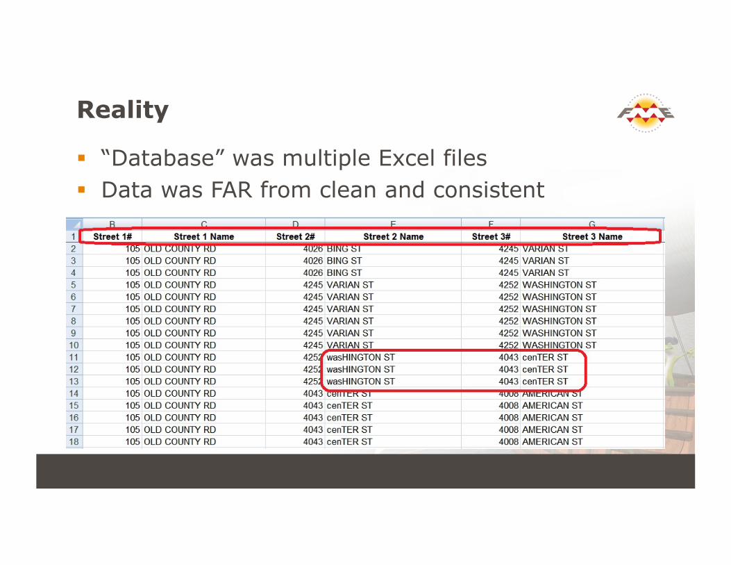
Reality
! “Database” was multiple Excel files ! Data was FAR from clean and consistent
Reality (cont.)
! Consultant used a road source they didn’t get from the City and they didn’t supply the road source to the City – (Street Segment References were useless)
! Non-existent streets were entered ! Direction indicators were based on direction of
travel and not fixed compass bearing
! Time to start sweating!!
Solution
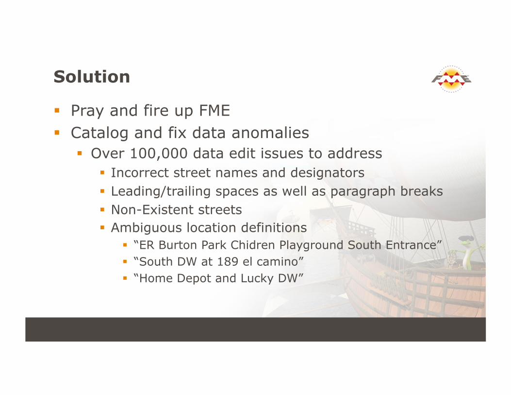
! Pray and fire up FME ! Catalog and fix data anomalies
! Over 100,000 data edit issues to address ! Incorrect street names and designators ! Leading/trailing spaces as well as paragraph breaks ! Non-Existent streets ! Ambiguous location definitions
! “ER Burton Park Chidren Playground South Entrance” ! “South DW at 189 el camino” ! “Home Depot and Lucky DW”
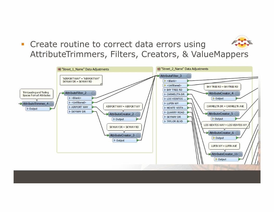
! Create routine to correct data errors using AttributeTrimmers, Filters, Creators, & ValueMappers
Data Scrub
! Iterative process: ! Run data normalization routine ! Examine the unmatched records ! Investigate reason for no-match ! Update FME routine with new data changes
! End Result is database with corrected data
Create Street & Intersection Data
! Used TopologyBuilder to create a street network
! Start and end nodes for streets ! Unique list of streets at each intersection ! Count of road segments at intersection ! Combined streets with private streets ! Prep for adding new road segments
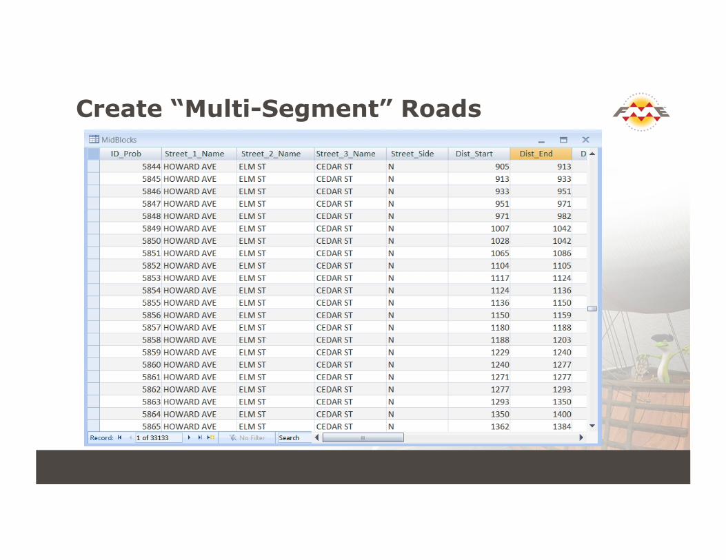
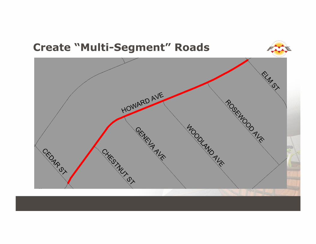
Create “Multi-Segment” Roads
Create “Multi-Segment” Roads

Create “Multi-Segment” Roads
! Join individual road segments in AutoCAD ! Run FME Routine:
! Assign start and end nodes from topology data (created in prior routine)
! Assign unique segment ID ! Combine with existing network segments
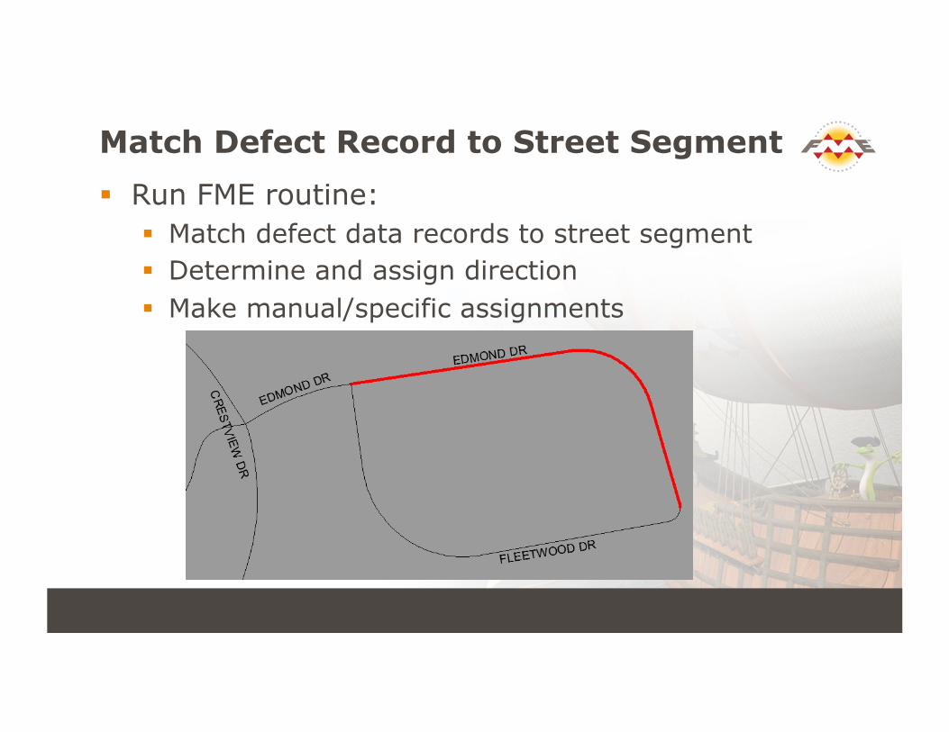
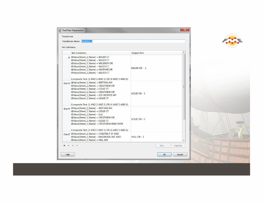
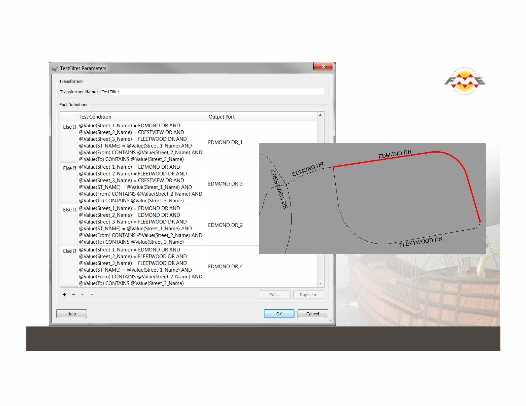
Match Defect Record to Street Segment
! Run FME routine: ! Match defect data records to street segment ! Determine and assign direction ! Make manual/specific assignments
Map Defects with Proper Street Offset
! Mapping parameters dictated by client: ! Offset defects from centerline to proper side of
street ! Mix of points and lines based on defect length ! Make sure not to map defects in intersections
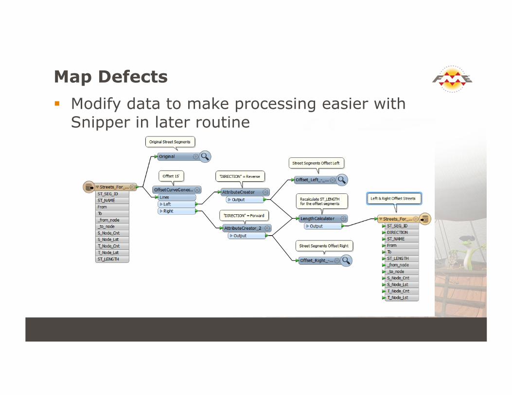
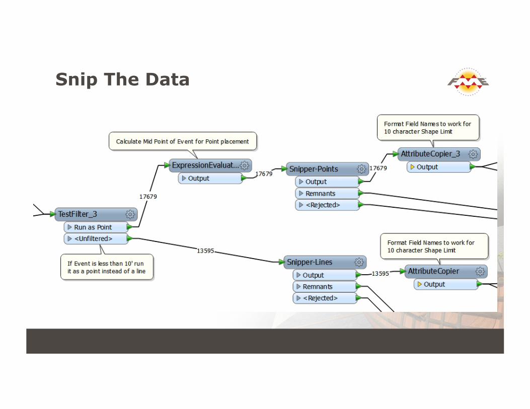
Map Defects ! Modify data to make processing easier with
Snipper in later routine
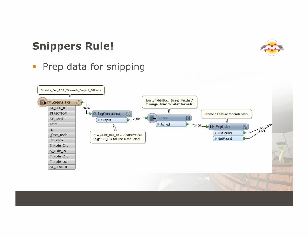
Snippers Rule!
! Prep data for snipping
Snip The Data
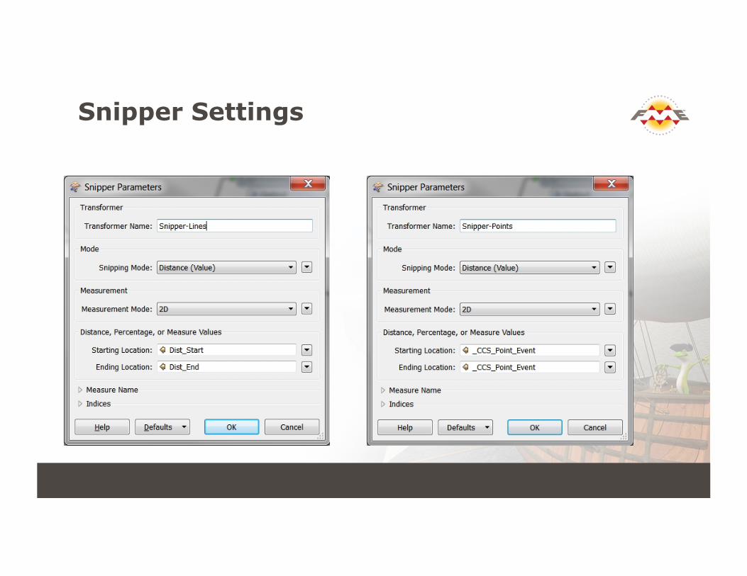
Snipper Settings
Process Intersections
! Unusable directional reference information mandated another method for placement ! Needed to rotate points around the intersection
! FME Store to the Rescue! ! Found and downloaded the 2DDirectionExtender
! Don’t Forget About the online FME Resources
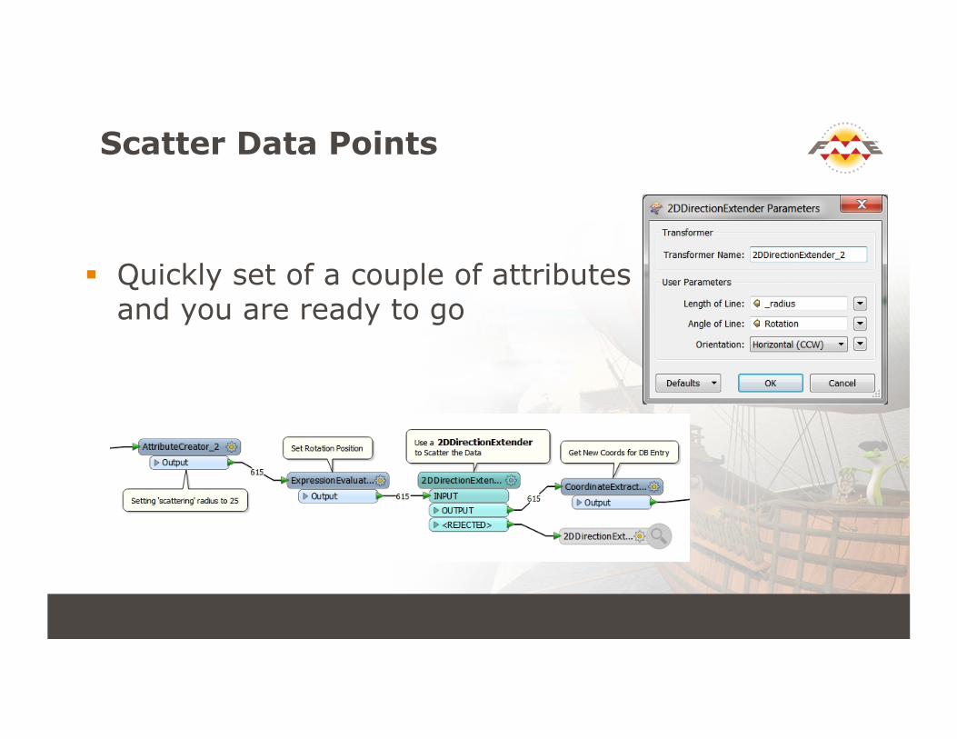
Scatter Data Points
! Quickly set of a couple of attributes and you are ready to go
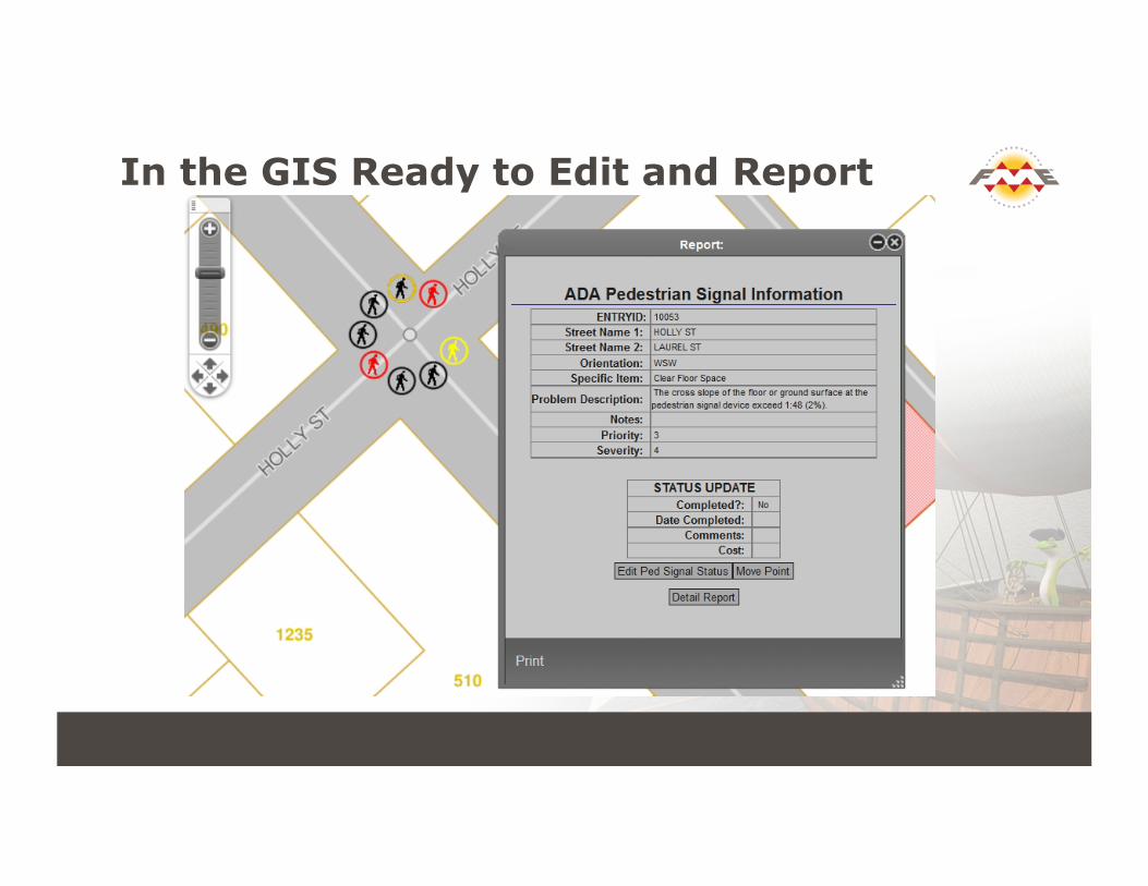
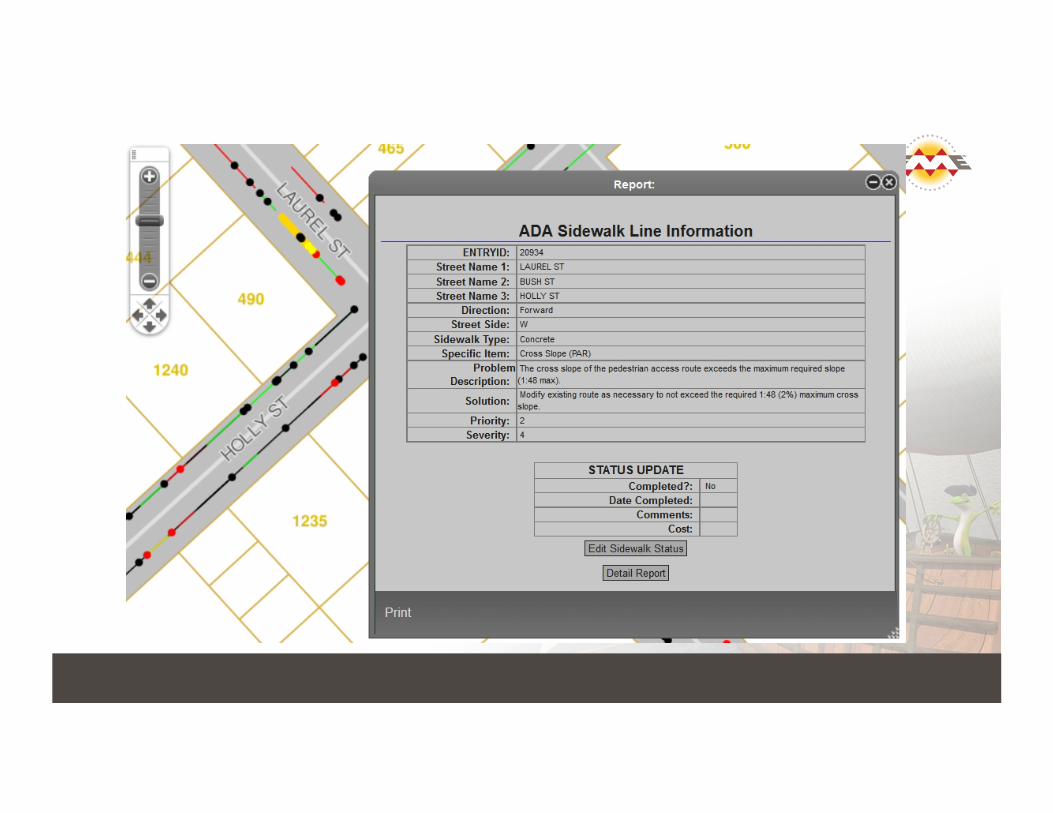
In the GIS Ready to Edit and Report

Thank You!
! Questions?
! For more information: ! Raymond Kinser ([email protected]) ! California CAD Solutions, Inc.
! www.calcad.com