Embed Size (px)
Citation preview
• PacIOOS is one of 11 regions of IOOS and is responsible for providing information about the ocean environment to a wide variety of users
• Built around different themes• Rely on “standard” services
for data
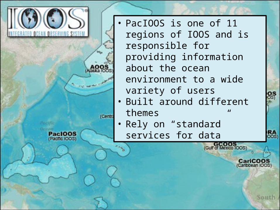
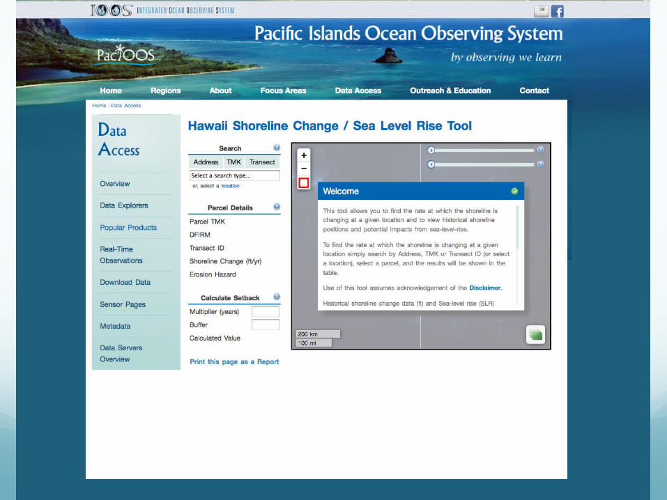
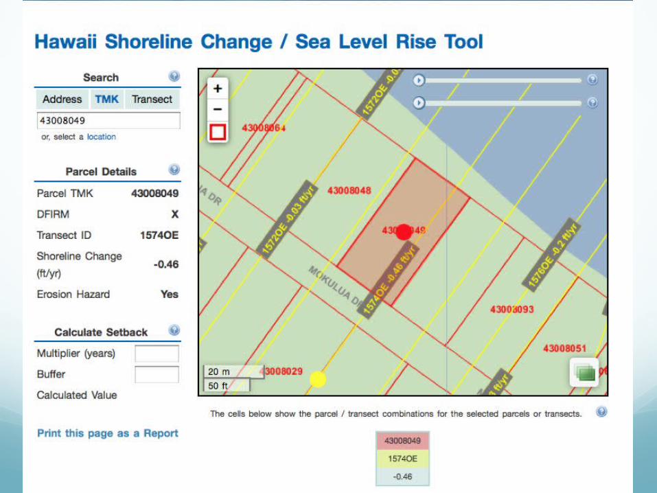
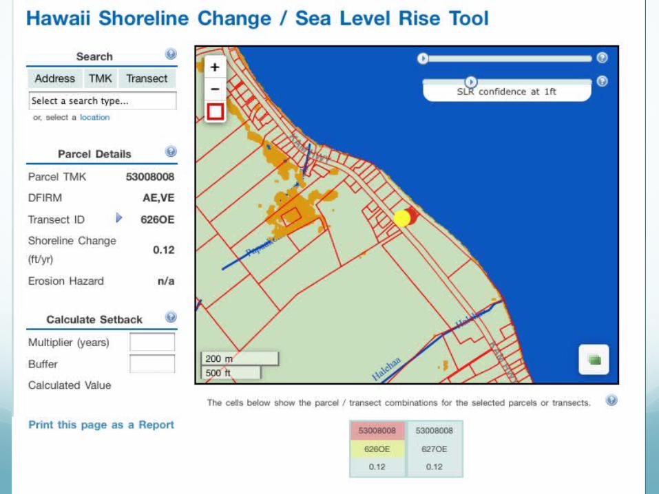
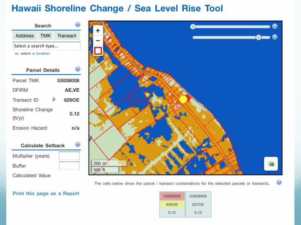
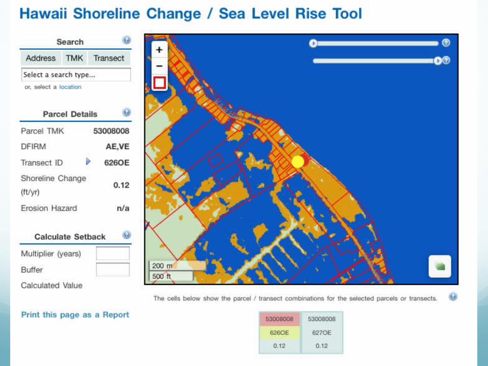
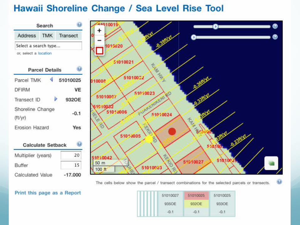
Example of customer-driven, research-enabled tool that combines estimates of sea level changes, and a map-based collection of property layers
Collaboration between UH/SOEST, NOAA (CSP), State (Coordinator for the National Flood Insurance Program within DLNR), City and County
Leverage “delivery mechanism” infrastructure of PacIOOS (regional association of IOOS)
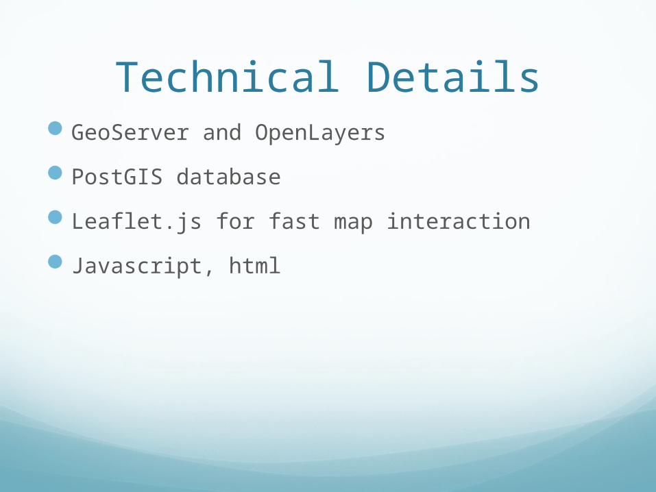
Technical DetailsGeoServer and OpenLayers
PostGIS database
Leaflet.js for fast map interaction
Javascript, html
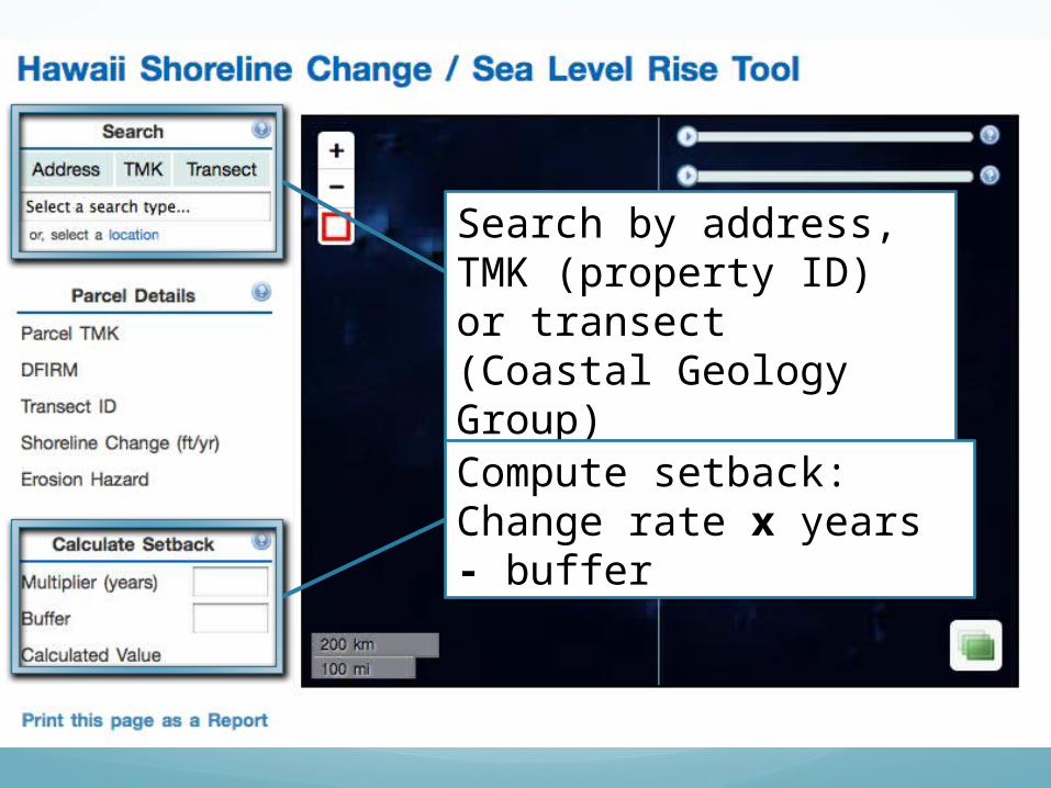
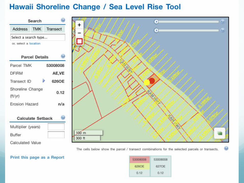
Search by address, TMK (property ID) or transect (Coastal Geology Group)
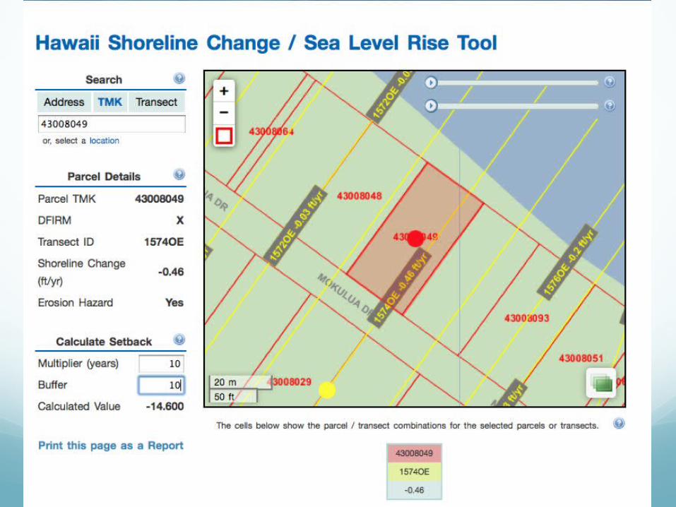
Compute setback:Change rate x years - buffer
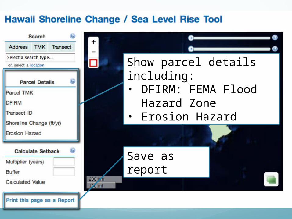
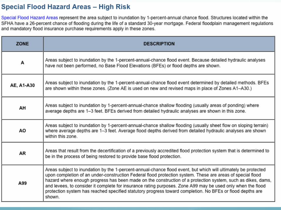
Show parcel details including:• DFIRM: FEMA Flood
Hazard Zone• Erosion Hazard
Save as report
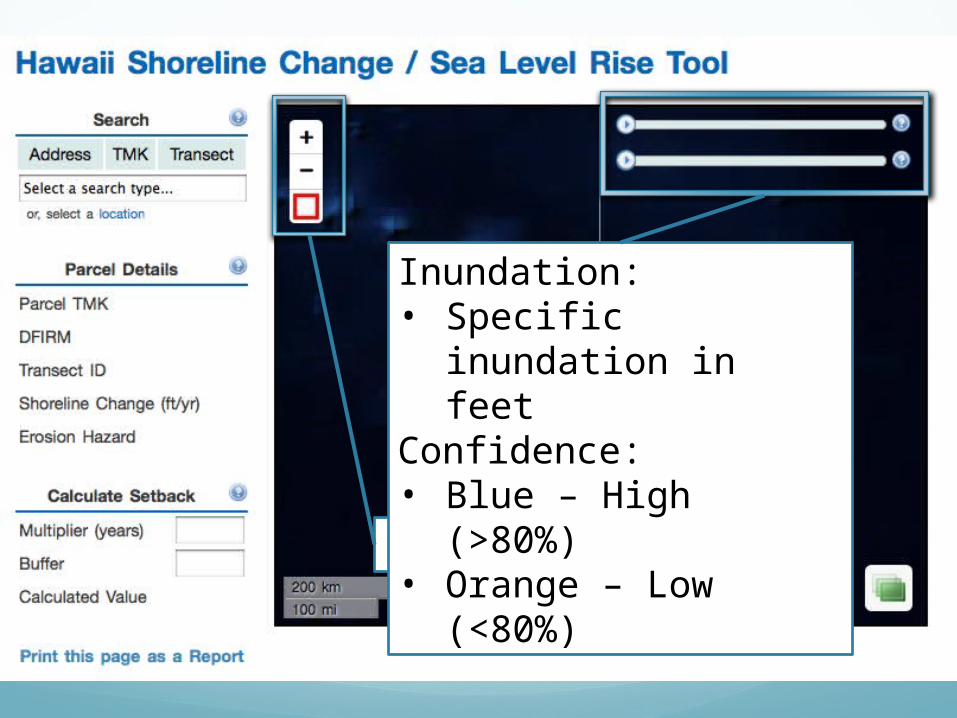
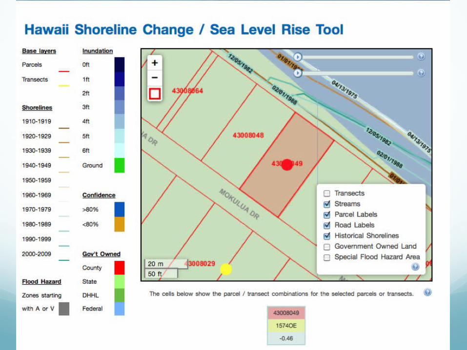
Pan/Zoom map
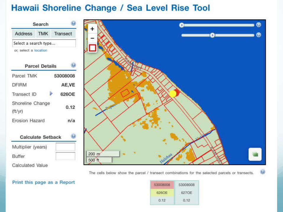
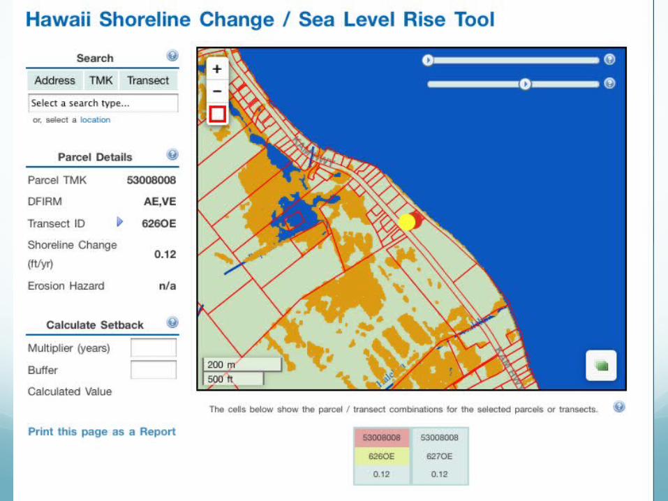
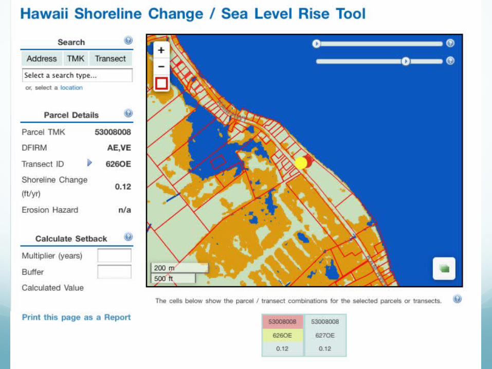
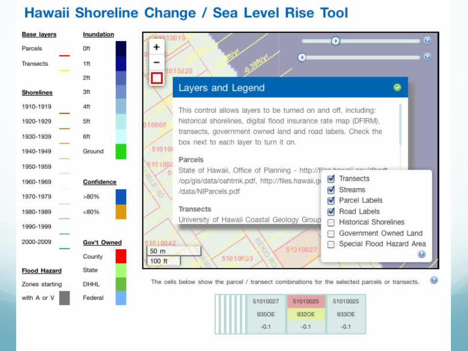
Inundation:• Specific inundation
in feetConfidence: • Blue – High (>80%)• Orange – Low
(<80%)
Present StatusIn evaluation stage
Full-screen version
More functional print option


![Carley GIS workshop 20101109 [Read-Only] · GIS in Coastal Management Coastal Engineering Physical Model Testings Coastal Processes Climate Change and Sea Level Rise Foreshore Protection](https://img.pdfslide.us/doc/110x75/5e70b53c54818046d600f219/carley-gis-workshop-20101109-read-only-gis-in-coastal-management-coastal-engineering.jpg)