Embed Size (px)
Citation preview
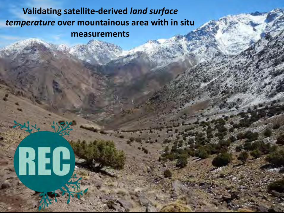
Validating satellite-derived land surface temperature over mountainous area with in
situ measurements
Imlil Valley (High Atlas) - Morocco
Yoann Malbéteau CESBIO / Toulouse [email protected]
http://rec.isardsat.com
Merlin O., Gascoin S., Gastellu J.P., Mattar, C. Olivera L., Khabba S., Jarlan L.
Validació de dades teletransportades en camp; Aplicacions agrícoles i hidrogeològiques 1 of 15
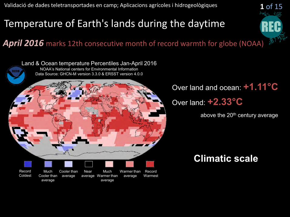
Temperature of Earth's lands during the daytime
April 2016 marks 12th consecutive month of record warmth for globe (NOAA)
Climatic scale
Land & Ocean temperature Percentiles Jan-April 2016 NOAA’s National centers for Environmental Information
Data Source: GHCN-M version 3.3.0 & ERSST version 4.0.0
Record Warmest
Much Warmer than
average
Warmer than average
Near average
Much Cooler than
average
Cooler than average
Record Coldest
Over land: +2.33°C Over land and ocean: +1.11°C
above the 20th century average
Validació de dades teletransportades en camp; Aplicacions agrícoles i hidrogeològiques 2 of 15
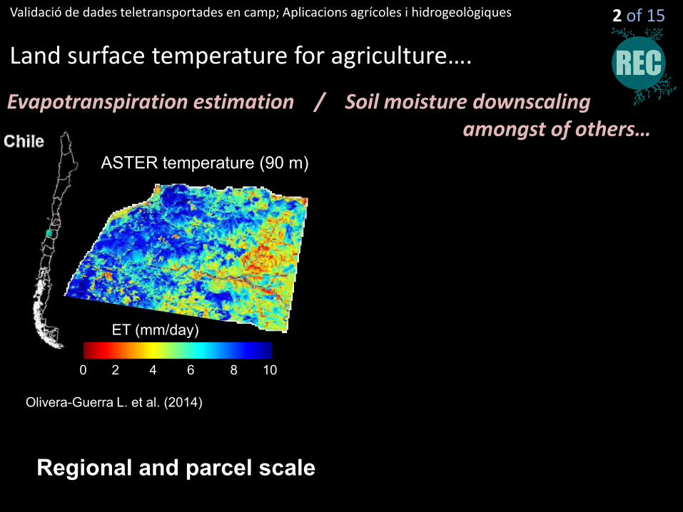
Land surface temperature for agriculture….
Evapotranspiration estimation / Soil moisture downscaling amongst of others…
Regional and parcel scale
ASTER temperature (90 m)
ET (mm/day)
0 10 8 6 4 2
Olivera-Guerra L. et al. (2014)
Validació de dades teletransportades en camp; Aplicacions agrícoles i hidrogeològiques 2 of 15
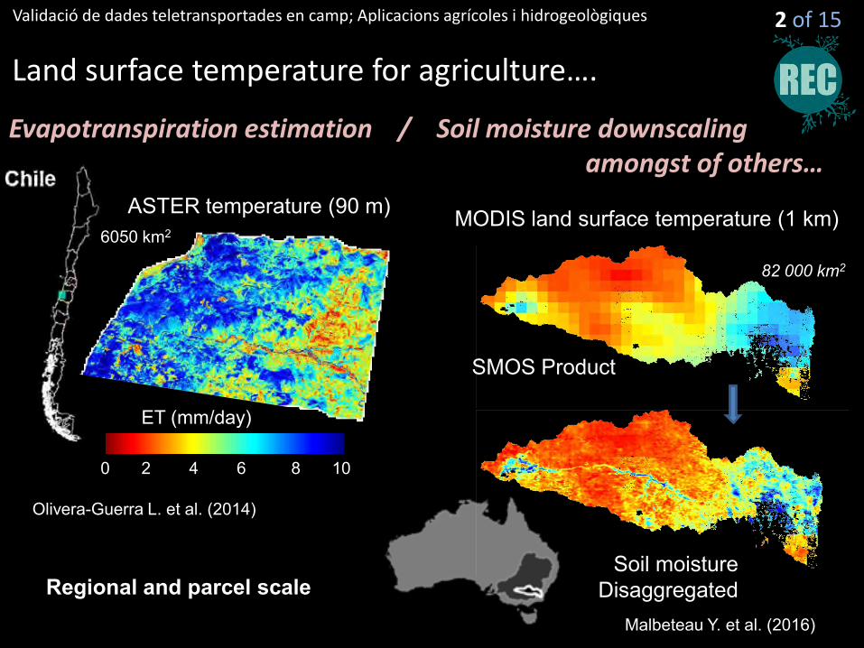
Land surface temperature for agriculture….
Evapotranspiration estimation / Soil moisture downscaling amongst of others…
Regional and parcel scale
SMOS Product
Soil moisture Disaggregated
82 000 km2
ASTER temperature (90 m) MODIS land surface temperature (1 km)
ET (mm/day)
0 10 8 6 4 2
Olivera-Guerra L. et al. (2014)
Malbeteau Y. et al. (2016)
6050 km2
Validació de dades teletransportades en camp; Aplicacions agrícoles i hidrogeològiques
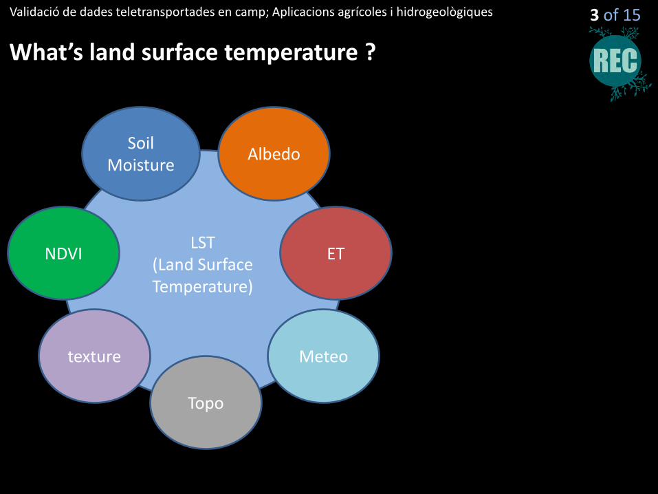
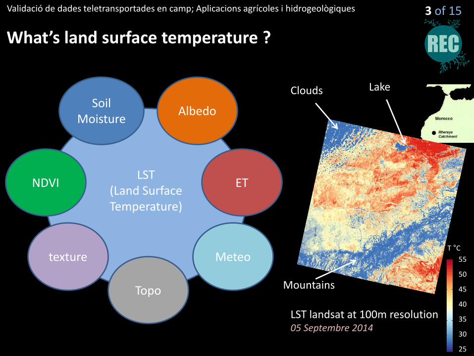
What’s land surface temperature ?
LST (Land Surface Temperature)
NDVI
Soil Moisture
Albedo
texture
ET
Meteo
Topo
3 of 15
Validació de dades teletransportades en camp; Aplicacions agrícoles i hidrogeològiques
What’s land surface temperature ?
LST (Land Surface Temperature)
NDVI
Soil Moisture
Albedo
texture
ET
Meteo
Topo
3 of 15
LST landsat at 100m resolution 05 Septembre 2014
Lake
Mountains
Clouds
55
40
30
25
50
45
35
T °C
Validació de dades teletransportades en camp; Aplicacions agrícoles i hidrogeològiques
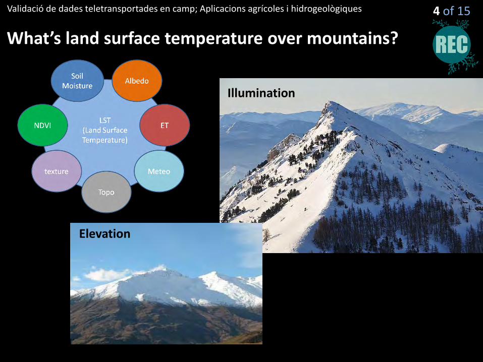
What’s land surface temperature over mountains?
4 of 15
Illumination
Elevation
Validació de dades teletransportades en camp; Aplicacions agrícoles i hidrogeològiques
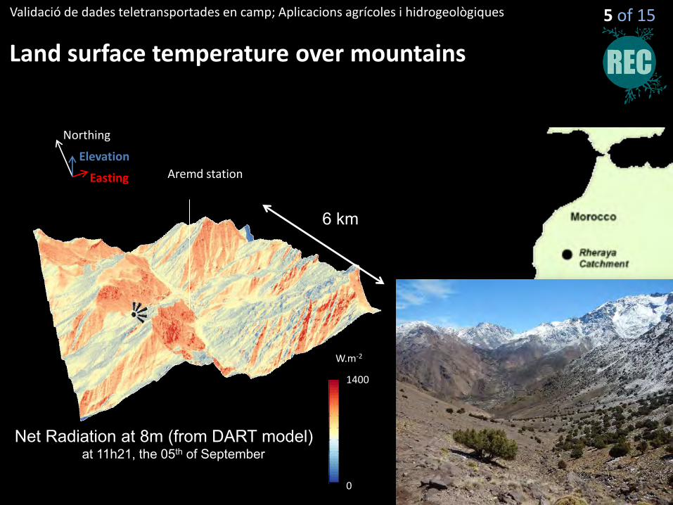
Land surface temperature over mountains
5 of 15
Aremd station
Northing
Easting
Elevation
1400
0
W.m-2
Net Radiation at 8m (from DART model) at 11h21, the 05th of September
6 km
Validació de dades teletransportades en camp; Aplicacions agrícoles i hidrogeològiques
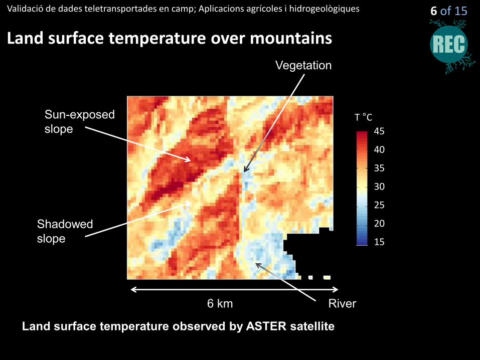
Land surface temperature over mountains
6 of 15
45
30
20
15
40
35
25
T °C Sun-exposed slope
Shadowed slope
Vegetation
River
Land surface temperature observed by ASTER satellite
6 km
Validació de dades teletransportades en camp; Aplicacions agrícoles i hidrogeològiques
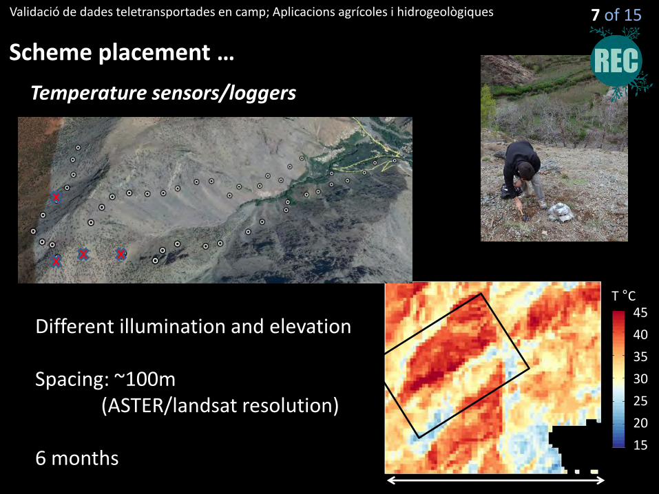
Scheme placement …
7 of 15
Temperature sensors/loggers
Different illumination and elevation Spacing: ~100m (ASTER/landsat resolution) 6 months
45
30
20
15
40
35
25
T °C
Validació de dades teletransportades en camp; Aplicacions agrícoles i hidrogeològiques
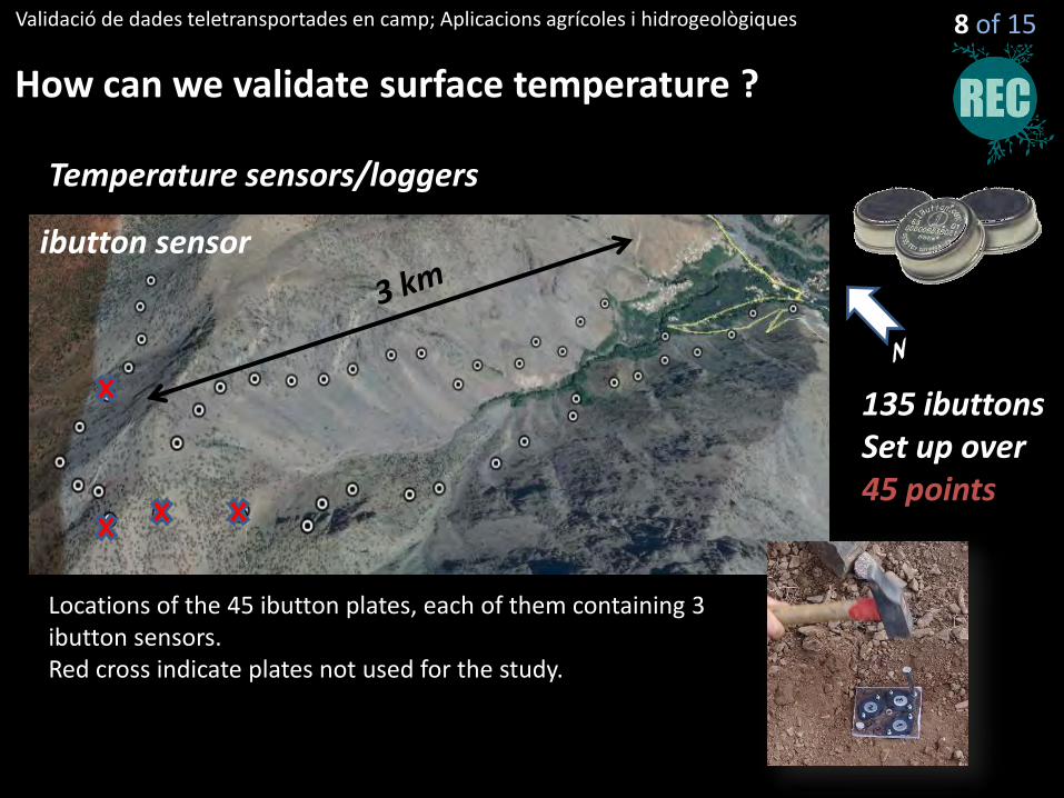
How can we validate surface temperature ?
8 of 15
Temperature sensors/loggers
ibutton sensor
135 ibuttons Set up over 45 points
Locations of the 45 ibutton plates, each of them containing 3 ibutton sensors. Red cross indicate plates not used for the study.
Validació de dades teletransportades en camp; Aplicacions agrícoles i hidrogeològiques
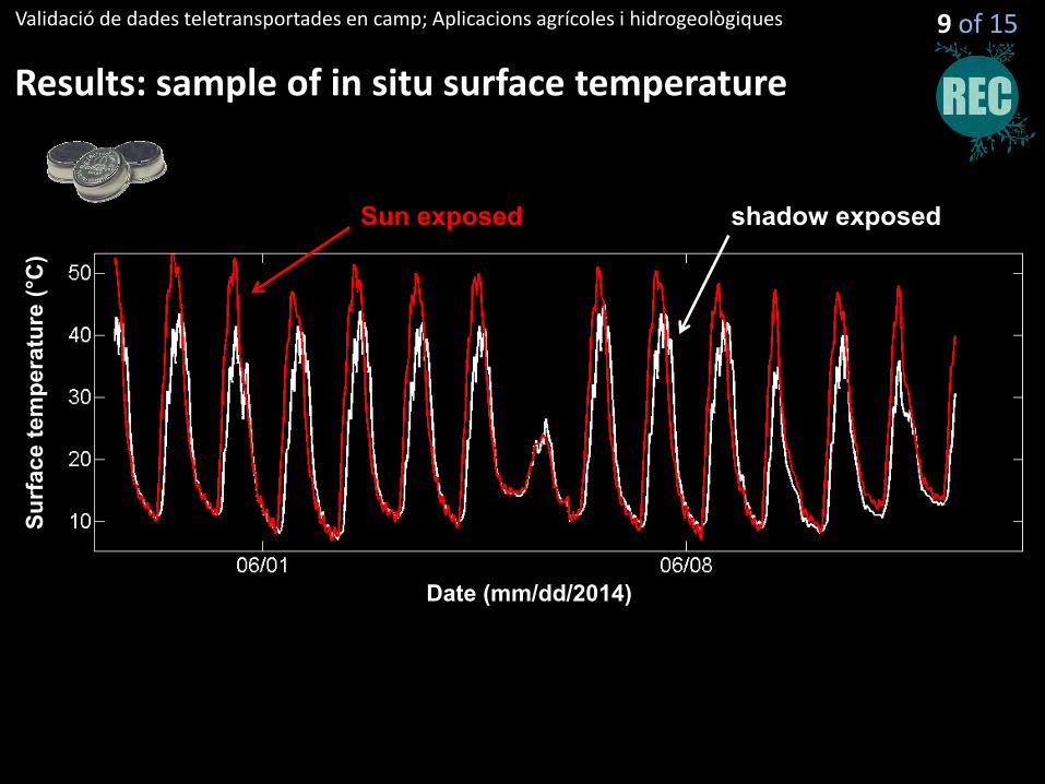
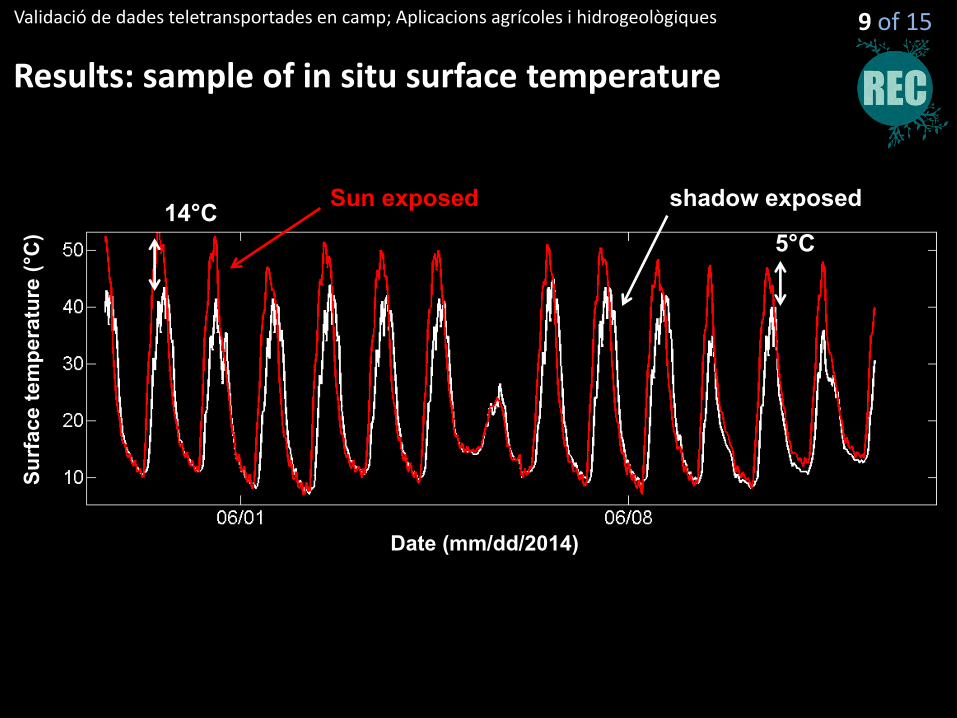
Results: sample of in situ surface temperature
9 of 15
Date (mm/dd/2014)
Surf
ace
tem
pera
ture
(°C
)
Sun exposed shadow exposed
Validació de dades teletransportades en camp; Aplicacions agrícoles i hidrogeològiques
Results: sample of in situ surface temperature
Date (mm/dd/2014)
Surf
ace
tem
pera
ture
(°C
)
Sun exposed shadow exposed 14°C 5°C
9 of 15
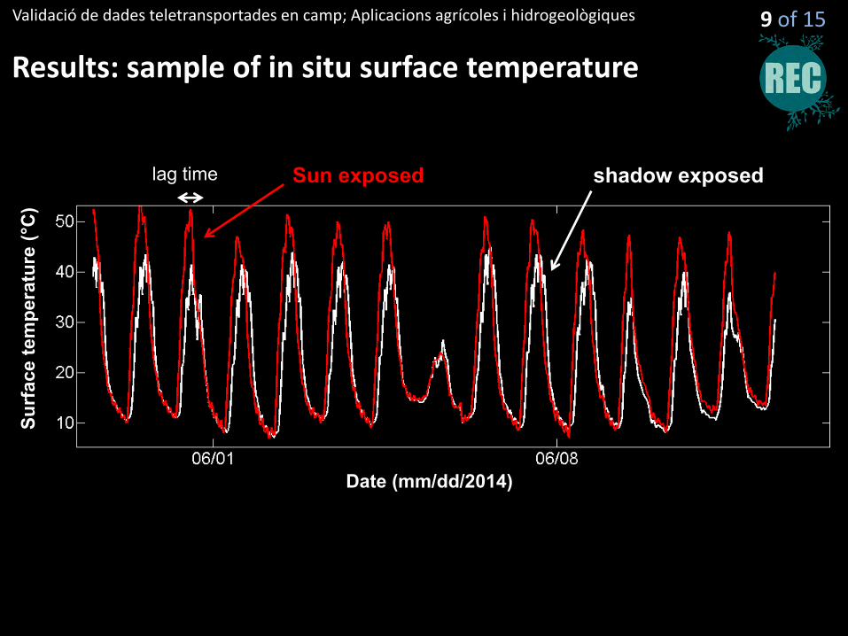
Validació de dades teletransportades en camp; Aplicacions agrícoles i hidrogeològiques
Results: sample of in situ surface temperature
Date (mm/dd/2014)
Surf
ace
tem
pera
ture
(°C
)
lag time
9 of 15
Sun exposed shadow exposed
Validació de dades teletransportades en camp; Aplicacions agrícoles i hidrogeològiques
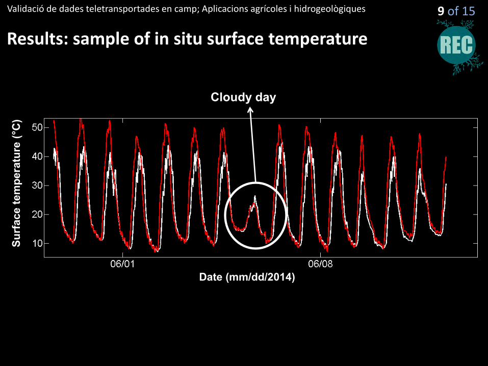
Results: sample of in situ surface temperature
Date (mm/dd/2014)
Surf
ace
tem
pera
ture
(°C
)
Cloudy day
9 of 15
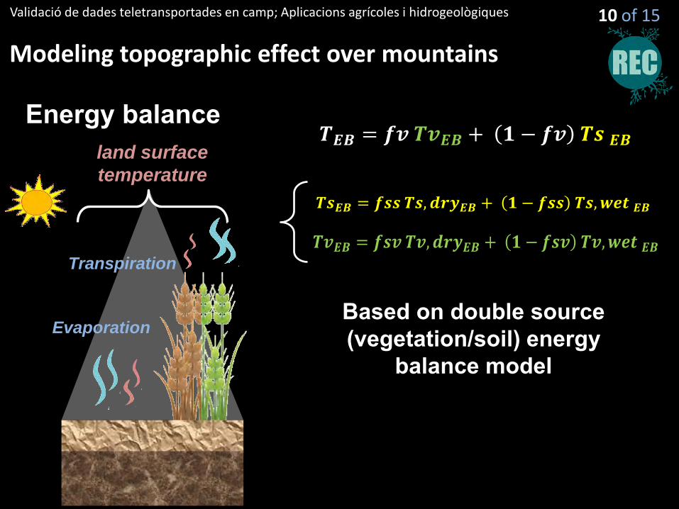
Energy balance
Transpiration
Evaporation
land surface
temperature
𝑻𝑬𝑩 = 𝒇𝒗 𝑻𝒗𝑬𝑩 + 𝟏 − 𝒇𝒗 𝑻𝒔 𝑬𝑩
Based on double source (vegetation/soil) energy
balance model
𝑻𝒔𝑬𝑩 = 𝒇𝒔𝒔 𝑻𝒔, 𝒅𝒓𝒚𝑬𝑩 + 𝟏 − 𝒇𝒔𝒔 𝑻𝒔, 𝒘𝒆𝒕 𝑬𝑩
𝑻𝒗𝑬𝑩 = 𝒇𝒔𝒗 𝑻𝒗, 𝒅𝒓𝒚𝑬𝑩 + 𝟏 − 𝒇𝒔𝒗 𝑻𝒗, 𝒘𝒆𝒕 𝑬𝑩
Validació de dades teletransportades en camp; Aplicacions agrícoles i hidrogeològiques
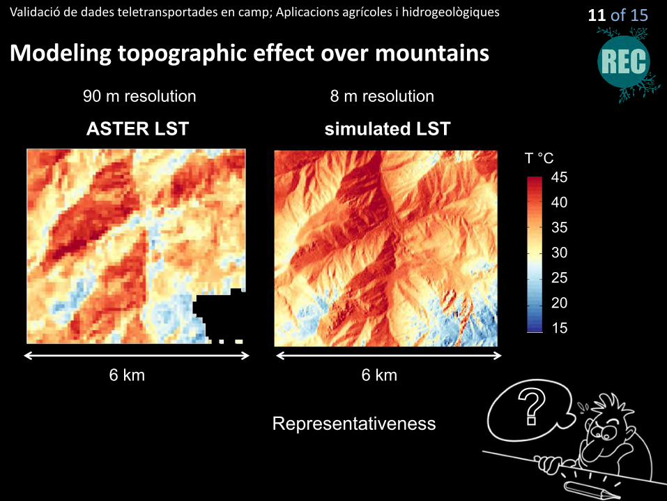
Modeling topographic effect over mountains
10 of 15
Validació de dades teletransportades en camp; Aplicacions agrícoles i hidrogeològiques
Modeling topographic effect over mountains
ASTER LST simulated LST
45
30
20
15
40
35
25
T °C
90 m resolution 8 m resolution
Representativeness
11 of 15
6 km 6 km
Validació de dades teletransportades en camp; Aplicacions agrícoles i hidrogeològiques
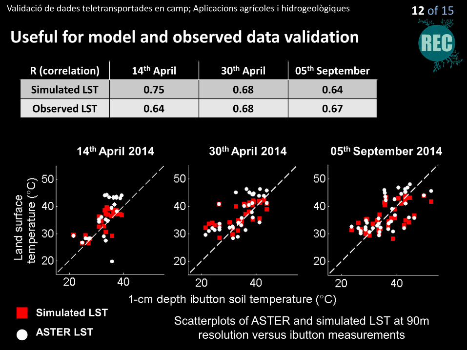
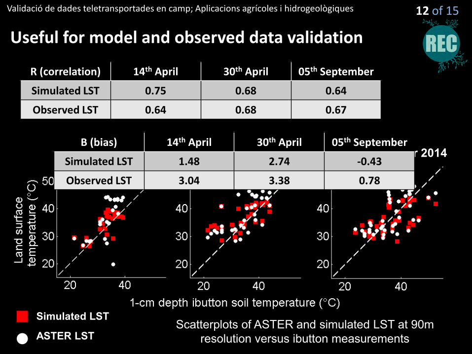
Useful for model and observed data validation
14th April 2014 30th April 2014 05th September 2014
Simulated LST
ASTER LST
R (correlation) 14th April 30th April 05th September
Simulated LST 0.75 0.68 0.64
Observed LST 0.64 0.68 0.67
Scatterplots of ASTER and simulated LST at 90m resolution versus ibutton measurements
12 of 15
Validació de dades teletransportades en camp; Aplicacions agrícoles i hidrogeològiques
Useful for model and observed data validation
14th April 2014 30th April 2014 05th September 2014
Simulated LST
ASTER LST
R (correlation) 14th April 30th April 05th September
Simulated LST 0.75 0.68 0.64
Observed LST 0.64 0.68 0.67
B (bias) 14th April 30th April 05th September
Simulated LST 1.48 2.74 -0.43
Observed LST 3.04 3.38 0.78
Scatterplots of ASTER and simulated LST at 90m resolution versus ibutton measurements
12 of 15
Validació de dades teletransportades en camp; Aplicacions agrícoles i hidrogeològiques
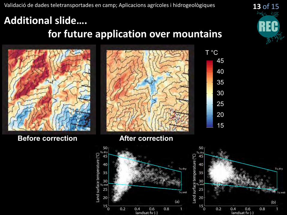
Additional slide…. for future application over mountains
45
30
20
15
40
35
25
T °C
Before correction After correction
13 of 15
Validació de dades teletransportades en camp; Aplicacions agrícoles i hidrogeològiques
Conclusion
Challenges: Representativeness of in situ measurement for remote sensing data validation solution ? very dense in situ measurement aggregation few in situ measurement disaggregation (downscaling) in situ measurement representative at the scale resolution
14 of 15
Validació de dades teletransportades en camp; Aplicacions agrícoles i hidrogeològiques
Conclusion
Challenges: Representativeness of in situ measurement for remote sensing data validation solution ? very dense in situ measurement aggregation few in situ measurement disaggregation (downscaling) in situ measurement representative at the scale resolution intercomparison between remotely sensed data
14 of 15
Validació de dades teletransportades en camp; Aplicacions agrícoles i hidrogeològiques
Conclusion
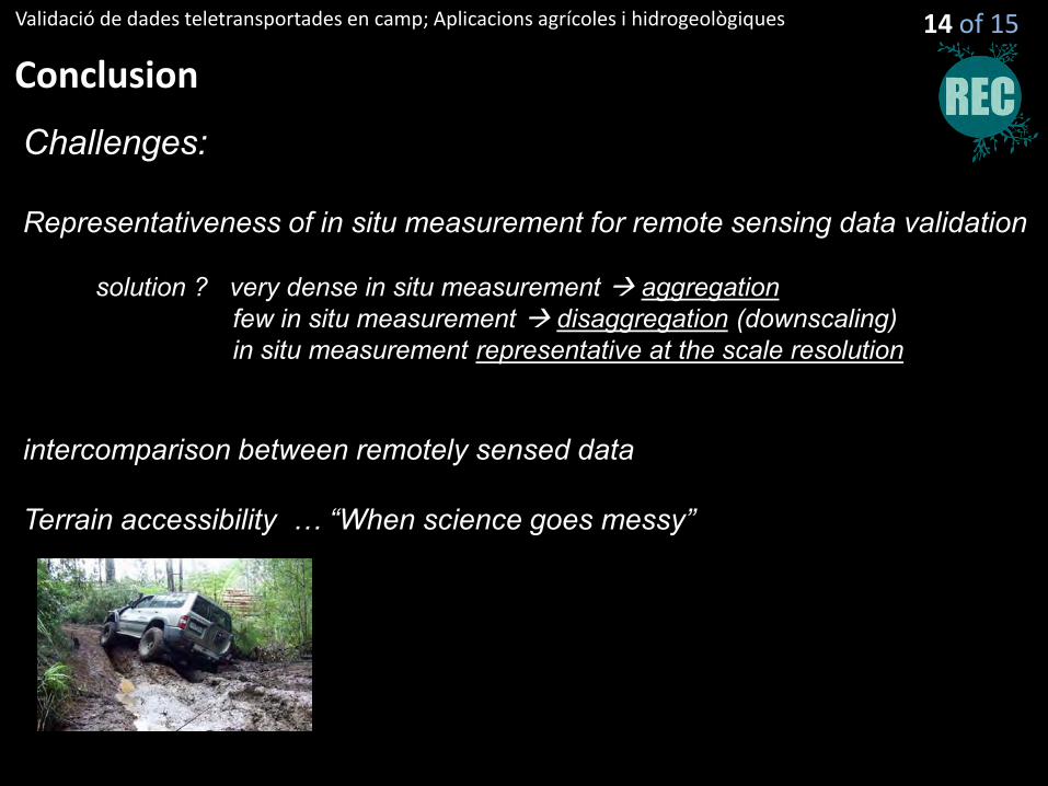
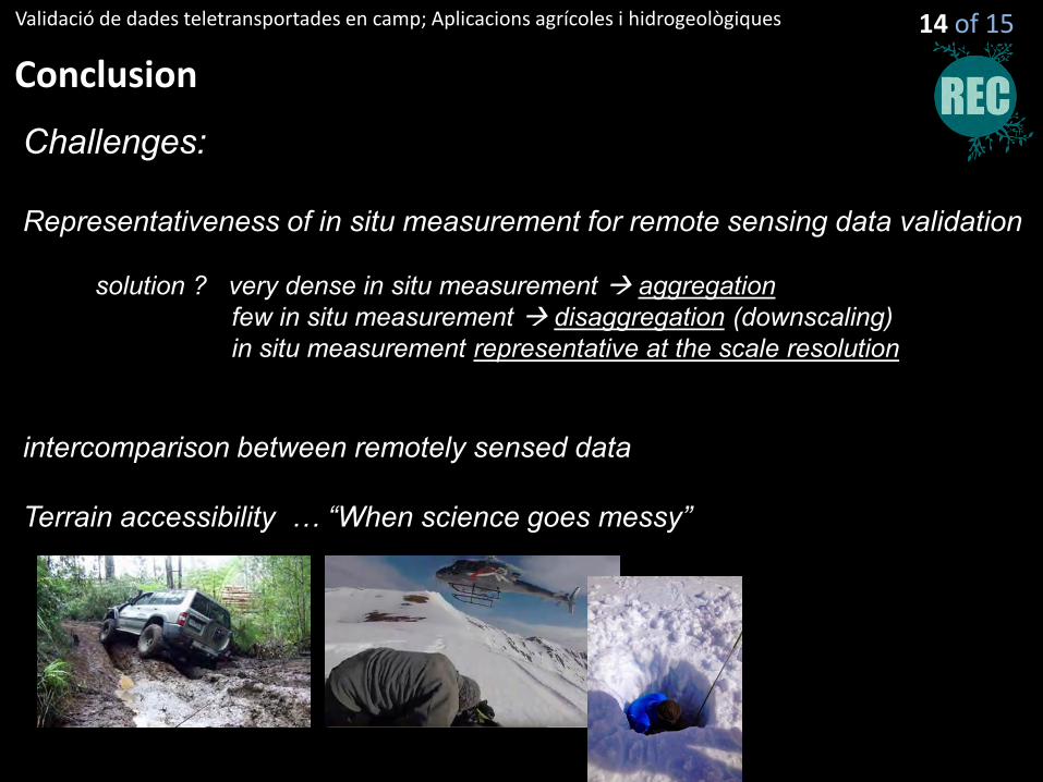
Challenges: Representativeness of in situ measurement for remote sensing data validation solution ? very dense in situ measurement aggregation few in situ measurement disaggregation (downscaling) in situ measurement representative at the scale resolution intercomparison between remotely sensed data Terrain accessibility … “When science goes messy”
14 of 15
Validació de dades teletransportades en camp; Aplicacions agrícoles i hidrogeològiques
Conclusion
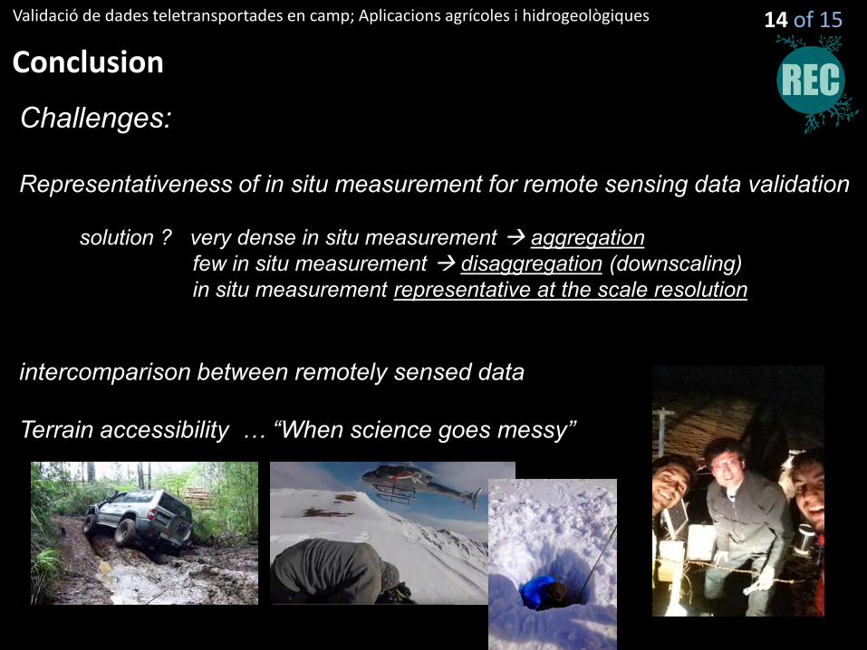
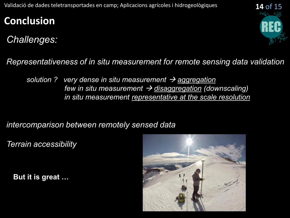
Challenges: Representativeness of in situ measurement for remote sensing data validation solution ? very dense in situ measurement aggregation few in situ measurement disaggregation (downscaling) in situ measurement representative at the scale resolution intercomparison between remotely sensed data Terrain accessibility
But it is great …
14 of 15
Validating satellite-derived land surface temperature over mountainous area with in situ
measurements