Embed Size (px)
Citation preview

THE ROLE OF REGIONAL
GEOSPATIAL COORDINATION FOR
EFFECTIVE CITY MANAGEMENT
Greg Babinski, MA, GISP Finance & Marketing Manager King County GIS Center Seattle, WA, USA
URISA Past-President URISA GIS Management Institute Committee Chair COGO Secretary Summit At-Large Editor 2013 Washington GIS Conference Co-Chair
Geospatial World Forum Rotterdam: 15 May 2013
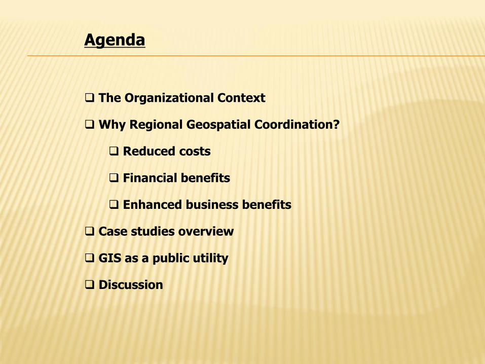
Agenda
The Organizational Context
Why Regional Geospatial Coordination?
Reduced costs
Financial benefits
Enhanced business benefits
Case studies overview
GIS as a public utility
Discussion

KING COUNTY, WASHINGTON
Microsoft
Gates Foundation
Boeing
Paccar
Nordstrom's
Amazon
Starbucks
Port of Seattle
Weyerhaeuser
Univ. of Washington
Skype
Population (1,931,000 (14th most populous US county)
Area: 2130 square miles (sea level to 8,000’)
39 incorporated cities
Viable agricultural and private forestry areas
Remote wilderness & watershed lands
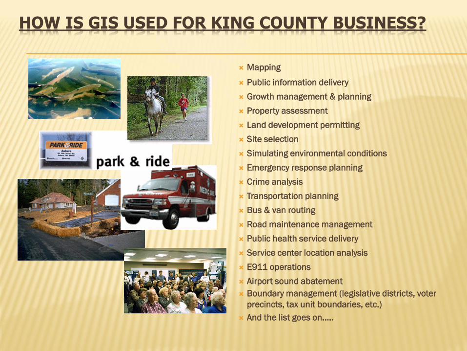
HOW IS GIS USED FOR KING COUNTY BUSINESS?
Mapping
Public information delivery
Growth management & planning
Property assessment
Land development permitting
Site selection
Simulating environmental conditions
Emergency response planning
Crime analysis
Transportation planning
Bus & van routing
Road maintenance management
Public health service delivery
Service center location analysis
E911 operations
Airport sound abatement
Boundary management (legislative districts, voter
precincts, tax unit boundaries, etc.)
And the list goes on…..
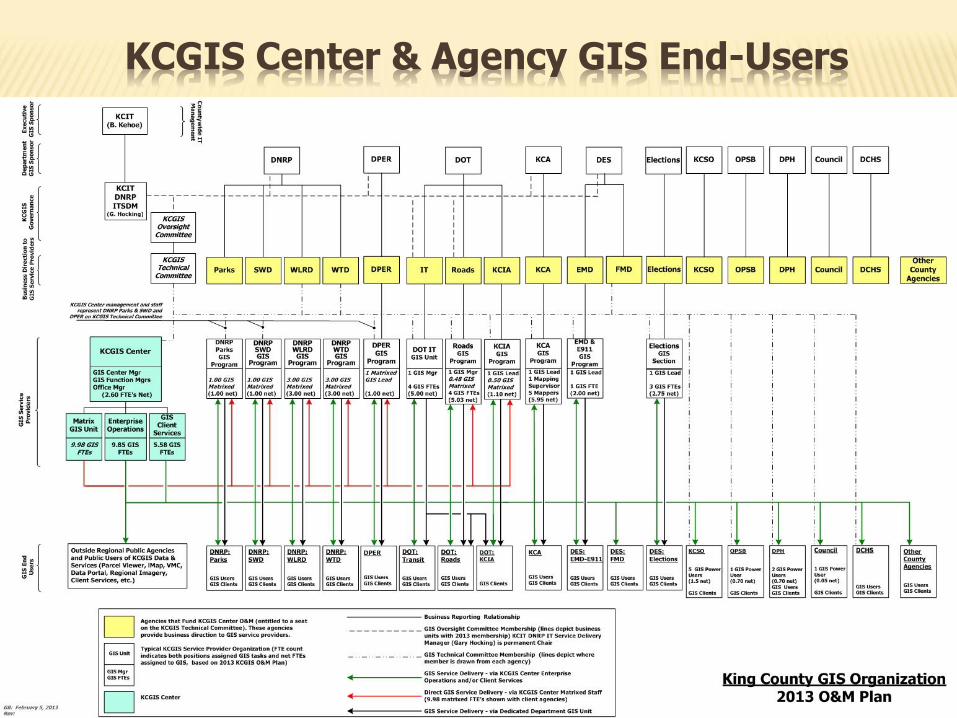
KCGIS Center & Agency GIS End-Users

King County GIS City of Seattle GIS:
Seattle Public Utilities GIS Seattle City Light GIS
Suburban cities: Bellevue, Redmond, Kirkland, Renton, ~20 other municipalities
Puget Sound Regional Council (growth and transportation planning agency)
Sound Transit (regional transit agency) Puget Sound Energy (private gas and electric utility) Cable service providers E911 emergency dispatch districts ~15 public school districts ~25 public utility districts Mukleshoot Indian Tribe U.S. Federal government State of Washington
THE ORGANIZATIONAL CONTEXT
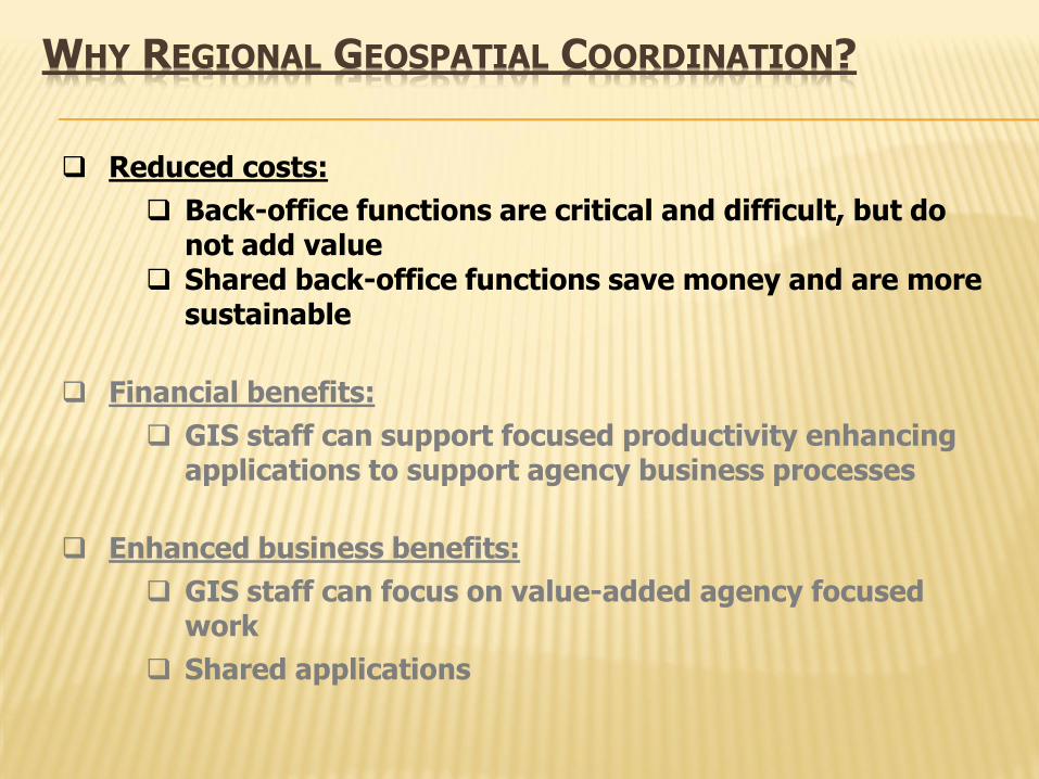
Reduced costs:
Back-office functions are critical and difficult, but do not add value
Shared back-office functions save money and are more sustainable
Financial benefits:
GIS staff can support focused productivity enhancing applications to support agency business processes
Enhanced business benefits:
GIS staff can focus on value-added agency focused work
Shared applications
WHY REGIONAL GEOSPATIAL COORDINATION?
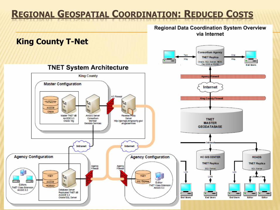
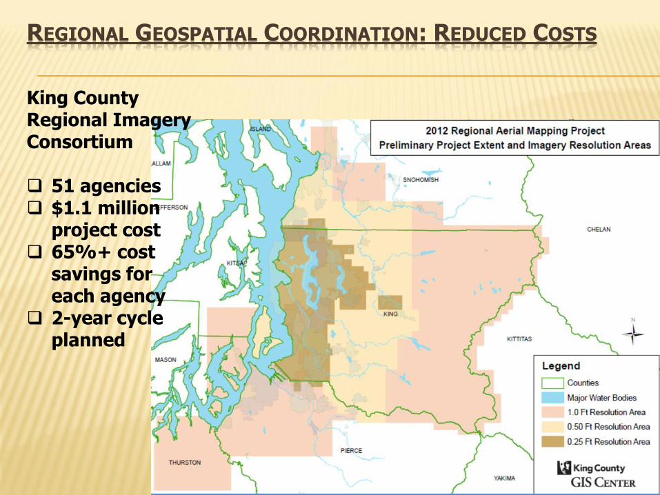
REGIONAL GEOSPATIAL COORDINATION: REDUCED COSTS
King County T-Net

REGIONAL GEOSPATIAL COORDINATION: REDUCED COSTS
REGIONAL GEOSPATIAL COORDINATION: REDUCED COSTS
King County Regional Imagery Consortium 51 agencies $1.1 million
project cost 65%+ cost
savings for each agency
2-year cycle planned
REGIONAL GEOSPATIAL COORDINATION: REDUCED COSTS
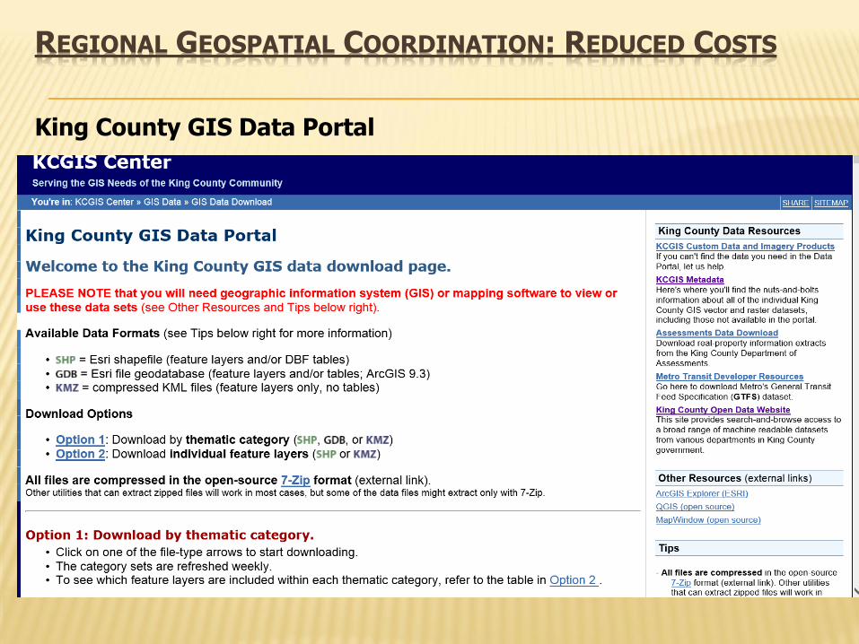
King County GIS Data Portal
Reduced costs:
Back-office functions are critical and difficult, but do not add value
Shared back-office functions save money and are more sustainable
Financial benefits:
GIS staff can support focused productivity enhancing applications to support agency business processes
Enhanced business benefits:
GIS staff can focus on value-added agency focused work
Shared applications
WHY REGIONAL GEOSPATIAL COORDINATION?

KCGIS GIS ROI Study
Consultant Team from UW Evans School of Public Affairs:
Prof. Richard W. Zerbe
Danielle Fumia & Travis Reynolds
Pradeep Singh & Tyler Scott
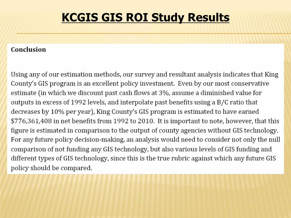
KCGIS GIS ROI Study Results

Reduced costs:
Back-office functions are critical and difficult, but do not add value
Shared back-office functions save money and are more sustainable
Financial benefits:
GIS staff can support focused productivity enhancing applications to support agency business processes
Enhanced business benefits:
GIS staff can focus on value-added agency focused work
Shared applications
WHY REGIONAL GEOSPATIAL COORDINATION?
REGIONAL GEOSPATIAL COORDINATION: ENHANCED BUSINESS BENEFITS
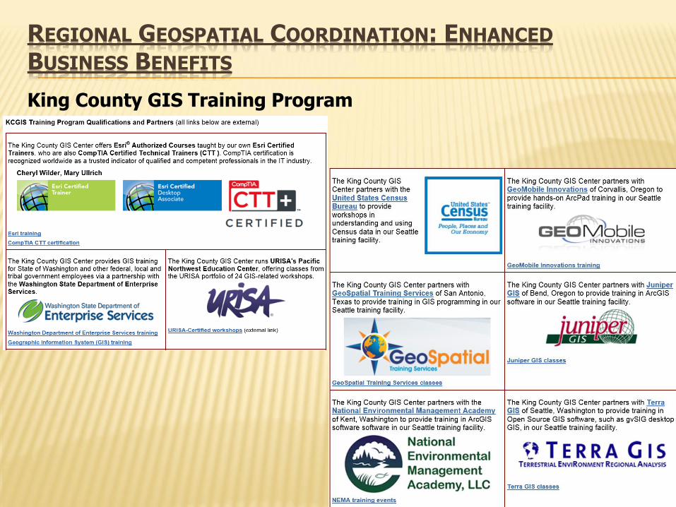
King County GIS Training Program
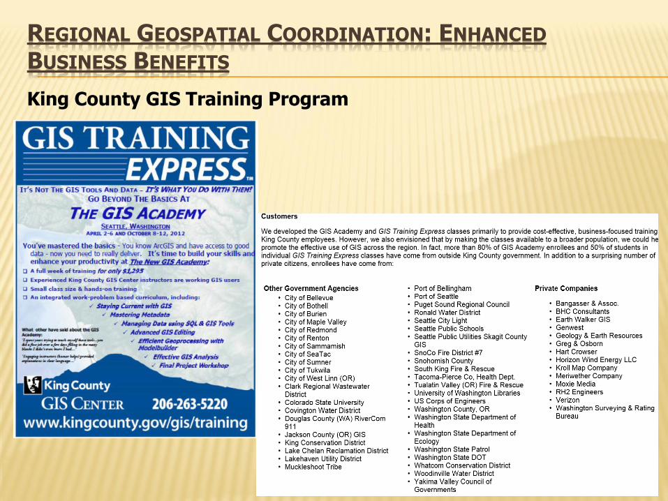
REGIONAL GEOSPATIAL COORDINATION: ENHANCED BUSINESS BENEFITS
King County GIS Training Program

REGIONAL GEOSPATIAL COORDINATION: ENHANCED BUSINESS BENEFITS
eCityGov Alliance: Regional GIS-based Applications 10 partners & 27 subscribers

REGIONAL GEOSPATIAL COORDINATION: ENHANCED BUSINESS BENEFITS
eCityGov Alliance: Regional GIS-based Applications

REGIONAL GEOSPATIAL COORDINATION
Other components of regional geospatial utilities:
Architectural design Hardware and software procurement Contract administration
Database management services:
Primary data centers and emergency back-up hot sites Database administration System administration Metadata management

URISA’s GIS Management Institute Promoting Regional Geospatial Coordination
GMBOK:
GIS Management
Body of Knowledge
Municipal GIS Operations
GCMM Accreditation
GCMM: GIS Capability Maturity Model
URISA Education
ULA & UMA
GIS Management Educational
Program Accreditation
GISCI
GIS Managers
Certification Component
GMCM: Geospatial
Management Competency
Model
Future:
ROI Services
Other
Accreditation
Benchmarking
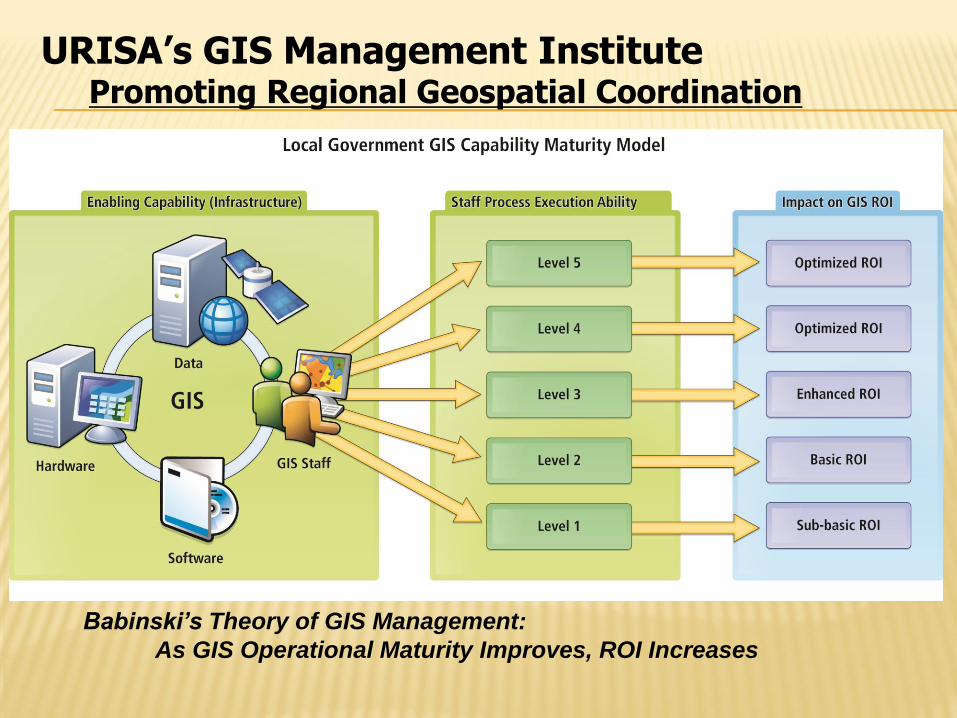
Babinski’s Theory of GIS Management:
As GIS Operational Maturity Improves, ROI Increases
URISA’s GIS Management Institute Promoting Regional Geospatial Coordination
Agenda
The Organizational Context
Why Regional Geospatial Coordination?
Reduced costs
Financial benefits
Enhanced business benefits
Case studies overview
GIS as a public utility
Discussion

Greg Babinski, MA, GISP URISA Past-President URISA GIS Management Institute Committee Chair COGO Secretary SUMMIT At-large Editor Finance & Marketing Manager King County GIS Center 201 South Jackson Street, Suite 706 Seattle, WA 98104 206-263-3753 [email protected] www.kingcounty.gov/gis