Embed Size (px)
Citation preview
5/22/2014
1
The GIS Management Institute® and the GIS Capability Maturity Model
Update, Overview, and Implementation
Southeast Washington & Northeast Oregon GIS User Group
Thursday, April 3, 2014
Greg Babinski, MA, GISPURISA Past-PresidentURISA GMI Committee Chair
Finance & Marketing ManagerKing County GIS CenterSeattle, WA USA
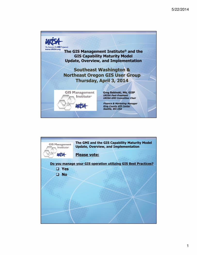
Do you manage your GIS operation utilizing GIS Best Practices?
� Yes
� No
The GMI and the GIS Capability Maturity ModelUpdate, Overview, and Implementation
Please vote:
5/22/2014
2
� What is a capability maturity model?
� Origins of the GIS Capability Maturity Model
� URISA Steps in and Babinski’s Theory of GIS Management
� The URISA Geospatial Management Competency Model
� Development of the revised, peer-reviewed URISA GIS Capability Maturity Model
� The URISA GIS Capability Maturity Model – Step by Step
� The pivotal role of the GIS CMM in the GIS Management Institute®
� The role of the GIS Management Institute® in enhancing sustainable Enterprise GIS
� The role of the GIS Management Institute® in developing professional GIS managers
� The GIS Management Institute® - next steps
The GMI and the GIS Capability Maturity ModelUpdate, Overview, and Implementation
Agenda
The GMI and the GIS Capability Maturity ModelUpdate, Overview, and Implementation
What is a Capability Maturity Model?
� A tool to assess an organization’s ability to accomplish a defined task or set of tasks
� Originated with the Software Engineering Institute
� Objective evaluation of software contractors
� SEI published Managing the Software Process 1989
� SEI CMM is process focused
� Other applications of the capability maturity model concept:
� System engineering
� Project management
� Risk management
� Information technology service providers
5/22/2014
3
The GMI and the GIS Capability Maturity ModelUpdate, Overview, and Implementation
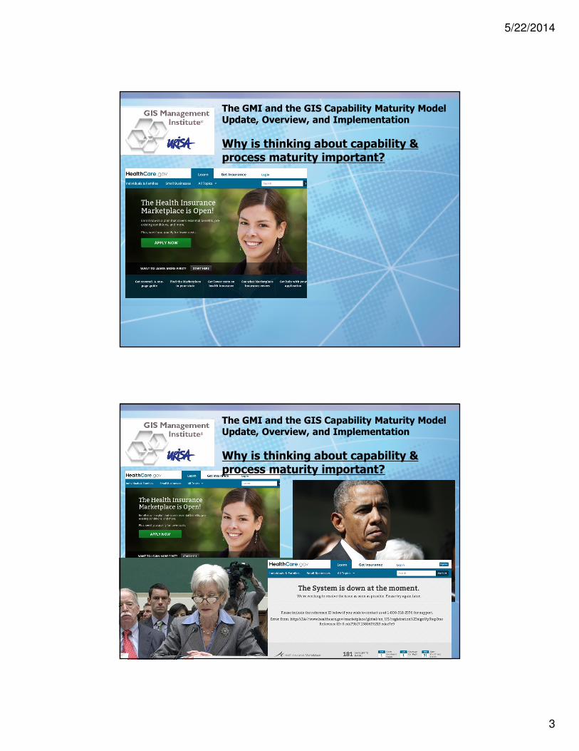
Why is thinking about capability & process maturity important?
The GMI and the GIS Capability Maturity ModelUpdate, Overview, and Implementation
Why is thinking about capability & process maturity important?

5/22/2014
4
The GMI and the GIS Capability Maturity ModelUpdate, Overview, and Implementation
The Capability Maturity Model Institute
The GMI and the GIS Capability Maturity ModelUpdate, Overview, and Implementation
Who uses CMMi?
5/22/2014
5
The GMI and the GIS Capability Maturity ModelUpdate, Overview, and Implementation
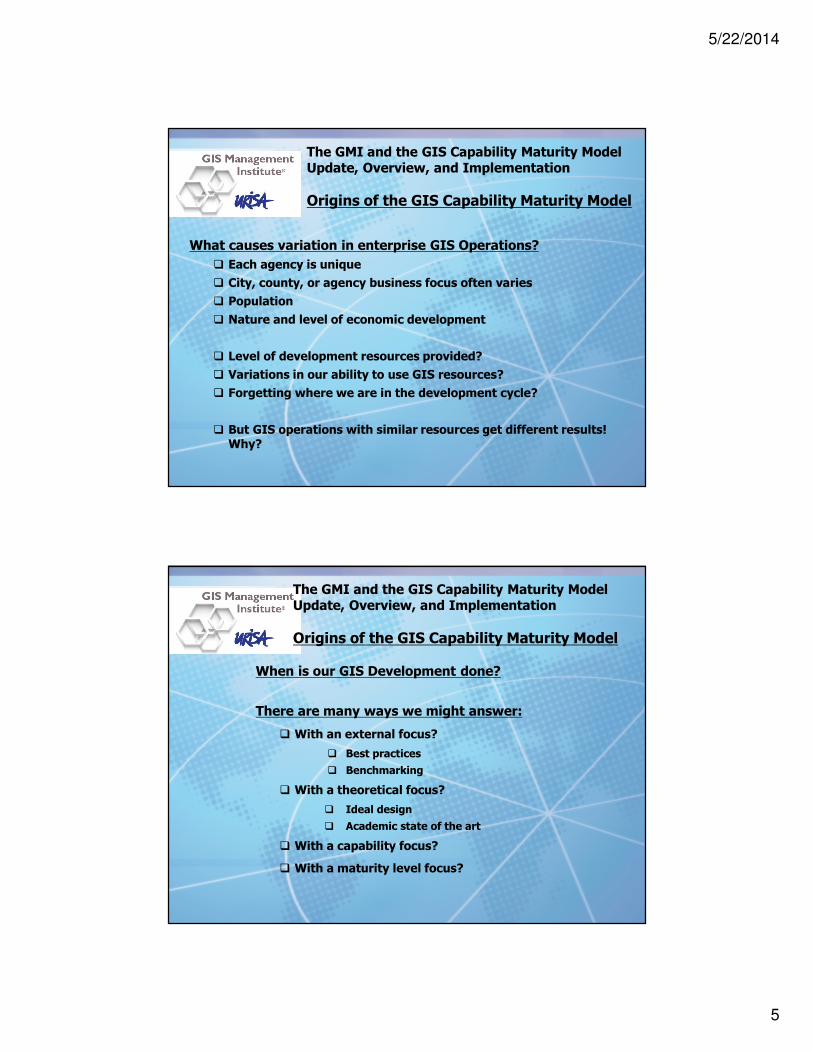
Origins of the GIS Capability Maturity Model
What causes variation in enterprise GIS Operations?
� Each agency is unique
� City, county, or agency business focus often varies
� Population
� Nature and level of economic development
� Level of development resources provided?
� Variations in our ability to use GIS resources?
� Forgetting where we are in the development cycle?
� But GIS operations with similar resources get different results! Why?
The GMI and the GIS Capability Maturity ModelUpdate, Overview, and Implementation
Origins of the GIS Capability Maturity Model
When is our GIS Development done?
There are many ways we might answer:
� With an external focus?
� Best practices
� Benchmarking
� With a theoretical focus?
� Ideal design
� Academic state of the art
� With a capability focus?
� With a maturity level focus?

5/22/2014
6
2009 Academic Exercise:
� Maturity for the proposed model indicates progression of an
organization towards GIS capability that maximizes:
� Potential for the use of state of the art GIS technology
� Commonly recognized quality data
� Organizational best practices appropriate for municipal business use
� The Municipal GIS Capability Maturity Model assumes two broad areas of GIS operational development:
� Enabling capability
� Execution ability
The GMI and the GIS Capability Maturity ModelUpdate, Overview, and Implementation
Origins of the GIS Capability Maturity Model
The GMI and the GIS Capability Maturity ModelUpdate, Overview, and Implementation
Origins of the GIS Capability Maturity Model
Enabling Capability Components:
What we buy or acquire for our GIS operation…
5/22/2014
7
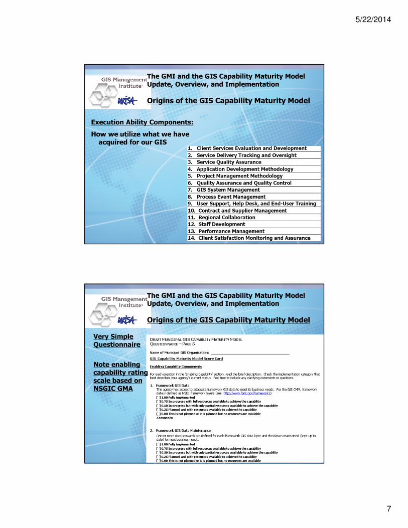
The GMI and the GIS Capability Maturity ModelUpdate, Overview, and Implementation
Origins of the GIS Capability Maturity Model
Execution Ability Components:
How we utilize what we have acquired for our GIS
The GMI and the GIS Capability Maturity ModelUpdate, Overview, and Implementation
Origins of the GIS Capability Maturity Model
Very Simple Questionnaire
Note enabling capability rating scale based on NSGIC GMA

5/22/2014
8
The GMI and the GIS Capability Maturity ModelUpdate, Overview, and Implementation
Origins of the GIS Capability Maturity Model
Very Simple Questionnaire
Note execution ability rating scale based on SEI CMM
The GMI and the GIS Capability Maturity ModelUpdate, Overview, and Implementation
Origins of the GIS Capability Maturity Model
2009 State of Washington Survey Results Presented at URISA Annual Conference:

5/22/2014
9
The GMI and the GIS Capability Maturity ModelUpdate, Overview, and Implementation
Origins of the GIS Capability Maturity Model
2009 State of Washington Survey Results Presented at URISA Annual Conference:
The GMI and the GIS Capability Maturity ModelUpdate, Overview, and Implementation
URISA Steps In

5/22/2014
10
The GMI and the GIS Capability Maturity ModelUpdate, Overview, and Implementation
URISA Steps In
2010 ArcNews Article in URISA GIS Management
Babinski’s Theory of GIS Management: As GIS Operational Maturity Improves, ROI Increases
The GMI and the GIS Capability Maturity ModelUpdate, Overview, and Implementation
URISA Steps In
� 2010: David DiBiase Proposes that URISA develop the Geospatial Management Competency Model (Tier 9 of the USDOLETA Geospatial Technology Competency Model)
� 2011: DiBiase, Babinski & Kennelly form URISA GMCM Committee
� 2011: Babinski convenes GIS Managers Task Force at Washington GIS Conference to:
� Create GMCM ‘Strawman’ Draft
� Review and revise the GIS Capability Maturity Model
� 2011: At GIS-Pro in Indianapolis, GMCM Committee revises Strawman Draft and by early 2012 Publishes GMCM for peer-review.
5/22/2014
11
The GMI and the GIS Capability Maturity ModelUpdate, Overview, and Implementation
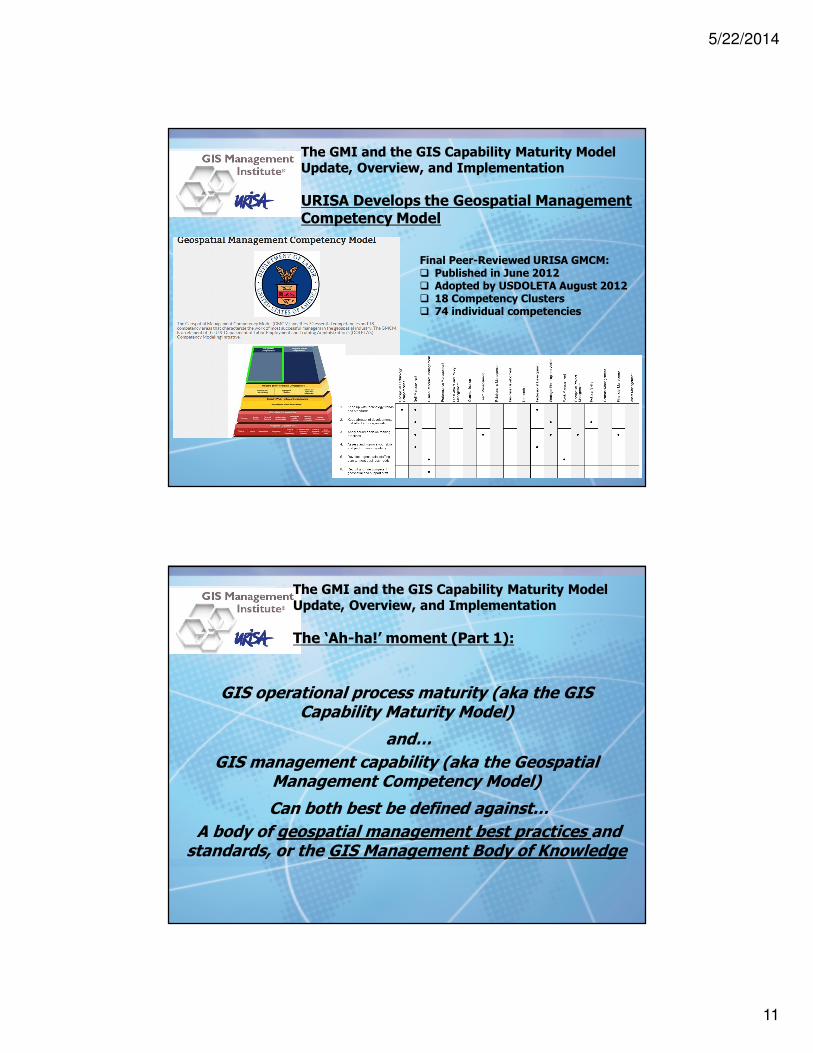
URISA Develops the Geospatial Management Competency Model
Final Peer-Reviewed URISA GMCM:� Published in June 2012� Adopted by USDOLETA August 2012� 18 Competency Clusters� 74 individual competencies
The GMI and the GIS Capability Maturity ModelUpdate, Overview, and Implementation
The ‘Ah-ha!’ moment (Part 1):
GIS operational process maturity (aka the GIS Capability Maturity Model)
and…
GIS management capability (aka the Geospatial Management Competency Model)
Can both best be defined against…
A body of geospatial management best practices and standards, or the GIS Management Body of Knowledge

5/22/2014
12
The GMI and the GIS Capability Maturity ModelUpdate, Overview, and Implementation
The ‘Ah-ha!’ moment (Part 2):
No one has ever defined
geospatial management best practices and standards
The GMI and the GIS Capability Maturity ModelUpdate, Overview, and Implementation
URISA Steps In
� 2010: David DiBiase Proposes that URISA develop the Geospatial Management Competency Model (Tier 9 of the USDOLETA Geospatial Technology Competency Model)
� 2011: DiBiase, Babinski & Kennelly form URISA GMCM Committee
� 2011: Babinski convenes GIS Managers Task Force at Washington GIS Conference to:
� Create GMCM ‘Strawman’ Draft
� Review and revise the GIS Capability Maturity Model
� 2011: At GIS-Pro in Indianapolis, GMCM Committee revises Strawman Draft and by early 2012 Publishes GMCM for peer-review.

5/22/2014
13
The GMI and the GIS Capability Maturity ModelUpdate, Overview, and Implementation
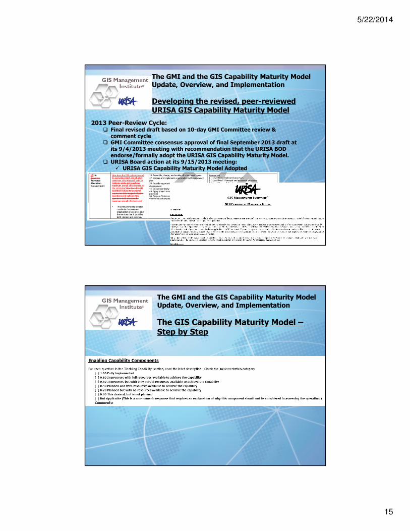
Developing the revised, peer-reviewed URISA GIS Capability Maturity Model
2011 Washington State GIS Managers Task Force
The GMI and the GIS Capability Maturity ModelUpdate, Overview, and Implementation
Developing the revised, peer-reviewed URISA GIS Capability Maturity Model
2012 – 2013 GMI Committee:� Incorporated 2011 GIS Managers Task Force Recommendations� Correlated 74 GMCM competencies� Prompted for assessing ‘Characteristics’ via questions

5/22/2014
14
The GMI and the GIS Capability Maturity ModelUpdate, Overview, and Implementation
Developing the revised, peer-reviewed URISA GIS Capability Maturity Model
2013 Peer-Review Cycle:� 6-weeks for public review via online questionnaire� Adequate high-quality responses� Responses consolidated by Hilary Perkins and Greg Babinski� Greg Babinski drafted initial recommendations to address/resolve comments
� Final 10-day GMI Committee review & comment cycle
The GMI and the GIS Capability Maturity ModelUpdate, Overview, and Implementation
Developing the revised, peer-reviewed URISA GIS Capability Maturity Model
2013 Peer-Review Cycle:
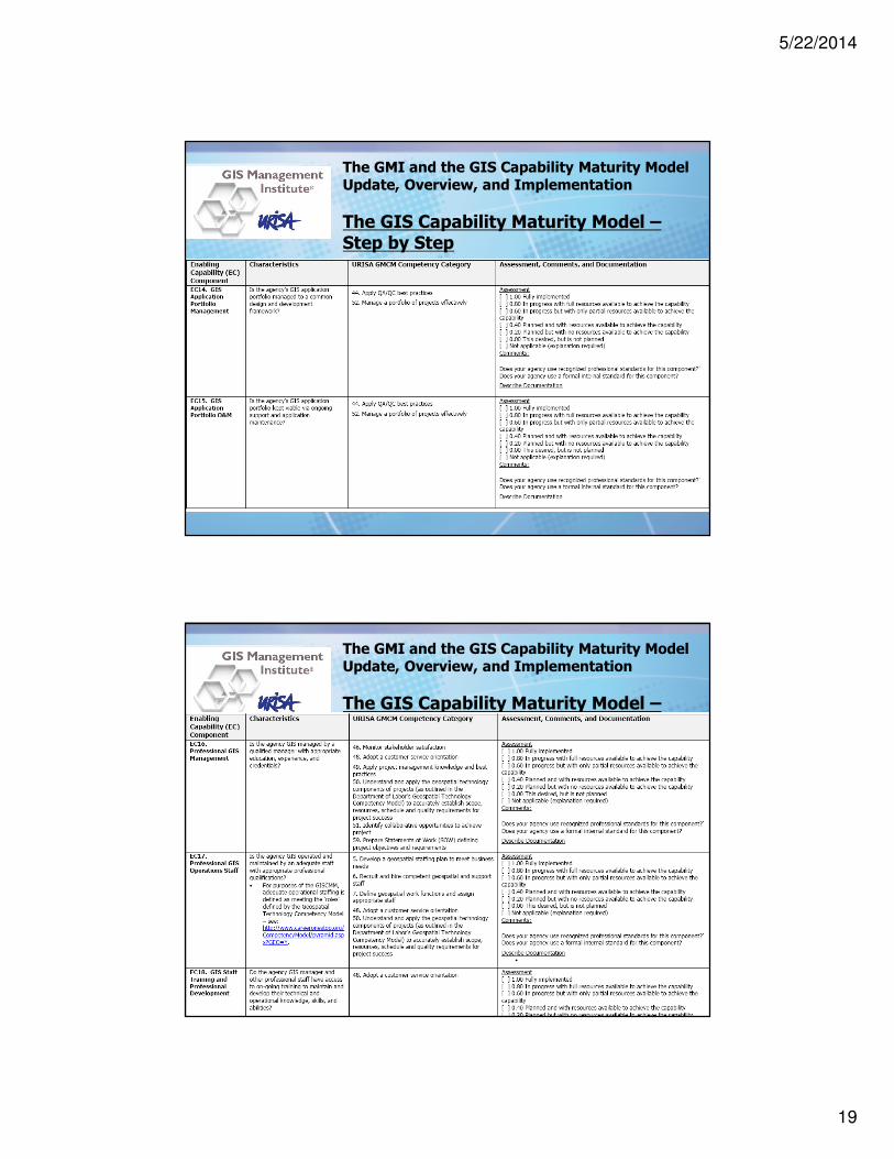
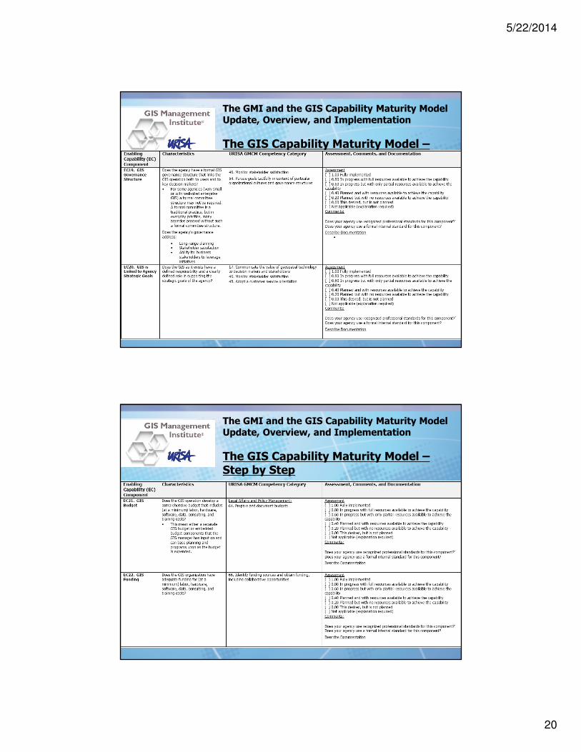
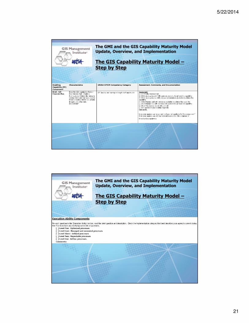
Enabling Capability (EC) ComponentEC1. Framework GIS DataEC2. Framework GIS Data MaintenanceEC3. Business GIS DataEC4. Business GIS Data MaintenanceEC5. GIS Data CoordinationEC6. MetadataEC7. Spatial Data WarehouseEC8. Architectural DesignEC9. Technical InfrastructureEC10. Replacement PlanEC11. GIS Software MaintenanceEC12. Data back-up and securityEC13. GIS Application PortfolioEC14. GIS Application Portfolio ManagementEC15. GIS Application Portfolio O&MEC16. Professional GIS ManagementEC17. Professional GIS Operations StaffEC18. GIS Staff Training and Professional DevelopmentEC19. GIS Governance StructureEC20. GIS is Linked to Agency Strategic GoalsEC21. GIS BudgetEC22. GIS FundingEC23. GIS Financial Plan
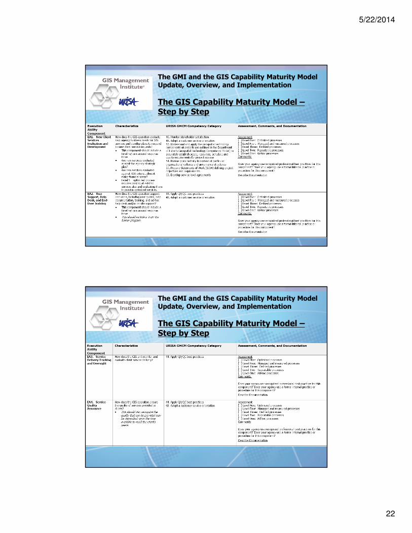
Execution Ability (EA) ComponentEA1. New Client Services Evaluation and DevelopmentEA2. User Support, Help Desk, and End-User TrainingEA3. Service Delivery Tracking and OversightEA4. Service Quality AssuranceEA5. Application Development or Procurement MethodologyEA6. Project Management MethodologyEA7. Quality Assurance and Quality ControlEA8. GIS System ManagementEA9. Process Event ManagementEA10. Contract and Supplier ManagementEA11. Regional CollaborationEA12. Staff DevelopmentEA13. Operation Performance ManagementEA14. Individual GIS Staff Performance ManagementEA15. Client Satisfaction Monitoring and AssuranceEA16. Resource Allocation ManagementEA17. GIS data sharingEA18. GIS Software License SharingEA19. GIS data inter-operabilityEA20. Legal and policy affairs managementEA21. Balancing minimal privacy with maximum data usageEA22. Service to the community and to the profession
5/22/2014
15
The GMI and the GIS Capability Maturity ModelUpdate, Overview, and Implementation
Developing the revised, peer-reviewed URISA GIS Capability Maturity Model
2013 Peer-Review Cycle:� Final revised draft based on 10-day GMI Committee review & comment cycle
� GMI Committee consensus approval of final September 2013 draft at its 9/4/2013 meeting with recommendation that the URISA BOD endorse/formally adopt the URISA GIS Capability Maturity Model.
� URISA Board action at its 9/15/2013 meeting:� URISA GIS Capability Maturity Model Adopted
The GMI and the GIS Capability Maturity ModelUpdate, Overview, and Implementation
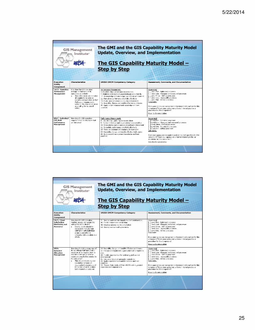
The GIS Capability Maturity Model –Step by Step

5/22/2014
16
The GMI and the GIS Capability Maturity ModelUpdate, Overview, and Implementation
The GIS Capability Maturity Model –Step by Step
The GMI and the GIS Capability Maturity ModelUpdate, Overview, and Implementation
The GIS Capability Maturity Model –Step by Step

5/22/2014
17
The GMI and the GIS Capability Maturity ModelUpdate, Overview, and Implementation
The GIS Capability Maturity Model –Step by Step
The GMI and the GIS Capability Maturity ModelUpdate, Overview, and Implementation
The GIS Capability Maturity Model –Step by Step

5/22/2014
18
The GMI and the GIS Capability Maturity ModelUpdate, Overview, and Implementation
The GIS Capability Maturity Model –Step by Step
The GMI and the GIS Capability Maturity ModelUpdate, Overview, and Implementation
The GIS Capability Maturity Model –Step by Step
5/22/2014
19
The GMI and the GIS Capability Maturity ModelUpdate, Overview, and Implementation
The GIS Capability Maturity Model –Step by Step
The GMI and the GIS Capability Maturity ModelUpdate, Overview, and Implementation
The GIS Capability Maturity Model –Step by Step
5/22/2014
20
The GMI and the GIS Capability Maturity ModelUpdate, Overview, and Implementation
The GIS Capability Maturity Model –Step by Step
The GMI and the GIS Capability Maturity ModelUpdate, Overview, and Implementation
The GIS Capability Maturity Model –Step by Step
5/22/2014
21
The GMI and the GIS Capability Maturity ModelUpdate, Overview, and Implementation
The GIS Capability Maturity Model –Step by Step
The GMI and the GIS Capability Maturity ModelUpdate, Overview, and Implementation
The GIS Capability Maturity Model –Step by Step
5/22/2014
22
The GMI and the GIS Capability Maturity ModelUpdate, Overview, and Implementation
The GIS Capability Maturity Model –Step by Step
The GMI and the GIS Capability Maturity ModelUpdate, Overview, and Implementation
The GIS Capability Maturity Model –Step by Step

5/22/2014
23
The GMI and the GIS Capability Maturity ModelUpdate, Overview, and Implementation
The GIS Capability Maturity Model –Step by Step
The GMI and the GIS Capability Maturity ModelUpdate, Overview, and Implementation
The GIS Capability Maturity Model –Step by Step

5/22/2014
24
The GMI and the GIS Capability Maturity ModelUpdate, Overview, and Implementation
The GIS Capability Maturity Model –Step by Step
The GMI and the GIS Capability Maturity ModelUpdate, Overview, and Implementation
The GIS Capability Maturity Model –Step by Step
5/22/2014
25
The GMI and the GIS Capability Maturity ModelUpdate, Overview, and Implementation
The GIS Capability Maturity Model –Step by Step
The GMI and the GIS Capability Maturity ModelUpdate, Overview, and Implementation
The GIS Capability Maturity Model –Step by Step

5/22/2014
26
The GMI and the GIS Capability Maturity ModelUpdate, Overview, and Implementation
The GIS Capability Maturity Model –Step by Step
The GMI and the GIS Capability Maturity ModelUpdate, Overview, and Implementation
The GIS Capability Maturity Model –Step by Step

5/22/2014
27
The GMI and the GIS Capability Maturity ModelUpdate, Overview, and Implementation
The GIS Capability Maturity Model –Step by Step
The GMI and the GIS Capability Maturity ModelUpdate, Overview, and Implementation
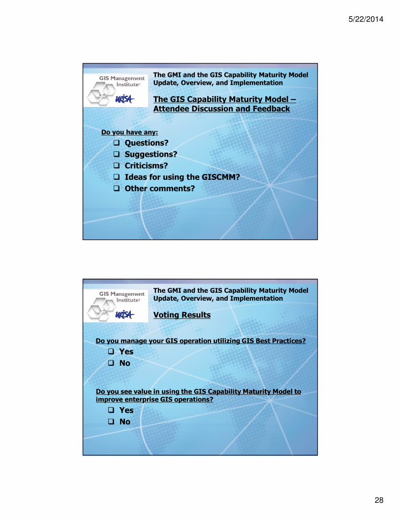
The GIS Capability Maturity Model –Please vote:
Do you see value in using the GIS Capability Maturity Model to improve enterprise GIS operations?
� Yes
� No
5/22/2014
28
The GMI and the GIS Capability Maturity ModelUpdate, Overview, and Implementation
The GIS Capability Maturity Model –Attendee Discussion and Feedback
Do you have any:
� Questions?
� Suggestions?
� Criticisms?
� Ideas for using the GISCMM?
� Other comments?
The GMI and the GIS Capability Maturity ModelUpdate, Overview, and Implementation
Voting Results

5/22/2014
29
The GMI and the GIS Capability Maturity ModelUpdate, Overview, and Implementation
The pivotal role of the GISCMM in the GIS Management Institute®
The GMI and the GIS Capability Maturity ModelUpdate, Overview, and Implementation
Enhancing sustainable Enterprise GIS

5/22/2014
30
The GMI and the GIS Capability Maturity ModelUpdate, Overview, and Implementation
Enhancing sustainable Enterprise GIS
� Submit completed GISCMM self assessments to GMI
� Annual GMI Report on the state of Enterprise GIS
� New URISA GMI Service: Enterprise GIS Assessment/Accreditation:
� Online survey instrument
� Self assessment with validation mechanisms
� Compilation of bench marking metrics
� Evaluation against GISCMM
� Manager assessment against GMCM
� Feedback report with benchmark analysis and development recommendations
� GMIcmm Maturity Level Accreditation
The GMI and the GIS Capability Maturity ModelUpdate, Overview, and Implementation
Enhancing sustainable Enterprise GIS

5/22/2014
31
The GMI and the GIS Capability Maturity ModelUpdate, Overview, and Implementation
Enhancing sustainable Enterprise GIS
The GMI and the GIS Capability Maturity ModelUpdate, Overview, and Implementation
Enhancing sustainable Enterprise GIS

5/22/2014
32
The GMI and the GIS Capability Maturity ModelUpdate, Overview, and Implementation
Enhancing sustainable Enterprise GIS
The GMI and the GIS Capability Maturity ModelUpdate, Overview, and Implementation
Enhancing sustainable Enterprise GIS

5/22/2014
33
The GMI and the GIS Capability Maturity ModelUpdate, Overview, and Implementation
Enhancing professionalism for GIS managers
The competency of the GIS manager is one of the key success factors for an effective enterprise GIS
The GMI and the GIS Capability Maturity ModelUpdate, Overview, and Implementation
Enhancing professionalism for GIS managers
Assessing the competency of a GIS manager against the Geospatial Management Competency Model

5/22/2014
34
The GMI and the GIS Capability Maturity ModelUpdate, Overview, and Implementation
The GIS Management Institute®
Next steps

5/22/2014
35
The GMI and the GIS Capability Maturity ModelUpdate, Overview, and Implementation
Contributors:
The GMI and the GIS Capability Maturity ModelUpdate, Overview, and Implementation
Contributors:

5/22/2014
36
The GMI and the GIS Capability Maturity ModelUpdate, Overview, and Implementation
Greg Babinski, MA, GISPURISA Past-PresidentURISA GMI Committee ChairCOGO SecretaryW: www.urisa.org/main/gis-management-institute/
Finance & Marketing Manager
King County GIS Center201 South Jackson StreetMS: KSC-IT-0706Seattle, WA 98104 USA
P: 206-477-4402F: 206-263-3145E: [email protected]: @gbabinskiW: www.kingcounty.gov/gis