Embed Size (px)
Citation preview

1
Route alignment Nairobi – Naivasha SGR development
Media briefing on Nairobi – Naivasha SGR approved route
Nairobi Serena
A. K. MainaManaging Director
13-09-16
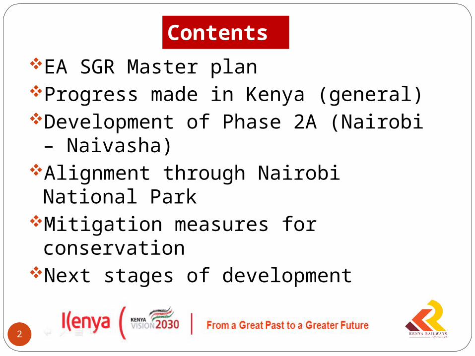
ContentsEA SGR Master planProgress made in Kenya (general)Development of Phase 2A (Nairobi –
Naivasha)Alignment through Nairobi National ParkMitigation measures for conservationNext stages of development
2

The EA SG Railways Master plan
3

Approved by the EA Community Secretariat
Each country to develop railways within its territory
Kenya, Uganda, Rwanda and South Sudan have signed and ratified the SGR protocol for developing the railway connecting Mombasa to Kampala, Kigali and Juba
4
The EA SG Railways Master plan
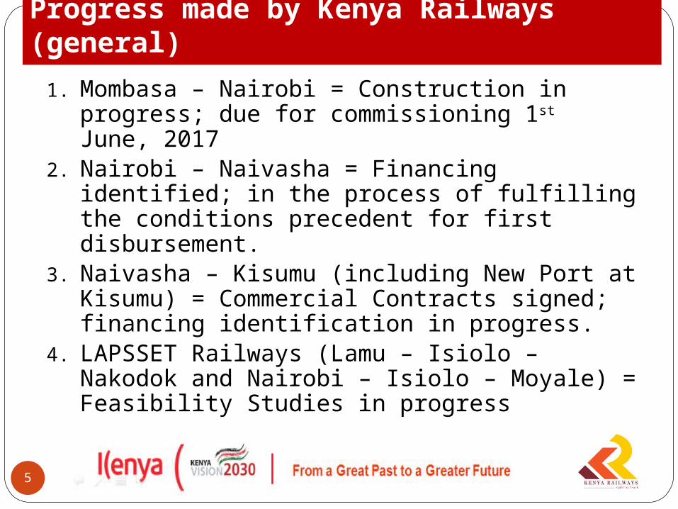
1. Mombasa – Nairobi = Construction in progress; due for commissioning 1st June, 2017
2. Nairobi – Naivasha = Financing identified; in the process of fulfilling the conditions precedent for first disbursement.
3. Naivasha – Kisumu (including New Port at Kisumu) = Commercial Contracts signed; financing identification in progress.
4. LAPSSET Railways (Lamu – Isiolo – Nakodok and Nairobi – Isiolo – Moyale) = Feasibility Studies in progress
5
Progress made by Kenya Railways (general)
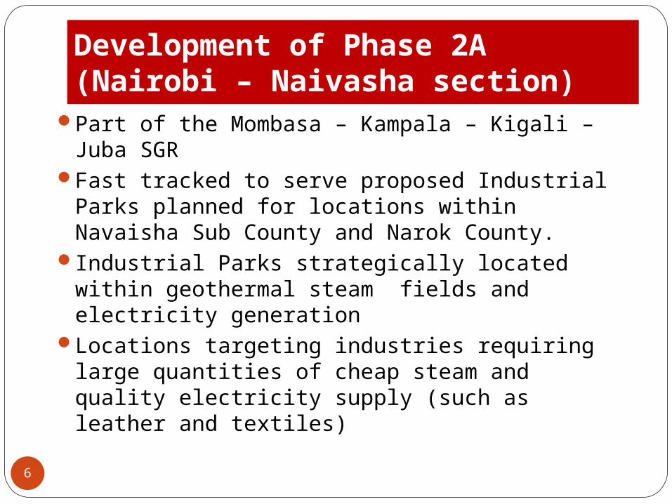
Development of Phase 2A (Nairobi – Naivasha section)
Part of the Mombasa – Kampala – Kigali – Juba SGR
Fast tracked to serve proposed Industrial Parks planned for locations within Navaisha Sub County and Narok County.
Industrial Parks strategically located within geothermal steam fields and electricity generation
Locations targeting industries requiring large quantities of cheap steam and quality electricity supply (such as leather and textiles)
6
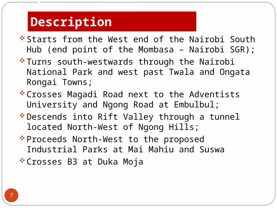
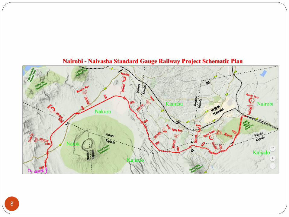
Phase 2A route DescriptionStarts from the West end of the Nairobi South Hub
(end point of the Mombasa – Nairobi SGR);Turns south-westwards through the Nairobi National
Park and west past Twala and Ongata Rongai Towns;
Crosses Magadi Road next to the Adventists University and Ngong Road at Embulbul;
Descends into Rift Valley through a tunnel located North-West of Ngong Hills;
Proceeds North-West to the proposed Industrial Parks at Mai Mahiu and Suswa
Crosses B3 at Duka Moja
7
8
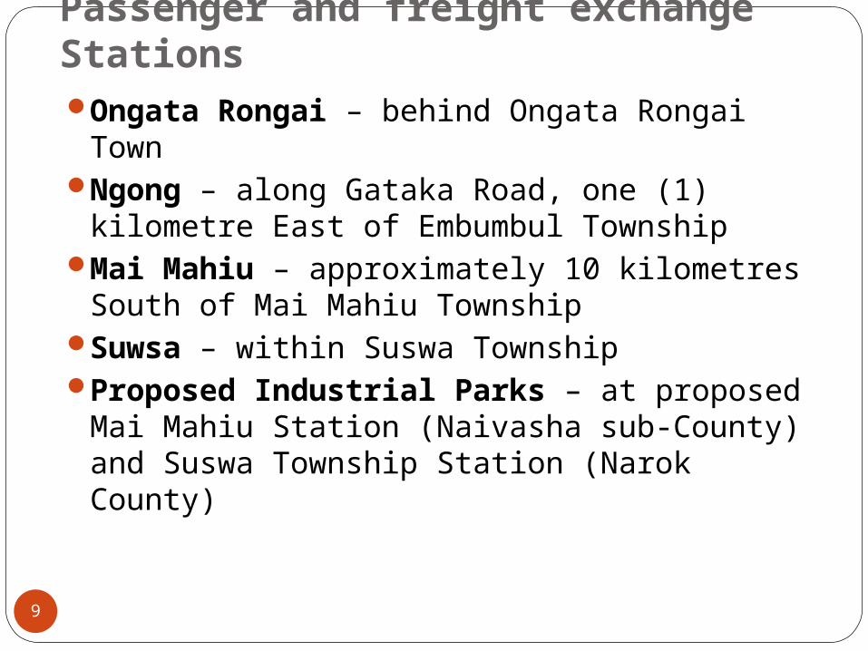
Passenger and freight exchange StationsOngata Rongai – behind Ongata Rongai
TownNgong – along Gataka Road, one (1)
kilometre East of Embumbul TownshipMai Mahiu – approximately 10 kilometres
South of Mai Mahiu TownshipSuwsa – within Suswa TownshipProposed Industrial Parks – at proposed
Mai Mahiu Station (Naivasha sub-County) and Suswa Township Station (Narok County)
9

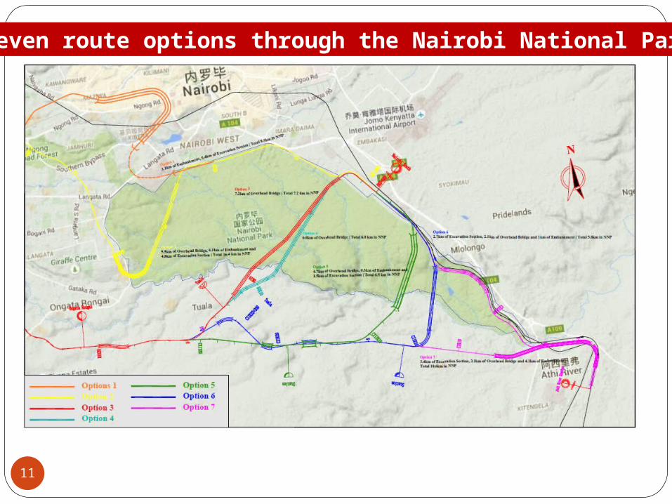
Options considered for alignment across NNP1. Kibera route – route considered originally for
convenient connection to Nairobi South Station;2. NNP forest and Langata/Karen route –shorter than
Kibera route and used in the preliminary designs;3. Savannah route – across savannah of NNP4. Modified Savannah route – approved by KWS5. South-East Route – considered due to less sight
intrusion6. Modified South-East Route – considered due to
even less sight intrusion7. Athi River route – considered due to less
interference with the active part of NNP.
10
11
Seven route options through the Nairobi National Park

12
Alignment Route length (Km) through NNP
Route length (Km) outside NNP up to Ngong' Tunnel
Estimated construction cost up to Ngong’ (Tunnel US$ million)
Estimated annual extra cost of operations compared to ‘Savannah Option’ (US$ Million)
1. Kibera 8.5 32.5 674 02. NNP Forest/
Langata/Karen (Preliminary Designs Option)
16.4 23.0 615 0
3. NNP Savannah Option (Initial Preferred Option)
6.4 28.8 523 0
4. Modified NNP Savannah Option Initial Preferred Option)
6.0 30.2 543 0
Summary of routes details and cost estimates
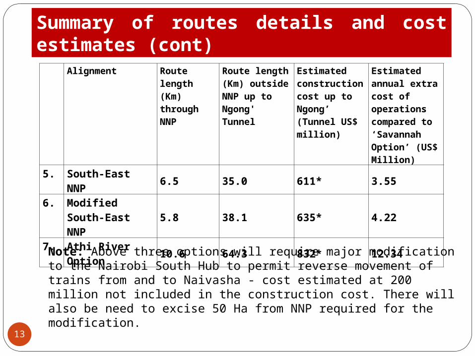
13
Alignment Route length (Km) through NNP
Route length (Km) outside NNP up to Ngong' Tunnel
Estimated construction cost up to Ngong’ (Tunnel US$ million)
Estimated annual extra cost of operations compared to ‘Savannah Option’ (US$ Million)
5. South-East NNP 6.5 35.0 611* 3.556. Modified South-
East NNP 5.8 38.1 635* 4.22
7. Athi River Option 10.6 64.3 832* 12.34
Summary of routes details and cost estimates (cont)
Note: Above three options will require major modification to the Nairobi South Hub to permit reverse movement of trains from and to Naivasha - cost estimated at 200 million not included in the construction cost. There will also be need to excise 50 Ha from NNP required for the modification.
14
SGR crossing the Park
1. SGR crosses the park on a single line bridge spanning the total width of the Park (6.0 Km);
2. Average height of the bridge above the ground = 18 metres – starting from 8 metres at the entrance into the Northern side of the Park and 41 metres at the exit Southern end of the Park;
3. Bridge ensures the Park remains undivided;4. Clearance under the bridge considered adequate for
smooth flow of Wildlife across the bridge and tourists traffic;
5. The bridge is similar to that applied across the Tsavo River where there is evidence wildlife have already got used to passing under the bridge;
Bridge pillar foundations dug deep in the ground to reduce ground vibration during the operations
Noise deflectors installed on the bridge to reduce noise from passing trains
Bridge abutments to be outside the park to prevent human trespass and wildlife escaping
Bridge colour to be chosen for blending with the environment.
Bridge pillars to be at least 32 metres apart for unrestricted movement of wildlife in the Park
15
Railway crossing the Park: Bridge specifications
16
Railway crossing the Park: Mitigations at construction
1. KWS and KR to agree on applicable rules during construction and conduct periodical sensitization to construction staff;
2. Bridge to be constructed in three (3) stages ensuring adequate space for wildlife and tourists traffic• First stage (2.2 Km) near the Northern Boundary of the
Park; wire mesh fence to be erected enclosing the working area leaving the rest of the corridor free for passage of Wildlife
• Second stage (2.1 Km) within the centre of the park; wire mesh fence to be erected enclosing the working area; mesh fence of first stage removed again for free passage of Wildlife.
• Third stage (1.7 Km) - with wire mesh fence for first and second stages removed.
17
1. The fence enclosing construction area designed and constructed according to KWS specification to minimise construction workers/wildlife conflict;
2. Movement of construction equipment and road vehicles restricted within the fenced out working areas;
3. Armed police and security guards stationed at the entrance and exit of the working area;
4. Regular patrols for the integrity of working area fencing immediate repairs.
5. All staff transported outside the Park after working hours; for clarity, no staff to remain inside the Park after 18.00 hours;
6. No construction activity after 18.00 hours;
Railway crossing the Park: Mitigations at construction
18
Modified Savannah option: Mitigations (cont.)
1. Excavated soil to be leveled within the Right of Way.2. Where excavated soil is to be disposed outside the
Right of Way, KR will request for permission from KWS and disposal will strictly adhere to KWS and NEMA guidelines
3. Slurry waste from drilling will be disposed of timely by the contractor to the satisfaction of KWS;
4. Spoil piles may be landscaped as required by KWS;5. Portable toilets shall be used inside the Park and only
within the fenced working area;6. At completion of constructions, the sites shall be
restored to the satisfaction of KWS.
19
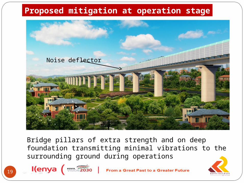
Proposed mitigation at operation stage
Noise deflector
Bridge pillars of extra strength and on deep foundation transmitting minimal vibrations to the surrounding ground during operations

20
Bridge abutment
Proposed mitigation at operation stage
Bridge abutment is located outside the park boundary and park fencing starts inside the bridge to discourage human trespass and Wildlife escaping
Unrestricted underpass for wildlife
Next stages of development following approval of the routeEnvironmental and Social Impact
Assessment E&SIA along the entire routeStake holders consultations along the routeLand acquisition processPayments and releasing the corridorContractor mobilisation and start of
construction(Construction expected to take 54 months
formed by the length of time to be taken drilling the Ngong Hills Tunnel)
21
22
THANK YOU


![SERVANT - sgr-store.com1].pdf · 2019 SGR SERVANT LEADERSHIP CONFERENCE. TABLE OF . CONTENTS. 2019 SGR SERVANT LEADERSHIP CONFERENCE PACIFIC NORTHWEST. 2019_SGR_Conference_PNW_Guide](https://img.pdfslide.us/doc/110x75/5f5a796013ea3c79ea64a464/servant-sgr-storecom-1pdf-2019-sgr-servant-leadership-conference-table-of.jpg)