Embed Size (px)
Citation preview
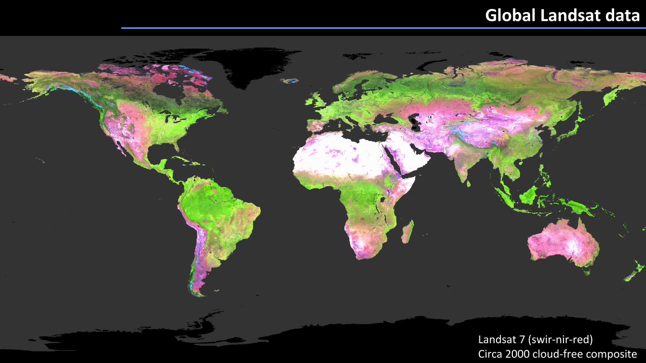
Global Landsat data
Landsat 7 (swir-nir-red)Circa 2000 cloud-free composite
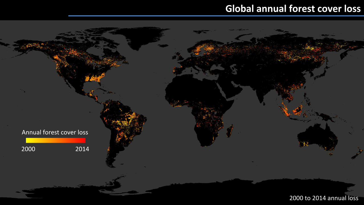
Global annual forest cover loss
2000 to 2014 annual loss
2000 2014
Annual forest cover loss
2001
2013
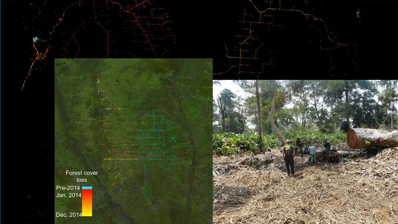
Forest coverloss
Pre-2014Jan. 2014
Forest coverloss
Dec. 2014
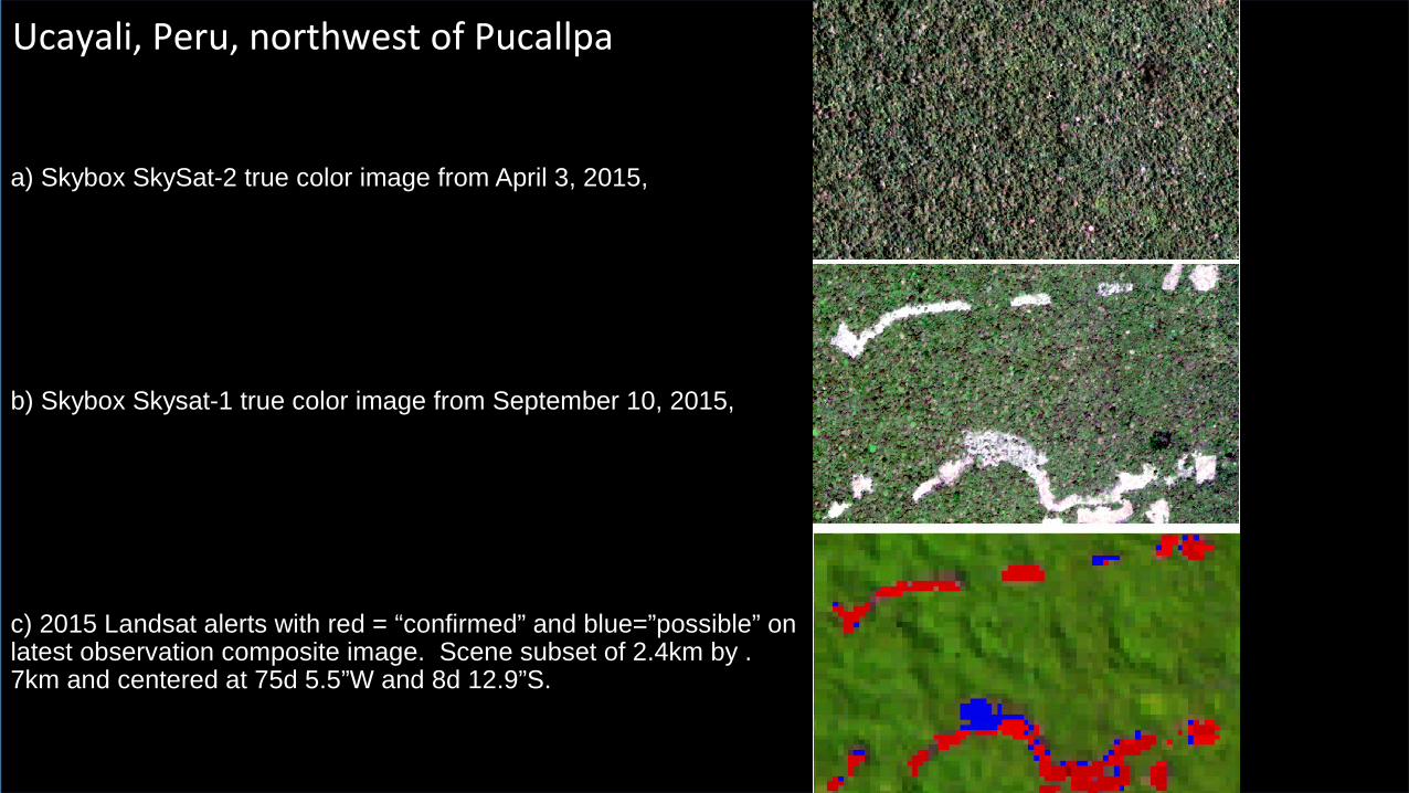
a) Skybox SkySat-2 true color image from April 3, 2015,
b) Skybox Skysat-1 true color image from September 10, 2015,
c) 2015 Landsat alerts with red = “confirmed” and blue=”possible” on latest observation composite image. Scene subset of 2.4km by .7km and centered at 75d 5.5”W and 8d 12.9”S.
Ucayali, Peru, northwest of Pucallpa
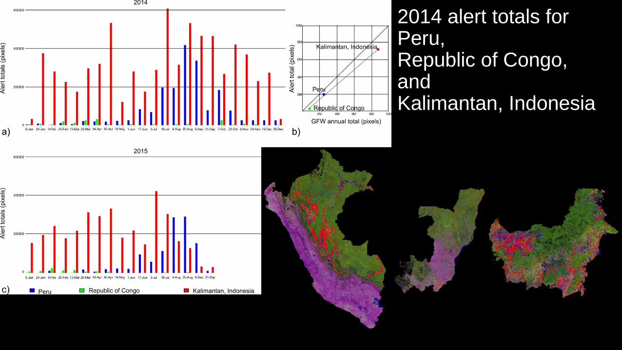
2014 alert totals forPeru, Republic of Congo, and Kalimantan, Indonesia
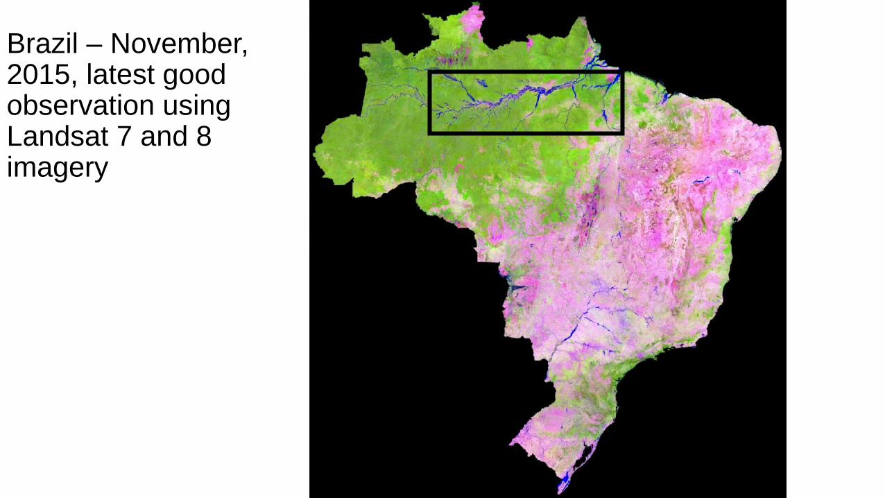
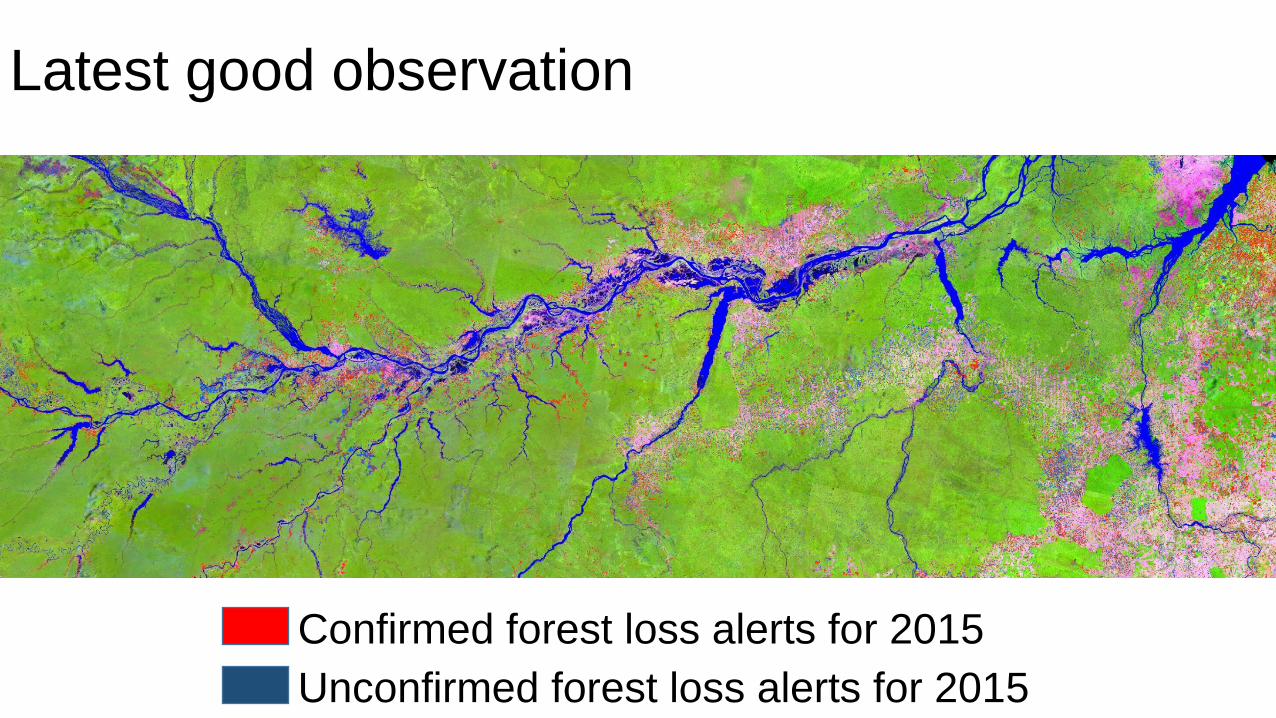
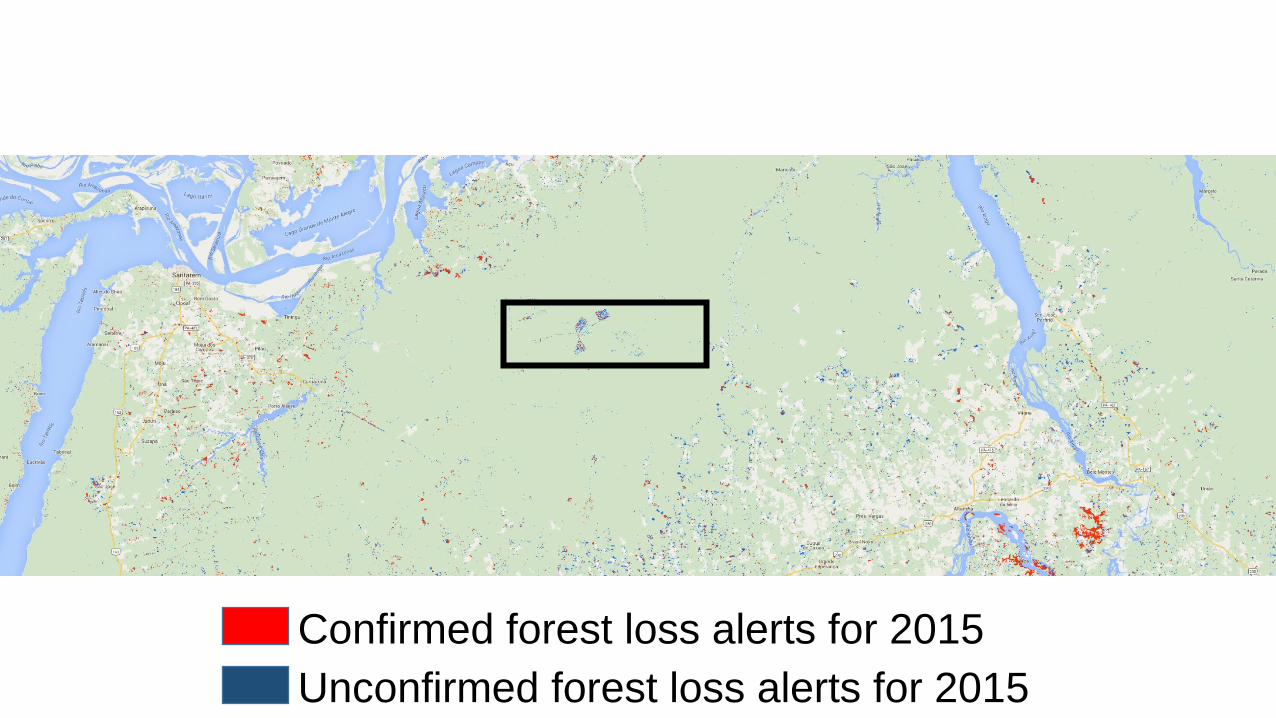
Brazil – November, 2015, latest good observation using Landsat 7 and 8 imagery
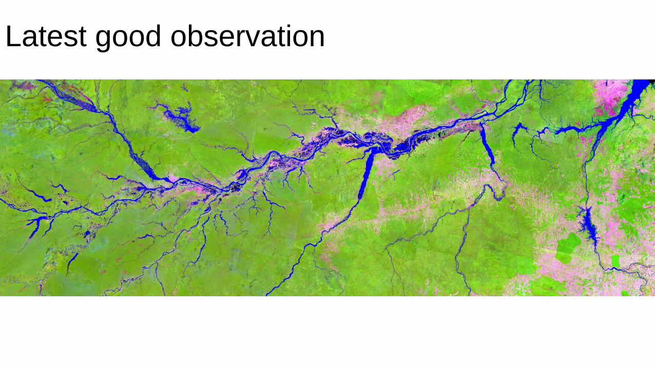
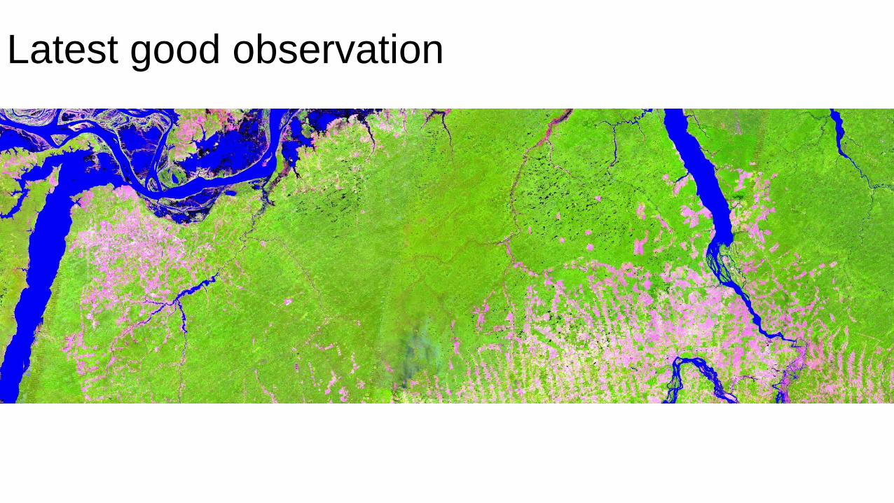
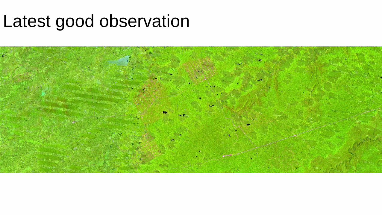
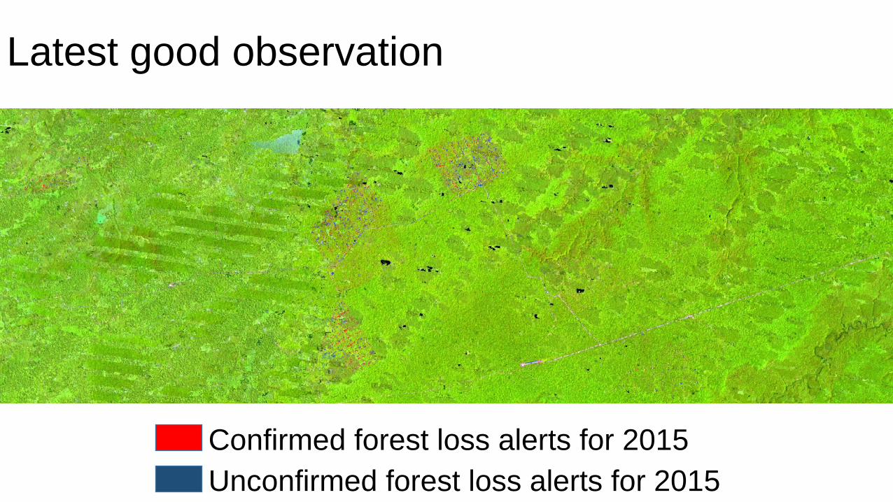
Latest good observation
Latest good observation
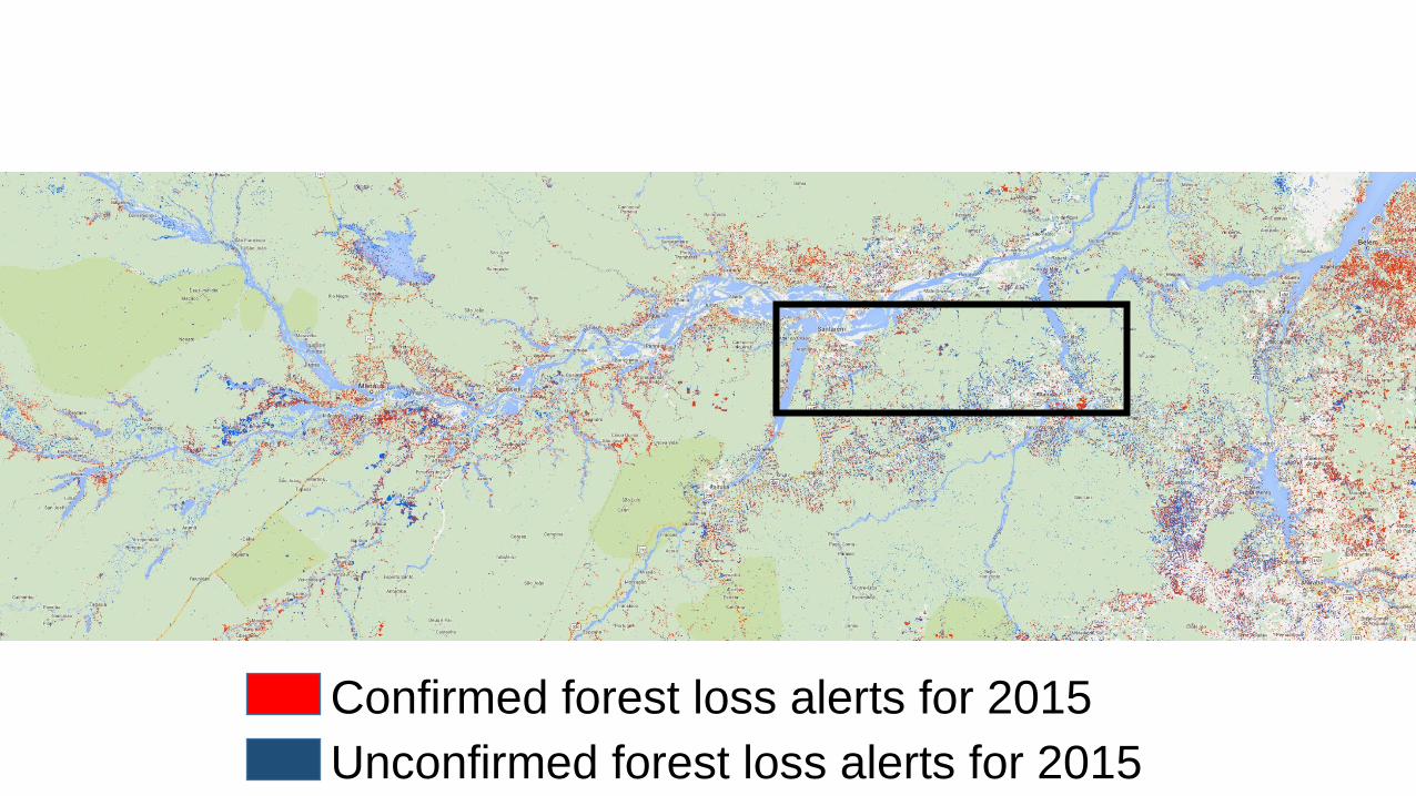
Confirmed forest loss alerts for 2015Unconfirmed forest loss alerts for 2015
Confirmed forest loss alerts for 2015Unconfirmed forest loss alerts for 2015
Latest good observation
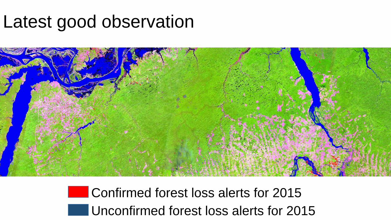
Confirmed forest loss alerts for 2015Unconfirmed forest loss alerts for 2015
Latest good observation
Confirmed forest loss alerts for 2015Unconfirmed forest loss alerts for 2015
Latest good observation
Confirmed forest loss alerts for 2015Unconfirmed forest loss alerts for 2015
Latest good observation

Confirmed forest loss alertUnconfirmed forest loss alert
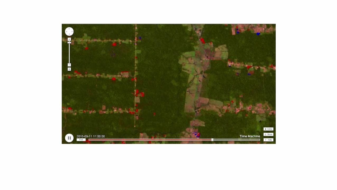
30m weekly forest disturbance alerts
• Near-real time updates on landscapes experiencing forest disturbance
• Serves as an indicator product with low commission error, not as an area estimator
• A complementary product to the annual global map
• In production for Peru, Republic of Congo and Kalimantan, Indonesia
• Expanding pan-tropically in 2016
• Globally in 2017