Embed Size (px)
Citation preview
Written by Tom M. Crimmins
In association with the National Off-Highway VehicleConservation Council
NO31-56 Cover 12/6/07 11:23 AM Page 1
© 2006 NOHVCC all rights reserved Reproduction prohibited without permission of NOHVCC.
Management Guidelines for Off-Highway Vehicle Recreation
A resource guide to assist in the planning, development,operation, and maintenance of environmentally sustainable
and quality OHV trails, trail systems, and areas.
Written by Tom M. Crimmins
In association with the
National Off-Highway Vehicle Conservation Council.
Introduction 4
User Needs and Desires 6Activities
Vehicle Types
OHV Enthusiast Desires
The 4 E’s of OHV Management 12Engineering
Education
Enforcement
Evaluation
Developing the Vision 20Type of Vehicles
Opportunities Available
Facilities Provided
Management Approach
System and Route Planning 21Making the Transition to Designated Routes
Route Inventory
System Layout
Understand Rider Needs
Adequate Experience
Loop Opportunities
Diversity in Trail Difficulty
Access to Desirable Features
Access to Camping Opportunities
Support Facilities
Opportunities for Young Riders
Avoid Fixation on Existing Trails
One-Way Trails
Trail Design 33Trail Management Objectives
Environmental Protection
Maintenance Efficiency
Rider Satisfaction
Site-specific Factors
Active Management 36Information and Education
Management Presence
Trail Maintenance
Volunteers
Monitoring
Enforcement
Summary 45
3Table of Contents2 Book Sponsors
Book Sponsors
This document wasproduced, in part, with financialsupport from the RecreationalTrails Program of the FederalHighway Administration U.S.Department of Transportation.
This document isdisseminated under sponsorshipof the U.S. Department ofTransportation in the interest of information exchange. The United States Governmentassumes no liability for itscontents or use thereof.
The contents of thisdocument reflect the views of the contractor, who is responsiblefor the accuracy of the datapresented herein. The contents do not necessarily reflect theofficial policy of the Departmentof Transportation. This documentdoes not constitute a standard,specification, or regulation.
The United StatesGovernment does not endorseproducts or manufacturers. Trade or manufacturers’names only appear in the content because they areconsidered essential to the object of this document.
Table of Contents
A winding trail on vast western lands or a tight eastern forest trail both equal quality
days for off-highway vehicle enthusiasts.
5Introduction4 Introduction
The Case for Management
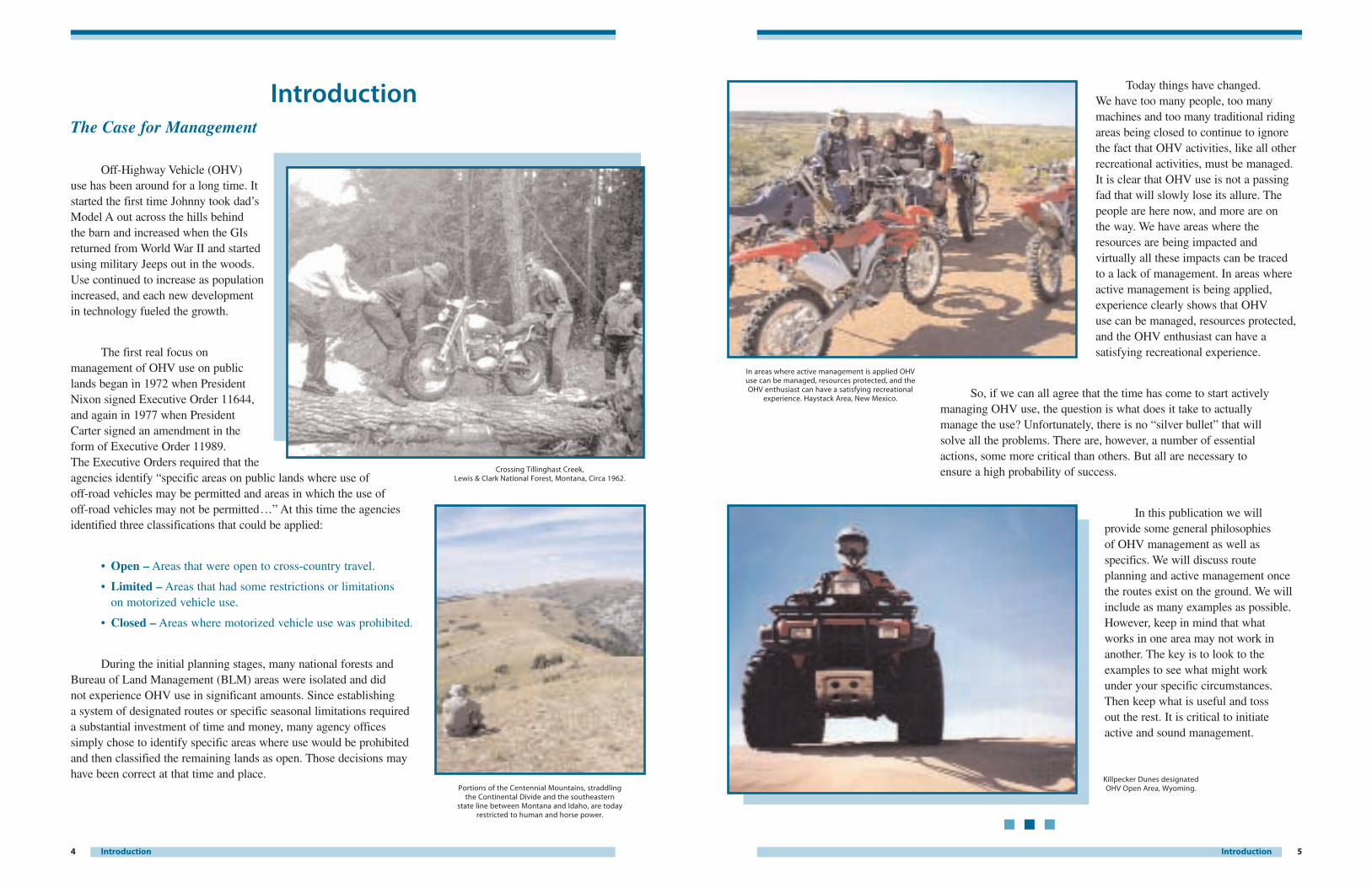
Off-Highway Vehicle (OHV) use has been around for a long time. Itstarted the first time Johnny took dad’sModel A out across the hills behind the barn and increased when the GIsreturned from World War II and startedusing military Jeeps out in the woods.Use continued to increase as populationincreased, and each new development in technology fueled the growth.
The first real focus onmanagement of OHV use on publiclands began in 1972 when PresidentNixon signed Executive Order 11644,and again in 1977 when PresidentCarter signed an amendment in the form of Executive Order 11989. The Executive Orders required that theagencies identify “specific areas on public lands where use of off-road vehicles may be permitted and areas in which the use of off-road vehicles may not be permitted…” At this time the agenciesidentified three classifications that could be applied:
• Open – Areas that were open to cross-country travel.
• Limited – Areas that had some restrictions or limitations on motorized vehicle use.
• Closed – Areas where motorized vehicle use was prohibited.
During the initial planning stages, many national forests andBureau of Land Management (BLM) areas were isolated and did not experience OHV use in significant amounts. Since establishing a system of designated routes or specific seasonal limitations requireda substantial investment of time and money, many agency officessimply chose to identify specific areas where use would be prohibitedand then classified the remaining lands as open. Those decisions mayhave been correct at that time and place.
Today things have changed. We have too many people, too manymachines and too many traditional ridingareas being closed to continue to ignorethe fact that OHV activities, like all otherrecreational activities, must be managed.It is clear that OHV use is not a passingfad that will slowly lose its allure. Thepeople are here now, and more are on the way. We have areas where theresources are being impacted andvirtually all these impacts can be tracedto a lack of management. In areas whereactive management is being applied,experience clearly shows that OHV use can be managed, resources protected,and the OHV enthusiast can have asatisfying recreational experience.
So, if we can all agree that the time has come to start activelymanaging OHV use, the question is what does it take to actually manage the use? Unfortunately, there is no “silver bullet” that willsolve all the problems. There are, however, a number of essential actions, some more critical than others. But all are necessary to ensure a high probability of success.
In this publication we willprovide some general philosophies of OHV management as well asspecifics. We will discuss routeplanning and active management oncethe routes exist on the ground. We willinclude as many examples as possible.However, keep in mind that whatworks in one area may not work inanother. The key is to look to theexamples to see what might workunder your specific circumstances.Then keep what is useful and toss out the rest. It is critical to initiateactive and sound management.
Introduction
Portions of the Centennial Mountains, straddling the Continental Divide and the southeastern
state line between Montana and Idaho, are today restricted to human and horse power.
In areas where active management is applied OHV use can be managed, resources protected, and the OHV enthusiast can have a satisfying recreational
experience. Haystack Area, New Mexico.
Crossing Tillinghast Creek, Lewis & Clark National Forest, Montana, Circa 1962.
Killpecker Dunes designatedOHV Open Area, Wyoming.
7User Needs and Desires6 User Needs and Desires
Before any decision is made or action is taken to provide OHV recreation opportunities, it is important to understand the full range of activities that may be desired. Once these activities are recognized, a manager can make a conscious decision on which segment of the OHV population can be served in a particular area.
ActivitiesThe OHV public is a diverse group with diverse desires.
An individual may participate in one activity at one time and acompletely different activity at another. Riders may alsoparticipate in multiple activities during the same trip ifopportunities exist. Some of these activities may include:
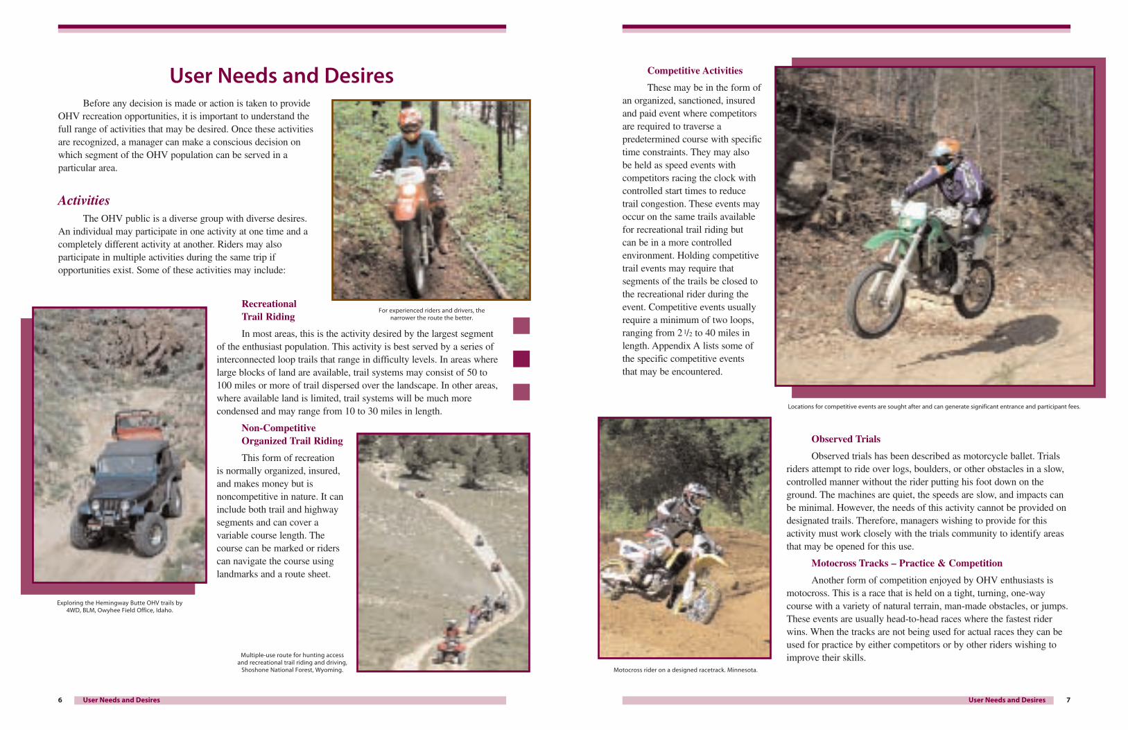
Recreational Trail Riding
In most areas, this is the activity desired by the largest segmentof the enthusiast population. This activity is best served by a series ofinterconnected loop trails that range in difficulty levels. In areas wherelarge blocks of land are available, trail systems may consist of 50 to100 miles or more of trail dispersed over the landscape. In other areas,where available land is limited, trail systems will be much morecondensed and may range from 10 to 30 miles in length.
Non-CompetitiveOrganized Trail Riding
This form of recreation is normally organized, insured,and makes money but isnoncompetitive in nature. It caninclude both trail and highwaysegments and can cover avariable course length. Thecourse can be marked or riderscan navigate the course usinglandmarks and a route sheet.
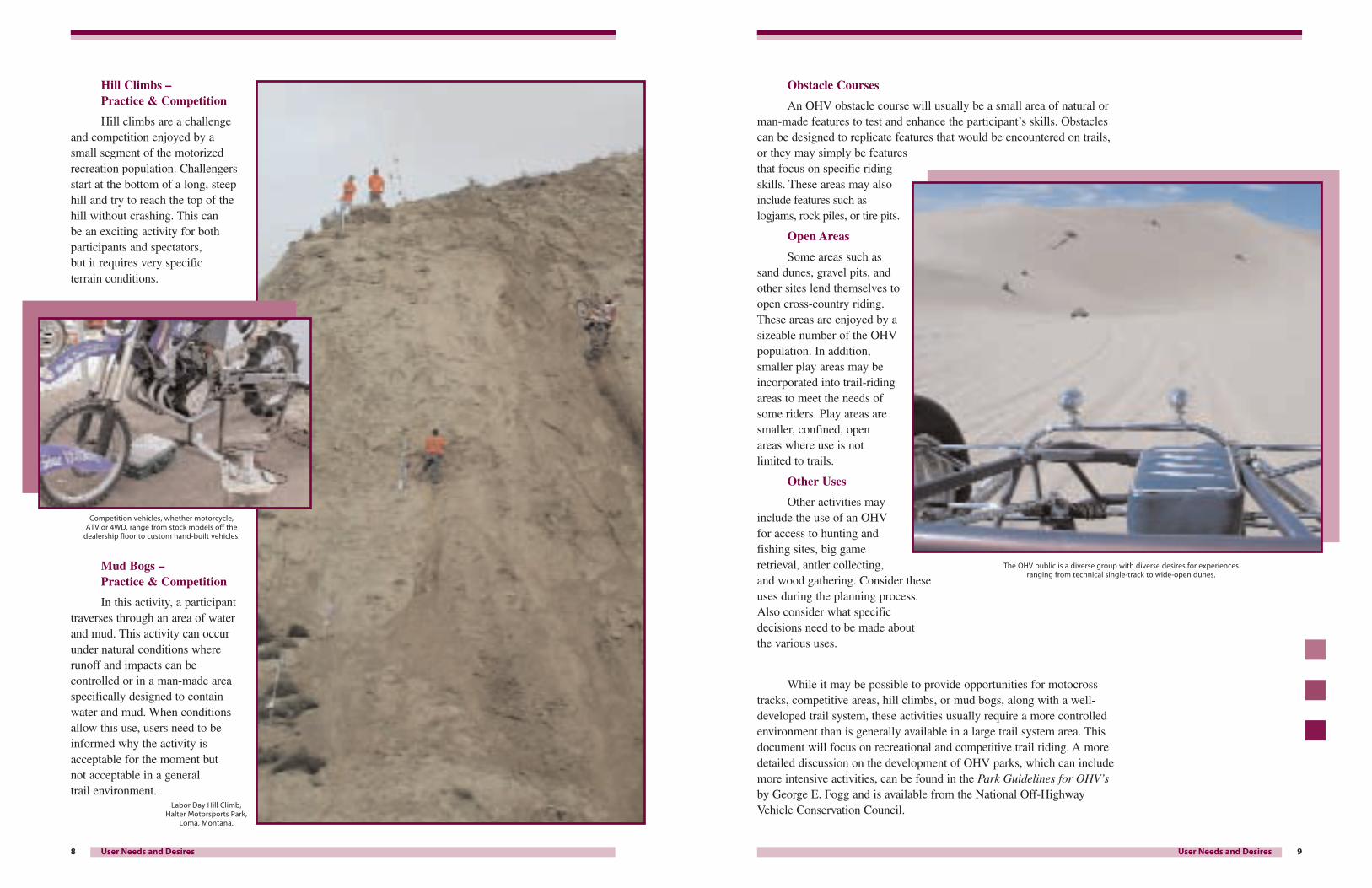
Competitive Activities
These may be in the form ofan organized, sanctioned, insuredand paid event where competitorsare required to traverse apredetermined course with specifictime constraints. They may also be held as speed events withcompetitors racing the clock withcontrolled start times to reduce trail congestion. These events mayoccur on the same trails availablefor recreational trail riding but can be in a more controlledenvironment. Holding competitivetrail events may require thatsegments of the trails be closed tothe recreational rider during theevent. Competitive events usuallyrequire a minimum of two loops,ranging from 2 1/2 to 40 miles inlength. Appendix A lists some ofthe specific competitive events that may be encountered.
Observed Trials
Observed trials has been described as motorcycle ballet. Trialsriders attempt to ride over logs, boulders, or other obstacles in a slow,controlled manner without the rider putting his foot down on theground. The machines are quiet, the speeds are slow, and impacts canbe minimal. However, the needs of this activity cannot be provided ondesignated trails. Therefore, managers wishing to provide for thisactivity must work closely with the trials community to identify areasthat may be opened for this use.
Motocross Tracks – Practice & Competition
Another form of competition enjoyed by OHV enthusiasts ismotocross. This is a race that is held on a tight, turning, one-waycourse with a variety of natural terrain, man-made obstacles, or jumps.These events are usually head-to-head races where the fastest riderwins. When the tracks are not being used for actual races they can beused for practice by either competitors or by other riders wishing toimprove their skills.
User Needs and Desires
For experienced riders and drivers, the narrower the route the better.
Locations for competitive events are sought after and can generate significant entrance and participant fees.
Motocross rider on a designed racetrack. Minnesota.
Exploring the Hemingway Butte OHV trails by4WD, BLM, Owyhee Field Office, Idaho.
Multiple-use route for hunting access and recreational trail riding and driving,
Shoshone National Forest, Wyoming.
9User Needs and Desires8 User Needs and Desires
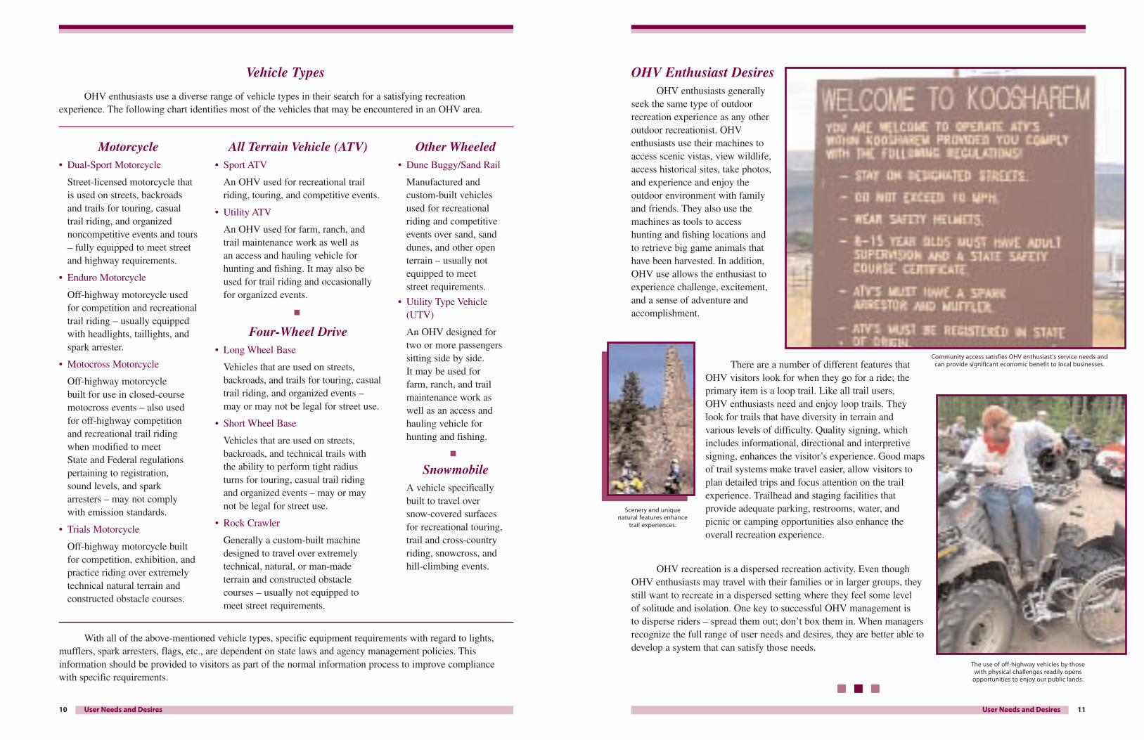
Hill Climbs – Practice & Competition
Hill climbs are a challengeand competition enjoyed by a small segment of the motorizedrecreation population. Challengersstart at the bottom of a long, steephill and try to reach the top of thehill without crashing. This can be an exciting activity for bothparticipants and spectators,but it requires very specific terrain conditions.
Mud Bogs – Practice & Competition
In this activity, a participanttraverses through an area of waterand mud. This activity can occurunder natural conditions whererunoff and impacts can becontrolled or in a man-made areaspecifically designed to containwater and mud. When conditionsallow this use, users need to beinformed why the activity isacceptable for the moment but not acceptable in a general trail environment.
Obstacle Courses
An OHV obstacle course will usually be a small area of natural orman-made features to test and enhance the participant’s skills. Obstaclescan be designed to replicate features that would be encountered on trails,or they may simply be featuresthat focus on specific ridingskills. These areas may alsoinclude features such aslogjams, rock piles, or tire pits.
Open Areas
Some areas such assand dunes, gravel pits, andother sites lend themselves toopen cross-country riding.These areas are enjoyed by asizeable number of the OHVpopulation. In addition,smaller play areas may beincorporated into trail-ridingareas to meet the needs ofsome riders. Play areas aresmaller, confined, open areas where use is notlimited to trails.
Other Uses
Other activities mayinclude the use of an OHVfor access to hunting andfishing sites, big gameretrieval, antler collecting,and wood gathering. Consider theseuses during the planning process.Also consider what specificdecisions need to be made about the various uses.
While it may be possible to provide opportunities for motocrosstracks, competitive areas, hill climbs, or mud bogs, along with a well-developed trail system, these activities usually require a more controlledenvironment than is generally available in a large trail system area. Thisdocument will focus on recreational and competitive trail riding. A moredetailed discussion on the development of OHV parks, which can includemore intensive activities, can be found in the Park Guidelines for OHV’sby George E. Fogg and is available from the National Off-HighwayVehicle Conservation Council.Labor Day Hill Climb,
Halter Motorsports Park, Loma, Montana.
Competition vehicles, whether motorcycle, ATV or 4WD, range from stock models off the
dealership floor to custom hand-built vehicles.
The OHV public is a diverse group with diverse desires for experiences ranging from technical single-track to wide-open dunes.
11User Needs and Desires10 User Needs and Desires
Motorcycle• Dual-Sport Motorcycle
Street-licensed motorcycle that is used on streets, backroadsand trails for touring, casualtrail riding, and organizednoncompetitive events and tours– fully equipped to meet streetand highway requirements.
• Enduro Motorcycle
Off-highway motorcycle usedfor competition and recreationaltrail riding – usually equippedwith headlights, taillights, andspark arrester.
• Motocross Motorcycle
Off-highway motorcycle built for use in closed-coursemotocross events – also usedfor off-highway competitionand recreational trail ridingwhen modified to meet State and Federal regulationspertaining to registration,sound levels, and sparkarresters – may not complywith emission standards.
• Trials Motorcycle
Off-highway motorcycle built for competition, exhibition, andpractice riding over extremelytechnical natural terrain andconstructed obstacle courses.
All Terrain Vehicle (ATV)• Sport ATV
An OHV used for recreational trailriding, touring, and competitive events.
• Utility ATV
An OHV used for farm, ranch, and trail maintenance work as well as an access and hauling vehicle forhunting and fishing. It may also beused for trail riding and occasionallyfor organized events.
Four-Wheel Drive• Long Wheel Base
Vehicles that are used on streets,backroads, and trails for touring, casualtrail riding, and organized events –may or may not be legal for street use.
• Short Wheel Base
Vehicles that are used on streets,backroads, and technical trails with the ability to perform tight radius turns for touring, casual trail ridingand organized events – may or may not be legal for street use.
• Rock Crawler
Generally a custom-built machinedesigned to travel over extremelytechnical, natural, or man-made terrain and constructed obstaclecourses – usually not equipped to meet street requirements.
Other Wheeled • Dune Buggy/Sand Rail
Manufactured andcustom-built vehiclesused for recreationalriding and competitiveevents over sand, sanddunes, and other openterrain – usually notequipped to meet street requirements.
• Utility Type Vehicle(UTV)
An OHV designed fortwo or more passengerssitting side by side. It may be used for farm, ranch, and trailmaintenance work as well as an access andhauling vehicle forhunting and fishing.
SnowmobileA vehicle specificallybuilt to travel over snow-covered surfaces for recreational touring,trail and cross-countryriding, snowcross, andhill-climbing events.
OHV Enthusiast DesiresOHV enthusiasts generally
seek the same type of outdoorrecreation experience as any otheroutdoor recreationist. OHVenthusiasts use their machines toaccess scenic vistas, view wildlife,access historical sites, take photos,and experience and enjoy theoutdoor environment with familyand friends. They also use themachines as tools to access hunting and fishing locations andto retrieve big game animals thathave been harvested. In addition,OHV use allows the enthusiast toexperience challenge, excitement,and a sense of adventure andaccomplishment.
There are a number of different features thatOHV visitors look for when they go for a ride; theprimary item is a loop trail. Like all trail users,OHV enthusiasts need and enjoy loop trails. Theylook for trails that have diversity in terrain and various levels of difficulty. Quality signing, whichincludes informational, directional and interpretivesigning, enhances the visitor’s experience. Good mapsof trail systems make travel easier, allow visitors toplan detailed trips and focus attention on the trailexperience. Trailhead and staging facilities thatprovide adequate parking, restrooms, water, and picnic or camping opportunities also enhance theoverall recreation experience.
OHV recreation is a dispersed recreation activity. Even thoughOHV enthusiasts may travel with their families or in larger groups, theystill want to recreate in a dispersed setting where they feel some level of solitude and isolation. One key to successful OHV management is to disperse riders – spread them out; don’t box them in. When managersrecognize the full range of user needs and desires, they are better able todevelop a system that can satisfy those needs.
Vehicle Types
OHV enthusiasts use a diverse range of vehicle types in their search for a satisfying recreationexperience. The following chart identifies most of the vehicles that may be encountered in an OHV area.
With all of the above-mentioned vehicle types, specific equipment requirements with regard to lights,mufflers, spark arresters, flags, etc., are dependent on state laws and agency management policies. Thisinformation should be provided to visitors as part of the normal information process to improve compliancewith specific requirements.
Community access satisfies OHV enthusiast’s service needs andcan provide significant economic benefit to local businesses.
Scenery and unique natural features enhance
trail experiences.
The use of off-highway vehicles by those with physical challenges readily opens
opportunities to enjoy our public lands.
Agencies must continually review how upper-level management decisions affect the ability of localmanagers to manage OHV recreation on the ground. The 4 E’s concept provides a checklist to compare howmanagerial decisions might affect the four most important elements of an effective OHV management program.
• How will this decision affect the ability of field offices to apply proper engineering?
• How will this decision help or hinder the various aspects of education?
• How will this decision help or hinder field offices’ ability to make enforcement more effective?
• How will this decision affect the ability to monitor results?
• And, most important, does this decision help OHV managers with one or more of these elements?
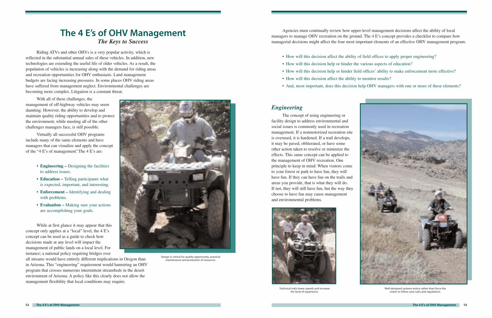
EngineeringThe concept of using engineering or
facility design to address environmental andsocial issues is commonly used in recreationmanagement. If a nonmotorized recreation siteis overused, it is hardened. If a trail develops,it may be paved, obliterated, or have someother action taken to resolve or minimize theeffects. This same concept can be applied tothe management of OHV recreation. Oneprinciple to keep in mind: When visitors cometo your forest or park to have fun, they willhave fun. If they can have fun on the trails andareas you provide, that is what they will do. If not, they will still have fun, but the way theychoose to have fun may cause managementand environmental problems.
13The 4 E’s of OHV Management
Technical trails lower speeds and increasethe level of experience.
Well-designed systems entice rather than force the visitor to follow area rules and regulations.
Riding ATVs and other OHVs is a very popular activity, which isreflected in the substantial annual sales of these vehicles. In addition, newtechnologies are extending the useful life of older vehicles. As a result, thepopulation of vehicles is increasing along with the demand for riding areasand recreation opportunities for OHV enthusiasts. Land managementbudgets are facing increasing pressures. In some places OHV riding areashave suffered from management neglect. Environmental challenges arebecoming more complex. Litigation is a constant threat.
With all of these challenges, themanagement of off-highway vehicles may seemdaunting. However, the ability to develop andmaintain quality riding opportunities and to protectthe environment, while meeting all of the otherchallenges managers face, is still possible.
Virtually all successful OHV programsinclude many of the same elements and havemanagers that can visualize and apply the conceptof the “4 E’s of management”. The 4 E’s are:
• Engineering – Designing the facilities to address issues.
• Education – Telling participants what is expected, important, and interesting.
• Enforcement – Identifying and dealingwith problems.
• Evaluation – Making sure your actionsare accomplishing your goals.
While at first glance it may appear that thisconcept only applies at a “local” level, the 4 E’sconcept can be used as a guide to check howdecisions made at any level will impact themanagement of public lands on a local level. Forinstance; a national policy requiring bridges overall streams would have entirely different implications in Oregon than in Arizona. This “engineering” requirement would hamstring an OHVprogram that crosses numerous intermittent streambeds in the desertenvironment of Arizona. A policy like this clearly does not allow themanagement flexibility that local conditions may require.
12 The 4 E’s of OHV Management
The 4 E’s of OHV ManagementThe Keys to Success
Design is critical for quality opportunity, practicalmaintenance and protection of resources.
15The 4 E’s of OHV Management
Wildlife Disturbance – Vehicle use reduces the effectiveness of wildlife habitats.
Solutions: Where wildlife security is an issue, trails and routes can belocated in a manner that provides increased screening. Trail locations can bemodified to divert use away from key wildlife areas. Trails could be locatedcloser to existing road corridors to increase habitat effectiveness. If seasonaldisturbance is a problem, such as during breeding or calving or nestingseasons, apply seasonal closures that protect the area during critical periodsbut allow use for as much of the season as possible. When trails must crossriparian areas, locate them in such a way as to limit impact on wildlife.
Water Quality – Trail erosion affects the watershed.
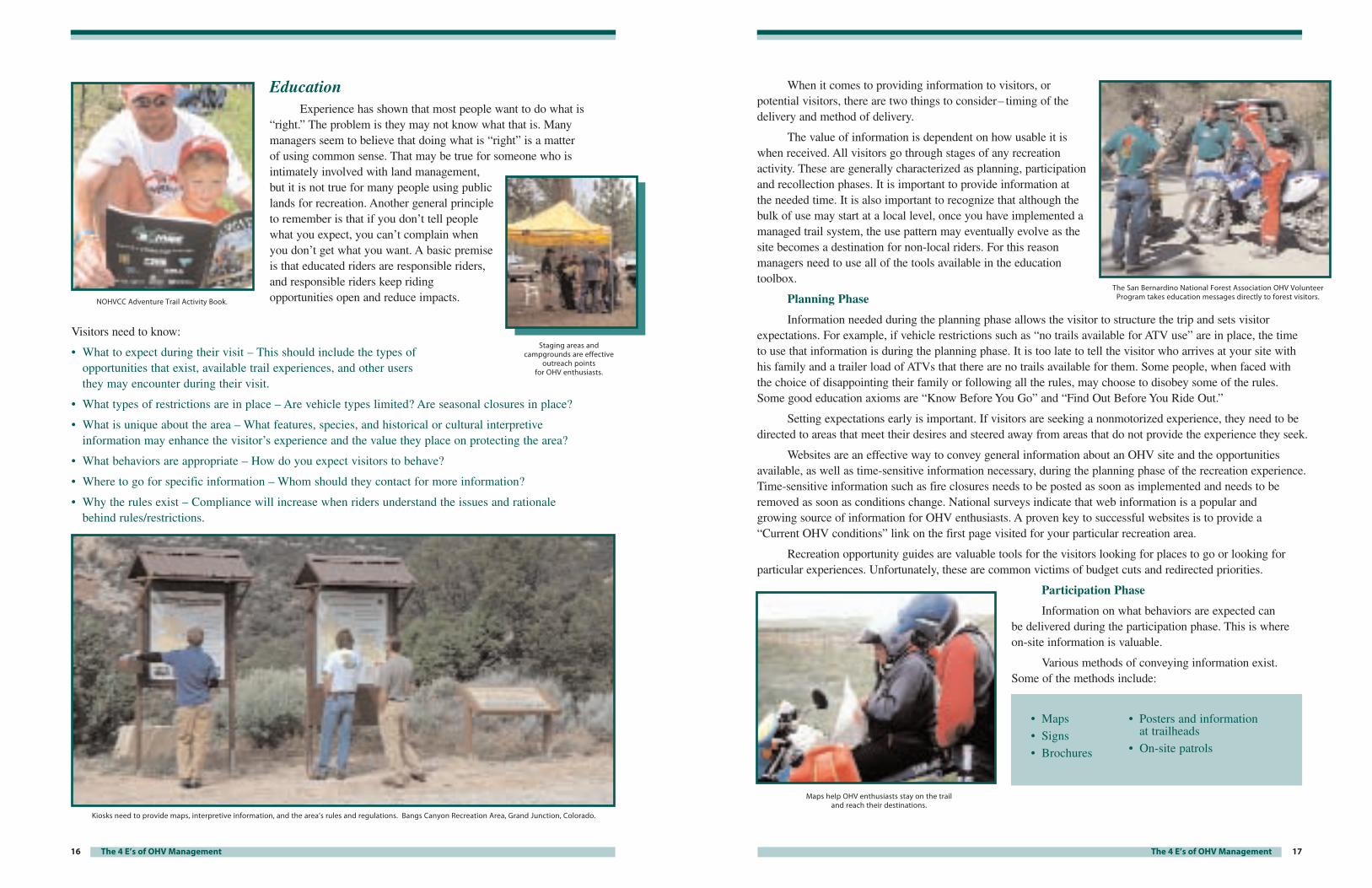
Solutions: Construct or reconstruct routes with rolling dips,undulating trail design, or trail grade breaks. Avoid installing multiplewaterbars. Locate trails to reduce the number of stream crossings. Harden stream crossings where appropriate to reduce sediment delivery.Properly engineered trails control water, enhance rider experience, andrequire less intense, though still regular, maintenance.
Sound – Vehicle noise disturbs neighbors, wildlife, and other forest users.
Solutions: Locate routes in a manner that reduces soundtransmission. Instead of putting a trail on the top of an open ridge, move it down the slope, away from sensitive areas. When possible, locate trailsaway from interface areas where housing development is encroaching on recreation areas. Managers might also consider lower sound levelrestrictions for particularly sensitive areas after appropriate analysis.
Harden or bridge stream crossings where appropriate to reduce sediment delivery.
Sound field testing can be easily and quicklyaccomplished with the 20" SAE J1287 sound test.
14
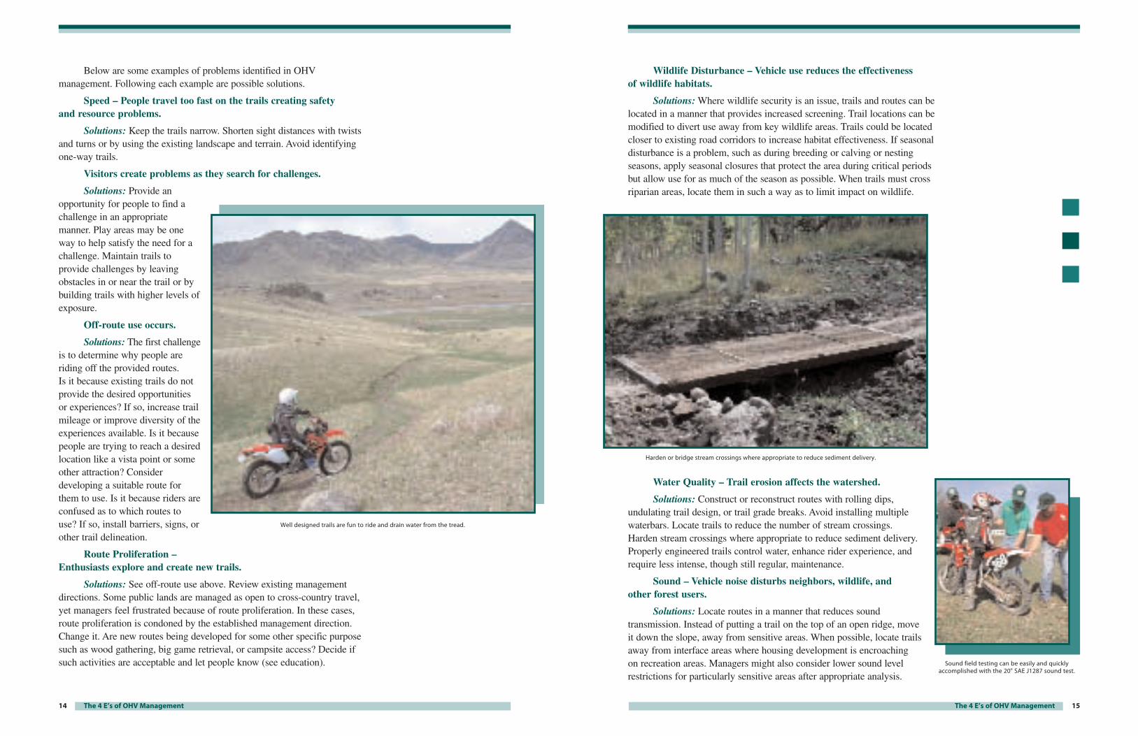
Below are some examples of problems identified in OHVmanagement. Following each example are possible solutions.
Speed – People travel too fast on the trails creating safety and resource problems.
Solutions: Keep the trails narrow. Shorten sight distances with twistsand turns or by using the existing landscape and terrain. Avoid identifyingone-way trails.
Visitors create problems as they search for challenges.
Solutions: Provide anopportunity for people to find achallenge in an appropriatemanner. Play areas may be oneway to help satisfy the need for achallenge. Maintain trails toprovide challenges by leavingobstacles in or near the trail or bybuilding trails with higher levels ofexposure.
Off-route use occurs.
Solutions: The first challengeis to determine why people areriding off the provided routes. Is it because existing trails do notprovide the desired opportunitiesor experiences? If so, increase trailmileage or improve diversity of theexperiences available. Is it becausepeople are trying to reach a desiredlocation like a vista point or someother attraction? Considerdeveloping a suitable route forthem to use. Is it because riders areconfused as to which routes touse? If so, install barriers, signs, orother trail delineation.
Route Proliferation – Enthusiasts explore and create new trails.
Solutions: See off-route use above. Review existing managementdirections. Some public lands are managed as open to cross-country travel,yet managers feel frustrated because of route proliferation. In these cases,route proliferation is condoned by the established management direction.Change it. Are new routes being developed for some other specific purposesuch as wood gathering, big game retrieval, or campsite access? Decide ifsuch activities are acceptable and let people know (see education).
The 4 E’s of OHV Management
Well designed trails are fun to ride and drain water from the tread.
17The 4 E’s of OHV Management
When it comes to providing information to visitors, orpotential visitors, there are two things to consider– timing of thedelivery and method of delivery.
The value of information is dependent on how usable it iswhen received. All visitors go through stages of any recreationactivity. These are generally characterized as planning, participationand recollection phases. It is important to provide information atthe needed time. It is also important to recognize that although thebulk of use may start at a local level, once you have implemented amanaged trail system, the use pattern may eventually evolve as thesite becomes a destination for non-local riders. For this reasonmanagers need to use all of the tools available in the educationtoolbox.
Planning Phase
Information needed during the planning phase allows the visitor to structure the trip and sets visitorexpectations. For example, if vehicle restrictions such as “no trails available for ATV use” are in place, the timeto use that information is during the planning phase. It is too late to tell the visitor who arrives at your site withhis family and a trailer load of ATVs that there are no trails available for them. Some people, when faced with the choice of disappointing their family or following all the rules, may choose to disobey some of the rules.Some good education axioms are “Know Before You Go” and “Find Out Before You Ride Out.”
Setting expectations early is important. If visitors are seeking a nonmotorized experience, they need to bedirected to areas that meet their desires and steered away from areas that do not provide the experience they seek.
Websites are an effective way to convey general information about an OHV site and the opportunitiesavailable, as well as time-sensitive information necessary, during the planning phase of the recreation experience.Time-sensitive information such as fire closures needs to be posted as soon as implemented and needs to beremoved as soon as conditions change. National surveys indicate that web information is a popular and growing source of information for OHV enthusiasts. A proven key to successful websites is to provide a “Current OHV conditions” link on the first page visited for your particular recreation area.
Recreation opportunity guides are valuable tools for the visitors looking for places to go or looking forparticular experiences. Unfortunately, these are common victims of budget cuts and redirected priorities.
Participation Phase
Information on what behaviors are expected can be delivered during the participation phase. This is where on-site information is valuable.
Various methods of conveying information exist. Some of the methods include:
• Maps• Signs• Brochures
• Posters and informationat trailheads
• On-site patrols
The San Bernardino National Forest Association OHV VolunteerProgram takes education messages directly to forest visitors.
Maps help OHV enthusiasts stay on the trail and reach their destinations.
16
EducationExperience has shown that most people want to do what is
“right.” The problem is they may not know what that is. Manymanagers seem to believe that doing what is “right” is a matter of using common sense. That may be true for someone who isintimately involved with land management,but it is not true for many people using publiclands for recreation. Another general principleto remember is that if you don’t tell peoplewhat you expect, you can’t complain whenyou don’t get what you want. A basic premiseis that educated riders are responsible riders,and responsible riders keep ridingopportunities open and reduce impacts.
The 4 E’s of OHV Management
Visitors need to know:
• What to expect during their visit – This should include the types of opportunities that exist, available trail experiences, and other users they may encounter during their visit.
• What types of restrictions are in place – Are vehicle types limited? Are seasonal closures in place?
• What is unique about the area – What features, species, and historical or cultural interpretive information may enhance the visitor’s experience and the value they place on protecting the area?
• What behaviors are appropriate – How do you expect visitors to behave?
• Where to go for specific information – Whom should they contact for more information?
• Why the rules exist – Compliance will increase when riders understand the issues and rationale behind rules/restrictions.
NOHVCC Adventure Trail Activity Book.
Staging areas andcampgrounds are effective
outreach points for OHV enthusiasts.
Kiosks need to provide maps, interpretive information, and the area’s rules and regulations. Bangs Canyon Recreation Area, Grand Junction, Colorado.

19The 4 E’s of OHV Management
Recognizing that the number of actual enforcement officers is limited, and they may not always beavailable, agency presence, whether they have enforcement authority or not, will improve compliance. Inaddition, it is important to build partnerships with local enforcement agencies. Their occasional visits to trails or trailheads can be beneficial in providing necessary law-enforcement presence. If visitors see uniformedpersonnel on the trails or at the trailheads, they know the area is managed and are more likely to comply withthe rules. Trained volunteers are also helpful in gaining compliance. Volunteer hosts and trail patrols cannot beinvolved in direct enforcement, but they can share information with visitors and provide an agency presence,which will improve compliance.
EvaluationManagers need to evaluate the effects of the recreational use on
the facilities and the environment. It is equally important to evaluate the success of the programs from the perspective of the user and theeffectiveness of the management actions you have taken.
The evaluation or monitoring process can easily take on a life of its own and can consume a significant portion of the budget, if youallow it to do so. Therefore, you must know what information youactually need before you start asking the questions.
Questions include:
• Are trail management objectives being met?
• Are user needs being satisfied?
• Are environmental issues being addressed?
• Is the activity in compliance with land management direction?
An effective evaluation process must be as simple as possible. The results of the analysis must bedocumented and readily available to the agency staff and to the public.
An example of a simple, yet effective, evaluation is photo point monitoring. It is a process that can becompleted by volunteers with a minimum amount of training and can yield valuable data over time. Photomonitoring will show trends in trail condition, effectiveness of management actions, and life expectancies oftrail structures.
Other forms of monitoring should focus on specific problems. For example, if the issue or concern is theeffect of sediment on aquatic resources, monitoring needs to address the aquatic environment. Then, if problemsare encountered, the causes and solutions need to be found and solved. It is of little value to simply measuresoil movement on a trail and assume that any soil moved is reaching a stream.
Management of a quality motorized recreation experience requires an understanding of the 4 E’s. Whenissues are viewed in this context, there is a logical progression toward problem resolution. The riders, theenvironment and the managing agency will benefit from application of the 4 E’s.
This approach can be a valuable tool for OHV managers on virtually every level, from the local areamanager to the top level in the agencies.
Temporary trail counters verify visitor counts.
18 The 4 E’s of OHV Management
Signs are an excellent way to convey site-specific routeinformation and to reinforce information provided on the maps. Signsshow visitors where they can go and where they should not go. Theycan also provide information on trail difficulty levels, trail conditions,and interpretation. Some effective education signs that should beconsidered are “Use It, But Don’t Abuse It;” “The Future of This Trail(System) Depends on You;” and “Stay on Trail or Stay Home.”
EnforcementActive and reasonable enforcement is critical to successful
long-term management of OHV use. The general principle that applies to enforcement is that most people want to do what is right.Active management will make it easy for visitors to know and complywith regulations, but when you identify a problem, deal with it.Education should be stressed over citation. “A talking to” and a warningare often far more effective and positive than a ticket. In somejurisdictions a “fix-it ticket” may be appropriate. Remember, positiveattitudes create positive programs, and the objective of enforcement is toobtain compliance with the rules.
When rule violations are identified, questions should be asked.Why are people behaving in this way? Are the signs in place? Are therules clear? Is this something that a change in management will resolve?Is there an engineering solution to the problem? If everything has beendone and problems persist, then it is time to bring in enforcement totake appropriate action.
Maps are critical to successfulmanagement of OHV activities.Depending on the specificmanagement directions for an area,maps may not need to show everyroute available for use, but they mustshow the routes where OHV use isencouraged. Even in areas where useis limited to existing routes, a map ofthe system and loop trails will improvea visitor’s ability and desire to use thesystem rather than having to search forit. Maps also provide an opportunity toshow the trail difficulty level and otherrestrictions such as seasonal closures.Maps need to be very clear, easy tounderstand and readily available. If amap covers a large area, GlobalPositioning System (GPS) waypointdata for specific areas and points canbe very helpful to the visitor.
Maps and area brochures need to be readily available twenty-four hours a day and seven days a week. BLM Grand Junction Field Office, Colorado.
USFS enforcement staff and volunteer patrolsprovide a regular presence at the
Oregon Dunes National Recreation Area.
21System and Route Planning
System and Route PlanningOHV system planning is, by necessity, a sequential process. It involves identifying what you have,
dealing with it, and making it better. It is a generally accepted principle that, in most areas, wheeled OHV useis a route-oriented activity. There are some notable exceptions, however, where cross-country travel is essentialto enthusiast enjoyment and where existing site conditions can support it. These areas may include sanddunes, and other areas for wheeled use, where management determines that such use is appropriate. While this publication does not focus on snowmobile management in general, it is important to mention that cross-country travel is often essential toa quality snowmobile experience.This publication will focus onforest, grasslands, and other areaswhere a system of routes is themost effective way to managewheeled OHV use.
Generally, riders will useroutes that exist on the ground if they satisfy their needs anddesires. Where existing routes fail to satisfy the riders, off-routetravel will often occur, and newroutes will become established.Since most user-created routes arenot designed or constructed, theyoften create resource impacts,cause social user conflicts, andprovide poor recreationalopportunities. However, theyshould be reviewed during theplanning process to determineif they fulfill a valid need and,
if necessary, can be changed tomeet resource considerations.
Many of the national OHV organizations recognize thedifficulty of managing cross-country travel in forest environments.The Blue Ribbon Coalition has adopted the following positionregarding use on designated routes and cross-country travel:
The BlueRibbon Coalition supports the policy of limiting wheeled off-highway vehicle (OHV)use to existing roads and trails, in areas where cross-country use of OHV has been adequately studiedand shown to cause adverse impacts. An open classification, which includes cross-country travel, canbe appropriate in areas such as sand dunes, borrow pits, play areas, and other open lands.
Dependence on trails or roads in the wrong location may lead to increaseddegradation, decreased experience,
and costly maintenance.
Heavy ATV traffic has little impact on this well-designed trail.
The 4 E’s of OHV Management20 Developing the Vision
The processes described in this book allow a manager to take his or her vision and make it a reality.
The critical thing to remember is “Vision without action is a daydream, but action without vision is a nightmare.” Don Howard, Creed Colorado
Type of Vehicles• Will opportunities be provided for mountain bicycles,
motorcycles, ATVs, four-wheel drive vehicles, or otherspecial vehicles?
• Are all vehicles expected to use the same routes or trails,or are some separate routes available for the differentvehicle types to satisfy specific needs?
• Is one vehicle type emphasized over others?
• How will other nonmotorized uses be accommodated?
Available Opportunities • Are opportunities available for more intensive use, such
as hill climbs, mud bogs, play areas, or obstacle courses?
• Will the trail riding experiences include the full range of difficulty levels for all vehicles?
• Will the area include designed areas for formal 4WD,OHM, and ATV training?
• Will emphasis be placed on providing unique ridingexperiences for the different vehicles?
• Will the area provide some single-track experiencefor motorcycle riders?
• Will the ATV experience include road and trailenvironments?
• Will events be allowed or encouraged, and, if so,under what conditions?
Facilities Provided• To facilitate public access to the project area,
will one or more trailheads be developed?
• Do camping facilities exist or will they beincluded in the project if needed?
• What type of sanitation facilities will beneeded?
• Will the project include track-type facilitiesor other specific developments to providedesired opportunities?
• What types of trails and facilities areprovided by other agencies or the private sector?
Management Approach• Will agency personnel solely manage the
project area?
• What types of collaborative opportunitiesexist to help with management?
• What type of volunteer workforce could be expected to assist with management?
• Will the project require an intensivemanagement effort, or will infrastructure be developed to facilitate a less intensivemanagement approach?
Developing the VisionBefore you, as a manager, even begin to start developing trails or a trail
system, you must create the vision for the type of opportunities you want to provideand are able to provide, given resource constraints. You must decide on the types ofvehicles to be accommodated and the manner in which that will be done, the rangeof opportunities that will be available, the facilities that will be provided and themanagement approach that will be used. These decisions should be based on anunderstanding of participant demographics enthusiast desires and needs, variousrecreational and resource uses of the land, and the capability of the land to supportthe various uses. The vision should be articulated in writing. As the site-specificplanning process proceeds, the vision statement needs to be periodically reviewed,and, if necessary, modified to reflect any changes in thinking. Some of the questionsthat need to be answered in the vision statement include:
Minooka County Park, Chilton, Alabama.
23
During this phase it is important to recognize the different levelsof inventory needed to accomplish the desired results. It may bedesirable to accomplish the entire inventory job with an initial trip alongthe trail. However, a one-pass inventory requires more time, betterequipment, and more funding than is commonly available. To completean initial system identification, the critical information is route location,general information on route condition, and potential managementissues. Volunteers using a good personal level GPS unit can accomplishthis level of inventory. As routes are selected for potential inclusion intothe final system, additional detail will be required and gathered.
During the initial datacollection phase of the process,features that enhance a trailexperience should also be located.These features may include vistas,waterfalls, lakes, streams, meadows,or hot springs. During the systemlayout phase of the process, trails canbe located or relocated to providevisitors the opportunity to accessthese features.
The other items that need to be located and identified early in theprocess are support facilities. Thesecould include trailheads, accesspoints, campgrounds, foodestablishments, and fuel sources. It is also important to identify possiblesites for special areas or facilities thatmay be desirable to enhance visitorenjoyment. These could includethings such as “tot lots,” play areas,mud bogs, or race sites, if such usesare deemed appropriate in theparticular area being considered.
You could also include conditions that influence systemdevelopment. These conditions could include identification of riparianzones, core habitat for endangered or sensitive wildlife species and plantcommunities, cultural and historic resources, or other situations thatmight constrain or preclude trail or route locations.
Before moving on to the system planning phase of the process,managers should review existing planning documents to determine whatactivities are currently allowed and areas where plan amendments maybe required if uses were to change. All of the above information shouldbe developed into graphic format so that the next step of system layoutcan commence.
System and Route Planning
Destination points and vistas are importantcomponents of a quality recreation experience.
Coal Creek OHV Area, Eastern Tennessee.
22 System and Route Planning
Making the Transition to Designated RoutesThe sequential process discussed below identifies the steps necessary to identify and designate
a system of routes that will protect resources and provide opportunities for satisfying recreationalexperiences. However, these steps will take time, money, and energy. What should be done in the meantime?Should managers just wait until they have the resources to do the entire job and live with the status quo until then? Living with the status quo is what has caused the situation that exists today. Something must be done immediately.
Some areas have been able to make the necessary commitment to do a complete job. They should,of course, continue. Other areas that do not have the resources to do the complete job at this time, but haveidentified unrestricted cross-country travel as the primary problem, can make a significant step towardresolving the issues.
The first step is to designate all existing routes as open and available for OHV use and then to prohibitcross-country travel except in appropriate areas. This will significantly reduce route proliferation and otherproblems caused by unrestricted cross-country travel and will allow the manager to focus on, and resolve,issues with specific routes. It will also allow managers to focus on smaller areas or to complete the systemidentification process in conjunction with other projects or area analysis.
Steps necessary to identify and develop a suitable OHV system are the same whether you are working on a large area or a smaller segment of the whole. The steps include:
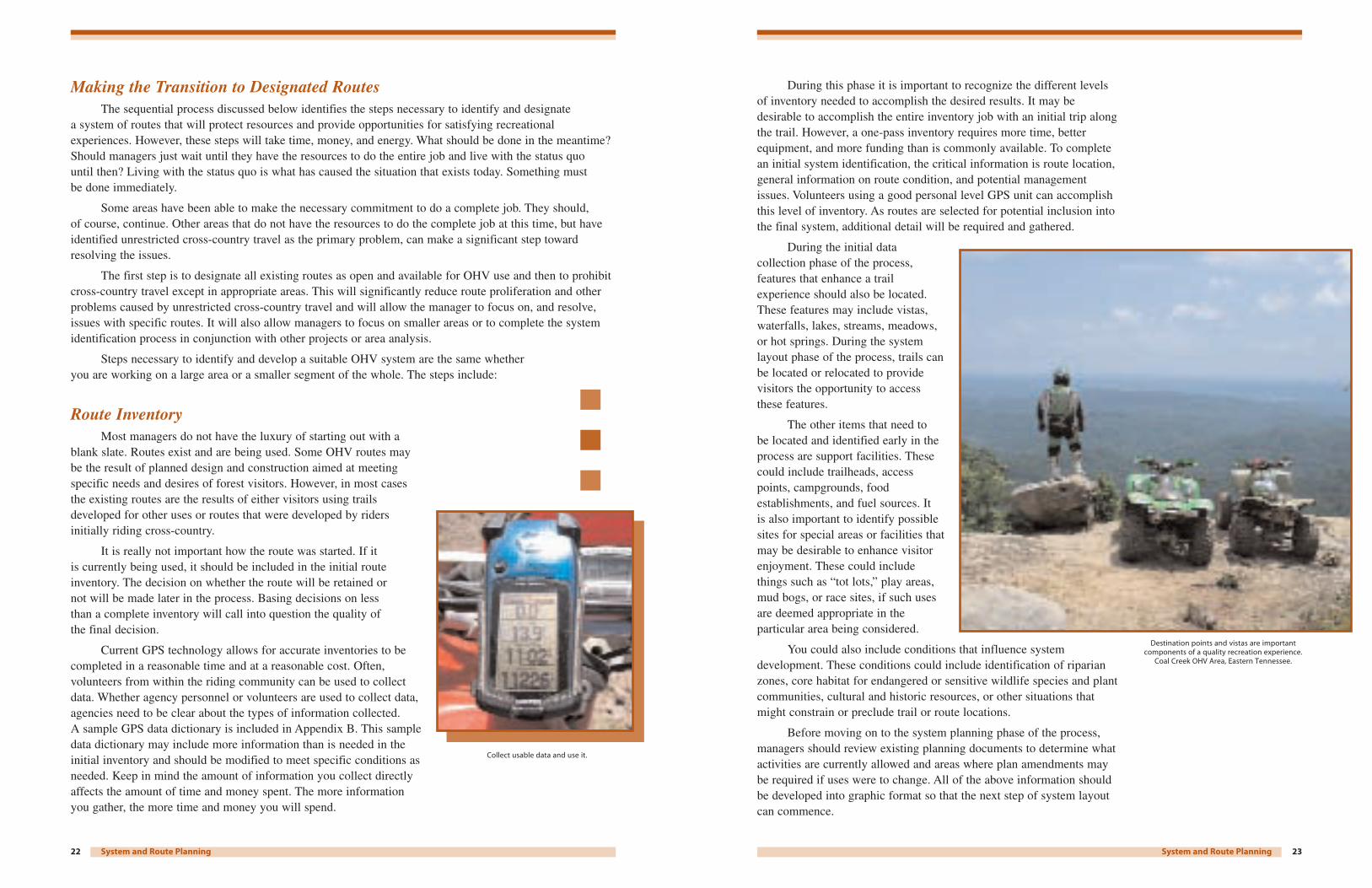
Route InventoryMost managers do not have the luxury of starting out with a
blank slate. Routes exist and are being used. Some OHV routes maybe the result of planned design and construction aimed at meetingspecific needs and desires of forest visitors. However, in most casesthe existing routes are the results of either visitors using trailsdeveloped for other uses or routes that were developed by ridersinitially riding cross-country.
It is really not important how the route was started. If it is currently being used, it should be included in the initial routeinventory. The decision on whether the route will be retained or not will be made later in the process. Basing decisions on less than a complete inventory will call into question the quality of the final decision.
Current GPS technology allows for accurate inventories to becompleted in a reasonable time and at a reasonable cost. Often,volunteers from within the riding community can be used to collectdata. Whether agency personnel or volunteers are used to collect data,agencies need to be clear about the types of information collected. A sample GPS data dictionary is included in Appendix B. This sampledata dictionary may include more information than is needed in theinitial inventory and should be modified to meet specific conditions asneeded. Keep in mind the amount of information you collect directlyaffects the amount of time and money spent. The more informationyou gather, the more time and money you will spend.
Collect usable data and use it.
25System and Route Planning
The actual loop system employed and layout of the loopsthemselves will, by necessity, be dictated by the conditions on the groundand the issues that must be addressed. Several conceptual loop layouts thatmay be used include the Stacked Loops, Multiple Loops, Spoked Wheel,Primary/Secondary Loops or the Maze Loop system (see Appendix C).
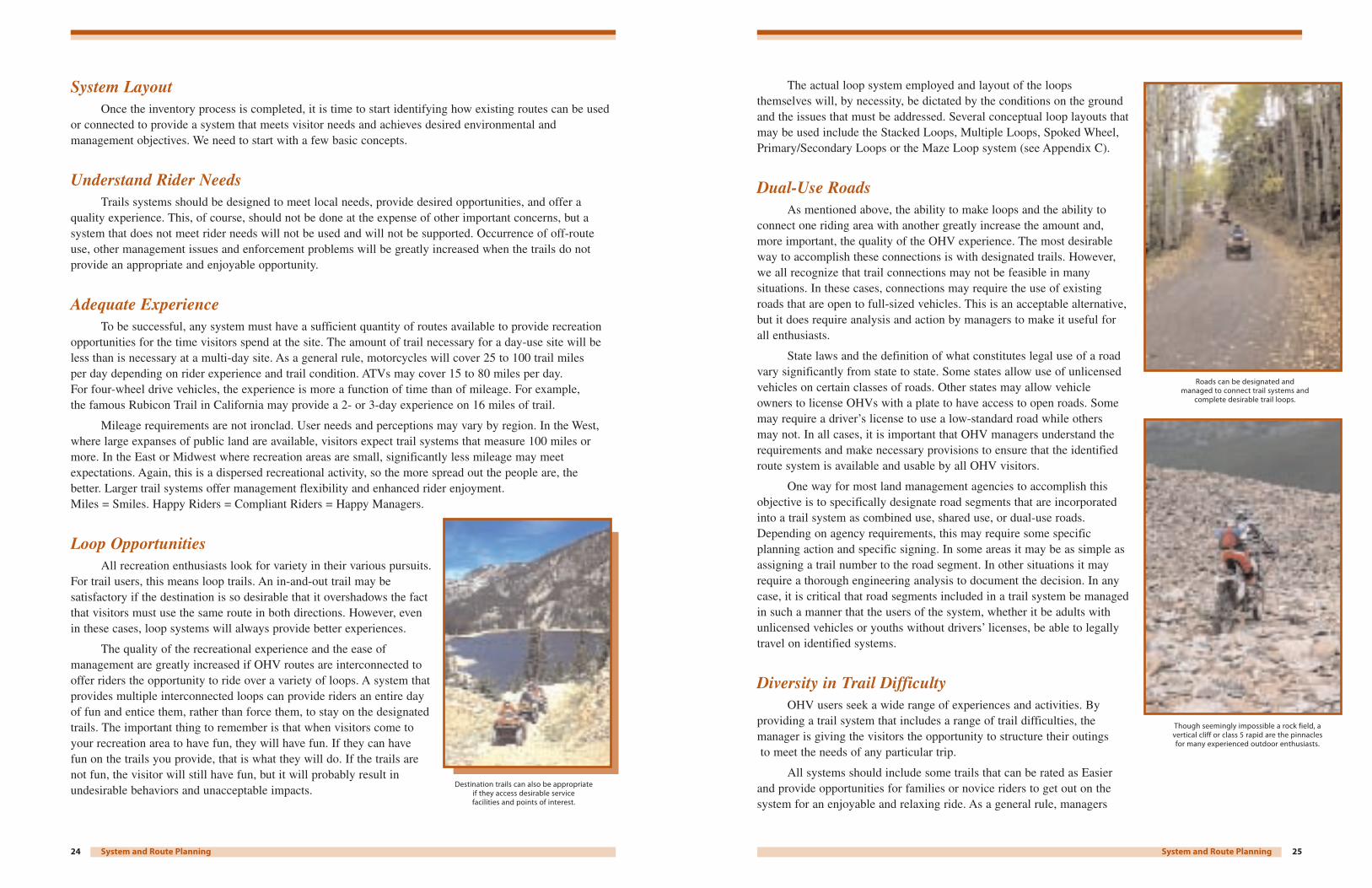
Dual-Use RoadsAs mentioned above, the ability to make loops and the ability to
connect one riding area with another greatly increase the amount and,more important, the quality of the OHV experience. The most desirableway to accomplish these connections is with designated trails. However,we all recognize that trail connections may not be feasible in manysituations. In these cases, connections may require the use of existingroads that are open to full-sized vehicles. This is an acceptable alternative,but it does require analysis and action by managers to make it useful forall enthusiasts.
State laws and the definition of what constitutes legal use of a roadvary significantly from state to state. Some states allow use of unlicensedvehicles on certain classes of roads. Other states may allow vehicleowners to license OHVs with a plate to have access to open roads. Somemay require a driver’s license to use a low-standard road while others may not. In all cases, it is important that OHV managers understand therequirements and make necessary provisions to ensure that the identifiedroute system is available and usable by all OHV visitors.
One way for most land management agencies to accomplish thisobjective is to specifically designate road segments that are incorporatedinto a trail system as combined use, shared use, or dual-use roads.Depending on agency requirements, this may require some specificplanning action and specific signing. In some areas it may be as simple asassigning a trail number to the road segment. In other situations it mayrequire a thorough engineering analysis to document the decision. In anycase, it is critical that road segments included in a trail system be managedin such a manner that the users of the system, whether it be adults withunlicensed vehicles or youths without drivers’ licenses, be able to legallytravel on identified systems.
Diversity in Trail DifficultyOHV users seek a wide range of experiences and activities. By
providing a trail system that includes a range of trail difficulties, themanager is giving the visitors the opportunity to structure their outingsto meet the needs of any particular trip.
All systems should include some trails that can be rated as Easierand provide opportunities for families or novice riders to get out on thesystem for an enjoyable and relaxing ride. As a general rule, managers
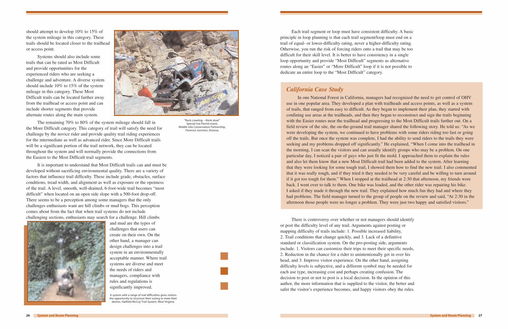
Though seemingly impossible a rock field, avertical cliff or class 5 rapid are the pinnaclesfor many experienced outdoor enthusiasts.
Roads can be designated and managed to connect trail systems and
complete desirable trail loops.
24 System and Route Planning
System LayoutOnce the inventory process is completed, it is time to start identifying how existing routes can be used
or connected to provide a system that meets visitor needs and achieves desired environmental andmanagement objectives. We need to start with a few basic concepts.
Understand Rider NeedsTrails systems should be designed to meet local needs, provide desired opportunities, and offer a
quality experience. This, of course, should not be done at the expense of other important concerns, but asystem that does not meet rider needs will not be used and will not be supported. Occurrence of off-routeuse, other management issues and enforcement problems will be greatly increased when the trails do notprovide an appropriate and enjoyable opportunity.
Adequate ExperienceTo be successful, any system must have a sufficient quantity of routes available to provide recreation
opportunities for the time visitors spend at the site. The amount of trail necessary for a day-use site will beless than is necessary at a multi-day site. As a general rule, motorcycles will cover 25 to 100 trail miles per day depending on rider experience and trail condition. ATVs may cover 15 to 80 miles per day. For four-wheel drive vehicles, the experience is more a function of time than of mileage. For example,the famous Rubicon Trail in California may provide a 2- or 3-day experience on 16 miles of trail.
Mileage requirements are not ironclad. User needs and perceptions may vary by region. In the West,where large expanses of public land are available, visitors expect trail systems that measure 100 miles ormore. In the East or Midwest where recreation areas are small, significantly less mileage may meetexpectations. Again, this is a dispersed recreational activity, so the more spread out the people are, the better. Larger trail systems offer management flexibility and enhanced rider enjoyment. Miles = Smiles. Happy Riders = Compliant Riders = Happy Managers.
Loop OpportunitiesAll recreation enthusiasts look for variety in their various pursuits.
For trail users, this means loop trails. An in-and-out trail may besatisfactory if the destination is so desirable that it overshadows the factthat visitors must use the same route in both directions. However, evenin these cases, loop systems will always provide better experiences.
The quality of the recreational experience and the ease ofmanagement are greatly increased if OHV routes are interconnected tooffer riders the opportunity to ride over a variety of loops. A system thatprovides multiple interconnected loops can provide riders an entire dayof fun and entice them, rather than force them, to stay on the designatedtrails. The important thing to remember is that when visitors come toyour recreation area to have fun, they will have fun. If they can have fun on the trails you provide, that is what they will do. If the trails arenot fun, the visitor will still have fun, but it will probably result inundesirable behaviors and unacceptable impacts.
Destination trails can also be appropriate if they access desirable service facilities and points of interest.
27System and Route Planning
Each trail segment or loop must have consistent difficulty. A basicprinciple in loop planning is that each trail segment/loop must end on atrail of equal- or lower-difficulty rating, never a higher-difficulty rating.Otherwise, you run the risk of forcing riders onto a trail that may be toodifficult for their skill level. It is better to have consistency in a singleloop opportunity and provide “Most Difficult” segments as alternativeroutes along an “Easier” or “More Difficult” loop if it is not possible todedicate an entire loop to the “Most Difficult” category.
There is controversy over whether or not managers should identifyor post the difficulty level of any trail. Arguments against posting ormapping difficulty of trails include: 1. Possible increased liability,2. Trail conditions that change quickly, and 3. Lack of a definitivestandard or classification system. On the pro-posting side, argumentsinclude: 1. Visitors can customize their trips to meet their specific needs,2. Reduction in the chance for a rider to unintentionally get in over hishead, and 3. Improve visitor experience. On the other hand, assigningdifficulty levels is subjective, and a different symbol may be needed foreach use type, increasing cost and perhaps creating confusion. Thedecision to post or not to post is a local decision. In the opinion of thisauthor, the more information that is supplied to the visitor, the better andsafer the visitor’s experience becomes, and happy visitors obey the rules.
California Case StudyIn one National Forest in California, managers had recognized the need to get control of OHV
use in one popular area. They developed a plan with trailheads and access points, as well as a system of trails, that ranged from easy to difficult. As they began to implement their plan, they started withconfining use areas at the trailheads, and then they began to reconstruct and sign the trails beginningwith the Easier routes near the trailhead and progressing to the Most Difficult trails further out. On afield review of the site, the on-the-ground trail manager shared the following story. He told us: “As wewere developing the system, we continued to have problems with some riders riding too fast or goingoff the trails. But once the system was complete, I had the ability to send riders to the trails they wereseeking and my problems dropped off significantly.” He explained, “When I come into the trailhead inthe morning, I can scan the visitors and can usually identify groups who may be a problem. On oneparticular day, I noticed a pair of guys who just fit the mold. I approached them to explain the rules and also let them know that a new Most Difficult trail had been added to the system. After learning that they were looking for some tough trail, I showed them how to find the new trail. I also commentedthat it was really tough, and if they tried it they needed to be very careful and be willing to turn aroundif it got too tough for them.” When I stopped at the trailhead at 2:30 that afternoon, my friends wereback. I went over to talk to them. One bike was loaded, and the other rider was repairing his bike. I asked if they made it through the new trail. They explained how much fun they had and where theyhad problems. The field manager turned to the group of people on the review and said, “At 2:30 in theafternoon those people were no longer a problem. They were just two happy and satisfied visitors.”
26 System and Route Planning
should attempt to develop 10% to 15% of the system mileage in this category. Thesetrails should be located closer to the trailheador access point.
Systems should also include sometrails that can be rated as Most Difficult and provide opportunities for theexperienced riders who are seeking achallenge and adventure. A diverse systemshould include 10% to 15% of the systemmileage in this category. These MostDifficult trails can be located further awayfrom the trailhead or access point and caninclude shorter segments that providealternate routes along the main system.
The remaining 70% to 80% of the system mileage should fall in the More Difficult category. This category of trail will satisfy the need forchallenge by the novice rider and provide quality trail riding experiences for the intermediate as well as advanced rider. Since More Difficult trailswill be a significant portion of the trail network, they can be locatedthroughout the system and will normally provide the connections from the Easiest to the Most Difficult trail segments.
It is important to understand that Most Difficult trails can and must bedeveloped without sacrificing environmental quality. There are a variety offactors that influence trail difficulty. These include grade, obstacles, surfaceconditions, tread width, and alignment as well as exposure or the opennessof the trail. A level, smooth, well-drained, 6-foot-wide trail becomes “mostdifficult” when located on an open side slope with a 500-foot drop-off.There seems to be a perception among some managers that the onlychallenges enthusiasts want are hill climbs or mud bogs. This perceptioncomes about from the fact that when trail systems do not includechallenging sections, enthusiasts may search for a challenge. Hill climbs
and mud are the types ofchallenges that users cancreate on their own. On theother hand, a manager candesign challenges into a trailsystem in an environmentallyacceptable manner. Where trailsystems are diverse and meetthe needs of riders andmanagers, compliance withrules and regulations issignificantly improved.
“Rock crawling – think slow!” Special Use Permit event,
Middle Gila Conservation Partnership, Florence Junction, Arizona.
A system with a range of trail difficulties gives visitorsthe opportunity to structure their outing to meet their
desires. Hatfield McCoy Trail System, West Virginia.
29System and Route Planning
range from small, one- or two-placemotorcycle or ATV trailers to largetrailers capable of hauling multiplevehicles or incorporating vehiclehauling and camping capabilities in the same unit. Parking facilitiesshould be provided to support theanticipated vehicle types.
Since many OHV parkingareas are unpaved and thereforeunlined, it is important that thedesired parking pattern be somewhatintuitive. Designing parking areaswith different entry and exit pointsor an obvious circulation pattern willresult in a more consistent parkingpattern and therefore a morepredictable capacity. Once in aparking lot, visitors will tend to parkin a location and direction that gives them unobstructed access to the exit.
Parking capacities are a topic of much discussion. It is generallyagreed that it is not necessary or cost-effective to size primary parkingfacilities to accommodate the peak weekend use if there is significantvariation in use levels between normal weekend days and majorholidays. However, it is desirable to provide less developed overflowparking to accommodate peak weekend use. Where overflow parkingis not possible, the manager needs to recognize that overflow willoccur and should be anticipated.
Parking development can be an effective tool to disperse anddirect riders as necessary. Developing larger, easily accessible parkingin one area and less developed parking at the access points will tend tofocus and direct the use to the more developed site without the need forrules or regulations to force the riders to go to one place or the other.
Parking Availability can be used in part to influence the level ofuse on a trail system. However, a manager who expects to regulate sitecapacities solely on the basis of parking is setting up a significantmanagement problem. Visitors, particularly those who have traveled a substantial distance to reach the site, will find a way to park andunload even if it disrupts traffic flow or impacts vegetation.
Another important component of the OHV recreation experienceinvolves camping. For instance, if a decision is made to includecamping facilities as part of the OHV development, it is important torecognize that many OHV enthusiasts generally do not fit well in thetraditional spur type campgrounds. OHV users commonly travel ingroups and appreciate the opportunity to cluster with other members of
Placement of fire rings or tables may be sufficient toidentify a site and direct visitors to an open area thatcan be configured to fit the group. Shade structures
will always be picked by the first arriving visitors.
Photo courtesy of Hungry Valley State Vehicular Area, California.
Shade structure and kiosk built by Two Rivers ATVClub, Riverview OHV Park, Waterloo, Iowa.
Trailheads developed for OHV use should generally include the same quality of facilities as trailheads for other users in the area.
28 System and Route Planning
Access to Desirable FeaturesWith OHV activity, part of the experience is using the vehicle
and the satisfaction that comes from building your expertise. However,another part of the experience is partaking of the outdoor environmentand all it has to offer. Trail location can be used to greatly enhance thisaspect of the activity. Trails and routes should be located to facilitateaccess to desirable outdoor locations. Things such as vista points, lakes,geologic features, and other scenic locations should be included alongthe trail system. In some cases it may be necessary to provide a short in-and-out trail to access these areas, but that should be considered in the system layout. When trails are built to areas where visitors may beexpected to get off their vehicle and explore a little, the trail systemshould include well-defined parking and turnaround areas to reduce the urge to explore on the vehicle or impact trailside vegetation.
Access to Camping OpportunitiesIn many places, camping is an integral part of the OHV recreation
experience. When camping is provided, enthusiasts need to have accessroutes from the campground to the trail system. It is not reasonable to expect visitors to load their vehicles and transport them to a trailhead if the campground is close to the trail system. If no connecting trails are provided, unauthorized routes inevitably develop as OHV enthusiaststry to reach the trails while avoiding the inconvenience of loading andunloading their vehicles.
When campgrounds are integrated into a loop trail system, it isimportant to ensure that the campground does not become part of theloop. Routes should not be designed that take a rider out one side of the campground and bring them back on the other side. It is mostdesirable to develop a short access trail that will allow riders to go from the campground to the trail system.
Support FacilitiesEarly on in the planning process, a decision needs to be made
on the level of facilities that will be provided. These early decisions will be based on the anticipated use patterns, management needs, andopportunities to provide access to communities, private sector partners,or recreation providers. Trailheads developed for OHV use shouldgenerally include the same quality of facilities as trailheads for otherusers in the area.
There are some essential design elements that need to beconsidered once a decision is made to provide a particular amenity.When considering a design for parking facilities, it is critical that thedesign includes opportunities for trailer parking. A significant portion ofthe OHV public uses trailers to transport their vehicles. Trailer types can
Natural arch, Lewis & Clark National Forest, Montana.
Wayehutta National Forest OHV trail with waterfall and mountain top vistas.
Cullowhee, North Carolina.
Crevice trail, Anza Borrego desert, California.
Sitting around a campfire with family and friends is the perfect ending for a day.
31System and Route Planning
designation should only be used inchildren’s trails and in specific casessuch as training loops for adults (seesection on one-way trails).
The children’s area should belocated in a place that an adult inthe campground or staging area canmonitor it. It does not need to bedirectly adjacent to parking orcampsites but should be within easyhearing range. Picnic tables or otherareas should be provided whereadults can sit and visually monitorthe activities. The children’s areashould be signed with the samesigns used on the regular trails andshould also include responsible usesigning to enhance the educationalbenefits to the young riders.
The area should be fenced andhave a specific entry and exit point.The site should be specifically identified as a children’s area todiscourage older riders from using the area to show off for their friends.
Avoid Fixation on Existing TrailsFew if any managers ever have the luxury of starting with a clean
slate. Most lands being considered for OHV designation have a systemof existing routes or trails. These may be the result of OHV use or ofpast management practices such as timber harvest, fire management, orlivestock grazing. The routes may be usable in their current form andlocation, or they may have problems.
As a route system is being developed, all existing routes must bereviewed to decide if they contribute to a logical route system. Once that is determined, the next question is whether these routes are usable in their current condition, or do they have problems that need to becorrected. For routes that need some corrective action, the questionbecomes what type of changes are needed and how can they beaccomplished. Here is one place management decisions can be made that could have a long-term negative effect on the overall cost anddifficulty of ongoing management of the system. It is an opportunity forlong-term management benefits to occur if the correct decision is made.
Straight equals boring, which generally results in increased speeds
and management concerns.
30 System and Route Planning
their group. Placement of fire rings or tables may be sufficient to identifya site and direct visitors to an open area that can be configured to fit the group. Campground design also needs to recognize that OHVenthusiasts travel with a lot of equipment. Parking should be designed to accommodate this equipment, including motor homes, trailers, and off-highway vehicles. When parking at sites is sufficient to accommodateall the equipment, vehicle use outside parking areas will be significantlyreduced. The publication Park Guidelines for OHVs by George Foggshows some examples of campground design and placement options.
Within the OHV community, camping facilities need not be highlydeveloped. Many enthusiasts travel and camp in an RV, so less developedsites may be appreciated. If available, water is desirable, but it is notcritical to the use. The perceived need for restrooms varies with gender,but from a management standpoint, providing restrooms resolvespotential sanitation problems that may develop if use is heavy. Otherhigh-end development such as showers, etc., will be used and appreciatedby many visitors, but if the choice is between building high-end campingfacilities or more trails, all riders would support building trails.
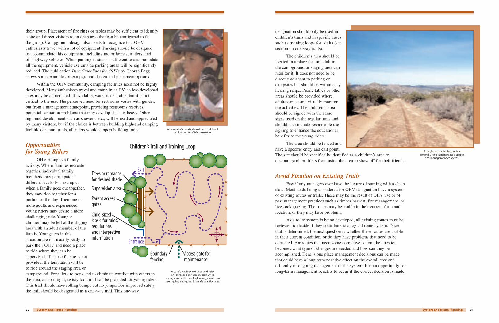
Opportunities for Young Riders
OHV riding is a familyactivity. Where families recreatetogether, individual familymembers may participate atdifferent levels. For example,when a family goes out together,they may ride together for aportion of the day. Then one ormore adults and experiencedyoung riders may desire a morechallenging ride. Youngerchildren may be left at the stagingarea with an adult member of thefamily. Youngsters in thissituation are not usually ready topark their OHV and need a placeto ride where they can besupervised. If a specific site is notprovided, the temptation will beto ride around the staging area orcampground. For safety reasons and to eliminate conflict with others inthe area, a short, tight, twisty loop trail can be provided for young riders.This trail should have rolling bumps but no jumps. For improved safety,the trail should be designated as a one-way trail. This one-way
Trees or ramadas for desired shade
Access gate formaintenance
Boundary fencing
Entrance
Exit
Supervision area
Parent accessgates
Child-sizedkiosk for rules, regulations and interpretive information
N
Children’s Trail and Training Loop
A comfortable place to sit and relaxencourages adult supervision while
youngsters, with their high energy level, cankeep going and going in a safe practice area.
A new rider’s needs should be consideredin planning for OHV recreation.
33Trail Design
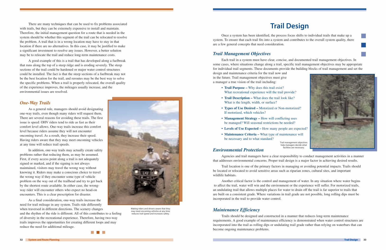
Trail Management ObjectivesEach trail in a system must have clear, concise, and documented trail management objectives. In
some cases, where situations change along a trail, specific trail management objectives may be appropriatefor individual trail segments. These documents provide the building blocks of trail management and set thedesign and maintenance criteria for the trail now and in the future. Trail management objectives must give a manager a true vision of the trail including:
• Trail Purpose – Why does this trail exist? What recreational experience will the trail provide?
• Trail Description – What does the trail look like? What is the length, width, or surface?
• Types of Use Desired – Motorized or Non-motorized? If motorized, which vehicles?
• Management Strategy – How will conflicting uses be managed? Will seasonal restrictions be needed?
• Levels of Use Expected – How many people are expected?
• Maintenance Criteria – What type of maintenance will be necessary and to what standard?
Environmental ProtectionAgencies and trail managers have a clear responsibility to conduct management activities in a manner
that addresses environmental concerns. Proper trail design is a major factor in achieving desired results.
Trail location is one of the primary factors in managing or avoiding potential impacts. Trails should be located or relocated to avoid sensitive areas such as riparian zones, cultural sites, and important wildlife habitats.
Another critical factor is the control and management of water. In any situation where water beginsto affect the trail, water will win and the environment or the experience will suffer. For motorized trails,
an undulating trail that allows multiple places for water to drain off the trail is far superior to trails that are built on a consistent grade. Where variations in trail grade are not possible, long rolling dips must beincorporated in the trail to provide water control.
Maintenance EfficiencyTrails should be designed and constructed in a manner that reduces long-term maintenance
requirements. A good example of maintenance efficiency is demonstrated when water control structures areincorporated into the trail as rolling dips or undulating trail grade rather than relying on waterbars that canbecome ongoing maintenance problems.
Trail DesignOnce a system has been identified, the process focus shifts to individual trails that make up a
system. To ensure that each trail fits into a system and contributes to the overall system quality, thereare a few general concepts that need consideration.
Trail management objectiveshelp managers decide what
facilities are necessary.
32 System and Route Planning
There are many techniques that can be used to fix problems associatedwith trails, but they can be extremely expensive to install and maintain.Therefore, the initial management question for a route that is needed in thesystem should be whether this segment of the trail can be relocated to resolvethe problem. A trail that is in a wrong location may have to stay in thatlocation if there are no alternatives. In this case, it may be justified to makea significant investment to resolve any issues. However, a better solutionmay be to relocate the trail and reduce long-term maintenance costs.
A good example of this is a trail that has developed along a fuelbreakthat runs along the top of a steep ridge and is eroding severely. The steepsections of the trail could be hardened or major water control structurescould be installed. The fact is that the steep sections of a fuelbreak may notbe the best location for the trail, and reroutes may be the best way to solvethe specific problems. When a trail is properly relocated, the overall qualityof the experience improves, the mileages usually increase, and theenvironmental issues are resolved.
One-Way TrailsAs a general rule, managers should avoid designating
one-way trails, even though many riders will request them.There are several reasons for avoiding these trails. The firstissue is speed: OHV riders tend to ride as fast as theircomfort level allows. One-way trails increase this comfortlevel because riders assume they will not encounteroncoming travel. As a result, they increase their speed.Having riders aware that they may meet oncoming vehiclesat any time will reduce trail speeds.
In addition, one-way trails may actually create safetyproblems rather that reducing them, as may be assumed.First, if every access point along a trail is not adequatelysigned or marked, and if the signing is not alwaysmaintained, visitors may travel the wrong way withoutknowing it. Riders may make a conscious choice to travelthe wrong way if they encounter some type of vehicleproblem on the way out of the trailhead and try to get backby the shortest route available. In either case, the wrong-way rider will encounter others who expect no head-onencounters. This is a clear prescription for disaster.
As a final consideration, one-way trails increase theneed for trail mileage in any system. Trails ride differentlywhen traversed in different directions. The scenery changesand the rhythm of the ride is different. All of this contributes to a feeling of diversity in the recreational experience. Therefore, having two-way trails improves the opportunities for creating different loops and may reduce the need for additional mileage.
Making riders and drivers aware that they may meet oncoming vehicles at any timereduces trail speed and increases safety.

35Trail Design
Water Control andStream Crossings
Water control structuresshould be incorporated into thetrail grade. Stream crossingsshould be located where thestream bottom is solid, stable or modified to support theexpected uses. Stream banksshould be hardened or stabilized,if necessary, to preventunacceptable erosion or sediment delivery into thestream. When local regulationsrequire and when crossingscannot be stabilized, streamsshould be bridged.
Soil Stability
Trails should avoid wet or boggy areas whenever possible. If itis necessary to cross a wet area, a suitable structure such as a turnpike,puncheon, or other armoring should be included in the trail design toensure long-term sustainability of the crossing. Where multiuse trailsare planned, the armoring method used must be compatible with alluses. For example, corduroy, which may be very effective for wheeledvehicle trails, is not compatible if horse travel is anticipated.
Intersections
Trail intersections should be designed to provide adequatevisibility from all approaches. Designers should avoid four-wayintersections, if possible, and instead use an offset to slow down riders.
Curves and Switchbacks
Turns and curves can be used as design features to reduce sightdistances, increase difficulty, and therefore reduce speed. When multipleturns are necessary to gain elevation in steep country, use climbingturns rather than switchbacks, if possible. Climbing turns have a longerradius and provide for a more usable and enjoyable turn. Whereswitchbacks are used, the level of difficulty of the trail will increase. In addition, switchbacks may result in significantly more maintenancecosts than climbing turns.
Vegetation and Clearing
The type of clearing on a trail can also be used to control speedor increase the level of difficulty on a trail. Narrow trails areappreciated by many riders and provide a better experience.
Rolling Contour TrailA rolling contour trail is characterized by a gentle grade, undulations called grade reversals and an outsloped tread.
Mechanically constructed rolling dips or undulating trail grades provide water
control and reduce maintenance.
34 Trail Design
Enthusiast SatisfactionTrail design must ensure that the trail will provide the desired recreational experiences. A trail that is
planned as a Most Difficult trail should be designed to include areas that will provide the challenges that a visitor would expect. For example, the trail could be routed through rocky areas to provide appropriateobstacles, downed logs could be left in the trail tread, or clearing limits could be reduced to add thechallenge of encountering vegetation.
Site-Specific FactorsIn addition to these general concepts, there are many site-specific factors that need to be considered
when designing a new trail for new construction or redesigning an existing trail to better meet managementrequirements. These can include:
Flow
OHV trails must “flow” to increaseridability and create a high fun factor.Curvilinear alignments and undulating gradescreate flow. Curves must be circular and shouldbe super-elevated. If a curve is parabolic ratherthan circular, it can be ridden more easily fromone direction, but not the other, which maycause riders to fail to negotiate the corner. As flow decreases, the difficulty of the trailincreases. If a change in the trail flow isrequired, designers should consider designing a transitional segment to avoid abrupt changesthat could increase safety problems.
Grade
Trails should be designed to cross any slopes rather than go straight up or down the fall line. Trailgrade should never exceed 50% of the cross slope of the area being crossed, to avoid channeling water.
Open and Flowing
Tight and Technical
Poor ßow–abrupt transitions from one type of ßow to another.
Half Rule Average Trail Segment GradeSideslope 20% Grade Trail 15% Grade
Water willßow down trail.
This trail breaks the Half Rule.
Sideslope 20% Grade Trail 8% Grade
Water willsheet across trail.
This trail meets the Half Rule.
Elev. 458 ft.
Elev. 450 ft.
Run = 100 ft.8 ÷ 100 x 100 = 8%Average Grade = 8%
Rise = 8 ft.
9%7% 5%
15%4%
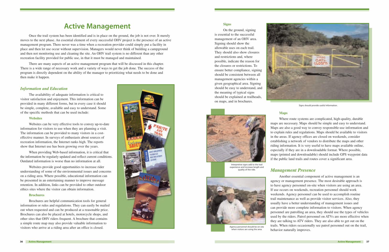
Signs
On the ground, signing is essential to the successfulmanagement of an OHV area.Signing should show theallowable uses on each trail. They should also show closures and restrictions and, wherepossible, indicate the reason forthe closures or restrictions. Toensure better compliance, signingshould be consistent between allmanagement agencies within agiven geographical area. Signingshould be easy to understand, andthe meaning of typical signsshould be explained at trailheads,on maps, and in brochures.
Maps
Where route systems are complicated, high-quality, durablemaps are necessary. Maps should be simple and easy to understand.Maps are also a good way to convey responsible-use information andto explain rules and regulations. Maps should be available to visitorsin the areas. If agency offices are closed on weekends, considerestablishing a network of vendors to distribute the maps and otherriding information. It is very useful to have maps available online,especially if they are in a downloadable format. Where possible,maps (printed and downloadable) should include GPS waypoint dataif the public land trails and routes cover a significant area.
Management PresenceAnother essential component of active management is an
agency or management presence. The most desirable approach is to have agency personnel on-site when visitors are using an area. If use occurs on weekends, recreation personnel should workweekends. Agency personnel can be used to accomplish routine trail maintenance as well as provide visitor services. Also, theyusually have a better understanding of management issues and can provide more complete information to visitors. When agencypersonnel are patrolling an area, they should use the types of vehiclesused by the riders. Patrol personnel on ATVs are more effective whenthey are talking to ATV riders. They are also able to get out on thetrails. When riders occasionally see patrol personnel out on the trail,behavior naturally improves.
37Active Management
Interpretive signs add to the trailexperience and increase length and
quality of the ride.
Signs should provide useful information.
Agency personnel should be on-sitewhen visitors are using the area.
Once the trail system has been identified and is in place on the ground, the job is not over. It merelymoves to the next phase. An essential element of every successful OHV project is the presence of an activemanagement program. There never was a time when a recreation provider could simply put a facility inplace and then let use occur without supervision. Managers would never think of building a campgroundand then not monitoring use and cleaning the site. An OHV trail system is no different than any otherrecreation facility provided for public use, in that it must be managed and maintained.
There are many aspects of an active management program that will be discussed in this chapter.There is a wide range of necessary work and a variety of ways to get the job done. The success of theprogram is directly dependent on the ability of the manager to prioritizing what needs to be done and then make it happen.
Information and EducationThe availability of adequate information is critical to
visitor satisfaction and enjoyment. This information can beprovided in many different forms, but in every case it should be simple, complete, available and easy to understand. Some of the specific methods that can be used include:
Websites
Websites can be very effective tools to convey up-to-dateinformation for visitors to use when they are planning a visit. The information can be provided to many visitors in a cost-effective manner. In surveys of enthusiasts about sources ofrecreation information, the Internet ranks high. The reports show that Internet use has been growing over the years.
When providing Web-based information, it is critical thatthe information be regularly updated and reflect current conditions.Outdated information is worse than no information at all.
Websites provide good opportunities to increase riderunderstanding of some of the environmental issues and concernson a riding area. Where possible, educational information can be presented in an entertaining manner to improve messageretention. In addition, links can be provided to other outdoorethics sites where the visitor can obtain information.
Brochures
Brochures are helpful communication tools for generalinformation or rules and regulations. They can easily be mailedout when requested and can be produced at a reasonable price.Brochures can also be placed at hotels, motorcycle shops, andother sites that OHV riders frequent. A brochure that contains a simple route map may also provide valuable information tovisitors who arrive at a riding area after an office is closed.
36 Active Management
Active Management
It is best if agency personnel can do maintenance with help fromvolunteers. Trail maintenance skills improve with every new season, andlong-term employees can become very effective in identifying problemsand fixing them before they become major issues. The fact that agencycrews may not be available is not a good reason to ignore trailmaintenance needs. Without trail crews, managers need to look for moreinnovative ways to get the job done. The Adopt-a-Trail program is oneway to get maintenance done by volunteers, and it also develops somerider “ownership” in the trail. Volunteer workdays are an effective wayto get larger projects done. In any case, when volunteers are used,agency involvement is alsorequired. Again, it is important to note that volunteers mustunderstand and adhere to the TrailManagement Objectives and notdevelop their own standards.
VolunteersFor most land management
agencies, volunteers are the key to survival. This is especially truefor OHV management programs.With budget cutbacks and shiftingpriorities, the money for trailmaintenance and patrol personnelis shrinking, but the job isgrowing and still needs to bedone. Recruitment and retention ofvolunteers is an ongoing process.
Agency NeedsAccomplishing Work
Some agencies primarilyfocus on using volunteers toaccomplish specific tasks. The fact is that volunteers canaccomplish amazing amounts of work, but the value ofvolunteerism is much more thanthe work that gets accomplished.There are times when it may bequicker and easier to use agencycrews, if they are available.
39Active Management
The Colorado Trail Rangers, managed under ColoradoState Parks, maintain trails and interact with the public.
Volunteers donate thousands of hours to maintain trails.
With funding constraints that agencies face, it may not be possibleto provide patrol personnel whenever they are needed. In these cases,managers should consider establishing a volunteer patrol staff. Thesetrail ambassadors need to be trained to understand agency policies andregulations. They need to be able to relate well to people, and they mustunderstand that they have no enforcement authority. Their primaryresponsibility should be to provide visitor information and assistance.When properly equipped, they can quickly summon enforcementpersonnel as situations warrant.
Trail MaintenanceAll trails must be
maintained if there is anyexpectation of maintaining visitorexperience, preserving the capitalinvestment, and reducingenvironmental impacts. The levelof maintenance may vary fromyear to year, but some minimallevel of attention is required everyyear. It is critical that the intendeddifficulty level not be changed by over maintaining or undermaintaining a trail. The TrailManagement Objectives (TMOs)must be closely adhered to. Earlyin the season the trail should beopened to the standard required bythe Trail Management Objectives.When logs and other obstacles are cleared, there is no reason forpeople to get off the route, andproblems caused when people tryto get around obstructions areeliminated. This is also a goodtime to identify and prioritizeother maintenance work that maybe needed on the trail, such asrepairing drainage problems.It is also a good practice to tryand visit the trails prior to theclose of the season to ensure thatdrainage is functioning and thetrail is ready for winter.
38 Active Management
Trail rakes can pull soil from berms without requiringthe operator to drive off the trail.
It is critical that the intended difficulty level not bechanged by over maintaining or under maintaining a trail.
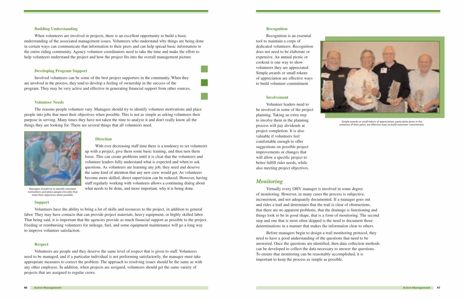
Recognition
Recognition is an essentialtool to maintain a corps ofdedicated volunteers. Recognitiondoes not need to be elaborate orexpensive. An annual picnic orcookout is one way to showvolunteers they are appreciated.Simple awards or small tokens of appreciation are effective waysto build volunteer commitment.
Involvement
Volunteer leaders need to be involved in some of the projectplanning. Taking an extra step to involve them in the planningprocess will pay dividends atproject completion. It is alsovaluable if volunteers feelcomfortable enough to offersuggestions on possible projectimprovements or changes that will allow a specific project tobetter fulfill rider needs, while also meeting project objectives.
MonitoringVirtually every OHV manager is involved in some degree
of monitoring. However, in many cases the process is subjective,inconsistent, and not adequately documented. If a manager goes out and rides a trail and determines that the trail is clear of obstructions,that there are no apparent problems, that the drainage is functioning andthings look to be in good shape, that is a form of monitoring. The secondstep and one that is most often skipped is the need to document thosedeterminations in a manner that makes the information clear to others.
Before managers begin to design a trail monitoring protocol, theyneed to have a good understanding of the questions that need to beanswered. Once the questions are identified, then data collection methodscan be developed to collect the data necessary to answer the questions. To ensure that monitoring can be reasonably accomplished, it isimportant to keep the process as simple as possible.
41Active Management
Simple awards or small tokens of appreciation, particularly given in thepresence of their peers, are effective ways to build volunteer commitment.
40
Building Understanding
When volunteers are involved in projects, there is an excellent opportunity to build a basicunderstanding of the associated management issues. Volunteers who understand why things are being done in certain ways can communicate that information to their peers and can help spread basic information to the entire riding community. Agency volunteer coordinators need to take the time and make the effort to help volunteers understand the project and how the project fits into the overall management picture.
Developing Program Support
Involved volunteers can be some of the best project supporters in the community. When theyare involved in the process, they tend to develop a feeling of ownership in the success of theprogram. They may be very active and effective in generating financial support from other sources.
Volunteer Needs
The reasons people volunteer vary. Managers should try to identify volunteer motivations and placepeople into jobs that meet their objectives when possible. This is not as simple as asking volunteers theirpurpose in serving. Many times they have not taken the time to analyze it and don't really know all the things they are looking for. There are several things that all volunteers need.
Direction
With ever decreasing staff time there is a tendency to set volunteersup with a project, give them some basic training, and then turn themloose. This can create problems until it is clear that the volunteers andvolunteer leaders fully understand what is expected and when to askquestions. As volunteers are learning any job, they need and deserve the same kind of attention that any new crew would get. As volunteersbecome more skilled, direct supervision can be reduced. However, havingstaff regularly working with volunteers allows a continuing dialog aboutwhat needs to be done, and more important, why it is being done.
Support
Volunteers have the ability to bring a lot of skills and resources to the project, in addition to generallabor. They may have contacts that can provide project materials, heavy equipment, or highly skilled labor.That being said, it is important that the agencies provide as much financial support as possible to the project.Feeding or reimbursing volunteers for mileage, fuel, and some equipment maintenance will go a long way to improve volunteer satisfaction.
Respect
Volunteers are people and they deserve the same level of respect that is given to staff. Volunteers need to be managed, and if a particular individual is not performing satisfactorily, the manager must takeappropriate measures to correct the problem. The approach to resolving issues should be the same as withany other employee. In addition, when projects are assigned, volunteers should get the same variety ofprojects that are assigned to regular crews.
Active Management
Managers should try to identify volunteermotivations and place people into jobs that
meet their objectives when possible.
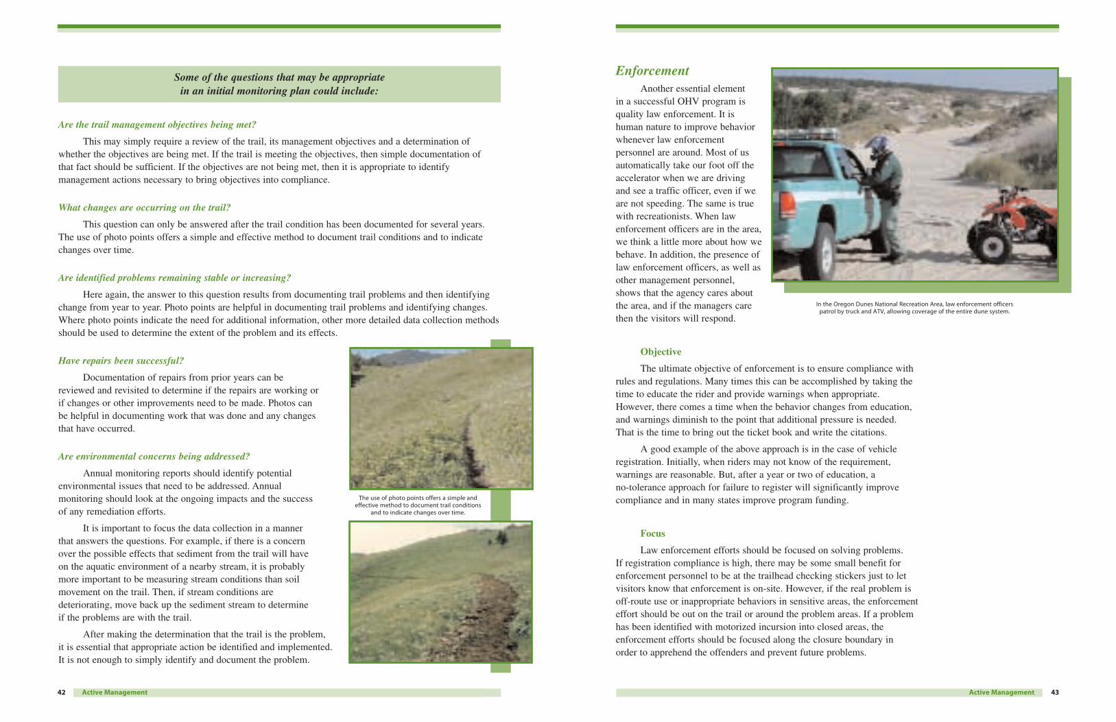
EnforcementAnother essential element
in a successful OHV program isquality law enforcement. It ishuman nature to improve behaviorwhenever law enforcementpersonnel are around. Most of usautomatically take our foot off theaccelerator when we are drivingand see a traffic officer, even if weare not speeding. The same is truewith recreationists. When lawenforcement officers are in the area,we think a little more about how webehave. In addition, the presence oflaw enforcement officers, as well asother management personnel,shows that the agency cares aboutthe area, and if the managers care then the visitors will respond.
Objective
The ultimate objective of enforcement is to ensure compliance withrules and regulations. Many times this can be accomplished by taking thetime to educate the rider and provide warnings when appropriate.However, there comes a time when the behavior changes from education,and warnings diminish to the point that additional pressure is needed. That is the time to bring out the ticket book and write the citations.
A good example of the above approach is in the case of vehicleregistration. Initially, when riders may not know of the requirement,warnings are reasonable. But, after a year or two of education, a no-tolerance approach for failure to register will significantly improvecompliance and in many states improve program funding.
Focus
Law enforcement efforts should be focused on solving problems. If registration compliance is high, there may be some small benefit forenforcement personnel to be at the trailhead checking stickers just to letvisitors know that enforcement is on-site. However, if the real problem isoff-route use or inappropriate behaviors in sensitive areas, the enforcementeffort should be out on the trail or around the problem areas. If a problemhas been identified with motorized incursion into closed areas, theenforcement efforts should be focused along the closure boundary in order to apprehend the offenders and prevent future problems.
43Active Management
In the Oregon Dunes National Recreation Area, law enforcement officers patrol by truck and ATV, allowing coverage of the entire dune system.
42
Some of the questions that may be appropriate in an initial monitoring plan could include:
Are the trail management objectives being met?
This may simply require a review of the trail, its management objectives and a determination ofwhether the objectives are being met. If the trail is meeting the objectives, then simple documentation of that fact should be sufficient. If the objectives are not being met, then it is appropriate to identifymanagement actions necessary to bring objectives into compliance.
What changes are occurring on the trail?
This question can only be answered after the trail condition has been documented for several years.The use of photo points offers a simple and effective method to document trail conditions and to indicatechanges over time.
Are identified problems remaining stable or increasing?
Here again, the answer to this question results from documenting trail problems and then identifyingchange from year to year. Photo points are helpful in documenting trail problems and identifying changes.Where photo points indicate the need for additional information, other more detailed data collection methodsshould be used to determine the extent of the problem and its effects.
Have repairs been successful?
Documentation of repairs from prior years can be reviewed and revisited to determine if the repairs are working or if changes or other improvements need to be made. Photos can be helpful in documenting work that was done and any changesthat have occurred.
Are environmental concerns being addressed?
Annual monitoring reports should identify potentialenvironmental issues that need to be addressed. Annual monitoring should look at the ongoing impacts and the success of any remediation efforts.
It is important to focus the data collection in a manner that answers the questions. For example, if there is a concern over the possible effects that sediment from the trail will have on the aquatic environment of a nearby stream, it is probably more important to be measuring stream conditions than soilmovement on the trail. Then, if stream conditions are deteriorating, move back up the sediment stream to determine if the problems are with the trail.
After making the determination that the trail is the problem,it is essential that appropriate action be identified and implemented.It is not enough to simply identify and document the problem.
Active Management
The use of photo points offers a simple andeffective method to document trail conditions
and to indicate changes over time.
Summary
45Summary
Management of OHV recreation can be a challenging experience,but it can also be very rewarding. OHV enthusiasts tend to be veryappreciative of the efforts of land managers who work to providesystems of quality trails for their use.
The challenges, though at times difficult, can be overcome. Theuse can be managed to meet rider and agency objectives. Many OHVmanagers produce high-quality programs by applying the tools and theapproaches presented in this book.
New managers may be able to take some of these guidelines andimmediately improve program quality. However, it is also important formanagers not to work in a vacuum. Maintaining a dialogue with othermanagers within an agency or in other agencies makes the job mucheasier. There are also a number of outside groups that may be able tooffer expertise or information to help with the management job. Chancesare that someone has already dealt with the problem you are facing.They may not be able to give you a simple solution, but they may helpyou avoid making the same mistakes. The primary focus should be toreach out beyond your administrative boundaries to find the tools andthe help you need to get the job done.
ReferencesGeorge E. Fogg, Park Guidelines for OHVs, National Off-HighwayVehicle Conservation Council, 2002.
Joe Wernex, Off-Highway Motorcycle and ATV Trails: Guidelines forDesign, Maintenance and User Satisfaction, American MotorcyclistAssociation, 1994.
Pennsylvania Trail Design Manual for Off-Highway Vehicle Trails,Pennsylvania Department of Conservation and Natural Resources,Prepared by Larson Design Group Inc., 2005.
44
Techniques
Enthusiasts respond muchmore favorably to enforcementefforts focused on the problemareas. They also respondfavorably to enforcement officerswho are out on the trail riding thesame vehicles. By getting out onthe trail on a motorcycle or anATV, enforcement officers gaincredibility and become muchmore effective because they areout where the problems mayoccur. They are also moreeffective in search and rescue and other safety-related activitiessince they are able to get to the immediate areas where they are needed.
Clearly, officers must have discretion in how they handle anyparticular problem. But it is the responsibility of management to set the priorities for enforcement activities and provide guidelines for theconduct of those activities. This cooperation between management andenforcement will result in significant improvements in the quality of an area and in visitor experiences.
Public OutreachWith all the work that is involved in managing the visitors and
the facilities, it is easy to lose focus of one important component ofOHV management: local public or the project neighbors. Failure toconsider the effects on the neighbors early in the process will lead toconflict, confrontation, and possible litigation.
Neighbors need to be involved early in the planning process toensure that they understand the entire project and its effects. In addition,the local concerns need to be identified and addressed during theplanning phase. Controversy and opposition are an element that must be addressed in nearly every OHV project. By getting neighbors andlocal stakeholders involved in the process and by allowing them toinfluence and understand the project design, the manager is better able to control public perception.
Active Management
“Amnesty Days”. Giving stickers out to the quietest vehicles, providing information to clubs
and at events or dealerships about stationary soundtesting and how to keep their vehicles quiet all
help build compliance and cooperation.

47
APPENDIX BSample GPS Data Dictionary for Detailed OHV Inventories
Route (Line) Roads & Trails
Road Type/Class (Menu)
Reclaiming [R]Has not been used for longenough that there is intact woodyvegetation growing that would bedamaged by the passage ofvehicles. Erosion and vegetationmay block the way and cause thevehicle to get stuck or damaged.
Single Track [ST]Hiking and biking; too narrow for a truck and, most times, anATV. Can be up to 1⁄2-meter wide,not allowing ATVs or trucks.
Wide Trail [WT]Allow ATV use but not full size vehicle.
Tertiary Road Unpav. [TRU]default
Generally a two-track that may or may not be usable by a two-wheel drive vehicle. No formal maintenance.
Secondary Road Unpav. [SRU]Generally a regularly maintainedone-lane road, with other roads of lesser quality branching fromit. Connects primary roads and major points.
Secondary Road Paved [SRP]A paved road that is not ahighway, such as back roads.Often not striped. Connectsprimary roads and major points.
Primary Road Unpaved [PRU]A regularly maintained road wideenough for at least two vehicles.Serves a large area, with manyroads branching from it.
Primary Road Paved [PRP]Major/Minor highway. Providesaccess between major points.
Road Material (Menu) Kind of surface
Asphalt [A] Paved
Gravel (Overlay) [GO]Material was brought in fromoffsite; road bed can be raised.
Gravel (Natural) [GN]Surface is covered with naturalgravel. Common in areas of decomposed granite and desert pavement.
Soil [S] default The native ground; often maylook like gravel, but gravel is skin-deep with soil underneath.Includes deep dust situations.
Packed Sand [P]Usually in roads along wash bottoms.
Cobbles [C]Usually in roads along wash bottoms.
Rock [R]Loose rock that is rough to drive on; usually on steeperslopes on mountains.
Bedrock [B]Exposed expanses of bedrock,usually due to erosion on anunmaintained road.
Use1 (Menu) Mandatory,actual use observed or usecriteria listed below:
Undetermined [-]Cannot be determined.
Motorcycle [M]Can tell by tire tread andoccasional broken accessory.
Bicycle [B]Can tell by narrow tire tread. Do not ride ATVs on these trails.
2WD [T]All paved roads, most secondaryunpaved roads, and a few tertiaryunpaved roads that are smoothenough for at least higher-clearance vehicles.
4WD [F] defaultCan tell from roughness of road;erosion and/or steepness preventstwo-wheel drive vehicles fromusing the road. Long-bed pickup trucks may run intotrouble, especially crossingnarrow washes. Some very steep segments may preventGPSing using the ATV.
ATV [A]Applies to most remote roads(especially many Tertiary RoadUnpaved roads).
Hiking [H]Single-track trails signed forhiking. Tread is often rougherthan those used by ATVs,motorcycles, and bicycles. Some motorized trails may also be used by hikers.
Equestrian [E]Horseback riding trails. Dung and hoof marks often a clue. Wild burro and other wildlifetrails are not part of inventory.
Note: After “Use” entrydetermines type of vehicle,degree of difficulty can beassigned for the largest vehicleable to use route. These aresubjective for planning purposes only. May change with maintenance.
46
Appendix AOHV Event Descriptions
Organized events are an important aspect of an OHV experience for many enthusiasts. The types ofevents vary. Listed below are short descriptions of some of the events that managers may be called upon to consider as they manage OHV use.
Dual Sport
An on/off-road event where street-legal motorcycles are used. Only a rough time schedule is usedprimarily to get riders to catered lunch breaks or to get riders to a prescribed finish point before dark.Course length is typically greater than 50 miles, depending on trail difficulty. Alternate routes are providedto bypass more technically difficult sections. These events can vary widely in percentage of trail versusroad use.
Match Trial
An off-road event where the participants ride a prescribed course multiple times. Riders may ride at their own pace but are timed over each section of trail. The object is to match your time over the trailsections and speed is not required. No timing devices are permitted so riding consistency is being tested.Awards are based on the least differential time over the prescribed trail sections.
Poker Run/Turkey Run
An on/off-road event where participants follow a prescribed course. Contingency prizes are awardedat the end of the event by a random determination such as a poker hand or random drawing. Course lengthwill typically vary depending on trail levels of difficulty but usually will exceed 50 miles.
Hare Scrambles
This is a form of closed-course competition that utilizes a trail loop of 3 or more miles in length. It normally utilizes a mass start with one or more checkpoints. Time duration is normally two or morehours depending on rider class.
Enduro
A competition on a prescribed course and time schedule where a set speed, though not necessarily thefastest speed, is the determining factor. Trail length may vary from 25 to more than 100 miles, but total ridelength must exceed 50 miles. Rider progress is monitored through a series of checkpoints along the course.
Competitive 4x4 Rock Crawling
This activity is held in an “area” or “site” rather than a “trail”. A good site calls for small areas (10-30 acres) of natural rock / large boulder formations allowing a number of individual obstacles to be identified. Each obstacle (10-15) is marked for competitors to traverse on a predetermined course alongwith a maximum time limit per obstacle.
49
Point Sites (Point) Small Points of Interest
Type (Menu)
Campsite [C] default An arealarge enough for one or two tents or one or two vehicles. One or two fire rings.
Scenic Overlook [SO]A picturesque view, often from a pass/saddle. Often where thereis a dramatic change of view dueto reaching a ridge or saddle (the wow! factor).
Wildlife Water [WW]A developed Game & Fishwildlife water catchment made of a paved area funneling water to a tank and drinking facility.Usually has a fence around it and sign denoting restrictions.
Stock Tank [ST]A developed reservoir forlivestock, with water resembling a pond during wet times. Usually unsigned.
Gate Cattleguard [C]You can drive across withoutstopping.
Gate Swing [GS]Solid metal or wooden gate on hinges.
Gate Wire [GF]Looks like a fence and has to bedragged away from the road.Loop wire ties it to rest of fence.
Corral [CL]Enclosure for livestock, made of lumber or tree limbs;occasionally metal.
Wildlife Viewing [WV]May be officially designated or an area where wildlife has beenseen frequently.
Intersection [INT]Not required for every junction.Use only for junctions with asuspected or definite road thatwill require another trip.
Dead End [DC]Not required for every dead end.Use as needed when a road seems to fizzle out or hits a fence not far from another road such as a highway.
Trailhead [TH]The beginning of a hiking orequestrian trail from a road,often is designated, with parking facilities.
Old Car [CAR]Abandoned cars or major carparts, of any age.
Culvert [CV]Metal tube or very small concretetunnel under road.
Drainage Turnouts [TO]Road-like curves leading awayfrom road itself to guiderainwater away from road.
Area Sites (Area) Large Points of Interest
Type (Menu)
Large Campsite [C] defaultA large campsite where a pointGPS will not do, in excess of 20 meters in diameter.
Stock Pens [S]Very large corrals.
Parking [P]A large parking area.
Scenic Overlook [SO]A large viewpoint, usuallydeveloped.
Staging Area [SA] A large area where off-roadevents are often based. Oftencreated by constant, unauthorizeduse and has numerous campsitesand fire rings. Perimeter likelywill include small islands ofintact vegetation.
Photo Points (Point) Photo # and optional comment
Photo Points (Text, 30Characters)/the photo number and optional comment to makeidentification easier. Format is LB7-13 San Cristobel Panorama E.
L is the first name (Leah) of person. B is for Barry M.Goldwater Range Project. 7 is roll number. 13 is photonumber within that roll.
“San Cristobel Panorama”makes photo identification easier, as given number may not always match number on slide or negative strip. “E” is for looking east; use if you think there may be confusionfrom lack of landmarks when the photo comes out.
Use photo board for picture inmost cases. Photos will generallyshow a typical setting for the road being GPSed, preferablywith a scenic background that sets it apart from other roads.Occasional scenic views notshowing road are also welcome.Use of photo broad here isoptional, keeping in mind thatthese photos may be used fordisplays and brochures.
48
Degree of Difficulty
Easiest
More Difficult
Most Difficult
Characteristics (reasons for degree of difficulty)
Width
Slope
Boulders
Loose Rock
Loose Surface
Sideslope
Vegetation-Dead
Vegetation-Live
Sand
Mud
Etc…
Use2 (Menu) Optional (See Use1 Menu)
Undetermined [-]
Motorcycle [M]
Bicycle [B]
2WD [T]
4WD [F]
ATV [A]
Hiking [H]
Equestrian [E]
Use3 Menu) Optional (See Use1 Menu)
Undetermined [-]
Motorcycle [M]
Bicycle [B]
2WD [T]
4WD [F]
ATV [A]
Hiking [H]
Equestrian [E]
Use Level (Menu) Heavy and Light are relative for each type of road.
Heavy [H]
Moderate [M]
Light [L] default
Nonexistent [NE]Generally for reclaimed roads,with rare exceptions for recentlyabandoned roads.
Cross Slope
The angle of the trail’s crosssection from horizontal,in degrees.
Road Name/No.
(Text, 52 characters) Number or name of highway ordesignated back roads such asthose in National Forests. Somehiking trails may have names.
Comment
(Text, 52 characters) Any comment that does not fit in other parts of the (Menu).
Person
(Text, 30 characters) Initials of person gathering data.
Maintenance (Menu)
Describes what the road needsdone. Generally does not apply to unpaved secondary and tertiary roads and single tracks.
Dust Abatement [DA}
Shoulder Maintenance [SM}
Striping [ST]
Washboard [WB]
Grading [GR}
Aggregate Replace [AG]
Width (Numeric) 1,0.5, 30.0, 2.5Range from 0.5 to 30, in meters:default is 2.5, the width of mostTertiary Road Unpaved.
Hazards (Point) Dangersencountered on the way
Type (Menu)
Mining Site [M]Mine shafts, adits, open pits,even if hazards are not obvious.
Erosion [E] defaultRoad badly eroded beyond whatmight be expected for the roadtype and may be hazardous tovehicles and drivers.
Washout [W]Road is impassable due to severeerosion. Rest of road may becompletely cut off or accessiblevia other roads.
Water Xing [X]Crossing a perennial stream.
Poor Visibility [PV]Due to vegetation or a tight turn around a cliff or rock.
Overhanging Veg. [OV]Vegetation low enough to brushagainst vehicle or head, causingdamage or injury.
Flash Flood Area [FF]Long, narrow washes.
Trash Dump [TD]Areas of extensive dumping or a large item worthy of beingrecorded for later removal.
Hazardous Waste [HW]Suspicious barrels, smells, burnedmaterial, leaking containers.LEAVE SITE AND REPORTIMMEDIATELY!

51
Multiple Loop System – The multiple loop system has a single trailhead, with several loops radiating out fromthe point of origin. Each loop may be of a differing level of difficulty, provide a different experience orprovide access to a destination. This system provides the designer with the capability to meet a variety ofuser’s expectations. This system may permit one-wayor two-way traffic.
Spoked Wheel System – This system consists of an outer loop that is connected by linear trails to acenter trailhead, destination, or center loop. Multipletrailheads along the outer loop may also be used. A spoked wheel system can provide differing levels of difficulty for the spokes. The spokes can also beused to provide different experiences. This system may permit one-way or two-way traffic.
Primary and Secondary Loop System – This systemhas a primary loop, with multiple secondary loops. The secondary loops may offer a different level ofdifficulty, provide a different experience, or provideaccess to a destination. This system provides thedesigner with the most flexibility to meet userexpectations for a variety of users. This type of system is ideal for multiple-use trails. Trailheads may be located around the primary loop. This system may permit one-way or two-way traffic.
Maze System – The maze layout is a system of loops and linear trails that provides many alternative routes. A maze system can provide a variety of experiences but is usually of a single level of difficulty. This systemcan be used for orienteering events, where participantsare required to visit checkpoints in a particularsequence. Users can become disoriented or temporarilylost in this system. A maze trail system should be well-mapped and well-marked. It is not suitable for multiple-use trails. This system should provide for two-way traffic.
From: Pennsylvania Trail Design Manual for Off-Highway Vehicle Trails.
Linear Trail Layout
Multiple Loop System
Spoked Wheel System
Primary and SecondaryLoop System
Maze System
Single Loop System
Stacked Loop System
50
Linear Trail Layout (Point to Point) – The simplest traillayout has a point of origin and a destination. It connectstwo points or links two trails and is used when there arepoints of interest or destinations along a single narrowcorridor. Additionally, this layout may be used to connect other trail systems where the terrain or landownership restricts the trail to a single narrow corridor.This system may consist of several point-to-point trailsthat intersect.There may be multiple trailheads as well.The major disadvantage to this layout is that the ridermust return to his point of origin over trail he has alreadyridden, or vehicles must be shuttled between trailheads.The linear trail layout is best used for long snowmobiletrails or as a connecting system for other trail systems.
Single Loop System – A single loop system is used mostoften for a single, long distance all-day ride. However, itmay also be used for a shorter-duration ride around largefeatures such as a topographic feature, lake, reservoir or wetland. Trails of this system type are easy to developand administer. There may be multiple trailheads alongthe loop. The trail must not exceed its difficulty ratingover its entire length, unless bypasses are provided. This system may permit one-way or two-way traffic. The major disadvantage of a single loop system is that the rider’s choices are limited.
Stacked Loop System – With this type of system thedesigner can develop multiple levels of difficulty, witheach stacked loop becoming more difficult. The initialloop may be Easiest, followed by a More Difficult loop,with the final loop being Most Difficult. This systemgenerally has only one trailhead. A stacked loop systemcan also be used to provide the user with a choice of thelength and duration of the ride. Each loop offers adifferent experience and provides the rider with a morefulfilling and varied outing. This system type can allow a party of riders with varying skill levels to enjoy anouting together. All riders can ride the initial loops as a group, with the advanced riders following the MostDifficult final loop. The majority (average skill riders)would follow the More Difficult loop and meet theadvanced riders as the loops rejoin. This system maypermit one-way or two-way traffic.
APPENDIX CTrail System Layouts
Linear Trail Layout
Multiple Loop System
Spoked Wheel System
Primary and SecondaryLoop System
Maze System
Single Loop System
Stacked Loop System