Embed Size (px)
Citation preview
Comprehensive Screening for At-Risk Species
Why
Before planning any project, it’s important to know what species reside within theboundaries of your project area.
Screening for threatened and imperiled plants and animals is critical at the earlieststages of your planning, project selection, assessment, and review.
Access to the best available species data ensures that you have the knownlocations and other details of threatened or imperiled species.
What
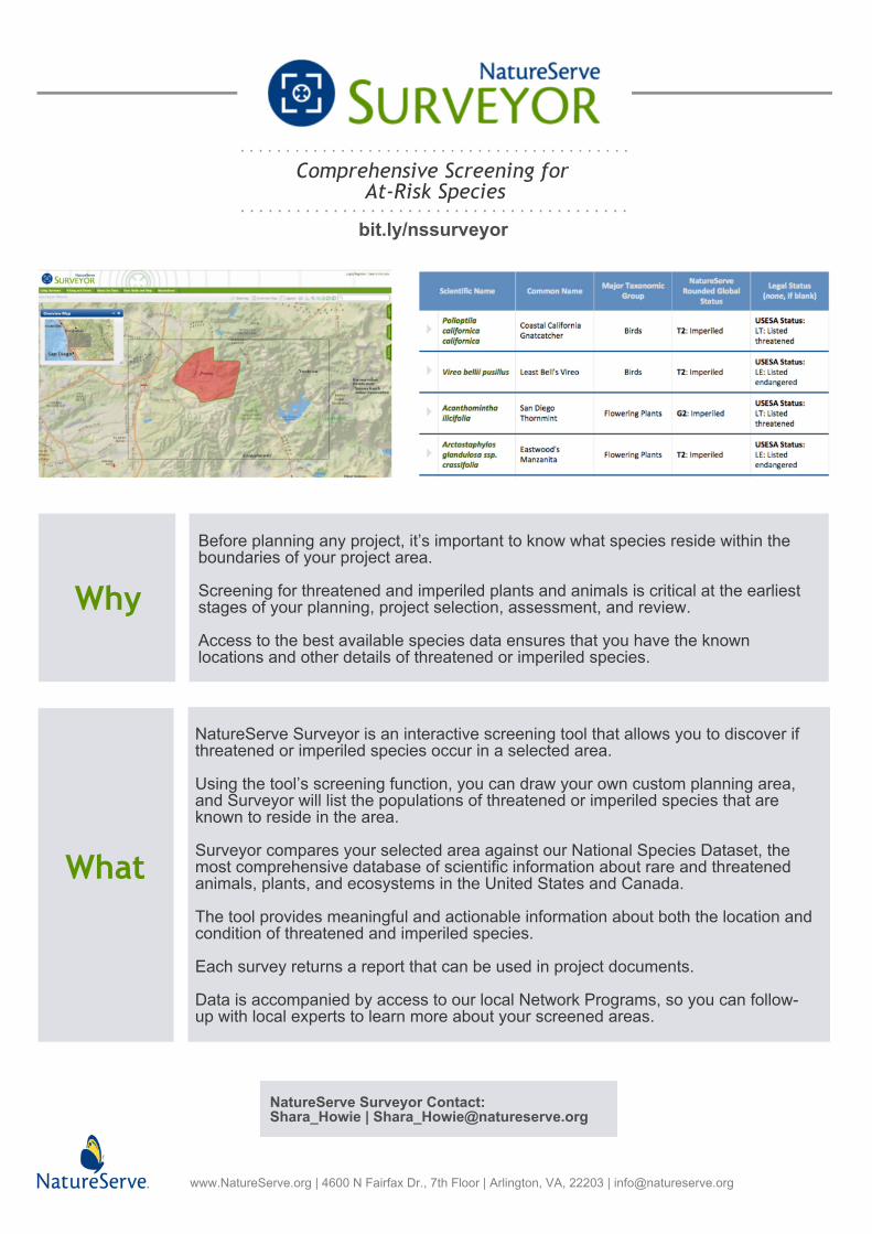
NatureServe Surveyor is an interactive screening tool that allows you to discover ifthreatened or imperiled species occur in a selected area.
Using the tool’s screening function, you can draw your own custom planning area,and Surveyor will list the populations of threatened or imperiled species that areknown to reside in the area.
Surveyor compares your selected area against our National Species Dataset, themost comprehensive database of scientific information about rare and threatenedanimals, plants, and ecosystems in the United States and Canada.
The tool provides meaningful and actionable information about both the location andcondition of threatened and imperiled species.
Each survey returns a report that can be used in project documents.
Data is accompanied by access to our local Network Programs, so you can follow-up with local experts to learn more about your screened areas.
bit.ly/nssurveyor
www.NatureServe.org | 4600 N Fairfax Dr., 7th Floor | Arlington, VA, 22203 | [email protected]
NatureServe Surveyor Contact:Shara_Howie | [email protected]
Surveyor in Action
www.NatureServe.org | 4600 N Fairfax Dr., 7th Floor | Arlington, VA, 22203 | [email protected]
"NatureServe Surveyor allows quick and easy access to valuable informationat the right scale, which can vary from one project to the next. It offers asecond layer of data to assist in defining the right approach for voluntary
conservation activities on working lands"
- Josiane Bonneau, Wildlife Habitat Council
Comprehensive Screening for At-Risk Species
bit.ly/nssurveyor
NatureServe Surveyor Contact:Shara_Howie | [email protected]
Using NatureServe Surveyor Is Easy
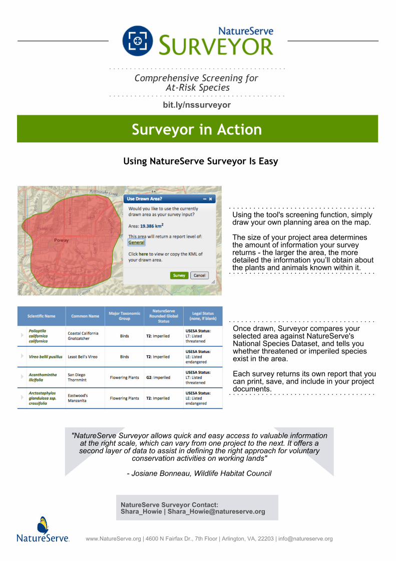
Using the tool's screening function, simplydraw your own planning area on the map.
The size of your project area determinesthe amount of information your surveyreturns - the larger the area, the moredetailed the information you’ll obtain aboutthe plants and animals known within it.
Once drawn, Surveyor compares yourselected area against NatureServe'sNational Species Dataset, and tells youwhether threatened or imperiled speciesexist in the area.
Each survey returns its own report that youcan print, save, and include in your projectdocuments.