Embed Size (px)
Citation preview
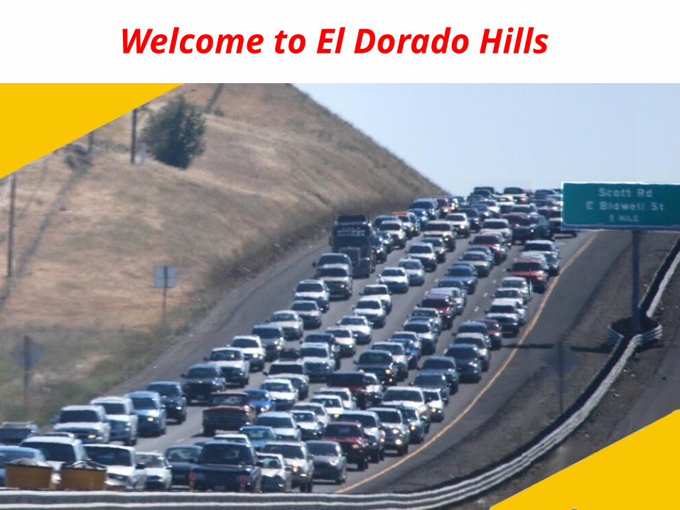
Welcome to El Dorado Hills
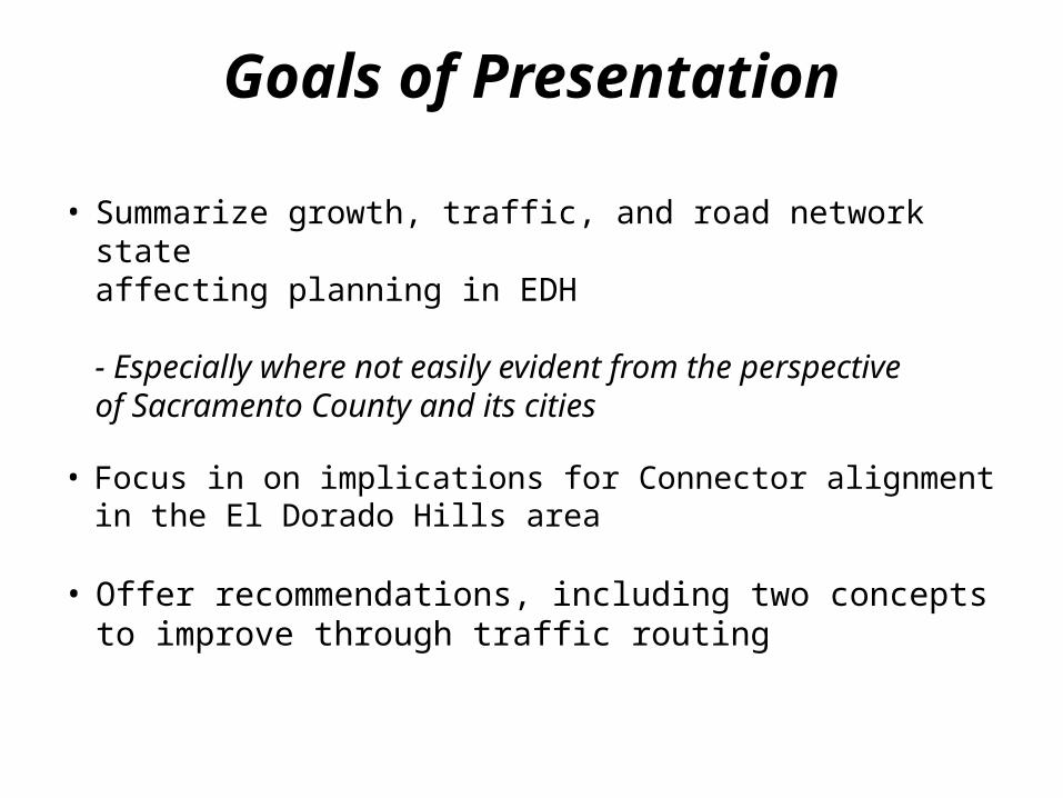
Goals of Presentation
• Summarize growth, traffic, and road network stateaffecting planning in EDH
- Especially where not easily evident from the perspectiveof Sacramento County and its cities
• Focus in on implications for Connector alignmentin the El Dorado Hills area
• Offer recommendations, including two conceptsto improve through traffic routing
Topics for the Connector in EDH
• Regional connections & through traffic
• Demand for road network capacity (traffic volume)
• Problems with through traffic on White Rock Road
• Available road network capacity
• Concepts for alternative Connector alignments
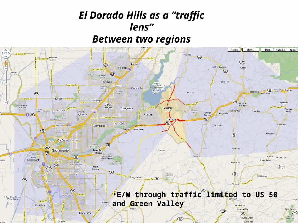
El Dorado Hills as a “traffic lens”Between two regions
•E/W through traffic limited to US 50 and Green Valley
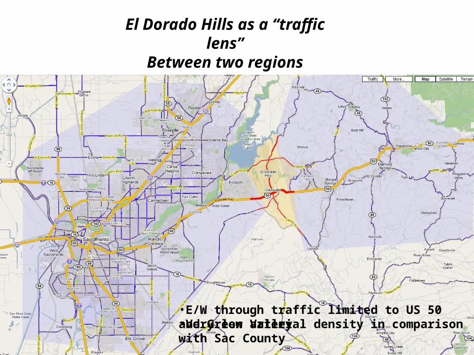
El Dorado Hills as a “traffic lens”Between two regions
•E/W through traffic limited to US 50 and Green Valley•Very low arterial density in comparison with Sac County
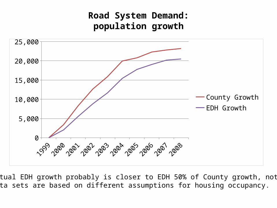
Road System Demand:population growth
1999 2000 2001 2002 2003 2004 2005 2006 2007 20080
5,000
10,000
15,000
20,000
25,000
County GrowthEDH Growth
Actual EDH growth probably is closer to EDH 50% of County growth, not 88%.Data sets are based on different assumptions for housing occupancy.
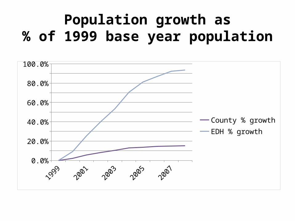
Population growth as% of 1999 base year population
1999 2000 2001 2002 2003 2004 2005 2006 2007 20080.0%
10.0%20.0%30.0%40.0%50.0%60.0%70.0%80.0%90.0%
100.0%
County % growthEDH % growth
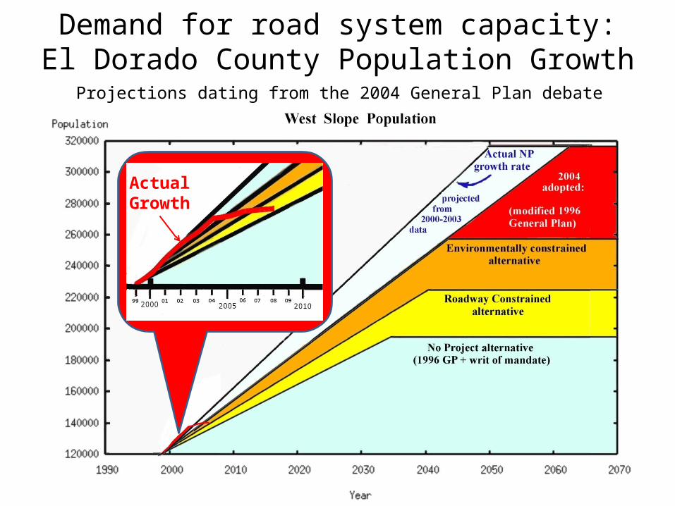
Demand for road system capacity:El Dorado County Population Growth
Projections dating from the 2004 General Plan debate
ActualGrowth
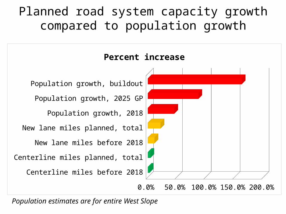
Planned road system capacity growthcompared to population growth
Centerline miles before 2018
Centerline miles planned, total
New lane miles before 2018
New lane miles planned, total
Population growth, 2018
Population growth, 2025 GP
Population growth, buildout
0.0%20.0%
40.0%60.0%
80.0%
100.0%
120.0%
140.0%
160.0%
180.0%
Percent increase
Population estimates are for entire West Slope
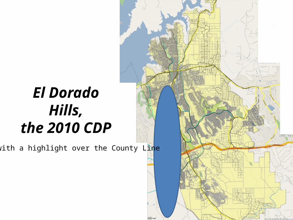
El Dorado Hills,the 2010 CDP
…with a highlight over the County Line

Existing EDHroad network
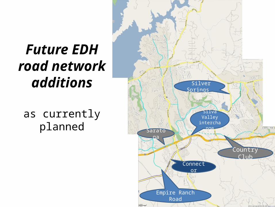
Future EDHroad network
additions
as currently planned Silva Valley interchange
Empire Ranch Road
Saratoga
Silver Springs
Country Club
Connector
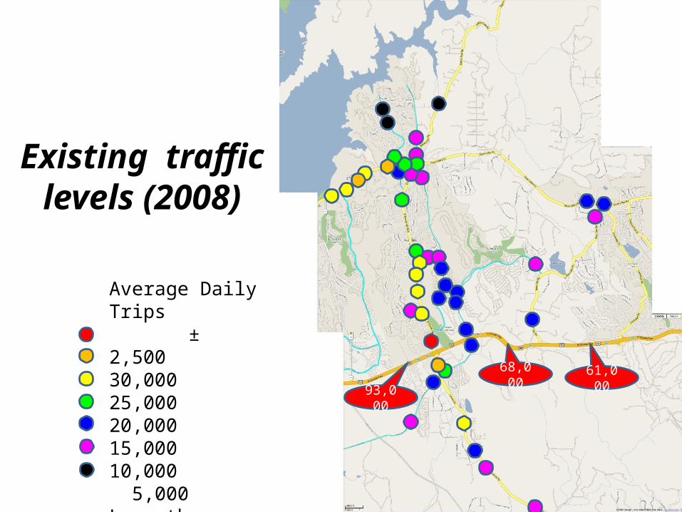
Existing traffic levels (2008)
Average Daily Trips ± 2,50030,00025,00020,00015,00010,000 5,000Less than 2,500
93,000
68,000 61,000
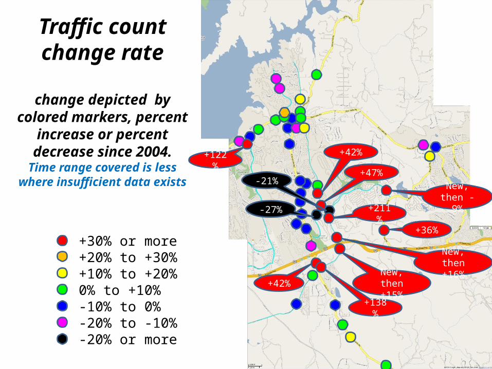
Traffic countchange rate
change depicted by colored markers, percent increase or
percent decrease since 2004.
Time range covered is lesswhere insufficient data exists
+30% or more+20% to +30%+10% to +20%0% to +10%-10% to 0%-20% to -10%-20% or more
+36%
+42%
New, then -9%
New, then +16%
+211%
+47%
+42%+122%
+138%
New, then +15%
-21%
-27%
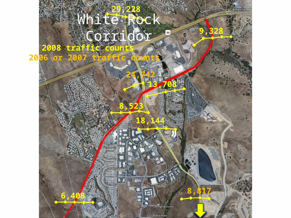
White Rock Corridor2008 traffic counts
6,408
8,523
13,708
9,328
29,228
24,742
2006 or 2007 traffic counts
18,144
8,817
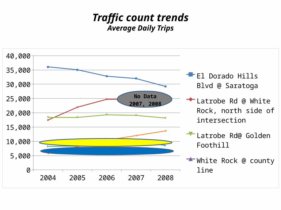
Traffic count trendsAverage Daily Trips
2004 2005 2006 2007 20080
5,000
10,000
15,000
20,000
25,000
30,000
35,000
40,000
El Dorado Hills Blvd @ Saratoga
Latrobe Rd @ White Rock, north side of intersection
Latrobe Rd@ Golden Foothill
White Rock @ county line
White Rock @ Latrobe, west side of intersection
White Rock @ Latrobe, east side of intersection
No Data2007, 2008
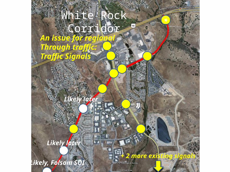
White Rock CorridorAn issue for regionalThrough traffic:Traffic Signals
+ 2 more existing signals
Likely later
Likely, Folsom SOI
Likely later
*
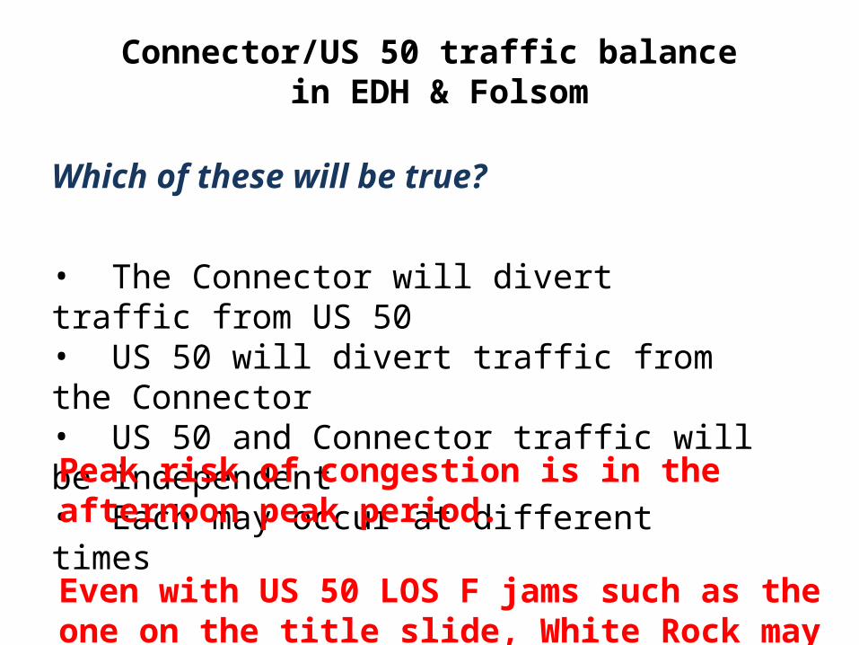
Connector/US 50 traffic balance in EDH & Folsom
• The Connector will divert traffic from US 50• US 50 will divert traffic from the Connector• US 50 and Connector traffic will be independent• Each may occur at different times
Which of these will be true?
Peak risk of congestion is in the afternoon peak period. Even with US 50 LOS F jams such as the one on the title slide, White Rock may be slower for through traffic.
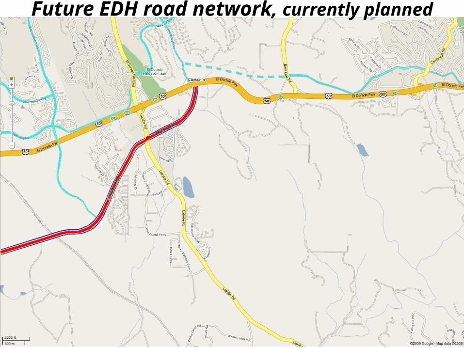
Future EDH road network, currently planned
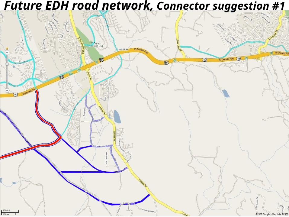
Future EDH road network, Connector suggestion #1
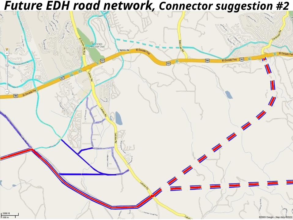
Future EDH road network, Connector suggestion #2
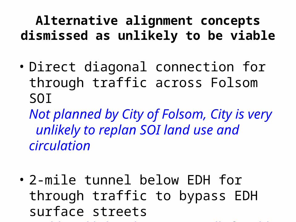
Alternative alignment concepts dismissed as unlikely to be viable
• Direct diagonal connection for through traffic across Folsom SOI Not planned by City of Folsom, City is very unlikely to replan SOI land use and circulation
• 2-mile tunnel below EDH for through traffic to bypass EDH surface streetsHighly unlikely to be economically feasible
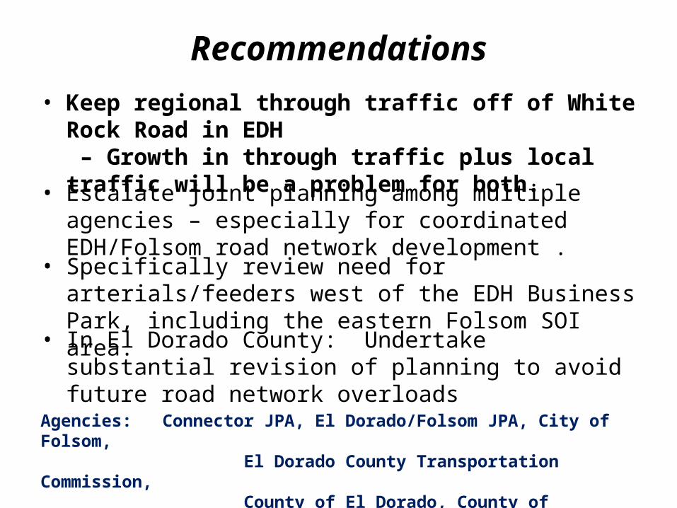
Recommendations• Keep regional through traffic off of White Rock Road in EDH
– Growth in through traffic plus local traffic will be a problem for both.
• Escalate joint planning among multiple agencies – especially for coordinated EDH/Folsom road network development .
• Specifically review need for arterials/feeders west of the EDH Business Park, including the eastern Folsom SOI area.
• In El Dorado County: Undertake substantial revision of planning to avoid future road network overloads
Agencies: Connector JPA, El Dorado/Folsom JPA, City of Folsom, El Dorado County Transportation Commission, County of El Dorado, County of Sacramento, possibly Caltrans
Not the end of traffic issuesBut nearly the exit for this presentation…
Best wishes forchoosing that idealEDH alignment forThe Connector!!!