Embed Size (px)
Citation preview
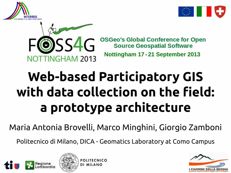
Web-based Participatory GISwith data collection on the field:
a prototype architecture
Maria Antonia Brovelli, Marco Minghini, Giorgio Zamboni
Politecnico di Milano, DICA - Geomatics Laboratory at Como Campus
Nottingham 17 - 21 September 2013
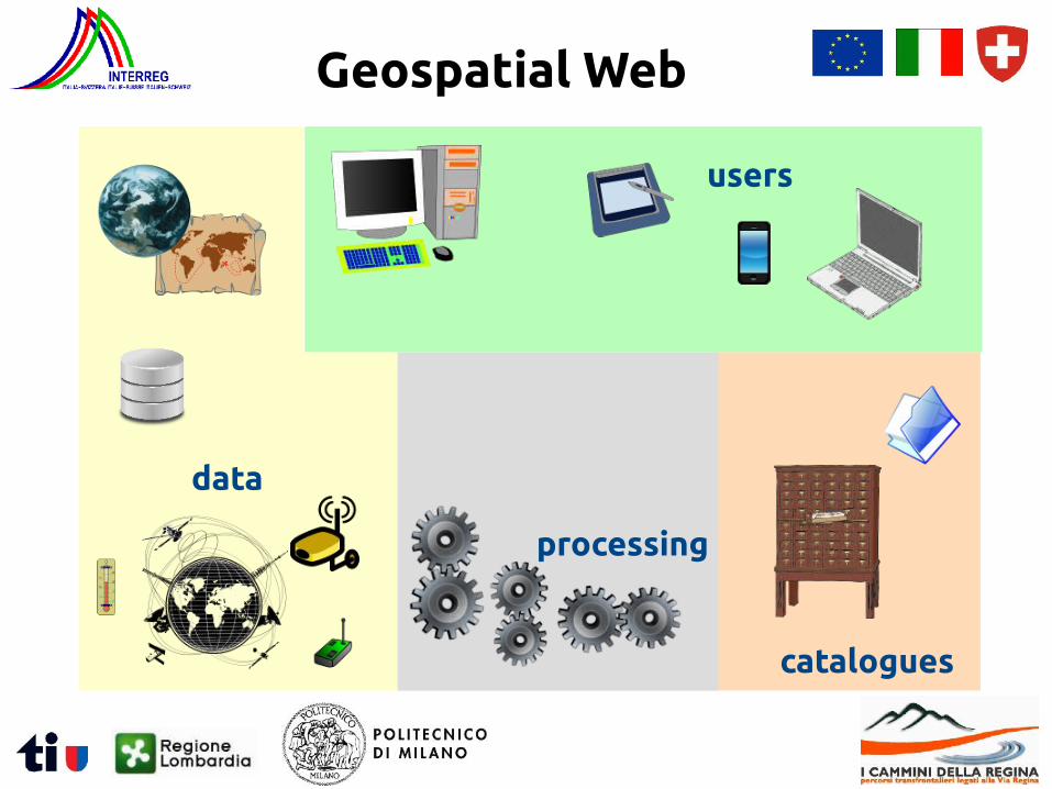
WWW
Geospatial Web
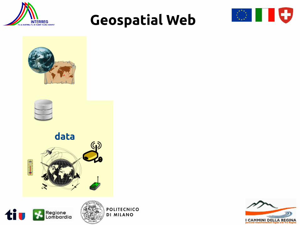
data
Geospatial Web
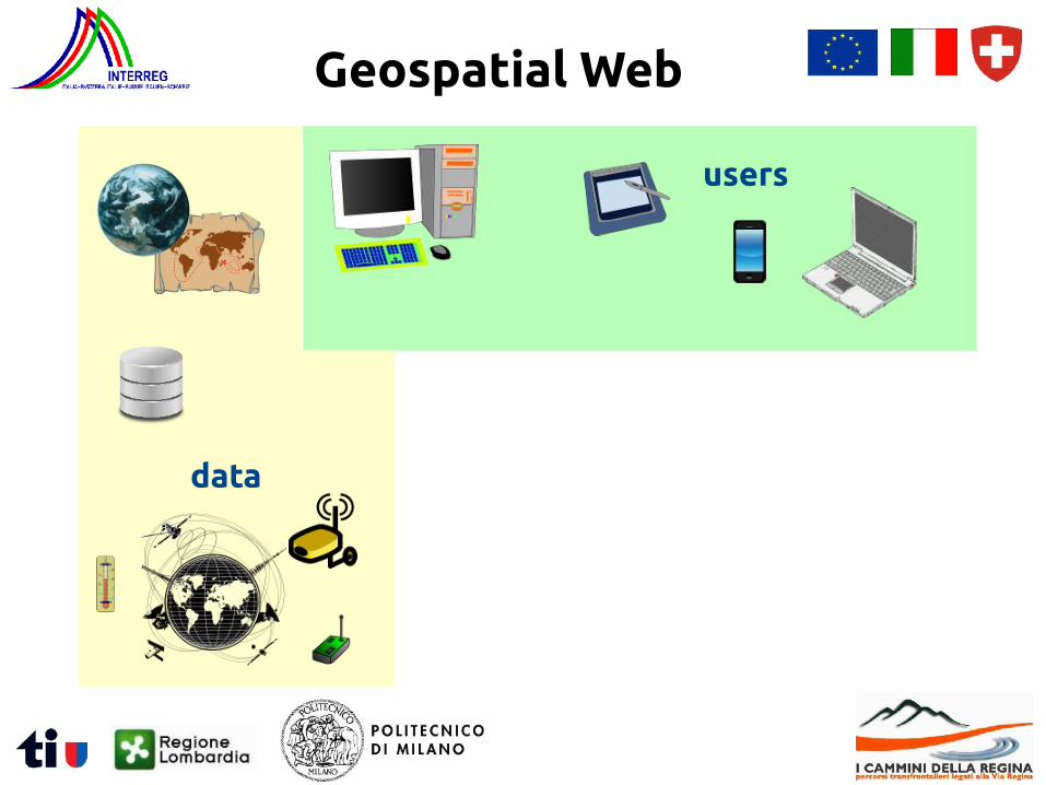
users
data
Geospatial Web
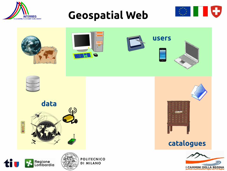
catalogues
data
users
Geospatial Web
data
processing
users
catalogues
Geospatial Web
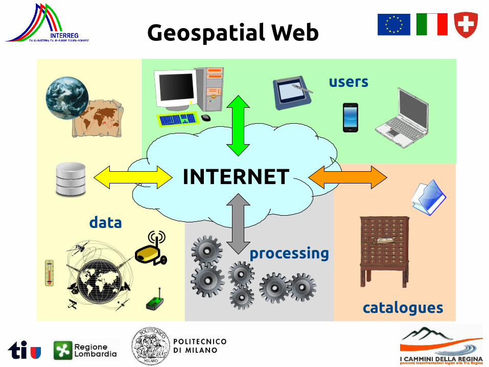
INTERNET
processing
data
users
catalogues
Geospatial Web
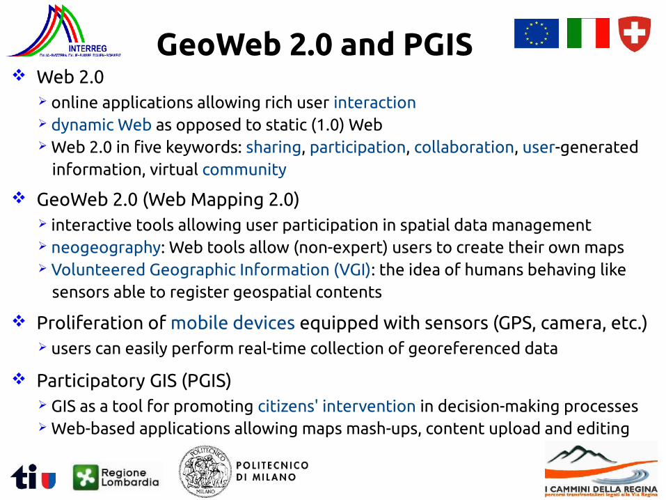
Web 2.0 online applications allowing rich user interaction dynamic Web as opposed to static (1.0) Web Web 2.0 in five keywords: sharing, participation, collaboration, user-generated
information, virtual community
GeoWeb 2.0 (Web Mapping 2.0) interactive tools allowing user participation in spatial data management neogeography: Web tools allow (non-expert) users to create their own maps Volunteered Geographic Information (VGI): the idea of humans behaving like
sensors able to register geospatial contents
Proliferation of mobile devices equipped with sensors (GPS, camera, etc.) users can easily perform real-time collection of georeferenced data
Participatory GIS (PGIS) GIS as a tool for promoting citizens' intervention in decision-making processes Web-based applications allowing maps mash-ups, content upload and editing
GeoWeb 2.0 and PGIS
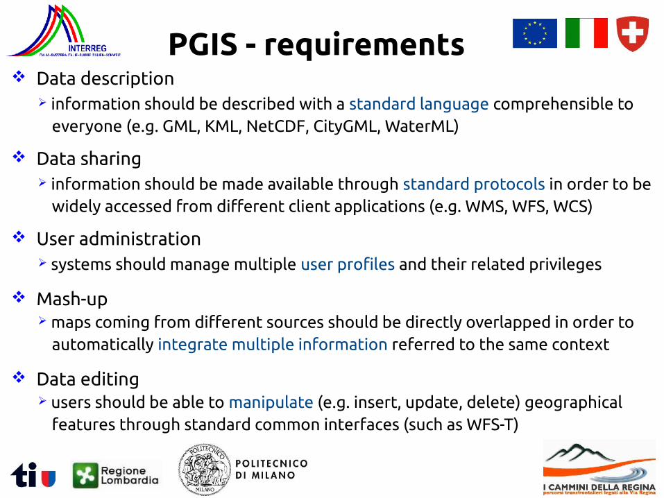
Data description information should be described with a standard language comprehensible to
everyone (e.g. GML, KML, NetCDF, CityGML, WaterML)
PGIS - requirements
Data sharing information should be made available through standard protocols in order to be
widely accessed from different client applications (e.g. WMS, WFS, WCS)
User administration systems should manage multiple user profiles and their related privileges
Mash-up maps coming from different sources should be directly overlapped in order to
automatically integrate multiple information referred to the same context
Data editing users should be able to manipulate (e.g. insert, update, delete) geographical
features through standard common interfaces (such as WFS-T)
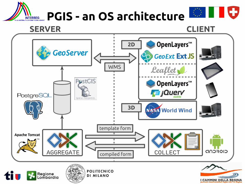
PGIS - an OS architectureSERVER CLIENT
template form
WMS
AGGREGATE COLLECT
2D
3D
compiled form

Suite providing a set of tools for managing mobile data collection http://opendatakit.org free and open source under Apache2 license developed from University of Washington – Department of Computer Science &
Engineering
Composed of 3 modules form authoring tools:
ODK Collect:
ODK Aggregate:
✗ ODK Build: graphical drag-and-drop tool for creating simple forms✗ XLSForm: form design via Excel spreadsheet
✗ Android app for filling forms (which can contain multimedia and locations)
✗ repository of the data sent by ODK Collect✗ can run in the cloud, on a virtual machine or on a private server (i.e. a
Tomcat server backed with a PostgreSQL database)
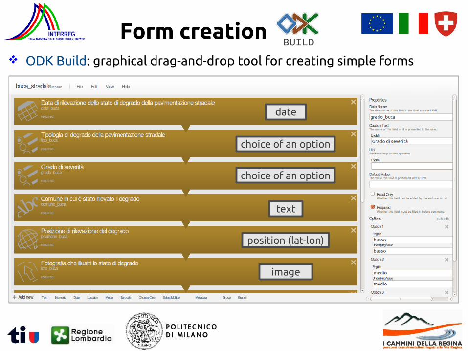
ODK Build: graphical drag-and-drop tool for creating simple forms
Form creationBUILD
date
choice of an option
text
position (lat-lon)
image
choice of an option
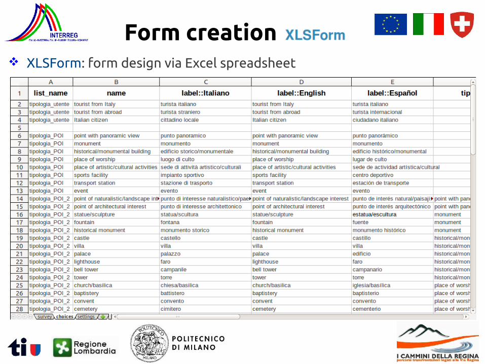
XLSForm: form design via Excel spreadsheet
Form creation
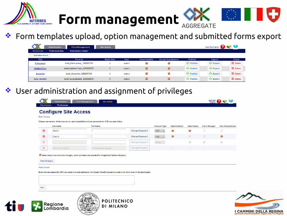
Form managementAGGREGATE
Form templates upload, option management and submitted forms export
User administration and assignment of privileges
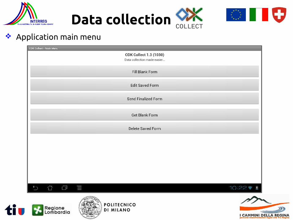
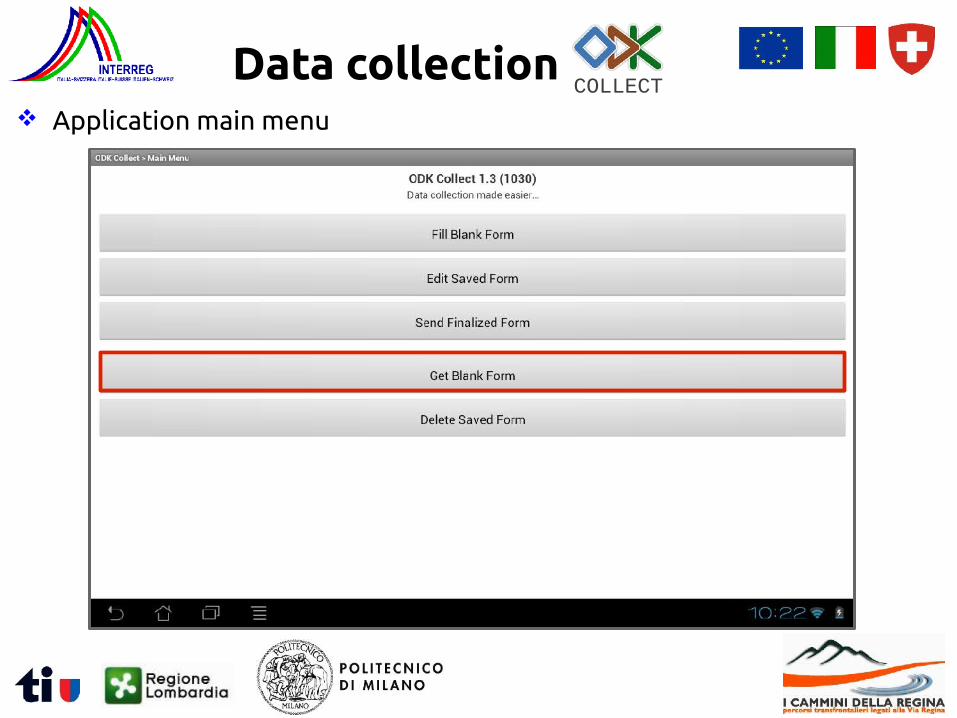
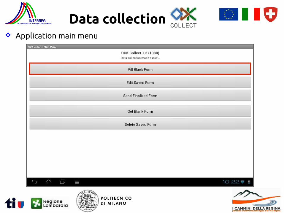
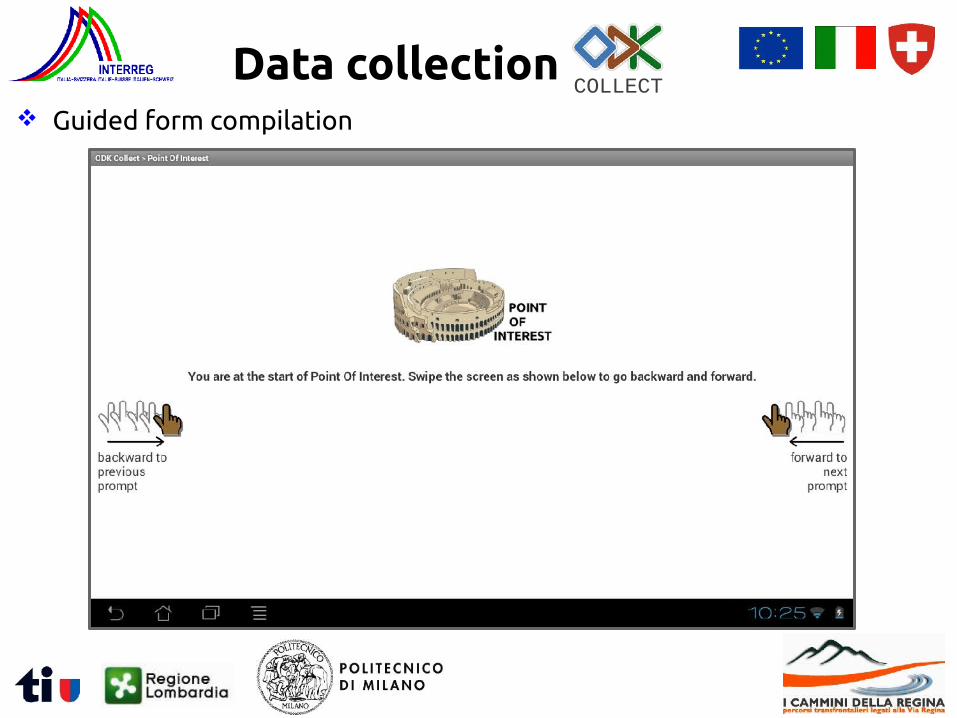
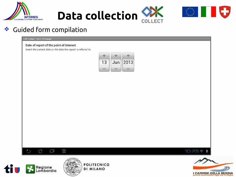
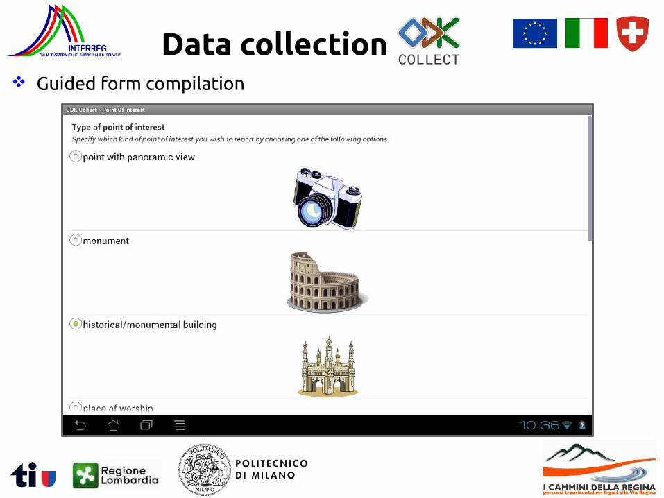
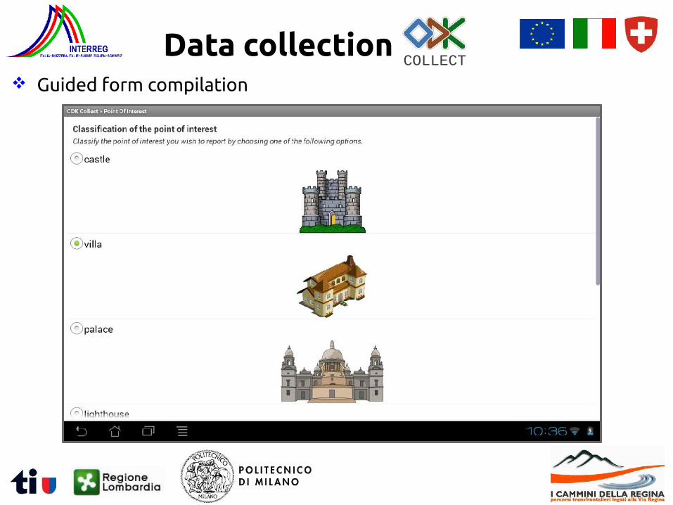
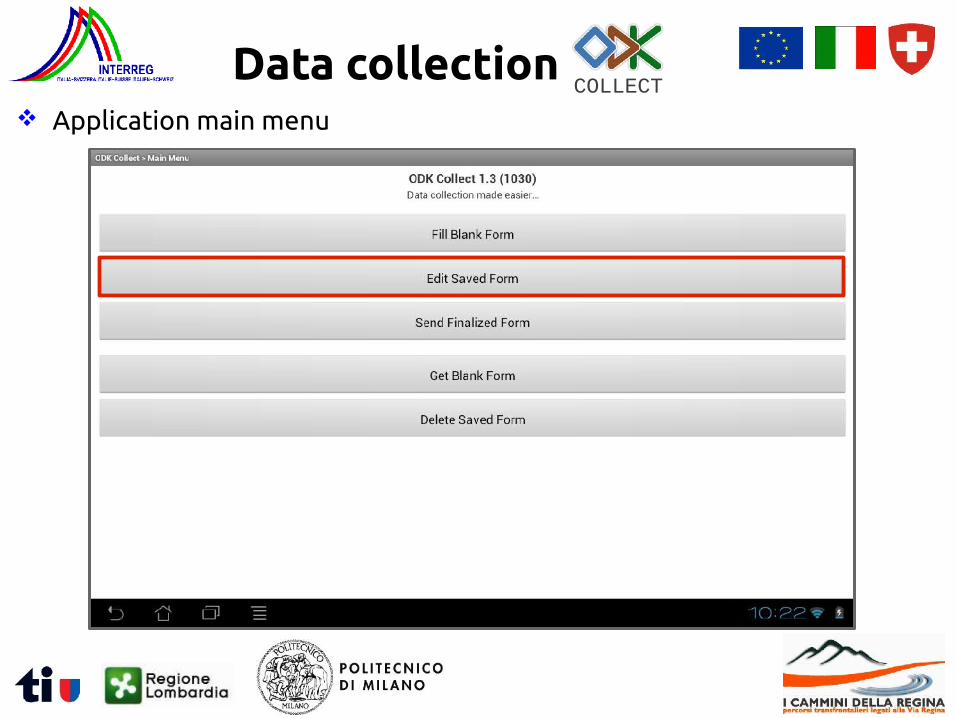
Data collectionCOLLECT
Application main menu
Data collectionCOLLECT
Application main menu
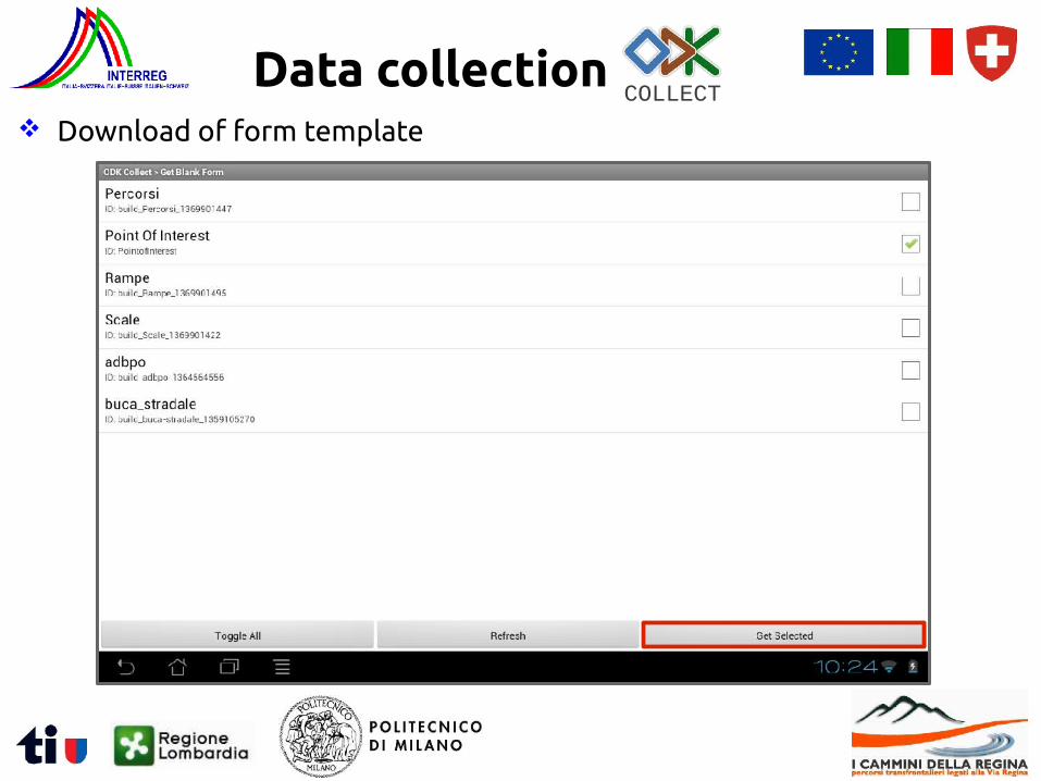
Data collectionCOLLECT
Download of form template
Data collectionCOLLECT
Application main menu
Data collectionCOLLECT
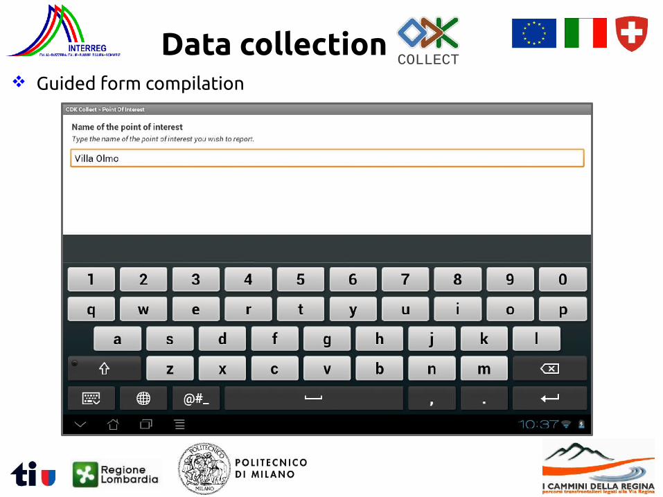
Guided form compilation
Data collectionCOLLECT
Guided form compilation
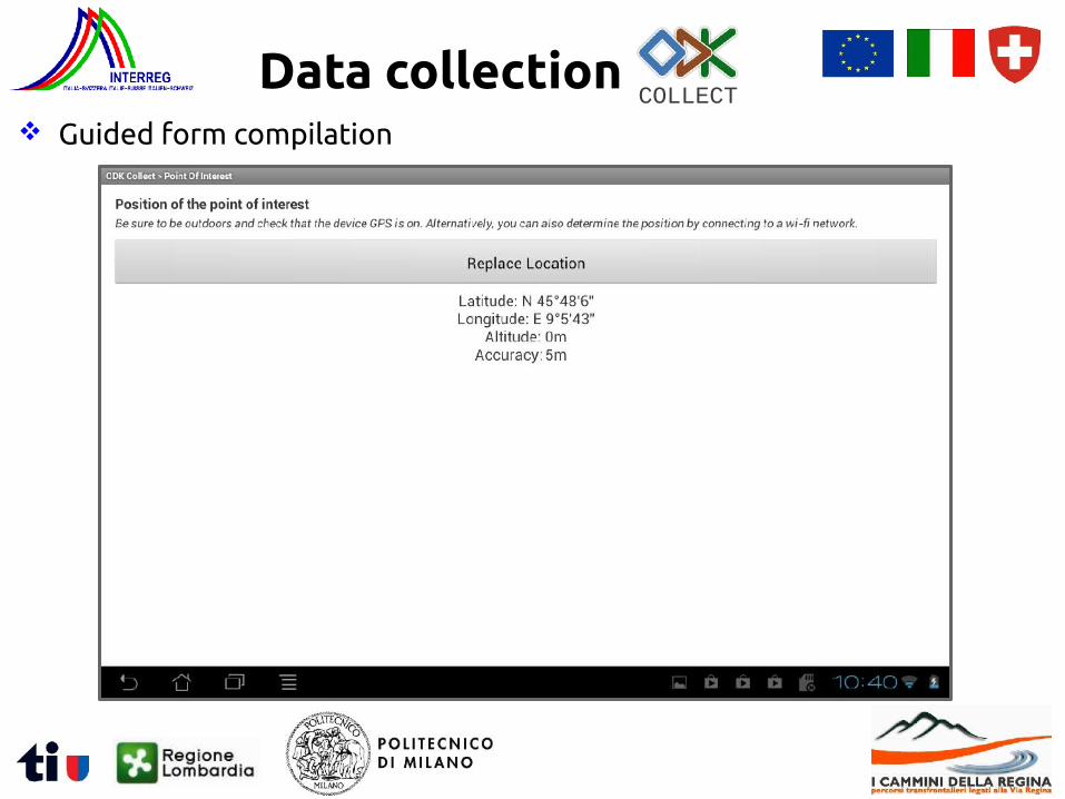
Data collectionCOLLECT
Guided form compilation
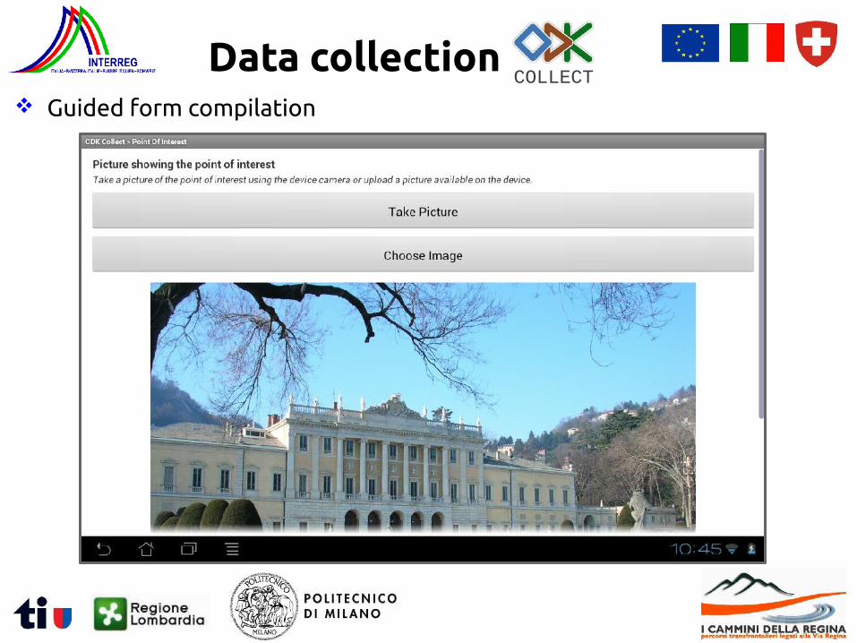
Data collectionCOLLECT
Guided form compilation
Data collectionCOLLECT
Guided form compilation
Data collectionCOLLECT
Guided form compilation
Data collectionCOLLECT
Guided form compilation
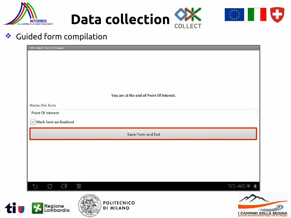
Data collectionCOLLECT
Guided form compilation
Data collectionCOLLECT
Application main menu

Data collectionCOLLECT
Application main menu
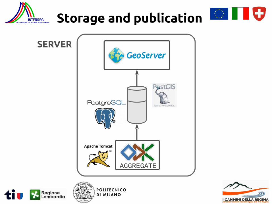
Storage and publication
SERVER
AGGREGATE
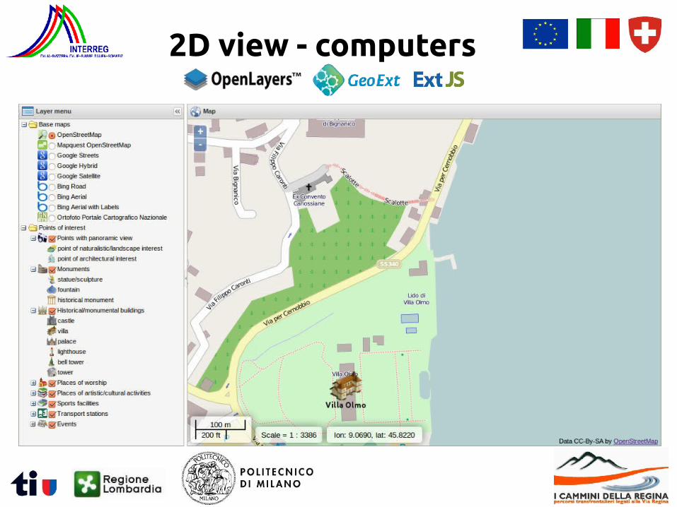
2D view - computers
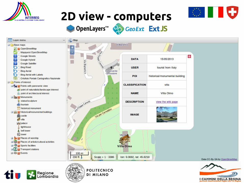
2D view - computers
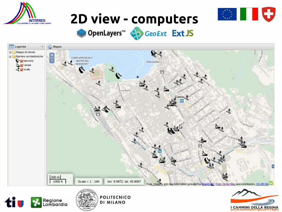
2D view - computers
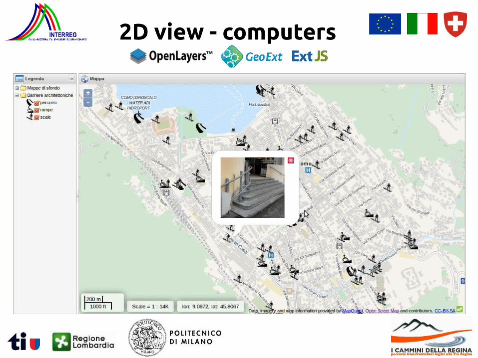
2D view - computers
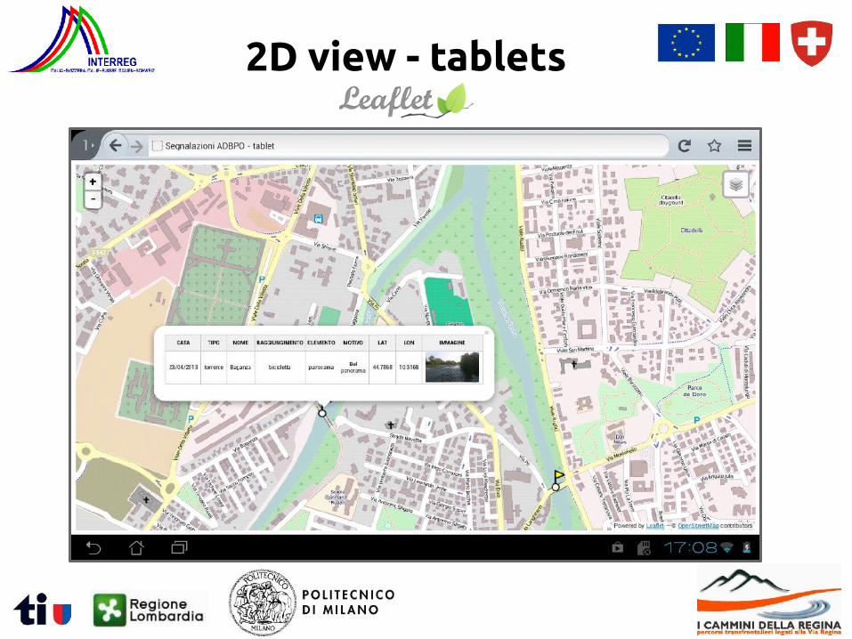
2D view - tablets
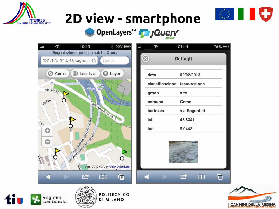
2D view - smartphone
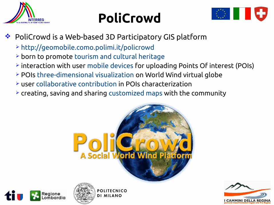
PoliCrowd is a Web-based 3D Participatory GIS platform http://geomobile.como.polimi.it/policrowd born to promote tourism and cultural heritage interaction with user mobile devices for uploading Points Of interest (POIs) POIs three-dimensional visualization on World Wind virtual globe user collaborative contribution in POIs characterization creating, saving and sharing customized maps with the community
PoliCrowd
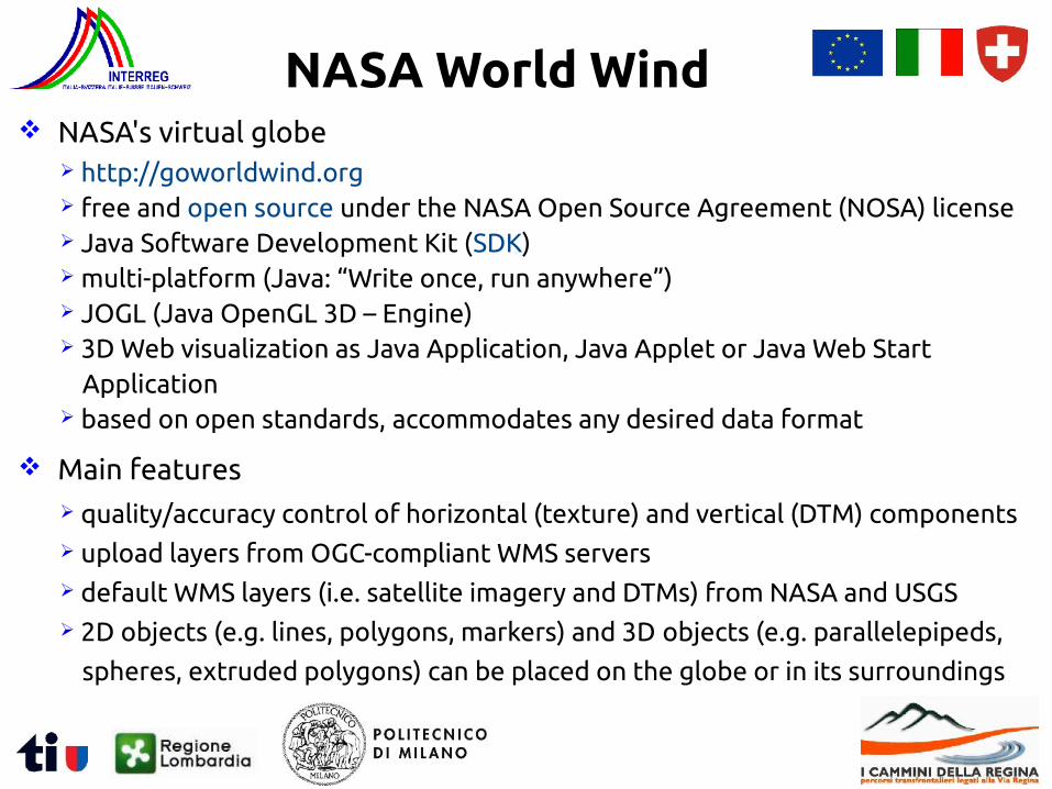
NASA's virtual globe http://goworldwind.org free and open source under the NASA Open Source Agreement (NOSA) license Java Software Development Kit (SDK) multi-platform (Java: “Write once, run anywhere”) JOGL (Java OpenGL 3D – Engine) 3D Web visualization as Java Application, Java Applet or Java Web Start
Application based on open standards, accommodates any desired data format
Main features quality/accuracy control of horizontal (texture) and vertical (DTM) components upload layers from OGC-compliant WMS servers default WMS layers (i.e. satellite imagery and DTMs) from NASA and USGS 2D objects (e.g. lines, polygons, markers) and 3D objects (e.g. parallelepipeds,
spheres, extruded polygons) can be placed on the globe or in its surroundings
NASA World Wind
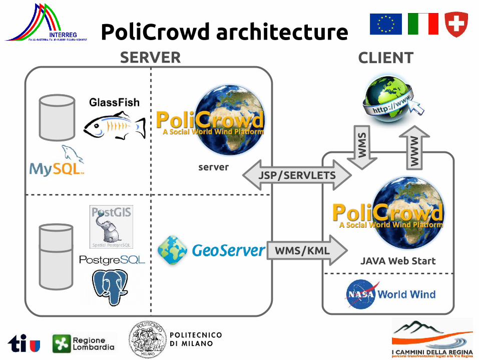
PoliCrowd architectureSERVER
server
WMS / KML
WM
S
WW
W
JAVA Web Start
JSP / SERVLETS
CLIENT
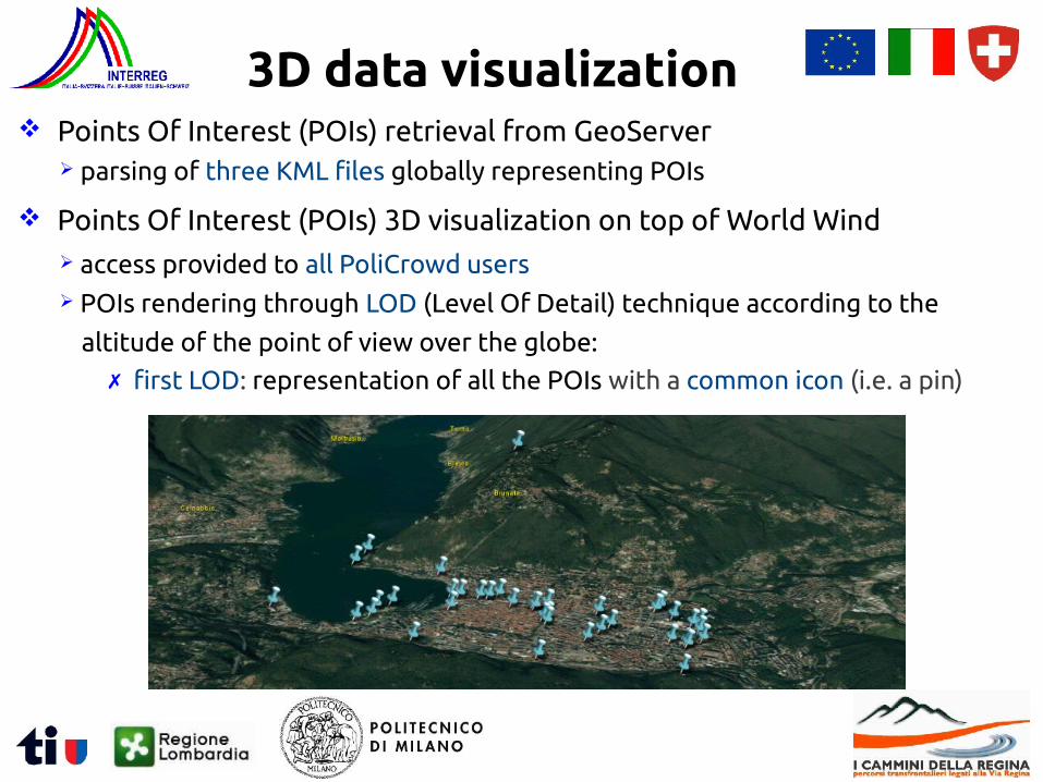
Points Of Interest (POIs) retrieval from GeoServer parsing of three KML files globally representing POIs
Points Of Interest (POIs) 3D visualization on top of World Wind access provided to all PoliCrowd users POIs rendering through LOD (Level Of Detail) technique according to the
altitude of the point of view over the globe:
3D data visualization
✗ first LOD: representation of all the POIs with a common icon (i.e. a pin)
Points Of Interest (POIs) retrieval from GeoServer parsing of three KML files globally representing POIs
Points Of Interest (POIs) 3D visualization on top of World Wind access provided to all PoliCrowd users POIs rendering through LOD (Level Of Detail) technique according to the
altitude of the point of view over the globe:
3D data visualization
✗ second LOD: representation of POIs with icons showing their category
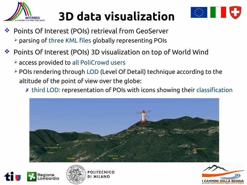
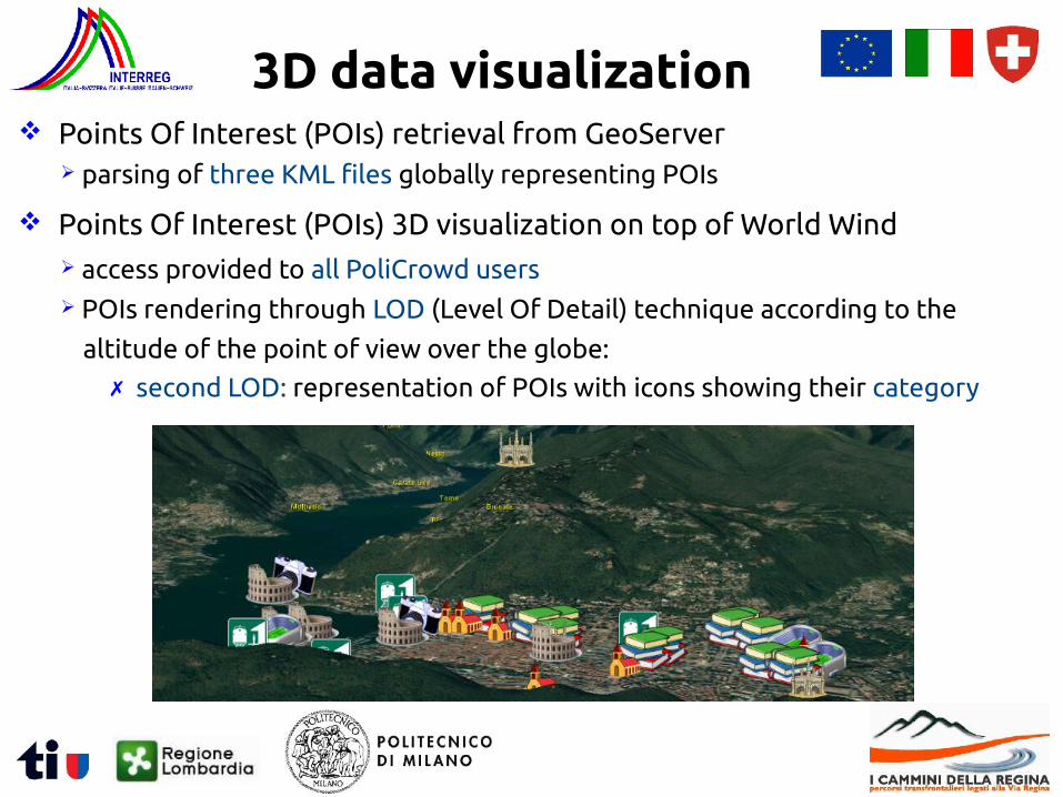
Points Of Interest (POIs) retrieval from GeoServer parsing of three KML files globally representing POIs
Points Of Interest (POIs) 3D visualization on top of World Wind access provided to all PoliCrowd users POIs rendering through LOD (Level Of Detail) technique according to the
altitude of the point of view over the globe:
3D data visualization
✗ third LOD: representation of POIs with icons showing their classification
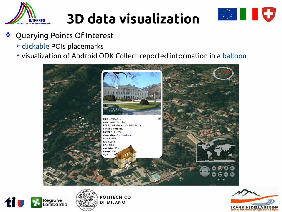
Querying Points Of Interest clickable POIs placemarks visualization of Android ODK Collect-reported information in a balloon
3D data visualization
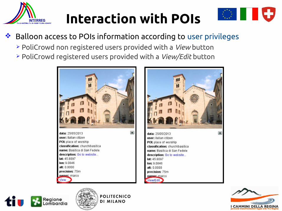
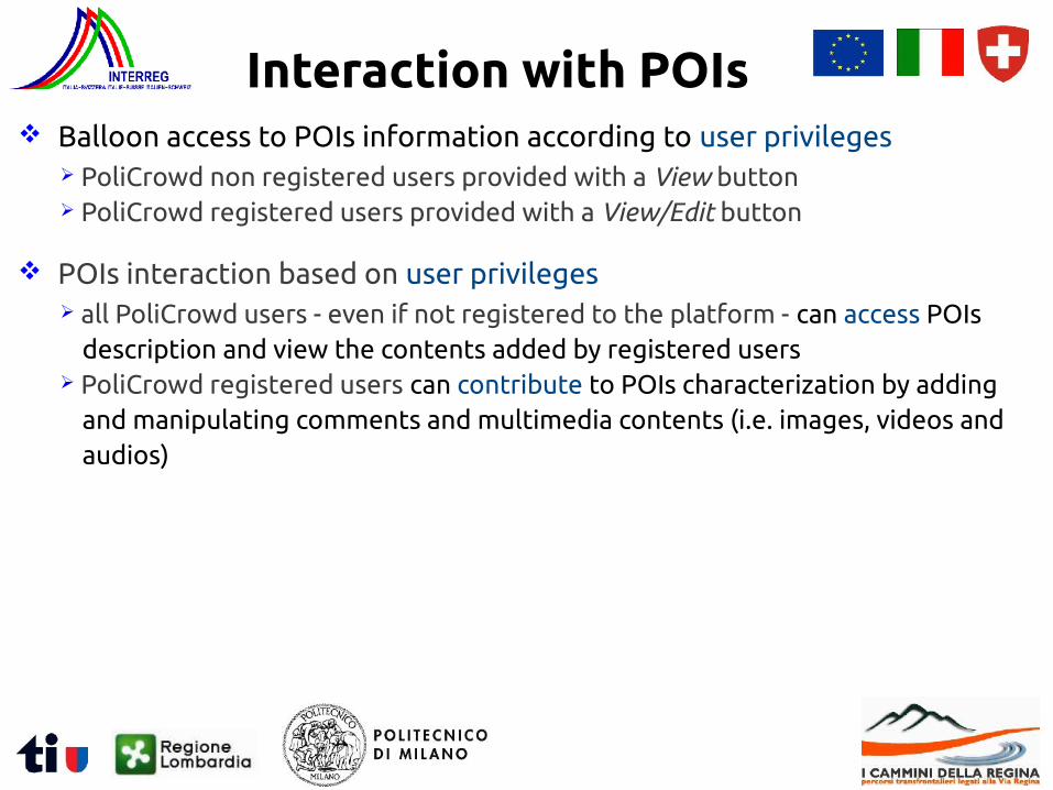
Interaction with POIs Balloon access to POIs information according to user privileges
PoliCrowd non registered users provided with a View button PoliCrowd registered users provided with a View/Edit button
Balloon access to POIs information according to user privileges PoliCrowd non registered users provided with a View button PoliCrowd registered users provided with a View/Edit button
POIs interaction based on user privileges all PoliCrowd users - even if not registered to the platform - can access POIs
description and view the contents added by registered users PoliCrowd registered users can contribute to POIs characterization by adding
and manipulating comments and multimedia contents (i.e. images, videos and audios)
Interaction with POIs
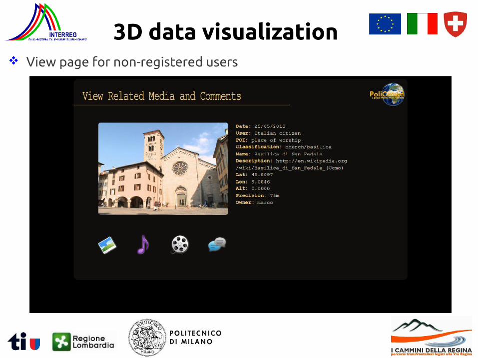
View page for non-registered users
3D data visualization
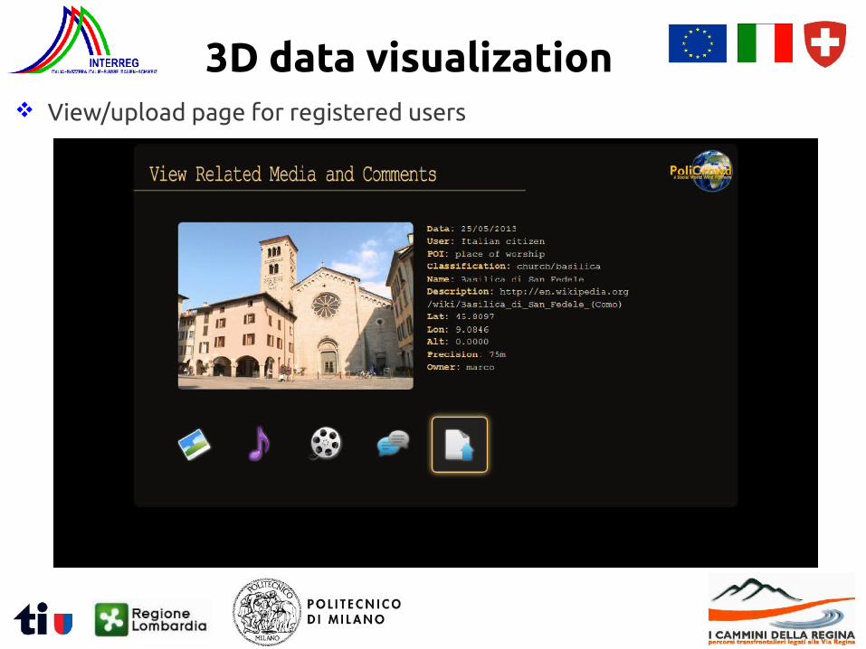
View/upload page for registered users
3D data visualization
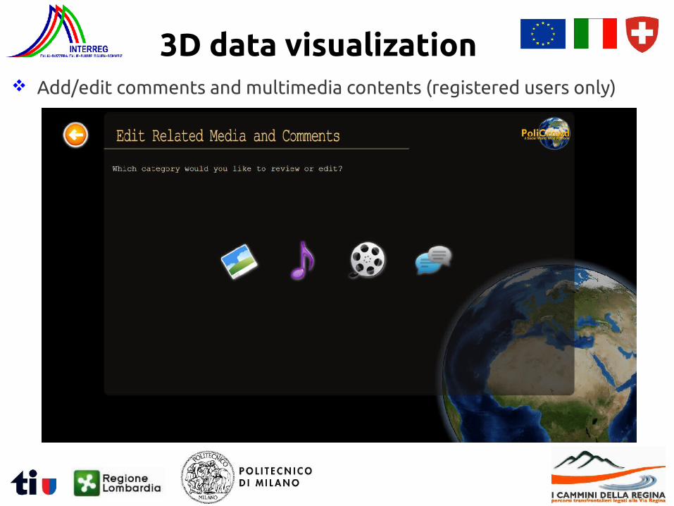
Add/edit comments and multimedia contents (registered users only)
3D data visualization
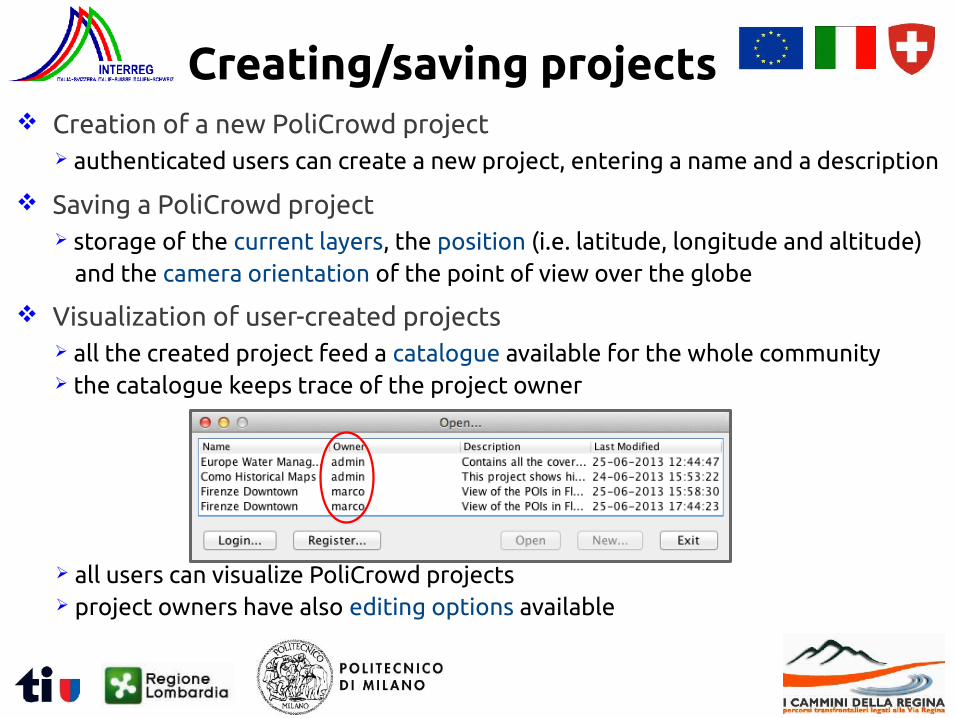
Creation of a new PoliCrowd project authenticated users can create a new project, entering a name and a description
Creating/saving projects
Saving a PoliCrowd project storage of the current layers, the position (i.e. latitude, longitude and altitude)
and the camera orientation of the point of view over the globe
Visualization of user-created projects all the created project feed a catalogue available for the whole community the catalogue keeps trace of the project owner
all users can visualize PoliCrowd projects project owners have also editing options available
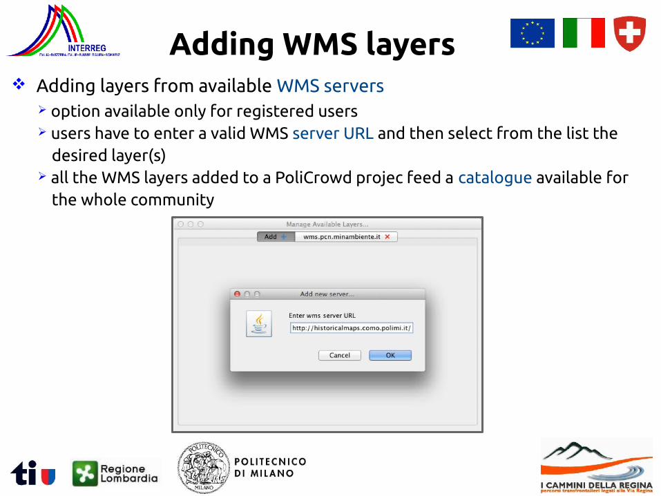
Adding layers from available WMS servers option available only for registered users users have to enter a valid WMS server URL and then select from the list the
desired layer(s) all the WMS layers added to a PoliCrowd projec feed a catalogue available for
the whole community
Adding WMS layers
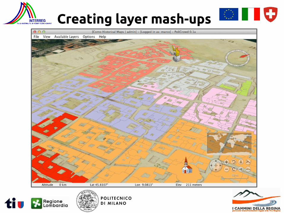
Creating layer mash-ups
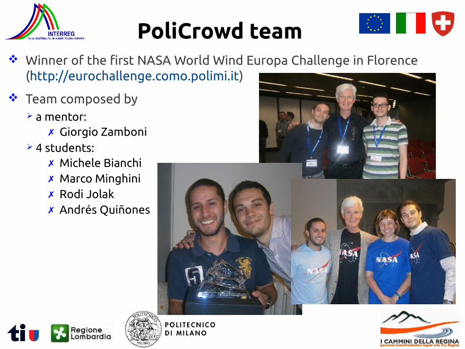
Winner of the first NASA World Wind Europa Challenge in Florence (http://eurochallenge.como.polimi.it)
PoliCrowd team
Team composed by a mentor:
4 students:
✗ Giorgio Zamboni
✗ Michele Bianchi✗ Marco Minghini✗ Rodi Jolak✗ Andrés Quiñones
Conclusions
Future improvements extension of the ODK Collect app to overcome positioning problems (i.e.
absence of GPS, poor GPS accuracy, mismatch between the position where the picture is taken and the position of the object being photographed)
synchronisation of user profiles on ODK toolkit and PoliCrowd platform
FOSS architecture for a Web-based participatory GIS system data collection on the field data Web visualization and sharing 3D fully-participatory platform
✗ positioning refinement through an interactive map✗ allowing positioning also for non GPS-enabled devices

Acknowledgments This research has been funded by the INTERREG “I cammini della Regina -
Percorsi transfrontalieri legati alla Via Regina (The paths of Regina - Crossborder paths departing from Via Regina)” 2007-2013 project.
Thanks for your attention!
Politecnico di Milano
Laboratorio di Geomatica - Polo Territoriale di Como
Via Valleggio 11, 22100 Como (Italy)
Marco Minghini