Embed Size (px)
Citation preview
www.dot.state.pa.us
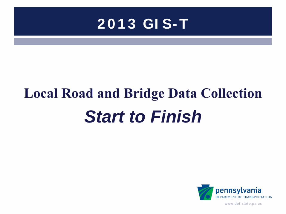
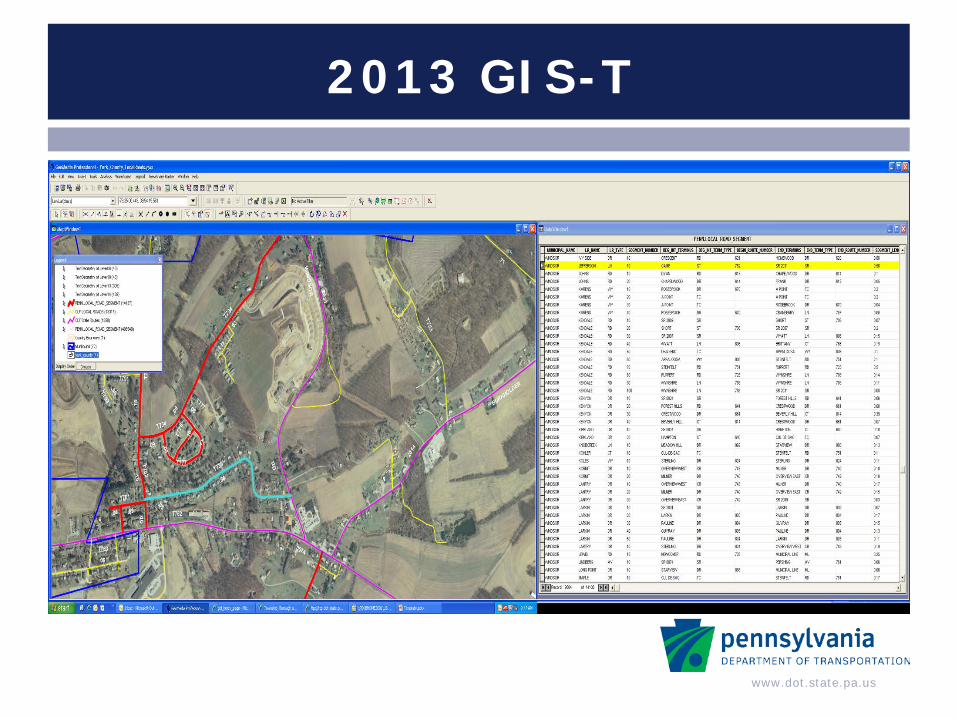
2013 GIS-T
Local Road and Bridge Data Collection
Start to Finish

www.dot.state.pa.us
Presentation Overview
Where we are now Initiative Overview Next Steps Lessons Learned End Results
www.dot.state.pa.us
Where we are now
PennDOT cannot produce a holistic view of its transportation system with internal data.
Pilot was done in Fall 2011
Statewide rollout – Spring 2012

www.dot.state.pa.us
How did we get here
December 2011 to March 2012 Worked with ESRI and local planning partners
April 2012 Multiple training across the state
May 2012 Started collection

www.dot.state.pa.us
What do we get in the long run?
Better planning and programming of Local bridge projects
Established local road network with
attributes Local outreach
www.dot.state.pa.us
Foundation
Establish a platform to work from
Roads Created geometry for Liquid & Non-Liquid Fuel roads
Bridges
Create potential locations for field collectors to visit
Result – transition to paperless mobile point and click application
www.dot.state.pa.us
2013 GIS-T

www.dot.state.pa.us
Data Movement
www.dot.state.pa.us
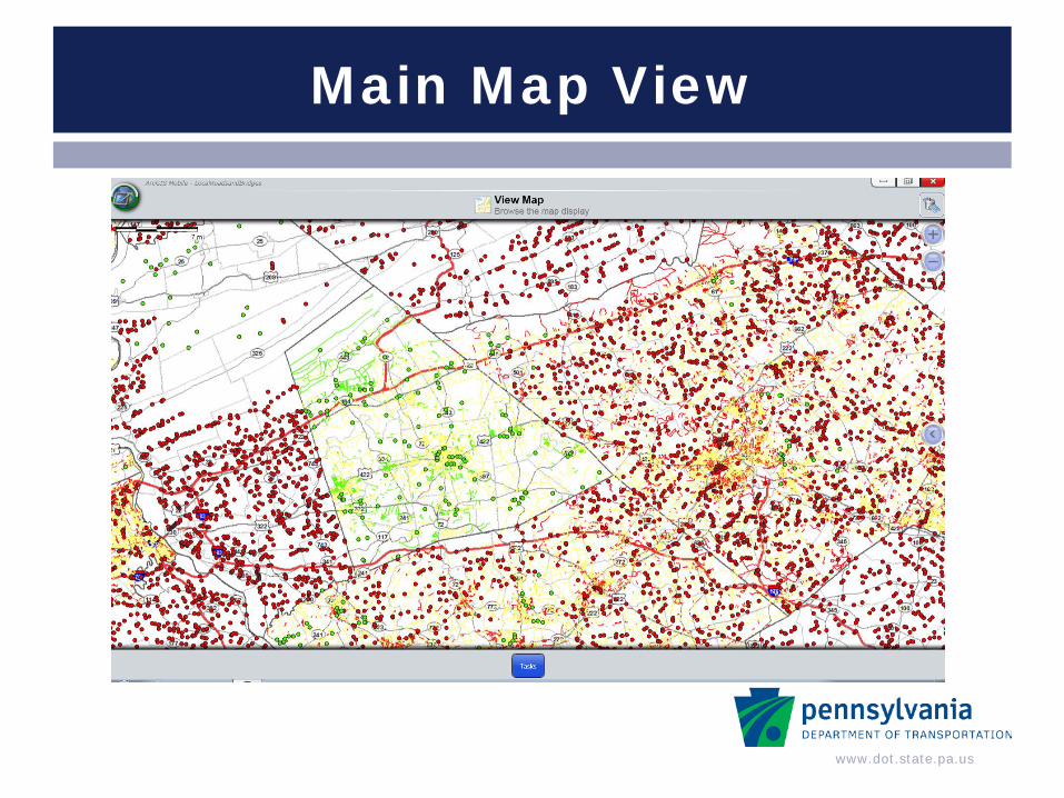
Main Map View
www.dot.state.pa.us
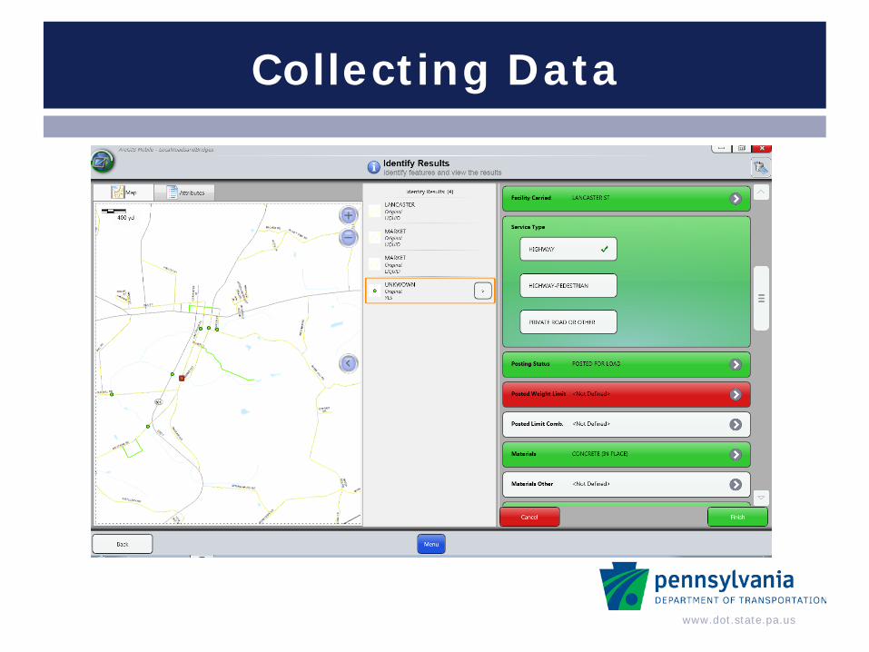
Collecting Data
www.dot.state.pa.us
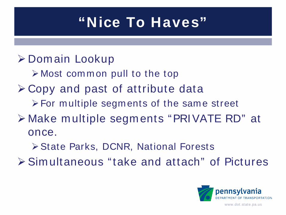
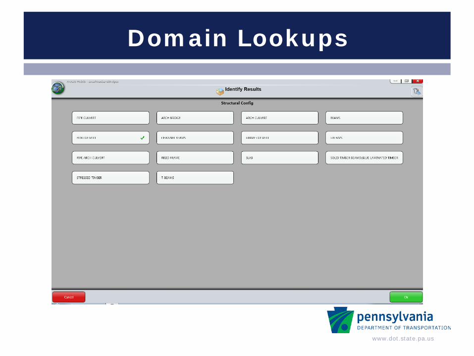
Domain Lookup Most common pull to the top
Copy and past of attribute data For multiple segments of the same street
Make multiple segments “PRIVATE RD” at once. State Parks, DCNR, National Forests
Simultaneous “take and attach” of Pictures
“Nice To Haves”
www.dot.state.pa.us
Domain Lookups

www.dot.state.pa.us
Server Sync
www.dot.state.pa.us
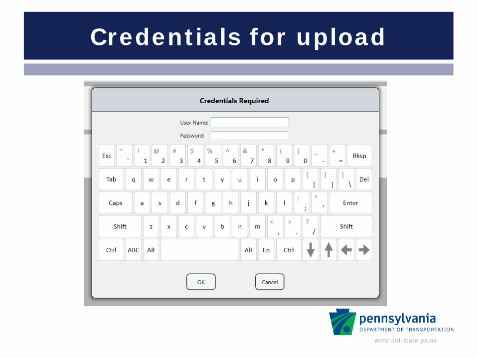
Credentials for upload
www.dot.state.pa.us
DEMO of Web Application
https://www.pdlocalroadmap.pa.gov/mLRBCS-UserAdministration/Default.aspx?ReturnUrl=%2fmLRBCS-
UserAdministration%2fLocalRoadsandBridges%2findex.aspx
www.dot.state.pa.us
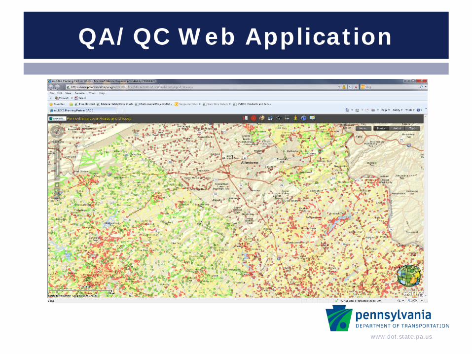
QA/QC Web Application
www.dot.state.pa.us
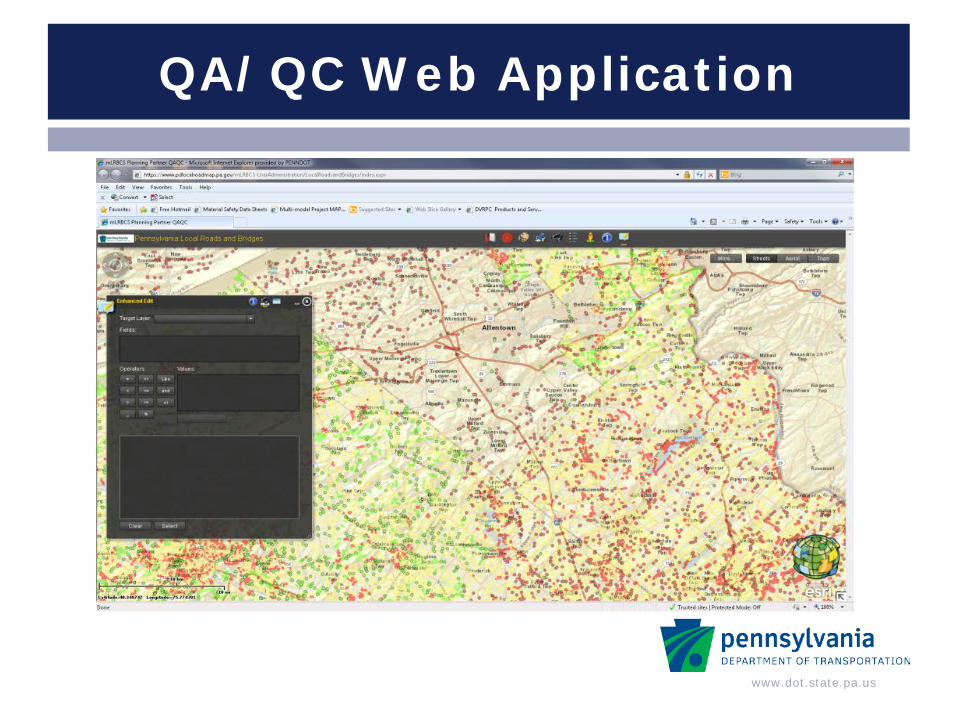
QA/QC Web Application
www.dot.state.pa.us
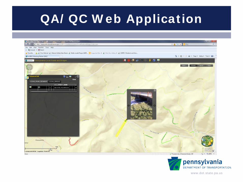
QA/QC Web Application
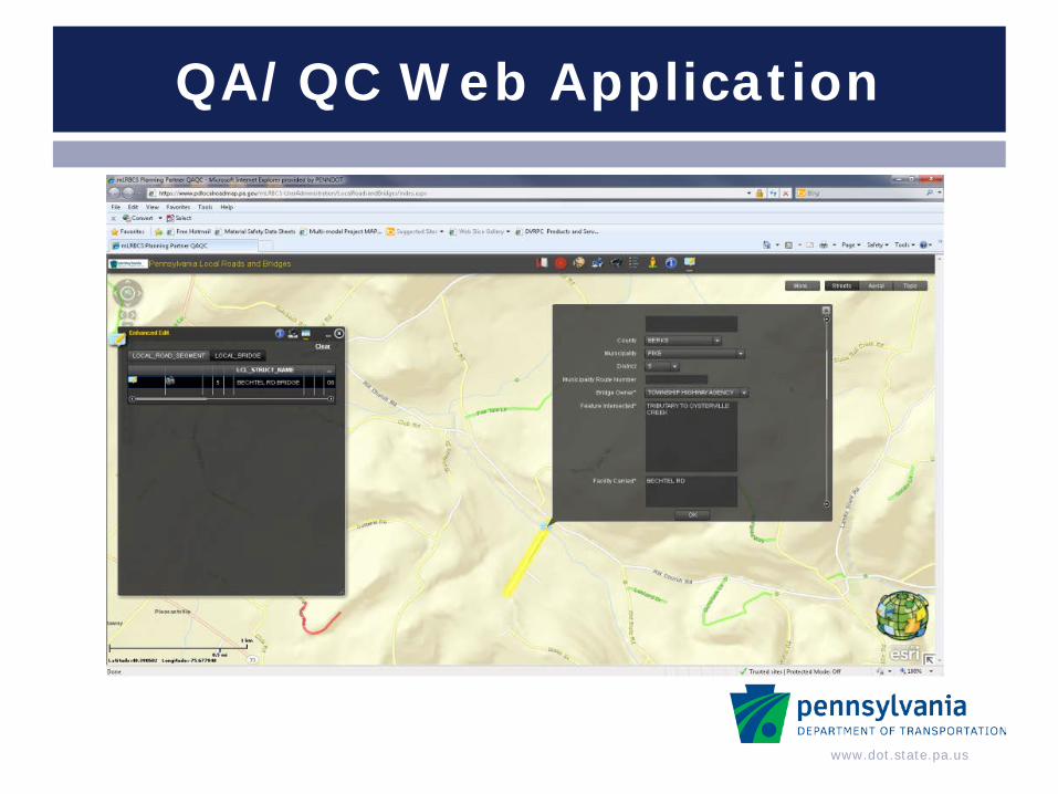
www.dot.state.pa.us
QA/QC Web Application
www.dot.state.pa.us
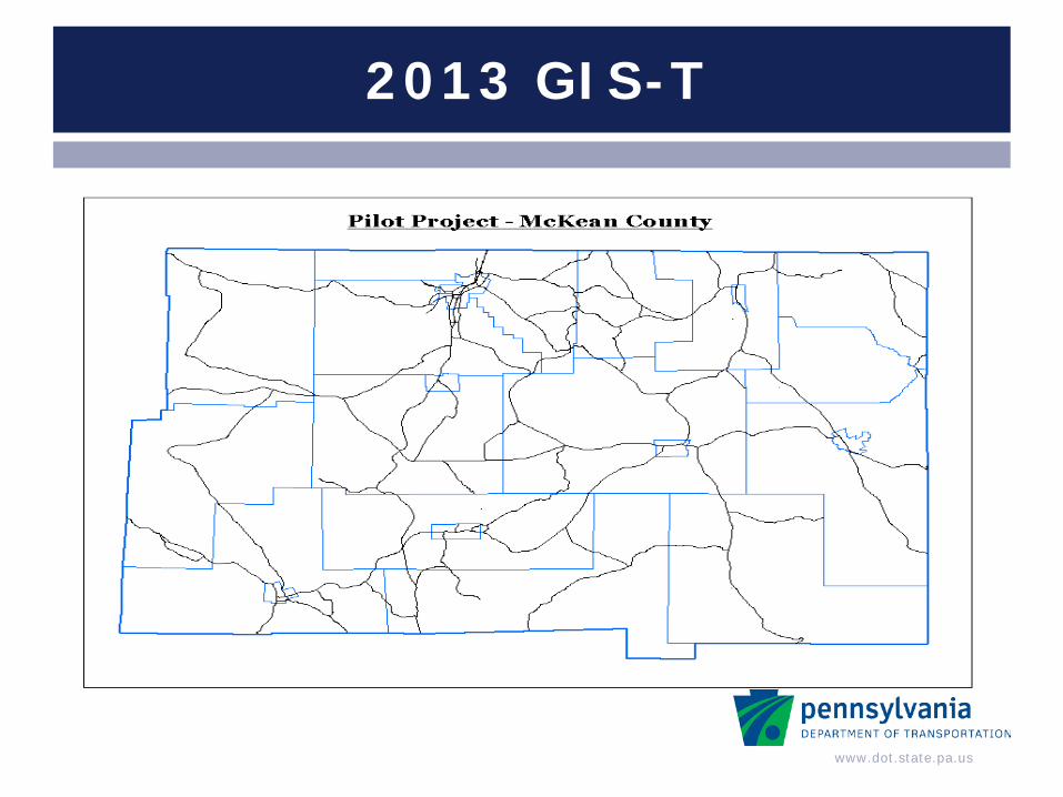
2013 GIS-T
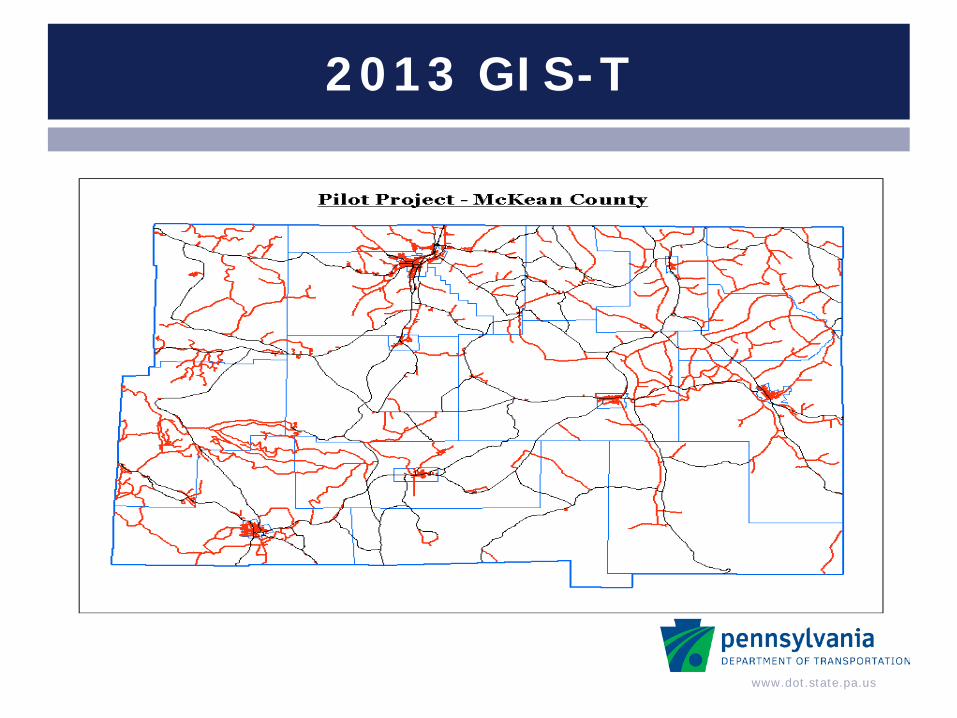
www.dot.state.pa.us
2013 GIS-T
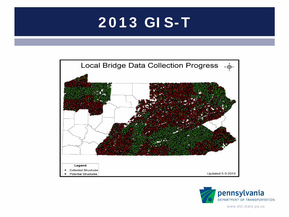
www.dot.state.pa.us
2013 GIS-T

www.dot.state.pa.us
2013 GIS-T
www.dot.state.pa.us
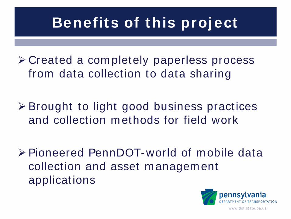
Benefits of this project
Created a completely paperless process from data collection to data sharing
Brought to light good business practices and collection methods for field work
Pioneered PennDOT-world of mobile data collection and asset management applications
www.dot.state.pa.us
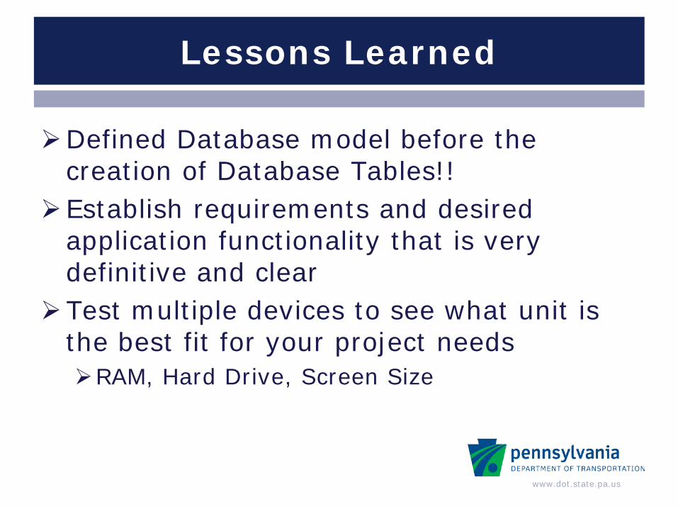
Lessons Learned
Defined Database model before the creation of Database Tables!!
Establish requirements and desired application functionality that is very definitive and clear
Test multiple devices to see what unit is the best fit for your project needs RAM, Hard Drive, Screen Size
www.dot.state.pa.us
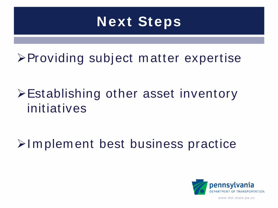
Next Steps
Providing subject matter expertise Establishing other asset inventory
initiatives Implement best business practice
www.dot.state.pa.us
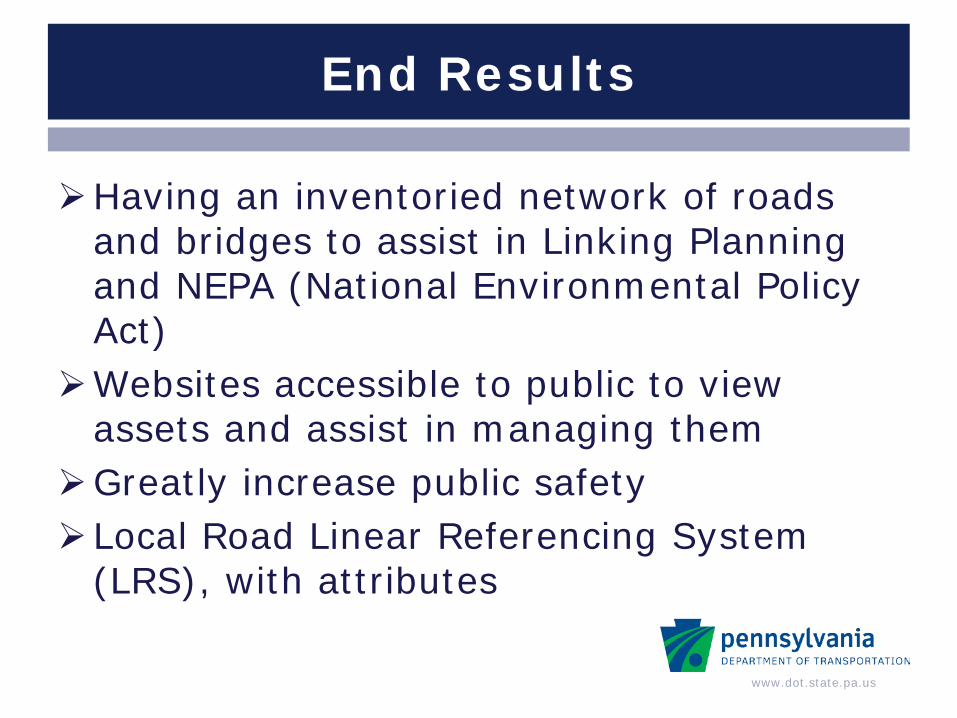
End Results
Having an inventoried network of roads and bridges to assist in Linking Planning and NEPA (National Environmental Policy Act)
Websites accessible to public to view assets and assist in managing them
Greatly increase public safety Local Road Linear Referencing System
(LRS), with attributes
www.dot.state.pa.us
QUESTIONS?????
Matthew Long PennDOT, [email protected] (717)-772-0795
John Parker PennDOT, [email protected] (717)-783-1230
2013 GIS-T