Embed Size (px)
Citation preview
1

2
About We Are Water MN is a traveling exhibition and community engagement initiative. It is also a partnership among state agencies and host sites, formed to tell Minnesota’s water stories collaboratively, bringing together personal narratives, historical materials, and scientific information. Combining these ways of knowing water strengthens Minnesotans’ relationships with and responsibilities to water.
The partnership supports host communities to collect and tell local water stories, rediscover the many reasons they care about clean water, and practice community-identified ways to protect water. There is about 1-year of planning together and then six weeks of public programming, events, and display of a water-themed exhibition. It’s not just about water science; it’s about history, economy, health, and community identity around water.
Visit the project website at mnhum.org/water.
History We Are Water MN was initially formed to support the Minnesota Humanities Center’s hosting of the Smithsonian Institution’s Water/Ways, a traveling exhibition and community engagement initiative of the Museum on Main Street program. The Humanities Center and its partners selected six Minnesota communities to host Water/Ways in 2016-2017 and built a companion exhibition, We Are Water MN, that shares information and stories about water in Minnesota.
These sites developed local exhibits, built partnerships, planned public activities, and inspired the partners to continue working together to build Minnesotans’ relationships with and responsibilities to water. The first communities were Spicer/New London (Prairie Woods Environmental Learning Center), St. Peter (Nicollet County Historical Society), Red Wing (Goodhue County Historical Society), Sandstone (Audubon Center of the North Woods), Lanesboro (Lanesboro Arts), and Detroit Lakes (Becker County Museum).
3
Welcome This handbook is for volunteers, staff, and educators who will help others appreciate and enjoy We Are Water MN. It includes:
• Tips for being an informed and effective docent. A docent is a volunteer or staff member who acts as a guide. They encourage visitors to think about the subject matter and invite them to share memories and personal connections
• Main messages, reflection questions, and activities that expand upon exhibition content and encourage conversation. Some of the “Get Interactive” activities will require additional materials. If they don’t, the activity is noted by a checkmark, instead of a circular bullet point.
• Ideas for group visits. How to structure a 1-hour visit from a student or community group. • Extension lessons for classroom teachers and other educators to use outside the exhibition. • Appendices and a Glossary for continued learning. Glossary words are bolded in blue
print throughout the handbook.
Thank you for hosting visitors in the We Are Water MN exhibition. We hope you and the visitors enjoy learning with, and from, one another.

4
Contents Tips for being an informed and effective docent .......................................................................................................5
Main Messages, Reflection Questions and Activities
We are water......................................................................................................................................................7
How’s the water? ...............................................................................................................................................8
People + water + choices ................................................................................................................................9
You + me + water ...........................................................................................................................................10
Hosting Groups ...............................................................................................................................................................12
Activity 1: We Are Water Stations .............................................................................................................13
Activity 2: Water Stories ...............................................................................................................................14
Activity 3: Water Worlds, Water Words .................................................................................................16
Extension Lessons...........................................................................................................................................................20
Lesson 1: Where We Gather .......................................................................................................................21
Lesson 2: Waterwalk Survey .........................................................................................................................26
Lesson 3: Stakeholders’ Dilemma.................................................................................................................34
Appendix ...........................................................................................................................................................................42
Appendix 1: A Drop in the Bucket ..............................................................................................................43
Appendix 2: Scavenger Hunt .........................................................................................................................44
Appendix 3: Extension Lessons Standards Alignment …………………………………………..48
Glossary ............................................................................................................................................................................53

5
Tips for being an informed and effective docent Docent tips adapted from the Smithsonian Museum on Main Street
Introduce yourself and make sure each visitor in your group feels welcome.
Orient your visitors to the exhibition.
Assess your audience and structure your time accordingly. Younger visitors often relate to technology, popular culture and references to today, while older visitors relate to historical content and personal memories. Be prepared to provide information to any visitors that may not be able to access the exhibition due to a disability.
Be familiar with the exhibition and the information provided. Aim for comfortable and conversational exchanges with your visitors.
Encourage visitors to ask questions. Don’t be afraid to say, “I don’t know,” but try to find out the answers before the visitors leave.
Avoid focusing on questions that can be answered with “yes” or “no.” Ask open-ended questions like: “What do you think…?” or “How do you feel about…”
Give visitors time to think about and answer questions. Usually someone will speak up in about 10 to 15 seconds.
Select a supplemental “Get Interactive” idea or activity to share with visitors. Be sure to ask your volunteer coordinator for any necessary supplies.
Practice your tour. Remember, if you’re relaxed and having a good time, your visitors will enjoy themselves too. Have fun!
Be prepared. As representatives of the host site, docents are often asked all sorts of questions.
Know the host site’s name, address, phone number, hours of operation, and the location of the gift shop, restrooms, water fountains, and seating areas for all visitors, including those with disabilities.
Be familiar with the dates and times of programs and special events associated with We Are Water MN, and with other exhibitions at the host site.
Ask visitors to fill out a survey when appropriate.

6
Main Messages, Reflection Questions, and Activities
This section is meant to prepare docents for their role as exhibit host. You’ll find the main messages of the exhibit and reflection questions that encourage conversation. Some of the “Get Interactive” activities will require additional materials. If they don’t, the activity is noted by a checkmark, instead of a circular bullet point.
7
Main Message #1: We Are Water
No one knows the water like the people who live here. Water is a large part of identity in the ‘Land of 10,000 Lakes’ and it’s been embedded in the heritage of the region for far longer. Dakota and Ojibwe people have been intimately connected to the region within and beyond the boundaries of ‘Minnesota’ for a very long time. Mnisota Makhoche is a Dakota phrase that means ‘Land where the water reflects the sky’. Through a Dakota perspective, water is more than a basic need or a source of recreation, it is a family member with whom we have a reciprocal relationship.
Let’s talk about it: Why do you think this exhibition is called We Are Water? Consider the biological, physical, and emotional ways water impacts you.
Water determines where we live and work, what we eat and drink. Consider your hometown. Is it located on or near a water body? How would your community be different without that water? Water also influences our cultures and religions. Do you have any water traditions? How is water a part of your holidays?
What place would you choose if you were asked to name a special water spot? Why is that place special to you? How do you take care of the water and how does the water take care of you?
Get interactive: ! Watch and listen to the water stories. Some of these stories share moments of fun or play.
Others tell of loss or change. Together, they reveal the central nature of water in our lives. Consider what happens when stories are told from only one person or group’s perspective. Why is important to have many perspectives on water?
! Remind visitors to share their personal water stories on the map or globe. Does your story categorize water as recreation, spiritual, survival, or something else? What about the stories already on the board? Do you notice any patterns in the ways visitors are telling their water stories?
! Play with the puppets! ! Read a book from the book basket. Talk through the discussion questions. • Allow children to trace their outlines on paper. Shade 60-70 percent in blue to represent the
percent of our bodies that is water.

8
Main Message #2: How’s the Water? We are the headwaters. Located on a triple, continental-scale water divide, Minnesota’s waters travel to the Gulf of Mexico, Hudson Bay, and the Atlantic Ocean. What we do matters downstream. Currently, 40% of Minnesotan waters are polluted. That’s not the end of the story, however. There are a multitude of ways citizens can improve the health of our waters.
Let’s talk about it: Water is eternal, but finite. No new water is created, but because of the water cycle, water acts like a renewable resource. Can you believe that we are drinking the same water that was used by the dinosaurs? What factors determine the availability or lack of water in different places around the world? Show visitors the map of altered streams in Minnesota. Why do we modify, create, and reroute waterways? How do humans make water work for us and how do humans work for water?
Public water supplies in Minnesota are tested regularly for more than 100 contaminants. When a new private well is built, it also is tested. After that, it is up to the property owner to have their well tested on a regular basis. Finances, language, and education can be barriers to having wells tested or treated. Do you use a public or private water source? Do you know from what body of water or aquifer your water is drawn? What can we do to ensure safe water for all?
Get interactive: ! Complete the water cycle puzzle. • Model a watershed! Color a watershed on wax paper. Include a headwater, main river
channel, tributaries, and human development. Color all the water bodies with washable marker and the rest with pencil or crayon. Crumple the wax paper to create elevation change and spritz it with water. Watch where the water flows!
• How’s my Watershed? Allow visitors to enter their zip code to learn more on the MPCA Website (https://www.pca.state.mn.us/water/watersheds) on a laptop or tablet.
• Altered Watercourses – pull up the searchable map on a laptop or tablet. Encourage visitors to notice modified watercourses near their communities. https://arcg.is/1i9q8T
• Show visitors a tray of aquatic macroinvertebrates collected from a local waterway. Some species are more sensitive to pollutants than others. Use a key to identify species and look through the flip book to see their sensitivity. What can the diversity of species tell us about the quality of the water?
9
Main Message #3: People + Water + Choices People change water. What you do matters. History, climate change, access to information, and aging infrastructure can all pose challenges to people sharing equally in our water wealth. The flow of water both connects and divides us; water can act as a boundary or a bridge.
Let’s talk about it: Water is shared and it crosses borders. Because of this, states, communities, and individuals often look for ways to agree upon water use, quality, and quantity. Are you affected by water laws? How do they make you feel? Are there groups of people that benefit more than others from certain water laws?
What are the ways water forms connections and divisions in your community? What boundaries in your area are formed by water? Are those boundaries political or cultural or both?
Read the text on the back of “naming water places” sign with visitors. What names do you know for lakes and streams in your area? Why were those names given? Do they have multiple names? Consider the debate surrounding changing the name of “Lake Calhoun” back to “Bde Maka Ska,” the original Dakota name for the Minneapolis water body. In order to take care of our aging water infrastructure, Minnesota will have some large investments to make in the coming years. It’s expected that in the next 20 years, it will cost $4 billion to upgrade wastewater infrastructure and $7.4 billion for drinking water infrastructure. How do you think we should cover those big bills? Is safe drinking water a right or privilege? Why is water, an essential for life, cheaper than many nonessential resources? What concerns and hopes do you have for the water in your community?
Get interactive: ! Bookmark your county in the Minnesota Place Names Encyclopedia. Flip through and locate local
waterways. Do you know other names or stories? ! Try out the listening games! Can you describe a picture for your partner to draw? What open-
ended questions can you think of? • Provide information about water infrastructure issues in your community such as wastewater,
drinking water, dams, stormwater, etc. Consider hosting a special community event with local representatives and experts to discuss these challenges and any proposed solutions.
• Show visitors the Water Sayings from Around the World sheets (page 18). Hypothesize from which region of the world these sayings originate and discuss what clues about the environment, peoples’ relationship to it, and lessons or morals are embedded in the sayings.
10
Main message #4: You + Me + Water Every day, more people are learning about Minnesota’s water and what it takes to protect and preserve it. Citizens of all ages, and organizations of all sizes are taking action around the state. Let’s improve the water together.
Let’s talk about it: The average American uses 80-100 gallons of water every day and, for many Americans, water is so easy to get that we don’t think about it. However, there are still places in the United States without access to running water, or safe water. How many times have you interacted with water today?
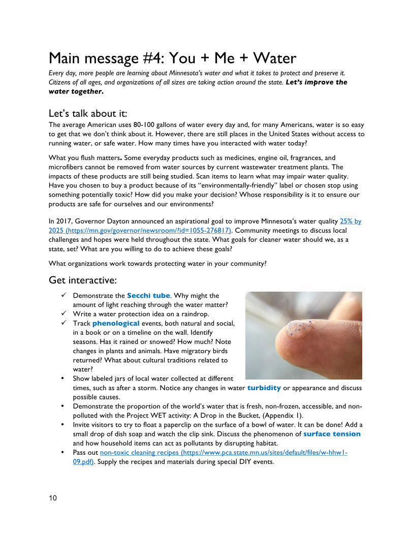
What you flush matters. Some everyday products such as medicines, engine oil, fragrances, and microfibers cannot be removed from water sources by current wastewater treatment plants. The impacts of these products are still being studied. Scan items to learn what may impair water quality. Have you chosen to buy a product because of its “environmentally-friendly” label or chosen stop using something potentially toxic? How did you make your decision? Whose responsibility is it to ensure our products are safe for ourselves and our environments?
In 2017, Governor Dayton announced an aspirational goal to improve Minnesota’s water quality 25% by 2025 (https://mn.gov/governor/newsroom/?id=1055-276817). Community meetings to discuss local challenges and hopes were held throughout the state. What goals for cleaner water should we, as a state, set? What are you willing to do to achieve these goals?
What organizations work towards protecting water in your community?
Get interactive: ! Demonstrate the Secchi tube. Why might the
amount of light reaching through the water matter? ! Write a water protection idea on a raindrop. ! Track phenological events, both natural and social,
in a book or on a timeline on the wall. Identify seasons. Has it rained or snowed? How much? Note changes in plants and animals. Have migratory birds returned? What about cultural traditions related to water?
• Show labeled jars of local water collected at different times, such as after a storm. Notice any changes in water turbidity or appearance and discuss possible causes.
• Demonstrate the proportion of the world’s water that is fresh, non-frozen, accessible, and non-polluted with the Project WET activity: A Drop in the Bucket, (Appendix 1).
• Invite visitors to try to float a paperclip on the surface of a bowl of water. It can be done! Add a small drop of dish soap and watch the clip sink. Discuss the phenomenon of surface tension and how household items can act as pollutants by disrupting habitat.
• Pass out non-toxic cleaning recipes (https://www.pca.state.mn.us/sites/default/files/w-hhw1-09.pdf). Supply the recipes and materials during special DIY events.
11
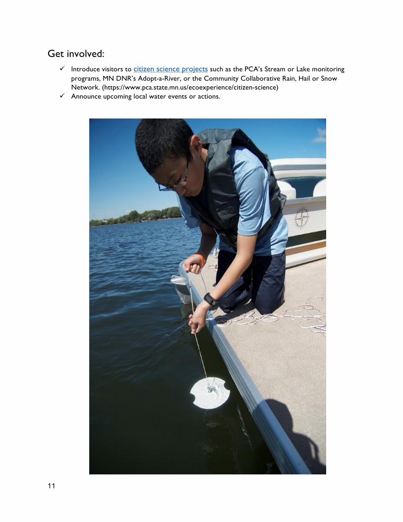
Get involved: ! Introduce visitors to citizen science projects such as the PCA’s Stream or Lake monitoring
programs, MN DNR’s Adopt-a-River, or the Community Collaborative Rain, Hail or Snow Network. (https://www.pca.state.mn.us/ecoexperience/citizen-science)
! Announce upcoming local water events or actions.

12
Hosting Groups Schools, Senior Centers, and community leaders are examples of groups that may come to visit the exhibition. The following activities provide an hour-long structured experience for these visitors. Consider adapting these activities to your community.
• Communicate with the group leader in advance to know how many visitors are coming and what age.
• Select activities for the visit from the following pages. • Schedule docents as needed. • See page 5 for more tips on being an informed and effective docent.
13
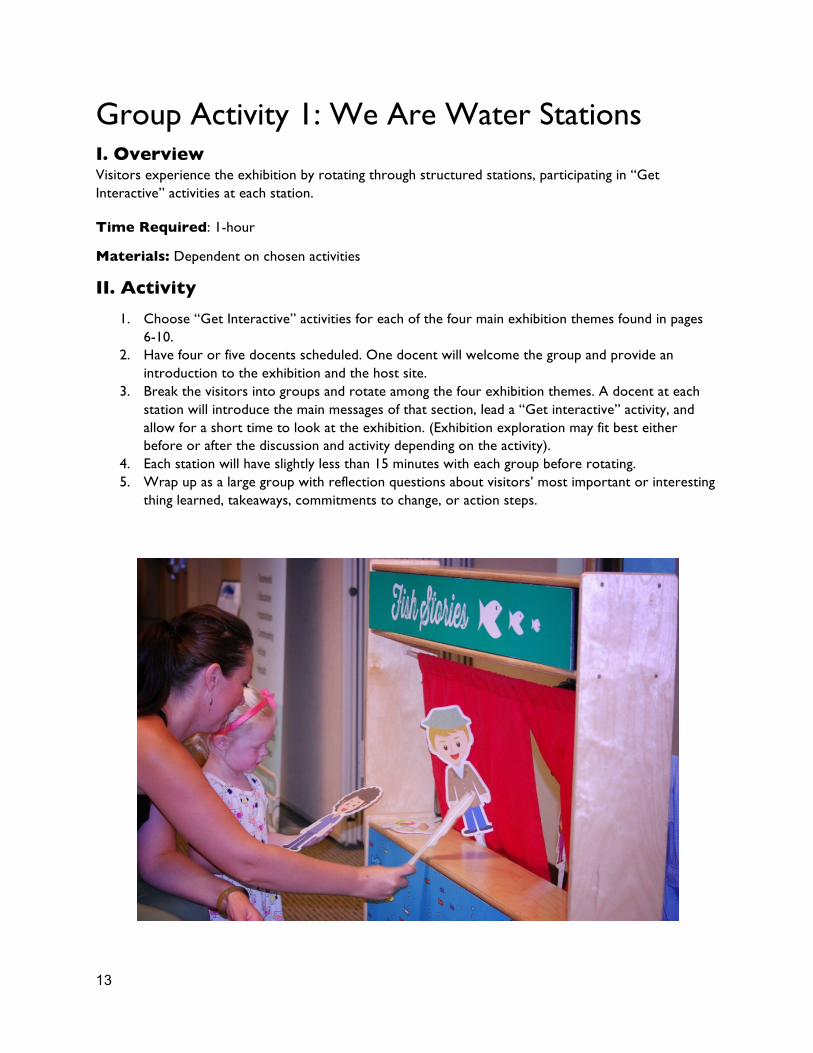
Group Activity 1: We Are Water Stations I. Overview Visitors experience the exhibition by rotating through structured stations, participating in “Get Interactive” activities at each station.
Time Required: 1-hour
Materials: Dependent on chosen activities
II. Activity 1. Choose “Get Interactive” activities for each of the four main exhibition themes found in pages
6-10. 2. Have four or five docents scheduled. One docent will welcome the group and provide an
introduction to the exhibition and the host site. 3. Break the visitors into groups and rotate among the four exhibition themes. A docent at each
station will introduce the main messages of that section, lead a “Get interactive” activity, and allow for a short time to look at the exhibition. (Exhibition exploration may fit best either before or after the discussion and activity depending on the activity).
4. Each station will have slightly less than 15 minutes with each group before rotating. 5. Wrap up as a large group with reflection questions about visitors’ most important or interesting
thing learned, takeaways, commitments to change, or action steps.
14
Group Activity 2: Water Stories I. Overview Stories share information, connect people, and create meaning. Cultural background and individual experiences are just two of many factors that affect a person’s relationship with and responsibilities to water and contribute to their ‘water story.’ Everyone has a water story; it may include a spiritual connection, happy memories of family, fear, scarcity, food, or floods. In this activity, visitors listen to water stories and share their own.
Subjects: Language Arts, Geography
Time Required: 1-hour
Materials: • Ability to play audio out loud • Sticky notes or slips of paper for each participant • Writing utensil for each participant • Labels • “Spiritual,” “Recreation,” “Survival,” “Livelihood,” and “Family” written on piece of paper or
chalkboard • Optional: Minnesota Map and We Are Water MN scavenger hunt (Appendix 2)
II. Activities A. Listen to water stories (15 min)
1. Set up a quiet space to listen to the stories in a large group. Welcome the group and introduce the exhibition. Ask visitors why they think the exhibition is called We Are Water MN.
2. Read one or two examples from the story board and introduce how every person has a ‘water story.’
3. Play a story off the Community’s Story Map (http://arcg.is/2hue8lL). If you have the map and picture visible on a screen it would give the group something to focus on while listening. Each story is about 3 minutes long.
4. Play stories as time allows (aim for two or three). After each story, ask the group a discussion question that allows them to think about their own relationship to water. These questions can come directly from the exhibition panel. Use pair-share and group discussion.
B. Share our own water stories (30 min)
1. Pass out paper and writing utensils. Ask the group to take some time to think about, and then draw or write their own water story (one they wouldn’t mind sharing with the group) on a piece of paper or sticky note. Include a location if they know where their story took place, but do not write their name on the card (yet).
2. Discuss the words “recreation,” “survival,” “spiritual,” “livelihood,” and “family” and give examples of how a water story could fit into these categories. Include examples from the stories you’ve just listened to.
a. Recreation is anything we do for fun. (E.g. swimming, building snow forts, etc.)
15
b. Survival deals with staying alive and our body’s needs. (E.g. drinking water, bathing, etc.) c. Spiritual relates to religion or sacred/holy experiences. (E.g. baptism, a water walk,
finding a sense of peace in nature, etc.) d. Livelihood (Work) includes the activities we do to support ourselves and our families. (E.g.
a barge captain on the Mississippi River, a chef, or lifeguard, etc.) e. Family include memories spent around/in/with water, where through family a connection
with water was formed. (E.g. a family trip to a lake, a story about water told by a grandparent, etc.)
3. Have the group think about what category their story falls into then invite them to come up and place their story by the selected sign. Some stories might fit into multiple categories and that’s okay. Ask the group if they think any category is missing.
4. Discuss: Water provides all this! Is one category more important than the others? Ask if the group notices any patterns in the ways they tell their water stories.
5. Have participants retrieve their stories, crumple the paper into a “snowball,” and toss it into the center of the circle. Once all stories are in the circle, ask each person to retrieve one story from the middle. (Each person must have written a story for everybody to pick one up.)
6. Give everyone a few minutes to read the story they picked up. 7. Have the group mingle, sharing stories, and trying find the author of the story they’re holding. 8. Once they’ve located the author of their story, in pairs or small groups, have participants locate
where their story takes place and attach one of the paired labels on the Minnesota map (either part of the exhibition or a separate one), labeling their story with the other. If stories are labeled on a Minnesota Highway map, teachers or the group leader can take the finished product for their classroom or meeting space.
C. Exhibition Exploration (15 min) 1. Free time in the exhibition. One or more “Get Interactive” activities can be set up with docents
during this time. Alternatively, pass out scavenger hunt sheets (Appendix 2) and allow the group to spend their remaining time exploring the exhibition to find the answers.
Questions to inspire stories: • What does water mean to you? • What role does water play in your work, your town, your neighborhood, and your worldview? • What would you lose if you did not have water? • How is water important to you and your culture? • What are the ways you and your community put water to work? • Consider your own hometown. Is it on or near water? Is it defined by a lack of water? Would
your community be the same without water? • How does the availability of water affect your decisions each day? • How are people working to restore your local waters? • Do you have a special water place? What would you do to save that place?
16
Group Activity 3: Water Worlds, Water Words I. Overview
The language we use to speak about water can give hints to how we think about and relate to it. In this activity, participants learn about where all the water in the world is and how through idioms people share morals and inspire behaviors—across the world, and in our backyards.
Subjects: Math, biology, language arts
Time Required: 1-hour
Materials: • Inflatable globe • Water Sayings from Around the World Cards
II. Activities A. Introduction: The World’s Water (15 min)
1. Stand in a circle. Tell the group that they are going to combine a game of catch with math to determine how much of the earth is covered in water.
2. Allow participants to toss the globe to one another. Each participant will count the number of fingers touching blue (water)—remind them not to move their fingers once they catch the globe. Record each visitor’s number as the globe is tossed around the circle. A docent can be the recorder. The averaged end result should be approximately 70%. This can also be used as a time to make introductions.
3. Once the group has a greater understanding of the amount of Earth covered by water, inform them that oceans hold 96.5% of all the water in the world. Ask the group to think about where the remaining 3.5% of the water exists naturally. Individuals easily remember lakes and rivers. Ask visitors to think about the other states in which water can exist. Glaciers are made of ice (a solid) and clouds are made of water vapor (a gas). Water is also found in our bodies (animals) and plants, in the soil and underground in aquifers (groundwater). Optional: Demonstrate the percentages of water located in these different states with Project WET activity: A Drop in the Bucket (Appendix 1).
4. Debrief: Different cultures have different ideas and values about water. As the group is guided through these activities, encourage them to think about how their water decisions affect others’ lives. Why does it matter that only 3.5% of the world’s water is fresh and less than .01% is readily available for human, animal, and plant use?
5. Minnesota has an abundance of freshwater. In fact, the Great Lakes contain 20% of the world’s fresh water! Minnesota, sitting atop a triple continental-scale water divide, is the headwaters, sending water out of our state to many other places. “What responsibilities do we have to water and to those we share it with?”
B. Water Idioms (30 min)
1. Sayings or idioms exist across the world. Passed from generation to generation, they can be rich in tradition or collective wisdom; they can express beliefs, values, and lifestyles. Because we
17
are all dependent on water, idioms related to observations about water pervade many cultures. The interpretation of a saying often reflects morals, lessons, or ideas about how a person should live within their culture and their environment.
a. Many English idioms are associated with observations about weather. “Save it for a rainy day” refers to thriftiness, and “You’re skating on thin ice” warns of trouble. In the 1700’s, Ben Franklin wrote, “You won’t miss the water til the well runs dry.” Adages like these can provide insight into a culture and indicate a people’s awareness of, and relationship to, water.
2. Ask the group to share sayings related to water they have heard within their families in any language. Brainstorm what the purpose of the sayings or proverbs might be and define their figurative vs. literal meanings. (See list on page 18.)
a. Sometimes the sayings from two different countries may have a similar meaning, but different modes of expression. For example, in Japan one might say, “Fukusui bon ni kaerazu,” or “Spilt water never returns to the tray.” And, in English, you might hear, “It’s no use crying over spilled milk.”
b. Optional extension: play a game of Pictionary or Charades with the water sayings. 3. Split participants into groups and pass out Water Sayings from Around the World sheets. Explain
that language can contain clues that show how we think about and relate to our environment. These sheets contain English Language translations of sayings from around the world. The sayings are grouped together based on what region of the world they originate from (polar, tropical, desert, or temperate.) To help them match the sayings with the region, have the groups respond to the following questions:
Do the sayings: • Provide any clues to temperature or indicate seasons? • Reference locations of water or reflect the scarcity or abundance of water? • Reference land forms or animals?
4. While waiting for all groups to finish, have participants discuss what the idioms mean and what morals they may contain.
Key: Region A: polar, Region B: temperate, Region C: tropical, Region D: desert.
5. Staying in the same groups, rotate between the regional panel, inspiration stories, and audio stories sections of the exhibition. Based on the content, what do you think is going on in your state or community with water? Are there decisions to be made? By whom?
6. Have each group create their own water saying. What lesson, moral, or behavior do you want to emphasize? What do you want your community to know about the water in your area? Share with the large group.
C. Exhibition Exploration (15 min) 1. Free time in the exhibition. One or more “Get Interactive” activities can be set up with docents
during this time. Alternatively, pass out scavenger hunt sheets and allow the group to spend their remaining time exploring the exhibition to find the answers.

18
Example Water Sayings
• A drop in the bucket • Blood is thicker than water • Feeling swamped • Get your ducks in a row • Having a ripple effect • When it rains, it pours • Wash my hands of the matter • Something smells fishy • To be in deep water • To be in hot water • To get your feet wet • When something snowballs • Finding your sea legs • Down the drain • Breaking the ice • Bogged down
• Something made a big splash • Sink or swim • Wet behind the ears • When our ship comes in • To be like a fish out of water • To pour cold water on something • To blow something out of the water • Water under the bridge • That does not hold water • Like water off a duck’s back • To keep one’s head above water • It’s raining cats and dogs • You can bring a horse to water but you
can’t make him drink • On cloud nine

19
Water Sayings from Around the World
Does your group of sayings originate from the desert, polar, tropical or temperate regions of the world? What clues helped you decide?
Group A
1. Ice three feet thick is not frozen in a day. 2. What lay hidden under the snow comes to light at last. 3. Much February snow, a fine summer doth show. 4. No one thinks of the snow that fell last year.
Group B
1. Up a creek without a paddle. 2. After a storm comes a calm. 3. The sea refuses no river. 4. Little drops of water make the mighty ocean.
Group C
1. Till you are across the river, beware how you insult mother alligator. 2. Store up the water while it rains. 3. Don’t empty your water jar until the rain falls. 4. What is written on sand is washed out by the tide.
Group D
1. A trickle of water is better than no water. 2. Putting the water back in the well is not waste. 3. If you go first you will not drink muddy water. 4. Gently flowing water will hollow even a rock.
Adapted from “Raining Cats and Dogs” Project WET Activity

20
Extension Lessons These three post-visit lessons can be offered to teachers, parents, and visitors as a way to bring the content of the We Are Water MN exhibition back to a classroom, home, or meeting space.
State education standards alignment for grades 6-8 can be found in Appendix 3. Each lesson has been assigned an “education focus,” or grade and subject level with which’s state standards the lesson’s content most clearly aligns. However, this should not be a limiting factor. These lessons can be easily adapted into different subjects and grade levels.
These lessons are designed to complement and build off each other. We encourage groups to use all three.
21
Extension Lesson 1: Where We Gather I. Overview
Cities tend to be found along waterways—just as they did centuries ago. In this activity, participants learn about Dakota peoples’ connection to Minnesotan waters, create a map of their own community and its relationship to water, and gather stories from community members in order to broaden their community’s water story.
Subjects: History, Geography, Language Arts
Education Focus: 6th Grade Social Studies
Materials: • Minnesota Map • Access to the online Bdote Memory Map • Materials for mapping community: markers and paper, stinky notes or notecards • Interviewing Community Members Guide Sheets • Optional: audio recorders or cameras
Time Required: Two or three class periods or meetings. Additional outside time is needed if participants conduct interviews.
II. Activities
A. Introduction: Where We Gather 1. Look at a map of Minnesota and note how many communities are located on or near rivers or
lakes. This is not something that is new to our present-day cultures. 2. As a group, brainstorm reasons why people of all cultures would choose to live along
waterways. This list might include ease of transportation and travel; supplies, water and food; religious reasons; and irrigation for farming.
B. Bdote Exploration 1. It is common for communities to be built at locations where waters come together. Introduce
the group to the word “bdote.” Bdote is a Dakota word that expresses “where two waters come together.” Ask the group what they think that means and discuss some situations where waters join (two rivers, river into lake or ocean, etc.) In addition to logistical benefits of these locations, Dakota people are connected to these places because of their spiritual and cultural importance.
2. Looking again at the Minnesota map, see how many communities you can find at the confluences of water bodies.
3. The most significant bdote to the Dakota people of Minnesota is in the area that has become the Twin Cities. The location where the Wakpa Tanka (translated as big river), also known as the Mississippi River, and the Mnisota Wakpa, also known as the Minnesota River, join together is a place of spiritual, cultural, and historical importance. For many Dakota, this particular bdote is the center of the earth and where their people began. It is a part of their creation story.

22
4. Show the Bdote Map (http://bdotememorymap.org/). Allow the group to explore this site to hear water stories and learn more about the Dakota people’s relationship to water and Minnesota. Discuss what the group noticed. What new information did they learn? Had they heard similar stories before?
5. Dig deeper with the worksheets and activities referenced in the “Additional Resources” section. C. Community Mapping
1. Having learned a little more about the histories of relationship between people and water in Minnesota, it’s time to focus on our local community.
2. Pass out materials (post-its, markers, paper) and have the group construct a map of their community as they know it. Specifically, note places where water flows/is used. Include community landmarks such as the school, post office, or sledding hill. Here are a few examples of areas that could be mapped:
o Waterways: streams, rivers, lakes, ponds o Water towers o Water treatment facilities o Parks, pools, and sport fields o Environmental organizations, clubs, businesses, and schools o Recycling or waste management areas o Hiking and bike trails o Farm fields
3. Ask participants to take turns naming places and drawing them in their location. Encourage participants to think about how places have connections to water. The more places that are mapped, the more you will be able to infer about how the group understands their community.
4. If desired, allow individuals to write short descriptions or memories of a time they interacted with water on notecards or sticky notes and locate them on the map. Draw inspiration from the stories and images from the Bdote Memory Map.
D. The Danger of a Single Story 1. Ask the group to consider what happens when a story, including history, is told from only one
person or group’s perspective. When talking about stories, learning about other cultures, or even trying to map a community, there is the danger of a single story. This is a phrase used by Chimamanda Adichie and the topic of her 2009 TED Talk. She roughly defines it as a limited viewpoint, or when a definition of an entire community, group, or culture is based upon a single person’s (or a small group’s) experience.
2. Watch Chimamanda Adichie’s TED talk (approx. 20 minutes) and discuss how it relates to your map. (https://www.ted.com/talks/chimamanda_adichie_the_danger_of_a_single_story)
3. Introduce the term “absent narrative.” Talk about how even maps can be subjective and tell a story from one perspective. Native Americans, African Americans, veterans, children, and other non-dominant perspectives are often left out of a community’s official story. Discuss the story your community map is telling and brainstorm ways to include more perspectives. Interviewing other community members is one possible approach.
E. Oral History Introduction 1. An oral history is a history “based on storytelling and listening” (Kathy Walbert, Duke
University and the Southern Oral History Program, www.sohp.org). Individuals can produce simple oral histories of their community’s water story by interviewing others about past and present water use. Group members can interview family members, neighbors, or friends.

23
Alternatively, a teacher or group leader can invite older community members into the classroom to speak to the group and answer questions. A partnership with a local senior center might be a good source of stories.
2. Conducting interviews teaches useful skills for carrying out conversations and attentive listening. Go over a simple interview process and safety precautions with participants before they conduct their interviews.
a. Make plans: coordinate times and locations with the interviewee, prepare questions. b. Be safe. Tell someone where you are going and when you plan to be back. c. Take careful notes—even if using a recording device. Note where certain stories took
place, and, ask permission to take a picture of the interviewee. d. Be curious and respectful. Ask follow up questions to show that you’re listening and that
the interviewee’s stories are important to you. Follow the interviewees’ lead on the level of formality and listen to their cues.
3. Have students practice interviewing each other before interviewing community members.
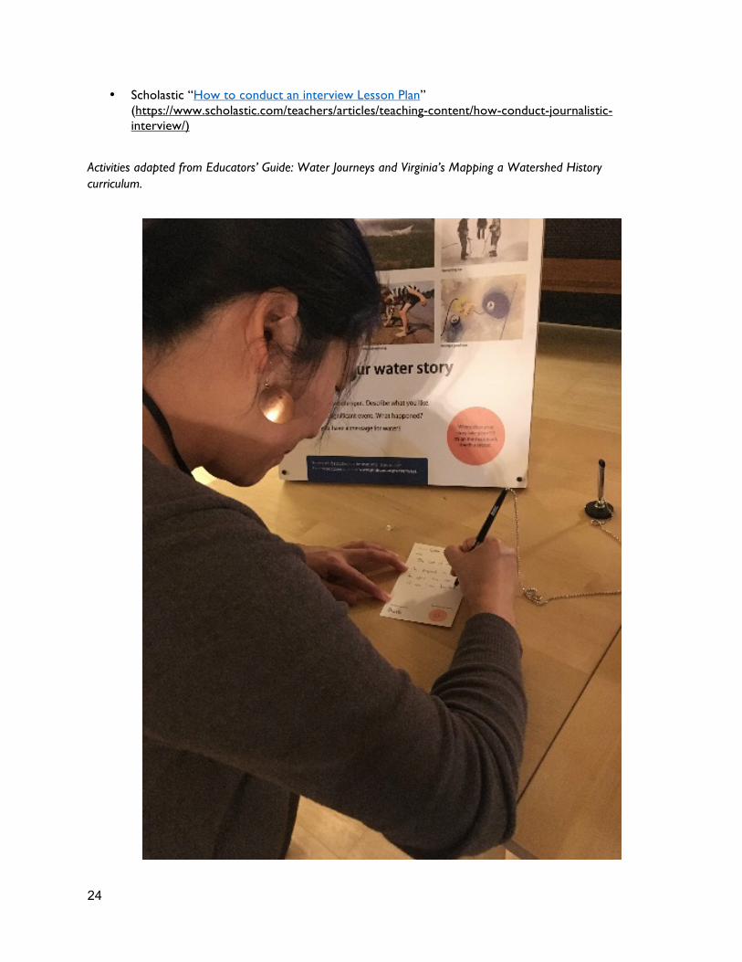
F. Gathering Stories 1. Use the Interviewing Community Members Guide to conduct interviews. 2. Remember to bring along a notebook and writing utensils, a list of questions, and perhaps a
camera or audio recorder.
G. Sharing our Stories 1. When the interviews are complete, have the group discuss their findings, first in small groups
and then as a whole. Ask participants in their small groups to select a few key points or quotes from their interviews to share with the whole.
a. What was the experience of interviewing like? What were the challenges/successes? b. What did you learn from your interviewee?
2. Have each participant write down key quotes or stories they learned from their interview twice each on notecards or sticky notes.
a. Post the first set of quotes around the map with string or drawn lines pointing to the location of the story. Include the pictures if possible.
b. Identify common themes/celebrations/concerns about water in your community from the selected quotes/stories. List these commonalities as headings on a large piece of paper or whiteboard and post the second set of quotes under the best fitting heading. Discuss any patterns you notice.
3. Post the map. Consider posting it in a public place such as a library or community center and providing materials so others can add their own stories and memories.
4. Optional Extension: Have participants write an essay about their community’s water story incorporating quotes from interviewees. What makes your community’s stories unique?
III. Additional Resources: • Bdote Memory Map teacher resources (http://bdotememorymap.org/for-teachers/) • VIRGINIA Mapping a Watershed History Curriculum
(http://www.longwood.edu/cleanva/images/Sec7.mapwatershed.pdf) • Incorporating Oral History into the k-12 Curriculum (http://www.learnnc.org/lp/pages/764)
24
• Scholastic “How to conduct an interview Lesson Plan” (https://www.scholastic.com/teachers/articles/teaching-content/how-conduct-journalistic-interview/)
Activities adapted from Educators’ Guide: Water Journeys and Virginia’s Mapping a Watershed History curriculum.
25
Interviewing Community Members Guide
We can learn about the history of our watershed through interviewing community members. At your interview site, introduce yourself, and explain the purpose of the project. Be prepared to share about yourself during the conversation.
Ask some of the following questions and the ones you’ve brainstormed, listen carefully, write down major points, and ask follow-up questions.
• How long have you lived in this area? • What childhood memories do you have relating to the water in our area? • Have any of your jobs ever depended on local waters? • Can you tell any stories of using local water for pleasure or recreation? • Do you know of any old customs or traditions that involved the water? • Can you tell any stories of memorable characters in our community relating to the
water? • What changes have you seen in the area relating to the water or the area surrounding
the water? • Do you know of any pollution affecting the water in our area, either now or in the past? • What changes would you like to see in the future that relate to our water?
In your notes, write down at least two interesting quotes from the interview which illustrate the history of the area and activities relating to the water.
Be sure to thank your interviewee for their time and stories!
26
Extension Lesson 2: Waterwalk Survey I. Overview
Individuals gain valuable hands-on experiences by getting out in the field, coming to know a local waterway, and monitoring that water’s health. By learning about local water bodies, participants will begin to understand how human actions affect local waters and develop a relationship with their place. In this activity, participants monitor a local stream’s conditions and reflect upon those observations.
Subjects: Science, Language Arts
Education Focus: 7th and 8th grade Science
Time Required: Dependent on travel time and chosen activities.
Materials: • Access to the online Watershed Health Assessment Framework • Clipboard and pencils • Data sheets • Secchi tube or disk • Thermometer • Tape measure • Trays and jars for looking at macroinvertebrates • pH test strips • Field guides, binoculars, camera
II. Activities A. Prepare for the field:
1. Before going to the field, explore your watershed by exploring the interactive Watershed Health Assessment Framework (WHAF) tool (http://www.dnr.state.mn.us/whaf/index.html). You can use the search function to locate your waterbody, highlight its watershed, and click through ecological health scores from five different perspectives. Discuss how “health” is made up of many factors that all contribute to the overall assessment.
2. Review the Waterwalk Survey Data Sheets (included at the end of this section). 3. Brainstorm a list of questions about your site that you’d like to find the answers to. (E.g., what
evidence of human impacts exist at our site? Is our watershed healthy?)
B. Collect information on a lake or stream: 1. Use the Waterwalk Survey Data Sheets and Instructions to monitor a local waterway. The
sheets walk you through it. You’ll look at water quality, riparian area vegetation, macroinvertebrates, and surrounding land use.
2. As you complete the survey, encourage participants to consider their relationship with water. 3. Consider visiting your site every season. You can still get outside in the winter! When it’s too
cold to get in the water, survey for animal tracks, look for plant and animal winter adaptations,
27
and take note on whether or not your site freezes over. Dress appropriately and remember that ice is never 100% safe!
C. Reflect:
1. Following the survey, allow time to debrief and discuss. a. How did you feel when you were monitoring the water? b. Did you notice anything that surprised you? c. What concerns do you have for the waterway? d. What are you reassured about after working alongside the water?
2. Assess whether or not you think your waterway is healthy. Base your assessment on the information you gathered during your time in the field. Return to the WHAF to compare what you found at your site with the health of the greater watershed. Where you able to answer your questions?
3. Brainstorm what you can do to further protect water and encourage stewardship in your community.
D. Extension: Participate in a Waterway Cleanup or Citizen Science Project Waterway cleanups and citizen science projects allow individuals the opportunity to care for and learn more about their environment. You can work to improve the health of local waters by leading or participating in a waterway cleanup or citizen science project. There are dozens of programs that train and support citizen scientists to collect data that are regularly used in decision-making and conservation efforts. Find a program that excites you and join in.
• Sample a nearby stream or lake weekly April through September. Volunteers measure the clarity of lakes and streams, collecting valuable data the Minnesota Pollution Control Agency uses to make decisions on watershed protection and restoration. For some lakes and streams, data collected by volunteers are the only data available, making this work indispensable. https://www.pca.state.mn.us/water/citizen-water-monitoring
• Keep a waterway clean with Adopt-a-River. This can be a one-time event, or something regular. You can even create a visual exhibit to showcase the items collected. Have participants create signage to share information on their project, what they collected, what they learned, and what they would like others to learn from the experience. http://www.dnr.state.mn.us/adoptriver/faq.html
• Find more citizen science ideas on the Pollution Control Agency’s website! https://www.pca.state.mn.us/ecoexperience/citizen-science
Tips for a Safe Waterwalk
• Have a plan – make sure someone knows where your group is going and when you will be back. • Get the permission of landowners. It’s recommended that you use public access points. • Always work with others. • Be aware that the streambed can be very slippery, uneven, and unpredictable. Wear appropriate
footwear and clothing. • Be careful of ticks, poison oak, nettles, wild parsnip, and poison ivy. • Take care of your body; use repellent and sunscreen as needed, and bring ample water. • Be considerate of streamside vegetation and wildlife. Disturb them as little as possible. • Don’t put yourself in danger to gather survey information.

28
III. Extra resources: • Izaak Walton League of America’s Save our Streams Program
(http://www.iwla.org/conservation/water/save-our-streams) • U.S. Environmental Protection Agency’s Water Drop Girl Scouts of America Patch Guide.
(https://nepis.epa.gov/Exe/ZyPDF.cgi/P1003RZ2.PDF?Dockey=P1003RZ2.PDF)
This lesson was adapted from the Izaak Walton League Save Our Streams Program, Whitewater State Park’s Watershed Field Experience, and the U.S. Environmental Protection Agency’s Water Drop Guide for Girl Scouts of America.
29
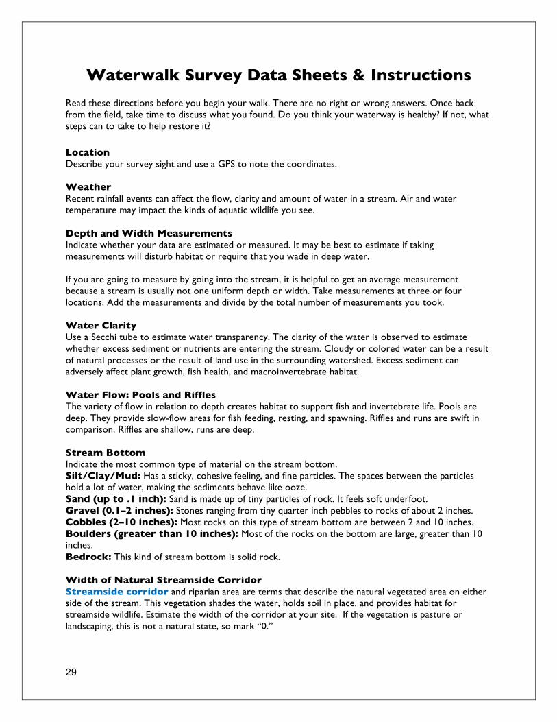
Waterwalk Survey Data Sheets & Instructions Read these directions before you begin your walk. There are no right or wrong answers. Once back from the field, take time to discuss what you found. Do you think your waterway is healthy? If not, what steps can to take to help restore it? Location Describe your survey sight and use a GPS to note the coordinates. Weather Recent rainfall events can affect the flow, clarity and amount of water in a stream. Air and water temperature may impact the kinds of aquatic wildlife you see. Depth and Width Measurements Indicate whether your data are estimated or measured. It may be best to estimate if taking measurements will disturb habitat or require that you wade in deep water. If you are going to measure by going into the stream, it is helpful to get an average measurement because a stream is usually not one uniform depth or width. Take measurements at three or four locations. Add the measurements and divide by the total number of measurements you took. Water Clarity Use a Secchi tube to estimate water transparency. The clarity of the water is observed to estimate whether excess sediment or nutrients are entering the stream. Cloudy or colored water can be a result of natural processes or the result of land use in the surrounding watershed. Excess sediment can adversely affect plant growth, fish health, and macroinvertebrate habitat. Water Flow: Pools and Riffles The variety of flow in relation to depth creates habitat to support fish and invertebrate life. Pools are deep. They provide slow-flow areas for fish feeding, resting, and spawning. Riffles and runs are swift in comparison. Riffles are shallow, runs are deep. Stream Bottom Indicate the most common type of material on the stream bottom. Silt/Clay/Mud: Has a sticky, cohesive feeling, and fine particles. The spaces between the particles hold a lot of water, making the sediments behave like ooze. Sand (up to .1 inch): Sand is made up of tiny particles of rock. It feels soft underfoot. Gravel (0.1–2 inches): Stones ranging from tiny quarter inch pebbles to rocks of about 2 inches. Cobbles (2–10 inches): Most rocks on this type of stream bottom are between 2 and 10 inches. Boulders (greater than 10 inches): Most of the rocks on the bottom are large, greater than 10 inches. Bedrock: This kind of stream bottom is solid rock. Width of Natural Streamside Corridor Streamside corridor and riparian area are terms that describe the natural vegetated area on either side of the stream. This vegetation shades the water, holds soil in place, and provides habitat for streamside wildlife. Estimate the width of the corridor at your site. If the vegetation is pasture or landscaping, this is not a natural state, so mark “0.”

30
Streamside Vegetation Vegetation acts as a filter for sediment and pollutants coming from nearby land. It provides shade that cools the water and habitat for creatures that are dependent on and influence the stream.
Overhead Canopy—stream cover The overhead canopy is the vegetation that overhangs the stream. It offers protection and refuge for fish and other organisms, shades the stream keeping the water cool, and provides “launching” areas for insects that might fall into the river. Estimate how much of the river is overhung by vegetation and circle the category that is appropriate for your site. Artificial Bank Protection This category includes streamside modifications like riprap (a retaining wall built of rocks or concrete) and bulkheads. Circle the percentage that best describes the condition of your waterbody. Presence of Logs or Woody Debris in Stream Logs and woody debris (not twigs and leaves) can slow or divert water and provide fish habitat such as pools and hiding places. Mark the general amount of logs and woody debris in the stream. Presence of Other Organic Debris in Stream The presence of organic matter in the stream can be both good and bad. Dumped grass clippings or excess nutrients from other sources can be bad for stream health. On the other hand, naturally falling leaves and twigs can be beneficial. Fish Can you see any fish? If you know what kind of fish it is, say so in the space next to the question. Adjacent Land Uses Adjacent land use has a great impact on the quality of the stream and riparian areas. Consider what water might pick up and carry to the river as it runs off adjacent land. Macroinvertebrates Use nets and turn over rocks in riffles and along the banks to search for macroinvertebrates. Use a key to identify and tally the species you find before releasing them. Some species are more sensitive to pollution than others. What can you conclude about the health of your waterway by the types of species you were able to find? (http://files.dnr.state.mn.us/education_safety/education/minnaqua/leadersguide/water_habitat_key.pdf)

31
Waterwalk Survey Data Sheet Location Stream name: _______________________________________ Date:___________________ County: ____________________________________________ State:___________________ Site (name, description):____________________________________-______________________ Latitude: ________degrees ________minutes ________seconds Longitude: ________degrees ________minutes ________seconds Weather
Past 24 hours: Clear Overcast Rain/showers Snow Storm Now: Clear Overcast Rain/showers Snow Storm
Air Temperature __________ Water Temperature __________ Stream Description
Depth): __________ feet measured estimated Width: __________ feet measured estimated Clarity: Does water appear: clear cloudy green brown blue
Secchi Tube/Disk Reading: ____________________
Would you recreate in this waterbody? No Yes Water Flow: (circle all that apply) pools riffles runs Stream Bottom: (check the most common) __ Clay/Mud __ Sand (up to 0.1in.) __ Cobbles (2–10in.) __ Boulders (over 10in.) __ Gravel (0.1–2in.) __ Bedrock (solid) Width of Natural Streamside Corridor: Left looking upstream: ________ feet Right looking upstream: ________ feet Streamside Vegetation:
None/Sparse Occasional Common Conifers __________ _________ ________ Deciduous trees __________ _________ ________ Small trees and shrubs __________ _________ ________ Grasses __________ _________ ________

32
Vegetation appears:
Natural Cultivated Mixed Extent of Overhead Canopy:
0%–25% 25%–50% 50%–70% 75%–100% Extent of Artificial Bank Protection:
0%–25% 25%–50% 50%–70% 75%–100% Presence of Logs or Large Woody Debris in Stream:
None Occasional Common Presence of Other Organic Debris in Stream:
Occasional Common Any Fish Present?
No Yes Land-use: Describe the land adjacent to your site and up to ¼ mile upstream. Circle all that apply. Agriculture Forest Fields/pasture Active construction Golf course Residential/mowed Natural/preserve Industrial/commercial Sewage treatment plant Roads
Field notes Use this space to note other interesting aspects of your site. What first captured your attention? What worries you? What’s your favorite part? Sketch your site on the back of this sheet, include features that you noted above such as pools, riffles, runs, riprap, landscape features, vegetation, pipes, etc. Indicate the direction of flow.

33
M
acroinvertebrates T
ally C
ount
Most C
addisflies
Mayflies
Stoneflies
Watersnipe
Riffle Beetles
Water Pennies
Gilled Snails
Dobsonflies
Fishflies
Craneflies
Dam
selflies
M
acroinvertebrates T
ally C
ount
Com
mon N
et-Spinning
Caddisflies
Crayfish
Scuds
Aquatic Sow
bugs
Clam
s
Mussels
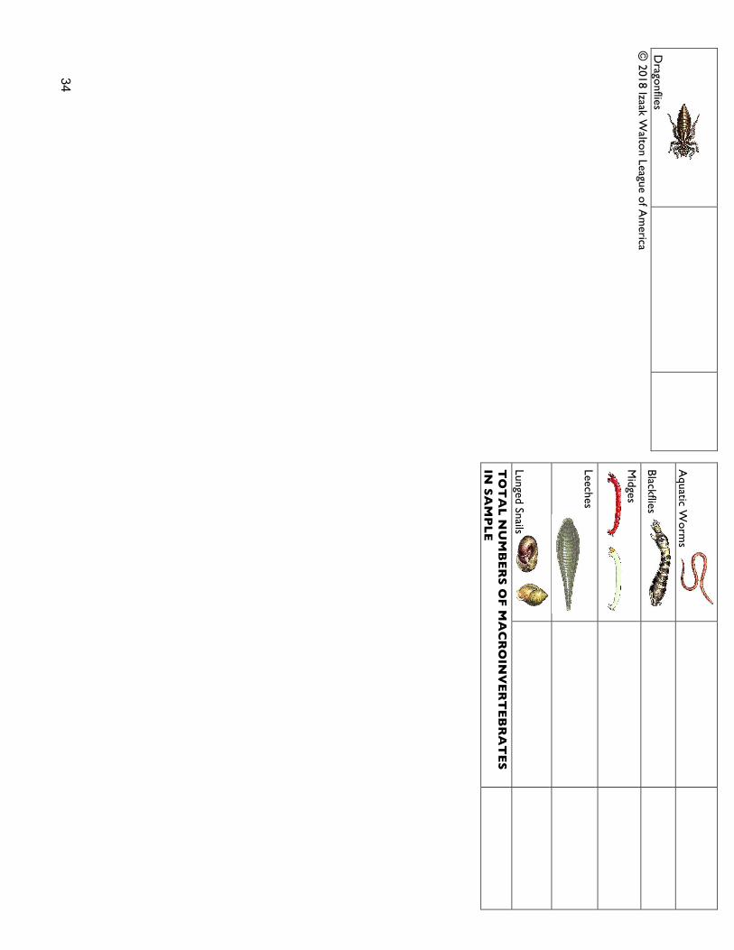
34
Dragonflies
© 2018 Izaak W
alton League of Am
erica
Aquatic W
orms
Blackflies
Midges
Leeches
Lunged Snails
TO
TA
L NU
MB
ERS O
F MA
CR
OIN
VER
TEB
RA
TES
IN SA
MP
LE

35
Extension Lesson 3: Stakeholders’ Dilemma I. Overview
Land-use planning and zoning laws have social and environmental consequences in our communities. This activity emphasizes the complexities of decision-making through the involvement of many points of view. In this activity, participants deliberate and make a decision about a land-use scenario that will impact community members’ lives and perhaps local water quality. The group prepares and role-plays a county board meeting.
Subjects: Science, Language Arts, Social Studies, Speech
Time Required: Two 45 minute sessions. May split into multiple class periods to allow for outside preparation time.
Education Focus: 7th grade social studies
Materials: • Character cards (22)
II. Introduction: Land-use decisions affecting wildlife have become a familiar issue where housing developments are concerned. The following is an imaginary conflict that corresponds to some real-life dilemmas:
The Bluewater Valley is an important agricultural production site and outdoor recreational destination in Southeastern Minnesota. Its location in the Driftless Area has defined its landscape with fertile river valleys, trout streams, and impressive limestone bluffs. Goldleaf, a town of 5,000, is the trade center of the area. Paradise Found Resorts Incorporated is planning to expand its operations into the area and has just completed a proposal to build the “Ultimate Blufflands Resort” complete with a hotel, 20 acres of zip lining, 15 miles of ATV trails, a full-service cafeteria and gift shop, and 75 winterized cabins. This will provide 250 new jobs, but housing in Goldleaf is very limited. A 200-home subdivision has been proposed for an 80-acre plot of undeveloped bluffland on the south edge of town owned by recently-retired Harper Cornwall. This forested area is bordered by the public Rattlesnake Creek Nature Preserve on the West. Rattlesnake Creek provides excellent fishing for trout, and 207 species of birds have been sighted in this area, including some rare species. In the spring and fall, the area is used by migrating waterfowl. Many game and nongame species such as deer, ground squirrels, and pocket gophers inhabit this land, and the threatened timber rattlesnake can be found on rock outcroppings.
Cornwall’s 80-acre plot is currently zoned for agriculture and forestry; it would have to be rezoned as “residential” by a vote of the county commissioners. Paradise Found Resorts Incorporated is waiting on this decision to decide whether or not to build the new resort in Goldleaf. In order for the resort to be built, the rezoning to residential would have to be voted “yes.”
The County Board will vote after hearing from citizen stakeholders.
36
III. Activity: A. Introduce the Scenario:
1. Read or pass out sheets with the above scenario. 2. Talk about what it means to be a stakeholder. Tell participants that they are members of the
Goldleaf community and will have an opportunity to voice their opinion before the previously-elected County Commissioners hold a vote on the rezoning of Cornwall’s land for development.
3. Discuss zoning laws and their implications for development in your community. Show your city’s map. (Most cities will have zoning maps publicly available on the municipal website.)
B. Role-Play 1. Randomly pass out character cards. Encourage participants to inhabit the mind of their
character, considering the character’s thoughts and opinions, and not just their own. There are 22 characters; big groups may have to partner up. Give participants time to individually read over and think about their character’s positions.
2. Allow for participants to mingle. Have them talk to at least three others and listen to their characters’ perspectives on the issue.
3. In preparation for the meeting, have participants fill out the Stakeholder Decision Form. Optional extension: Have participants develop their answers into a 2-page persuasive essay.
4. Hold the County Meeting. Allow each participant to introduce themselves and make a statement. County Commissioners should note what their constituents say.
a. Consider both direct and indirect potential results from rezoning and allowing the development of the new residential area. Consider potential ramifications of the resort complex including jobs, environmental degradation, and tourism increase.
5. Allow the Commissioners to take the final vote. The decision should be unanimous. Before they vote pose these questions for the Commissioners:
a. Are you going to say yes to the rezoning? b. If so, do you have any specifications on the rezoning? c. If no, are you going to consider a development elsewhere? d. Are you going to require any changes or commitments from Paradise Found?
C. Reflection: 1. After the vote, debrief:
o What did the group enjoy/what frustrated them throughout the process? o What factors influence land-use decision making and what responsibilities do citizens
have in helping to make land-use decisions? o Were any compromises made? Why or why not? o Did the Commissioners vote as the majority would have? Why or why not? Does this
happen in real life? o Why is land-use decision making important for people, wildlife, and the environment?
2. Discuss similarities/differences between your community and the role-play scenario.
Optional extension: • Discuss land-use dilemmas in your community. • Research decisions around land and water use in your community. Split the group into two
teams. Have one team write a scenario based on these events and the other team act it out.

37
Personality Cards
Riley Homer, Realtor (County Commissioner) You are 37 and started your realty business in Goldleaf five years ago. Your business is doing well but you have difficulty relating to the “old timers.” Your company is not developing this property. You have some questions about the credibility of the developer, but in general, you usually like to vote in favor of development.
Taylor Dresser, Merchant (County Commissioner) You are 46 and own a furniture store. You would like to sell furniture to all the new home owners should the subdivision be built. You can also see the value of 80 acres left in a natural and undeveloped condition for wildlife habitat. You are wondering if there might be another site for the development of this housing area.
December Thompson, Rancher (County Commissioner) You are the third generation to run the “Rolling T” Cattle Company. You are proud to tell people that your grandfather was one of the first to settle in this valley. Your property covers 800 acres, but some of it is no longer usable because of flooding and erosion. Employees from the Soil and Water Conservation District are starting to regularly contact you about complying with new conservation standards. Although you are involved in community affairs, you resent the increase in population and increase of individuals moving into the area who do not share your values.
Kelly Wells, Farmer (County Commissioner) You own and operate a large farm near the southern edge of town, adjacent to the 80-acre plot in question. You have been interested in the possibility of buying the land to add to your agricultural operations. You care deeply about the environment. You strive to employ agricultural practices that benefit wildlife and minimize damage to other natural resources. You are working on adding the last buffer strips to your land next to Rattlesnake Creek. Since you are an adjacent landholder, you may need to disqualify yourself from participation as a Commissioner in this meeting.
Cam Cash, Banker (County Commissioner) You are 50 years old and, as a banker, you are willing to finance new home loans. You are an art collector and former president of the local chamber of commerce. You also love birdwatching and fishing. You think the whole area south of town has economically valuable recreational potential but are concerned about protecting environmental quality.
Harper Cornwall, Land Owner You own the 80 acres of woodland south of town—the site of the proposed housing development. You are 65 years old, a newly retired business person. You want to sell your land in Goldleaf and move to Arizona where you can live happily under blue skies. You really don’t care who buys your land, but you want cash. Your asking price is very reasonable—priced to sell fast.
Casey Abode, Resident You are a 68-year-old “old timer” living on the land proposed for the subdivision. You have lived on Cornwall’s land for 45 years, built a home with Cornwall’s permission, and have raised four children. You keep bees and chickens out back and have a garden. You sell your produce to local families who’ve been coming to you for their veggies and eggs for years. You are settled in the middle of the area proposed for the housing development and there is no question that you will have to be evicted and
38
your house torn down should the development be approved. You have no legal claim to any of the land, but you have nowhere else to go.
Jessie Bow, Hunter You are 30 years old and have just been elected president of the “Rattlers,” the local hunting club. You feel like you should defend the club’s interest in the area staying natural. Cornwall currently allows hunters to use his land if they ask his permission and follow hunting regulations, and many hunters wouldn’t want to lose this local resource. You are currently search for employment and would like to open a hunters’ supply shop in the future. In the meantime however, provided development is approved, you’re going to try to get a job with a construction company to help build the new homes and resort and are looking forward to the added income.
Jamie Change, President of the Chamber of Commerce This is your tenth year as president of the Chamber of Commerce. You own a grocery store in the middle of town. Your greatest concern is the weak business climate in your community. The Chamber recently hired a business consulting firm to evaluate the retail potential of Goldleaf. Their findings indicate that the business community has overbuilt, and the economy is unsteady due to the seasonal nature of tourism in the area. During the winter many people lose their jobs and are left to make do with unemployment. You see a potential salvation of your business in this new resort because it would provide year-round employment, but you’re wondering if another resort isn’t the best option for the community. Does the area really need more low-paying service jobs? You’ve heard some local people complaining about the increase in tourism. You’ve also wondered about possible ways to improve the economy through increased lumbering.
Robin Day, Local Audubon President You represent over 200 active Audubon members, and are director of the annual bird count competition. You have a list of 15 rare bird species found in the Rattlesnake Creek area. You are 37 years old, and work in construction. You know that a new subdivision would be great for business, but you worry about the loss of critical habitat for the birds.
Quinn Wing, Indigenous Leader You have an interest in the sanctity of the area in question as it is a site of historical significance for your people. Cornwall has allowed you to hold occasional ceremonies on the property. You’ve worked to start a community center in Goldleaf where people come to learn and speak the Dakota language and keep cultural traditions alive. Your work has received national press and occasionally visitors volunteer their time at the community center’s garden. You know several reporters who could bring this story to a national audience if you asked it of them.
Charlie Spa, Owner of Paradise Found Resorts You don’t live in Goldleaf, but you’ve been coming here to camp since you were a kid. You think it’s about time this place get a little bit of class! You’ve bought a few of the smaller private campgrounds in the area, but are looking forward to doing something bigger. With the construction of a new resort you’ll need inexpensive housing for the estimated 250 new employees. You know how important tourism money is for the local economy and are hoping to profit handsomely as well. Your siblings are upset that you’re developing so close to where you spent happy summers throughout childhood.
Emery Hill, Local Landscape Architecture Professor You’ve lived in the area your whole life, and have witnessed some major flood events. You can remember when all of Goldleaf had to evacuate because the creek water was rising too quickly. It was a few weeks before electricity was returned to the neighborhood, and one road had to be completely

39
closed and redesigned. You’ve made it a personal mission to educate the community about the connection between land-use and water quality because many new residents don’t know the history of flooding in the valley. You are wondering what municipal plans are in place to accommodate 200 new homes in the wastewater and storm water systems. It seems to you like the rezoning efforts are being rushed through without consideration of the environmental impacts. You know that more streets, roofs and other impervious pavements will exacerbate flood events in your community. You’ve seen how some of Martin Diggins’ development projects have previously caused erosion problems that then must be fixed with taxpayer money.
Jay Diggins, Developer You are a big time developer in the area and can afford to buy the 80-acre plot of land outright. You will make a substantial profit if the rezoning that is needed to develop land for the resort employees is approved and you win the bid to develop it. You are successful and fairly competent, but you have been criticized more than once for a lack of attention to landscape detail and design in your previous projects.
Alex Block, Day Care Operator You have started and run your own business: a small daycare. Every day you are responsible for up to 30 children. You like to let the kids outside to play, but with the increase in tourism, you’re becoming concerned about safety. A new housing development could help spur your business, and you’ve been looking into expanding your operations.
Sam Study, High School Teacher You teach biology and technology education at the local high school. You are an active member of several animal welfare organizations and are vocal in your opposition to hunting. You sometimes give community lectures on the value of Goldleaf’s natural resources and unique biology. You hope that with development more residents (and taxpayers) in the community would bolster the school’s budget and result in needed upgrades and improvements school district-wide.
Ash Fresh, Student You are an 11th grade student in Reagan Study’s biology class. You’ve lived in Goldleaf your whole life and have never seen such a stir in the community over a political decision. You decide to come to the County Board Meeting to share your perspective and some of your findings from a project you’ve done on the timber rattlesnake. You’ve learned that while many people are frightened of these animals, they are an important member of the ecosystem and do a lot to keep the rodent population in check. New development would reduce the rattle snakes already rapidly shrinking habitat. On the other hand, you would love to see some growth in the community. All your friends complain about how there’s nothing to do in Goldleaf. Maybe 250 new families could change that.
Payton Pew, Pastor You’d like to grow your congregation with new residents but you understand some of the concerns about the new resort that your congregants have. You love partnership and are wondering if you could help facilitate a compromise. Your cousin is a sustainability specialist and landscape architect in the next county over. You make plans to ask her advice.
Andy Grade, College Student You are a college student home on a break. You’ve learned about sustainable, equal housing projects in California where you go to school, and you want something similar to be considered in Goldleaf. These buildings have low carbon footprints, foster community living, and provide space for individuals and families of all types. You’d like to be able to work at the new resort during the summer break.

40
Pat Glass, Equine Trainer You and your family are new to Goldleaf, and new to the United States. You attend English as a Second Language classes in the evenings after work where talk of the development has been all the buzz. Your family has been asking you about the proposed development and resort in Goldleaf so you’ve been paying close attention. You would be happy to see more jobs in the area, but don’t want the development to take place too close to Rattlesnake Creek. You love to picnic there on the weekends with your family; the hills and valleys remind you of your homeland.
Sage Call, Parent and Restaurant Staff You’re a busy single parent trying to balance raising your two children, work at the family diner, and studying for an online class. You’re hoping to one day be a restaurant manager in Goldleaf. You normally would have no time to think about issues such as this, but you know that if this new development were to occur, you might have better chances at starting your dream restaurant. You want to someday build the restaurant adjacent to a natural area where people can bird watch while waiting for their food to arrive, so you want to make sure that sufficient natural vegetation is left.
Max Post, Reporter You are the head reporter for the Goldleaf Herald, the well-read local newspaper. You’re responsible for accurately reporting on the proposed development, the County Meeting and the discussions leading up to it. While other participants are working on their decision forms, walk around and poll them. Take notes on community members’ viewpoints, tally the majority opinion, and collect some quotes to share at the meeting.
41
Stakeholder Decision Form
Your character: ____________________________________________________
1. Do you have enough info to make a sound decision? If not, what do you need to know? ______________________________________________________________________
______________________________________________________________________
2. Did the stories or perspectives of any others influence your decision? Describe what you learned from them or how they influenced you.
______________________________________________________________________
______________________________________________________________________
______________________________________________________________________
3. Do you have conflicting interests? Describe them.
______________________________________________________________________
______________________________________________________________________
______________________________________________________________________
4. What questions/topic do you want the Commissioners to consider before taking their vote?
______________________________________________________________________
______________________________________________________________________
______________________________________________________________________
5. If it were up to you, would you vote “yes” or “no” to the rezoning of 80 acres to residential use? List several reasons why: ______________________________________________________________________
______________________________________________________________________
______________________________________________________________________
42
Appendices

43
Appendix 1: A Drop in the Bucket Activity (Adapted from Project WET)
Summary: Visitors understand the precious nature of fresh, accessible, and potable water through a visual representation. Materials:
• 1000 ml container • 100 ml container • 10 ml container (2) • Eyedropper • Optional: small metal bucket • Water
Directions:
1. Show visitors 1 liter (1000 ml) of water and tell them it represents all the water on Earth 2. Ask where most of the water on Earth is located. Oceans. Can we use ocean water for drinking?
Pour 30 ml of the water into a 100-ml graduated cylinder. This represents Earth’s fresh water, about 3% of the total.
3. Ask visitors where the next largest amount of fresh water is located. Glaciers, ice. Almost 80% of Earth’s fresh water is frozen in ice caps and glaciers. Pour 6 ml of fresh water into a small dish or cylinder and set the rest (24 ml) aside. The water in the dish (.6 percent of the total) represents fresh, non-frozen water.
4. Ask visitors where the next largest amount of fresh water is located. Below Ground. Only about 1.5 ml of this water is surface water; the rest is underground. Pour 1.5 ml into another small dish or cylinder. This represents the fresh, non-frozen, surface water.
5. Use an eyedropper to remove a single drop of water (.003 ml). Release this one drop into a small metal bucket or drop it into a visitor’s palm. If using the bucket, ask visitors to be quiet enough to hear the sound of the drop hitting the bottom of the bucket. This represents clean, fresh water that is not polluted or otherwise unavailable for use, about 0.00003% (or 3/100,000) of the total! This precious drop must be managed properly.
Discussion: Why does water seem plentiful in some places but in others it is a scarce commodity? Geography, climate, and weather affect water distribution. Agriculture, infrastructure, industry and domestic use also affect availability.
44
Appendix 2: Scavenger Hunt Adapt or print the next two pages as a fun scavenger hunt for visitors.
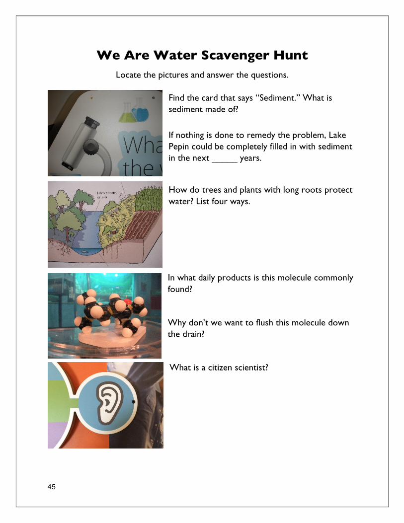
45
We Are Water Scavenger Hunt Locate the pictures and answer the questions.
Find the card that says “Sediment.” What is sediment made of?
If nothing is done to remedy the problem, Lake Pepin could be completely filled in with sediment in the next _____ years.
How do trees and plants with long roots protect water? List four ways.
In what daily products is this molecule commonly found?
Why don’t we want to flush this molecule down the drain?
What is a citizen scientist?

46
What might the owners of private wells need to know about maintaining their water supply?
What barriers to this information might exist?
Read some water stories. Can you find one that talks about a favorite spot? Mark the number here: _______
What about a story about a significant event? Number: ______
Who does safe drinking water depend on? List three people.
What happens to the water that flows into storm drains? Do you have a storm drain by your home or school?

47
Appendix 3: Extension Lessons Standards Alignment This chart shows the state standards for grades 6-8 with which each extension lesson aligns.
Grade 6
Subject Standard Code Benchmark Lesson Social Studies- Citizenship and Government
1. Democratic government depends on informed and engaged citizens who exhibit civic skills and values, practice civic discourse, vote and participate in elections, apply inquiry and analysis skills and take action to solve problems and shape public policy.
6.1.1.1.2 Use graphic data to analyze information about a public issue in state or local government.
Where We Gather
Social Studies- Geography
6. Geographic factors influence the distribution, functions, growth and patterns of cities and other human settlements.
6.3.3.6.1 Locate, identify and describe major physical features in Minnesota; explain how physical features and the location of resources affect settlement patterns and the growth of cities in different parts of Minnesota.
Where We Gather
Social Studies- Geography
1. People use geographic representations and geospatial technologies to acquire, process and report information within a spatial context.
6.3.1.1.1 Create and use various kinds of maps, including overlaying thematic maps, of places in Minnesota; incorporate the “TODALSS” map basics, as well as points, lines and colored areas to display spatial information.
Where We Gather
English Language Arts- Reading
7. Integrate and evaluate content presented in diverse media and formats, including visually and quantitatively, as well as in words.
6.12.7.7 Integrate visual information (e.g., in charts, graphs, photographs, videos, maps) with other information in print and digital texts.
Where We Gather
English Language Arts- Reading
6. Assess how point of view or purpose shapes the content and style of a text.
6.4.6.6 Explain how an author develops the point of view of the narrator or speaker in a text, including those by or about Minnesota American Indians. (e.g., the interviewees, bdote memory map)
Where We Gather
English Language Arts- Reading
3. Analyze how and why individuals, events, and ideas develop and interact over the course of a text.
6.5.3.3 Analyze in detail how a key individual, event, or idea is introduced, illustrated, and elaborated in a text (e.g., water in your community).
Where We Gather
English Language Arts-Reading
7. Integrate and evaluate content presented in diverse media and formats, including visually and quantitatively, as well as in words.
6.5.7.7 Integrate information presented in different media or formats (e.g., visually, quantitatively) as well as in words to develop a coherent understanding of a topic or issue.
Where We Gather

48
Subject Standard Code Benchmark Lesson English Language Arts- Reading
9. Analyze how two or more texts address similar themes or topics in order to build knowledge or to compare the approaches the authors take.
6.5.9.9 Compare and contrast one author's presentation of events, including events related to Minnesota American Indians, with that of another (e.g., multiple interviewees’ perspective on the same topic).
Where We Gather
English Language Arts- Reading
9. Analyze how two or more texts address similar themes or topics in order to build knowledge or to compare the approaches the authors take.
6.4.9.9 Compare and contrast texts in different forms or genres including those by and about Minnesota American Indians (e.g., stories and poems; content from the bdote memory map) in terms of their approaches to similar themes and topics.
Where We Gather
English Language Arts-Speaking, Viewing, Listening and Media Literacy
2. Integrate and evaluate information presented in diverse media and formats, including visually, quantitatively, and orally.
6.9.2.2 Interpret information presented in diverse media and formats (e.g., visually, quantitatively, orally) and explain how it contributes to a topic, text, or issue under study.
Where We Gather
Science-The Nature of Science and Engineering
1. Designed and natural systems exist in the world. These systems consist of components that act within the system and interact with other systems.
6.1.3.1.1 Describe a system in terms of its subsystems and parts, as well as its inputs, processes and outputs.
Waterwalk Survey
Science- The Nature of Science and Engineering
4. Current and emerging technologies have enabled humans to develop and use models to understand and communicate how natural and designed systems work and interact.
6.1.3.4.1 Determine and use appropriate safe procedures, tools, measurements, graphs, and mathematical analyses to describe and investigate natural and designed systems in a physical science context.
Waterwalk Survey
English Language Arts- Writing
1. Write arguments to support claims in an analysis of substantive topics or texts, using valid reasoning and relevant and sufficient evidence.
6.7.1.1 Write arguments to support claims with clear reasons and relevant evidence. (e.g., Stakeholder Decision Form, could be expanded into essay.)
Stakeholder's Dilemma
English Language Arts- Writing
4. Produce clear and coherent writing in which the development, organization, and style are appropriate to task, purpose, and audience.
6.7.4.4 Produce clear and coherent writing in which the development, organization, and style are appropriate to task, purpose, and audience.
Stakeholder's Dilemma
English Language Arts- Speaking, Viewing, Listening and Media Literacy
1. Prepare for and participate effectively in a range of conversations and collaborations with diverse partners, building on others’ ideas and expressing their own clearly and persuasively.
6.9.1.1 Engage effectively in a range of collaborative discussions (one-on-one, in groups, and teacher-led) with diverse partners on grade 6 topics, texts, and issues, building on others’ ideas and expressing their own clearly.
Stakeholder's Dilemma
Social Studies- Citizenship and Government
1. Democratic government depends on informed and engaged citizens who exhibit civic skills and values, practice civic discourse, vote and participate in elections, apply inquiry and analysis skills and take action to solve problems and shape public policy.
6.1.1.1.1 Evaluate arguments about selected issues from diverse perspectives and frames of reference, noting the strengths, weaknesses and consequences associated with the decision made on each issue.
Stakeholder's Dilemma

49
Subject Standard Code Benchmark Lesson Social Studies- Citizenship and Government
6. The United States government has specific functions that are determined by the way that power is delegated and controlled among various bodies: the three levels (federal, state, local) and the three branches (legislative, executive, judicial) of government.
6.1.4.6.4 Identify the major state and local (county, city, school board, township) governmental offices; describe the primary duties associated with them.
Stakeholder's Dilemma
Grade 7
Subject Standard Code Benchmark Lesson Social Studies- Geography
1. People use geographic representations and geospatial technologies to acquire, process and report information within a spatial context.
7.3.1.1.1 Create and use various kinds of maps, including overlaying thematic maps, of places in the United States; incorporate the “TODALSS” map basics, as well as points, lines and colored areas to display spatial information.
Where We Gather
Science- The Nature of Science and Engineering
2. Scientific inquiry uses multiple interrelated processes to investigate questions and propose explanations about the natural world.
7.1.1.2.1 Generate and refine a variety of scientific questions and match them with appropriate methods of investigation, such as field studies, controlled experiments, review of existing work, and development of models.
Waterwalk Survey
Science- The Nature of Science and Engineering
3. Current and emerging technologies have enabled humans to develop and use models to understand and communicate how natural and designed systems work and interact.
7.1.3.4.1 Use maps, satellite images and other data sets to describe patterns and make predictions about natural systems in a life science context. (e.g., use online WHAF data to compare water quality in regions of Minnesota and make predictions about what you’ll see in the field.)
Waterwalk Survey
Science- Life Science
2. The flow of energy and the recycling of matter are essential to a stable ecosystem.
7.4.2.2.2 Describe the roles and relationships among producers, consumers, and decomposers in changing energy from one form to another in a food web within an ecosystem.
Waterwalk Survey
Science- Life Science
1. Human activity can change living organisms and ecosystems.
7.4.4.1.2 Describe ways that human activities can change the populations and communities in an ecosystem.
Waterwalk Survey
Science- Life Science
1. Natural systems include a variety of organisms that interact with one another in several ways.
7.4.2.1.3 Explain how the number of populations an ecosystem can support depends on the biotic resources available as well as abiotic factors such as amount of light and water, temperature range and soil composition. (e.g., aquatic macroinvertebrates)
Waterwalk Survey
50
Subject Standard Code Benchmark Lesson Social Studies-Citizenship and Government
1. Democratic government depends on informed and engaged citizens who exhibit civic skills and values, practice civic discourse, vote and participate in elections, apply inquiry and analysis skills and take action to solve problems and shape public policy.
7.1.1.1.1 Exhibit civic skills including participating in civic discussion on issues in the contemporary United States, demonstrating respect for the opinions of people or groups who have different perspectives, and reaching consensus.
Stakeholder's Dilemma
Social Studies- Citizenship and Government
5. Citizenship and its rights and duties are established by law.
7.1.3.5.1 Describe the components of responsible citizenship including informed voting and decision making, developing and defending positions on public policy issues, and monitoring and influencing public decision making.
Stakeholder's Dilemma
Social Studies- Economics
1. People make informed economic choices by identifying their goals, interpreting and applying data, considering the short-and long-run costs and benefits of alternative choices and revising their goals based on their analysis.
7.2.1.1.1 Apply reasoned decision-making techniques in making choices; explain why different households or groups faced with the same alternatives might make different choices.
Stakeholder's Dilemma
English Language Arts- Writing
1. Write arguments to support claims in an analysis of substantive topics or texts, using valid reasoning and relevant and sufficient evidence.
7.7.1.1 Write arguments to support claims with clear reasons and relevant evidence. (e.g., Stakeholders Decision Form)
Stakeholder's Dilemma
English Language Arts- Speaking, Viewing, Listening and Media Literacy
1. Prepare for and participate effectively in a range of conversations and collaborations with diverse partners, building on others’ ideas and expressing their own clearly and persuasively.
7.9.1.1 Engage effectively in a range of collaborative discussions (one-on-one, in groups, and teacher-led) with diverse partners on grade 7 topics, texts, and issues, building on others’ ideas and expressing their own clearly.
Stakeholder's Dilemma
Grade 8
Subject Standard Code Benchmark Lesson English Language Arts- Writing
7. Conduct short as well as more sustained research projects based on focused questions, demonstrating understanding of the subject under investigation.
8.7.7.7 Conduct short research projects to answer a question (including a self-generated question), drawing on several sources and generating additional related, focused questions that allow for multiple avenues of exploration. (E.g. "What is our community's water story?"
Where We Gather
Social Studies- Geography
6. Geographic factors influence the distribution, functions, growth and patterns of cities and other human settlements.
8.3.3.6.1 Describe how the physical and environmental features of the United States and Canada affect human activity and settlement (e.g., the impact of waterways)
Where We Gather
51
Subject Standard Code Benchmark Lesson Social Studies- Geography
1. People use geographic representations and geospatial technologies to acquire, process and report information within a spatial context.
8.3.1.1.2 Create and use various kinds of maps, including overlaying thematic maps, of places in the world; incorporate the “TODALSS” map basics, as well as points, lines and colored areas to display spatial information.
Where We Gather
Social Studies- Geography
1. People use geographic representations and geospatial technologies to acquire, process and report information within a spatial context.
8.3.1.1.1 Obtain and analyze geographic information from a variety of print and electronic sources to investigate places or answer specific geographic questions; provide rationale for its use.
Where We Gather
Social Studies- Geography
3. Places have physical characteristics (such as climate, topography and vegetation) and human characteristics (such as culture, population, political and economic systems).
8.3.2.3.1 Use appropriate geographic tools to analyze and explain the distribution of physical and human characteristics of places.
Where We Gather
Science-Earth Science
3. Water, which covers the majority of the Earth’s surface, circulates through the crust, oceans and atmosphere in what is known as the water cycle.
8.3.2.3.2 Describe how the water cycle distributes materials and purifies water. (e.g., land use and watersheds, where does our water go?)
Waterwalk Survey
Science- Earth Science
2. Landforms are the result of the combination of constructive and destructive processes.
8.3.1.2.1 Explain how landforms result from the processes of crustal deformation, volcanic eruptions, weathering, erosion and deposition of sediment.
Waterwalk Survey
Science- The Nature of Science and Engineering
4. Current and emerging technologies have enabled humans to develop and use models to understand and communicate how natural and designed systems work and interact.
8.1.3.4.2 Determine and use appropriate safety procedures, tools, measurements, graphs and mathematical analyses to describe and investigate natural and designed systems in Earth and physical science contexts.
Waterwalk Survey
Science- Earth Science
1. In order to maintain and improve their existence humans interact with and influence Earth systems.
8.3.4.1.2 Recognize that land and water use practices affect natural processes and that natural processes interfere and interact with human systems. (e.g., Agricultural runoff influences natural systems far from the source- buffers mitigate)
Waterwalk Survey, Stakeholder's Dilemma
Science- The Nature of Science and Engineering
3. Science and engineering operate in the context of society and both influence and are influenced by this context
8.1.3.3.1 Explain how scientific laws and engineering principles, as well as economic, political, social, and ethical expectations, must be taken into account in designing engineering solutions or conducting scientific investigations.
Stakeholder's Dilemma
Social Studies-Citizenship and Government
1. Democratic government depends on informed and engaged citizens who exhibit civic skills and values, practice civic discourse, vote and participate in elections, apply inquiry and analysis skills and take action to solve problems and shape public policy.
8.1.1.1.1 Exhibit civic skills including participating in civic discussion on issues in the contemporary United States, demonstrating respect for the opinions of people or groups who have different perspectives, and reaching consensus.
Stakeholder's Dilemma
52
Subject Standard Code Benchmark Lesson Writing 1. Write arguments to support claims
in an analysis of substantive topics or texts, using valid reasoning and relevant and sufficient evidence.
8.7.1.1 Write arguments to support claims with clear reasons and relevant evidence. (e.g., Stakeholders’ Decision Form.)
Stakeholder's Dilemma
English Language Arts- Speaking, Viewing, Listening and Media Literacy
1. Prepare for and participate effectively in a range of conversations and collaborations with diverse partners, building on others’ ideas and expressing their own clearly and persuasively.
8.9.1.1 Engage effectively in a range of collaborative discussions (one-on-one, in groups, and teacher-led) with diverse partners on grade 8 topics, texts, and issues, building on others’ ideas and expressing their own clearly.
Stakeholder's Dilemma
53
Glossary
Absent Narratives: The voices, perspectives, or stories of groups or individuals that are often left out, forgotten, or marginalized by the dominant narrative.
Aquatic Macroinvertebrates: Animals without backbones that are large enough to be seen without a microscope and who spend most of their lifecycles in water. Macroinvertebrates have differing levels of sensitivity to pollution, so their presence (or lack of) in waterways is often used as in indication of water quality. Some examples include mayflies, water striders, and fingernail clams.
Aquifer: An underground bed of saturated soil or rock that contains significant quantities of water. This water is often pumped to the surface for use by people, livestock, or for irrigation.
Bdote: A Dakota word that holds multiple meanings. In a general sense, bdote means where two or more waters come together. The Bdote of the Mississippi and the Minnesota Rivers (and the wider area of Minneapolis-St. Paul) is central to Dakota spirituality and history; it’s where their creation story takes place.
Headwaters: The source of a stream. Lake Itasca in Itasca State Park is the headwaters of the Mississippi River. From there the water flows over 2,318 miles to the Gulf of Mexico.
Idiom: An expression or saying whose meaning does not correspond to the literal meaning of its parts. E.g. raining cats and dogs
Mnisota Makhoche: A Dakota phrase from which the name ‘Minnesota’ comes. The phrase roughly means ‘Land where the water reflects the sky’.
Phenology: A branch of science that studies plant and animal cycles. Phenologists take note of seasonal changes and their timing such as when a species of birds migrates or when a flower blooms.
Riparian Area: The undeveloped land adjacent to water bodies. The vegetation in this land is influenced by, and influences the water and can reduce sediment and pollution runoff. Farmers in Minnesota are required to install a 50 foot “buffer zone” of perennial plants to protect water quality.
Secchi Tube: A Secchi tube, or Secchi disk if you’re working with lakes, is an instrument used to measure the transparency of the water. A disk with alternating black and white quadrants is lowered into the water until it can no longer be seen by the observer. This depth of disappearance, called the Secchi depth, is a measure of the transparency of the water which can be affected by excess sediments or algae in the waterbody.
Streamside Corridor: See riparian area. Surface tension: Water molecules have bonds that hold them together. At the surface of the water, the molecules hold on to each other even more tightly than those in the middle because there are no molecules pulling on them from the air above. As the molecules on the surface stick together, they form an invisible "skin," a thin, dense layer of molecules called surface tension.
Turbidity: A measurement of water clarity. The turbidity of a waterbody can be impacted by increased sediment, detritus, or algal growth in the water, often caused by poor land-use practices. High

54
turbidity can alter light levels needed for beneficial aquatic plants and disrupt fish. A Secchi Tube or Disk provides a measure of stream transparency.
Water Cycle: Water is always in motion and can change forms—from liquid to gas to solid. Water travels through rivers, lakes, plants, oceans, groundwater, glaciers, people, and the atmosphere in a path called the water cycle. Gravity and heat energy from the sun drive the water cycle.
Watershed: An area of land and everything within it (land, air, surface and ground water, plants and animals, cities, people) that drains to a common outlet, which may be a lake, larger stream, wetland, estuary, ocean or closed basin. Watersheds are defined by ridges, high points of elevation. You are always within a watershed. Minnesota has 80 major watersheds.