Embed Size (px)
Citation preview
Utilization of Android
Tablets for Data Entry in the
Field
Joseph Roth Jr., MPH
Career Epidemiology Field Officer
Assigned to the Tennessee Department of Health
Outline
• Background
• Data collection in the field
• Other Android Uses

BACKGROUND
TN RAPID Team
• Risk Assessment of Populations
Impacted by disasters (RAPID) team
formed in TN in 2009
• Aims:
1. Compile all products necessary prior to
disasters to enable immediate
deployment of assessment teams
2. Facilitate regional use of CASPER
methods
RAPID Toolkit Version 1.0
• Developed to minimize deployment
delays
• Contains everything one needs to
conduct a CASPER
• Includes ready-to-use materials
• Includes modifiable tools and
templates
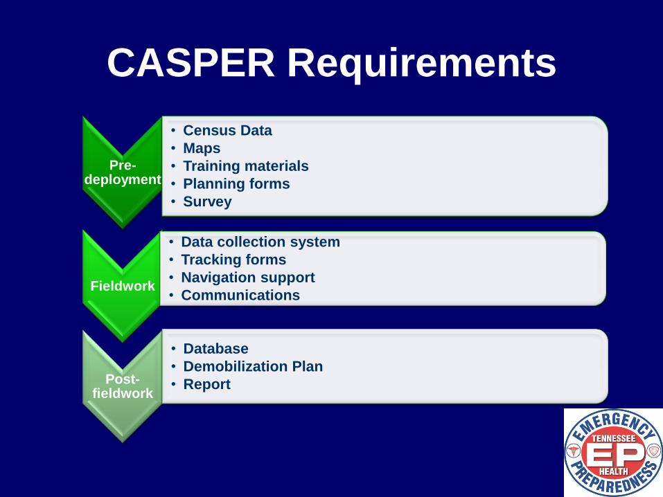
CASPER Requirements
Pre-deployment
• Census Data
• Maps
• Training materials
• Planning forms
• Survey
Fieldwork
• Data collection system
• Tracking forms
• Navigation support
• Communications
Post-fieldwork
• Database
• Demobilization Plan
• Report
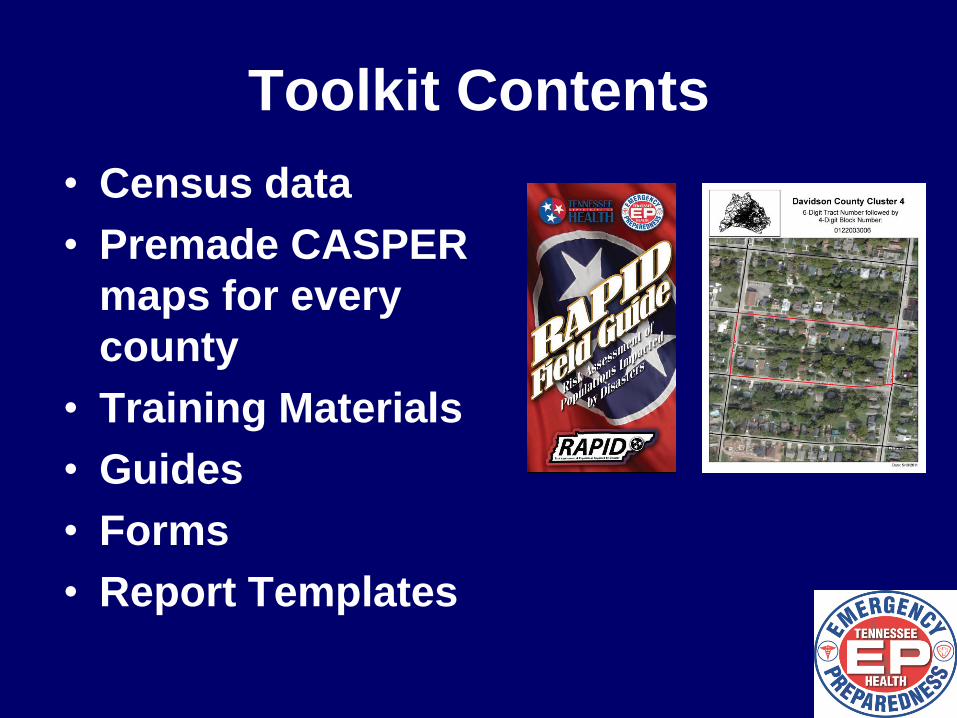
Toolkit Contents
• Census data
• Premade CASPER
maps for every
county
• Training Materials
• Guides
• Forms
• Report Templates
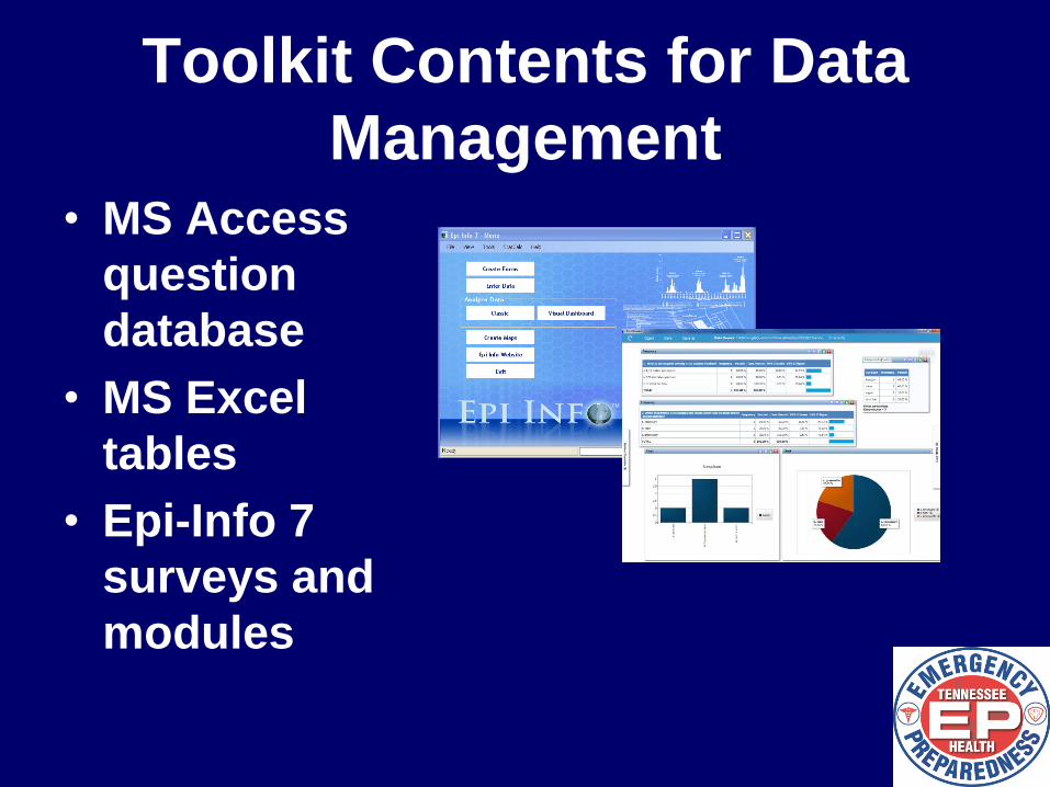
Toolkit Contents for Data
Management • MS Access
question
database
• MS Excel
tables
• Epi-Info 7
surveys and
modules
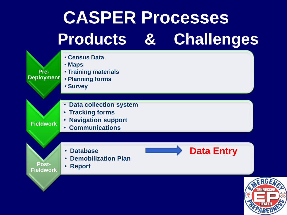
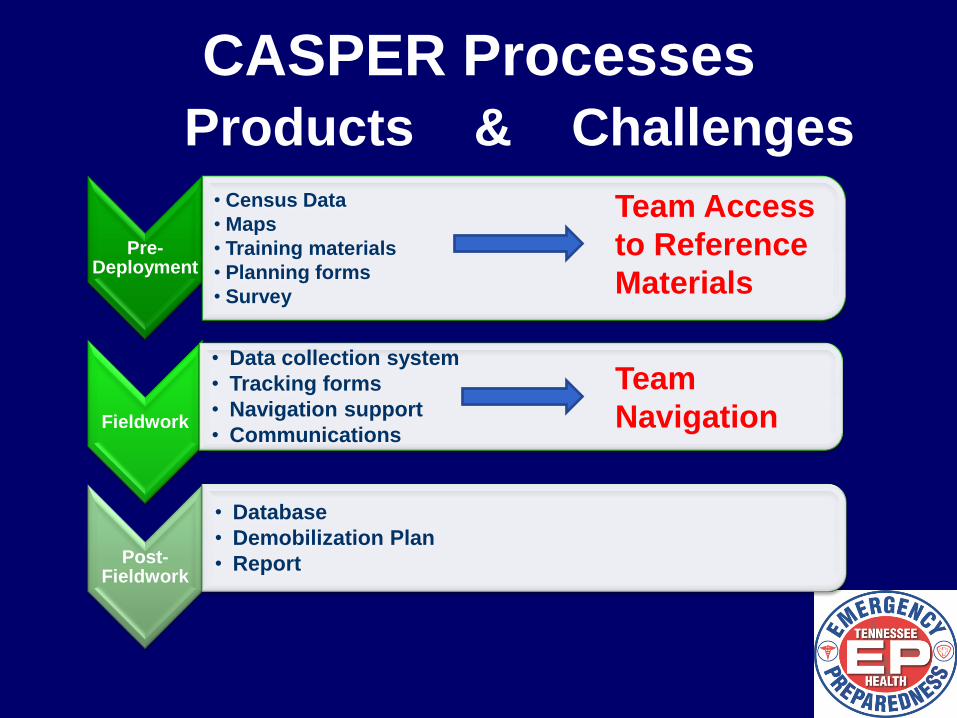
CASPER Processes
Products & Challenges
Pre-Deployment
• Census Data
• Maps
• Training materials
• Planning forms
• Survey
Fieldwork
• Data collection system
• Tracking forms
• Navigation support
• Communications
Post-Fieldwork
• Database
• Demobilization Plan
• Report
Data Entry

DATA COLLECTION IN THE
FIELD
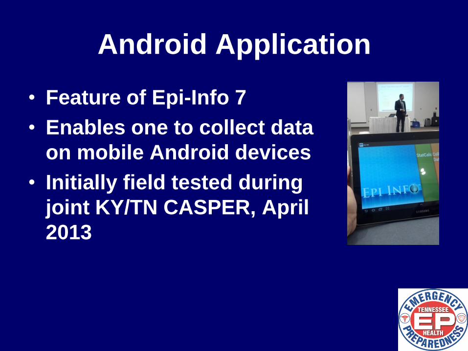
Android Application
• Feature of Epi-Info 7
• Enables one to collect data
on mobile Android devices
• Initially field tested during
joint KY/TN CASPER, April
2013
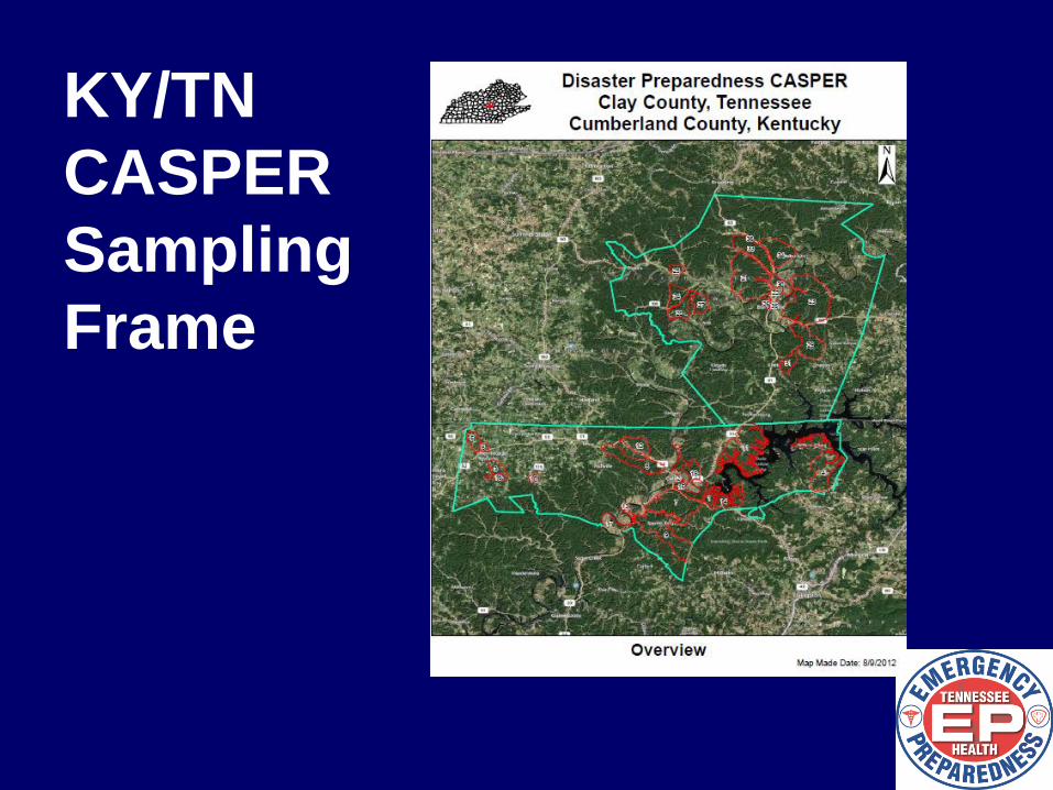
KY/TN
CASPER
Sampling
Frame
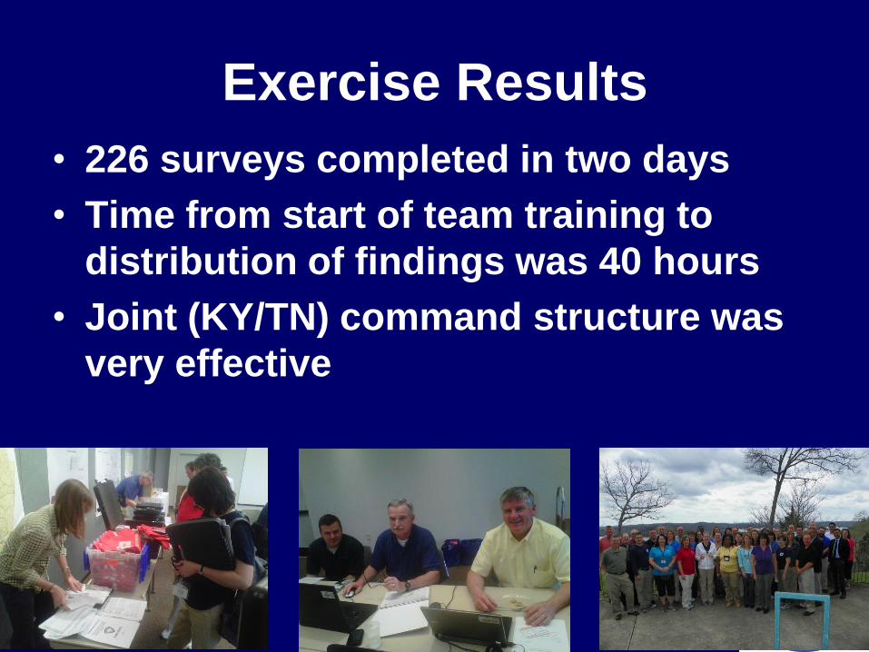
Exercise Results
• 226 surveys completed in two days
• Time from start of team training to
distribution of findings was 40 hours
• Joint (KY/TN) command structure was
very effective
CASPER Exercises using
Androids during 2013-2014 • Clay Co., TN & Cumberland Co., KY
–April 2013
• Ledge Light Health District, CT
–September 2013
• Henry Co., TN
–April 2014
• Marengo Co., AL
–April 2014
Advantages of Using
Androids in the Field
• Reduce data entry time
• Integrate CASPER processes
• Transmit data remotely
• Flexibility to add innumerable
applications
• Increases field team independence and
flexibility
Frequent Surveyor Feedback
• Paper-based survey use preference
often expressed
• Data collection may take longer using
tablets
• Using Google Earth with cluster maps
is simple and aids navigation
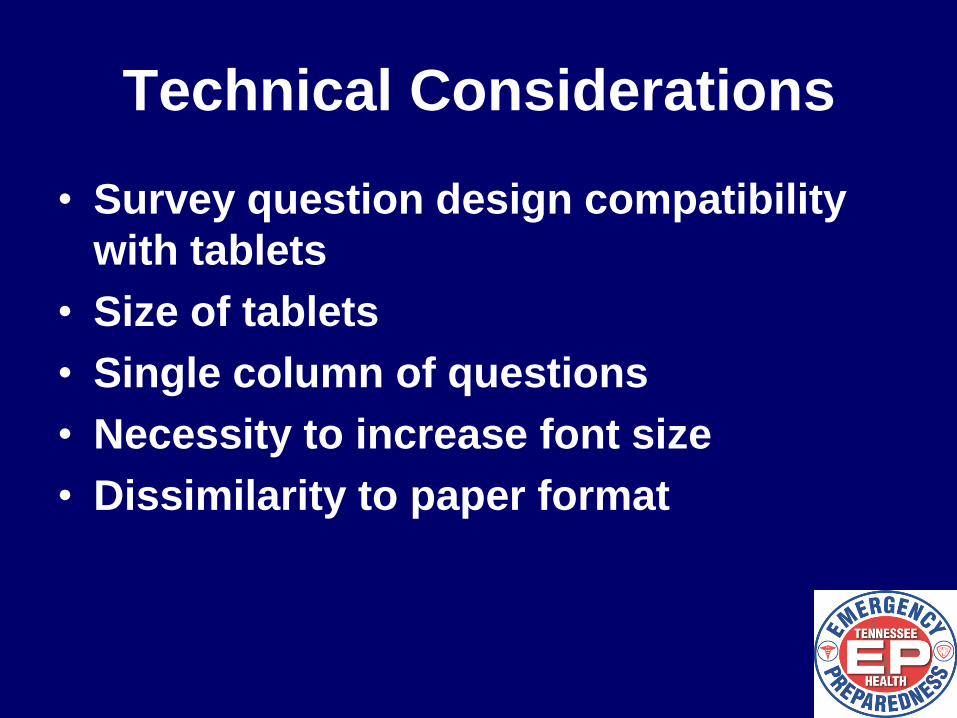
Technical Considerations
• Survey question design compatibility
with tablets
• Size of tablets
• Single column of questions
• Necessity to increase font size
• Dissimilarity to paper format
OTHER ANDROID USES
Pre-Deployment
• Census Data
• Maps
• Training materials
• Planning forms
• Survey
Fieldwork
• Data collection system
• Tracking forms
• Navigation support
• Communications
Post-Fieldwork
• Database
• Demobilization Plan
• Report
Team
Navigation
CASPER Processes
Products & Challenges
Team Access
to Reference
Materials
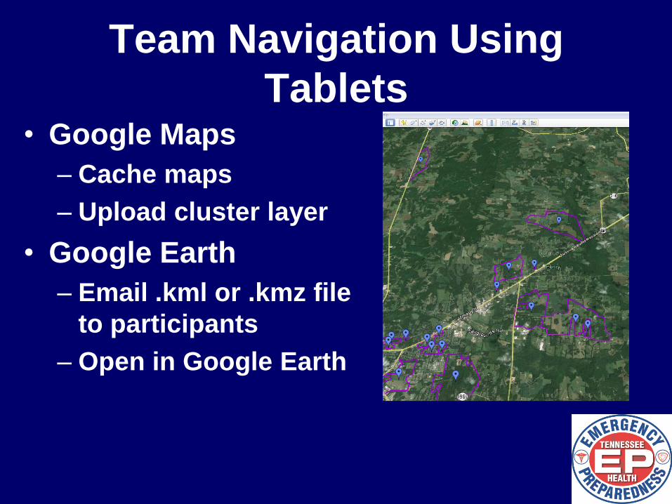
Team Navigation Using
Tablets • Google Maps
– Cache maps
– Upload cluster layer
• Google Earth
– Email .kml or .kmz file
to participants
– Open in Google Earth
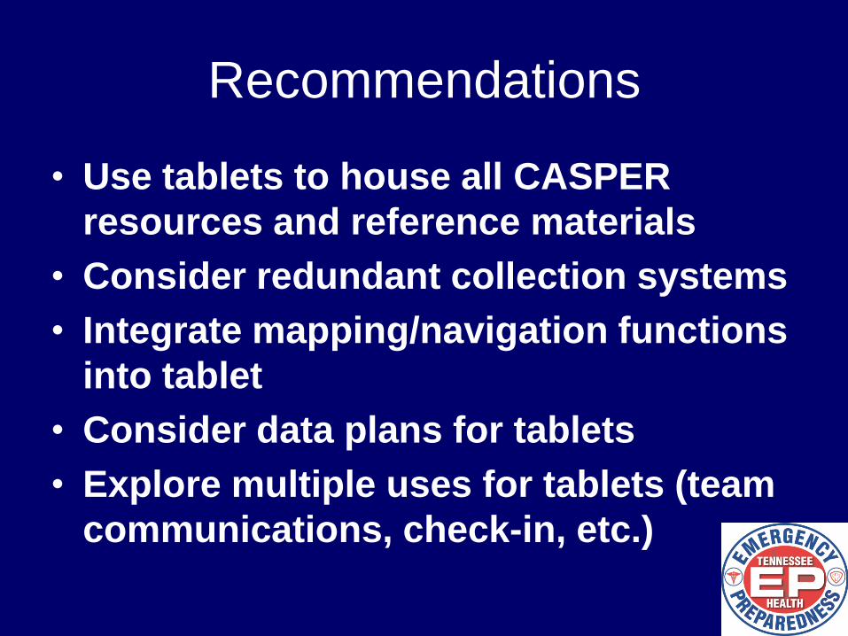
Recommendations
• Use tablets to house all CASPER
resources and reference materials
• Consider redundant collection systems
• Integrate mapping/navigation functions
into tablet
• Consider data plans for tablets
• Explore multiple uses for tablets (team
communications, check-in, etc.)