Embed Size (px)
Citation preview
International Boundary and Water Commission United States Section Engineering Services Division
July 17, 2013
Upper Rio Grande Flood Control Projects

International Boundary and Water Commission United States Section
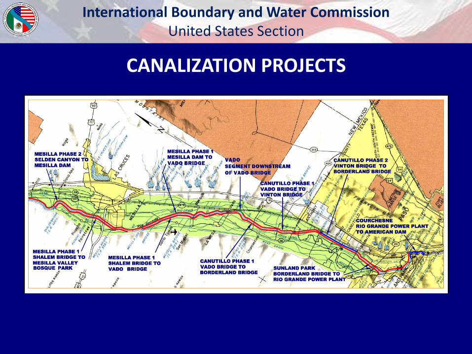
• Mesilla Levee Improvements, Phase 2
• Vado Levee Design
• Canutillo Levee Design, Phase 2
• Courchesne & NEMEXAS Levee Design
• American Canal Re-Lining Design
• American Dam Soil Remediation
• American Dam Gate Replacement
CURRENT AREA PROJECTS
International Boundary and Water Commission United States Section
CANALIZATION PROJECTS
International Boundary and Water Commission United States Section
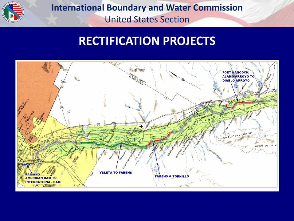
RECTIFICATION PROJECTS
International Boundary and Water Commission United States Section
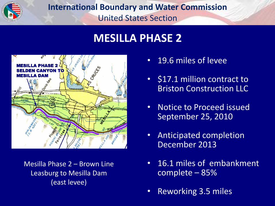
Mesilla Phase 2 – Brown Line Leasburg to Mesilla Dam
(east levee)
MESILLA PHASE 2
• 19.6 miles of levee
• $17.1 million contract to Briston Construction LLC
• Notice to Proceed issued September 25, 2010
• Anticipated completion December 2013
• 16.1 miles of embankment complete – 85%
• Reworking 3.5 miles
International Boundary and Water Commission United States Section
FLOODGATE NOISE STUDY
• Based upon citizen complaints, USIBWC has released a task order to collect and study noise caused by floodgates
• HDR Engineering performing study
• Canutillo Bridge (FM 259) and Country Club Bridge
• Data collected June 18 through June 28
• Analysis complete by September 30, 2013
International Boundary and Water Commission United States Section
Floodgates
International Boundary and Water Commission United States Section
----
....
International Boundary and Water Commission United States Section
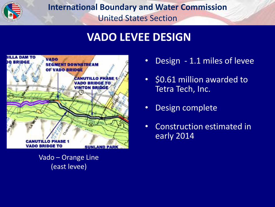
Vado – Orange Line (east levee)
VADO LEVEE DESIGN
• Design - 1.1 miles of levee
• $0.61 million awarded to Tetra Tech, Inc.
• Design complete
• Construction estimated in early 2014
International Boundary and Water Commission United States Section
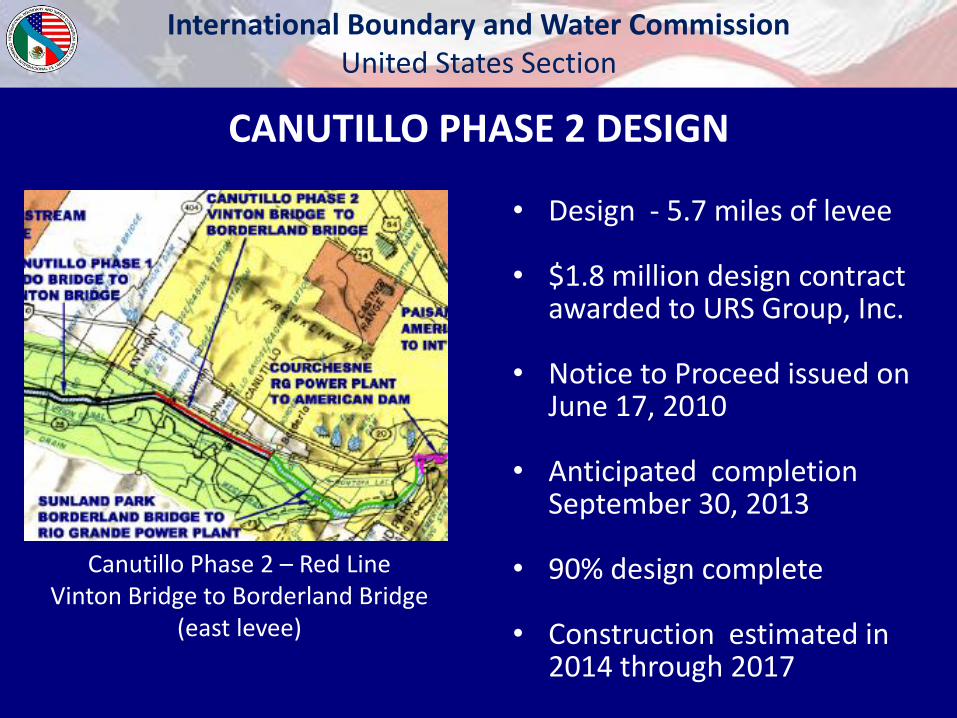
CANUTILLO PHASE 2 DESIGN
Canutillo Phase 2 – Red Line Vinton Bridge to Borderland Bridge
(east levee)
• Design - 5.7 miles of levee
• $1.8 million design contract awarded to URS Group, Inc.
• Notice to Proceed issued on June 17, 2010
• Anticipated completion September 30, 2013
• 90% design complete
• Construction estimated in 2014 through 2017
International Boundary and Water Commission United States Section
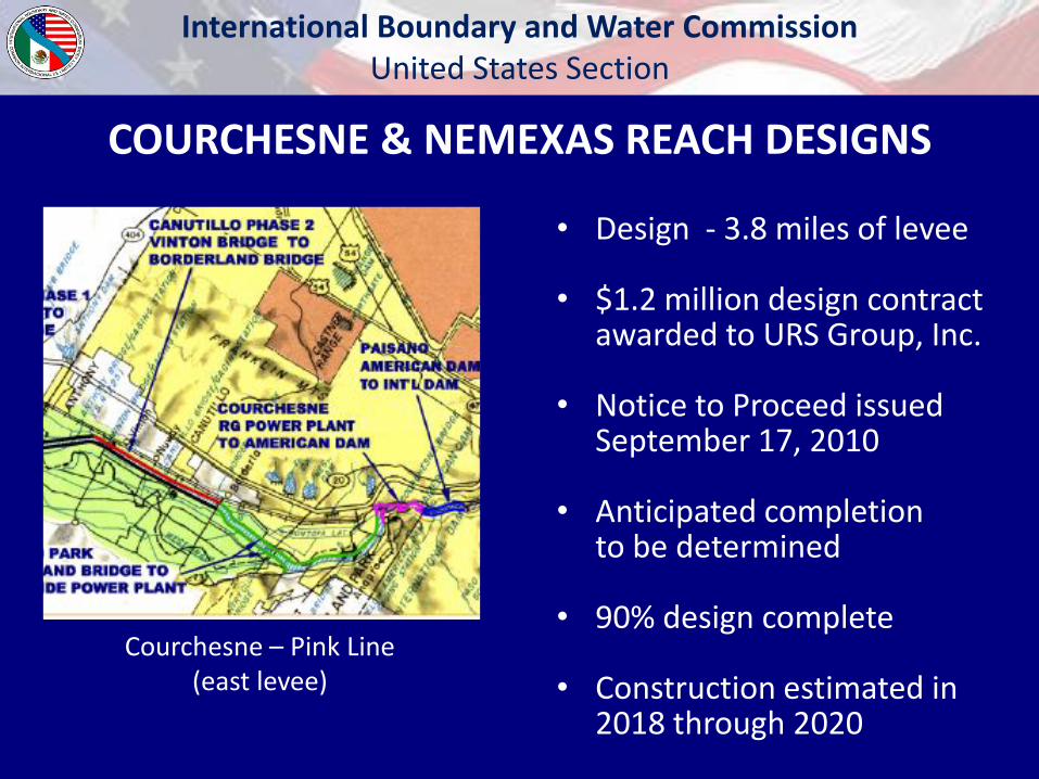
Courchesne – Pink Line (east levee)
COURCHESNE & NEMEXAS REACH DESIGNS
• Design - 3.8 miles of levee
• $1.2 million design contract awarded to URS Group, Inc.
• Notice to Proceed issued September 17, 2010
• Anticipated completion to be determined
• 90% design complete
• Construction estimated in 2018 through 2020
International Boundary and Water Commission United States Section
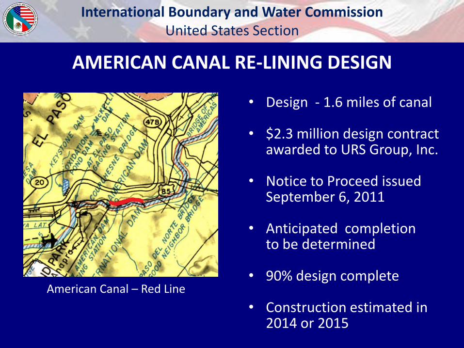
American Canal – Red Line
AMERICAN CANAL RE-LINING DESIGN
• Design - 1.6 miles of canal
• $2.3 million design contract awarded to URS Group, Inc.
• Notice to Proceed issued September 6, 2011
• Anticipated completion to be determined
• 90% design complete
• Construction estimated in 2014 or 2015
International Boundary and Water Commission United States Section
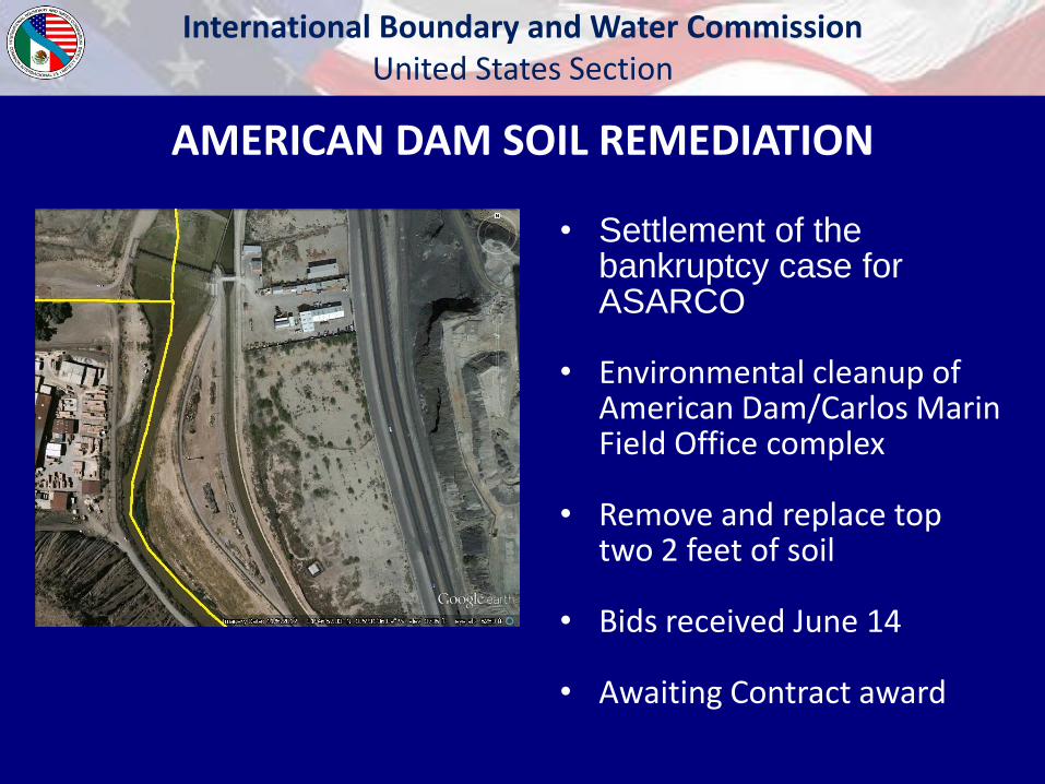
AMERICAN DAM SOIL REMEDIATION
• Settlement of the bankruptcy case for ASARCO
• Environmental cleanup of American Dam/Carlos Marin Field Office complex
• Remove and replace top two 2 feet of soil
• Bids received June 14
• Awaiting Contract award
International Boundary and Water Commission United States Section
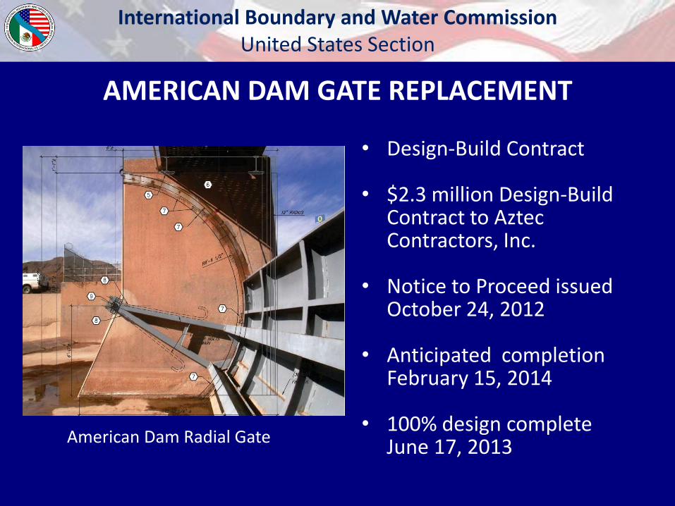
American Dam Radial Gate
AMERICAN DAM GATE REPLACEMENT
• Design-Build Contract
• $2.3 million Design-Build Contract to Aztec Contractors, Inc.
• Notice to Proceed issued October 24, 2012
• Anticipated completion February 15, 2014
• 100% design complete June 17, 2013
International Boundary and Water Commission United States Section
• Levee – A man-made structure, usually an earthen embankment, designed and constructed with sound engineering practices to contain, control or divert the flow of water in order to provide protection from temporary flooding. (44 CFR 59.1)
• A levee is a flood risk reduction structure.
FEMA Definitions
International Boundary and Water Commission United States Section
• Levee System – A flood hazard-reduction system that consists of a levee, or levees, and associated structures, such as closure and drainage devices, which are constructed and operated in accordance with sound engineering practices. (44 CFR 59.1)
FEMA Definitions, continued
International Boundary and Water Commission United States Section
• Accredited Levee System - A FEMA accredited levee system is a levee system that meets the requirements of 44CFR65.10 and therefore is shown on the FIRM as providing protection from the 1-percent-annual-chance flood.
FEMA Definitions, continued
International Boundary and Water Commission United States Section
• FEMA does not own, operate, maintain, or inspect levee systems or develop certified levee-related data for accreditation purposes.
• As the levee owner, USIBWC will evaluate (certify) that the levees have been constructed to required design standards and are operated appropriately.
FEMA Accreditation
International Boundary and Water Commission United States Section
• For FEMA to accredit a levee system with 1%-annual-chance flood hazard reduction capability on a Flood Insurance Rate Map (FIRM), the levee owner/local project sponsor must submit a package containing the required data and documentation to show that the levee system meets all design and operation requirements of 44CFR 65.10.
FEMA Accreditation, continued
International Boundary and Water Commission United States Section
• 44 CFR 65.10 requires: levee design (freeboard, closures, erosion protection, seepage, and
settlement), interior drainage, operation plans, and maintenance plans.
• USIBWC developed levee designs based upon best criteria available in 2009 (44 CFR 65.10).
• In October 2010, FEMA added additional requirements such as requiring levees to tie in to high ground.
FEMA Accreditation, continued
International Boundary and Water Commission United States Section
• FEMA new Levee Analysis and Mapping Procedures (LAMP) released July 12, 2013
• LAMP replaces without levee approach
• Allows mapping behind non-accredited levees
• FEMA will only accredit levee systems, not individual levee reaches
• FEMA plans to release additional guidance on the practical definition of levee systems soon.
Current FEMA Status

International Boundary and Water Commission United States Section
CANALIZATION PROJECTS
International Boundary and Water Commission United States Section
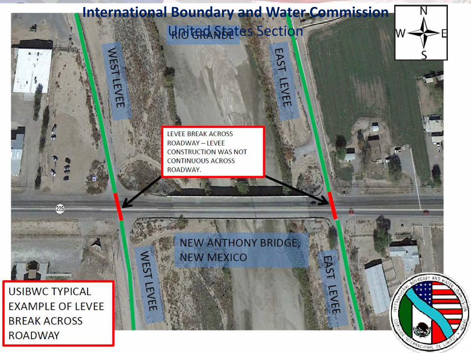
• 29 bridges within system that intersect with levees.
• Road intersections not addressed in levee designs.
• FHWA does not intend that highway embankments act as a flood control structure.
• FHWA recommends that DOTs decline any certification of highway embankments as levees.
Rio Grande Canalization
International Boundary and Water Commission United States Section
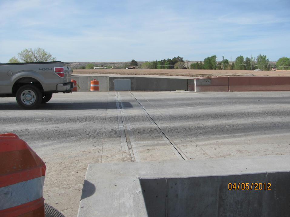
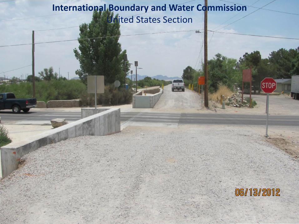
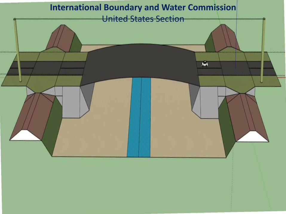
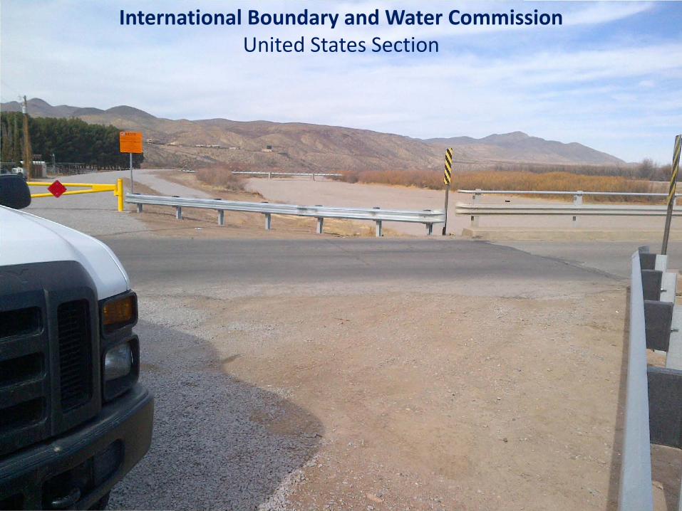
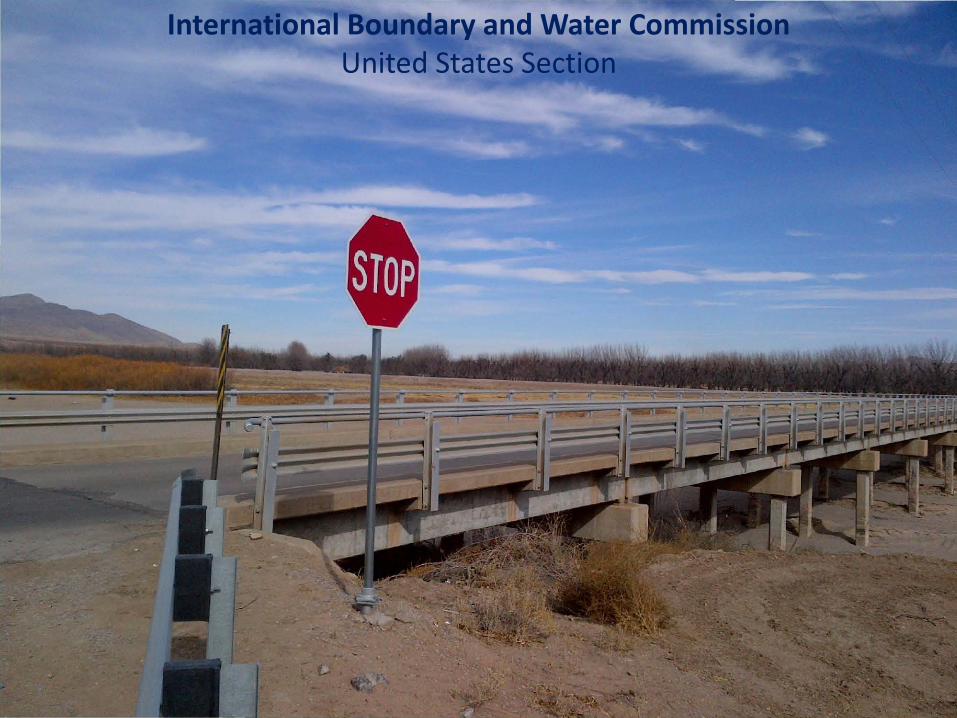
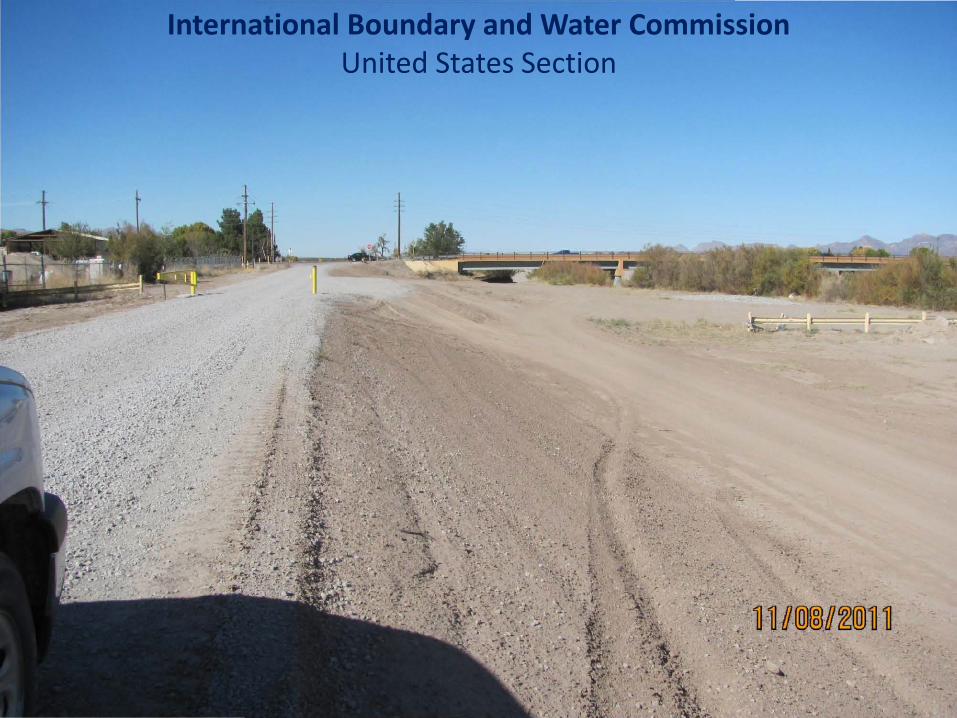
EXAMPLE OF LEVEE BREAK ACROSS ROADWAY
ROADWAY - LEVEE
CONSTRUCTION W AS NOT
CONTINUOUS ACROSS
International Boundary and Water Commission United States Section
International Boundary and Water Commission United States Section
International Boundary and Water Commission United States Section
International Boundary and Water Commission United States Section
International Boundary and Water Commission United States Section
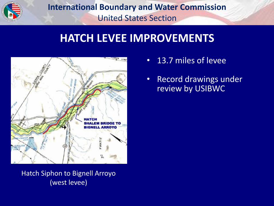
Hatch Siphon to Bignell Arroyo (west levee)
HATCH LEVEE IMPROVEMENTS
• 13.7 miles of levee • Record drawings under
review by USIBWC
International Boundary and Water Commission United States Section
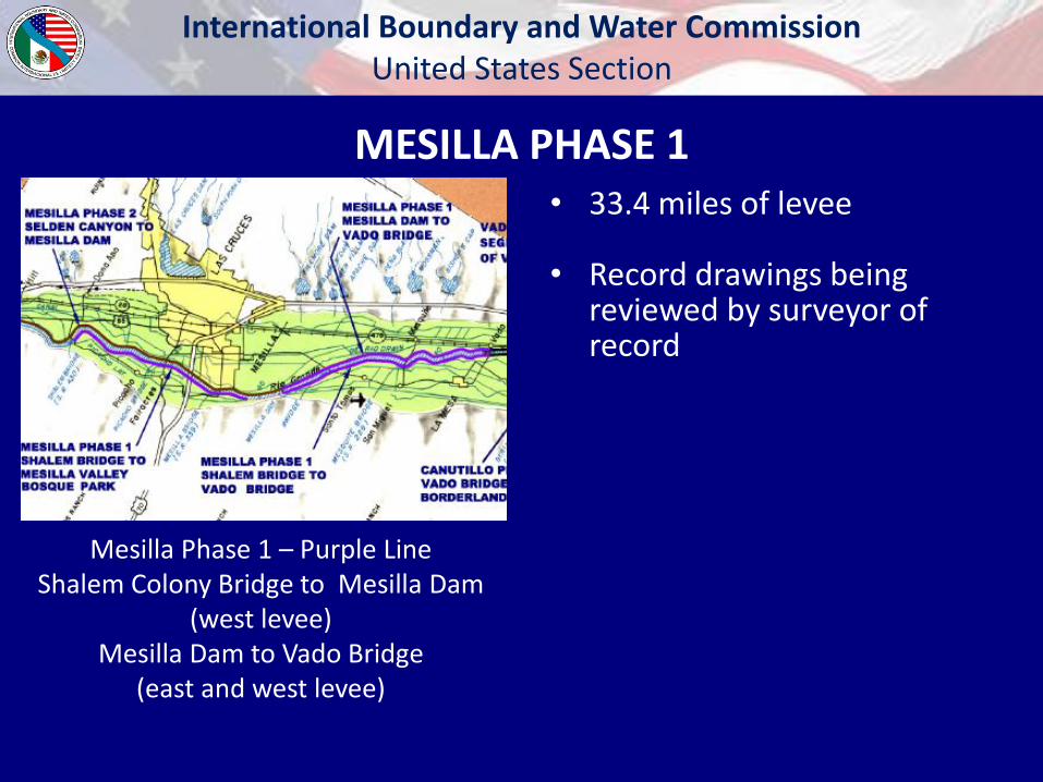
MESILLA PHASE 1 • 33.4 miles of levee
• Record drawings being
reviewed by surveyor of record
Mesilla Phase 1 – Purple Line Shalem Colony Bridge to Mesilla Dam
(west levee) Mesilla Dam to Vado Bridge
(east and west levee)

International Boundary and Water Commission United States Section
Canutillo 1 – Black Line Vado Bridge To Vinton Bridge
(east and west levees) Vinton Bridge to Borderland Bridge
(west levee)
CANUTILLO PHASE 1
• 28.6 levee miles
• Record drawings under revision by Contractor
International Boundary and Water Commission United States Section
• Interior Drainage - FEMA requires an Interior Drainage Analysis. To date, no analysis exists. USIBWC is only authorized to do work on the levees within USIBWC ROW and does not have authority in assessing the interior drainage issues.
• Levees need to tie into high ground
• Levee/Roadway intersections
Accreditation Speed Bumps
International Boundary and Water Commission United States Section
• FEMA Region 6 should be providing direction as to how LAMP will be used to complete the FIRMS within the next couple of months.
• When will FEMA complete FIRMs? FEMA has FIRMs on hold until FEMA completes revising its “Levee Analysis and Mapping Approach (LAMP)”, and such date is currently unknown to the USIBWC.
Accreditation Speed Bumps
International Boundary and Water Commission
United States Section Engineering Services Division
Construction Branch
4171 N. Mesa, Ste C-100
El Paso, TX 79902
(915) 832-4759
Andrea Glover, PE
(915) 832-4747