Embed Size (px)
Citation preview
Unser Blvd./Mariposa Trail/Riverview Trail Parking: Parking along residential streets at south end of trail, accessed from Anderson Hill Ave. or Rio Clara Ave. off Unser Blvd. or near the intersection of Blake Rd. and Unser Blvd. Lot at Alamosa Community Center, on Coors Blvd. between Bridge Blvd. and Central Ave. At Petroglyphs National Monument lots at Rinconada Canyon (corner of St. Josephs and Unser Blvd.) and the park’s visitor center (on Western Trails west of Unser Blvd.) Parking lot at little park at northwest end of Tiwa Place NW. At the northwest end of Atrisco Dr., as it curves up to Unser near Petra Pointe Rd. At Mariposa Basin Park On residential streets in the development called Rancho Sereno at the north end of the trail, including Butterfield Trail, where the trail meets the road. Public transit (on ABQ Ride’s bicycle-rack equipped buses): Rapid Ride 766 route or regular route 66 to Unser Blvd. and Central Ave. and/or Route 198 to Dennis Chavez and Unser. Rapid Ride 790 route to Eagle Ranch Rd. and Coors Blvd. You’ll find the beginning of this long trail that overlooks much of the West Side of Albuquerque a mile up
the hill west from the busy intersection of Rio Bravo Blvd. and Dennis Chaves Rd. Had there been a trail here 20 years ago, you would have seen a few hardy homesteads perched precariously on the sandy slopes, as development had its western border very close to Rio Bravo Blvd. In the intervening years, the “frontier” has advanced almost to the top of the hill – to the ceja, as the Spanish settlers called it – the “eyebrow” of the Rio Grande. The trail sits right along the east side of Unser Blvd.; at the moment this is
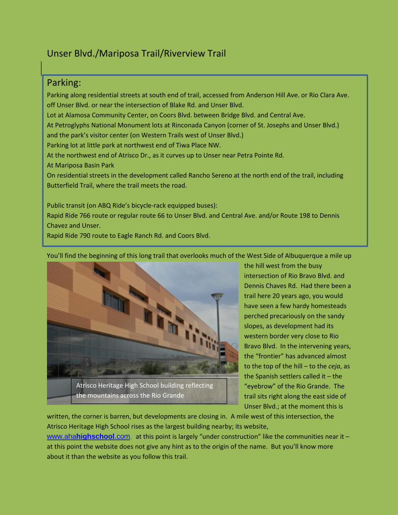
written, the corner is barren, but developments are closing in. A mile west of this intersection, the Atrisco Heritage High School rises as the largest building nearby; its website, www.ahahighschool.com, at this point is largely “under construction” like the communities near it – at this point the website does not give any hint as to the origin of the name. But you’ll know more about it than the website as you follow this trail.
Atrisco Heritage High School building reflecting the mountains across the Rio Grande
As you head north from here, you’re not far from the center of the Atrisco Land Grant, awarded to a trusted soldier by victorious re-conquistador, Governor Diego de Vargas, after the reconquest of New Mexico in 1692. The reconquest in 1692, 12 years after the Pueblo , had sent Spanish settlers packing south to El Paso, was largely peaceful. Nevertheless Vargas felt he owed a debt of gratitude to his victorious aides; Fernando Duran y Chaves was deeded some 50,000 acres on what is now Albuquerque’s West Mesa, but before there was an Albuquerque. The grant stretched from the Rio Grande to the western ceja (about 15 miles from east to west), and from near the present-day street Western Trail on the north to near the current street Pajarito Rd. (about 2 ½ miles south of the start of this trail), a distance of about ten miles. That is, the consolidated grants of Atrisco and Rio Puerco ended at the ceja. Initially, the western border of the Atrisco Land Grant was at the top of what is now called Nine-Mile Hill. The early inhabitants of Atrisco, called atrisqueños, were pasturing their flocks on the west side of the ceja before then; the addition of what had been initially the Rio Puerco Grant, made to Ana de Sandoval y Manzanares in the 18th century,
occurred in 1894 by action of the Federal Court of Private Land Claims; the consolidated grant occupied some 83,000 acres. Early Spanish settlement on the grant was largely on the rich Rio Grande Valley land along the river. The settlers grew wheat
and corn, squash and potatoes, grapes and fruit and kept cattle and sheep. There were, of course, neither bicycles nor bicycle trails then; settlers relied upon their horses for transportation. At the time the grant was made there were few or no Native Americans living within the grant borders, though history records the depredations of Apache raiders on many occasions, most notably in 1704. The founding of Alburquerque in 1706 put a few soldiers and another settlement in the way of the bands that came through Tijeras Canyon to prey on the small settlements of Alburquerque and Atrisco. No, the name of the town is not mis-spelled in this narrative: the first “r” was apparently dropped at the end of the 19th century by a railroad clerk. Atrisco was often at war within itself regarding land sales and exchanges, boundaries and water rights. Initially the direct heirs of Duran y Chaves had attempted to keep the land within the family, though others soon joined family members in owning parts of the acreage. Thus what had been a private land grant in 1694 soon became a de facto community land grant, but court battles among inhabitants continued through the ensuing three centuries. One source of conflict was land; another was sheep. Large sheep-owners often made use of the partido system, a type of sharecropping that applied to animal husbandry. The owners ceded care of large herds to partidarios, who agreed to pay back the original owners in ewes and rams, meat and wool. It’s
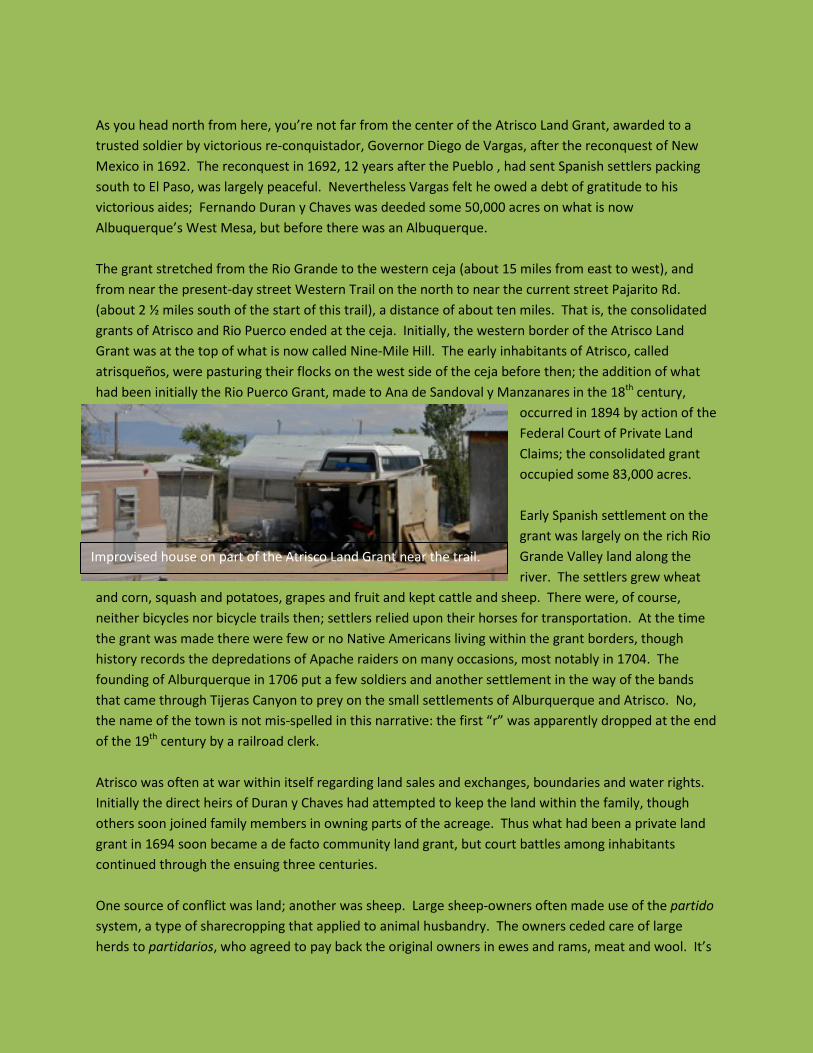
Improvised house on part of the Atrisco Land Grant near the trail.
hard now to imagine the West Mesa covered with sheep, as there seems to be relatively little grass now, and the West Mesa – the eastern part of the Atrisco Grant – is largely filled with homes on small plots. Land disputes have figured heavily in conflict among the residents of the grant since, whether during the Spanish period ending in 1821, the Mexican government of the next 25 years, or the American regime in the years following 1846, both before and after the Court of Private Land Claims adjudicated the grant in 1894. The Treaty of Guadalupe Hidalgo of 1898 ended the Mexican-American War, but did not fully settle the issue of the Spanish- and Mexican-era land grants. Joseph Sánchez, the historian who has written the definitive history of the Atrisco Land Grant, “Between Two Rivers,” states that “The failure of the U.S. government to adjudicate titles and ownership of many Spanish and Mexican land grants in the nineteenth century has proved to be one of the most shameful affairs in American history.” Congress, perhaps realizing the extent to which the almost half century of delay had exerted hardship on those whose lives depended on the affected land, in 1891 created a Court of Private Land Claims, which ruled on claims from the Southwest, not including California. A large majority of the cases involved land in New Mexico.
In 1892, the Bernalillo County District Court created the Town of Atrisco; almost immediately, the town’s Board of Trustees became embroiled with the City of Alburquerque in litigation regarding land claimed by both jurisdictions. The Atlantic and Pacific Railroad Company, whose tracks had reached Alburquerque more than a decade before on the east side of the Rio Grande, entered the case along with the city. But the Court of Private Land Claims recognized the existence of the Atrisco Land Grant as a community land grant, and fixed its boundaries. Continued litigation delayed the final result, but in 1905,
President Teddy Roosevelt finally signed the patent approving the Court of Private Land Claims result. In its 13 years of existence, the Court of Private Land Claims confirmed fewer than half of the 290 claims it settled, and only 21 were confirmed for all of the land claimed. Atrisco was one of those 21; Joseph Sánchez suggests that the internal Atrisco court battles had prepared the atrisqueños well for the prolonged US court challenges. However, the twentieth century saw an unhappy continuance of the court battles among some of the grant’s inhabitants. In 1967, some of the Atrisco land grant heirs incorporated as Westland
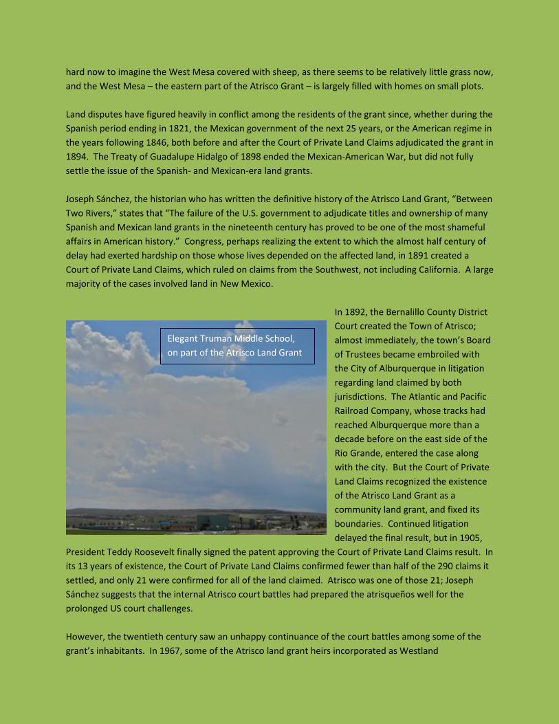
Elegant Truman Middle School, on part of the Atrisco Land Grant

Development Company and took possession of the land, and the Town of Atrisco ceased to exist. Other land grant heirs formed an Atrisco Land Rights Council in opposition. For almost 30 contentious years, Westland held title to the land, but in a hotly contested decision of 2006, sold it to a California corporation, SunCal. SunCal’s Westland subdivision, which had a grand plan for a major planned community on the West Side, was declared bankrupt in 2010, and its assets on the West Mesa of the Rio Grande were acquired by one of its chief creditors, a branch of Barclay’s Bank. A very recent development is the founding of the Town of Atrisco Grant – Merced, authorized by the 2011 New Mexico State Legislature. Jesus (Jesse) Anzures, one of the new town’s trustees, notes that in 2012, the new town is occupied by some 90,000 people, only a minority of whom is eligible by heredity to be actual town members. The mid twentieth century estimate of heirs of Don Fernando and other early settlers was about 6000, descendants of the original 200 families who settled in the Duran y Chavez Grant in the 17th and 18th centuries. Mr. Anzures estimates that there are 5500 heirs living on grant land now, with a total of 10,000 in the Albuquerque metropolitan area and 35,000 throughout the country. The new town is a curious entity, having no power of taxation and needing to coordinate its activities with the overlapping jurisdictions of the City of Albuquerque and Bernalillo County. Mr. Anzures wanted to make it clear that other inhabitants of the grant’s area were welcome, and would be entitled to use the common lands that Atrisco Grant – Merced is seeking to keep intact. The town would also hope to perpetuate the cultural values of the early Spanish settlers, and has declared its intention to mobilize Grant heirs and residents to clean up the land, some of which has been used as dumping grounds for centuries. Heading north on the bicycle trail, you soon (at 0.7 miles) cross two storm control drains of concrete:
the Sacate Diversion Channel drains an arroyo coming from the southwest, and the Amole Arroyo crosses the bike trail almost immediately afterwards, from the northwest. Both empty into the Amole Detention Basin, to the right down a very short segment of trail to the east at the Amole Arroyo underpass. Here the Amole Arroyo is finished in a rippling, textured brown concrete, unlike most of the flat gray concrete used elsewhere in the city. The Amole Arroyo (amole is the Spanish word for the soap-root plant,
Amole Detention Basin with view of Manzano Mountains behind Amole Detention Basin, with Manzano Mountains
not related to guac-amole) itself is accompanied to the northwest by another bike trail, which continues northwest along the paved arroyo formed by the confluence of Amole Arroyo and Snow Vista Channel; that bike trail continues northwest along Snow Vista Channel to end just south of Central Avenue. The Unser Trail, though, comes up out of the Amole Arroyo heading north. At about 1.0 miles, you’ll come across one of the older houses that pioneered out here on the West Mesa – several small outbuildings covered with patchwork corrugated steel sheathing look a little out of place among the more recently built and close-packed homes. Shortly afterwards, the trail crosses Blake Road. At 2.1 miles, Arenal Rd., an old South Valley street, meets Unser from the east; west of here the road is called Sapphire St. and heads west a short distance to one of the few parks in this section of Albuquerque/Atrisco Grant-Merced, Western Heights Park. Other major West Mesa streets crossed are Sage Road, at 2.4, Tower Road at 2.9, and Bridge Blvd. at 3.4 miles. Taking Bridge east half a mile gets you very close to the Alamosa Community Center, with its library and clinic. Then you reach the Mother Road, old US-66, Central Avenue, itself, at 3.8 miles. Both Central and Unser around this corner have seen much recent commercial development, with Central lined by a number of small motels, gas stations, restaurants and other small businesses as the road ascends Nine Mile Hill to
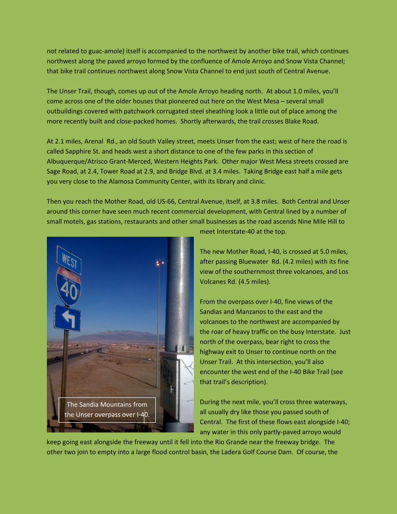
meet Interstate-40 at the top. The new Mother Road, I-40, is crossed at 5.0 miles, after passing Bluewater Rd. (4.2 miles) with its fine view of the southernmost three volcanoes, and Los Volcanes Rd. (4.5 miles). From the overpass over I-40, fine views of the Sandias and Manzanos to the east and the volcanoes to the northwest are accompanied by the roar of heavy traffic on the busy Interstate. Just north of the overpass, bear right to cross the highway exit to Unser to continue north on the Unser Trail. At this intersection, you’ll also encounter the west end of the I-40 Bike Trail (see that trail’s description). During the next mile, you’ll cross three waterways, all usually dry like those you passed south of Central. The first of these flows east alongside I-40; any water in this only partly-paved arroyo would
keep going east alongside the freeway until it fell into the Rio Grande near the freeway bridge. The other two join to empty into a large flood control basin, the Ladera Golf Course Dam. Of course, the
The Sandia Mountains from the Unser overpass over I-40.
Ladera Golf Course is mostly grass, holes and pins and rarely water, though if water did accumulate there, it too would reach the river a couple of miles to the north through the San Antonio Arroyo. Past Ouray Rd., the west side of Unser is composed of the lava on the sides of a steep incline down from the top of the mesa; this is the southeast corner of Petroglyph National Monument.
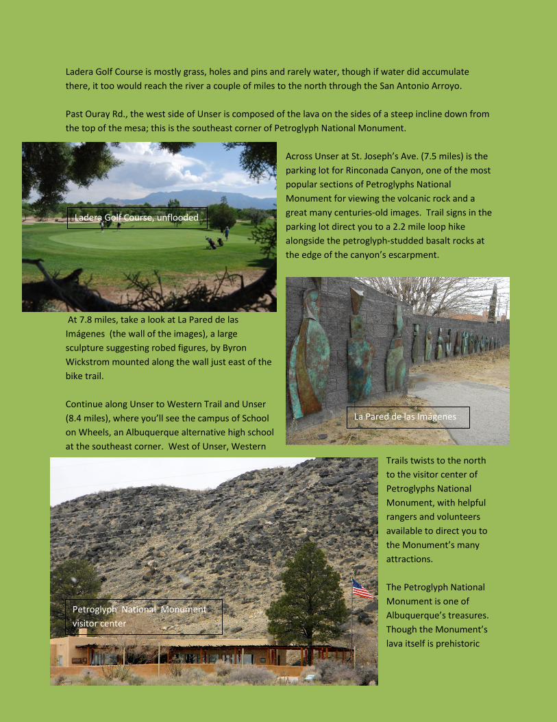
Across Unser at St. Joseph’s Ave. (7.5 miles) is the parking lot for Rinconada Canyon, one of the most popular sections of Petroglyphs National Monument for viewing the volcanic rock and a great many centuries-old images. Trail signs in the parking lot direct you to a 2.2 mile loop hike alongside the petroglyph-studded basalt rocks at the edge of the canyon’s escarpment.
At 7.8 miles, take a look at La Pared de las Imágenes (the wall of the images), a large sculpture suggesting robed figures, by Byron Wickstrom mounted along the wall just east of the bike trail. Continue along Unser to Western Trail and Unser (8.4 miles), where you’ll see the campus of School on Wheels, an Albuquerque alternative high school at the southeast corner. West of Unser, Western
Trails twists to the north to the visitor center of Petroglyphs National Monument, with helpful rangers and volunteers available to direct you to the Monument’s many attractions. The Petroglyph National Monument is one of Albuquerque’s treasures. Though the Monument’s lava itself is prehistoric
Ladera Golf Course, unflooded
La Pared de las Imágenes
Petroglyph National Monument visitor center
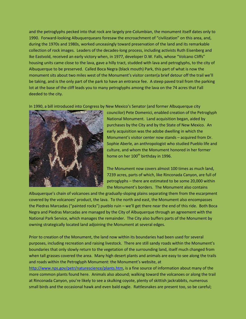
and the petroglyphs pecked into that rock are largely pre-Columbian, the monument itself dates only to 1990. Forward-looking Albuquerqueans foresaw the encroachment of “civilization” on this area, and, during the 1970s and 1980s, worked unceasingly toward preservation of the land and its remarkable collection of rock images. Leaders of the decades-long process, including activists Ruth Eisenberg and Ike Eastvold, received an early victory when, in 1977, developer D.W. Falls, whose “Volcano Cliffs” housing units came close to the lava, gave a hilly tract, studded with lava and petroglyphs, to the city of Albuquerque to be preserved. Called Boca Negra (black mouth) Park, this part of what is now the monument sits about two miles west of the Monument’s visitor center(a brief detour off the trail we’ll be taking, and is the only part of the park to have an entrance fee. A steep paved trail from the parking lot at the base of the cliff leads you to many petroglyphs among the lava on the 74 acres that Fall deeded to the city. In 1990, a bill introduced into Congress by New Mexico’s Senator (and former Albuquerque city
councilor) Pete Domenici, enabled creation of the Petroglyph National Monument. Land acquisition began, aided by purchases by the City and by the State of New Mexico. An early acquisition was the adobe dwelling in which the Monument’s visitor center now stands – acquired from Dr. Sophie Aberle, an anthropologist who studied Pueblo life and culture, and whom the Monument honored in her former home on her 100th birthday in 1996. The Monument now covers almost 100 times as much land, 7239 acres, parts of which, like Rinconada Canyon, are full of petroglyphs – there are estimated to be some 20,000 within the Monument’s borders. The Monument also contains
Albuquerque’s chain of volcanoes and the gradually-sloping plains separating them from the escarpment covered by the volcanoes’ product, the lava. To the north and east, the Monument also encompasses the Piedras Marcadas (“painted rocks”) pueblo ruin – we’ll get there near the end of this ride. Both Boca Negra and Piedras Marcadas are managed by the City of Albuquerque through an agreement with the National Park Service, which manages the remainder. The City also buffers parts of the Monument by owning strategically located land adjoining the Monument at several edges. Prior to creation of the Monument, the land now within its boundaries had been used for several purposes, including recreation and raising livestock. There are still sandy roads within the Monument’s boundaries that only slowly return to the vegetation of the surrounding land, itself much changed from when tall grasses covered the area. Many high desert plants and animals are easy to see along the trails and roads within the Petroglyph Monument: the Monument’s website, at http://www.nps.gov/petr/naturescience/plants.htm, is a fine source of information about many of the more common plants found here. Animals also abound; walking toward the volcanoes or along the trail at Rinconada Canyon, you’re likely to see a skulking coyote, plenty of skittish jackrabbits, numerous small birds and the occasional hawk and even bald eagle. Rattlesnakes are present too, so be careful;
harmless but half-foot-long millipedes are frequently encountered residents. The Monument’s website is a good fount of information about all of these beings with whom we share this remarkable resource.
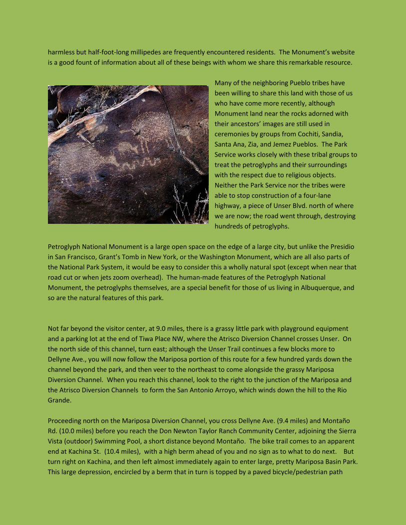
Many of the neighboring Pueblo tribes have been willing to share this land with those of us who have come more recently, although Monument land near the rocks adorned with their ancestors’ images are still used in ceremonies by groups from Cochiti, Sandia, Santa Ana, Zia, and Jemez Pueblos. The Park Service works closely with these tribal groups to treat the petroglyphs and their surroundings with the respect due to religious objects. Neither the Park Service nor the tribes were able to stop construction of a four-lane highway, a piece of Unser Blvd. north of where we are now; the road went through, destroying hundreds of petroglyphs.
Petroglyph National Monument is a large open space on the edge of a large city, but unlike the Presidio in San Francisco, Grant’s Tomb in New York, or the Washington Monument, which are all also parts of the National Park System, it would be easy to consider this a wholly natural spot (except when near that road cut or when jets zoom overhead). The human-made features of the Petroglyph National Monument, the petroglyphs themselves, are a special benefit for those of us living in Albuquerque, and so are the natural features of this park. Not far beyond the visitor center, at 9.0 miles, there is a grassy little park with playground equipment and a parking lot at the end of Tiwa Place NW, where the Atrisco Diversion Channel crosses Unser. On the north side of this channel, turn east; although the Unser Trail continues a few blocks more to Dellyne Ave., you will now follow the Mariposa portion of this route for a few hundred yards down the channel beyond the park, and then veer to the northeast to come alongside the grassy Mariposa Diversion Channel. When you reach this channel, look to the right to the junction of the Mariposa and the Atrisco Diversion Channels to form the San Antonio Arroyo, which winds down the hill to the Rio Grande. Proceeding north on the Mariposa Diversion Channel, you cross Dellyne Ave. (9.4 miles) and Montaño Rd. (10.0 miles) before you reach the Don Newton Taylor Ranch Community Center, adjoining the Sierra Vista (outdoor) Swimming Pool, a short distance beyond Montaño. The bike trail comes to an apparent end at Kachina St. (10.4 miles), with a high berm ahead of you and no sign as to what to do next. But turn right on Kachina, and then left almost immediately again to enter large, pretty Mariposa Basin Park. This large depression, encircled by a berm that in turn is topped by a paved bicycle/pedestrian path
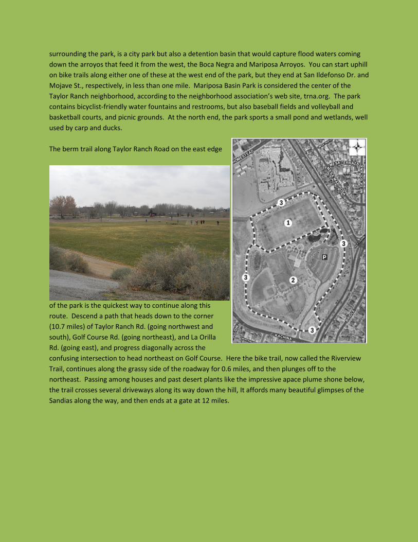
surrounding the park, is a city park but also a detention basin that would capture flood waters coming down the arroyos that feed it from the west, the Boca Negra and Mariposa Arroyos. You can start uphill on bike trails along either one of these at the west end of the park, but they end at San Ildefonso Dr. and Mojave St., respectively, in less than one mile. Mariposa Basin Park is considered the center of the Taylor Ranch neighborhood, according to the neighborhood association’s web site, trna.org. The park contains bicyclist-friendly water fountains and restrooms, but also baseball fields and volleyball and basketball courts, and picnic grounds. At the north end, the park sports a small pond and wetlands, well used by carp and ducks. The berm trail along Taylor Ranch Road on the east edge
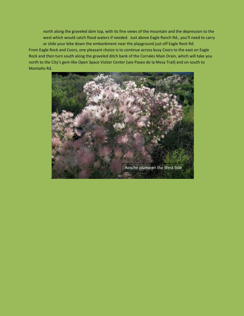
of the park is the quickest way to continue along this route. Descend a path that heads down to the corner (10.7 miles) of Taylor Ranch Rd. (going northwest and south), Golf Course Rd. (going northeast), and La Orilla Rd. (going east), and progress diagonally across the confusing intersection to head northeast on Golf Course. Here the bike trail, now called the Riverview Trail, continues along the grassy side of the roadway for 0.6 miles, and then plunges off to the northeast. Passing among houses and past desert plants like the impressive apace plume shone below, the trail crosses several driveways along its way down the hill, It affords many beautiful glimpses of the Sandias along the way, and then ends at a gate at 12 miles.
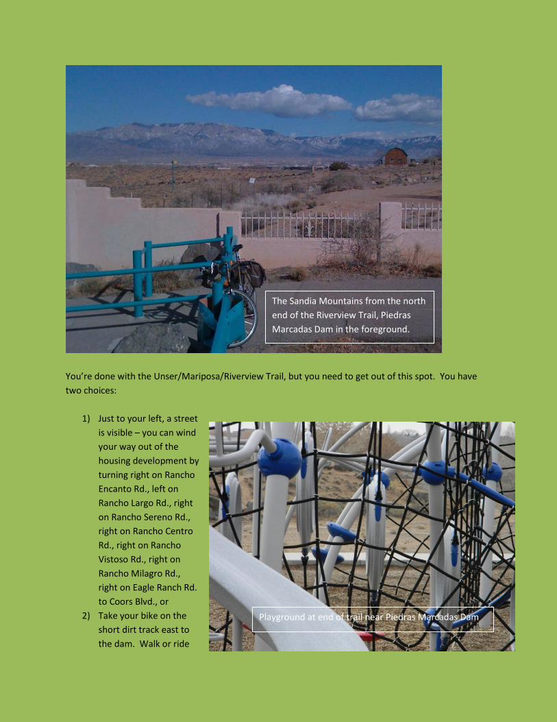
You’re done with the Unser/Mariposa/Riverview Trail, but you need to get out of this spot. You have two choices:
1) Just to your left, a street is visible – you can wind your way out of the housing development by turning right on Rancho Encanto Rd., left on Rancho Largo Rd., right on Rancho Sereno Rd., right on Rancho Centro Rd., right on Rancho Vistoso Rd., right on Rancho Milagro Rd., right on Eagle Ranch Rd. to Coors Blvd., or
2) Take your bike on the short dirt track east to the dam. Walk or ride
The Sandia Mountains from the north end of the Riverview Trail, Piedras Marcadas Dam in the foreground.
Playground at end of trail near Piedras Marcadas Dam
north along the graveled dam top, with its fine views of the mountain and the depression to the west which would catch flood waters if needed. Just above Eagle Ranch Rd., you’ll need to carry or slide your bike down the embankment near the playground just off Eagle Rock Rd.
From Eagle Rock and Coors, one pleasant choice is to continue across busy Coors to the east on Eagle Rock and then turn south along the graveled ditch bank of the Corrales Main Drain, which will take you north to the City’s gem-like Open Space Visitor Center (see Paseo de la Mesa Trail) and on south to Montaño Rd.
.
Apache plume on the West Side


![Mariposa Democrat (Mariposa, Calif.) 1857-07-30 [p ]...Mariposa Brewery.—Messrs. Hornneber & Lcsman,proprietors ofthe Mariposa Brew-ery,appreciating ourexertionsthishot weath-erinthe](https://img.pdfslide.us/doc/110x75/612d6a161ecc515869422c8c/mariposa-democrat-mariposa-calif-1857-07-30-p-mariposa-breweryamessrs.jpg)