Embed Size (px)
Citation preview

United States Coast United States Coast GuardGuard
Office of Navigation SystemsOffice of Navigation Systems
Providing Providing navigation safety navigation safety information for information for
America’s America’s waterwayswaterways
Jorge ArroyoJorge ArroyoOffice of Navigation SystemsOffice of Navigation SystemsU.S. Coast GuardU.S. Coast GuardWashington, DCWashington, DC
U.S. Army Corp of Engineers & U.S. Coast GuardU.S. Army Corp of Engineers & U.S. Coast Guard
Inland Waterways ConferenceInland Waterways ConferenceCincinnati, OHCincinnati, OH
March 7March 7thth, 2007, 2007

Automatic Identification System (AIS)Automatic Identification System (AIS)
Why? What is it? Who has to have it…and will have too?
How does it work and used? Where do we have coverage?
Nationwide AIS Project (NAIS) Common Operating Picture (COP)
Shipboard AISShipboard AIS

What started the USCG on AIS?What started the USCG on AIS?
In 1990, Congress passed the Oil Pollution Act which participation in VTS mandatory and directed the USCG to seek ways to
have ‘dependent surveillance’ of all tankers bound for Valdez, Alaska.
To that end, in 1993 the USCG developed Automated Dependent Surveillance
Shipboard Equipment (ADSSE), based on Digital Selective Calling (DSC) protocol.

In 1997, Congress…stated that AIS “technology should be the foundation of any future VTS system” and that it
“strongly believes that this technology will significantly improve navigational
safety, not just in select VTS target ports, but throughout the navigable
waters of the U.S”, and, that we “continue working with
stakeholders…”
Congress supports/mandates AIS!Congress supports/mandates AIS!
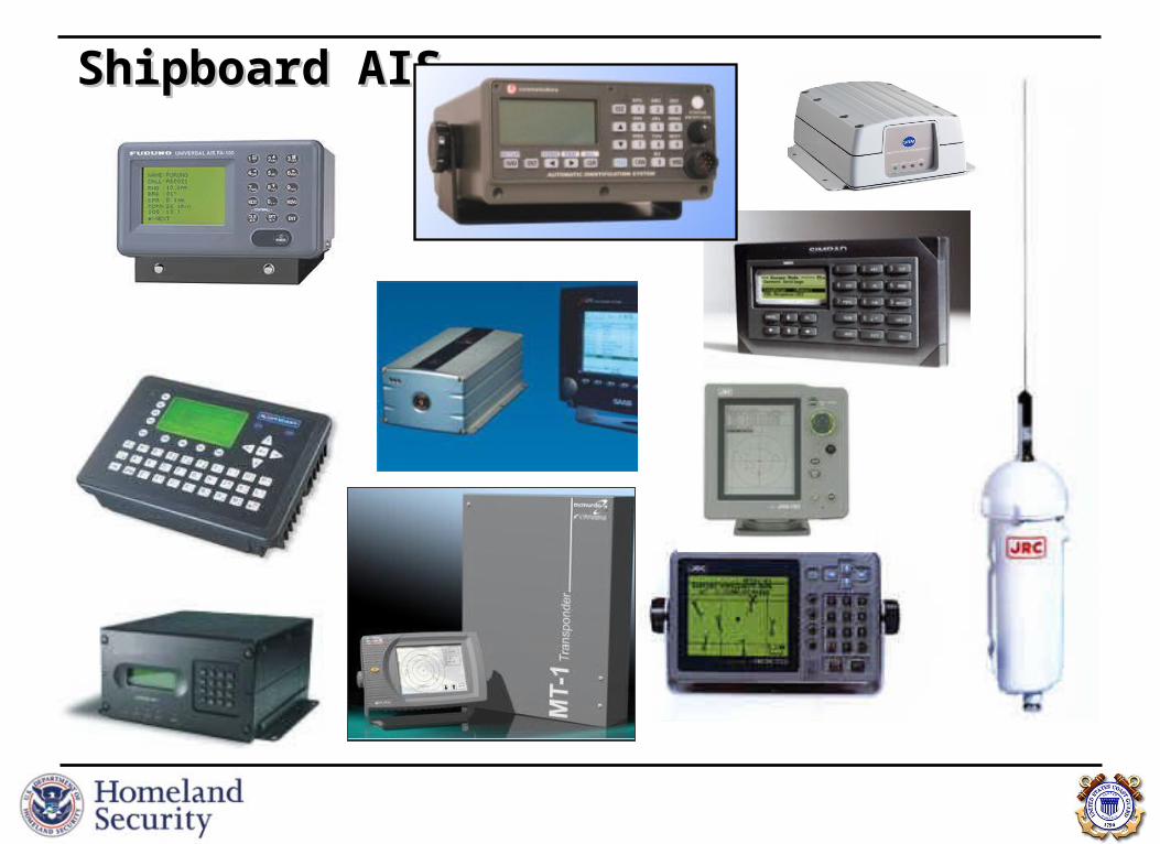
In 1999, the National Dialog Group, comprised of the marine private and public
representatives, stated they:
“strongly endorse the widespread use of AIS employing dGPS and onboard transponder
technologies…that national use of AIS technology on the greatest number of vessels is
essential both as a foundation of a VTS system…improving navigation safety…strongly urge the USCG to take the lead…in developing equipment and procedural standards that will
promote universal use of AIS technology”, which will “be less intrusive and distracting to
the mariner than will a voice-based control system…”
Industry endorses AIS!Industry endorses AIS!
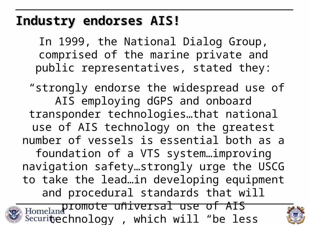
As of December 31st, 2004, the following must have a properly installed, operational, type-approved AIS
• On international voyage:
Tankers, Passenger > 150 GT, all others ships > 300 GT Per SOLAS Regulation V/19.2.4
Self-propelled commercial vessels > 65 feet Except fishing and passenger vessels (<150 passengers)
• Within a VTS area:
Self-propelled commercial vessels > 65 feet Except fishing and passenger vessels (<150 passengers)
Towing vessel > 26 feet and > 600 hp Vessel certificated to carry > 150 passengers
AIS Carriage RegulationsAIS Carriage Regulations 33 CFR 164.46 33 CFR 164.46

What is AIS?What is AIS?
• Autonomous Continuous Station-to-Station Navigation Broadcast System
- 3 modes of operation: automatic/self-reporting, assigned, interrogation/polling- Open protocol & non-proprietary- Robust capability: can handle up to 4500 reports per minute- Frequency agile: any 2 channels in the VHF Marine Band- Versatile: multiple standard interfaces and display options
• Internationally Adopted & Required (IMO SOLAS Regulation V/19.2.4) - Tankers, passenger vessels, and, other ships 300 of gross tonnage or greater
Purpose: collision avoidance, vessel traffic service tool, and, coastal surveillance
• Mandated by Congress by the Marine Transportation & Security Act of 2002
- Commercial self-propelled vessels 65 feet or greater;- Towing Vessels over 26 feet or greater and 600 hp or more;- Passenger vessels as determined by USCG; and
- those the USCG deems necessary for safety.

Forthcoming AIS RuleForthcoming AIS Rule Announcement published October 31st, 2005 Extend to all U.S. navigable waters Potentially could effect 17,000 vessels.
Commercial self-propelled vessel of > 65 feet No exceptions
Towing vessel > 26 feet and > 600 hp Vessels carrying > 50 passengers (vice 150) Hi-Speed vessels carry > 12 passengers Certain dredges / floating plants, and Vessel moving certain dangerous cargoes
Forthcoming rulemaking will address timeline Reasonable time will be given for installation/use Waiver provisions already exist
Estimated Expanded AIS Population
Ships >65ft 2,973Freight Ship 298
Industrial Ship 748
MODU 210
OSV 553
Research Vessel 97
School Ship 19
Tank Ship 122
Unclassified 385
Unknown 541
Fishing >65ft 5,520Documented 4,571
Undocumented (est.) 949
Towing >26ft & >600hp 4,560
Passenger 3,235>65ft 2,167
<65' but >50 pax 1,062
>30kts & >12 pax for hire 6
Dredges 35
Total (U.S.) 16,323
Foreign Flag >65ft 1,119
Total (All) 17,442
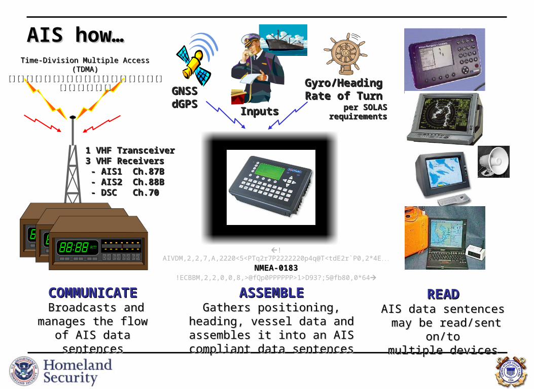
ASSEMBLEASSEMBLEGathers positioning, heading, Gathers positioning, heading,
vessel data and assembles it into vessel data and assembles it into an AIS compliant data sentencesan AIS compliant data sentences
READREADAIS data sentencesAIS data sentences may be read/sent may be read/sent
on/toon/tomultiple devicesmultiple devices
COMMUNICATECOMMUNICATE Broadcasts and Broadcasts and
manages the flow of manages the flow of AIS data sentencesAIS data sentences
GNSS GNSS dGPSdGPS
Gyro/Gyro/HeadingHeadingRate of TurnRate of Turn
per SOLAS per SOLAS requirementsrequirements
!AIVDM,2,2,7,A,2220<5<PTq2r7P2222220p4q@T<tdE2r`P0,2*4E...
NMEA-0183NMEA-0183!ECBBM,2,2,0,0,8,>@fQp0PPPPPP>1>D93?;5@fb80,0*64
1 VHF Transceiver1 VHF Transceiver3 VHF Receivers3 VHF Receivers - AIS1 Ch.87B- AIS1 Ch.87B - AIS2 Ch.88B- AIS2 Ch.88B - DSC Ch.70- DSC Ch.70
Time-Division Multiple Access (TDMA)Time-Division Multiple Access (TDMA)[][][][][][]][][][][][][][][][][][][][][][][][][][][][][][]][][][][][][][][][][][][][][][][][]
AIS how…AIS how…
InputsInputs

AIS ATON’sAIS ATON’s
• Monitors ‘health’ & position
• Improves availability by reducing time to respond to outages because of near real time monitoring.
• Improves “visibility” to AIS equipped vessels.


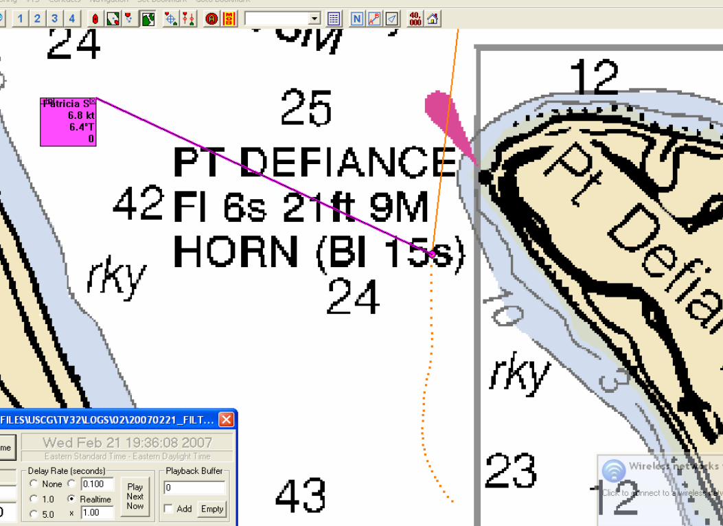
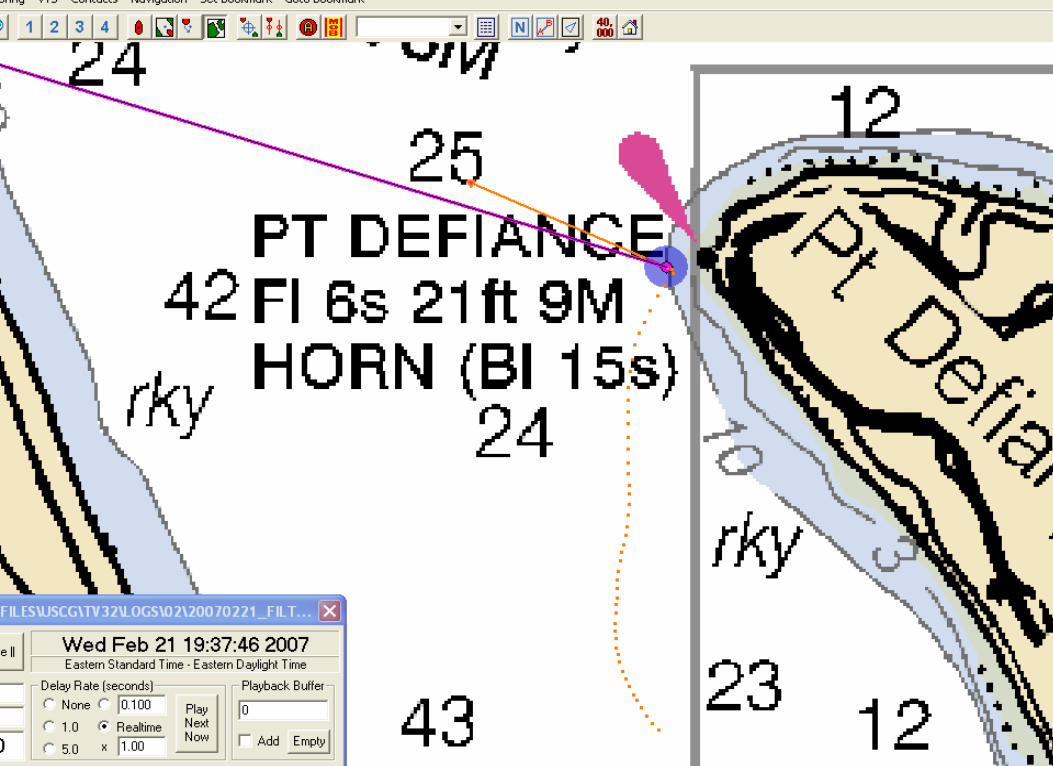

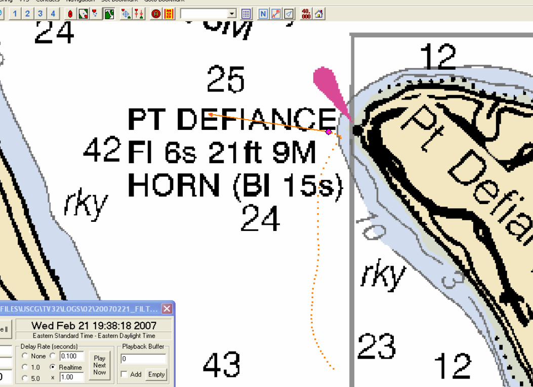
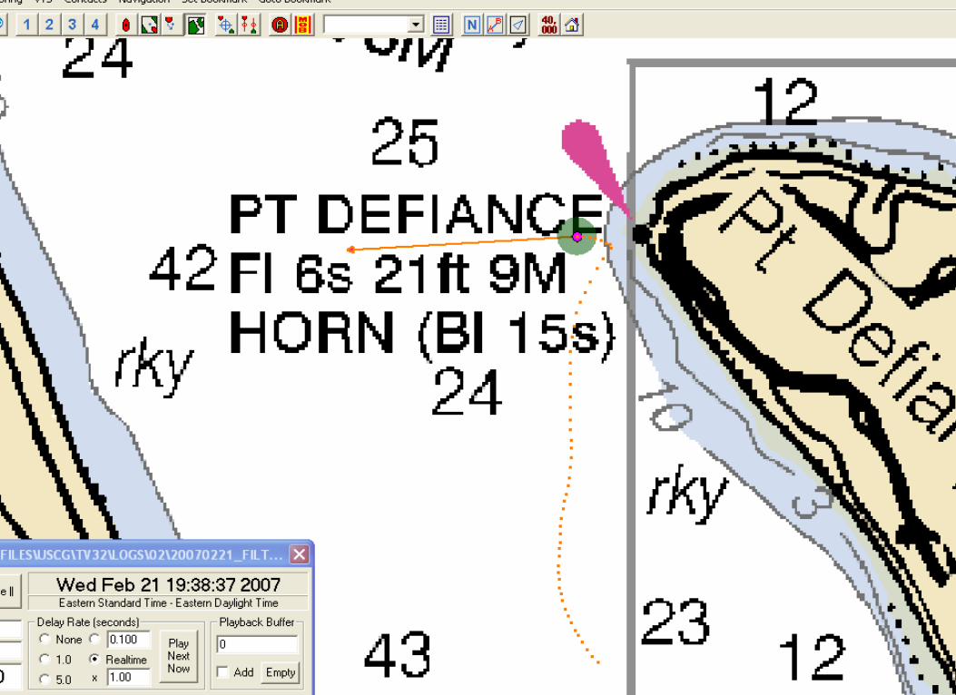

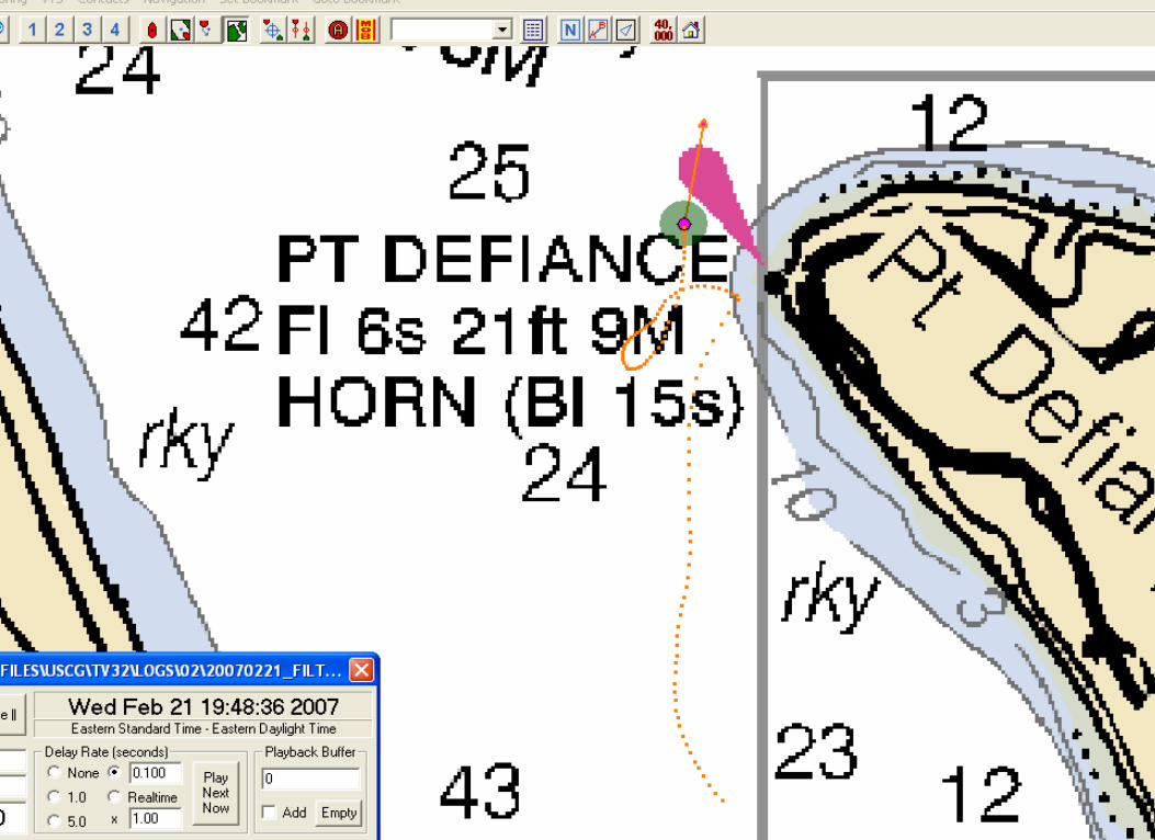
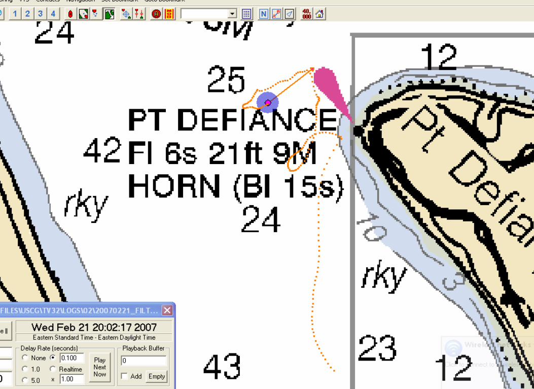

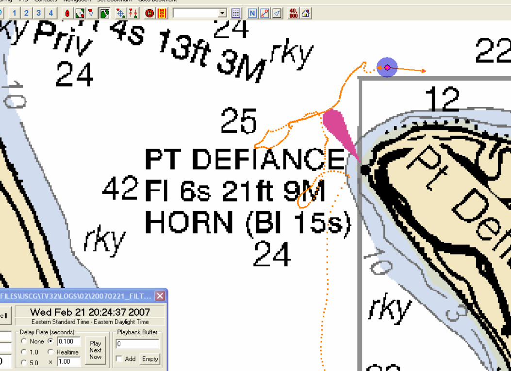

Vessel Name – Bearing - RangeVessel Name – Bearing - Range

See around
bends Calculate
encounter zones

See around
bends Calculate
encounter zones

Binary Messages and Functional IdentifiersBinary Messages and Functional Identifiers
AIS allows the transfer of Binary MessagesAIS allows the transfer of Binary Messages
• a means for communication for external applications • General broadcast• Addressed to specific station (MMSI)
• Results in a Binary Acknowledgement to confirm that the addressed binary message was received
All binary messages are composed by All binary messages are composed by
• an external application on the transmission side• can only be used by the same external application connected to the AIS on the receiver side.
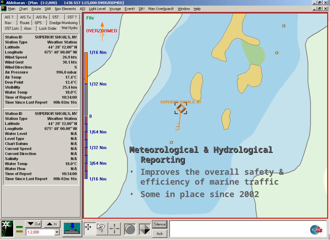
Meteorological & Hydrological Meteorological & Hydrological ReportingReporting
• Improves the overall safety & efficiency of marine traffic
• Some in place since 2002

AIS Event DetectionAIS Event Detection
Automatic event detectionAutomatic event detection
• User specified event types • Flag to indicate status of event• Find vessel involved in event• Forward event information via:
• System Integration Module• SMS or email
• Speech integrated
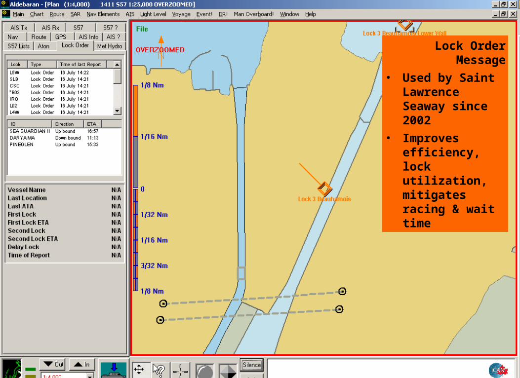
Lock Order Message
• Used by Saint Lawrence Seaway since 2002
• Improves efficiency, lock utilization, mitigates racing & wait time

Malaysia Dredge Malaysia Dredge
Monitoring Monitoring ProjectProject
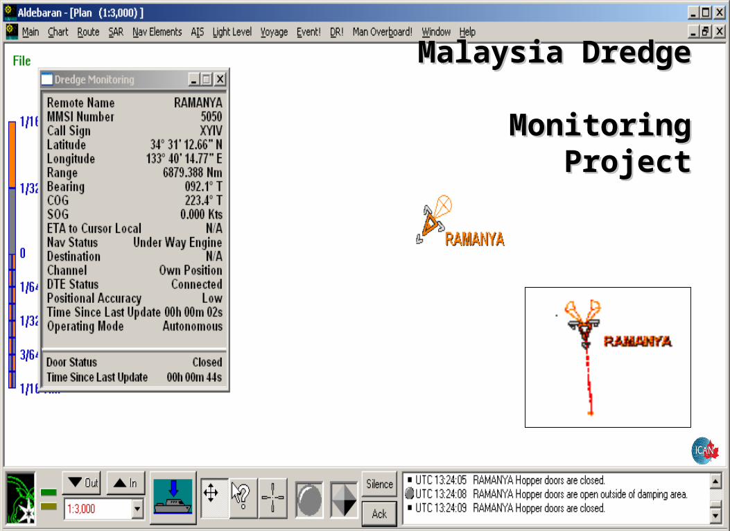
Malaysia Dredge Malaysia Dredge
Monitoring Monitoring ProjectProject
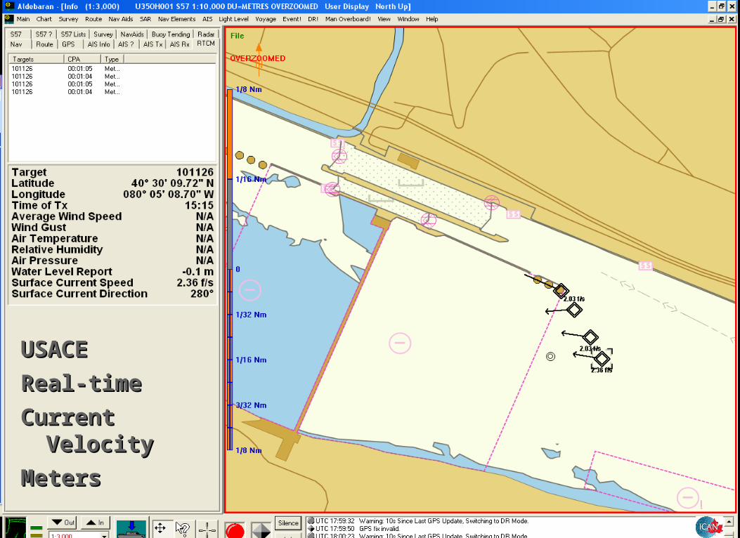
USACE USACE
Real-timeReal-time
Current Current VelocityVelocity
MetersMeters
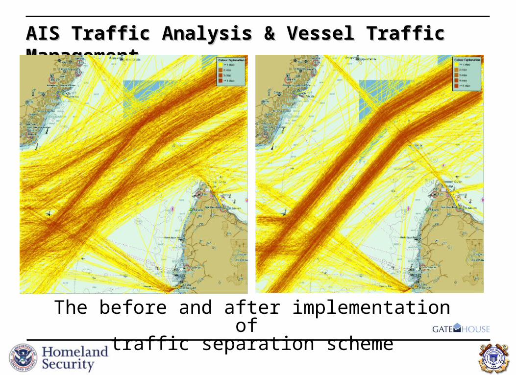
AIS Traffic Analysis & Vessel Traffic ManagementAIS Traffic Analysis & Vessel Traffic Management
The before and after implementation of traffic separation scheme

Industry is using AIS Industry is using AIS – Washington St. – Washington St. FerriesFerries
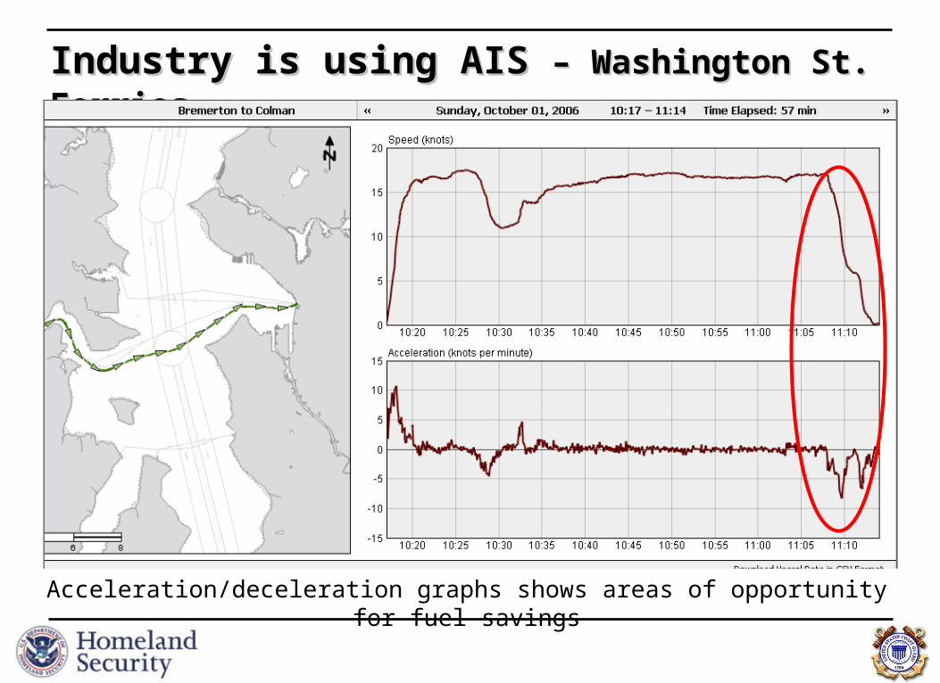
Industry is using AIS Industry is using AIS – Washington St. – Washington St. FerriesFerries
Acceleration/deceleration graphs shows areas of opportunity for fuel savings
RainLow
TempHigh Temp
Fog
Forest Fire
AvalancheSnow
and Ice FloodThunder
storm
Wind
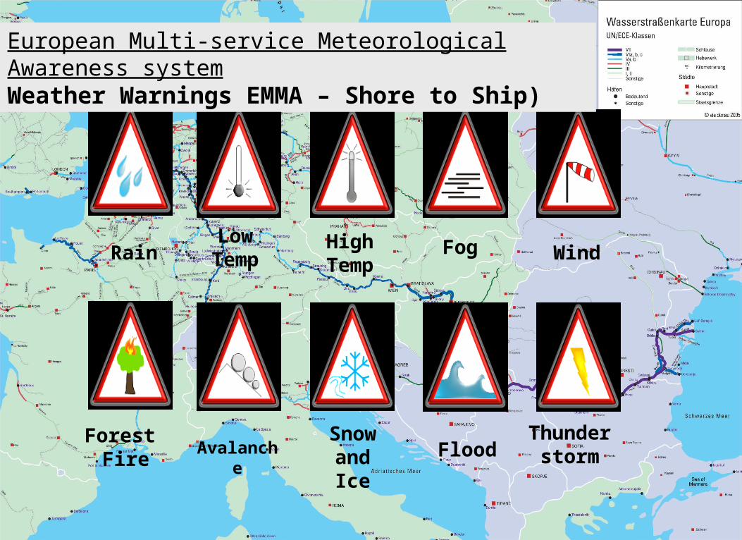
European Multi-service Meteorological Awareness systemWeather Warnings EMMA – Shore to Ship)
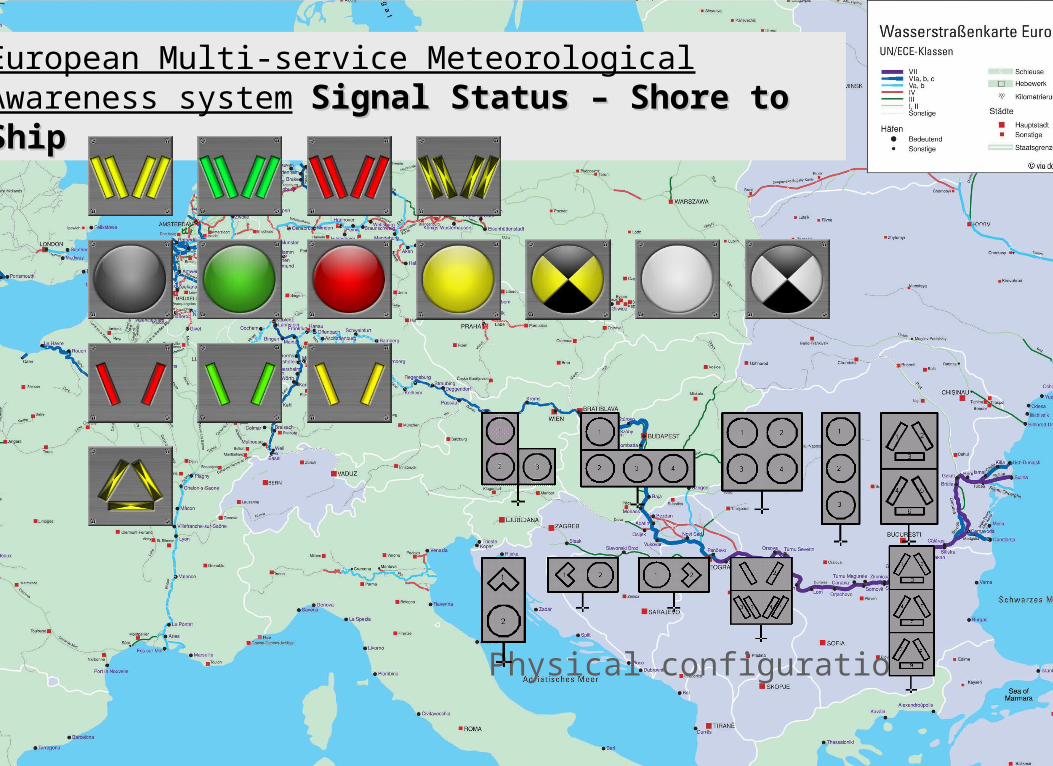
European Multi-service Meteorological Awareness system
Signal Status – Shore to ShipSignal Status – Shore to Ship
Physical configurations
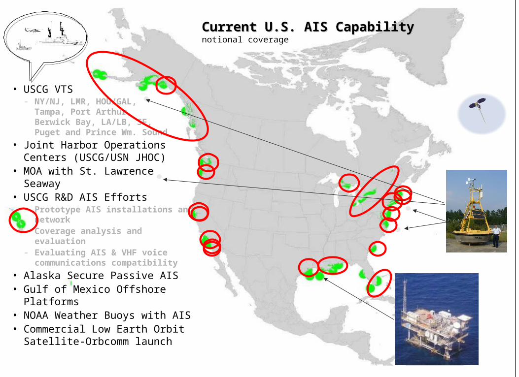
Current U.S. AIS Capability Current U.S. AIS Capability notional coverage
• USCG VTS- NY/NJ, LMR, HOU/GAL,
Tampa, Port Arthur, Berwick Bay, LA/LB, SF, Puget and Prince Wm. Sound
• Joint Harbor Operations Centers (USCG/USN JHOC)
• MOA with St. Lawrence Seaway• USCG R&D AIS Efforts
- Prototype AIS installations and network
- Coverage analysis and evaluation
- Evaluating AIS & VHF voice communications compatibility
• Alaska Secure Passive AIS• Gulf of Mexico Offshore
Platforms• NOAA Weather Buoys with AIS• Commercial Low Earth Orbit
Satellite-Orbcomm launch

Different vessels logged by USCG AIS Research Network each day
0
200
400
600
800
1000
1200
1400
1600
1800
2000
2200
2400
2600
2800
3000
3200
3400
3600
3800
4000
4200
3/27/03 6/27/03 9/27/03 12/27/03 3/27/04 6/27/04 9/27/04 12/27/04 3/27/05 6/27/05 9/27/05 12/27/05 3/27/06 6/27/06 9/27/06 12/27/06
Daily number of vessels tracked between 3/03 and 3/07 Coast Guard R&D Center AIS Network
•
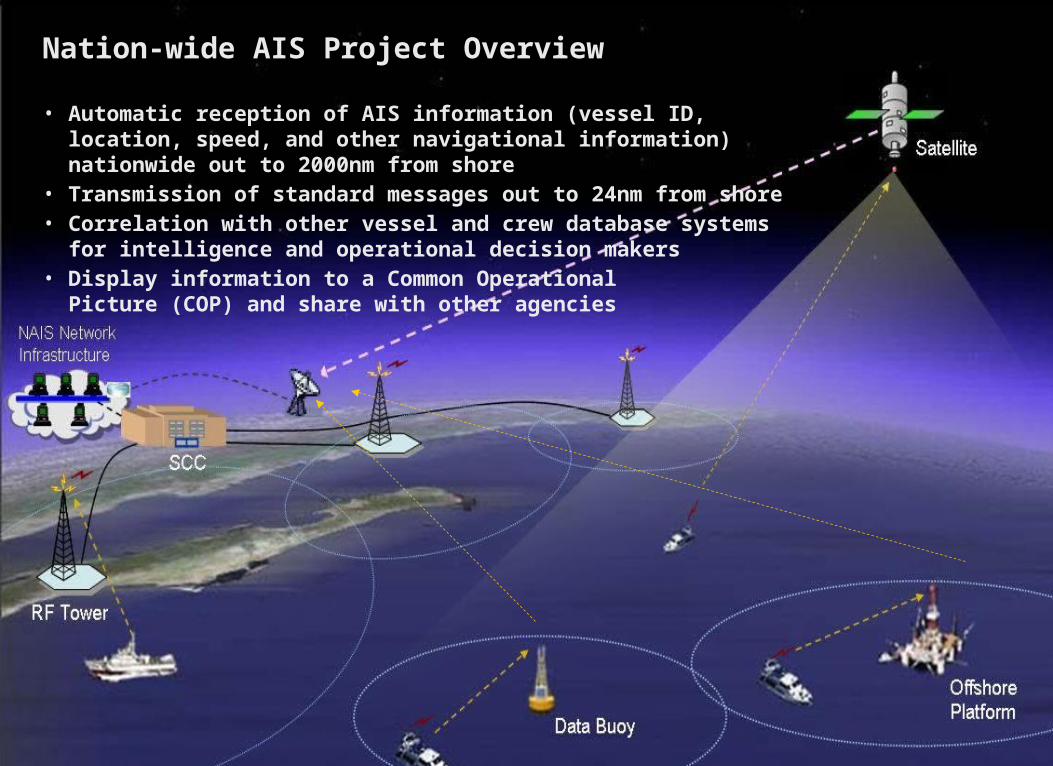
Nation-wide AIS Project OverviewNation-wide AIS Project Overview
• Automatic reception of AIS information (vessel ID, location, speed, and other navigational information) nationwide out to 2000nm from shore
• Transmission of standard messages out to 24nm from shore• Correlation with other vessel and crew database systems for intelligence
and operational decision makers• Display information to a Common Operational
Picture (COP) and share with other agencies

One known need: Common Operating Picture One known need: Common Operating Picture “plus”“plus”
DefenseOperations
Plans
DefenseOperations
Plans
Weather DataWeather Data
NationalAssets
NationalAssets
CommonIntelligence
Picture
CommonIntelligence
Picture
ForceDeployments
ForceDeployments
Law EnforcementOperations Plans
Law EnforcementOperations Plans
UnclassifiedSatellite Photos
UnclassifiedSatellite Photos
UnclassifiedVessel Tracking Data
UnclassifiedVessel Tracking Data
Maps & ChartsMaps & Charts
Models(e.g. radiological dispersion)
Models(e.g. radiological dispersion)
CustomsInformation
CustomsInformation
FBIInformation
FBIInformation
Maritime Informationfor Safety and Law Enforcement
(MISLE) data
Maritime Informationfor Safety and Law Enforcement
(MISLE) data
Facilities SecurityPlans
Facilities SecurityPlans
Port SecurityAssessments
Port SecurityAssessments
AutomaticAutomaticIdentificationIdentificationSystem dataSystem data
AutomaticAutomaticIdentificationIdentificationSystem dataSystem data
UnclassifiedCargo, Crew Data
UnclassifiedCargo, Crew Data
Port SecurityPlans
Port SecurityPlans
CommonCommonOperatingOperating
PicturePicture““plus”plus”
CommonCommonOperatingOperating
PicturePicture““plus”plus”
News MediaNews Media

Nation-wide AIS ProjectNation-wide AIS Project• Display information to a Common Operational Display information to a Common Operational
Picture (COP) and share with other agenciesPicture (COP) and share with other agencies

• Display information to a Common Operational Display information to a Common Operational Picture (COP) and share with other agenciesPicture (COP) and share with other agencies

United States Coast GuardUnited States Coast GuardOffice of Navigation SystemsOffice of Navigation Systems
NEW**********************
******[email protected] www.navcen.uscg.gov
U.S. Coast GuardU.S. Coast GuardOffice of Navigation SystemsOffice of Navigation Systems
2100 Second St. SW2100 Second St. SWWashington, DC 20953Washington, DC 20953

What AIS broadcastsWhat AIS broadcasts Safety Related & Binary ApplicationsSafety Related & Binary Applications• SHORT TEXT MESSAGING < 156 characters• DATA MESSAGING & BINARY APPLICATIONS
Weather & Hydrological Information-• NOAA Physical Oceanographic Real Time System• NWS-Real-time weather buoy (C-MAN station)• USACE Real-time Current Meter System (RTCM)
Vessel Traffic Service (VTS)-• ATON Discrepancies• Distress Alerts• Urgent Notices & Warnings• Traffic Advisories• Radar Overlay / Pseudo-targets• Additional Hydro & Meteorological Information
Other possible uses-• Aids to Navigation • Search and Rescue• Port Partners• Lock/Canal operations• … endless opportunities!
• MARITIME MOBILE SERVICE INDENTIFIER • UNIVERSAL TIME STAMP (GPS)
Dynamic DataDynamic Data-every 2-10 seconds per speed and course change-every 2-10 seconds per speed and course change
• POSITION & ACCURACY (+/-10m)• COURSE OVER GROUND• SPEED OVER GROUND• HEADING• RATE OF TURN
• VESSEL IMO NUMBER • COLREG NAVIGATION STATUS
Static & Voyage DataStatic & Voyage Data-every 6 minutes or upon change-every 6 minutes or upon change
• VESSEL NAME & CALL SIGN• VESSEL TYPE & DIMMENSIONS
• STATIC DRAFT• HAZARDOUS CARGO FLAG• DESTINATION & ETA

GPS Multi-path Error
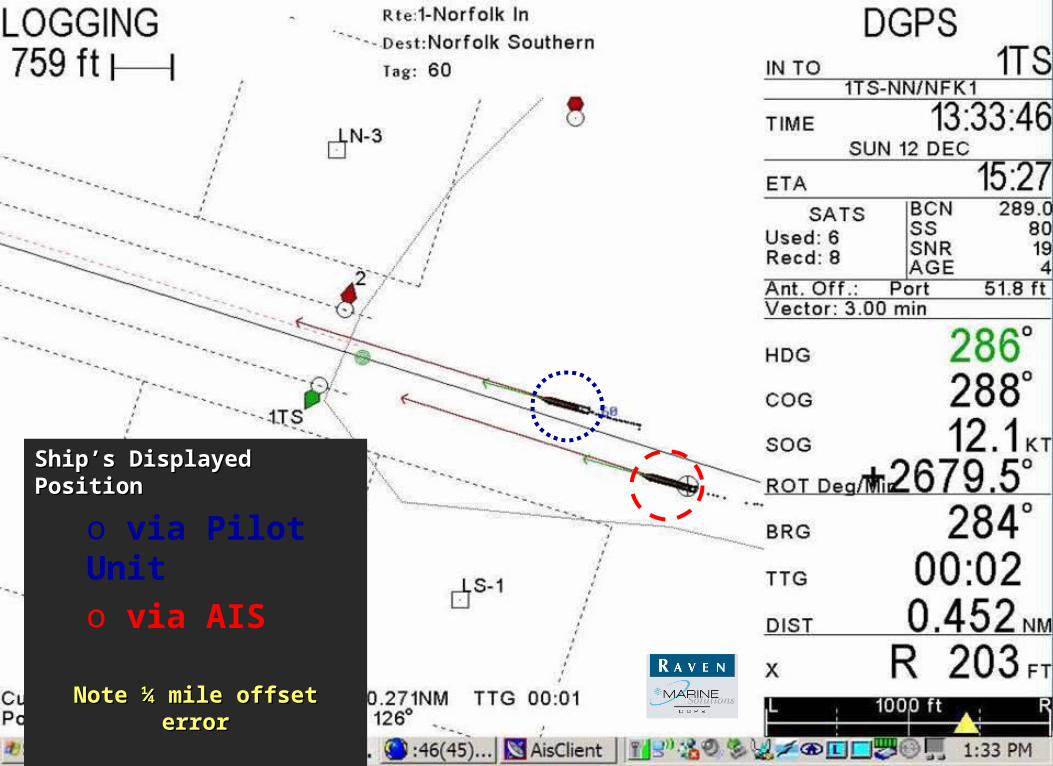
False position from ships AIS
Correct position from Pilot’s GPS
Ship’s Displayed Ship’s Displayed PositionPosition
o via Pilot Unito via AIS
Note ¼ mile offset errorNote ¼ mile offset error

Ship’s Displayed Ship’s Displayed PositionPosition
o via Pilot Unito via AIS
Note ¼ mile offset errorNote ¼ mile offset error

NAIS - System Context DiagramNAIS - System Context Diagram
Data Processing
Data Processing
Storage/ ArchiveStorage/ Archive
LAN
NAIS ScopeSAR Aircraft
Aids to Navigation
Aids to Navigation
RxRx
VHF Data Link
WAN & Diverse Remote Site Connectivity
Commercial Vessels
Coast Guard Systems• C2• Law Enforcement• Intelligence• Marine Safety• Waterways Management
External Users• Coast Guard• DHS• Government• Non-government
Cutters andDeepwater
Assets
Government Vessels
Recreational Vessels
Rx/TxPlatform
Rx/TxPlatform
RxPlatform
RxPlatform
RxPlatform
System Operations
Center