Embed Size (px)
Citation preview

Unit II - Physical Landscapes of Asia Pacific
Francis YeeCamosun College

I. Landforms
II. ClimateIII.Vegetati
on
Origin of Yangtze River in Tibetan Plateau (Photo by F. Yee, 2007)

3 broad divisions of landformsA. Chinese Checkerboard (covered most
parts of China)B. Alluvial Fan (included Mainland SE Asia)C. Island Realms (consisted of Maritime SE
Asia, Taiwan & Japan)

Consists of a mix of different landforms1. Mountains2. Plateaus3. Plains4. Basins

A view of Tian Shan Mt. (7,439 metres) with few settlements & economic activities [Photo by F. Chow 2002]

Xizang (Tibetan) Plateau (>3,000 metres) with sheep and cattle raising [Photo by F. Yee, 2007]

Extensive farming area in Pearl River Delta, S. China (Photo by F. Yee, 2005)

Nanshan Pasture (Urumqi, W. China) for sheep & cattle raising (Photo by F. Chow 2002)

Alluvial Fan: Lowlands, fertile soil, flood plains
e.g.1. Menam (Chao
Phraya) (S. Thailand)2. Mekong Delta (S.
Vietnam, Cambodia)3. Irrawaddy River
(Myanmar)
Lowland farming in Myanmar (Photo by F. Yee 2005)
Rice farming in Bali, Indonesia (photo by F. Yee 2012)

Characteristics: young fold mountains (high elevations, less eroded, unstable, young age) with large number of islands
An extended Himalaya Mt. System: ◦ extends from China ->Nepal ->Burma-
>Sumatra->Java->Borneo->Philippines->Taiwan->Japan)
Geological Structure (tectonic plates): ◦ Ring of Fire (Volcanoes)◦ Earthquakes◦ Tsunamis (tidal waves)

rigid plates float on top of the Earth’s mantle with movement of the plates causing seismic activities

zones of high earthquake and volcanic activities (>150 active volcanoes in Asia-Pacific)

Tangkuban Perahu is a dormant volcano 30 km north of the city of Bandung, last erupted in 1959 (photo by F. Yee 2012)

Photo by F. Yee, Mt. Fuji, Japan, 2013

Major earthquake in Japan 2011 - Magnitude 9.0, 15,000 deaths (http://www.huffingtonpost.com/news/japan-earthquake)

Sichuan, China 2008, magnitude 7.9, 87,000 deaths (Details available from : http://earthquake.usgs.gov/eqcenter/eqinthenews/2008/us2008ryan/#details)
Kobe, Japan, 1995, M 6.9, 5,500 deaths Tangshan, China 1976, M 7.5, 255,000 deaths Taichung, Taiwan, 1999, M 7.7, 2,400 deaths Kanto, Japan, 1923, M7.9, 143,000 deaths

Japan (2011): tsunamis impacted East coast of Honshu with runup of 37.9 metre high and caused damage in Indonesia, California, Ecudaor, and Chile.
Video showing tsunamis hitting Japan. http://www.youtube.com/watch?v=80CH_XkpSCE

Quake magnitude - 9.1, Impacts: 227,000 deaths, 1 million people displaced, 13% coastal coral reefs damaged◦ Details from USGS:
http://earthquake.usgs.gov/eqcenter/eqinthenews/2004/usslav/◦ Tsunami Images on affected areas:
http://www.pdc.org/PDCNewsWebArticles/2004SouthAsiaTsunami/InformationProducts/index.htm

A. Monsoon Climate B. TemperatureC. PrecipitationD. Typhoons

Wet Monsoon: wind pass through ocean and bring a lot of precipitation (from SW & SE)

wind pass through continent and bring little moisture (from NW)

1. East Asiaa) Summer: little regional variation – high
throughout (200C to 280C)b) Winter: North-South differences (cold in north
[-100C in NE China], mild in south [100C in S. China]
2. Southeast Asia: Equatorial region - little seasonal variations (high year round)
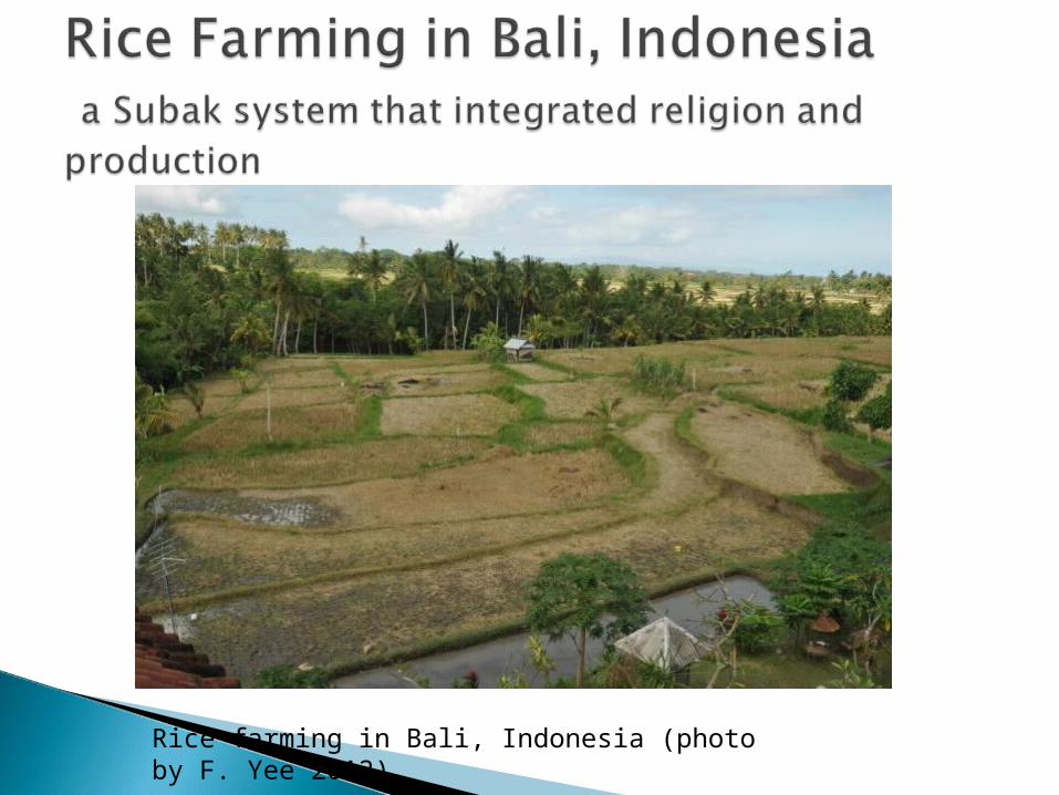
varied from 130 days in NE China and 300 days in S. China
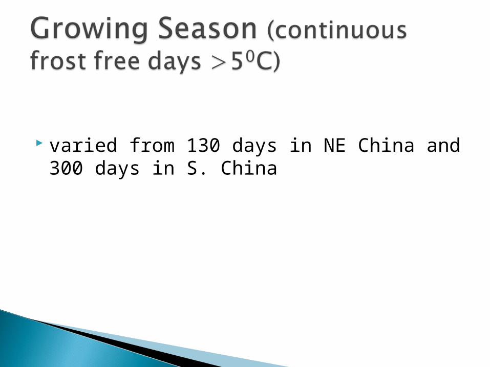
1.Coastal (abundant) Vs. inland (little)a) >2000 mm: abundant in coastal areas of China
and Vietnam, and equatorial areas of Indonesia, Malaysia, Singapore, the Philippines;
b) 500 mm isohyets: scanty in NW China (grasslands and semiarid areas)

2. Seasonal: Summer (wet monsoon) Vs. winter (dry monsoon)
a) East Asia - wet monsoon in summer (May – Sep) and dry monsoon (Oct – April);
b) SE Asia: short dry monsoon in the equatorial region (only one month in Borneo and peninsular Malaysia

how much rain on average recorded in Taiwan and Mongolia?

1. Characteristics: atmospheric instability, warm sea temperatures, high humidity
2. Season: May to September3. Typhoon Categories:
i. Tropical storm: 63-87 km/hr.ii. Typhoon: > 118 -149 km./hr.iii. Super Typhoon – wind over 185 km/hr
(Hurricane category 3 or 4), e.g. Utor in August 2013

3 main paths: originate from Pacific Ocean and move towards
◦N Philippines Central China Japan / Korea
◦Central Philippines Taiwan coastal China
◦S. Philippines S. China Vietnam

A #10 typhoon signal was posted in Hong Kong on July 23, 2012 with all air, land, and sea transport grounded. The Hong Kong International Airport airport was closed for several hours due to high wind (photo by F. Yee, 2012). Video on typhoon Vincente: http://www.youtube.com/watch?v=DjArMVHcsdU&feature=fvwrel

Tracks of Super Typhoon Utor with sustained winds over 240 km/hr, causing 25 deaths and 13 missing as well as US2.3 billion damage in the Philippines, Hong Kong, Macao, and China. Video showing Typhoon Utor in the Philippines. http://www.bbc.co.uk/news/world-asia-23680782

Affected by:
1.climate, 2.aspects,3.altitude
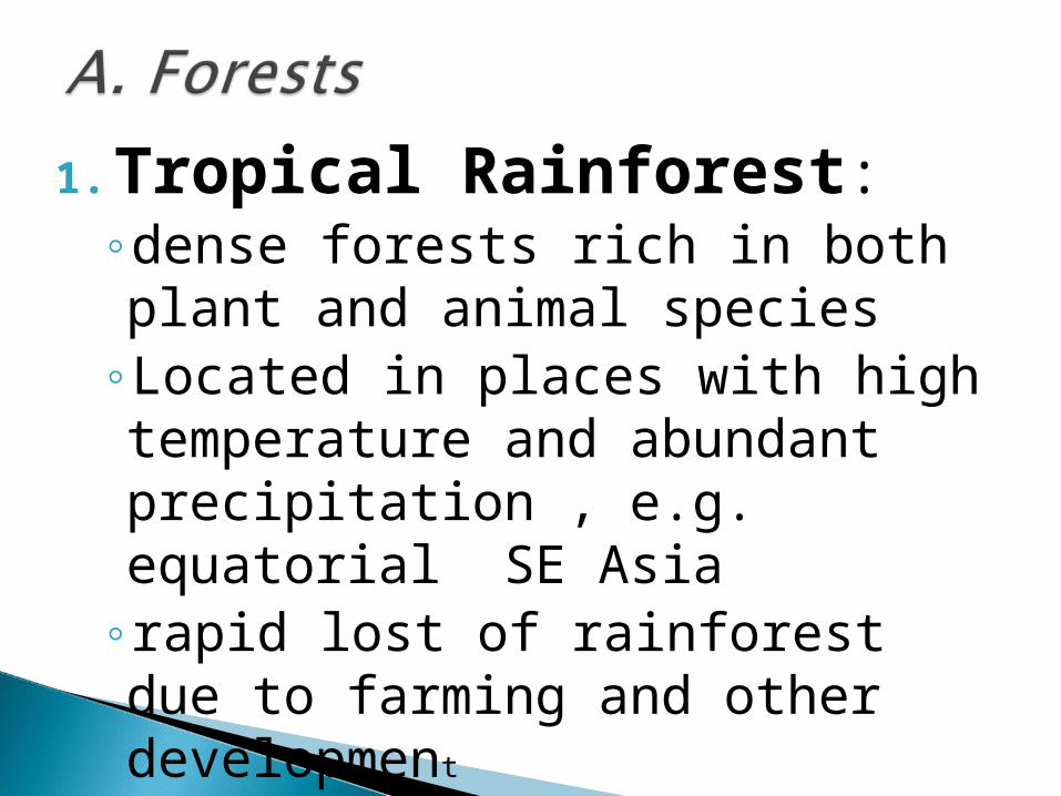
1. Tropical Rainforest: ◦dense forests rich in both plant and animal species
◦Located in places with high temperature and abundant precipitation , e.g. equatorial SE Asia
◦rapid lost of rainforest due to farming and other development

Monsoon Forest along the Mekong River in Burma (photo by F. Yee 2005)
◦transition between rainforest and grassland,
◦most trees are deciduous and use as firewood,
◦rich collection of wildlife
◦locate in Mainland SE Asia

Forested area near Mt. Fuji, Japan (photo by F. Yee 2013)
◦ broadleaf deciduous forests in mid-latitude, drop leaves during winter (e.g. oak, birch, and elm),
◦ used for making furniture and other products
◦ Located in NE China, Japan, Korea

Coastal plants along the Mekong Delta (photo by F. Yee 2010)
coastal plants in tropical and subtropical inter-tidal regions (Vietnam, Cambodia, Philippines)
plants adapted to saline conditions,
generate large amount of organic matters, rich in fish and bird species,
help to reduce coastal erosion, tsunami impacts, and maintain water quality

Grassland in Tibet Plateau (photo by F. Yee 2007)
Grasslands in places with low precipitation, e.g. NW China, Inner Mongolia,
important grazing land
Soil erosion due to over grazing

Desert area in Gansu (photo by F. Chow 2001)
Cold deserts: ◦ in high elevation with little
moisture◦ cold year round e.g. Tibet
Plateau◦ Gobi desert (1.3 million sq.
km.) in Mongolia and China with cold winter and hot summer
Hot Deserts: ◦ rainfall below 2.5 cm; ◦ high temperature 24-26C; ◦ xeophytic vegetation, ◦ wildlife present but wind
erosion severe

◦altitudinal zonation of vegetation,◦ ranging from tropical in the lower
altitude to deciduous and grasslands in higher altitude until the tree line,
◦e.g. Himalaya Mt.

Weightman ch. 2