Embed Size (px)
Citation preview

Glencoe
Unit 2 North Africa and Southwest Asia
Chapter 3 North Africa and Southwest Asia—Early Cultures
Chapter 4 North Africa and Southwest Asia Today

Copyright © by The McGraw-Hill Companies, Inc. All rights reserved. Permission is granted to reproduce the material contained herein on the condition that such material be reproduced only for classroom use; be provided to students, teachers, and families without charge; and be used solely in conjunction with Our World Today: People, Places, and Issues. Any other reproduction, for use or sale, is prohibited without prior written permission of the publisher.
Send all inquiries to:Glencoe/McGraw-Hill8787 Orion PlaceColumbus, Ohio 43240-4027
ISBN 0-07-829380-4
Printed in the United States of America
1 2 3 4 5 6 7 8 9 10 024 08 07 06 05 04 03 02
BOOK ORGANIZATION
Glencoe offers resources that accompany Our World Today: People, Places, andIssues to expand, enrich, review, and assess every lesson you teach and for every stu-dent you teach. Now Glencoe has organized its many resources for the way youteach.
How This Book is OrganizedEach unit resources book offers blackline masters at unit, chapter, and section lev-
els for each unit. Each book is divided into three parts—unit-based resources, chap-ter-based resources, and section-based resources. Glencoe has included tabs at the sideof every activity page in this book to help you navigate.
Unit-Based ResourcesWe have organized this book so that all unit resources appear in the first part
of the unit resources books. Although you may choose to use the specific activi-ties at any time during the course of unit study, Glencoe has placed these resourcesup front so that you can review your options.
Chapter-Based and Section-Based ResourcesChapter-based resources follow the unit materials. For example, in the Unit 1
Resources booklet Chapter 1 blackline masters appear immediately following Unit 1 materials. The materials appear in the order you teach—Chapter 1 activi-ties; Chapter 1, Section 1 activities; Chapter 1, Section 2 activities; and so on. Fol-lowing the end of the last section activity for Chapter 1, the Chapter 2 resourcesappear.
A Complete Answer KeyA complete answer key appears at the back of this book. This answer key
includes answers for every activity in the book in the order in which the activitiesappear in the book.

iii
To the Teacher v
Unit 2 Resources viRegional Atlas Activity 2 1Economics and Geography Activity 2 9History and Geography Activity 2 11Environmental Case Study 2 13Citizenship Activity 2 19World Literature Reading 2 21
Chapter 3 Resources 25Vocabulary Activity 3 26Cooperative Learning Activity 3 27Chapter Map Activity 3 29Chapter Skills Activity 3 33Reteaching Activity 3 35Critical Thinking Skills Activity 3 37Map and Graph Skills Activity 3 39Reading and Writing Skills Activity 3 41GeoLab Activity 3 43Enrichment Activity 3 45
Chapter 3, Section Resources 47Guided Reading Activity 3-1 48Guided Reading Activity 3-2 49
Chapter 4 Resources 51Vocabulary Activity 4 52Cooperative Learning Activity 4 53Chapter Map Activity 4 55Chapter Skills Activity 4 61Reteaching Activity 4 63Critical Thinking Skills Activity 4 65Map and Graph Skills Activity 4 67Reading and Writing Skills Activity 4 69GeoLab Activity 4 71Enrichment Activity 4 73
TABLE OF CONTENTS
Chapter 4, Section Resources 75Guided Reading Activity 4-1 76Guided Reading Activity 4-2 77Guided Reading Activity 4-3 78Guided Reading Activity 4-4 79
Answer Key 81
iv
TABLE OF CONTENTS, CONTINUED

v
The Total Package—Our World Today: People,Places, and Issues Classroom Resources
Glencoe’s Unit Resources books are packed with activi-ties for the varied needs of all of your students. They includethe following activities.
Activities Found in Unit Resources Booklets • Regional Atlas Activities
These activities enable students to work with the infor-mation in the Regional Atlas sections of the student text-book. The activities require students to focus on politicaland physical maps, charts and graphs, and facts aboutcultural geography related to each region of the world.
• Economics and Geography ActivitiesThese interdisciplinary activities provide students withthe opportunity to analyze and interpret geographicalconcepts and maps in relation to economics and theeconomies of the world’s regions. The activities aredesigned to help students appreciate how economicsand geography are interrelated.
• History and Geography ActivitiesThese interdisciplinary activities provide students with theopportunity to analyze and interpret maps in relation tohistorical events. Students are required to practice usinggeography skills as an aid to understanding history.
• Environmental Case StudiesThese case studies provide students with the opportu-nity to actively explore environmental issues that affecteach of the world’s regions. Case studies include criti-cal thinking questions and activities designed to extendstudents’ knowledge and appreciation of environmen-tal challenges.
• Citizenship Activities: Geography and Your CommunityThese application activities give students the opportunityto participate in their communities. The activities involvestudents in grassroots community projects that may havenational or international implications. The projects helpstudents understand how geography affects their ownlives on a daily basis. The projects also show students howthey can use their communities as resources for becom-ing geographically informed persons.
• World Literature ReadingsThese readings provide students with the opportunityto read literature by or about people who live in eachof the world’s geographic regions. Each selection is pre-ceded by background information and a guided read-ing suggestion, and followed by comprehension andcritical thinking questions.
• Vocabulary ActivitiesThese review and reinforcement activities help studentsto master unfamiliar terms used in the student edition.The worksheets emphasize identification of wordmeanings and provide visual and kinesthetic reinforce-ment of language skills.
TO THE TEACHER
• Cooperative Learning ActivitiesThese extension activities offer students clear manage-ment directions for working together on a variety ofactivities that enrich prior learning.
• Chapter Map ActivitiesThese activities include 89 reproducible outline maps,which can be used for a variety of purposes. Twenty-fivepages of teacher strategies are included that offer sugges-tions for using the reproducible maps in the classroom.
• Chapter Skills ActivitiesThese reinforcement activities correspond to the skillslessons presented in each student textbook chapter. Theactivities give students the opportunity to gain addi-tional skills practice.
• Reteaching ActivitiesThese are a variety of activities designed to enable stu-dents to visualize the connections among facts in theirtextbook. Graphs, charts, tables, and concept maps areamong the many types of graphic organizers used.
• Critical Thinking Skills ActivitiesCritical thinking skills are important to students andto their roles as future voting citizens because they pro-vide the tools to live and work in an ever-changingworld. These activities show students how to use infor-mation to make judgments, develop their own ideas,and apply what they have learned to new situations.
• Map and Graph Skills ActivitiesThese activities help students develop and practicemap- and graphic-based skills. These activities developthe map and graph skills that will help students becomegeographically informed persons.
• Reading and Writing Skills ActivitiesThese activities help students develop and practice read-ing and writing skills. These activities are designed to helpstudents not only develop geography skills, but to enablestudents to apply, relate, interpret, analyze, compare,organize, and write about geography facts and concepts.
• GeoLab ActivitiesThese activities give students the opportunity toexplore, through hands-on experience, the various geo-graphic topics presented in the textbook.
• Enrichment ActivitiesThese activities introduce students to content that isdifferent from, but related to, the themes, ideas, andinformation in the student textbook. Enrichment activ-ities help students develop a broader and deeper under-standing of the physical world and global community.
• Guided Reading ActivitiesThese activities provide help for students who are hav-ing difficulty comprehending the student text. Stu-dents fill in missing information in the guided readingoutlines, sentence completion activities, or other infor-mation-organizing exercises as they read the textbook.

vi
Unit 2 Resources
Regional Atlas Activity 2: North Africa and Southwest Asia 1
Economics and Geography Activity 2:The Demand for Oil 9
History and Geography Activity 2: The Suez Canal 11
Environmental Case Study 2:Farming in a Minefield 13
Citizenship Activity 2:Creating a Students’ Bill of Rights 19
World Literature Reading 2:North Africa and Southwest Asia 21
UN
IT2

Regional Outline Map Activity
DIRECTIONS: Draw the correct borders on the map for the countries in this region.Then write the name of the country on the correct area.
1
Cop
yrig
ht ©
by
The
McG
raw
-Hill
Com
pani
es, I
nc.
Name Date Class
NORTH AFRICA AND SOUTHWEST ASIA
Regional Atlas Activity 2-A
UN
IT2
0
0
1,000 mi.500
1,000 km500
N
E
S
W
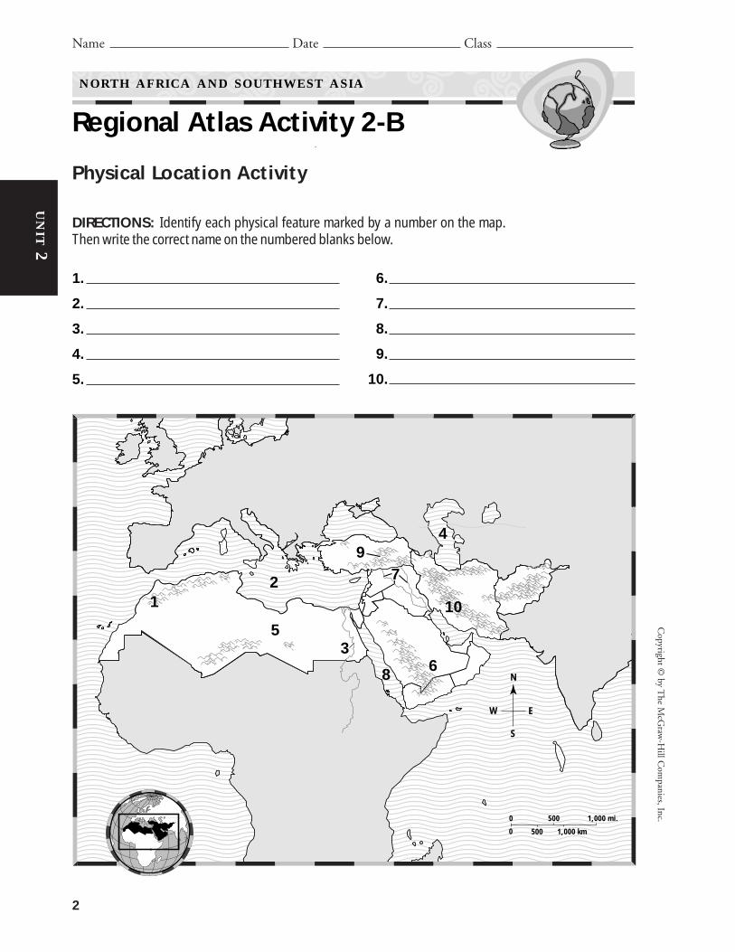
Physical Location Activity
DIRECTIONS: Identify each physical feature marked by a number on the map.Then write the correct name on the numbered blanks below.
2
Copyright ©
by The M
cGraw
-Hill C
ompanies, Inc.
Name Date Class
NORTH AFRICA AND SOUTHWEST ASIA
Regional Atlas Activity 2-B
UN
IT2
1.
2.
3.
4.
5.
6.
7.
8.
9.
10.
0
0
1,000 mi.500
1,000 km500
N
E
S
W
12
3
4
5
6
77
8
10
9

Political Location Activity
DIRECTIONS: Identify each country marked by a number on the map. Then writethe correct name on the numbered blanks below.
3
Cop
yrig
ht ©
by
The
McG
raw
-Hill
Com
pani
es, I
nc.
Name Date Class
NORTH AFRICA AND SOUTHWEST ASIA
Regional Atlas Activity 2-C
UN
IT2
1.
2.
3.
4.
5.
6.
7.
8.
9.
10.
0
0
1,000 mi.500
1,000 km500
2
1
3
4
5
67 8
910
N
E
S
W

City Location Activity
DIRECTIONS: Identify each capital or major city marked by a number on the map.Then write the correct name on the numbered blanks below.
4
Copyright ©
by The M
cGraw
-Hill C
ompanies, Inc.
Name Date Class
NORTH AFRICA AND SOUTHWEST ASIA
Regional Atlas Activity 2-D
UN
IT2
1.
2.
3.
4.
5.
6.
7.
8.
9.
10.
0
0
1,000 mi.500
1,000 km500
N
E
S
W
12 3
45
67 8
9
10

Physical Geography Activity
DIRECTIONS: Find the Unit 2 Regional Atlas physical map on page 74 of your textbook. Then look at the elevation profile below and answer the questions thatfollow.
5
Cop
yrig
ht ©
by
The
McG
raw
-Hill
Com
pani
es, I
nc.
Name Date Class
NORTH AFRICA AND SOUTHWEST ASIA
Regional Atlas Activity 2-E
UN
IT2
1. What landform shown on this profile is atthe highest elevation in Southwest Asia? InNorth Africa?
2. What two bodies of water are at the lowestelevations shown on this profile?
3. Describe the relative location of the NileRiver in relation to North Africa and South-west Asia.
4. What city is shown lying next to the NileRiver on this profile?
5. What large landform lies between the AtlasMountains and the Nile River?
6. What general statements can you make aboutthe physical features of Southwest Asia andNorth Africa?
7. At what latitude is this elevation profileshown?
8. What is the westernmost landform shown onthis profile?
West to East at 30°N latitude
0 250
0 250 500 km0 250 500 km
500 mi.
Atlantic Ocean
Atlas Mountains Cairo
Nile RiverSuezCanal
ZagrosMountains
EuphratesRiver
SinaiPeninsula
SuezCanal
ZagrosMountains
EuphratesRiver
SinaiPeninsula
8,000 m
6,000 m
4,000 m
2,000 m
Sea level
26,247 ft.
19,685 ft.
13,123 ft.
6,562 ft.
Sea level
26,247 ft.
19,685 ft.
13,123 ft.
6,562 ft.
Sea level
NORTH AFRICA AND SOUTHWEST ASIA
SaharaSahara

Cultural Geography Activity
DIRECTIONS: Study the Fast Facts on page 77 in the Unit 2 Regional Atlas of yourtextbook. Then answer the questions below.
6
Copyright ©
by The M
cGraw
-Hill C
ompanies, Inc.
Name Date Class
NORTH AFRICA AND SOUTHWEST ASIA
Regional Atlas Activity 2-F
UN
IT2
1. Which country on the Comparing Popula-tion chart has fewer than 20,000,000 people?
2. Which countries on the Comparing Popu-lation chart have fewer people than Algeria?
3. Which two cities have urban populations ofabout three million?
4. Which country has the largest percentage ofits population living in cities?
5. Which countries have a larger percentage oftheir populations living in rural areas than inurban areas?
6. How many automobiles and telephones doesLibya have per 1,000 people?
7. Which country has more telephones thanautomobiles?
8. Approximately how many people live inEgypt?
9. Which city has more people: Ankara, Turkey,or Alexandria, Egypt?
10. Which country has nearly the same numberof automobiles and telephones per 1,000people?

7
Cop
yrig
ht ©
by
The
McG
raw
-Hill
Com
pani
es, I
nc.
Name Date Class
NORTH AFRICA AND SOUTHWEST ASIA
Regional Atlas Activity 2-G
UN
IT2
Data Table Activity
DIRECTIONS: Study the information in “Country Profiles” on pages 78–79 in theUnit 2 Regional Atlas of your textbook. Fill in the missing data for each country ofSouthwest Asia on the table below. Then answer the questions that follow on thelines below.
1. What is the main language spoken in South-west Asia?
2. Arabic and French are the main languages forwhich country?
3. Which countries have people who also speakKurdish?
Country Language(s)
Afghanistan
Iran
Iraq
Israel
Jordan
Kuwait
Lebanon
Oman
Qatar
Saudi Arabia
Syria
Turkey
United Arab Emirates
Yemen
Languages of Southwest Asia


Americans demand oil for many uses, but agood share of it is used as fuel for their automo-biles. (Oil is used to make gasoline.) In the UnitedStates, about 193 million vehicles burn 122 bil-lion gallons of gasoline a year. The United Statesand Canada produce only about half of thatneeded oil. Where do Americans get their oil andwhat do they pay for it?
Much of the world’s oil is produced in South-west Asia and North Africa. These countries, aswell as Venezuela in South America, formed theOrganization of Petroleum Exporting Countries(OPEC) in 1960. OPEC attempts to set world oilprices by controlling oil production. Their con-trol of oil production has other far-reachingeffects. In October 1973, after the outbreak of theArab-Israeli War, the Arab oil-producing nations
created a gasoline shortage by placing a ban on oilexports to the United States. They lifted the banin March 1974.
In a market economy such as the UnitedStates, the price of goods is determined by sup-ply and demand. Supply is the amount of a goodproduced and available for sale to consumers.Demand is the amount of the good that con-sumers want to buy. For example, the demand for gasoline in the United States is about 122 bil-lion gallons per year. If the supply is the same asthe demand, the price will remain the same. By placing a ban on exports, OPEC reduced thesupply of oil. As a result, prices increased.Generally, when demand is greater than supply,prices rise. When supply is greater than demand,prices fall.
9
Cop
yrig
ht ©
by
The
McG
raw
-Hill
Com
pani
es, I
nc.
Name Date Class
NORTH AFRICA AND SOUTHWEST ASIA
Economics and Geography Activity 2The Demand for Oil
UN
IT2
Directions: Examine the table and line graphs below. Then answer the questionsthat follow in the space provided.
World Crude Oil Production, 1997 (in millions of barrels per day)Organization of PetroleumExporting Countries (OPEC) Non-OPEC Countries
Iran 3.66 Canada 1.89Iraq 1.19 China 3.20Kuwait 2.08 Mexico 3.03Nigeria 2.32 Norway 3.15Saudi Arabia 8.56 Russia 5.88United Arab Emirates 2.32 United Kingdom 2.52Venezuela 3.31 United States 6.41
SOURCE: The New York Times Almanac, 2000, New York, NY, p. 376.

1. According to the table, which country pro-duces the most oil?
2. What was the total oil production per day ofthe OPEC countries in 1997?
3. What was the total world oil production perday in 1997?
4. What does OPEC attempt to do?
5. How much of their demand for oil do theUnited States and Canada produce?
6. Why might the United States leaders be con-cerned about the political situations of themajor oil-producing countries?
7. According to the graph, how has the price ofgasoline changed since 1950?
8. What other products might be affected byhigh oil prices?
9. Explain why gasoline prices changed in the1970s.
10. Critical Thinking Activity The people ofthe United States account for only about 5percent of the world’s population. However,Americans consume close to 25 percent ofthe world’s oil. What might occur in theUnited States if it were suddenly unable toobtain oil from the major oil producers?Write an imaginary news story in which thissituation occurs.
10
Copyright ©
by The M
cGraw
-Hill C
ompanies, Inc.
UN
IT2
140
120
100
80
60
40
20
0
1950
1960
1970
1975
1980
1985
1990
1991
1992
1993
1994
1995
1996
1997Years
Cent
s Pe
r Gal
lon
Gasoline Prices in the United States, 1950 to 1997 (in cents per gallon)
SOURCE: The New York Times Almanac, 2000, New York, NY, p. 376.
NORTH AFRICA AND SOUTHWEST ASIA
Economics and Geography Activity 2 (continued)
Name Date Class

11
Cop
yrig
ht ©
by
The
McG
raw
-Hill
Com
pani
es, I
nc.
UN
IT2
Simply defined, the Suez Canal is a man-made open water channel that connects theMediterranean Sea to the Red Sea.
The 101-mile-long (163 km) canal is morethan that, however. It links the Atlantic and theIndian Oceans together. It is the bridge betweentwo continents, the African and Asian continents.Finally, it is the main channel for trade betweenAsia and Europe. Before the Suez Canal was built,ships had to travel around Africa. No wonder ithas been called one of the most strategic andimportant waterways in the world.
Construction on the canal began in 1859,and took 10 years to complete. More than 1.5million Egyptian workers took part, of whichmore than 125,000 lost their lives working on thecanal. In 1869 the Suez Canal opened for navi-gation. The ownership of the Suez Canalremained largely in French and British hands forthe next 87 years. Egypt took control of the SuezCanal in 1956.
The Suez Canal we see today was not the firstattempt to connect the Mediterranean Sea to theRed Sea. Previous canals were built as early as1874 B.C.
The opening of the Suez Canal had animmediate effect on world travel. In 1800 it tooksix months to travel from London to India. In1870, one year after the canal opened, the sametrip took only two months. The chart at the topof the next page gives examples of how the SuezCanal shortened sea travel distances.
Overall, the canal saves from 20 percent to60 percent in distance and from 25 percent to 50percent of fuel for ships that use the canal ratherthan travel around Africa. Today more than 14percent of the total world trade passes throughthis waterway, making $1.9 billion a year for theEgyptian economy.
NORTH AFRICA AND SOUTHWEST ASIA
History and Geography Activity 2
The Suez Canal
Name Date Class
Mediterranean Sea
ATLANTICOCEAN
INDIANOCEAN
Red Sea
Suez Canal
Cape of Good Hope
AFRICA
SOUTHWESTASIANORTH
AFRICA
N
E
S
W
Directions: Answer the questions below in the spaces provided.
1. What is the Suez Canal? 2. How long is the Suez Canal?
Suez Canal

Copyright ©
by The M
cGraw
-Hill C
ompanies, Inc.
12
UN
IT2
NORTH AFRICA AND SOUTHWEST ASIA
History and Geography Activity 2 (continued)
Name Date Class
Distance via the Distance viaRoute Cape of Good Hope the Suez Canal
Jeddah, Saudi Arabia toConstanta, Romania 11,771 miles (18,940 km) 1,698 miles (2,732 km)
London, England toMumbai, India 12,400 miles (19,952 km) 7,250 miles (11,665 km)
3. Before the Suez Canal was built, what con-tinent did ships have to travel around?
4. How many Egyptians worked on the canal?
5. Who controlled the canal until the Egyptiangovernment took ownership of it in 1956?
6. On average, using the Suez Canal shortensthe length of a ship’s journey by how much?
7. What seas does the Suez Canal connect?
8. Making Inferences Locate the Cape ofGood Hope on the map. Did ship traffic at
the Cape of Good Hope increase or decreaseafter 1869? Justify your answer.
9. Mapping Activity Copyor trace a world map. Thenlocate each city in the pairs
listed below. Using a color or solid line, tracethe sea route between the pairs of cities usingthe Suez Canal. Then use the same color dot-ted line to trace the sea route between the citypairs if the sea route involves travelingaround the Cape of Good Hope in southernAfrica. Finally, create a legend for the mapthat shows the color used for each pair ofcities.
From ToLondon, England Tokyo, JapanRotterdam, Mumbai, India
NetherlandsOdesa, Ukraine Jeddah, Saudi ArabiaLisbon, Portugal Aden, Yemen

OverviewIn October 2001, the United States began assist-ing the Northern Alliance of Afghanistan in itsarmed resistance to the ruling Taliban regime. Per-sistent bombing, combined with ground attacks,eventually drove the Taliban from Afghanistanand opened the way to establishing a governmentmore representative of all the Afghan people. Thenew government faces many immediate problems,but the problem of enough food for its people isthe biggest challenge. Afghanistan was in themidst of a grave food crisis. A severe drought, plusdifficult economic and social problems brought onby decades of international and civil conflict, hadpushed the agricultural system of this countryalmost to the point of collapse, with millions ofAfghans facing starvation.
Drought By 2001, a three-year-long droughthad contributed to the almost total failure of rain-fed crops such as wheat and barley, and substan-tially reduced irrigated crops as well. As cropsfailed, not only was food for immediate use lost,but also seed to plant for the next year’s crops aswell. Food production in neighboring countriessuch as Pakistan, Iran, Tajikistan, Uzbekistan andTurkmenistan also suffered because of thedrought, reducing their ability to assist theAfghan people.
The drought also affected livestock herds,with serious consequences for the Afghan nomadsthat tend them. With little food for their livestockto eat, and no access to veterinary medicines, theherdsmen were forced to sell off their cattle,sheep, and goats at low prices or watch themstarve to death as well.
The environment suffers from a number ofproblems, including deforestation from thedemand for fuel for heating in harsh winters,desertification, soil degradation and erosion, water
pollution, water scarcity as a result of decimatedirrigation systems, and contamination of food.
Land Mines and War Damage Thousands ofacres of fertile agricultural land were no longeravailable for farming. This was due to millions ofland mines planted by Russian troops during the1980s and warring Afghan factions in the 1990s,as well as the destruction of irrigation systems.
Afghanistan is one of the most heavily minedcountries in the world. Despite a decade-longmine removal program, millions of land mines lieburied across the country. Some land mines werecarefully laid, and crude maps exist to help the de-miners find and destroy those land mines. Butmany were scattered randomly, and finding theseis a slow, painstaking, and dangerous process. Inthe year 2000 there were 88 mine casualties permonth, a steep drop from the 5 to 10 per day in1999. Still, it is estimated that half of mine casu-alties die before they get medical treatment.
13
Cop
yrig
ht ©
by
The
McG
raw
-Hill
Com
pani
es, I
nc.
Name Date Class
Environmental Case Study 2
NORTH AFRICA AND SOUTHWEST ASIA
Farming in a Minefield
UN
IT2
0
0 150 300 km
150 300 mi.
TURKMENISTAN
UZBEKISTAN
TAJIKISTAN
KYR.CHINA
INDIA
PAKISTANIRAN
INDIA
Shindand
Zaranj
BagramKABUL
Line ofcontrol
Hindu Kush
Herat
Kandahar
Shir KhanShir KhanKonduz
JalalabadJalalabad
KheyrabadKheyrabad
Towraghon
Mazar-eSharif
Ghazn
N
E
S
W
Afghanistan

Irrigation systems of aqueducts and pipesserving agricultural areas and residential com-munities were severely damaged in both the con-flict with the Russians and subsequent internalstrife. Without a strong central government toorganize programs to repair and rebuild, thedestruction became permanent.
Economic Difficulties As the economy ofAfghanistan deteriorated, employment opportu-nities for the Afghan people became more lim-ited. Economic activity was reduced to little morethan subsistence farming and cross-border trade.
Up to 85 percent of the people depend onagriculture for their livelihood. A major crop inAfghanistan was poppies, used in making opium.The drought, dangerous conditions in the fields,and a Taliban-imposed ban caused a dramaticdrop in poppy cultivation. While this was a pos-itive development worldwide, it left many farm-ers without an income.
Involvement in the opium trade and its tol-erance of terrorists isolated Afghanistan further.Neighboring countries limited contact by closingtheir borders. Distant countries froze Afghaniassets and enacted sanctions against investment inAfghanistan. This created even more economicdifficulties for the Afghan people.
While the Taliban was in power it bannedwomen from working outside the home anddenied them an education. This effectively cut theworkforce in half. Although the Taliban no longer
rule the government, traditional attitudes maystill make it difficult for women to participatefully in society.
Without a chance to earn money, and deniedthe chance to grow food of their own on heavilymined farm fields, more and more families facedstarvation. It is estimated that five millionAfghans have little or no access to food andrequire humanitarian food aid. Refugees return-ing from neighboring countries will make the sit-uation even more desperate.
Solutions Two decades of conflict have reducedAfghanistan to one of the world’s poorest coun-tries. Solving the many interdependent problemswill not be easy.
In the short term, massive shipments of foodaid help Afghanis get through the harsh winter.After the fall of the Taliban, the United NationsFood and Agricultural Organization launched a$10 million dollar appeal that enabled it to resumeimmediate emergency assistance and provideseeds, fertilizers, feed, and vaccines for animals.
In the long term, Afghanistan does have thecapacity to meet its agricultural needs if it gets enough rain. It also has considerable mineralwealth in hydrocarbon resources and gemstones.With the political conflict resolved and a stablegovernment in place, attention can turn to build-ing Afghanistan’s agricultural systems. Repairingirrigation and farm power systems, replantingorchards and forests, replenishing livestock herds,
and re-establishingagricultural educa-tion programs are allpriorities.
14
Copyright ©
by The M
cGraw
-Hill C
ompanies, Inc.
NORTH AFRICA AND SOUTHWEST ASIA
Environmental Case Study 2 (continued)
UN
IT2
Name Date Class
1. It is estimated that there are 10 million land minesin Afghanistan.
2. Mine-clearers make about $105 a month inAfghanistan, where the average monthly wage is $4.
3. In 1999 rainfall was 70 to 90 percent less than in1998.
4. At the end of 2001 there were 3.6 million Afghans living as refugees.
It's a
FACT

Farming in a Minefield:Review the FactsDirections: Write the answer to each question inthe space provided.
1. What countries in Southwest Asia have beenaffected by the extended drought?
2. Who planted landmines in Afghanistan?
3. Why have the irrigation systems destroyed bywar not been rebuilt or repaired?
4. Why did Afghanistan become isolated inter-nationally? How did other countries respond?
5. What immediate benefits come from improv-ing the situation of women in developingcountries?
15
Cop
yrig
ht ©
by
The
McG
raw
-Hill
Com
pani
es, I
nc.
NORTH AFRICA AND SOUTHWEST ASIA
Environmental Case Study 2 (continued)
UN
IT2
Name Date Class
There is an ancient African proverb, “With-out women we all go hungry.” Women pro-duce 60 to 80 percent of the food supplyin developing countries. In Africa they pro-vide 80 percent of the staple foods, and inAsia they perform 90 percent of the work inrice fields.
It is difficult for rural farmers—men andwomen—to obtain credit, improved tools,and technology. However, traditional beliefsmake it even more difficult for women farm-ers to gain the resources they need to be successful. When women’s access toeducation, credit, and other resources in-creases, their incomes rise, birth ratesdecline, and children’s health and educa-tional opportunities improve. A recent WorldBank study showed that if women receivedthe same education as men, food produc-tion would increase 22 percent. Yet womenfarmers benefit from only five percent offarm education programs.
Scientists are beginning to use theirunderstanding of women’s issues to createeffective programs for farmers with fewresources. This includes developing cropsthat grow rapidly, cook easily, and are higherin protein and other basic nutrients.Research that takes into account women’sknowledge and concerns will increase pro-ductivity, manage natural resources better,and maintain peace through a plentiful foodsupply. And this benefits the entire world.
WOMEN FEED THE WORLD

16
Copyright ©
by The M
cGraw
-Hill C
ompanies, Inc.
NORTH AFRICA AND SOUTHWEST ASIA
Environmental Case Study 2 (continued)
Name Date Class
There are many organizations at work toimprove the lives of refugees and impoverishedpeople in Afghanistan and other places aroundthe world. Learning about what these groupsare doing will help you and others understandthe situation and what you might be able to doto help. Form a team of three or four studentsand choose one of the organizations listed belowor another you know about. Work together tocreate a classroom learning center about theorganization you have selected.
Concern Worldwide US, Inc.www.concernusa.orgWorking in Afghanistan since 1998, Concernprovides basic humanitarian needs.
Cooperative for Assistance and Relief Everywhere (CARE)www.care.orgProviding humanitarian assistance in four key areas: shelter, food distribution, distribution ofother basic items (for example, pots and utensils for cooking), and health education.
Doctors Without Borders (Medecins san frontieres)www.doctorswithoutborders.orgProviding medical assistance in sections of northern Afghanistan.
Red Crosswww.redcross.orgSupplying food, water, and medical supplies to Afghanistan.
UNICEFwww.unicefusa.orgInternational development and relief services for children.
What to Do1. Use the Internet or library resources to research the organization
you have chosen. Find out about its members, activities, location, andsources of funding. Consider visiting if a regional office is nearby.
Create a Classroom Learning Center
• magazines• poster board• butcher paper• paints or markers• audiocassette player
(optional)• videocamera (optional)• access to a library and/or
the Internet
Materials
UN
IT2

17
Cop
yrig
ht ©
by
The
McG
raw
-Hill
Com
pani
es, I
nc.
NORTH AFRICA AND SOUTHWEST ASIA
Environmental Case Study 2 (continued)
Name Date Class
UN
IT2
2. Find ways to present your information that will be interesting to yourclass and other students. For instance, you could create a mural, col-lage, annotated map, or display on a large piece of poster board. Youcould write a script and make an audiocassette recording.
3. As a handout, make a fact sheet about the organization that includespictures of its members at work.
4. Set up your display on a table or desk in your classroom. Take turns“hosting” your presentation, and visit the displays of other groups.
Create a Classroom Learning Center (continued)

Why It’s Important The United States Bill ofRights protects the individual rights of the citi-zens of the United States. Many countries do nothave a bill of rights. Without a bill of rights, gov-ernments may ignore the rights of the people. Incountries like Iraq, citizens are not allowed tospeak freely against the government. To do socould mean going to prison or even death. Inother countries, such as Libya, government secu-rity forces can arrest and torture citizens.
BackgroundThe first 10 amendments to the United
States Constitution are known as the Bill ofRights. After the Constitution was ratified, oraccepted, by all the states, some Americansbelieved it did not protect the individual rightsof the citizens. Many colonists did not want astrong federal government. These colonistsbelieved that protecting the people’s individual
rights was one of the most important tasks of thegovernment.
Encouraged by Thomas Jefferson, JamesMadison wrote the first draft of the Bill of Rights.Twelve amendments that protected individualrights were submitted to Congress in 1789. Ofthese 12 amendments, Articles 3 through 12 wereratified. In 1791, these articles became the first10 amendments to the U.S. Constitution. Theybecame known as the Bill of Rights.
Other democratic countries have similar pro-tections of individuals’ rights. However, there arestill many countries with other types of govern-ments that may not have a bill of rights to pro-tect citizens’ individual rights.
Questions to ConsiderDirections: Answer the questions below on aseparate sheet of paper.
1. Do you think it was important for theFounders of the United States to include theBill of Rights in the Constitution? Why orwhy not? Why do you think some colonistsbelieved that protecting individual rights wasan important task of the federal government?
2. Many countries without a bill of rights havehuman rights problems. Why do you thinkthis is so? Do you think individuals should befree to speak out against the government? Whyor why not? Do you think all governmentsshould have a bill of rights? Why or why not?
3. Why might some citizens not want a strongfederal government? Do you think a strongfederal government is a good thing for the cit-izens? Why or why not?
4. Which do you think is more important, astrong federal government or individualrights? Can a government provide both? If so,how?
19
Cop
yrig
ht ©
by
The
McG
raw
-Hill
Com
pani
es, I
nc.
Name Date Class
NORTH AFRICA AND SOUTHWEST ASIA
Citizenship Activity 2Creating a Students’ Bill of Rights
UN
IT2

5. If you believe the U.S. government is violat-ing your individual rights, what could you doto change the situation? Do you think youhave a right to help citizens of other countriesif their government violates their individualrights? If so, what could you do to help citi-zens of other countries?
6. What is the government of your school like?Is it ruled by a strong administration? By theprincipal and teachers? Do the individual stu-dents and their parents have a vote in therules of the school and school district?
7. How do you think your school should beruled? Defend your position. If you believe aschool rule is unfair to students, do you thinkyou have a right to try to change it? Howmight you go about changing a school rule?
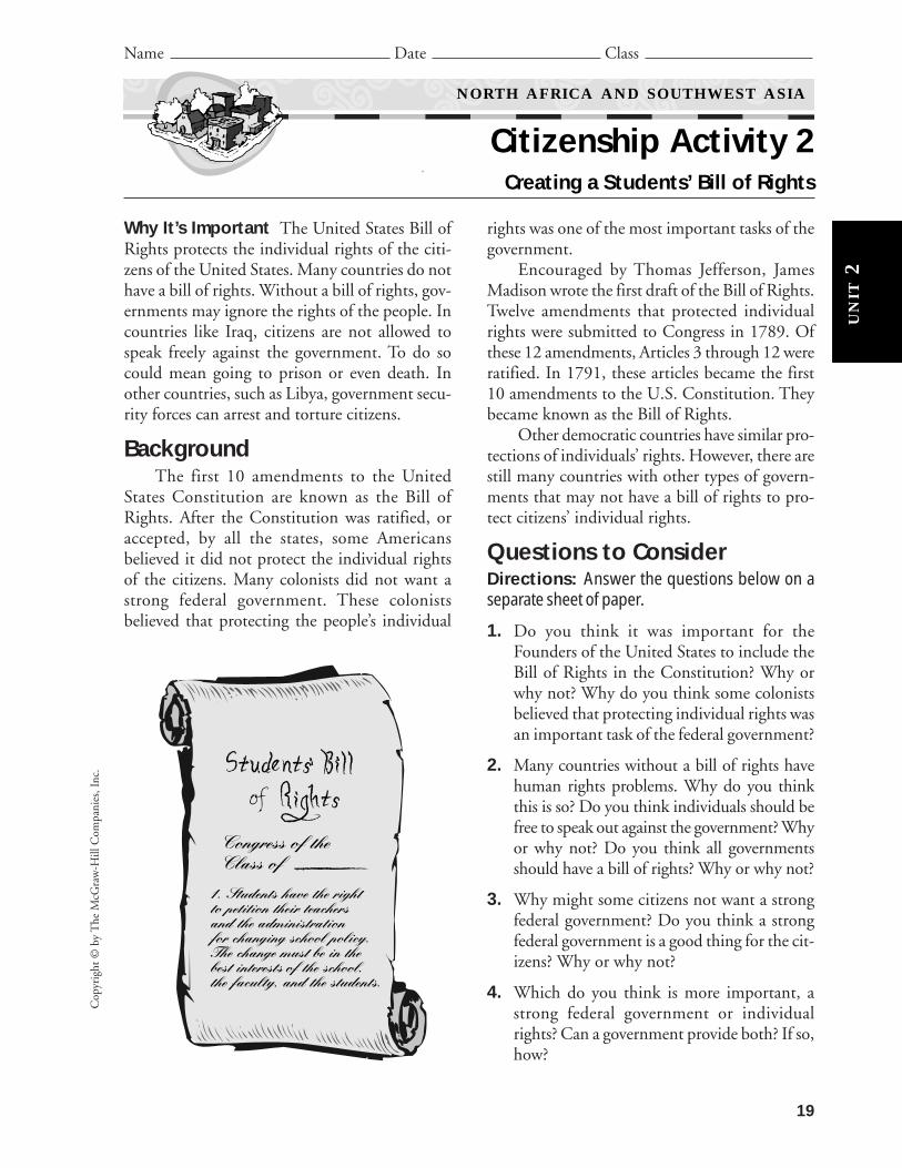
Your TaskYour task is to create a students’ bill of rights
for your school. Write 10 ideas that you believeare important that protect your rights as a stu-dent. Using poster board and markers, create aposter for your students’ bill of rights.
How to Do ItDirections: Follow the steps below to completethe activity.
1. Research the U.S. Bill of Rights. Keep a copyof the United States Bill of Rights nearby forreference while you write your students’ billof rights.
2. Work in about five small groups. Talk aboutwhat rights you believe your students’ bill ofrights should have in it. For example, your listmight include the following:
Students have the right to petition their teach-ers and the administration for changing schoolpolicy. The change must be in the best inter-ests of the school, the faculty, and the students.
3. Each group is to write two ideas for your stu-dents’ bill of rights for a total of 10 rights.
4. Come together as a class. Have someone copythe rights from each group on the board.Change any rights that the majority does notagree with.
5. Read the final list of rights aloud. Edit therights to make sure everything is correct.Make any necessary changes.
6. Using a computer, type your students’ bill ofrights and print it out on 8 1/2″ � 11″ sheetof paper. Make copies for everyone in theclass.
7. Using poster board, as a class create a posterof your students’ bill of rights. Display yourposter in the classroom.
Follow-Up ActivityAsk other classes in your school to write a
students’ bill of rights. Compare their students’bill of rights with the one your class created. Thenform a committee from all the classes to write astudents’ bill of rights for your school.
20
Copyright ©
by The M
cGraw
-Hill C
ompanies, Inc.
NORTH AFRICA AND SOUTHWEST ASIA
Citizenship Activity 2 (continued)
Name Date Class
Even though yourfreedom of speech is pro-tected under the FirstAmendment, there are still
limitations on this freedom. According tothe United States Supreme Court—thehighest court in the country—you cannotspeak if doing so causes “clear and presentdanger.” For example, if you shout “Fire!”in a crowded area and there is no fire, youcould create panic. This may result in peo-ple getting injured. Because you are creat-ing a potentially dangerous situation forothers, you are breaking the law.
Did YouKnow?
UN
IT2
Cop
yrig
ht ©
by
The
McG
raw
-Hill
Com
pani
es, I
nc.
Name Date Class
NORTH AFRICA AND SOUTHWEST ASIA
World Literature Reading 2
UN
IT2
About the Selection For many years Israel has hadan uneasy relationship with its Arab neighbors. Attimes war has broken out. In part, the controversy isdue to whether the Golan Heights area belongs toIsrael or Syria. Smoke Over Golan is a novel about ayoung boy who took part in the 1973 Yom Kippur Warin Israel. This excerpt from the novel tells about howthe boy, Eitan, came to live on a farm in the GolanHeights.
Guided Reading As you read, look for elements that show what life in Israelmight be like. Then answer the questions that follow.
TO N E OT- G O L A N
f r o m S M O K E OV E R G O L A Nb y U r i e l O f e k
I shall begin at the beginning, maybe even a bit before that. It’s important.We’ve been living here at Neot-Golan for six years. Before that we lived
in Hadera, but I don’t remember much from those days. They seem to have hap-pened even before I was born (who can imagine it?). Well, I was only about fiveand a half at the time.
But one particular evening I remember very well.The two of us—Mom and I—were sitting in the room. Mom was in the
armchair, knitting a sweater. I was on the floor, with my drawing pad. The radiowas on. Suddenly I heard Dad’s pickup truck stopped by the window. Its doorslammed shut, the house door opened, and Dad came in—tall, tanned, hairblown wild, his bright eyes on us.
“Everything’s in order,” he said, shedding his coat. “We’re going up tomor-row.” …
“To the Heights?” Mom asked.“Affirmative,” Dad replied, in his favorite army talk. “You’ll have every-
thing ready?”“Yes. Everything. Now go and wash up. The water is hot, and so is supper.”I was very young then. I understood more or less what my folks were talk-
ing about, but how could I have known that this talk meant that our lives weregoing to change—and so suddenly!
Re a de r ’ s D i c t i o n ar y
basalt: a dark gray or blackigneous rock
hillocks: small hillspost: a place at which a soldier is
stationed
21

Copyright ©
by The M
cGraw
-Hill C
ompanies, Inc.
NORTH AFRICA AND SOUTHWEST ASIA
World Literature Reading 2 (continued)
UN
IT2
Name Date Class
Two days later—it was on Wednesday, actually—we climbed into thetruck. Dad was at the wheel, Mom next to him, and I sat behind them in our wickerchair, among the furniture and the crates. The next minute we were off on ourlong trip, to a new life about which I knew nothing.
We drove northward, through Wadi Ara and past Afula, and still keptgoing north. We passed Tiberias and Rosh-Pinna, and here the truck turned tothe east. We crossed the Jordan River by Bnot Yaacov Bridge, past the old Britishcustoms depot, and kept climbing. For about half an hour the truck continuedalong the narrow road. I had a look at the route on both sides; the road was linedwith gray basalt. Deep and narrow gullies. Small stone huts scattered here andthere. A few cows grazing among the bushes, under the watchful eye of an Arabshepherd. Once in a while an abandoned concrete post would flash by. A mili-tary vehicle passed us, and the driver waved to me.
Suddenly the truck turned onto a dirt road and kept bumping and grind-ing through large and empty fields. I was afraid I couldn’t hold on, but suddenlyDad cut the motor and the truck stopped.
“You can climb down, Eitan,” he said. “We’re home.”I jumped down from the truck and stood next to my dad. I saw an old but
pretty stone house, in the shade of oak trees. A bit beyond it, close to each other,were two other buildings: a barn with a dozen cows in it and a stable with horses.Another building, the chicken coop, was still being built. All around us werelight-brown hillocks, and to the northeast the snowy crest of Mount Hermon glis-tened in the distance.
“We’re home,” Dad repeated, and I could hear the tone of pride in hisvoice.
“Neot-Golan,” said Mom. So that was the name of our farm! Mom wassmiling, but I thought I heard a hidden sigh? …
We went into the house. Mom went to the kitchen and Dad opened the windows.
I climbed up on the first chair I saw, curled up—and that’s the end of whatI remember of our first day here, in Neot-Golan.
Source: Uriel Ofek. Smoke Over Golan. Translated by Israel I. Taslitt. Harper &Row Publishers, Inc., 1979.
Analyzing the Reading
1. What was Eitan doing when his father drove up to announce they weremoving?
22

Cop
yrig
ht ©
by
The
McG
raw
-Hill
Com
pani
es, I
nc.
23
NORTH AFRICA AND SOUTHWEST ASIA
World Literature Reading 2 (continued)
UN
IT2
About this Selection We Live in Saudi Arabia byAbdul Latif Al Hoad is a collection of short essays toldby people of different professions living in Saudi Ara-bia. This selection is written by Mohammed binAbdullah Al Shaiq who lives in Riyadh with his fam-ily. In his spare time he manages the family farm atMuzahimiya outside Riyadh.
Guided Reading As you read this selection, noticewhat crops and animals are grown and raised on thisfarm. Then answer the questions that follow.
W E LI V E I N S AU D I A R A B I Ab y A b d u l La t i f A l H o a d
Four years ago my father bought a large piece of land just outside Muza-himiya, which is on a plain about 112 km (70 miles) from Riyadh. This was to be thebeginning of a great enterprise! We had plans to establish a market garden and toindulge our love of animals by breeding horses, camels, goats and sheep.
First of all we had to drill wells for water, as there was nothing here butthornscrub and sand! This was, however, what we call “sweet” sand, that is, sandwithout too much salt and other minerals that would not allow plants to grow.
We can find water around Muzahimiya, at a depth of about 200 m (656 ft),although it is very brackish water and tastes very salty. But it is good enough for
2. How old was Eitan when he and his family moved to Neot-Golan?
3. Critical Thinking Name two things that Eitan saw during his trip toNeot-Golan that might indicate past or present uneasiness with neighbor-ing countries.
Re a de r ’ s D i c t i o n ar y
enterprise: a project or under-taking
thornscrub: a thorny, underde-veloped tree or shrub
brackish: salty, not tasty, repul-sive
cultivation: the preparing of landfor raising crops
tamarisk: desert shrubs and treesfound in Europe having tinynarrow leaves and masses ofsmall flowers
Name Date Class

most plants, and enabled us to start cultivation as soon as we had installed thepump, leveled the ground and dug water channels to distribute the water aroundour 9 hectares (20 acres). The land here is extremely fertile and only water isrequired for almost anything to grow.
Around the entire area we planted rows of a quick-growing type of treecalled tamarisk, which serve as wind breaks. We then brought in date palms. Thesewere partially grown in a nursery and were about 3.5 m (10 ft) high when they cameto us four years ago. They bore fruit this year for the first time. A very exciting eventfor us!
The main crop of the farm is lucerne, which is sometimes called alfalfa. Butwe also grow melons, cucumbers, pumpkins, zucchini and tomatoes in the spring,and corn, cabbage, and potatoes in the autumn. These are sold at the Oteiga mar-ket in Riyadh.
Animals cannot drink the salty water, so we had to drill for fresh water. Totell us exactly where to drill, we consulted a water diviner, who, with the use of aspecial forked stick, is able to discover the location of water. I was doubtful abouthis skills until we drilled at the spot he suggested and struck water immediately! Wehad to drill much deeper for sweet water, however, to a depth of more than 500 m(1600 ft).
Once we had a well producing fresh water, we could really start keepinganimals. Before we had only kept a few because it was so expensive to have waterbrought in by water truck. Apart from a number of horses and camels, we alsohave about 500 sheep and goats.
Source: Abdul Latif Al Hoad. We Live in Saudi Arabia. New York: The BookwrightPress, 1987.
Analyzing the Reading
1. What is the main crop produced on this farm in Saudi Arabia?
2. What animal named in this selection would not likely be found on a farmin the United States?
3. Critical Thinking Do you think farming in Saudi Arabia is really so different from farming in the United States? Explain your answer.
Copyright ©
by The M
cGraw
-Hill C
ompanies, Inc.
NORTH AFRICA AND SOUTHWEST ASIA
World Literature Reading 2 (continued)
UN
IT2
Name Date Class
24
CH
AP
TE
R3
25
Chapter 3 Resources
Vocabulary Activity 3:North Africa and Southwest Asia—Early Cultures 26
Cooperative Learning Activity 3:Who Am I? 27
Chapter Map Activity 3:North Africa and Southwest Asia—Early Cultures 29
Chapter Skills Activity 3:Using Latitude and Longitude 33
Reteaching Activity 3:North Africa and Southwest Asia—Early Cultures 35
Critical Thinking Skills Activity 3:Drawing Conclusions 37
Map and Graph Skills Activity 3:Using Technology: Using an Electronic Spreadsheet 39
Reading and Writing Skills Activity 3:Writing a Rough Draft 41
GeoLab Activity 3:Let It Grow 43
Enrichment Activity 3:Hieroglyphics 45

DIRECTIONS: Matching Select a term that matches each definition below.Write the correct term in the space provided.
pharaoh Diaspora monotheism five pillars of faiththeocracy scapegoat cuneiform civilizationpyramid polytheistic hajj messiah
hieroglyphics
1. The term historians use to describe a culture that has reached a certain level of development is
.
2. The kind of government of city-states in which the ruler was both the religious leader and the
king is .
3. The Sumerian method of writing using wedged-shaped markings on moist clay tablets is
.
4. A name for an ancient Egyptian ruler is .
5. A religion that has many gods is .
6. Egyptian tombs for pharaohs are .
7. The ancient Egyptian form of picture writing is .
8. The belief in one supreme god is .
9. The scattering of Jews outside of the Holy Land is the .
10. The savior that Jews believe God will deliver to the Jewish people is a .
11. Military campaigns organized by Catholic popes and kings to capture the city of Jerusalem were
.
12. The obligations all Muslims must fulfill are the
.
13. A pilgrimage to Makkah to pray is the .
DIRECTIONS: Writing Sentences Use each of the following terms correctlyin a complete sentence. Write the sentences on a separate sheet of paper.
irrigation system city-state empire deltapapyrus scapegoat disciples minister
26
Copyright ©
by The M
cGraw
-Hill C
ompanies, Inc.
Name Date Class
NORTH AFRICA AND SOUTHWEST ASIA—EARLY CULTURES
Vocabulary Activity 3
CH
AP
TE
R3

BackgroundReligion was very important to the Egyptians. They believed in gods to
explain what they could not understand. For instance, why did the Nile Riverrise each year? When they did not understand something they invented a godto explain it. They worshiped many gods, and created stories for each one. Thesestories are called myths. The primary gods were part of a large family, but therewere many minor gods as well. Learning about some of the gods will help youunderstand how the Egyptians thought about their world
Group Directions1. Use Chapter 3 and library resources or the Internet to learn about Egyptian
gods and goddesses and their myths. The study of myths is called mythology.
2. Use what you learn to write descriptions of gods and goddesses of theancient Egyptians.
3. Choose one god or goddess and read a myth about him or her. Then writethe story in your own words without revealing the identity of the being.Instead, put yourself in the story. Your classmates will try to guess who youare.
4. The following box lists the ancient Egyptian gods and goddesses that youwill study.
Organizing the Group1. Decision Making As a group, divide up the list of gods and goddesses
among group members. Make sure to cover all of them.
2. Individual Work Do research on your assigned gods and goddesses. Writea brief description of each one.
3. Group Work/Decision Making Share your descriptions with your group.Together, compile the descriptions into one list. Select someone to copythe list and give it to everyone in the group. Each group member should
27
CH
AP
TE
R3
Nut Sekhmet Horus AmunGeb Isis ThothRa Osiris AnubisHathor Seth Ma’at
Cop
yrig
ht ©
by
The
McG
raw
-Hill
Com
pani
es, I
nc.
Who Am I?
Name Date Class
NORTH AFRICA AND SOUTHWEST ASIA—EARLY CULTURES
Cooperative Learning Activity 3

select one god or goddess to explore further. Each person should choose adifferent being. You do not have to cover every one in the list.
4. Additional Individual Work Find an interesting myth about your godor goddess. Rewrite the story in your own words. Do not use the being’sname. Instead, write it as if you were the god or goddess. Give hints to thebeing’s identity in the story. At the end of the story, write “Who am I?” Yourmyth should be no longer than one page. Draw a picture of what the godor goddess looks like to go along with your story.
5. Additional Group Work Take turns reading your myths to the group.Give one another suggestions for improving the stories. Revise your storiesinto final form.
6. Group Sharing Take turns reading your stories to the class. At the endof the story, ask “Who am I?” The other group members should try to guessyour identity. Members can use their group’s list of descriptions to help iden-tify the gods and goddesses in the stories.
Group Process Questions• What is the most interesting thing you learned about Egyptian gods and
goddesses from this activity?
• What part of the project did you enjoy most?
• What problems did you have?
• How did you solve the problems?
• How was it helpful to work with others?
Quick Check1. Was the goal of the assignment clear at all times?
2. Did you have problems working well together? If so, how did you solvethem?
3. Were you satisfied with your work on this project? Why or why not?
28
Copyright ©
by The M
cGraw
-Hill C
ompanies, Inc.
CH
AP
TE
R3
NORTH AFRICA AND SOUTHWEST ASIA—EARLY CULTURES
Cooperative Learning Activity 3 (continued)
Name Date Class

Physical Maps
Place Location ActivityReproduce the physical map of Southwest Asia for eachstudent. Ask students to:• Label the countries. (Afghanistan, Bahrain, Iran, Iraq,
Israel, Jordan, Kuwait, Lebanon, Oman, Qatar, SaudiArabia, Syria, Turkey, United Arab Emirates, Yemen)
• Label the rivers and major bodies of water. (TigrisRiver, Euphrates River, Caspian Sea, Persian Gulf,Gulf of Oman, Arabian Sea, Gulf of Aden, Red Sea,Mediterranean Sea, Black Sea; North Africa: AtlanticOcean, Mediterranean Sea, Red Sea)
• Label the following: Hindu Kush, Plateau of Iran,Elburz Mountains, Zagros Mountains, Anatolia, Tau-rus Mountains, Syrian Desert, Arabian Peninsula,Rub‘ al Khali, Hejaz Asir
Reproduce the physical map of North Africa. Ask stu-dents to:• Label the countries. (North Africa: Algeria, Egypt,
Libya, Morocco, Tunisia)• Label the rivers and major bodies of water. (Nile River,
Atlantic Ocean, Mediterranean Sea, Red Sea)• Label the following: Ahaggar Mountains, Atlas
Mountains, Western Sahara, Aswan High Dam, SinaiPeninsula.
Discussing the Maps1. True or false: Afghanistan is situated on the Arabian
Peninsula. (false)2. What made the area around the Tigris and Euphrates
Rivers a good place for early human civilizations?Explain your answer. (Early civilizations arose therebecause there was an ample supply of water for peopleto use and because the land was fertile.)
3. True or false: The Mediterranean Sea is the source ofthe Nile River. (False; the Nile’s sources are in EastAfrica. The river flows into the Mediterranean Sea.)
4. Based on the map, where in North Africa would youhave expected early human civilizations to have devel-oped? Explain your answer. (Early human civiliza-tions developed in Egypt near the Nile River whichsupplied water and supported agriculture.)
Mesopotamia and the Fertile Crescent Map
Place Location ActivityReproduce the Mesopotamia and the Fertile Crescentmap for each student. Ask students to:• Label the following land areas: Europe, Asia Minor,
Phoenicia, Persia, Akkad, Sumer, Egypt, Sinai Penin-sula, and Arabian Desert.
• Label the Black Sea, Mediterranean Sea, Red Sea, Persian Gulf, Nile River, Tigris River, and EuphratesRiver.
• Locate and label the following cities: Tyre, Nineveh,Babylon, and Ur.
• Circle the names of land areas and bodies of waterthat still have the same name today. (Europe, BlackSea, Persian Gulf, Arabian Desert, Syrian Desert,Sinai Peninsula, Red Sea, Egypt, Nile River, TigrisRiver, Euphrates River)
Discussing the Map1. What do the four cities shown on the map have in
common? (They are all located near a body of water.)2. Which city is not located on a river? (Tyre)3. Which city is located the farthest north? (Nineveh)
APPLYING GEOGRAPHY SKILLSCreating a Map QuizYou may use the following activity as a cooperative learn-ing activity or extra credit project.
Tell students that the area shown on the map is located inSouthwest Asia. Have students locate a map showing thepresent day boundaries of the countries in SouthwestAsia. Have students draw in the current country bordersand label the current countries. Once students have com-pleted their maps, organize them into small groups tocreate a five-question quiz that can be answered from themap. Have teams take turns asking another group theirquestions and timing how long it takes for the othergroup to answer correctly.
29
Cop
yrig
ht ©
by
The
McG
raw
-Hill
Com
pani
es, I
nc.
NORTH AFRICA AND SOUTHWEST ASIA—EARLY CULTURES
Chapter Map Activity 3Teaching Strategy
Civilizations are levels of human development that include systems of writings, dwelling incities, and worker specialization. Although people lived on the earth long before civilizationsarose, our first written records of human history date to these early civilizations.
CH
AP
TE
R3

30
Copyright ©
by The M
cGraw
-Hill C
ompanies, Inc.
Name Date Class
NORTH AFRICA AND SOUTHWEST ASIA—EARLY CULTURES
Chapter Map Activity 3
CH
AP
TE
R3
N
E
S
W0
mi.
0 km
500
250 50
025
0
Sout
hwes
t A
sia:
Phy
sica
l

31
Cop
yrig
ht ©
by
The
McG
raw
-Hill
Com
pani
es, I
nc.
Name Date Class
NORTH AFRICA AND SOUTHWEST ASIA—EARLY CULTURES
Chapter Map Activity 3
0 m
i.
0 km
500
250 50
025
0
N
E
S
W
CH
AP
TE
R3
No
rth
Afr
ica:
Phy
sica
l

32
Copyright ©
by The M
cGraw
-Hill C
ompanies, Inc.
Name Date Class
NORTH AFRICA AND SOUTHWEST ASIA—EARLY CULTURES
Chapter Map Activity 3
0 mi.
0 km
500500
500Lambert Azimuthal Equal-Area projection
Mesopotamia
Fertile Crescent
N
E
S
W
CH
AP
TE
R3
Mesopotamia and the Fertile Crescent
33
Cop
yrig
ht ©
by
The
McG
raw
-Hill
Com
pani
es, I
nc.
Name Date Class
NORTH AFRICA AND SOUTHWEST ASIA—EARLY CULTURES
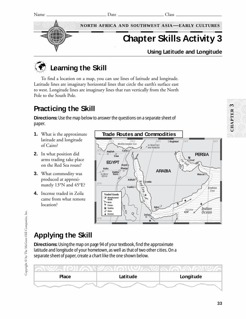
Chapter Skills Activity 3Using Latitude and Longitude
CH
AP
TE
R3
Learning the SkillTo find a location on a map, you can use lines of latitude and longitude.
Latitude lines are imaginary horizontal lines that circle the earth’s surface eastto west. Longitude lines are imaginary lines that run vertically from the NorthPole to the South Pole.
Practicing the SkillDirections: Use the map below to answer the questions on a separate sheet ofpaper.
1. What is the approximatelatitude and longitudeof Cairo?
2. In what position didarms trading take placeon the Red Sea route?
3. What commodity wasproduced at approxi-mately 13°N and 45°E?
4. Incense traded in Zeilacame from what remotelocation?
Applying the SkillDirections: Using the map on page 94 of your textbook, find the approximatelatitude and longitude of your hometown, as well as that of two other cities. On aseparate sheet of paper, create a chart like the one shown below.
Blue Nile
Nile
60ºE50ºE40ºE30ºE20ºE
30ºN
20ºN
10ºN
ARABIA
PERSIA
EGYPT
Mediterranean Sea
IndianOcean
ArabianSea
The Gulf
Red Sea
Baghdad
Siraf
Jedda
Aden
Asyut
Siwa
Awjilah
Kufra Kharga
DakhlaOasis
Cairo
Aidhab
Suakin
Muscat
Zeila
to Near Eastand Anatolia
to WestAfrica
Socotra
Traded GoodsManufacturedGoodsArmsSlavesTextilesGlass Incense
Place Latitude Longitude
Trade Routes and Commodities


Egypt, in North Africa, and Mesopotamia,in Southwest Asia, are the earliest known humancivilizations, dating back about 6,500 years.Judaism, Christianity, and Islam are three of the
world’s monotheistic religions and all were devel-oped in Southwest Asia. Learning about past cul-tures and the development of these religions helpsus better understand our own culture.
35
Cop
yrig
ht ©
by
The
McG
raw
-Hill
Com
pani
es, I
nc.
Name Date Class
NORTH AFRICA AND SOUTHWEST ASIA—EARLY CULTURES
Reteaching Activity 3
DIRECTIONS: Making a Chart Read each item below. Each item refers to eitherMesopotamia or ancient Egypt. Write the letter of the item in the appropriate box.
CH
AP
TE
R3
A. Tigris and Euphrates Rivers
B. pharaoh
C. Hammurabi’s Code
D. embalming
E. Great Pyramid of Khufu
F. Fertile Crescent
G. Phoenicians
H. Nile River
I. polytheistic religion
J. Sumer
K. Bronze Age
L. Babylon
M. Hatsheptsut
N. cuneiform
O. hieroglyphics
P. theocracy
MESOPOTAMIA
ANCIENT EGYPT


Name Date Class
NORTH AFRICA AND SOUTHWEST ASIA—EARLY CULTURES
Critical Thinking Skills Activity 3Drawing Conclusions
SOCIAL STUDIES OBJECTIVE: Analyze information by drawing conclusions.
CH
AP
TE
R3
Learning the SkillDrawing conclusions from collected facts is
a necessary step in making sense of information.You draw conclusions by making a judgment afterthinking about facts you have studied. For yourconclusion to be valid, it must be supported bylogical and factual evidence. You can find facts inbooks and articles, and on the Internet. You alsocan find facts in special reference works such asalmanacs, encyclopedias, and atlases. For instance,you may learn from an almanac that a country hasthree main language groups. From this fact youmay draw the conclusion that the country’s peo-ple have different ethnic backgrounds.
To draw conclusions, use the following steps:
• Read the information carefully for statedfacts and ideas.
• Make a list of the important facts or ideas inthe material you are studying.
• Study the list and ask what more needs to beknown.
• Write down several conclusions that mightexplain the meaning of the information.
• Look for information to check the accuracyof your conclusions.
Applying the SkillDirections: Use the facts below to draw some conclusions about the three majorreligions that developed in the Middle East’s Fertile Crescent. Then answer thequestions that follow.
Cop
yrig
ht ©
by
The
McG
raw
-Hill
Com
pani
es, I
nc.
37
Date founded: approximately 4,000 years ago
Principal figure: patriarch Abraham
Primary beliefs: One God; followersshould live a moral life and observe thelaw of Moses, including the TenCommandments
Important writings: the Torah
Main types: Orthodox, Conservative,Reformed
Place of worship: synagogue
Number of people: about 13 million
JUDAISMDate founded: approximately 2,000years agoPrincipal figure: Jesus, a descendant of AbrahamPrimary beliefs: One God; followersshould live by the Golden Rule: Treat oth-ers as you would like to be treated.Important writings: the Bible, whichincludes the TorahMain types: Roman Catholic, Orthodox,ProtestantPlace of worship: churchNumber of people: about 1 billion
CHRISTIANITY

NORTH AFRICA AND SOUTHWEST ASIA—EARLY CULTURES
Critical Thinking Skills Activity 3 (continued)
Name Date Class
CH
AP
TE
R3
1. What conclusions can you draw about thesimilarities of the three religions?
2. In what ways do you think Judaism, theoldest of these religions, has influenced Christianity and Islam?
Copyright ©
by The M
cGraw
-Hill C
ompanies, Inc.
38
3. What conclusions can you draw about thenumber of people who follow each religion?
Practicing the SkillDirections: Use the same information about thethree religions to answer the following questionsby circling the letter of the correct answer.
1. Which of the following is NOT a conclusionthat you can draw from the facts given?
A. All three religions believe in one God.
B. Any building can function as a place ofworship.
C. Islam is the newest of the three religions.
D. The religions support doing good workand helping others.
2. Which of the following would likely violateall three religions?
A. opening a business
B. getting married
C. stealing from another person
D. exercising daily
Date founded: approximately 1,500years agoPrincipal figure: Muhammad, a descen-dant of AbrahamPrimary beliefs: One God; daily prayerfive times a day; give alms to the poor;fasting during Ramadan (holy month); pilgrimage to holy city of Makkah (Mecca)at least once during lifetimeImportant writings: the Quran (Koran)Main types: Sunni, Shi’itePlace of worship: mosqueNumber of people: about 1 billion
ISLAM

Cop
yrig
ht ©
by
The
McG
raw
-Hill
Com
pani
es, I
nc.
39
Learning the SkillAn electronic spreadsheet is a worksheet you cancreate on your computer that can organize num-bers quickly and easily. Spreadsheets allow you tochange or update information and the spread-sheet automatically performs the calculations foryou. All spreadsheets follow a basic design of rowsand numbers. Each column is assigned a letterand each row is assigned a number. Each pointwhere a column and row intersect is called a cell.The cell’s position is labeled according to its cor-responding column and row—A1 in column A,row 1, for example.
To create spreadsheets about the number of auto-mobiles in selected countries in North Africa andSouthwest Asia, follow these steps:• Read the Data Bits on page 77 of your
textbook.• In cell A1, enter the title Automobiles in
North Africa and Southwest Asia.• In cell A2, enter the column heading
Country.• In cell B2, enter the column heading Auto-
mobiles per 1,000 People.• In cell C2, enter the column heading
Population.• In cell D2, enter the column heading Total
Number of Automobiles.• In cells A3–A8, enter the names of the coun-
tries from the Data Bits table shown on page77 of your textbook.
• In cells B3–B8, enter the number of auto-mobiles shown for each of these countries.
• In cells C3–C8, enter the population of eachcountry. You will find the populations listed
in the Country Profiles on pages 78 and 79of your textbook.
• Enter the following formula in cell D3:=C3/1000*B3. This formula divides thecountry’s population by 1,000 then multi-ples by the number of automobiles per 1,000people.
• Copy the formula in cell D3 to cells D4–D8.
• Format the spreadsheet as you wish. You canwiden the columns if necessary to show allthe data in each cell.
• Follow the same steps to create a spreadsheetfor the number of telephones in the samecountries. Use cells A10–D16 to create thisspreadsheet.
• Save and print your spreadsheets.
• Use the spreadsheets to draw conclusionsabout transportation and communication inNorth Africa and Southwest Asia.
Applying the SkillDirections: The completed spreadsheets on thenext page show the number of automobiles andtelephones in selected countries. Study the spread-sheets and use them to answer the questionsbelow in the spaces provided.
1. What country has the most automobiles?
2. What country has the fewest automobiles?
3. What country has the most telephones?
Name Date Class
NORTH AFRICA AND SOUTHWEST ASIA—EARLY CULTURES
Map and Graph Skills Activity 3Using Technology: Using an Electronic Spreadsheet
NATIONAL GEOGRAPHY STANDARDS 1 AND 11: The geographically informed personknows how to use geographic tools and technologies and understands the patterns andnetworks of economic interdependence on Earth’s surface.
CH
AP
TE
R3

Copyright ©
by The M
cGraw
-Hill C
ompanies, Inc.
40
4. Critical Thinking Why does the countrywith the largest number of automobiles per1,000 people not have the greatest totalnumber of automobiles?
5. Activity Use the library or Internet tolocate the same information for other coun-tries in North Africa and Southwest Asia.Add the data to your spreadsheet and printthe revised spreadsheets.
Practicing the SkillDirections: Answer the following questionsbased on the spreadsheets by circling the letter ofthe correct answer.
1. In which country would you be most likelyto own an automobile?A. KuwaitB. LebanonC. MoroccoD. Yemen
2. What country has the fewest total telephones?A. KuwaitB. LebanonC. LibyaD. Yemen
3. Which of the following is a true statementabout the use of telephones in the countriesshown on the spreadsheet?A. The total number of telephones in a
country tells you how many people canuse the telephone each day.
B. The number of telephones per 1,000people lets you compare telephone avail-ability among countries.
C. The countries with the largest popula-tion have the most total telephones.
D. The populations of the countries werenot used in determining the total num-ber of telephones in the country.
NORTH AFRICA AND SOUTHWEST ASIA—EARLY CULTURES
Map and Graph Skills Activity 3 (continued)
Name Date Class
CH
AP
TE
R3
A1
2345678910
111213141516
B C DAutomobiles in North Africa and Southwest Asia
CountryKuwaitLebanonLibyaMoroccoYemen
3172991593815
2,300,0004,300,0005,200,000
29,200,00016,372,000
729,1001,285,700
826,8001,109,600
245,580
Telephones in North Africa and Southwest Asia
CountryKuwaitLebanonLibyaMoroccoYemen
227179685013
2,300,0004,300,0005,200,000
29,200,00016,372,000
522,100769,700353,600
1,460,000212,836
PopulationAutomobiles per
1,000 PeopleTotal Number of
Automobiles
PopulationTelephones per1,000 People
Total Number ofTelephones
Learning the SkillWriting a rough draft, or turning your ideas intoparagraphs, is a stage in the writing process.Before you begin to write your rough draft, youshould have already organized the ideas anddetails for your research report into an outline.When drafting, keep in mind the followingguidelines.
1. Make sure each paragraph has a main ideaand does not bring in unrelated information.
2. State the main idea in a topic sentence, andsupport it by details that explain or clarify it.Details can be facts and statistics, examples
or incidents, or sensory details, such asdescriptions of what was seen or heard.
3. Keep your details organized as you write.You will do this as you write your draftbecause you might find links between ideasthat give new meanings to your words orphrases.
4. Remember that the structure of a paper orreport includes an introduction, a body, anda conclusion.
5. Vary your sentence lengths to make your sen-tences interesting. Do not use too many shortsentences or too many long sentences. Donot connect all your ideas with the word and.
41
Cop
yrig
ht ©
by
The
McG
raw
-Hill
Com
pani
es, I
nc.
Name Date Class
NORTH AFRICA AND SOUTHWEST ASIA—EARLY CULTURES
Reading and Writing Skills Activity 3Writing a Rough Draft
CH
AP
TE
R3
SOCIAL STUDIES OBJECTIVE: To combine information to produce a written document.
Applying the SkillDirections: Write a rough draft of an introduction paragraph for each item below,using the information given.
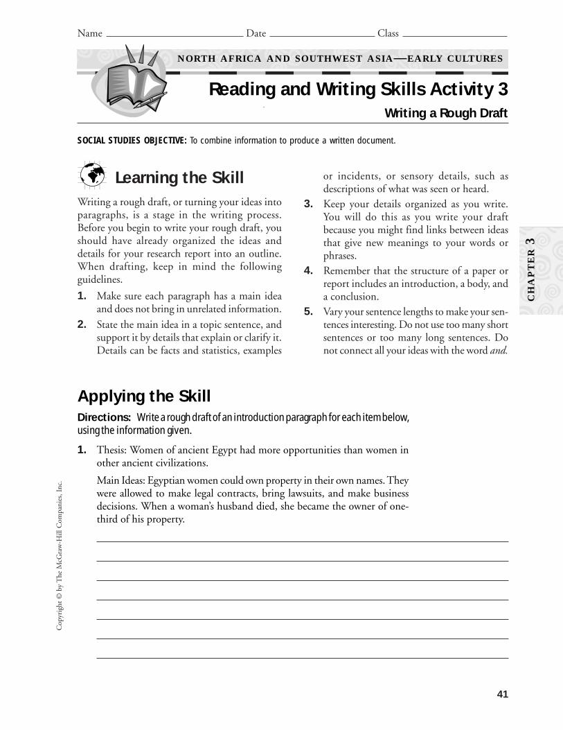
1. Thesis: Women of ancient Egypt had more opportunities than women inother ancient civilizations.
Main Ideas: Egyptian women could own property in their own names. Theywere allowed to make legal contracts, bring lawsuits, and make businessdecisions. When a woman’s husband died, she became the owner of one-third of his property.

2. Thesis: We learn much about the ancient Egyptian culture from hiero-glyphics.
Main Ideas: Hieroglyphics is a form of writing that uses symbols or picturesfor words. Ideas are expressed by combining pictures. Archeologists can nowread the hieroglyphics. Pharaohs used scribes to keep records. The scribesdescribed great battles and important events in the pharaoh’s life. Businessrecords and daily events were also carved on stones or written on papyrus.
3. Thesis: Judaism was unique because it believed in only one God.
Main Ideas: Most ancient peoples believed that there were many gods.Each god had limited power. Among them were gods of the sun, moon,harvests, and waters. To the Hebrews only one God was in control. He wasthe God of all heaven and earth.
Practicing the SkillDirections: Answer the following questions by circling the letter of the correctanswer.
1. Which of the following may be used as details in a report?
A. facts and statistics C. sensory details
B. examples or incidents D. all of the above
2. Which of the following should be completed before you begin writing arough draft of your report?
A. report outline C. presentation of your report
B. an edit of your report D. final revision of your report
42
Copyright ©
by The M
cGraw
-Hill C
ompanies, Inc.
NORTH AFRICA AND SOUTHWEST ASIA—EARLY CULTURES
Reading and Writing Skills Activity 3 (continued)
Name Date Class
CH
AP
TE
R3

Learn how plant life might grow in the northern part of Africa.
BackgroundThe Egyptian civilization originally developed as a farming culture because
of the silt deposited by the seasonal flooding of the Nile River. Let’s considerhow different conditions affect agriculture.
Materials
What to Do1. Fill the first terrarium 3/4 full of humus. Label this terrarium “1.”2. Fill the second terrarium 1/4 full of sand, and then layer humus on top until
the terrarium is 3/4 full of soil. Label this terrarium “2.”3. Fill the third terrarium 1/2 full of sand and then layer humus on top until
the terrarium is 3/4 full of soil. Label this terrarium “3.”4. Fill the fourth terrarium 3/4 full of sand. Label this terrarium “4.”5. Use a soil moisture meter to check the moisture level of the soil in each ter-
rarium. If the moisture levels are different, slowly add water to each soillayer to bring the moisture levels of all the terrariums to the level of themoistest soil.
6. Plant the seedlings in each terrarium so that one of each type of plant is ineach terrarium. The roots of each seedling should be at the same depth(about half the height of the terrarium). They will be at the soil change levelin terrarium 2 and terrarium 3.
7. Place the terrariums in a well lit portion of your room where each receivesthe same amount of sunlight.
8. Use the eyedropper to water the seedlings with four drops of water eachaccording to the following schedule:• terrarium 1: Only at the start• terrariums 2, 3, and 4: every day
9. Chart the growth and change in the plants over two weeks. Be sure to labelyour chart for each individual terrarium. Note the size and color of boththe plants and the roots that you can see.
43
Cop
yrig
ht ©
by
The
McG
raw
-Hill
Com
pani
es, I
nc.
Name Date Class
HISTORY AND GEOGRAPHY ACTIVITIES GEOGRAPHY AND THE WORLD
GeoLab Activity 3
NORTH AFRICA AND SOUTHWEST ASIA—EARLY CULTURES
Let It Grow
From the classroom of Thomas Lucey, St. Anne School, Memphis, Tennessee
CH
AP
TE
R3
■ 4 terrariums■ 1 10-pound bag of humus■ 1 10-pound bag of sand■ 4 healthy herb seedlings of the following
types: mint, basil, chives
■ water■ eyedropper■ soil moisture meter

44
Copyright ©
by The M
cGraw
-Hill C
ompanies, Inc.
NORTH AFRICA AND SOUTHWEST ASIA—EARLY CULTURES
GeoLab Activity 3 (continued)
Name Date Class
CH
AP
TE
R3
Several years ago thieves stole the head from thefamous statue of Ramses II. They removed the headfrom the one-ton statue with an electric saw, and thendragged the head 70 miles across the desert. Thepolice later recovered the missing statue piece in anEgyptian farmhouse.
Lab Activity Report
1. What differences are there in the fragrances and tastes of herbs from thedifferent terrariums? What do you think caused any differences?
2. How are the terrariums like the different North African countries that youhave studied?
3. Drawing Conclusions When food is easier to grow in one place and harderto grow in another place, what would you expect to happen to the popu-lation in each place? Why?
Go A Step FurtherSimulate the effects of the artificial fertilizers of modern farming and/or the
Mediterranean Sea by adding small amounts of salt to the water for terrariums2 and 3.

45
Cop
yrig
ht ©
by
The
McG
raw
-Hill
Com
pani
es, I
nc.
Name Date Class
CH
AP
TE
R3
Directions: Read the following information about hieroglyphics. Then answer thequestions that follow.
NORTH AFRICA AND SOUTHWEST ASIA—EARLY CULTURES
Enrichment Activity 3Hieroglyphics
Ancient Egyptians used hieroglyphics tokeep records. Hieroglyphics are pictures used torepresent words, symbols, or sounds. Archaeol-ogists have found hieroglyphics carved on stonesand written on papyrus. From studying these doc-uments, archaeologists have learned to interpretmany of these symbols.
Ancient Egyptians wrote down only veryimportant information. Most of the hieroglyphics
tell about events of the king’s life. Battles won,lands owned, and important decisions made bythe king would have been written or carved usinghieroglyphics. Kings employed scribes to writeabout these things. Scribes also kept track of thenumbers of animals owned, the amount of grainstored, and other important numbers. The hiero-glyphics used for numbers are as follows:
Taking Another LookWrite each of the following numbers in hieroglyphics. The numbers should readfrom left to right.
1. 12
2. 423
3. 1,122
Write each of the following numbers so that they read from right to left.
4. 10,134
5. 21,211
6. Evaluating Information Why do you think ancient Egyptians wroteonly very important information on papyrus or carved it on stone?
To display the number 14,321 in hieroglyphics, the scribe would write:
When you read a book, you read from left toright. Hieroglyphics may be written from left toright. They may also be written from right to left.Some of the symbols use human and animal fig-
ures. To determine which way to read the hiero-glyphics, look at the faces of the human figures.The figures face the direction that you shouldread.
1 10 100 1,000 10,000 100,000 1,000,000


47
Chapter 3, Section Resources
Guided Reading Activity 3-1:Mesopotamia and Ancient Egypt 48
Guided Reading Activity 3-2:Religions of the Middle East 49
SE
CT
ION
S

Copyright ©
by The M
cGraw
-Hill C
ompanies, Inc.
48
Name Date Class
HISTORY AND GEOGRAPHY ACTIVITIES GEOGRAPHY AND THE WORLD
Guided Reading Activity 3-1
NORTH AFRICA AND SOUTHWEST ASIA—EARLY CULTURES
Mesopotamia and Ancient Egypt
DIRECTIONS: Summarizing Reading the section and completing the sum-mary paragraphs below will help you learn more about Mesopotamia and ancientEgypt. Use your textbook to fill in the blanks.
The earliest known human civilizations in the world were
(1) in North Africa and (2) in South-
west Asia. Historians use the word (3) to describe a culture that
has reached a certain level of development. The development includes a system of
writing, building cities, and specialized workers.
One of the first civilizations started between the (4)
and (5) Rivers. This region was then called
(6) . It was an area of rich farmland, so it has been described as
the (7) . People settled in the region
because they knew it would be a good area to farm. Some of the villages grew into
(8) , which were made up of the city and farmland around it.
(9) was one of the earliest of these city-states.
The first empire in the region was the (10) Empire.
It eventually gave way to (11) , whose greatest king was
(12) .
Ancient Egypt started in the (13) River Valley. Egypt
was ruled by a (14) . The Egyptian religion was a
(15) one, which means it had many gods. The Egyptians
believed in life after death. The pharaohs were buried in big tombs called
(16) .
The ancient Egyptian system of writing is called (17) .
Language experts learned how to read the Egyptian writing when they cracked the code
on the (18) .
SE
CT
ION
3-1

Cop
yrig
ht ©
by
The
McG
raw
-Hill
Com
pani
es, I
nc.
49
Name Date Class
HISTORY AND GEOGRAPHY ACTIVITIES GEOGRAPHY AND THE WORLD
Guided Reading Activity 3-2
NORTH AFRICA AND SOUTHWEST ASIA—EARLY CULTURES
Religions of the Middle East
DIRECTIONS: Answering Questions Reading the section and answeringthe questions below will help you learn more about the religions of the MiddleEast. Use your textbook to write answers to the questions.
1. What do the religions of Judaism, Christianity, and Islam have in common?
2. What items make up the complete Torah, the holy book of the Jews?
3. What are some beliefs of Judaism?
4. What are some beliefs of Christianity?
5. What items make up the Bible, the holy book of the Christians?
6. How was the spread of Christianity achieved?
7. What are the followers of Islam called?
8. What does the Quran, the Muslim holy book, describe?
9. Why is Ramadan an important holiday on the Muslim calendar?
SE
CT
ION
3-2

CH
AP
TE
R4
51
Chapter 4 Resources
Vocabulary Activity 4:North Africa and Southwest Asia Today 52
Cooperative Learning Activity 4:Let’s Party 53
Chapter Map Activity 4:North Africa and Southwest Asia Today 55
Chapter Skills Activity 4:Using the Internet 61
Reteaching Activity 4:North Africa and Southwest Asia Today 63
Critical Thinking Skills Activity 4:Recognizing Propaganda 65
Map and Graph Skills Activity 4:Reading a Time Zones Map 67
Reading and Writing Skills Activity 4:Revising a Rough Draft 69
GeoLab Activity 4:Expand Your Company! 71
Enrichment Activity 4:Presidential Fact Sheet 73
52
Copyright ©
by The M
cGraw
-Hill C
ompanies, Inc.
Name Date Class
NORTH AFRICA AND SOUTHWEST ASIA TODAY
Vocabulary Activity 4
CH
AP
TE
R4
DIRECTIONS: Fill in the Blanks Select a term to fill each blank below.
alluvial plain hajj constitutional monarchy moshavBedouin silt oasis mosqueaquifer Islamic republic kibbutz shah
I had decided to move to Istanbul to find work. From my room, I could see the nearby
(1) where Muslims worship. Muslims are followers of Islam.
Most rural Israelis work on two types of farm settlements. In a (2) ,
people share all of the property and may also produce goods such as clothing or electronic equip-
ment. In a (3) , people also share production and farming, but each person
may own some private property as well.
In Egypt, the (4) left behind when the Nile River floods its banks,
enriches the soil. Libya has no permanent rivers, but (5) store large amounts
of water beneath the desert.
Abdul knew it was time to make a (6) , or religious journey, to
Makkah. It would be a long trip. Between the Tigris and Euphrates Rivers, Abdul crossed the wide
(7) formed from flooding. In the desert, he stopped for water at each
(8) . He met a people called the (9) , who wander the
desert and follow a traditional way of life.
Governments vary. A country can be governed by a king or, as Iran was, by a
(10) . Today Iran is an (11) run by Muslim religious
leaders. Like Jordan, a country can be a (12) , in which a monarch shares
power with elected officials.

BackgroundThe cultures of Southwest Asia are very diverse. People from a variety of
ethnic groups live side by side in this region. They practice many different reli-gions and celebrate different holidays. They do have one thing in common. Theyall love to have parties! In this activity, you will arrange a party according to thetraditions of one of the nations of Southwest Asia. By exploring the ways thatpeople celebrate, you will gain an appreciation for the diversity of this region.
Group Directions1. Use Chapter 4 and library resources or the Internet to learn about holidays
and celebrations in different Southwest Asian countries. Take notes onwhat you discover.
2. Collect pictures and make sketches of people taking part in their holidaycelebrations. Note their traditional dress and decorations.
3. Use what you learn to plan a party in the traditions of your chosen country.
4. Think about the following categories as you plan your party:
Organizing the Group1. Decision Making With your group, decide which Southwest Asian coun-
try you will study. Select a holiday of that country on which to base yourcelebration. Using the categories in the box above, decide how to divide upthe tasks of organizing the party.
2. Individual Work Do research about your part of the celebration. Find,make, or prepare the party supplies you need.
3. Group Work/Decision Making Share your plans with your group.Together, decide how you will organize your party. Each group will have
53
CH
AP
TE
R4
story behind the holiday decorationstraditional holiday activities snackstime of year musictraditional dress dance
Cop
yrig
ht ©
by
The
McG
raw
-Hill
Com
pani
es, I
nc.
Let’s Party
Name Date Class
NORTH AFRICA AND SOUTHWEST ASIA TODAY
Cooperative Learning Activity 4
an area of the classroom in which to set up its party. Together, plan all thedetails that go into making a party fun.
4. Additional Group Work On party day, set up your party in your assignedarea of the classroom. Wear your costumes. Put up your decorations andset out your snacks.
5. Group Sharing Groups take turns attending other groups’ parties. Thegroup in charge of the party should tell party-goers the story behind theholiday they are celebrating. They should also tell them about the music,snacks, dances, and any other activities at the party. Have a great time!
Group Process Questions• What is the most important thing you learned about the diversity of South-
west Asia from the parties you attended?
• What part of the project did you enjoy most?
• What problems did you have?
• How did you solve the problems?
• How was it helpful to work with others?
Quick Check1. Was the goal of the assignment clear at all times?
2. Did you have problems working well together? If so, how did you solvethem?
3. Were you satisfied with your work on this project? Why or why not?
54
Copyright ©
by The M
cGraw
-Hill C
ompanies, Inc.
CH
AP
TE
R4
NORTH AFRICA AND SOUTHWEST ASIA TODAY
Cooperative Learning Activity 4 (continued)
Name Date Class

55
Cop
yrig
ht ©
by
The
McG
raw
-Hill
Com
pani
es, I
nc.
NORTH AFRICA AND SOUTHWEST ASIA TODAY
Chapter Map Activity 4Teaching Strategy
CH
AP
TE
R4
Regional Maps
Place Location ActivityReproduce the two regional maps for each student. Askstudents to:• Label the following countries and their boundaries:
Egypt, Libya, Tunisia, Algeria, Morocco, Turkey,Syria, Lebanon, Israel, Jordan, Saudi Arabia, Yemen,Oman, United Arab Emirates, Qatar, Bahrain,Kuwait, Iraq, Iran, Afghanistan. Also label the regionof Western Sahara.
• Trace the following: Nile River.• Label the following bodies of water: Red Sea,
Mediterranean Sea, Atlantic Ocean, Black Sea,Caspian Sea, Persian Gulf, Gulf of Oman, ArabianSea, Gulf of Adon.
Discussing the Maps1. What is the largest North African country? The small-
est? (Algeria is the largest North African country.Tunisia is the smallest.)
2. Name the body of water that borders every NorthAfrican country. (Mediterranean Sea)
3. How many countries border Iraq? Name them. (Sixcountries border Iraq: Turkey, Syria, Jordan, SaudiArabia, Kuwait, and Iran.)
4. The capital of Oman lies in what direction from thecapital of Afghanistan? What is the approximatestraight-line distance between the two cities? (Muscat,Oman, lies southwest of Kabul, Afghanistan. Theapproximate distance between the cities is 980 miles[1,568 km].)
Import/Export Maps
Place Location ActivityReproduce the Import/Export maps for each student.Ask students to:• Label the countries. (See the list of countries for the
regional map.)• Label the capital cities of each country.
Then ask students to use the country profiles in theregional atlas to label the major import and export ofeach country in North Africa and Southwest Asia.
Discussing the Maps1. How many countries have petroleum as their major
export? Name them. (9—Algeria, Bahrain, Iran,Kuwait, Oman, Qatar, Saudi Arabia, Syria, UnitedArab Emirates)
2. What products do the countries of North Africaimport? (machinery, manufactured goods)
3. Which capitals in North Africa and Southwest Asiaare situated near a river? (Cairo, Egypt; Baghdad,Iraq))
APPLYING GEOGRAPHY SKILLSCreating an Arable Land MapYou may use the following activity as a portfolio or extracredit project.
Arable land is land that is fit for or used for growingcrops. Ask students to use the library or Internet to findthe amount of arable land in each of the North Africanand Southwest Asian countries. Students should write thepercentage of arable land on copies of their completedpolitical maps, writing the percentage next to the nameof each country. Then ask them to list the countries inorder of most to least arable land.
Deserts cover most of the lands of North Africa. Despite the often inhospitable environment,however, North Africans have developed rich and diverse societies, often combining elementsof Arab, Berber, and African cultures. Southwest Asia is the birthplace of three major world reli-gions: Islam, Judaism, and Christianity.

56
Copyright ©
by The M
cGraw
-Hill C
ompanies, Inc.
Name Date Class
NORTH AFRICA AND SOUTHWEST ASIA TODAY
Chapter Map Activity 4
CH
AP
TE
R4
0 m
i.
0 km
500
250 50
025
0
N
E
S
W
No
rth
Afr
ica:
Reg
iona
l

57
Cop
yrig
ht ©
by
The
McG
raw
-Hill
Com
pani
es, I
nc.
Name Date Class
NORTH AFRICA AND SOUTHWEST ASIA TODAY
Chapter Map Activity 4
N
E
S
W0
mi.
0 km
500
250 50
025
0
CH
AP
TE
R4
Sout
hwes
t A
sia:
Reg
iona
l

58
Copyright ©
by The M
cGraw
-Hill C
ompanies, Inc.
Name Date Class
NORTH AFRICA AND SOUTHWEST ASIA TODAY
Chapter Map Activity 4
✪
✪✪
✪
✪
0 m
i.
0 km
500
250 50
025
0
N
E
S
W
CH
AP
TE
R4
No
rth
Afr
ica:
Imp
ort
/Exp
ort
59
Cop
yrig
ht ©
by
The
McG
raw
-Hill
Com
pani
es, I
nc.
Name Date Class
NORTH AFRICA AND SOUTHWEST ASIA TODAY
Chapter Map Activity 4
CH
AP
TE
R4
N
E
S
W
✪
✪✪
✪✪
✪
✪
✪✪
✪✪
✪
✪
✪✪
0 m
i.
0 km
500
250 50
025
0
Sout
hwes
t A
sia:
Imp
ort
/Exp
ort


Learning the SkillThe Internet is a global network of computers. The Internet can connect
you to many sources of information about geography and other subjects. Learn-ing to search with a Web browser is essential to finding information on the Inter-net. A search engine such as AltaVista uses keywords that you type to find theWeb site for information you want.
Practicing the SkillDirections: Log on to the Internet. Use an Internet Web browser to find theanswers to the questions below. Write the answers on a separate sheet of paper.
1. Write the name of the search engine your Web browser uses (click theSearch button). If there are more than one, write the names of two of them.
2. Write the name of three sites that give information about the capital cityof Afghanistan, Kabul.
3. Search for Web sites that contain information about the oil economy ofSaudi Arabia. Write a 50- to 75-word report about this primary economicsource. Write the Web addresses (URL) of the sites.
4. Prepare a list of three facts about the religion Islam. Write the Webaddress (URL) for each fact that you find.
Applying the SkillDirections: Use your favorite search engines to find one or two Web sites thatwill give you the following information about your local area. Write the sites inthe chart below.
61
Cop
yrig
ht ©
by
The
McG
raw
-Hill
Com
pani
es, I
nc.
Name Date Class
NORTH AFRICA AND SOUTHWEST ASIA TODAY
Chapter Skills Activity 4Using the Internet
CH
AP
TE
R4
Local entertainment
Local news
Local weather


63
Cop
yrig
ht ©
by
The
McG
raw
-Hill
Com
pani
es, I
nc.
Name Date Class
NORTH AFRICA AND SOUTHWEST ASIA TODAY
Reteaching Activity 4
CH
AP
TE
R4
North Africa and Southwest Asia are called“crossroads of the world” due to their locationnear Europe and Asia. The main export for these
countries is oil. Because of the world’s depend-ence on this oil, the volatile political environ-ment in these countries must be watched.
DIRECTIONS: Filling in the Blanks On the line before each statement, writethe name of the country of North Africa or Southwest Asia the statement bestdescribes. Refer to Chapter 4 of your text for the names of the countries.
Turkey, Israel, Syria, Lebanon, Jordan, Saudi Arabia
Egypt, Libya, Iran, Iraq, Afghanistan
1. The Negev desert covers almost half of this country.
2. This country invaded its neighbor Kuwait in August1990.
3. This oil-rich country is the largest country of South-west Asia. It is about the same size as the eastern halfof the United States.
4. The lifeline of this country is the Nile River.
5. Istanbul, this nation’s largest city, is the only citylocated on two continents, Europe and Asia.
6. This country is the most densely wooded country inSouthwest Asia.
7. The Khyber Pass has been the major trade route link-ing Southwest Asia to Asia for centuries. It cutsthrough the Hindu Kush mountains in this country.
8. King Hussain I ruled this country from 1952–1999.
9. This country boasts a distinctive population: morethan half the people claim Persian rather than Arab orTurkish descent and most speak Farsi.
10. Damascus, one of the oldest continuously inhabitedcities in the world, is the capital of this country.
11. Tripoli is the capital of this country.


Name Date Class
NORTH AFRICA AND SOUTHWEST ASIA TODAY
Critical Thinking Skills Activity 4Recognizing Propaganda
SOCIAL STUDIES OBJECTIVE: Identify propaganda in written, oral, and visual material.
CH
AP
TE
R4
Learning the SkillPeople whose jobs involve persuading oth-
ers—such as advertisers, writers, and politi-cians—often use propaganda. Propaganda is thespreading of ideas that aims to persuade peopleto accept a viewpoint that may be good or bad.Often propaganda appeals to people’s emotionsin an attempt to get them to accept a particularviewpoint without careful consideration. Somecommon techniques used in propaganda are:
• Using words, themes, or tone of voice thatpeople will respond to with strong emotion.For example, themes of safety, justice, andtruth move people.
• Using negative labels for people or ideas thepropagandist wants others to reject.
• Using positive labels for people or ideas thepropagandist wants others to approve.
• Using testimonials from famous people.
• Using only those facts that support a certainpoint of view.
To recognize propaganda, follow these steps:
• Look for words or images that are filled withemotion or used as warnings.
• Find out who is the target of the propaganda.
• Draw conclusions about the use of propa-ganda to unite and motivate.
Applying the SkillDirections:A. Put an X in front of each statement that is an example of propaganda.
1. Many cities in North Africa cannot provide adequate housing or jobsfor their rapidly growing populations.
2. Militant forces in North Africa must be stopped before their evilinfluence spreads throughout the region.
3. Libya expected the easy money from oil revenues would fund dozensof poorly planned projects for industrial development.
4. In 1980, the United States suspended all activities at its embassy inTripoli.
5. The aggression and greed of Western nations prevent the farmersand nomadic herders of North Africa from obtaining prosperity.
6. Egypt was once one of the most important centers of art, learning,and science in the ancient world.
Cop
yrig
ht ©
by
The
McG
raw
-Hill
Com
pani
es, I
nc.
65

NORTH AFRICA AND SOUTHWEST ASIA TODAY
Critical Thinking Skills Activity 4 (continued)
Name Date Class
CH
AP
TE
R4
Practicing the SkillDirections: Answer the following questions bycircling the letter of each correct answer.
1. Which of the following techniques of propaganda does the writer of the AswanHigh Dam paragraph use?
A. using negative words to influence thereader
B. using negative labels for peopleC. using only those facts that support his
viewD. all of the above
2. The Aswan High Dam was built on whichof the following rivers?
A. MississippiB. TigrisC. NileD. Euphrates
3. Who might be the target audience of this paragraph?
A. Gamal Abdel NassarB. potential dam builders in EuropeC. American teensD. Egyptian voters
B. The Aswan High Dam in Egypt helped Egyptian agriculture and industry. How-ever, it also caused serious environmental problems. The paragraph below is anexample of propaganda. It tells about the problems caused by the dam, but it doesnot mention the benefits. As you read it, circle the negative words the author usesto influence the reader against the Aswan High Dam. Underline phrases that try tomake the reader angry or fearful.
The construction of the Aswan High Dam has been disas-trous for Egypt. The rich, life-giving deposits of silt that theNile used to carry downstream are now trapped behind thedam, forcing farmers to use expensive, unhealthy fertilizers.The lack of silt has also caused massive erosion of landalong the shores of the Nile. Gamal Abdel Nassar’s “dream”of creating this dam was hardly a dream of Egyptian pros-perity. Instead, it was the dream of a self-obsessed leader toglorify himself through the creation of this monstrous feat ofengineering. Just as the lake that bears his name hasdrowned Egypt’s ancient historical sites, so it has begun toengulf [overwhelm] Egypt’s hopes for the future.
Copyright ©
by The M
cGraw
-Hill C
ompanies, Inc.
66

Cop
yrig
ht ©
by
The
McG
raw
-Hill
Com
pani
es, I
nc.
67
Learning the SkillWhen it is 4 P.M. in Cairo, Egypt, it is 2 P.M. inRabat, Morocco. Both are important NorthAfrican cities. Why isn’t the time the same inboth? The answer is that Cairo and Rabat arelocated in different time zones. The earth’s surfaceis divided into 24 different time zones. The 0° lineof longitude, the Prime Meridian, is the startingpoint for figuring out time around the world. Toread a time zones map, follow these steps:
• Locate a place where you know the time andselect another place where you wish to knowthe time.
• Notice the time zones you cross betweenthese places.
• If the second place lies east of the first, addan hour for each time zone. If it lies west,subtract an hour for each zone. If you crossthe International Date Line—the 180°Meridian—add or subtract one day.
Name Date Class
NORTH AFRICA AND SOUTHWEST ASIA TODAY
Map and Graph Skills Activity 4Reading a Time Zones Map
NATIONAL GEOGRAPHY STANDARD 13: The geographically informed person knows andunderstands how the forces of cooperation and conflict among people influence the divi-sion and control of Earth’s surface.
Applying the SkillDirections: The map below shows the world time zones. Study the map and useit to answer the questions on the next page in the spaces provided.
1 am 4 pm 5 pm 6 pm 7 pm 8 pm 9 pm 10 pm 11 pm 12 am2 am 3 am 4 am 5 am 6 am 7 am 8 am 9 am 10 am 11 am 12 pm 1 pm 2 pm 3 pm
165° 150° 135° 120° 105° 90° 75° 60° 45° 30° 15° 0° 15° 30° 45° 60° 75° 90° 105° 120° 135° 150° 165° 180°
Inte
rnat
iona
l Dat
e Li
ne
Inte
rnat
iona
l Dat
e Li
ne
Prim
e M
erid
ian
Inte
rnat
iona
l Dat
e Li
ne
Inte
rnat
iona
l Dat
e Li
ne
Prim
e M
erid
ian
Tokyo
Sydney
Mumbai
Rabat
Mexico City
New York
AustinMemphis
Denver
Los Angeles
Honolulu
Anchorage
Rio de
Janeiro
Rome
Cairo
Istanbul
LondonWarsaw
CapeTown
BeijingTokyo
Sydney
Mumbai
Rabat
Mexico City
New York
AustinMemphis
Denver
Los Angeles
Honolulu
Anchorage
Rio deJaneiro
Rome
Cairo
Istanbul
LondonWarsaw
CapeTown
Beijing3:30 pm
4:00 pm
5:30 pm5:45 pm
6:30 pm
9:30 pm 11:30 pm
12:45 pm
6:30 pm
3:30 am
4:30 am
8:30 am
Mercator projection
Nonstandard time
World Time Zones
CH
AP
TE
R4

Copyright ©
by The M
cGraw
-Hill C
ompanies, Inc.
68
1. What line of longitude is used as the base todetermine all time zones?
2. Because the earth rotates from west to east,what is true about the time in time zones eastof your location?
3. Critical Thinking China does not observethe standard world time zones. Instead, thegovernment has decided that the entirecountry should be on Beijing time. When itis 8 P.M. in Beijing, it is 8 P.M. everywhere inChina—even the far western section of thecountry, where it would be 5 P.M. if standardtime were followed. What do you think aresome benefits and disadvantages of China’ssystem?
4. Activity Imagine that you live in New YorkCity and are phoning friends in other worldcities. You are making your calls at 7 A.M. Atwhat time would your friends answer thephone if they lived in
A. Los Angeles?
B. Sydney?
C. Istanbul?
D. Rio de Janeiro?
Practicing the SkillDirections: Answer the following questionsbased on the map by circling the letter of the correctanswer.
1. It is 11 A.M. on Tuesday in Cairo. What dayand time is it in Tokyo?
A. Tuesday, 2 A.M.B. Tuesday, 6 P.M.C. Wednesday, 2 P.M.D. Wednesday, 6 P.M.
2. You leave Memphis, Tennessee, at 8 P.M. onan 11-hour flight to Istanbul, Turkey. Whattime will you arrive in Istanbul?
A. 8 A.M. the day beforeB. 8 P.M. the same day C. 3 A.M. the next dayD. 3 P.M. the next day
3. Which of the following cities on the map isin the same time zone as Austin?
A. MemphisB. New York CityC. DenverD. Los Angeles
NORTH AFRICA AND SOUTHWEST ASIA TODAY
Map and Graph Skills Activity 4 (continued)
Name Date Class
CH
AP
TE
R4

Learning the SkillAfter you research, form an outline, and write arough draft of your research report, put it asidefor a day or so. Then reread your rough draft andrevise it. Revising means going over a documentagain, looking at it as another person might. Asyou revise your report, make sure that yourwriting is clear and well organized, that it accom-plishes your goals, and that it reaches your audi-ence. The revision stage is the point at which you:• improve paragraphs
• review your work and have others reviewyour work
• check the content and structure of your report• make sure the language is specific and
descriptive• check unity and logic• check style and tone
After you review your rough draft, you may wantto move sentences or change them, add or deleteinformation, or rewrite parts of your report.
69
Cop
yrig
ht ©
by
The
McG
raw
-Hill
Com
pani
es, I
nc.
Name Date Class
NORTH AFRICA AND SOUTHWEST ASIA TODAY
Reading and Writing Skills Activity 4Revising a Rough Draft
CH
AP
TE
R4
SOCIAL STUDIES OBJECTIVE: To combine information to produce a written document.
Applying the SkillDirections: Read the following passages. In the space below each passage, writewhy and how each passage needs to be revised.
Egypt isn’t all chaos and clatter. It’s also a diver’s dream dip, a quiet camelcaravan through the desert or a long lazy punt down the Nile. Mud-brick vil-lages stand beside the ruins of the pharaohs surrounded by buildings of steel,stone, and glass. Bedouins live in goatskin tents and farmers till the earth withthe tools of their ancestors. Townsfolk dress in long flowing robes, others injeans and sneakers, and city traffic competes with donkey carts and wanderinggoats. Nowhere are these contrasts so stark as in Cairo, a massive city throng-ing with people and ringing to the sound of car horns, stereos and muezzinssummoning the faithful to prayer.
The ‘black land’ was the fertile land on the banks of the Nile. The ancientEgyptians used this land for growing their crops. This was the only land inancient Egypt that could be farmed because a layer of rich black silt wasdeposited there every year after the Nile flooded. The ancient Egyptiansthought of Egypt as being divided into two types of land, the ‘black land’ andthe ‘red land.’ The ‘red land’ was the barren desert that protected Egypt on twosides. These deserts separated ancient Egypt from neighboring countries andinvading armies. They also provided the ancient Egyptians with a source forprecious metals and semi-precious stones.

Directions: Write an introduction paragraph for a report on tourism in Turkey. Todo this correctly, you will need to do some research on possible topics. After you fin-ish writing this paragraph, exchange paragraphs with a classmate. On the linesbelow your classmate’s paragraph, write your suggestions for revising his or herparagraph. Then, return your suggestions to your classmate. Read the suggestionsthat your classmate had for your paragraph.
Suggestions for revising the introduction paragraph:
Practicing the SkillDirections: Answer the following questions by circling the letter of the correctanswer.
1. What is revising?
A. changing your thesis
B. looking over a document again, looking at it as another personmight
C. outlining
D. researching topics for a research report
2. Which of the following is NOT a purpose of revising?
A. to find a thesis statement
B. to make sure that your writing is clear and well organized
C. to make sure that your writing accomplishes your goals
D. to make sure that your writing reaches your audience
70
Copyright ©
by The M
cGraw
-Hill C
ompanies, Inc.
NORTH AFRICA AND SOUTHWEST ASIA TODAY
Reading and Writing Skills Activity 4 (continued)
Name Date Class
CH
AP
TE
R4

71
Cop
yrig
ht ©
by
The
McG
raw
-Hill
Com
pani
es, I
nc.
Name Date Class
HISTORY AND GEOGRAPHY ACTIVITIES GEOGRAPHY AND THE WORLD
GeoLab Activity 4
NORTH AFRICA AND SOUTHWEST ASIA TODAY
Expand Your Company!
From the classroom of David Anderson, Tamarac Middle School, Troy, New York
CH
AP
TE
R4
■ encyclopedias, an atlas, and other referencebooks concerning Southwest Asia or theInternet
■ dictionary■ economic data chart (example provided)
■ poster board■ colored pencils■ overhead projector (optional)■ transparencies (optional)■ pens for writing on transparencies (optional)
Southwest Asia is rich in oil and other natural resources. Learn more aboutthis part of the world by looking at the possibilities for the expansion of yourimaginary company to one of these countries.
BackgroundTamco, an imaginary international computer company and your employer,
is considering opening an office in Southwest Asia. Although this area is rich innatural resources and beauty, the political and religious strife there has escalated,and the economic separation between the wealthy and the poor seems to haveincreased. You and some other company representatives have been asked toresearch the Middle East to determine which country, if any, would provide thebest opportunities for expansion and development. You will then provide an oralreport to the board of directors detailing your findings.
Materials
What to Do1. Choose your team members. Decide which three Southwest Asian coun-
tries you would like to investigate as possible company expansion locations.2. Learn these vocabulary terms and their definitions: arable land, population
density, GNP per capita, ethnic group, resources, workforce3. Research to investigate your countries. Find out the information needed to
complete an economic data chart similar to the one below.4. Prepare a graph comparing the GNP per capita of the three countries. You
and the other representatives should discuss and compare all of the infor-mation on your chart. As you compare, think about the positives and neg-atives of the products already available for export, location of bodies of waterfor transportation, and available qualified workers.
5. Display your graph on the poster board.6. In addition to the information on your graph, consider the major cities in
each country. Are they modern? Do they have good accessible transporta-tion within the city such as airports and public services?

72
Copyright ©
by The M
cGraw
-Hill C
ompanies, Inc.
NORTH AFRICA AND SOUTHWEST ASIA TODAY
GeoLab Activity 4 (continued)
Name Date Class
CH
AP
TE
R4
Lab Activity Report
1. What were some negatives about your city that may have made you hesi-tant to make it your final choice?
2. Why did you feel that you could choose that city anyway?
3. What problems are involved in expanding a business to another country?
4. Drawing Conclusions When companies expand to other countries, doyou think it brings the people living there closer together, or does it drivethem apart? Why?
Country Amount of GNP Per Major Exports Access to Size of LiteracyArable Land Capita Bodies of Water Workforce Rate
SOUTHWEST ASIA ECONOMIC DATA SHEET
7. Research to determine political and religious attitudes toward nationals andinternationals.
8. Based on the gathered data, determine the best places in each country foryour company to expand.
9. Discuss and narrow your choice to one country and then one city.10. Prepare a persuasive report to present to the board of directors of Tamco
that supports the best opportunities for expansion and development.

73
Cop
yrig
ht ©
by
The
McG
raw
-Hill
Com
pani
es, I
nc.
Name Date Class
NORTH AFRICA AND SOUTHWEST ASIA TODAY
Enrichment Activity 4Presidential Fact Sheet
CH
AP
TE
R4
Directions: United States presidents and other world leaders may use fact sheetsas quick-reference tools. Their staffs prepare these fact sheets to provide informa-tion these leaders need to know about world regions. Imagine that you are the pres-ident’s press secretary. You have to help the president prepare for a news conferenceon Southwest Asia. Fill in the information required in each category in the spacesbelow. You may use your textbook and other resources to find the information.
1. Major countries of Southwest Asia:
2. Climate and landscape of the Arabian Peninsula:
3. Most abundant resource of the region:
4. Importance of this resource to the United States:
5. Major world religions in region:
6. Recent changes in Israel’s relations with neighboring Arab countries:
7. Identifying Assumptions How might a fact sheet be helpful to a president who ispreparing for a news conference?


75
Chapter 4, Section Resources
Guided Reading Activity 4-1:North Africa 76
Guided Reading Activity 4-2:Southwest Asia: Turkey and Israel 77
Guided Reading Activity 4-3:Syria, Lebanon, Jordan, and Arabia 78
Guided Reading Activity 4-4:Iraq, Iran, and Afghanistan 79
SE
CT
ION
S

Copyright ©
by The M
cGraw
-Hill C
ompanies, Inc.
76
Name Date Class
HISTORY AND GEOGRAPHY ACTIVITIES GEOGRAPHY AND THE WORLD
Guided Reading Activity 4-1
NORTH AFRICA AND SOUTHWEST ASIA TODAY
North Africa
DIRECTIONS: Reading for Accuracy Reading the section and completingthe activity below will help you learn more about North Africa. Refer to your text-book to decide if a statement is true or false. Write T or F, and if a statement isfalse, rewrite it correctly.
1. The Sinai Peninsula is a major crossroads between Africa and Southwest Asia.
2. The Suez Canal is helpful because it lets ships pass to the Red Sea without having to go around the continent of Africa.
3. Dams of the Nile only bring harm to the farmers and their crops.
4. Almost half of Egypt’s exports are made up of farm products.
5. Most of Libya is covered by the Sahara.
6. Libya uses oil money to buy food, build schools, and keep a strong military.
7. Libya has a democratic government, ruled by a king.
8. Algeria is North Africa’s smallest country.
9. Algeria is a republic, with a strong president and a legislature.
10. Morocco has an economy that is based only on tourism.
SE
CT
ION
4-1
Cop
yrig
ht ©
by
The
McG
raw
-Hill
Com
pani
es, I
nc.
77
Name Date Class
HISTORY AND GEOGRAPHY ACTIVITIES GEOGRAPHY AND THE WORLD
Guided Reading Activity 4-2
NORTH AFRICA AND SOUTHWEST ASIA TODAY
Southwest Asia: Turkey and Israel
DIRECTIONS: Filling in the Blanks Reading the section and completing thesentences below will help you learn more about Turkey and Israel. Refer to yourtextbook to fill in the blanks.
Turkey has a unique location because it bridges the continents of
(1) and (2) . Three important water-
ways separate the Asian and European parts of Turkey: the (3) ,
the (4) , and the (5) . Most of Turkey’s
people practice the religion of (6) and worship in places called
(7) . Many of Turkey’s people today are descendants of an Asian
people called (8) .
Mountains are located in northern Israel and the (9)
lies east of the mountains. Between Israel and Jordan is the
(10) , which is the lowest place on the
earth’s surface. The (11) covers almost half of the country.
(12) are Israel’s major agricultural
export. People who live in a (13) share all the property. People
who live in a (14) share in farming and production, but also
own private property. The largest manufacturing industry is (15)
. Most of Israel’s people are (16) . The
rest of the people are Arabs called Palestinians.
SE
CT
ION
4-2

Copyright ©
by The M
cGraw
-Hill C
ompanies, Inc.
78
Name Date Class
HISTORY AND GEOGRAPHY ACTIVITIES GEOGRAPHY AND THE WORLD
Guided Reading Activity 4-3
NORTH AFRICA AND SOUTHWEST ASIA TODAY
Syria, Lebanon, Jordan, and Arabia
DIRECTIONS: Answering Questions Reading the section and answeringthe questions below will help you learn more about the countries of Syria,Lebanon, Jordan, and Saudi Arabia. Use your textbook to write answers to thequestions.
1. What kind of land does Syria include?
2. What is the main economic activity of Syria?
3. Where do more than half of Syria’s people live?
4. What is the capital and largest city of Lebanon?
5. What languages are spoken in Lebanon?
6. What kinds of resources does Jordan lack?
7. In what industries do most of Jordan’s people work?
8. What kind of government does Jordan have?
9. How does Saudi Arabia get water for farming?
10. What does Saudi Arabia’s economy depend on?
11. How is Saudi Arabia ruled?
SE
CT
ION
4-3

Cop
yrig
ht ©
by
The
McG
raw
-Hill
Com
pani
es, I
nc.
79
Name Date Class
HISTORY AND GEOGRAPHY ACTIVITIES GEOGRAPHY AND THE WORLD
Guided Reading Activity 4-4
NORTH AFRICA AND SOUTHWEST ASIA TODAY
Iraq, Iran, and Afghanistan
DIRECTIONS: Outlining Reading the section and completing the outlinebelow will help you learn more about the countries of Iraq, Iran, and Afghanistan.Refer to your textbook to fill in the blanks.
I. Iraq
A. The and Rivers are the major geographic
features.
1. Farming takes place on an .
2. is the country’s major export.
B. Most people live in areas.
1. make up the largest population group.
2. The are the second-largest group.
3. Iraq’s government is a .
4. After the Persian Gulf War, an was put on Iraq.
II. Iran
A. Iran was once known as .
1. Iran’s economy depends on .
B. More than one-half of the people are .
1. Most people practice some form of .
2. The government is now an .
III. Afghanistan
A. The country is mostly covered by the
mountain range.
1. The was used as a major trade
route through the mountains.
B. is the major economic activity.
C. The people are divided into 20 different groups.
D. The Taliban strictly enforces religious laws.
SE
CT
ION
4-4


Regional Atlas Activity 22-ABorders should match those on subsequentmaps for this unit.
2-B1. Atlas Mountains2. Mediterranean Sea3. Nile River4. Caspian Sea5. Sahara6. Rub‘ al Khali (Empty Quarter)7. Tigris and Euphrates Rivers8. Red Sea9. Taurus Mountains
10. Zagros Mountains
2-C1. Saudi Arabia2. Israel3. Turkey4. Iran5. Oman6. Iraq7. Syria8. Afghanistan9. Libya
10. Algeria
2-D1. Kabul 2. Algiers 3. Tehran 4. Cairo 5. Tripoli 6. Damascus 7. Rabat 8. Amman 9. Jerusalem
10. Ankara
2-E1. The Zagros Mountains are at the highest
elevation in Southwest Asia that is shownon this profile. The Atlas Mountains areat the highest elevation in North Africa.
2. The Atlantic Ocean and the Nile Riverare shown at the lowest elevations on thisprofile.
3. Answers may vary but should mentionthat the Nile River borders the SinaiPeninsula, which separates North Africaand Southwest Asia; it is in the northeastcorner of Africa, flowing from Sudanthrough Egypt into the Mediterranean.
4. Cairo, Egypt, lies next to the Nile River.5. The Sahara lies between the Atlas Moun-
tains and the Nile River.6. Answers may vary but should mention the
major role of deserts as physical featuresin both regions; formidable mountainranges and plateaus are found there too.
7. This elevation profile runs west to east at30°N latitude.
8. The Atlas Mountains are the westernmostlandform shown on this profile.
2-F1. Israel2. Saudi Arabia and Israel3. Ankara and Istanbul, Turkey4. Kuwait5. Morocco and Yemen6. Libya has 159 automobiles and 68 tele-
phones per thousand people.7. Morocco8. 80,000,0009. Alexandria, Egypt
10. Yemen
2-GLanguages of Southwest Asia:
Afghanistan—Pashto, DariIran—Persian, KurdishIraq—Arabic, KurdishIsrael—Hebrew, ArabicJordan—ArabicKuwait—ArabicLebanon—Arabic, FrenchOman—ArabicQatar—ArabicSaudi Arabia—ArabicSyria—Arabic, Kurdish, ArmenianTurkey—Turkish, KurdishUnited Arab Emirates—Arabic, PersianYemen—Arabic
ANSWER KEY
81
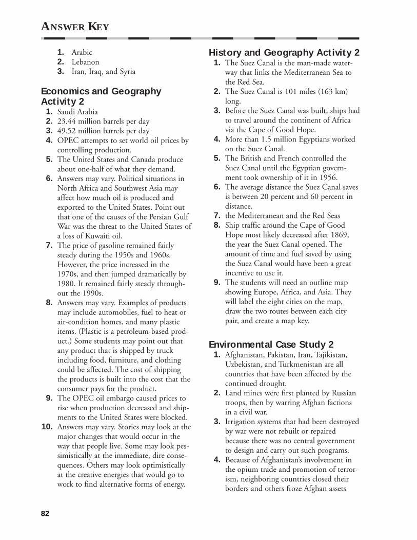
1. Arabic2. Lebanon3. Iran, Iraq, and Syria
Economics and GeographyActivity 2
1. Saudi Arabia2. 23.44 million barrels per day3. 49.52 million barrels per day4. OPEC attempts to set world oil prices by
controlling production.5. The United States and Canada produce
about one-half of what they demand.6. Answers may vary. Political situations in
North Africa and Southwest Asia mayaffect how much oil is produced andexported to the United States. Point outthat one of the causes of the Persian GulfWar was the threat to the United States ofa loss of Kuwaiti oil.
7. The price of gasoline remained fairlysteady during the 1950s and 1960s.However, the price increased in the1970s, and then jumped dramatically by1980. It remained fairly steady through-out the 1990s.
8. Answers may vary. Examples of products may include automobiles, fuel to heat orair-condition homes, and many plasticitems. (Plastic is a petroleum-based prod-uct.) Some students may point out thatany product that is shipped by truckincluding food, furniture, and clothingcould be affected. The cost of shippingthe products is built into the cost that theconsumer pays for the product.
9. The OPEC oil embargo caused prices torise when production decreased and ship-ments to the United States were blocked.
10. Answers may vary. Stories may look at themajor changes that would occur in theway that people live. Some may look pes-simistically at the immediate, dire conse-quences. Others may look optimisticallyat the creative energies that would go towork to find alternative forms of energy.
History and Geography Activity 21. The Suez Canal is the man-made water-
way that links the Mediterranean Sea tothe Red Sea.
2. The Suez Canal is 101 miles (163 km)long.
3. Before the Suez Canal was built, ships hadto travel around the continent of Africavia the Cape of Good Hope.
4. More than 1.5 million Egyptians workedon the Suez Canal.
5. The British and French controlled theSuez Canal until the Egyptian govern-ment took ownership of it in 1956.
6. The average distance the Suez Canal savesis between 20 percent and 60 percent indistance.
7. the Mediterranean and the Red Seas8. Ship traffic around the Cape of Good
Hope most likely decreased after 1869,the year the Suez Canal opened. Theamount of time and fuel saved by usingthe Suez Canal would have been a greatincentive to use it.
9. The students will need an outline mapshowing Europe, Africa, and Asia. Theywill label the eight cities on the map,draw the two routes between each citypair, and create a map key.
Environmental Case Study 21. Afghanistan, Pakistan, Iran, Tajikistan,
Uzbekistan, and Turkmenistan are allcountries that have been affected by thecontinued drought.
2. Land mines were first planted by Russiantroops, then by warring Afghan factionsin a civil war.
3. Irrigation systems that had been destroyedby war were not rebuilt or repairedbecause there was no central governmentto design and carry out such programs.
4. Because of Afghanistan’s involvement inthe opium trade and promotion of terror-ism, neighboring countries closed theirborders and others froze Afghan assets
ANSWER KEY
82

abroad and enacted sanctions againstinvestment in the country.
5. As the situation for women improves,their incomes rise, the birth rate falls, andtheir children’s health and educationalopportunities increase.
Citizenship Activity 2Student answers to the Questions to Considerwill vary. These questions require students touse examples from their daily lives and to criti-cally think about issues that affect them.Students should answer the questions by usingcomplete sentences and by supporting theiropinions with logical arguments. Studentsshould complete the Citizenship Activity Taskby working individually and in groups. At theend of the project, have students review theirwork by discussing the difficulties they facedand how they resolved them. Encourage stu-dents to explain how they would improve theirwork if they did this project again.
World Literature Reading 2To Neot-Golan
1. Eitan was drawing on a pad and listeningto the radio.
2. Eitan was about five and a half years old.3. Eitan saw abandoned concrete posts and a
military vehicle. The strong presence ofmilitary forces could indicate tensions.
We Live in Saudi Arabia1. The main crop is lucerne, which is some-
times called alfalfa.2. Camels are not likely to be raised on
farms in the United States.3. Answers will vary. Students may suggest
that all farmers face the same challengesand excitement at success. Other studentsmay note that Saudi farmers work in adifferent environment, and this is a hugedifference. Accept all reasonable and logi-cal, organized opinions.
Vocabulary Activity 31. civilization2. theocracy3. cuneiform4. pharaoh5. polytheistic6. pyramid7. hieroglyphics8. monotheism9. Diaspora
10. messiah11. crusades12. five pillars of faith13. hajj
Cooperative Learning Activity 3Students should complete the CooperativeGroup Process activities and questions andanswer the Quick Check questions. Havestudents share their responses with their groupsor with the class as a whole.
Chapter Map Activity 3Use the reproducible maps in the classroom.You may wish to use the teacher strategies presented for this chapter or other map skillsstrategies of your own design.
Chapter Skills Activity 3Practicing the Skill
1. 31°N, 31°E2. 16°N, 39°N3. glass4. 9°N, 46°E
Applying the SkillStudent answers will vary. Check answersagainst the map on page 94. Please note thatstudents may need to estimate the exact loca-tions of their hometowns and two other citiesso their approximate latitude and longitudemeasurements may vary.
ANSWER KEY
83

Reteaching Activity 3Mesopotamia: A, C, F, G, J, K, L, N, P Ancient Egypt: B, D, E, H, I, M, O
Critical Thinking Skills Activity 3Applying the Skill
1. Answers may vary. Students should men-tion that all three religions trace theirroots back to Abraham, all believe in oneGod who created humans, all advocate amoral life, and all have more than onetype.
2. Answers will vary but should mention thefact that both Jesus and Muhammad tracetheir ancestry to Abraham, that the beliefin one God is common to the three reli-gions and that elements of Jewish law canbe found in the other two religions.
3. Answers will vary but should note thatChristianity and Islam have made greaterefforts to spread their religions around theworld than Judaism.
Practicing the Skill1. B2. C
Map and Graph Skills Activity 3Applying the Skill
1. Lebanon2. Yemen3. Morocco4. Kuwait has more automobiles per 1,000,
but it has a smaller population than othercountries on the spreadsheet. Therefore,the total number of automobiles inKuwait is less than most of the othercountries.
5. Answers will vary depending on thesource used and the countries selected.Students should use the population fig-ures from the Country Profiles in theirtextbooks.
Practicing the Skill1. A2. D3. B
Reading and Writing SkillsActivity 3Applying the Skill
1. Student answers will vary. Correct exam-ples will include the thesis statement andall three main ideas. Make sure the sen-tence lengths are varied and the paragraphdoes not bring in unrelated information.A sample correct paragraph is as follows.
Women of ancient Egypt had moreopportunities than women in otherancient civilizations. For example,Egyptian women could own propertyin their own names, a right not sharedby women of other civilizations at thattime. Egyptian women were alsoallowed to make legal contracts, bringlawsuits, and make business decisions.Plus, when a woman’s husband died,she became the owner of one-third ofhis property.
2. Student answers will vary. Correct exam-ples will include the thesis statement andall three main ideas. Make sure the sen-tence lengths are varied and the paragraphdoes not bring in unrelated information.A sample correct paragraph is as follows.
We learn much about the ancientEgyptian culture from hieroglyphics.Hieroglyphics, a form of writing thatuses symbols or pictures for words,expresses ideas by combining pictures.Archeologists, now able to read thehieroglyphics, report that the pharaohsused scribes to keep records. Thescribes wrote about many differentaspects of life in ancient Egypt, fromreporting about great military battles torecording important events in thepharaoh’s life. Scribes carved business
ANSWER KEY
84

records and daily events onto stones orwrote them down on papyrus.
3. Student answers will vary. Correct exam-ples will include the thesis statement andall three main ideas. Make sure the sen-tence lengths are varied and the paragraphdoes not bring in unrelated information.A sample correct paragraph is as follows.
Judaism was unique because it believedin only one God. Most ancient peoplesbelieved that there were many gods,each with limited power. Among themwere gods of the sun, moon, harvest,and waters. To the Hebrews, however,only one God was in control. He wasthe God of all heaven and earth.
Practicing the Skill1. D2. A
GeoLab Activity 31. The students should detect stronger aro-
mas or tastes in the herbs as the humuscontent increases. The differences arecaused by (a) the amount of humus andsand in each terrarium; (b) the amount ofwater in each terrarium; (c) if the classdoes the “Go a Step Further” exercise, theamount of artificial fertilizers used willaffect the differences. The plants willprobably have the strongest qualities inthe terrarium that has high humus con-tent and adequate moisture. In soil withlower humus content, plants will haveweaker characteristics. Artificial fertilizerswill strengthen plants in low-humus soil,but the plants still tend to be weaker thanthose in high-humus soil.
2. The fertile soil along the Nile Riverresults from the silt (the humus), whichbuilt up from the repeated seasonal flood-ing of the river. The sand represents thesoil for most of the North African coun-tries outside the immediate area aroundthe Nile. The two combinations represent
the changing elements of the soil aroundthe Nile where the soil is made up of lesssilt and more artificial fertilizer.
3. Populations will tend to grow in placeswhere food is easier to grow and todecrease in places where food is harder togrow. In areas where food is easier togrow, populations will grow because peo-ple will be healthier and live longer andbecause people from other areas will tendto immigrate to those areas. In areaswhere food is harder to grow, the popula-tion will shrink because people will be lesshealthy and because they will tend to emi-grate to other places. In places where foodis harder to grow, people must give muchof their time and energy to growing andfinding food. Consequently, they have lesstime or energy to develop literature,music, art, or architecture. Where food iseasier to grow, people can give more timeto these cultural elements. Students mayobserve that ancient Egypt, where foodwas relatively easy to grow, is famous forits art and architecture.
Enrichment Activity 31. 12 is
ANSWER KEY
85
2. 423 is
3. 1,122 is
4. 10,134 read from right to left is
6. Answers will vary. Ideas may include thefact that few people knew how to readand write, writing materials were expen-sive, and daily life did not require writtenmaterials.
Guided Reading Activity 3-11. Egypt2. Mesopotamia3. civilization4. Tigris5. Euphrates6. Mesopotamia7. Fertile Crescent8. city-states9. Sumer
10. Akkadian11. Babylon12. Hammurabi13. Nile14. pharaoh15. polytheistic16. pyramids17. hieroglyphics18. Rosetta Stone
Guided Reading Activity 3-21. All three are monotheistic and look to the
city of Jerusalem in Israel as a holy site.2. The five books of Moses and the books of
laws and teachings make up the Torah.3. The Jews believe that God will deliver a
messiah to the Jewish people; at that time,God would also provide the Jews with ahomeland of their own. Many Jewsaccepted the creation of a Jewish state asan act of God.
4. Christians believe that Jesus is the Son ofGod and that he was the Messiah that theJews were awaiting.
5. The Bible is made up of the OldTestament, which is composed of thebooks of Moses and other Jewish writers,and the New Testament, which deals withthe teachings of Jesus as recorded by hisfollowers.
6. Christianity spread mainly through thework of individuals and missions.
7. The followers of Islam are called Muslims.8. The Quran describes the five pillars of
faith, or the five obligations all Muslimsmust fulfill.
9. Ramadan is an important holidaybecause, according to Muslim beliefs, it isthe month in which God began to revealthe Quran to Muhammad.
Vocabulary Activity 41. mosque2. kibbutz3. moshav4. silt5. aquifer6. hajj7. alluvial plain8. oasis9. Bedouin
10. shah11. Islamic republic12. constitutional monarchy
Cooperative Learning Activity 4Students should complete the CooperativeGroup Process activities and questions andanswer the Quick Check questions. Havestudents share their responses with their groupsor with the class as a whole.
Chapter Map Activity 4Use the reproducible maps in the classroom.You may wish to use the teacher strategies presented for this chapter or other map skillsstrategies of your own design.
ANSWER KEY
86
5. 21,211 read from right to left is

Chapter Skills Activity 4Practicing the Skill
1. Student answers will vary. Possible namesmay include Yahoo!, AltaVista, Excite,Ask Jeeves, and Lycos.
2. Student answers may vary. Kabul, Kabul(city), Afghanistan: CIA Factbook, CNNWeather—Kabul, Kabul: Capital ofAfghanistan, Kabul City Map, andEncyclopedia.com: Kabul.
3. Student answers will vary. The informa-tion in the report should contain the factsthat oil production is the most importanteconomic activity in the country and thatSaudi Arabia is the world’s largest pro-ducer of oil.
4. Student answers will vary. Examples of thefacts students can give include: Islammeans to surrender to the will of Allah;Islam was founded by the ProphetMuhammad; Muslims are the followers ofthe Islam religion; Islam began in Arabia;Makkah is the city that a Muslim musttry to travel to at least once in his/her lifetime.
Applying the SkillStudent answers will vary. Some students mayneed help with selecting the keywords that willgive them results. Have a list ready with wordssuch as the name of your area, the name ofyour local news stations, “entertainment,”“news,” and “weather.”
Reteaching Activity 41. Israel2. Iraq3. Saudi Arabia4. Egypt5. Turkey6. Lebanon7. Afghanistan8. Jordan9. Iran
10. Syria11. Libya
Critical Thinking Skills Activity 4Applying the SkillA. Sentences 2, 3, and 5 are examples of
propaganda.B. Answers will vary although students
might circle disastrous, trapped, forcing,expensive, unhealthy, self-obsessed, mon-strous, drowned, engulfed. Answers willvary but students should underline thelast two sentences.
Practicing the Skill1. D2. C3. D
Map and Graph Skills Activity 4Applying the Skill
1. The base is the line of 0° longitude, orthe Prime Meridian, passing throughGreenwich (London), England.
2. The time is later in all time zones east of your location.
3. Answers may vary but students couldmention that one advantage is that thereis no confusion in China about the offi-cial time as it is always the same through-out the country. One obvious disadvan-tage is that official time deviates from nat-ural time, especially in western China.
4. A. 4 A.M. B. 10 P.M. C. 2 P.M.D. 9 A.M.
Practicing the Skill1. B2. D3. A
Reading and Writing SkillsActivity 4Applying the Skill
1. Students’ answers may vary. Students’revision suggestions may include: The first two sentences should be the last twosentences. The contractions should bespelled out. Insert a comma after stereos
ANSWER KEY
87

to separate the three items in the series.Source: Destination Egypt. (2000). LonelyPlanet. Retrieved November 10, 2000,from the World Wide Web at http://www.lonelyplanet.com/destinations/africa/egypt/
2. Students’ answers may vary. Students’revision suggestions may include: Thesentence, “The ancient Egyptians thoughtof Egypt as being divided into two typesof land, the ‘black land’ and the ‘redland.’” should be the first sentence of thepassage.Source: Ancient Egypt/Geography. (1999).The British Museum. RetrievedNovember 10, 2000, from the WorldWide Web athttp://www.ancientegypt.co.uk/geogra-phy/ home.html
Student paragraphs will vary. Check studentparagraphs to make sure there is a thesis state-ment and an introduction to the main ideas thatwill be used to support the thesis statement.Students must demonstrate that they havecompleted some preliminary research. Theymust do this research in order to come up witha feasible topic of research.
Student suggestions will vary. Check studentsuggestions to be sure they pertain to one ofthe following:
• improving the paragraph
• improving content and structure
• making sure the language is specific anddescriptive
• checking unity and logic
• checking style and tone
Practicing the Skill1. B2. A
GeoLab Activity 41. Answers could range anywhere from ques-
tionable terrain or weather to size of cityto political or religious turmoil. Studentsshould be able to support their answers.
2. Students will have determined that thepositives outweighed the negatives, butthey should be able to express why thosepositives were an advantage in this partic-ular city over another city.
3. Students should realize that even after theinvestigation of establishing a business theactual implementation will include deter-mining the costs (including taxes) of themove and maintenance of the business,the availability of land, the possible exten-sive rules and regulations for establishinga foreign business, familiarizing executiveswith the country’s laws, and recruitingpeople willing to move to another countryto work and preparing them to adjust toanother way of life.
4. Students may determine that the availabil-ity of new job opportunities would be apositive for those living in the country.These jobs would bring a new source ofincome and perhaps an opportunity tolearn new skills. Some citizens, however,might not like the fact that foreignershave moved in, concerned that these busi-nesspeople would try to influence theirway of life politically and religiously, andas a result sacrifice their own culture.There could also be tension between thosewho are given jobs at the new companyand those who are not. Such expansioncould work positively and negatively atthe same time.
Enrichment Activity 41. The major countries are Saudi Arabia,
Iran, Iraq, Israel, Syria, Turkey, Lebanon,Jordan, and Afghanistan.
2. The climate is hot and dry all year long.The landscape is largely desert andplateaus with oases and some highlands.
3. Oil is the most abundant resource. Thisregion has more than half of the world’sknown oil deposits; oil is the world’s lead-ing energy fuel.
4. Answers will vary but should include thatthe United States imports oil to fuel cars,
ANSWER KEY
88

heat homes, generate electricity, andpower factories.
5. This region is home to Islam, Judaism,and Christianity.
6. Answers will vary. Encourage students to find the most recent progress towardpeace in the region. Identify nations thatplay major roles in the process.
7. Answers will vary but may mention thatfact sheets offer convenient summaries ofbackground data to inform or refresh thepresident’s memory. They help focus thepresident’s attention on particular prob-lems or issues in the region.
Guided Reading Activity 4-11. True.2. True.3. False. The dams on the Nile allow the
farmers to harvest two or three times ayear instead of just once.
4. False. Petroleum products make up almosthalf the value of Egypt’s exports.
5. True.6. True.7. False. Libya is ruled by a military dictator.8. False. Tunisia is North Africa’s smallest
country.9. True.
10. False. Morocco has an economy based onagriculture and industry.
Guided Reading Activity 4-21. Asia2. Europe3. Bosporous4. Sea of Marmara5. Daradnelles6. Islam7. mosques8. Turks9. Golan Heights
10. Dead Sea11. Negev12. citrus fruits13. kibbutz
14. moshav15. Tel Aviv16. Jews
Guided Reading Activity 4-31. It includes plains and valleys and deserts.2. The main economic activity of Syria is
agriculture.3. More than half of Syria’s people live in
rural areas.4. Beirut is Lebanon’s capital and largest city.5. Arabic is the most widely spoken language
in Lebanon; French is also an official language.
6. Jordan lacks water and energy resources.7. They work in service and manufacturing
industries.8. Jordan has a constitutional monarchy.9. It gets it from seasonal wadis, or dry river-
beds filled by rainwater, and from oases.10. The Saudi Arabian economy depends on
oil.11. Saudi Arabia is ruled by the Saud family.
Guided Reading Activity 4-4I.
A. Tigris, Euphrates1. alluvial plain2. Oil
B. urban1. Muslim Arabs2. Kurds3. dictatorship4. embargo
II.A. Persia
1. oilB. Persians
1. Islam2. Islamic republic
III.A. Hindu Kush
1. Khyber PassB. FarmingC. ethnicD. Islamic
ANSWER KEY
89