Embed Size (px)
Citation preview

Geographic Database Systems
Emmanuel Stefanakis
http://www2.unb.ca/~estef/
Stefanakis, E., 2014. Geographic Databases and Information Systems.
CreateSpace Independent Publ. [In English], pp.386.
Get a copy from Amazon
Chapter 15
2
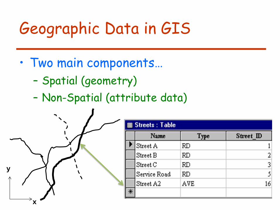
Geographic Data in GIS
• Two main components…
– Spatial (geometry)
– Non-Spatial (attribute data)
x
y
3
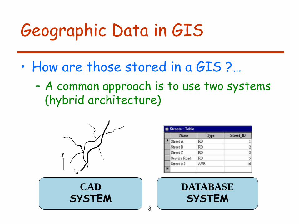
Geographic Data in GIS
• How are those stored in a GIS ?…
– A common approach is to use two systems (hybrid architecture)
CAD
SYSTEM
DATABASE
SYSTEM
x
y
4
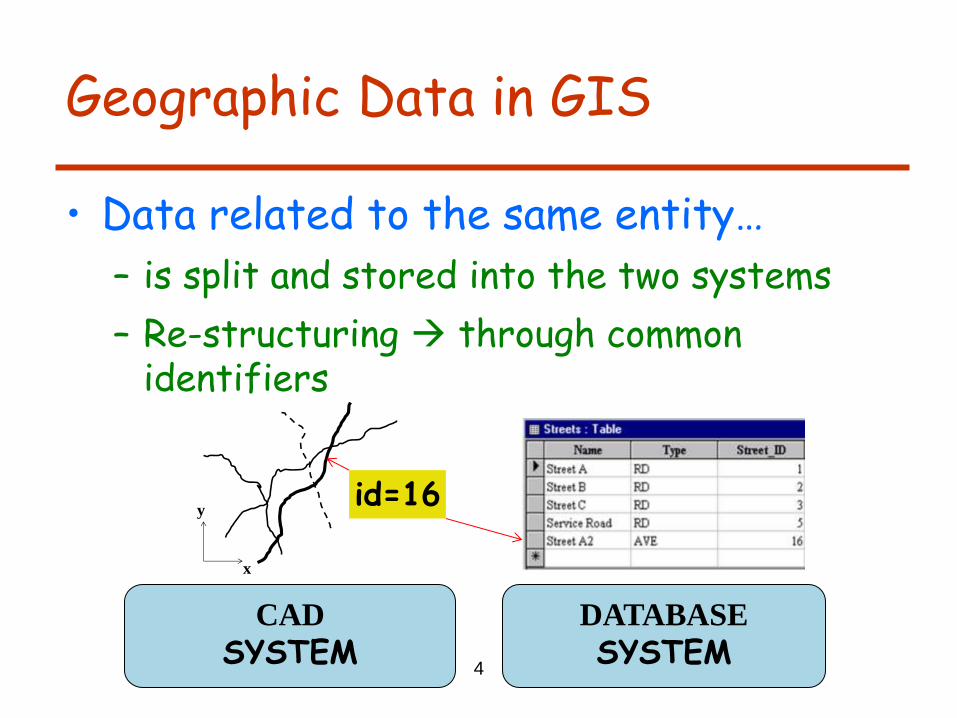
Geographic Data in GIS
• Data related to the same entity…
– is split and stored into the two systems
– Re-structuring through common identifiers
CAD
SYSTEM
DATABASE
SYSTEM
x
yid=16
5
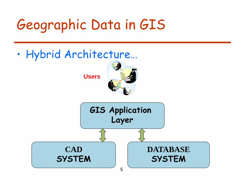
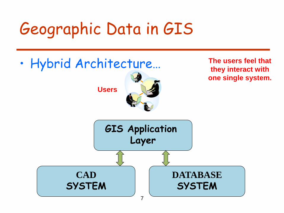
Geographic Data in GIS
• Hybrid Architecture…
CAD
SYSTEM
DATABASE
SYSTEM
GIS Application Layer
Users
6
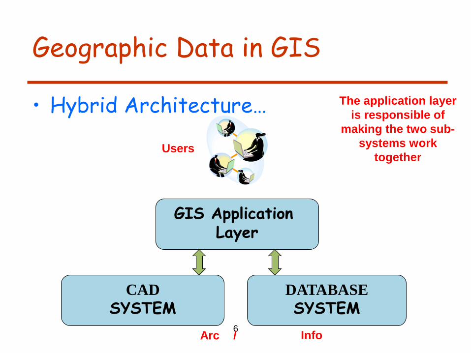
Geographic Data in GIS
• Hybrid Architecture…
CAD
SYSTEM
DATABASE
SYSTEM
GIS Application Layer
The application layer
is responsible of
making the two sub-
systems work
together Users
Arc Info /
7
Geographic Data in GIS
• Hybrid Architecture… The users feel that
they interact with
one single system.
CAD
SYSTEM
DATABASE
SYSTEM
GIS Application Layer
Users
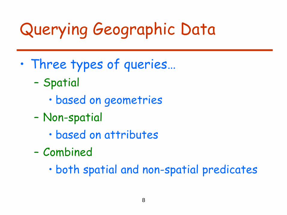
Querying Geographic Data
• Three types of queries…
– Spatial
• based on geometries
– Non-spatial
• based on attributes
– Combined
• both spatial and non-spatial predicates
8
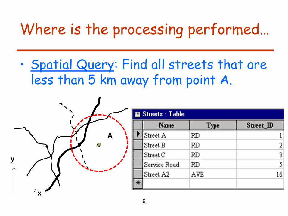
Where is the processing performed…
• Spatial Query: Find all streets that are less than 5 km away from point A.
9
x
y
A
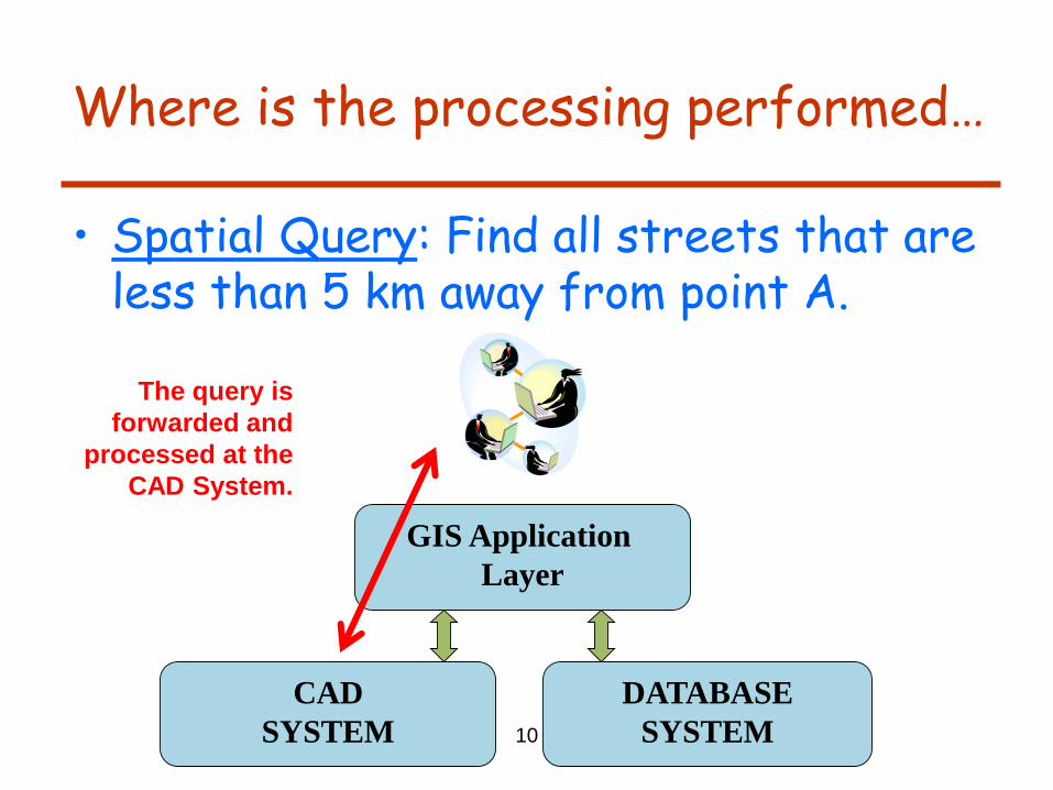
Where is the processing performed…
• Spatial Query: Find all streets that are less than 5 km away from point A.
10
CAD
SYSTEM
DATABASE
SYSTEM
GIS Application
Layer
The query is
forwarded and
processed at the
CAD System.
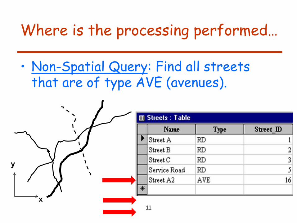
Where is the processing performed…
• Non-Spatial Query: Find all streets that are of type AVE (avenues).
11
x
y

Where is the processing performed…
• Non-Spatial Query: Find all streets that are of type AVE (avenues).
12
CAD
SYSTEM
DATABASE
SYSTEM
GIS Application
Layer
The query is
forwarded and
processed at the
Database System.

Where is the processing performed…
• Combined Query: Find all avenues that are less than 5 km away from point A.
13
x
y
A
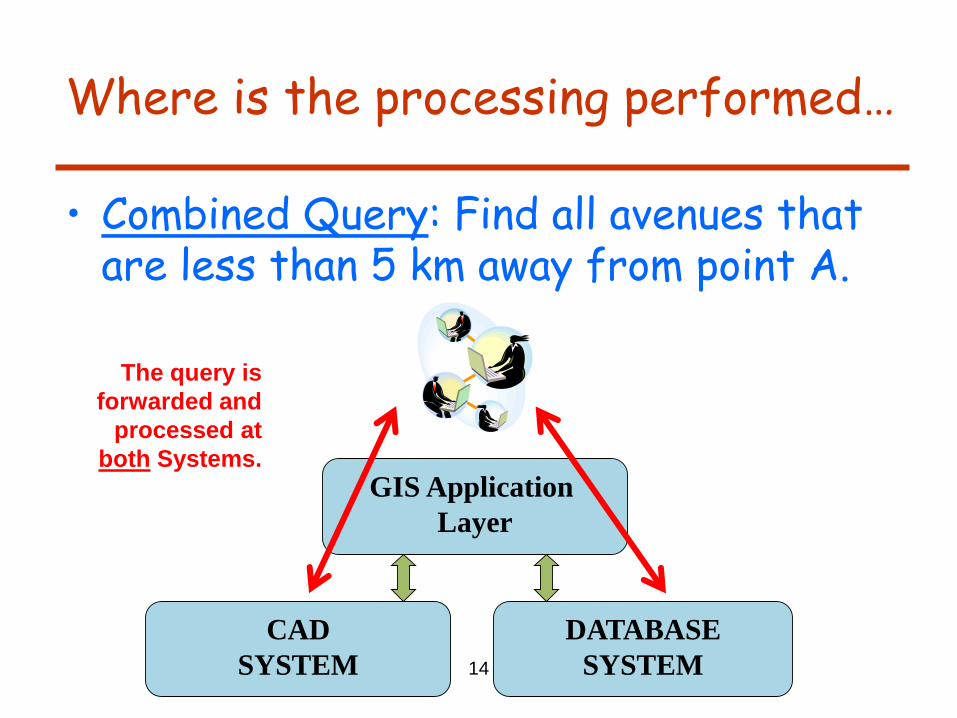
Where is the processing performed…
• Combined Query: Find all avenues that are less than 5 km away from point A.
14
CAD
SYSTEM
DATABASE
SYSTEM
GIS Application
Layer
The query is
forwarded and
processed at
both Systems.

Where is the processing performed…
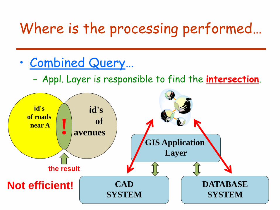
• Combined Query… – Appl. Layer is responsible to find the intersection.
15
CAD
SYSTEM
DATABASE
SYSTEM
GIS Application
Layer
id's
of roads
near A
id's
of
avenues !
the result
Where is the processing performed…
• Combined Query… – Appl. Layer is responsible to find the intersection.
16
CAD
SYSTEM
DATABASE
SYSTEM
GIS Application
Layer
id's
of roads
near A
id's
of
avenues !
the result
Not efficient!
17
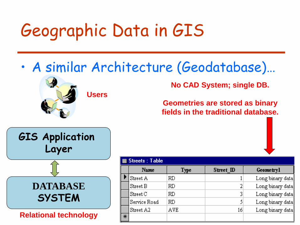
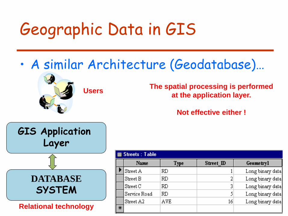
Geographic Data in GIS
• A similar Architecture (Geodatabase)…
DATABASE
SYSTEM
GIS Application Layer
Users
No CAD System; single DB.
Geometries are stored as binary
fields in the traditional database.
Relational technology
18
Geographic Data in GIS
• A similar Architecture (Geodatabase)…
DATABASE
SYSTEM
GIS Application Layer
Users The spatial processing is performed
at the application layer.
Not effective either !
Relational technology
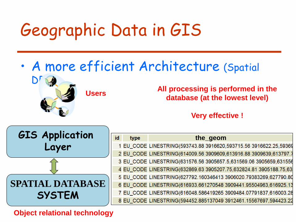
Geographic Data in GIS
• A more efficient Architecture (Spatial DB)…
SPATIAL DATABASE
SYSTEM
GIS Application Layer
Users All processing is performed in the
database (at the lowest level)
Very effective !
Object relational technology
the_geom

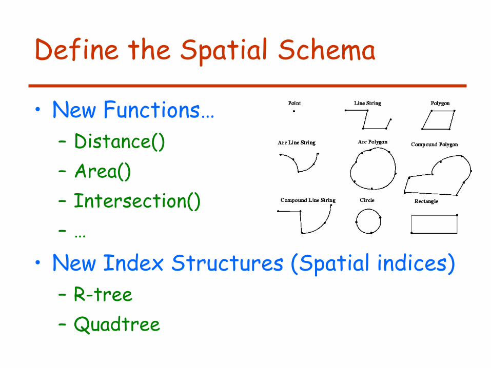
Define the Spatial Schema
• New Geometry types…
Define the Spatial Schema
• New Functions…
– Distance()
– Area()
– Intersection()
– …
• New Index Structures (Spatial indices)
– R-tree
– Quadtree
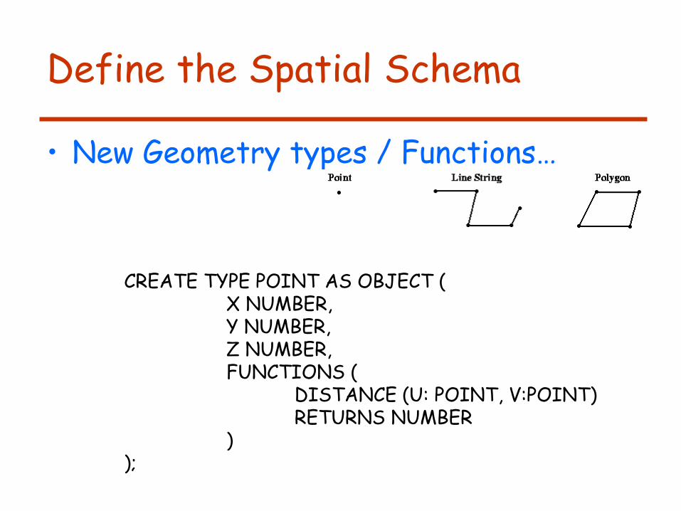
Define the Spatial Schema
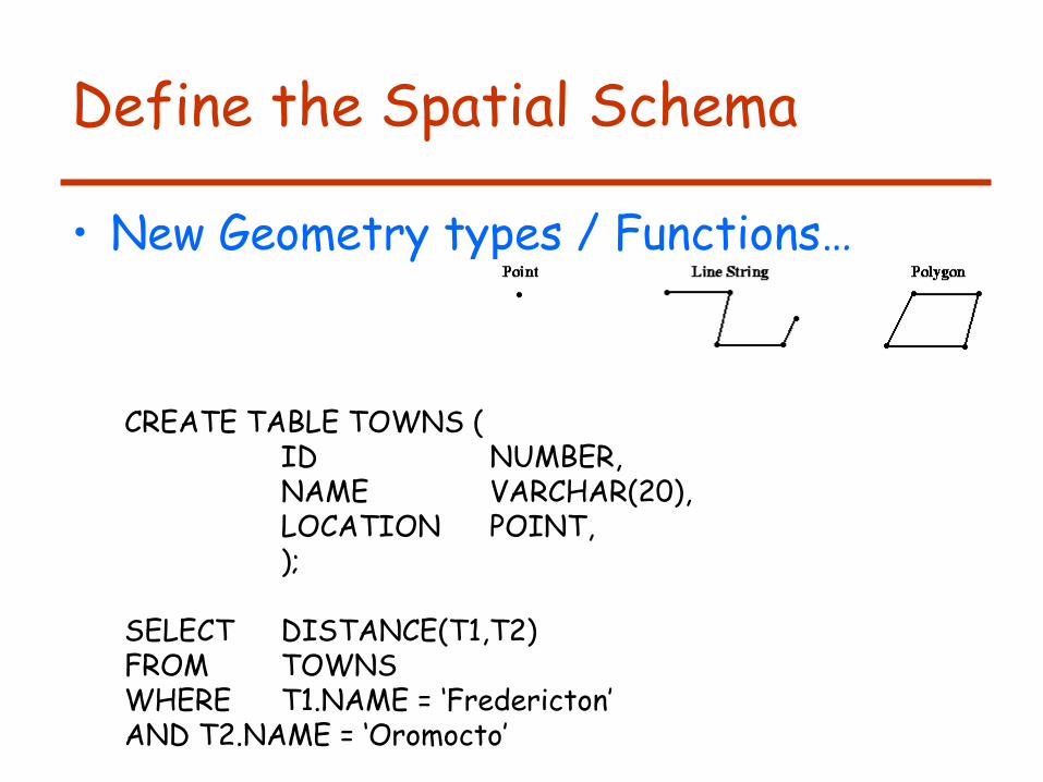
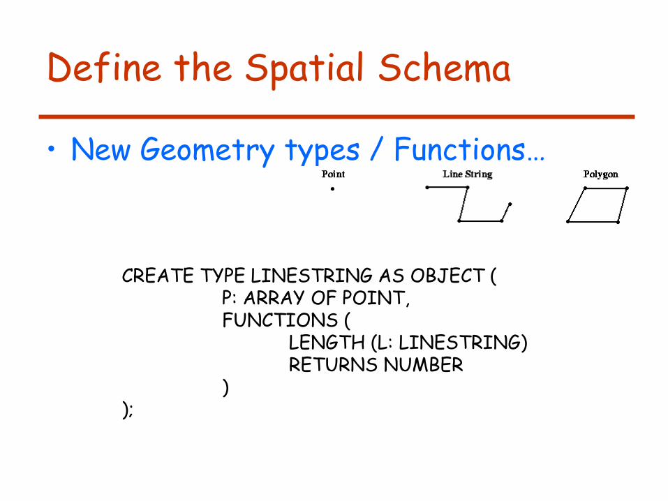
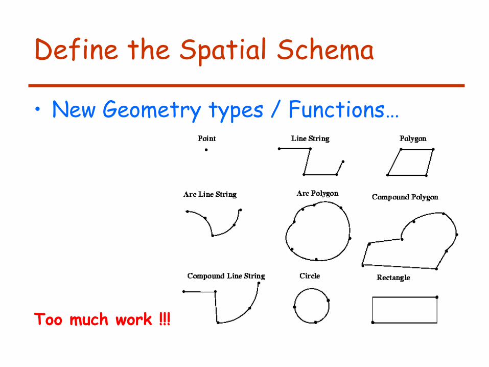
• New Geometry types / Functions…
CREATE TYPE POINT AS OBJECT ( X NUMBER, Y NUMBER, Ζ NUMBER, FUNCTIONS ( DISTANCE (U: POINT, V:POINT) RETURNS NUMBER ) );
Define the Spatial Schema
• New Geometry types / Functions…
CREATE TABLE TOWNS ( ID NUMBER, NAME VARCHAR(20), LOCATION POINT, ); SELECT DISTANCE(T1,T2) FROM TOWNS WHERE T1.NAME = ‘Fredericton’ AND T2.NAME = ‘Oromocto’
Define the Spatial Schema
• New Geometry types / Functions…
CREATE TYPE LINESTRING AS OBJECT ( P: ARRAY OF POINT, FUNCTIONS ( LENGTH (L: LINESTRING) RETURNS NUMBER ) );
Define the Spatial Schema
• New Geometry types / Functions…
Etc…
Too much work !!!

Define the Spatial Schema
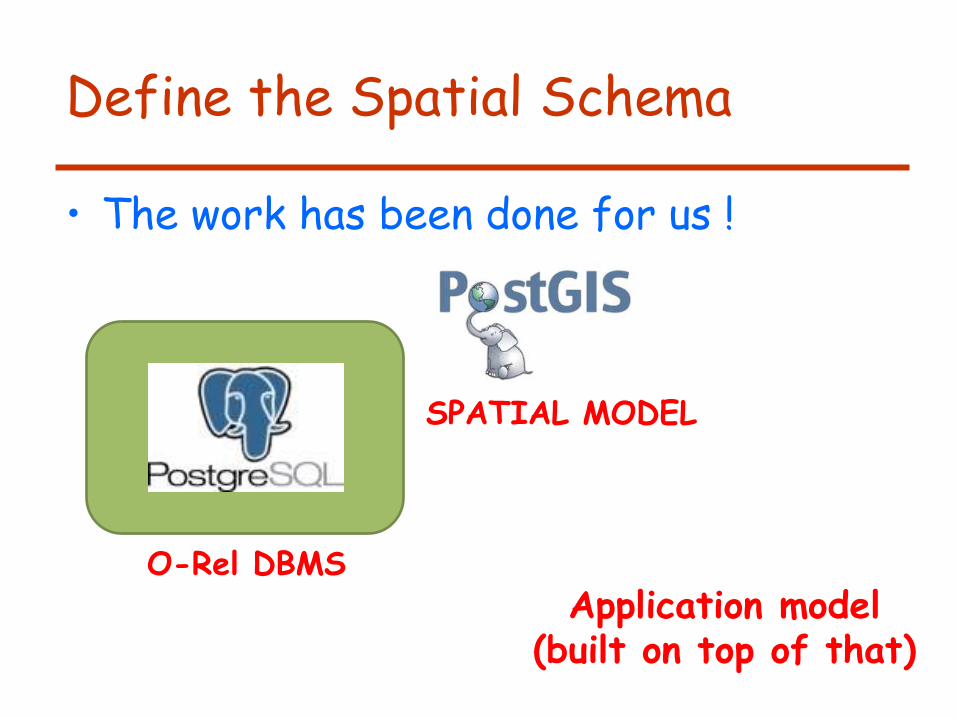
• The work has been done for us !
Geometry
Point LineString Polygon
MultiPolygon MultiLineString MultiPoint
Geom_Collection
Spatial Reference System
LinearRing Line
2..* 2..* 2..* 2..*
1..*
Define the Spatial Schema
• The work has been done for us !
O-Rel DBMS
SPATIAL MODEL
Application model (built on top of that)
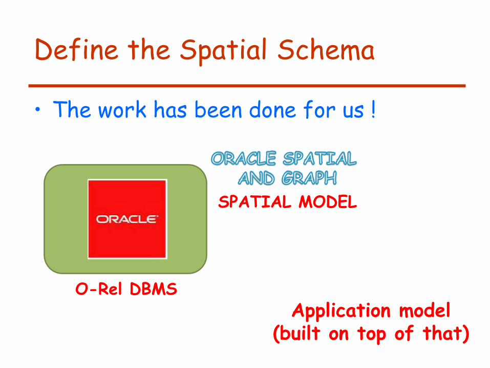
Define the Spatial Schema
• The work has been done for us !
O-Rel DBMS
SPATIAL MODEL
Application model (built on top of that)
29
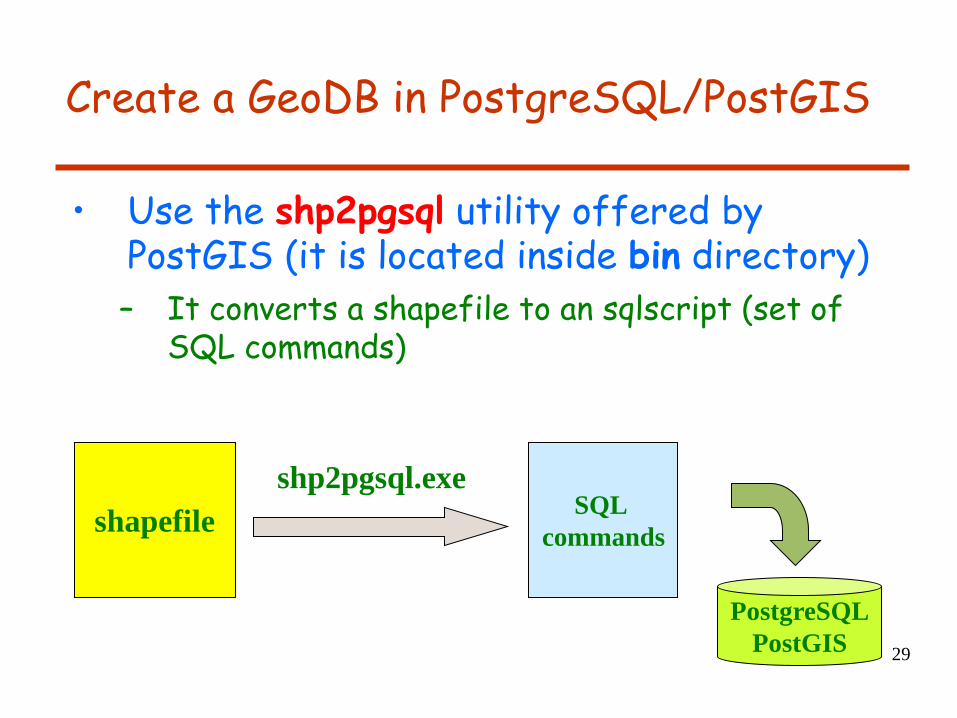
Create a GeoDB in PostgreSQL/PostGIS
• Use the shp2pgsql utility offered by PostGIS (it is located inside bin directory)
– It converts a shapefile to an sqlscript (set of SQL commands)
shapefile SQL
commands
shp2pgsql.exe
PostgreSQL
PostGIS
30
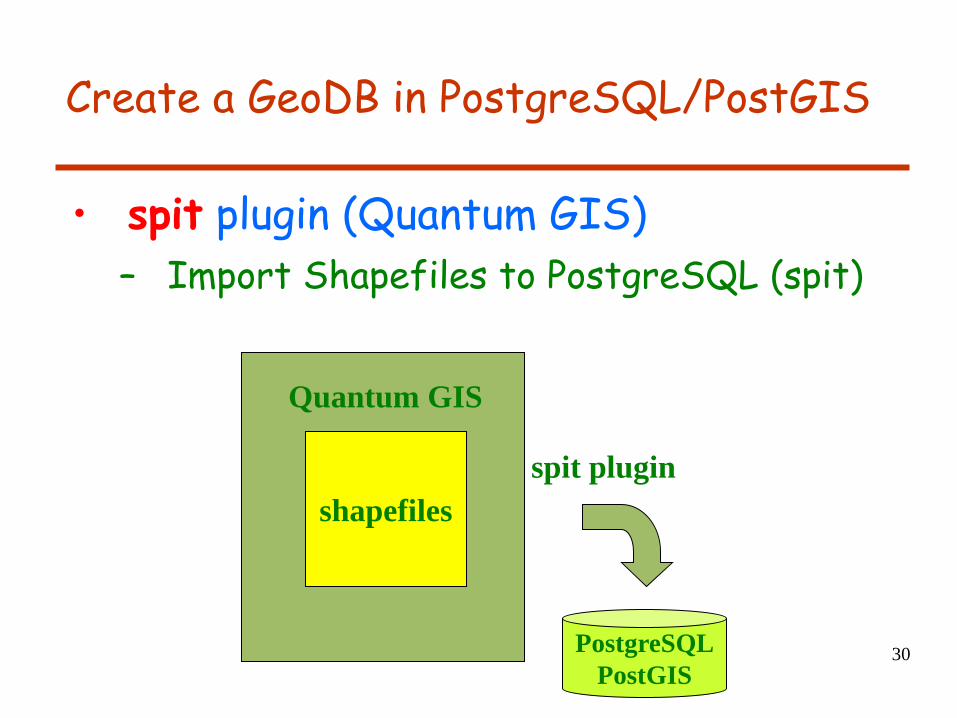
Create a GeoDB in PostgreSQL/PostGIS
• spit plugin (Quantum GIS)
– Import Shapefiles to PostgreSQL (spit)
shapefiles
spit plugin
PostgreSQL
PostGIS
Quantum GIS
31
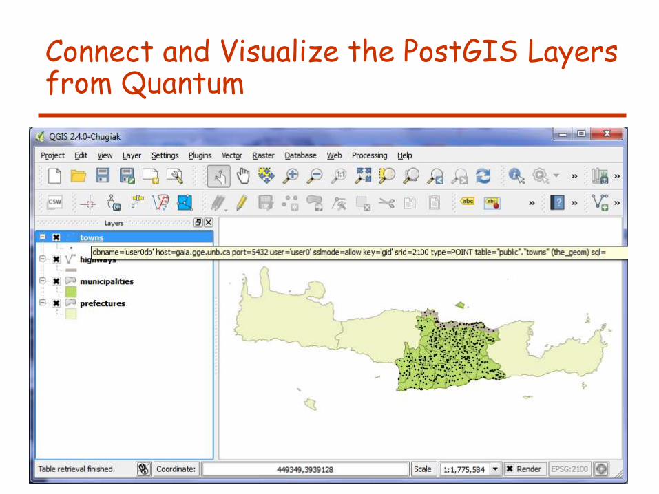
Connect and Visualize the PostGIS Layers from Quantum
32
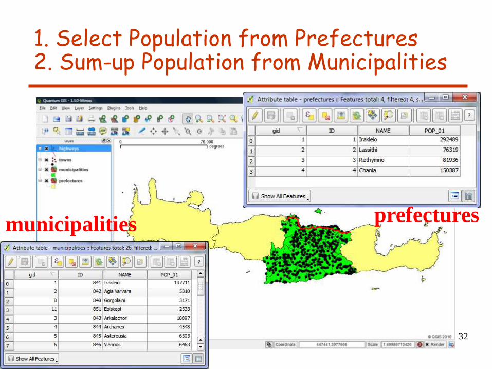
1. Select Population from Prefectures 2. Sum-up Population from Municipalities
prefectures municipalities
33
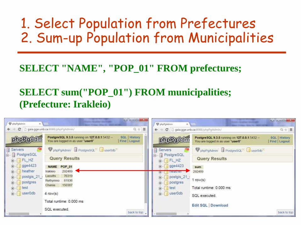
1. Select Population from Prefectures 2. Sum-up Population from Municipalities
SELECT "NAME", "POP_01" FROM prefectures;
SELECT sum("POP_01") FROM municipalities;
(Prefecture: Irakleio)

34
Towns in the municipality of Mallia.
SELECT r."NAME" as municipality, m. "NAME" as town
FROM municipalities AS r, towns AS m
WHERE r.the_geom && m.the_geom
AND ST_contains(r.the_geom, m.the_geom)
AND r."NAME" = 'Mallia';
35
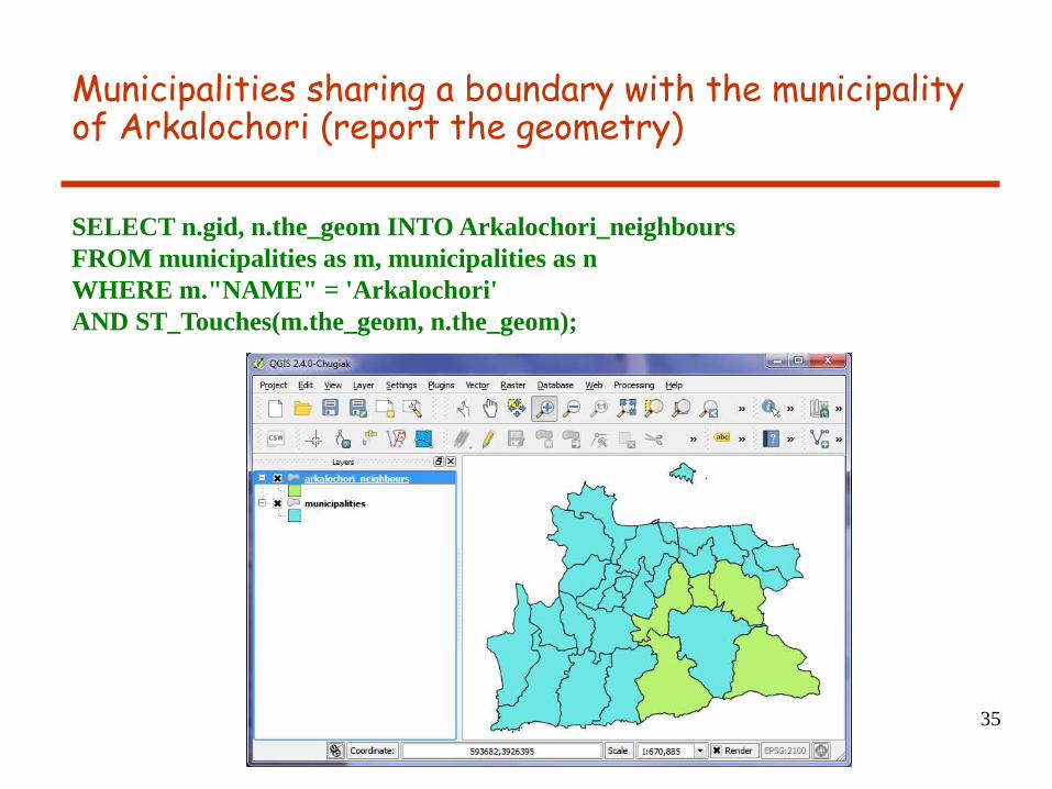
Municipalities sharing a boundary with the municipality of Arkalochori (report the geometry)
SELECT n.gid, n.the_geom INTO Arkalochori_neighbours
FROM municipalities as m, municipalities as n
WHERE m."NAME" = 'Arkalochori'
AND ST_Touches(m.the_geom, n.the_geom);
36
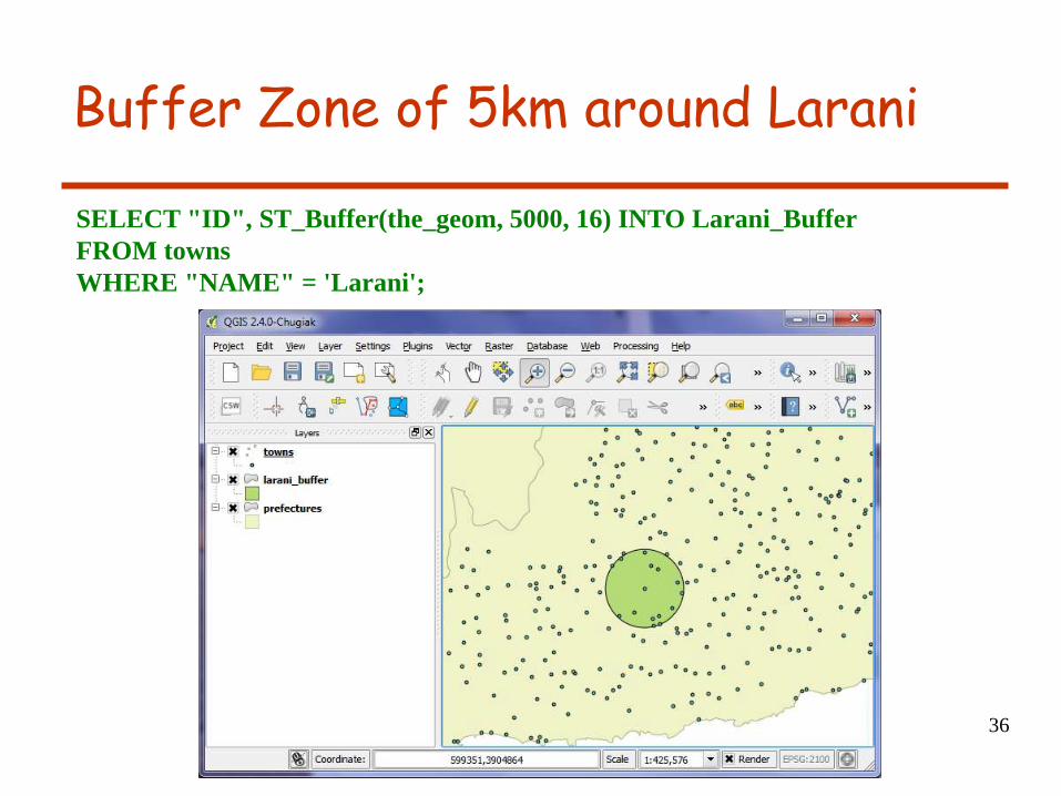
Buffer Zone of 5km around Larani
SELECT "ID", ST_Buffer(the_geom, 5000, 16) INTO Larani_Buffer
FROM towns
WHERE "NAME" = 'Larani';
37
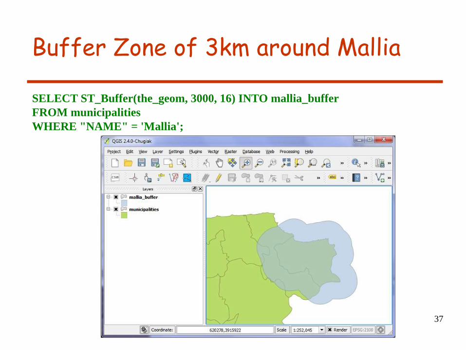
Buffer Zone of 3km around Mallia
SELECT ST_Buffer(the_geom, 3000, 16) INTO mallia_buffer
FROM municipalities
WHERE "NAME" = 'Mallia';
Geographic Database Systems
Emmanuel Stefanakis
http://www2.unb.ca/~estef/
Stefanakis, E., 2014. Geographic Databases and Information Systems.
CreateSpace Independent Publ. [In English], pp.386.
Get a copy from Amazon
Chapter 15