Embed Size (px)
Citation preview
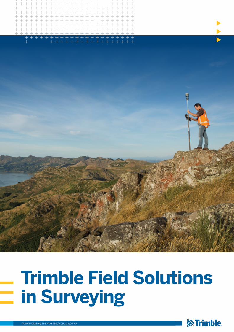
Trimble Field Solutions in Surveying TRANSFORMING THE WAY THE WORLD WORKS
TRANSFORMING THE WAY THE WORLD WORKS2
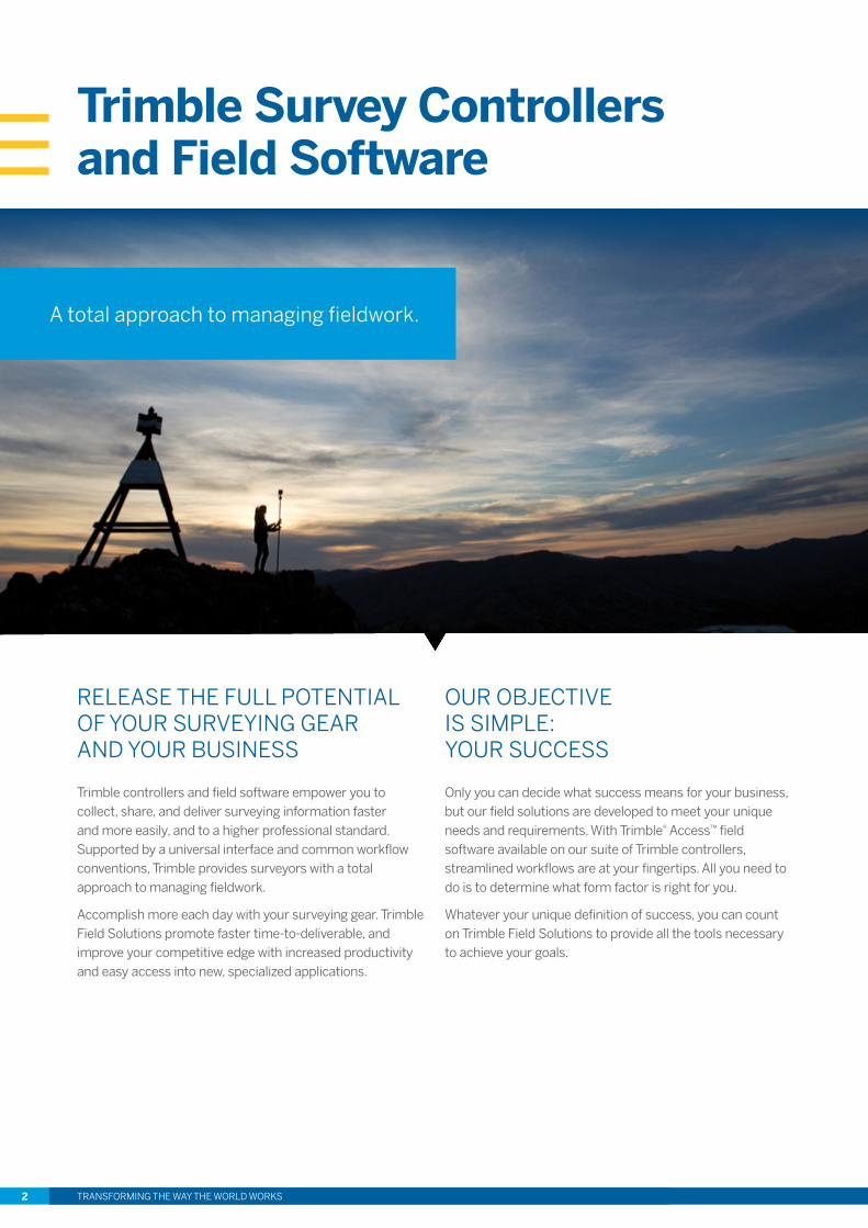
RELEASE THE FULL POTENTIAL OF YOUR SURVEYING GEAR AND YOUR BUSINESS
Trimble controllers and field software empower you to collect, share, and deliver surveying information faster and more easily, and to a higher professional standard. Supported by a universal interface and common workflow conventions, Trimble provides surveyors with a total approach to managing fieldwork.
Accomplish more each day with your surveying gear. Trimble Field Solutions promote faster time-to-deliverable, and improve your competitive edge with increased productivity and easy access into new, specialized applications.
OUR OBJECTIVE IS SIMPLE: YOUR SUCCESS
Only you can decide what success means for your business, but our field solutions are developed to meet your unique needs and requirements. With Trimble® Access™ field software available on our suite of Trimble controllers, streamlined workflows are at your fingertips. All you need to do is to determine what form factor is right for you.
Whatever your unique definition of success, you can count on Trimble Field Solutions to provide all the tools necessary to achieve your goals.
A total approach to managing fieldwork.
Trimble Survey Controllers and Field Software
TRANSFORMING THE WAY THE WORLD WORKS 3
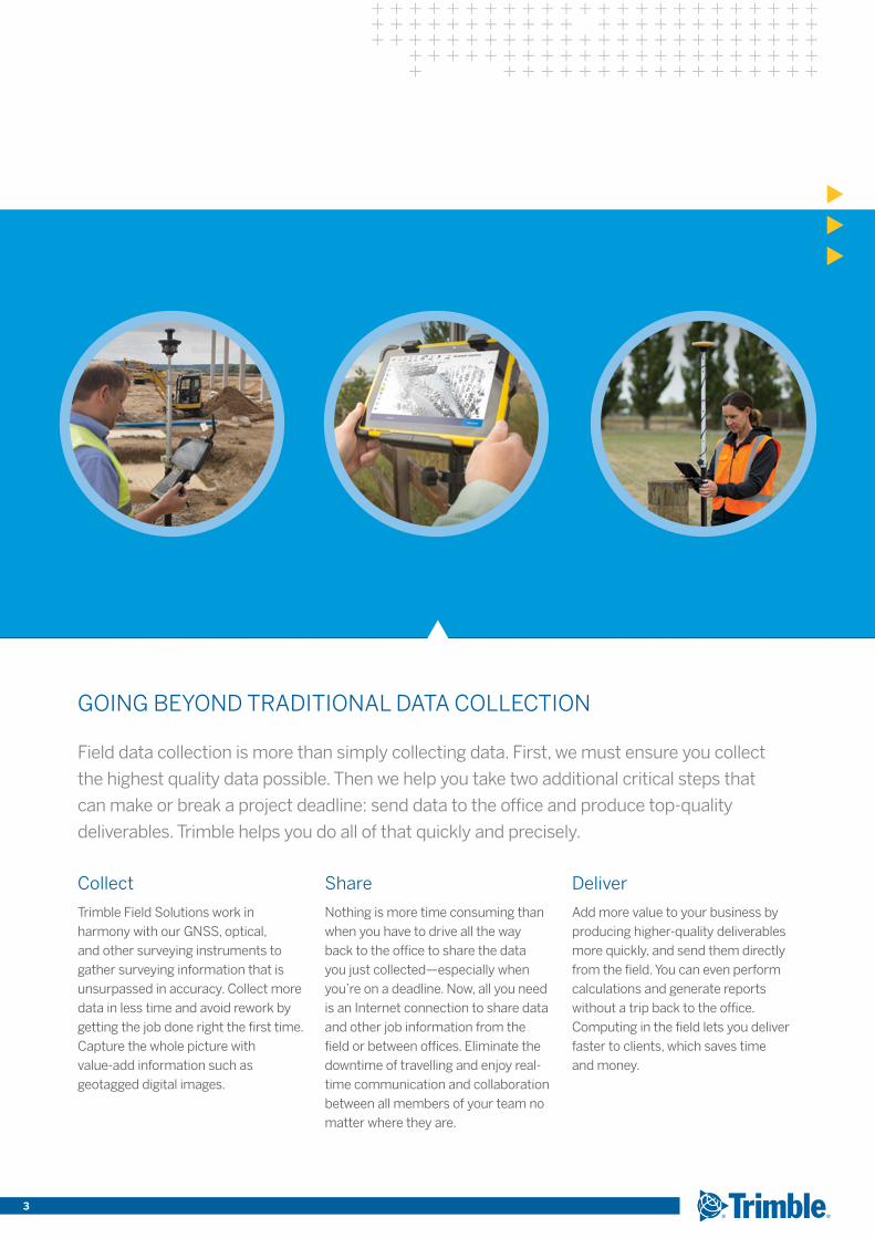
GOING BEYOND TRADITIONAL DATA COLLECTION
Field data collection is more than simply collecting data. First, we must ensure you collect
the highest quality data possible. Then we help you take two additional critical steps that
can make or break a project deadline: send data to the office and produce top-quality
deliverables. Trimble helps you do all of that quickly and precisely.
Collect
Trimble Field Solutions work in harmony with our GNSS, optical, and other surveying instruments to gather surveying information that is unsurpassed in accuracy. Collect more data in less time and avoid rework by getting the job done right the first time. Capture the whole picture with value-add information such as geotagged digital images.
Share
Nothing is more time consuming than when you have to drive all the way back to the office to share the data you just collected—especially when you’re on a deadline. Now, all you need is an Internet connection to share data and other job information from the field or between offices. Eliminate the downtime of travelling and enjoy real-time communication and collaboration between all members of your team no matter where they are.
Deliver
Add more value to your business by producing higher-quality deliverables more quickly, and send them directly from the field. You can even perform calculations and generate reports without a trip back to the office. Computing in the field lets you deliver faster to clients, which saves time and money.
TRANSFORMING THE WAY THE WORLD WORKS4
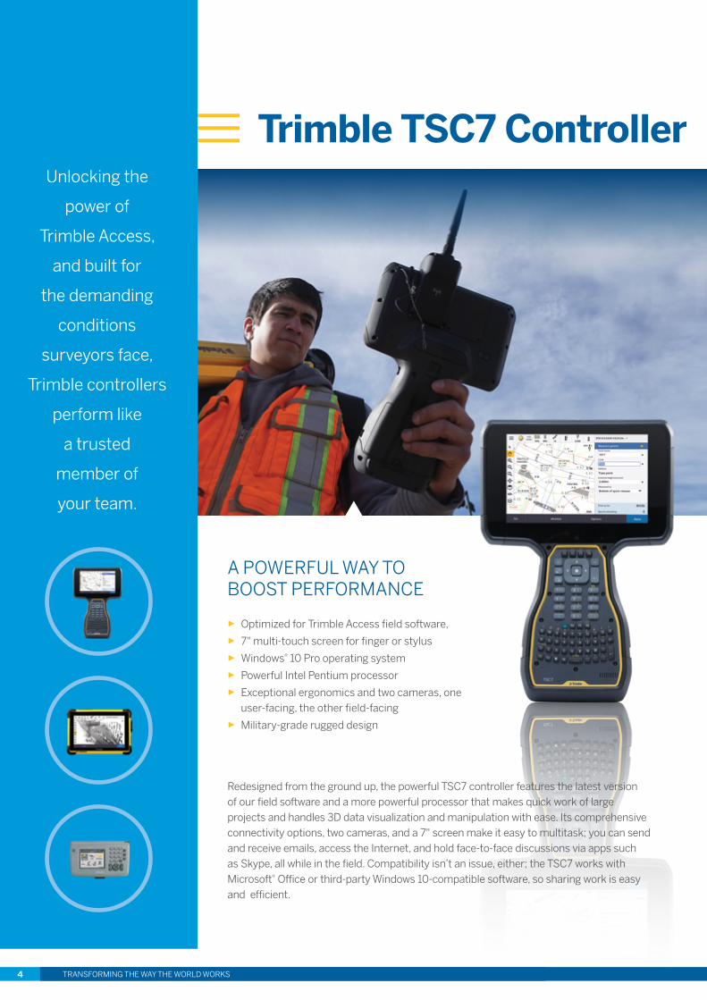
A POWERFUL WAY TO BOOST PERFORMANCE
► Optimized for Trimble Access field software, ► 7" multi-touch screen for finger or stylus ► Windows® 10 Pro operating system ► Powerful Intel Pentium processor ► Exceptional ergonomics and two cameras, one
user-facing, the other field-facing ► Military-grade rugged design
Trimble TSC7 Controller
Redesigned from the ground up, the powerful TSC7 controller features the latest version of our field software and a more powerful processor that makes quick work of large projects and handles 3D data visualization and manipulation with ease. Its comprehensive connectivity options, two cameras, and a 7" screen make it easy to multitask; you can send and receive emails, access the Internet, and hold face-to-face discussions via apps such as Skype, all while in the field. Compatibility isn’t an issue, either; the TSC7 works with Microsoft® Office or third-party Windows 10-compatible software, so sharing work is easy and efficient.
Unlocking the
power of
Trimble Access,
and built for
the demanding
conditions
surveyors face,
Trimble controllers
perform like
a trusted
member of
your team.
TRANSFORMING THE WAY THE WORLD WORKS 5
Trimble TSC7 Controller
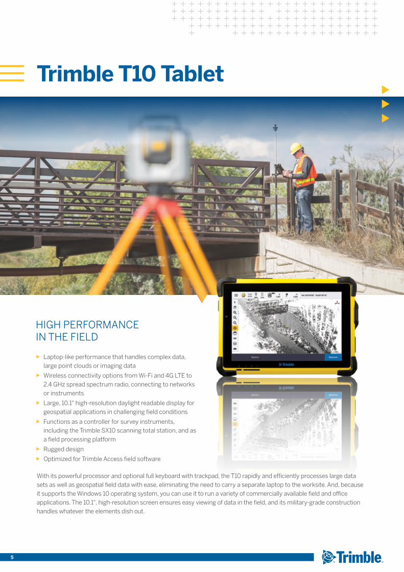
HIGH PERFORMANCE IN THE FIELD
► Laptop-like performance that handles complex data, large point clouds or imaging data
► Wireless connectivity options from Wi-Fi and 4G LTE to 2.4 GHz spread spectrum radio, connecting to networks or instruments
► Large, 10.1" high-resolution daylight readable display for geospatial applications in challenging field conditions
► Functions as a controller for survey instruments, including the Trimble SX10 scanning total station, and as a field processing platform
► Rugged design ► Optimized for Trimble Access field software
Trimble T10 Tablet
With its powerful processor and optional full keyboard with trackpad, the T10 rapidly and efficiently processes large data sets as well as geospatial field data with ease, eliminating the need to carry a separate laptop to the worksite. And, because it supports the Windows 10 operating system, you can use it to run a variety of commercially available field and office applications. The 10.1", high-resolution screen ensures easy viewing of data in the field, and its military-grade construction handles whatever the elements dish out.
TRANSFORMING THE WAY THE WORLD WORKS6
Trimble CU Controller
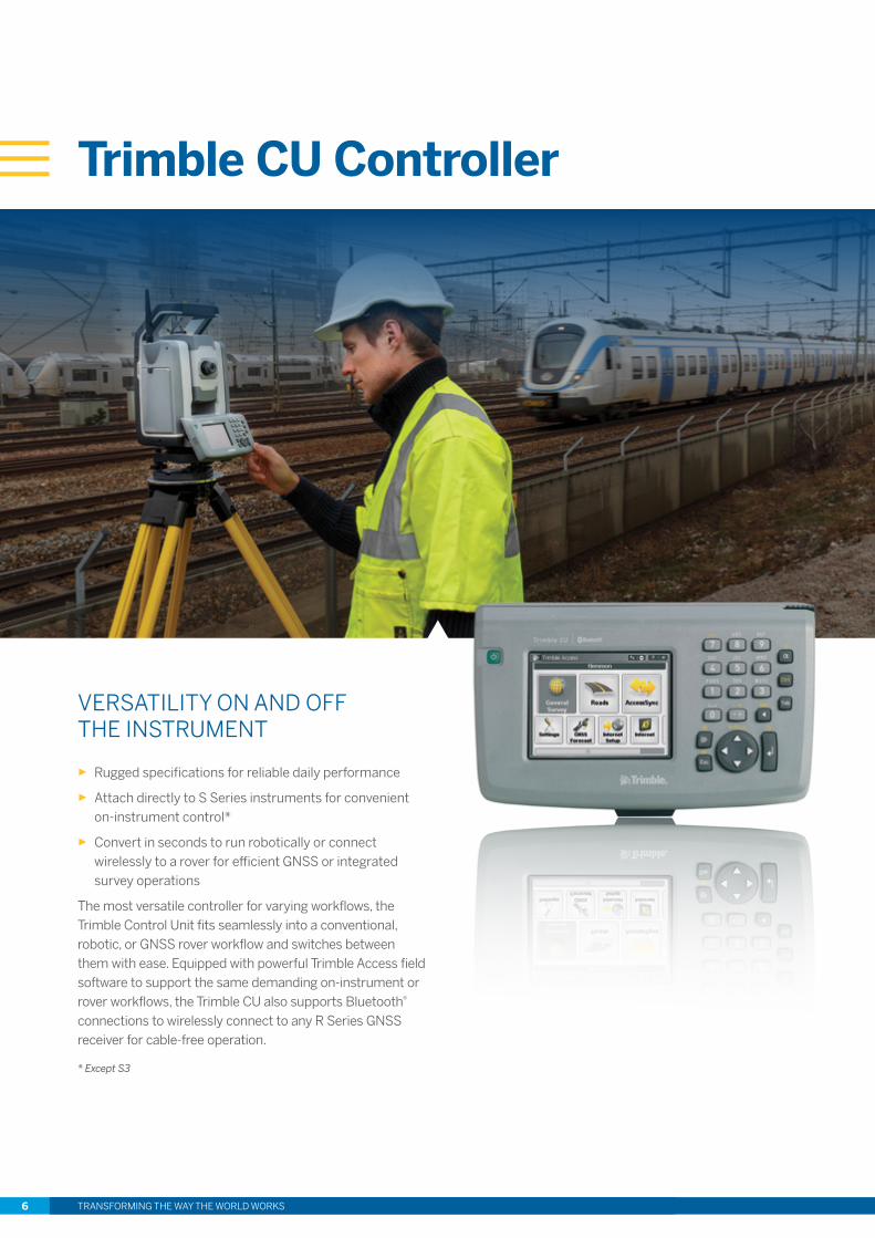
VERSATILITY ON AND OFF THE INSTRUMENT
► Rugged specifications for reliable daily performance
► Attach directly to S Series instruments for convenient on-instrument control*
► Convert in seconds to run robotically or connect wirelessly to a rover for efficient GNSS or integrated survey operations
The most versatile controller for varying workflows, the Trimble Control Unit fits seamlessly into a conventional, robotic, or GNSS rover workflow and switches between them with ease. Equipped with powerful Trimble Access field software to support the same demanding on-instrument or rover workflows, the Trimble CU also supports Bluetooth® connections to wirelessly connect to any R Series GNSS receiver for cable-free operation.
* Except S3
TRANSFORMING THE WAY THE WORLD WORKS 7
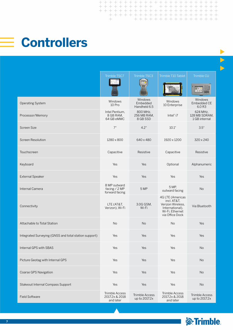
Controllers
Trimble TSC7 Trimble TSC3 Trimble T10 Tablet Trimble CU
Operating System Windows 10 Pro
Windows Embedded
Handheld 6.5
Windows 10 Enterprise
Windows Embedded CE
6.0 R3
Processor/MemoryIntel Pentium,
8 GB RAM, 64 GB eMMC
800 MHz, 256 MB RAM,
8 GB SSDIntel® i7
624 MHz, 128 MB SDRAM,
1 GB internal
Screen Size 7" 4.2" 10.1" 3.5"
Screen Resolution 1280 x 800 640 x 480 1920 x 1200 320 x 240
Touchscreen Capacitive Resistive Capacitive Resistive
Keyboard Yes Yes Optional Alphanumeric
External Speaker Yes Yes Yes Yes
Internal Camera8 MP outward facing / 2 MP forward facing
5 MP 5 MP, outward facing No
Connectivity LTE (AT&T, Verizon), Wi-Fi
3.0G GSM, Wi-Fi
4G LTE (Americas incl. AT&T,
Verizon Wireless, International), Wi-Fi, Ethernet via Office Dock
Via Bluetooth
Attachable to Total Station No No No Yes
Integrated Surveying (GNSS and total station support) Yes Yes Yes Yes
Internal GPS with SBAS Yes Yes Yes No
Picture Geotag with Internal GPS Yes Yes Yes No
Coarse GPS Navigation Yes Yes Yes No
Stakeout Internal Compass Support Yes Yes Yes No
Field SoftwareTrimble Access 2017.2x & 2018
and later
Trimble Access up to 2017.2x
Trimble Access 2017.2x & 2018
and later
Trimble Access up to 2017.2x
TRANSFORMING THE WAY THE WORLD WORKS8
Trimble Access Field Software: Supporting Your Workflows
With Trimble Access field software, the power is literally in your hands to take on more jobs
and complete them more efficiently than ever before. Our field software is powerful and easy
to use, so you can focus on getting each job completed.
Make every minute of every day more productive
What’s in your schedule today? You might need to observe a first-order control point at one location, set out a section of road grades at a second, and then perform an as-built audit at the third site. When you have multiple jobs to complete and mountains of data to move, every minute of every day counts. You can’t waste time configuring your surveying gear—you need to get to work.
Designed to support your everyday work, including topographic surveys, staking, control, and more; Trimble Access offers a familiar, easy-to-use interface that will ensure your instant productivity—you’ll experience less of the typical downtime associated with learning new software. Trimble Access supports the full range of Trimble GNSS and optical sensors, plus robotic radio connections.
* This feature is available in Trimble Access version 2018 and later.
Share data in real time
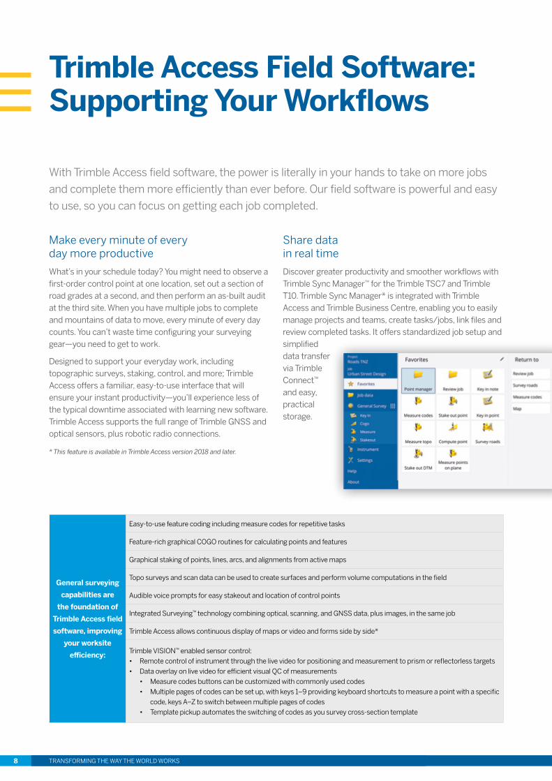
Discover greater productivity and smoother workflows with Trimble Sync Manager™ for the Trimble TSC7 and Trimble T10. Trimble Sync Manager* is integrated with Trimble Access and Trimble Business Centre, enabling you to easily manage projects and teams, create tasks/jobs, link files and review completed tasks. It offers standardized job setup and simplified data transfer via Trimble Connect™ and easy, practical storage.
General surveying
capabilities are
the foundation of
Trimble Access field
software, improving
your worksite
efficiency:
Easy-to-use feature coding including measure codes for repetitive tasks
Feature-rich graphical COGO routines for calculating points and features
Graphical staking of points, lines, arcs, and alignments from active maps
Topo surveys and scan data can be used to create surfaces and perform volume computations in the field
Audible voice prompts for easy stakeout and location of control points
Integrated Surveying™ technology combining optical, scanning, and GNSS data, plus images, in the same job
Trimble Access allows continuous display of maps or video and forms side by side*
Trimble VISION™ enabled sensor control:• Remote control of instrument through the live video for positioning and measurement to prism or reflectorless targets • Data overlay on live video for efficient visual QC of measurements
• Measure codes buttons can be customized with commonly used codes• Multiple pages of codes can be set up, with keys 1–9 providing keyboard shortcuts to measure a point with a specific
code, keys A–Z to switch between multiple pages of codes• Template pickup automates the switching of codes as you survey cross-section template
TRANSFORMING THE WAY THE WORLD WORKS 9
Trimble Access Applications
Trimble Access offers optional streamlined workflows to guide crews through common
project types and improve data consistency. These specialized applications make data
collection fast and easy. And they allow crews to focus entirely on the deliverables—instead
of the software commands for each task along the way.
Visit Trimble.com/Access to learn about the full suite of Trimble Access applications available to you!
Roads
Tunnels
Monitoring
Cloud Connectivity
Software Development
Kit
Pipelines
The Trimble Access Roads app imports road definitions from many third-party sources, or you can key in a complete road definition that includes horizontal and vertical alignments, templates and superelevation, and widening records. A graphical stakeout workflow includes slope staking, real-time redesign, and real-time quality control.
The easy-to-follow workflow guides the user through tasks such as the automated scanning of tunnel profiles and the setout of rock bolt positions. Marking areas of underbreak is quick and easy with the laser pointer of a Trimble S Series total station. The graphical interface provides a clear view of the as-designed versus as-built conditions.
Surveyors looking for a fast entry to deformation monitoring can take advantage of the Monitoring specialized app for the Trimble Access software suite. The Monitoring app guides surveyors through a step-by-step process that speeds setup, data collection and reporting
The perfect compliment to Trimble Access, Trimble Access Cloud Connectivity* (available to all subscribers with a valid software maintenance agreement) allows users to easily share information for faster delivery from the field and last-minute changes from the office. This enables the entire team to securely collaborate throughout the duration of the job.
Trimble Access Pipelines automates common pipeline survey tasks, simplifying attribute and inventory collection and integrating all collected data in one easy-to-use workflow. It even reduces office processing time by consolidating as-built pipeline data linked with inventory information into one database.
Do you need to customize Trimble Access to do a particular task? Do you need to create advanced workflows that match your business needs? The Trimble Access Software Developer Kit provides software developers with the tools to customize and extend Trimble Access. Specialized applications created by third party developers also include applications for utilities, leveling, and more.
For more information, visit www.trimble.com/developer

TRANSFORMING THE WAY THE WORLD WORKS10
Trimble VISION Video-Assisted Control
Trimble VISION technology integrates calibrated digital cameras with Trimble S9 and S7 total
stations, as well as the Trimble SX10 scanning total station. These instruments have the ability
to collect survey data, stream video from the perspective of the instrument, and capture
panoramic still images. Trimble Access field software overlays survey data on the streaming
video, which enhances your field productivity when operating the instrument robotically.
See what the instrument sees
Trimble VISION brings the instrument telescope to your field controller. Using live video and remote control, you see what the instrument sees. High-quality video and digital zoom make it easy to identify survey targets. Collect measurements and geotagged images for use throughout your Trimble surveying system. The large display screens on the Trimble TSC7 controller and Trimble T10 tablet allow you to take full advantage of these features.
Measure with speed and safety
Seeking comprehensive, detailed data on project conditions and features? Trimble VISION enables surveyors to combine visual information with field measurements and design data.
Collect more data in less time
You can use Trimble VISION to produce comprehensive, detailed data on project conditions and features. By integrating survey and design information with real-time images, you can verify that you have collected all the data you need before leaving the job site.
TRANSFORMING THE WAY THE WORLD WORKS 11
TRIMBLE TECHNOLOGY AT YOUR FINGERTIPS
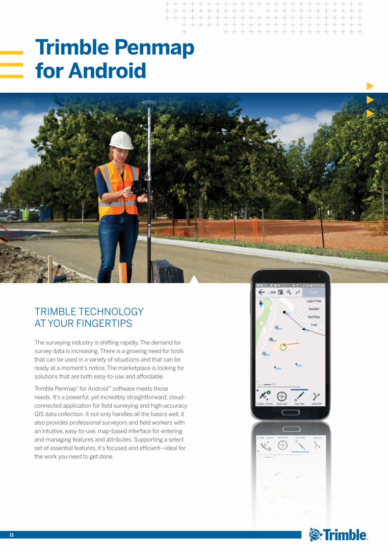
The surveying industry is shifting rapidly. The demand for survey data is increasing. There is a growing need for tools that can be used in a variety of situations and that can be ready at a moment’s notice. The marketplace is looking for solutions that are both easy-to-use and affordable.
Trimble Penmap® for Android™ software meets those needs. It’s a powerful, yet incredibly straightforward, cloud-connected application for field surveying and high-accuracy GIS data collection. It not only handles all the basics well, it also provides professional surveyors and field workers with an intuitive, easy-to-use, map-based interface for entering and managing features and attributes. Supporting a select set of essential features, it’s focused and efficient—ideal for the work you need to get done.
Trimble Penmap for Android
Trimble’s Distribution Partners offer world-class customer service, support and training our users know and trust. Our service centers provide everything you need to optimize equipment performance, from preventative maintenance to full calibration, cleaning and repair. We’ll do whatever it takes to minimize downtime and keep you running at maximum efficiency.
Trimble support offers an online Knowledge Center for quick access to product information, technical tips, workflow descriptions, videos, and more. When you need specific hardware or software support on a project, we have the experts that can help. Trimble has a vast network of trained Distribution Partners to provide local support and we offer Preferred Support contracts to give you direct access to highly experienced Trimble support engineers.
For more than 35 years, Trimble’s positioning-centric products have been transforming the way people, businesses and governments work.
The Trimble portfolio now includes more than 1,100 patents. And we continue to support our organic product development with strategic acquisitions to bring the latest positioning technologies to a broader market.
Trimble employees, coupled with a highly capable network of dealers and distribution partners, serve and support customers in 150 countries. Though best known for GPS technology, Trimble integrates GPS, laser, optical and inertial technologies with application software, wireless communications, and other services to provide complete, integrated solutions for our customers. These integrated solutions allow our customers to collect, manage and analyze complex information quickly and efficiently, making them more productive and more profitable.
For more information on our field surveying solutions, please visit geospatial.trimble.com
Customer service you can count on
A history of transforming the way the world works
Contact your local Trimble Authorized Distribution Partner for more information
TRANSFORMING THE WAY THE WORLD WORKS
NORTH AMERICATrimble Inc.10368 Westmoor DriveWestminster CO 80021 USA
EUROPETrimble Germany GmbHAm Prime Parc 1165479 Raunheim GERMANY
ASIA-PACIFICTrimble NavigationSingapore PTE Limited3 HarbourFront Place#13-02 HarbourFront Tower TwoSingapore 099254SINGAPORE
© 2015–2018, Trimble Inc. All rights reserved. Trimble, the Globe & Triangle logo and PenMap are trademarks of Trimble Inc., registered in the United States and in other countries. Access, Connect, Integrated Surveying, Sync Manager and VISION are trademarks of Trimble Inc. The Bluetooth word mark and logos are owned by the Bluetooth SIG, Inc. and any use of such marks by Trimble Inc. is under license. Microsoft and Windows are registered trademarks of Microsoft Corporation in the United States and/or other countries. Android is a trademark of Google Inc. All other trademarks are the property of their respective owners. PN 022543-524D (04/18)
www.trimble.com