Embed Size (px)
Citation preview
Topic 18 Coasts, Beaches, and Estuaries
GEOL 2503
Introduction to Oceanography
2
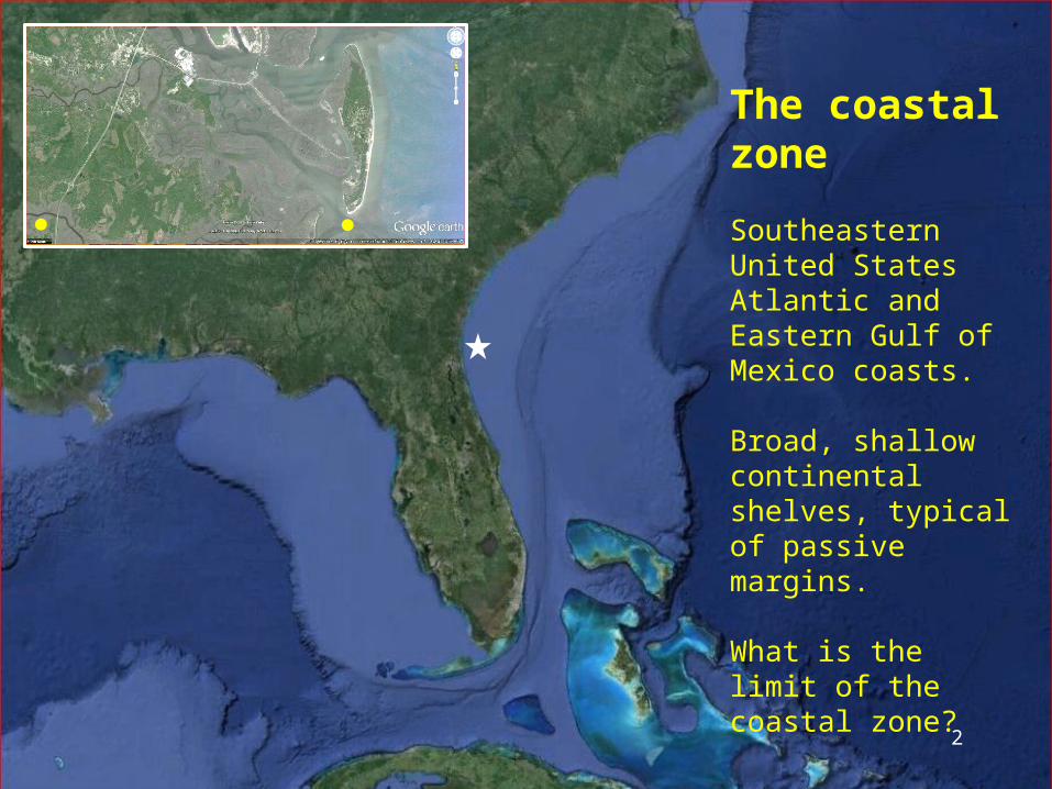
The coastal zone
Southeastern United States Atlantic and Eastern Gulf of Mexico coasts.
Broad, shallow continental shelves, typical of passive margins.
What is the limit of the coastal zone?
3
4
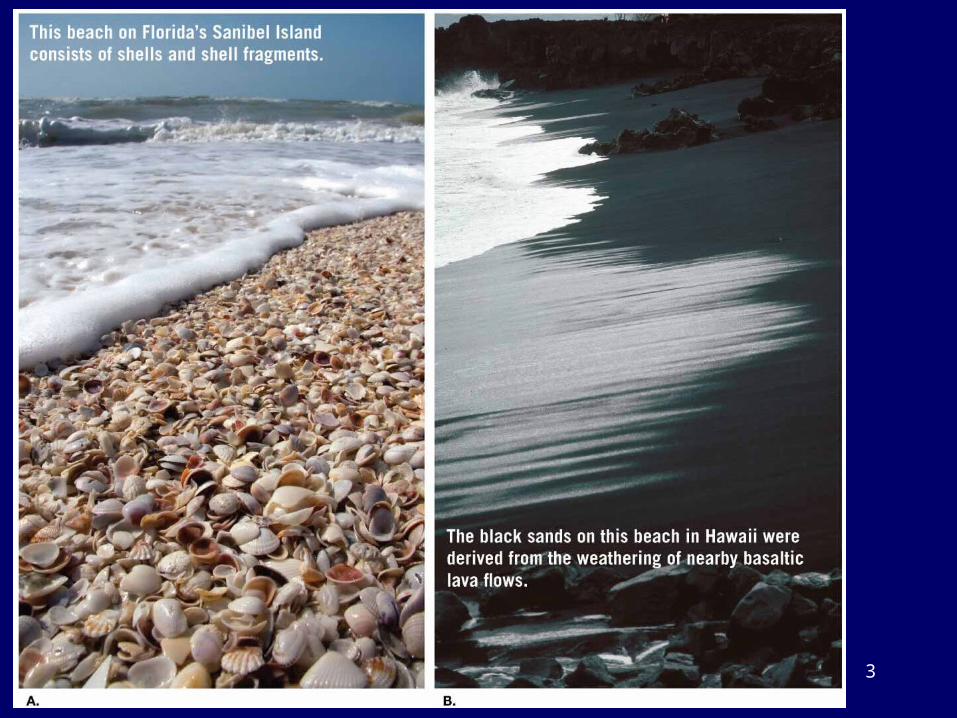
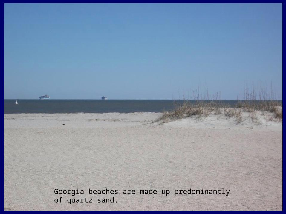
Georgia beaches are made up predominantly of quartz sand.
Types of Coasts
• Erosional– A stretch of shoreline exhibiting erosion by marine
processes
• Depositional– A stretch of shoreline where sediments carried by
marine currents are deposited
• Both types may be present in the same area• There are other types of coastal classifications
5
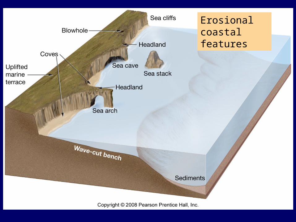
Erosional coastal features
6
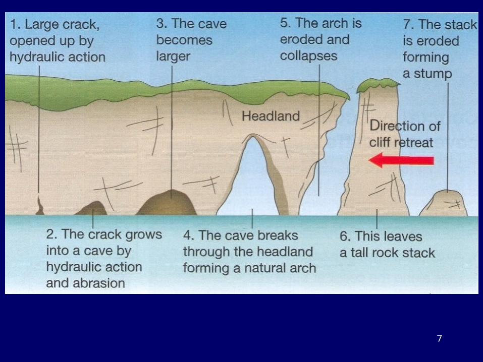
7
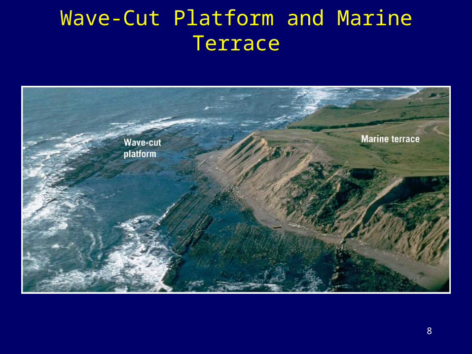
Wave-Cut Platform and Marine Terrace
8
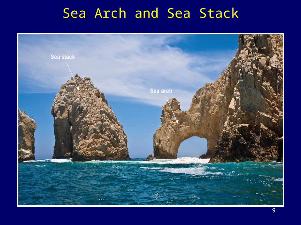
Sea Arch and Sea Stack
9
10
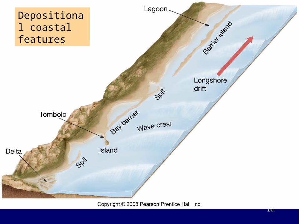
Depositional coastal features
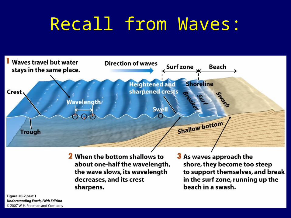
Recall from Waves:
11
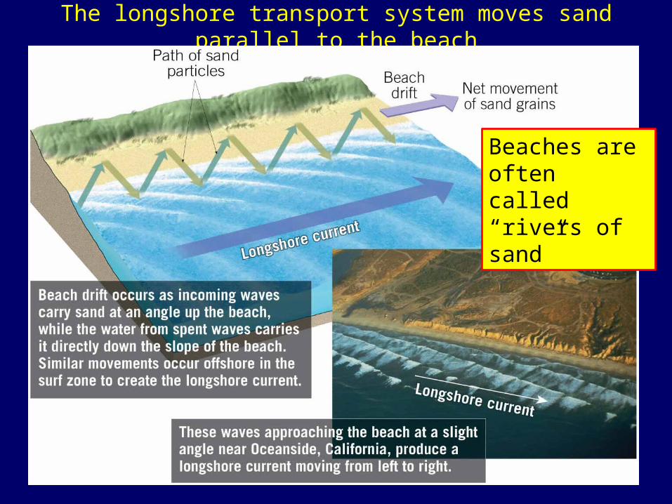
The longshore transport system moves sand parallel to the beach
12
Beaches are often called “rivers of sand”
13
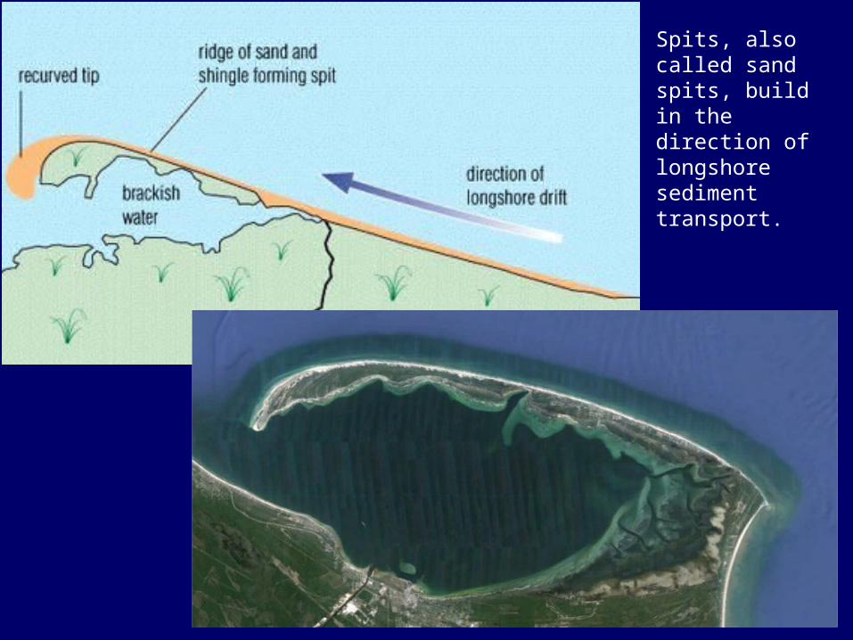
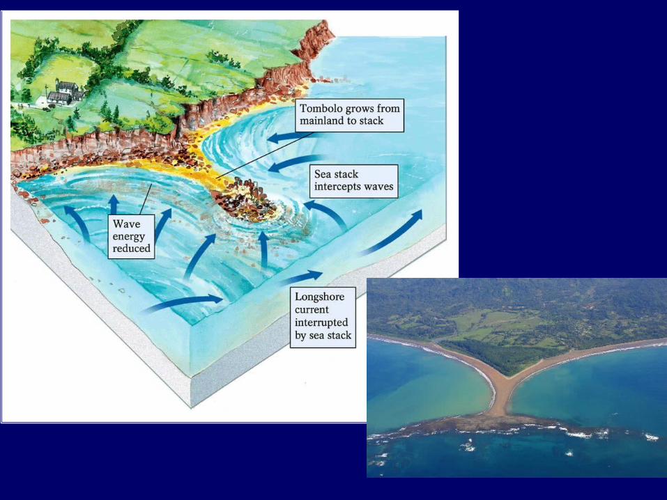
Spits, also called sand spits, build in the direction of longshore sediment transport.
14
15
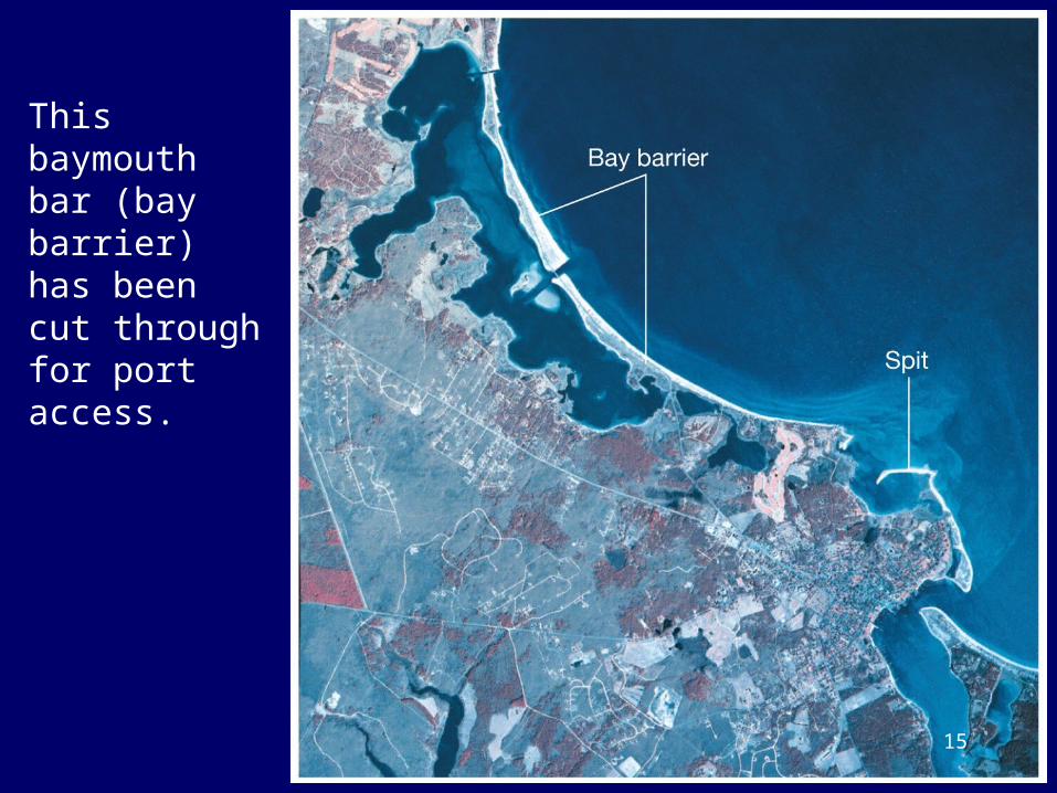
This baymouth bar (bay barrier) has been cut through for port access.
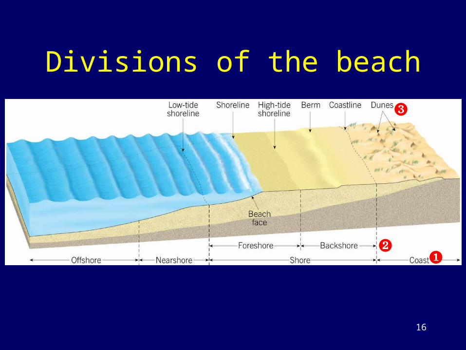
Divisions of the beach
16
❷
❸
❶
17
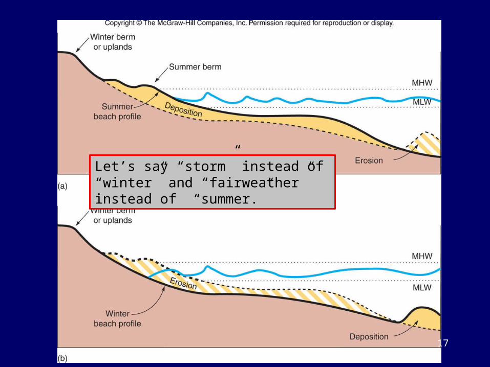
Let’s say “storm” instead of “winter” and “fairweather” instead of “summer.”
Barrier Islands
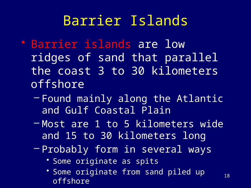
• Barrier islands are low ridges of sand that parallel the coast 3 to 30 kilometers offshore– Found mainly along the Atlantic and Gulf
Coastal Plain– Most are 1 to 5 kilometers wide and 15 to 30
kilometers long– Probably form in several ways
• Some originate as spits • Some originate from sand piled up offshore• Some are flooded sand dunes from the last glacial period
18
19
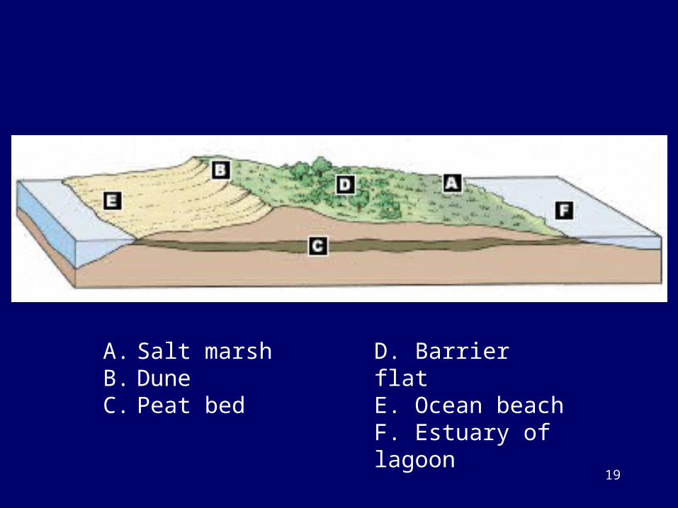
A. Salt marshB. DuneC. Peat bed
D. Barrier flatE. Ocean beachF. Estuary of lagoon
20
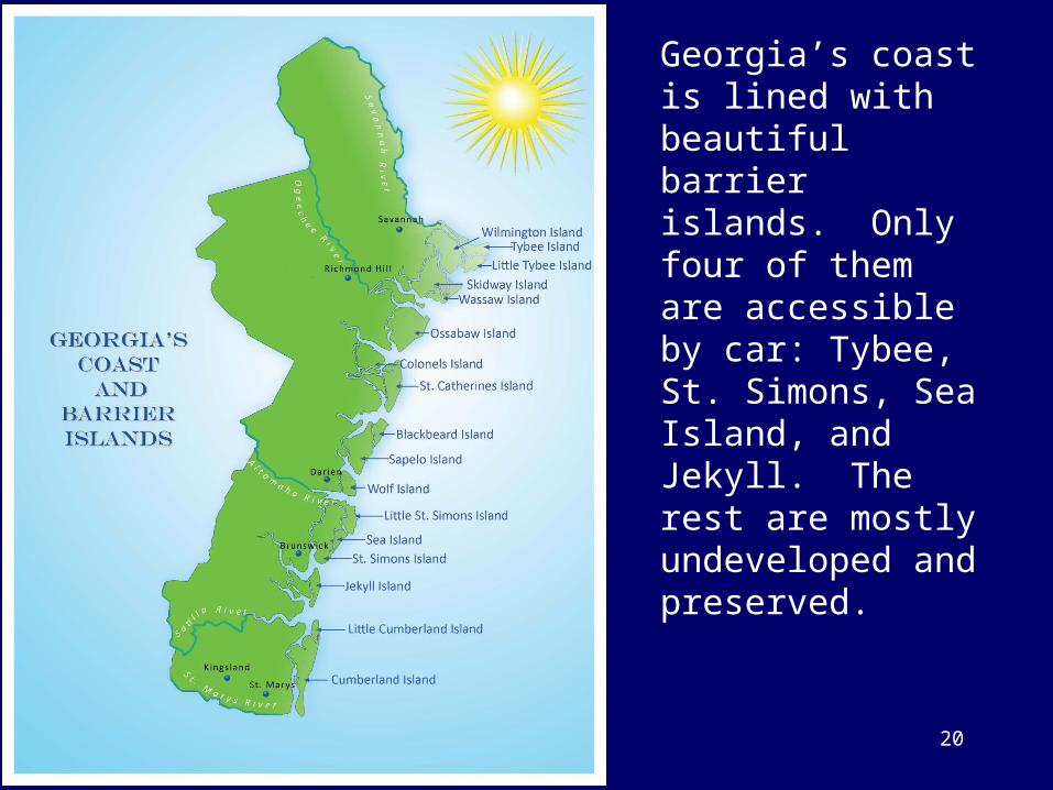
Georgia’s coast is lined with beautiful barrier islands. Only four of them are accessible by car: Tybee, St. Simons, Sea Island, and Jekyll. The rest are mostly undeveloped and preserved.
Video
• Watch the learner.org video on Waves, Beaches and Coasts to see more about shallow water waves
• An episode of the “Earth Revealed” series• http://www.learner.org/resources/series78.ht
ml
21
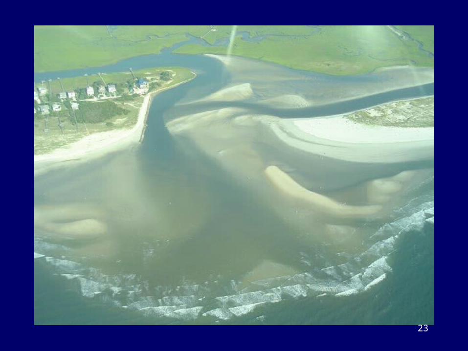
Tidal Inlets
• Recall flood tides and ebb tides• Water moving in and out of channels
between barrier islands (called tidal inlets) also moves sediment in and out of the inlets
• The amount of water moving in and out of an inlet is controlled by the tidal range and the size of the water body behind the barrier islands
22
23
Estuary vs Lagoon
• Both are semi-enclosed coastal bays• Estuaries have fresh water input, low
salinity• Lagoons have limited fresh water input,
often hypersaline• “Sound” is another term for coastal estuary
or lagoon behind a barrier island
24
Estuaries
• Estuaries are the mixing zones of river water and sea water
• They may be river mouths or coastal bays• They typically have restricted connection to
the ocean and salinity lower than that of seawater
• They are important ecosystems
25
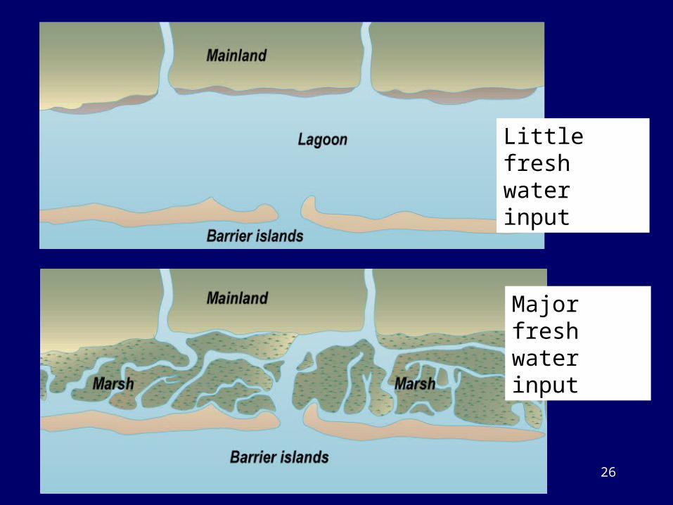
Little fresh water input
Major fresh water input
26
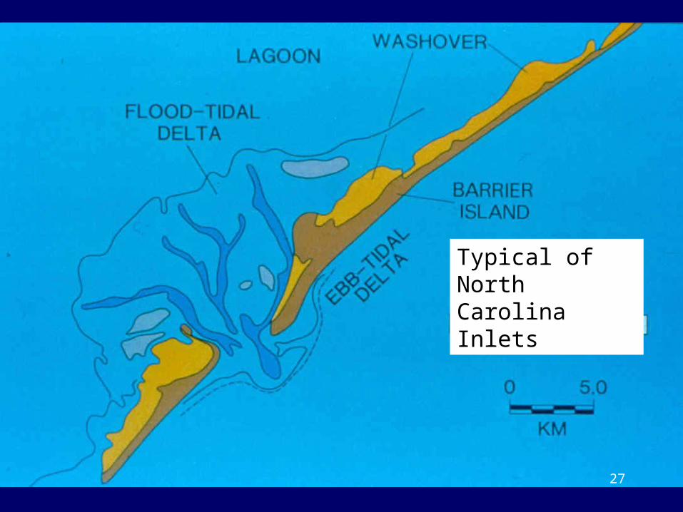
Typical of North Carolina Inlets
27
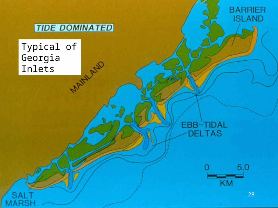
Typical of Georgia Inlets
28
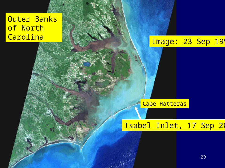
Isabel Inlet, 17 Sep 2003
Image: 23 Sep 1999
Outer Banks of North Carolina
Cape Hatteras
29
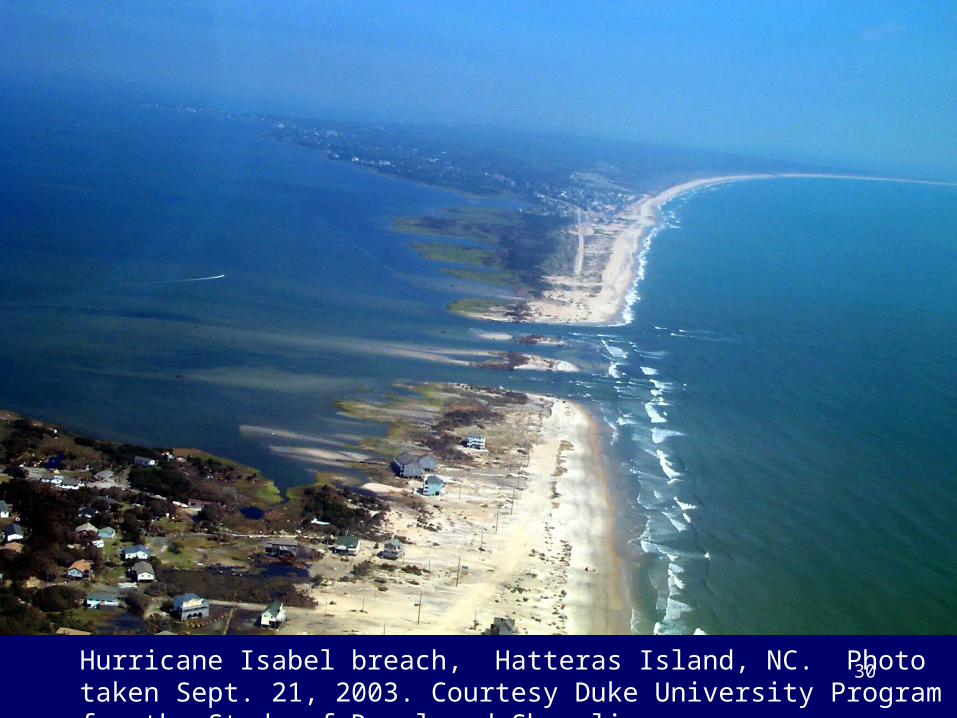
Hurricane Isabel breach, Hatteras Island, NC. Photo taken Sept. 21, 2003. Courtesy Duke University Program for the Study of Developed Shorelines.
30
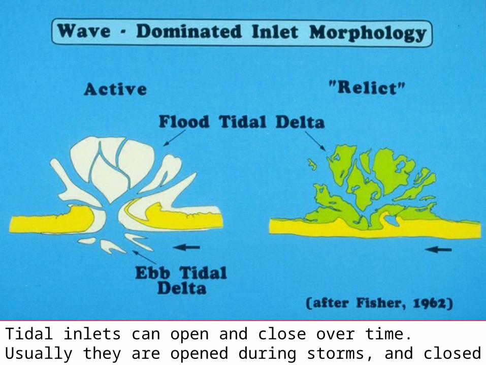
Tidal inlets can open and close over time. Usually they are opened during storms, and closed by longshore transport during fair weather.
31
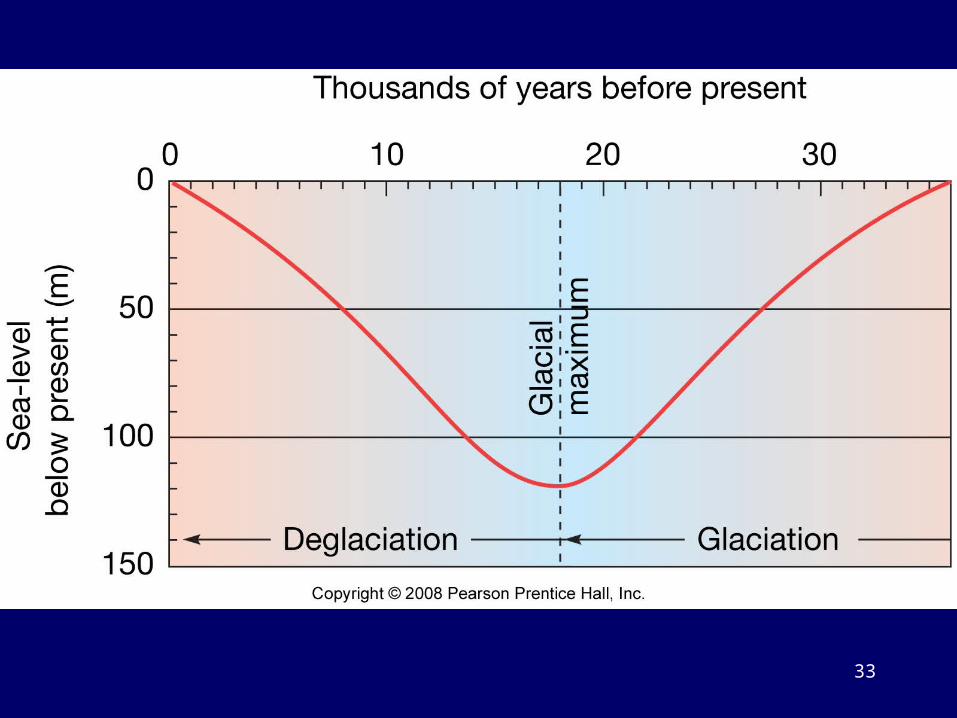
Changing Sea Level• Sea level rises and falls largely controlled by land ice
volume • Glaciation is a time of increasing volume of land ice, thus
sea-level fall• Deglaciation is a time of decreasing volume of land ice,
thus sea-level rise• We currently are in a period of land ice melting and sea
level rise • Sea-level rise becomes a natural hazard when rising water
level encroaches upon human development• Difficult for coastal communities to incorporate into
planning regulations
32
33
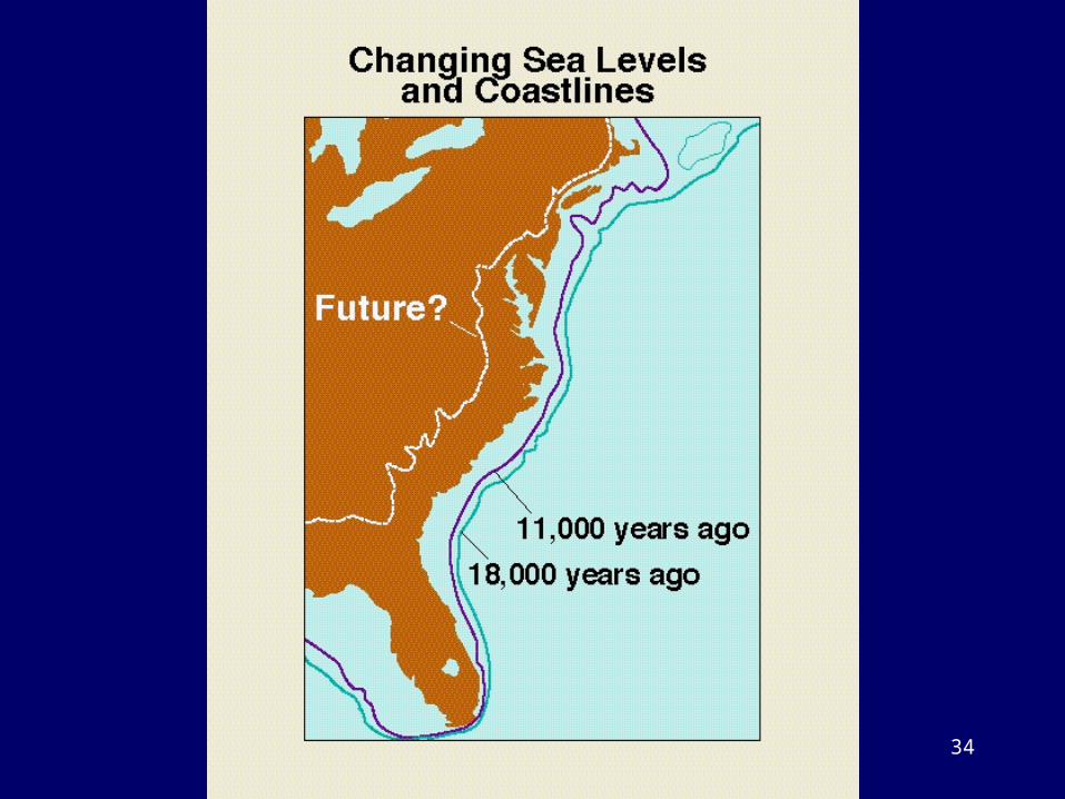
34
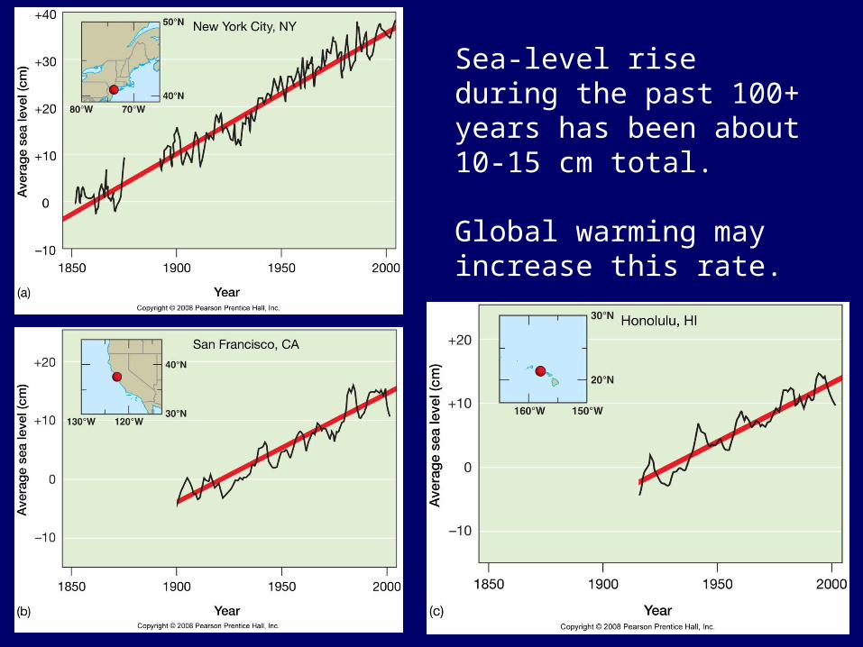
Sea-level rise during the past 100+ years has been about 10-15 cm total.
Global warming may increase this rate.
35
36
37
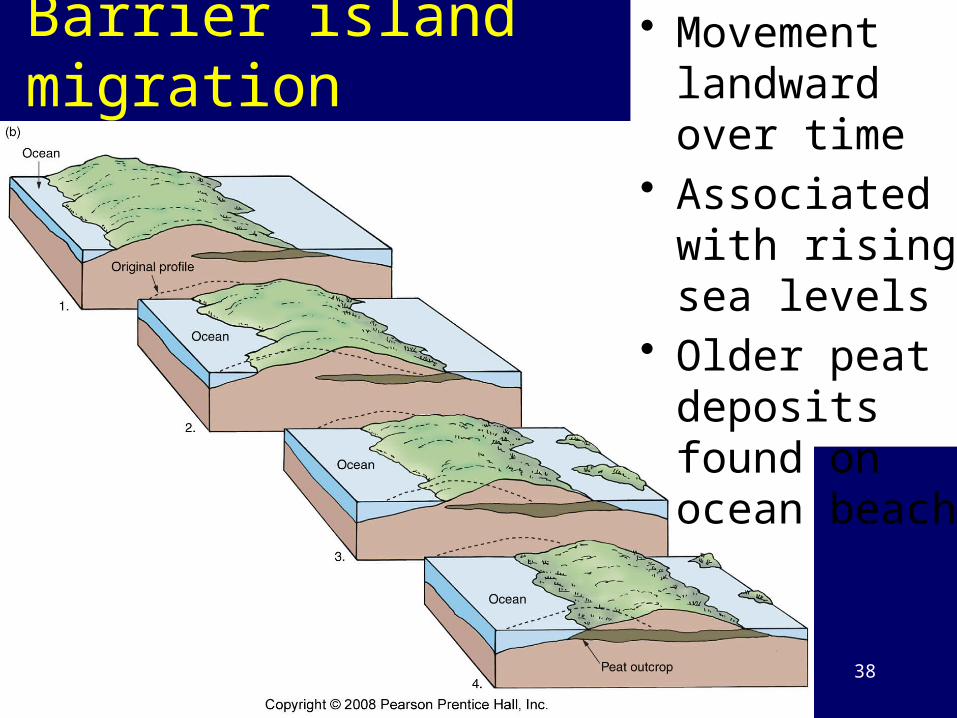
Barrier island migration • Movement landward over time
• Associated with rising sea levels
• Older peat deposits found on ocean beach
38
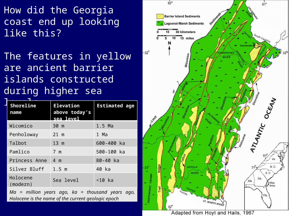
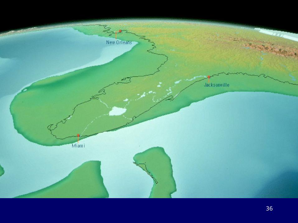
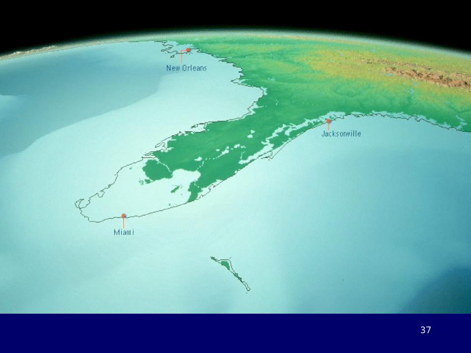
How did the Georgia coast end up looking like this?
The features in yellow are ancient barrier islands constructed during higher sea levels.
Shoreline name Elevation above today’s sea level
Estimated age
Wicomico 30 m 1.5 Ma
Penholoway 21 m 1 Ma
Talbot 13 m 600-400 ka
Pamlico 7 m 500-100 ka
Princess Anne 4 m 80-40 ka
Silver Bluff 1.5 m 40 ka
Holocene (modern) Sea level <10 ka
Ma = million years ago, ka = thousand years ago, Holocene is the name of the current geologic epoch
39
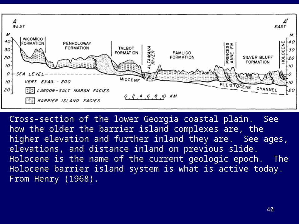
Cross-section of the lower Georgia coastal plain. See how the older the barrier island complexes are, the higher elevation and further inland they are. See ages, elevations, and distance inland on previous slide. Holocene is the name of the current geologic epoch. The Holocene barrier island system is what is active today. From Henry (1968).
40
41