Embed Size (px)
Citation preview
Estuaries of North Carolina
By
Kella Randolph
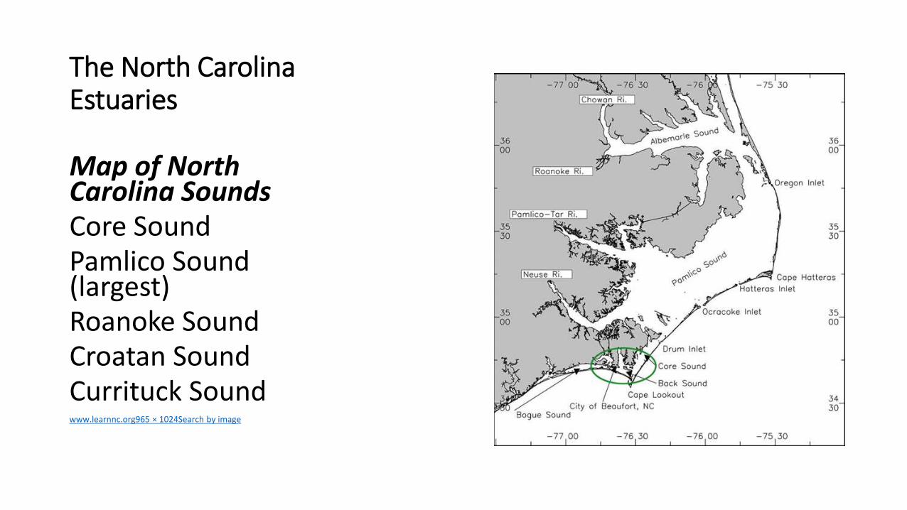
The North Carolina Estuaries
Map of North Carolina SoundsCore SoundPamlico Sound (largest)Roanoke SoundCroatan SoundCurrituck Soundwwwlearnncorg965 times 1024Search by image
Answer the following questions
1 Specifically where is your estuary located
2 Why are estuaries important
3 What kinds of animals and habitats are found in your
estuary
4 What are 3 rivers streams or waterways that feed into
your chosen sound
5 What are the threats to NC estuaries
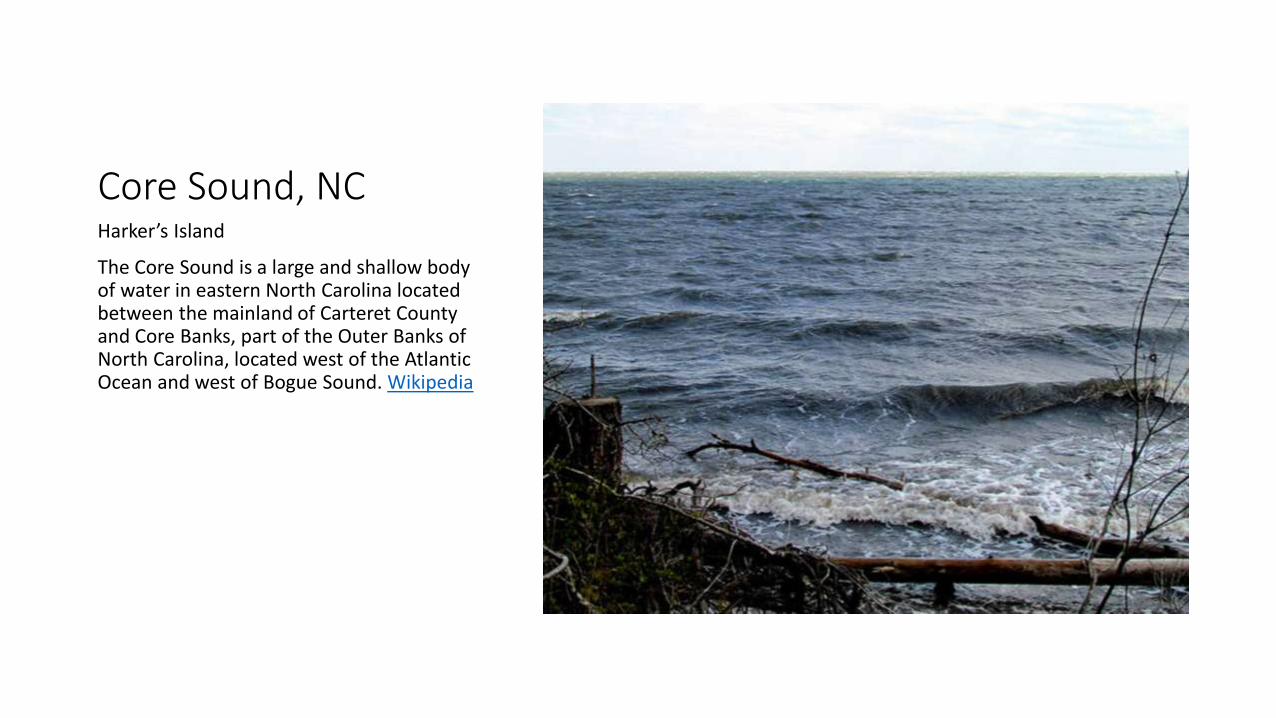
Core Sound NCHarkerrsquos Island
The Core Sound is a large and shallow body of water in eastern North Carolina located between the mainland of Carteret County and Core Banks part of the Outer Banks of North Carolina located west of the Atlantic Ocean and west of Bogue Sound Wikipedia
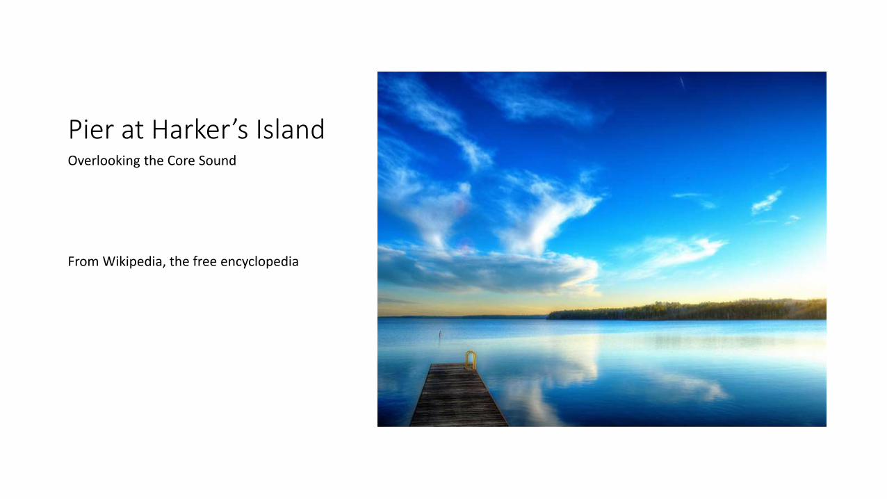
Pier at Harkerrsquos IslandOverlooking the Core Sound
From Wikipedia the free encyclopedia
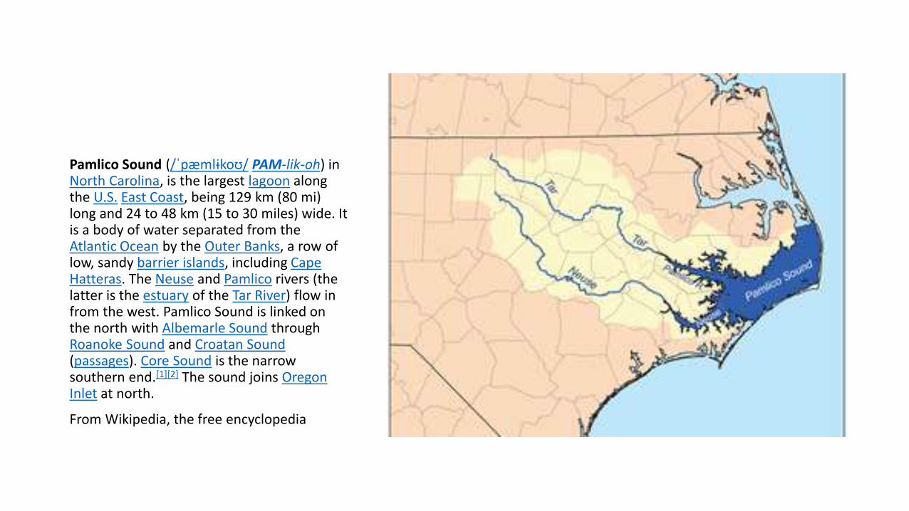
Pamlico Sound
Pamlico Sound (ˈpaeligmlɨkoʊ PAM-lik-oh) in North Carolina is the largest lagoon along the US East Coast being 129 km (80 mi) long and 24 to 48 km (15 to 30 miles) wide It is a body of water separated from the Atlantic Ocean by the Outer Banks a row of low sandy barrier islands including Cape Hatteras The Neuse and Pamlico rivers (the latter is the estuary of the Tar River) flow in from the west Pamlico Sound is linked on the north with Albemarle Sound through Roanoke Sound and Croatan Sound(passages) Core Sound is the narrow southern end[1][2] The sound joins Oregon Inlet at north
From Wikipedia the free encyclopedia
Pamlico Sound is part of a large interconnected network of lagoon estuaries As a whole it is the second
largest estuary in the United States (Chesapeake Bay is the largest) Seven sounds making up the whole
Albemarle Sound Currituck Sound Croatan Sound Pamlico Sound Bogue Sound Core Sound and Roanoke
Sound[1][2] Cape Hatteras National Seashore and Cape Lookout National Seashore are located on the barrier
islands Along the coastal areas are numerous waterfowl nesting sites including Pea Island National Wildlife
Refuge and Swanquarter National Wildlife Refuge on the mainland[1][2] Dolphins and sea turtles[3] that are at
risks on being involved in fishing nets[4] live in the sound with occasional visits by seals such as Harp Seal
while many other cetaceans including rare species like Fin Whales Cuviers Beaked Whales and Orcas are
present off Outer Banks and Cape Hatteras whales such as Atlantic Gray (now extinct)[5] North Atlantic
Right (critically endangerend) and North Atlantic Humpback were historically common Endangered species
such as Leatherback Turtles[6] Great White Sharks and Basking Sharks are known to visit the sound as
well[7]
The Albemarle-Pamlico Sound is one of nineteen great waters recognized by the Americas Great Waters
Coalition[8]
Fishing at Pamlico SoundExplorer Giovanni da Verrazzano mistook the sound for the Pacific Ocean The sound and its ocean inlets are noted for wide expanses of shallow water and occasional shoaling making the area hazardous for larger vessels In addition the shallow waters are susceptible to wind and barometric pressure-driven tidal fluctuations This effect is amplified on the tributary rivers where water levels can change by as much as two feet in three hours when winds are aligned with the rivers axes and are blowing strongly[1][2] From Wikipedia the free encyclopedia
Pamlico Sound (largestThe Hobucken Bridge provides access to islands in and near the Pamlico Sound
Roanoke Island MysteryFor centuries treasure hunters have looked for hidden piratersquos treasure on this island
When John Smith and the Jamestown colonists arrived in 1607 Smith took up the search for the colonists and discovered that they probably had been in the area In his dealings with the hostile Indian chief Powhatan he learned that the colonists had lived among the friendly Chesapeake Indians on the south side of the Bay Threatened by the intrusion of white men into the region Powhatan claimed to have attacked the colonists and murdered most of them As proof of his claim he showed Smith a musket barrell and a brass mortar and certain pieces of iron that had been theirs
By 1612 the Jamestown leaders had received numerous reports that at least some of the Roanoke colonists were living nearby They sent out several search parties but had no success and soon gave up the search
Roanoke Sound
What became of the remainder of the colonists left on Roanoke Island Scholars speculate that they were left behind to meet White upon his return from England but soon fled to Croatoan leaving the mysterious carvings behind as a signal to White Spanish archives reveal that they were gone by June 1588 when a raiding party put in at Roanoke Island only to find the settlement deserted Scholars assume that they were then assimilated into the Croatoan tribe
Today the north end of Roanoke Island is regularly visited by historians and archaeologists hoping to uncover new evidence as to the fate of the colony So far none has been forthcoming The post and the tree bearing the carvings have long since vanished although many of the live oaks in the National Historic Site were seedlings during the colonists tenure
The ldquoLost Colonyrdquo disappeared from Roanoke Island
The name Roanoke which pops up all over the East Coast in North Carolina and Virginia is a nod to the original Native Americans that populated the island before the English Settlers arrived the Roanoac Tribe which was a an Algonquin-speaking community that some historians believe stretched all the way into mainland Dare County These locals were the first residents that the original military settlers encountered during their initial 1584 expedition and the chief of the tribe Wanchese actually made a good-will trip back to England and became an international celebrity in the process
Originally the settlers had intended to set up roots near Hatteras Island but after several severe storms and days of rough sailing they opted for Roanoke Island which could be easily accessed via the deep wide and much more navigable Roanoke Sound Their first settlements the military settlement and the famed Lost Colony which landed three years later were located right on the banks of Roanoke Sound amidst live oaks and towering pine and cedar trees This terrain made for rough travel once on land but also provided a more than ample supply of lumber and raw materials for constructing a village
The Lost Colony at RoanokeRoanoke Island contains the town of Manteo as well as the village of Wanchese Manteo is the county seat and is more and more a major draw for Outer Banks vacations Wanchese is a quiet fishing village where life is centered on the commerce from the sea not on tourism We will mostly refer to Manteo in this guide since the majority of the visitor-oriented activity happens there
httpbitlys1Jxth
The Roanoke Sound essentially separates Roanoke Island from the barrier island beaches with shallow saltwater that runs approximately 3-7 miles wideThe sound borders the towns of Nags Head South Nags Head and a chunk of Bodie Islandand the Cape Hatteras National Seashore before it joins with the Albemarle Sound to the north and the Pamlico Sound to the south
On the western side of the sound lies the towns of Manteo and Wanchese which can be accessed by the Washington Baum Bridge (better known as the Manteo Nags Head Causeway or vice versa) which stretches across the Roanoke Sound Bear in mind that Roanoke Island is bordered by two sounds the CroatanSound which separates it from the mainland and the Roanoke Sound which separates it from the beaches meaning that this little waterfront community is always surrounded by water From Wikipedia the free encyclopedia
Croatan SoundCroatan Sound is a bay located just 33 miles from Wanchese in Dare County in the state of North Carolina United States near Baumtown NC
Alternate names for this bay includes The Narrows Croetan and Occam To find this fishing spot check the map shown above or enter 3583739 latitude and -7569712 longitude into your GPS device View CroatanSound Topo MapRead more httpwwwhookandbulletcomfishing-croatan-sound-wanchese-ncixzz3VHcJUJyK
The Croatan Sound resembles a river rather than a lagoon-like body of water Ranging from about 4-6 miles wide and easily reaching depths of 10 or even 20 the sound is also consistently moving Serving as a veritable channel between the expansive Albemarle Sound and the Pamlico Sound and fed by the Albemarles many smaller streams and estuaries flowing water is a constant along the Croatan Sound
The Croatan Sound is also unique in that while many of the saltier sound beaches like the ones along the Pamlico Sound are bordered by a line of sea grasses and then patches of shrubby maritime forests the beaches of the Croatan Sound are strikingly different As the Croatan Sound was once a marsh itself the borders of this sound consist of mainly wooded terrain including towering pines thickets of woods and forests and smaller beaches that are bulk headed or just steps away from the woods From Wikipedia the free encyclopedia
The Croatan Sound is one of the smaller sounds on the Outer Banks but is certainly no less picturesque or worthy of exploration for Roanoke Island visitors or Outer Banks travelers arriving from the west
The Crouton Sound basically separates Roanoke Island and the towns of Wanchese and Manteo from the mainland and essentially creates the island itself buffering it from the small town of Manns Harbor and the Dare County Mainland with a wide body of saltwater that generally circulates like a slow moving river depending on the wind and current directions
Currituck Soundhttpwwwouterbankscomcurrituck-soundhtml
The Currituck Sound connects with the Albemarle Sound which borders the central Outer Banks at around Southern Shores and continues north until Virginia where it meets Norfolk and Virginia Beachs Back Bay
Essentially the sound ranges from 3-8 miles wide but is good 30 miles long extending well into the state of Virginia Because of its narrow nature and expansive length visitors and residents of Virginia Beach the northern Outer Banks and everywhere in between essentially have fantastic boating access to the wide open waters of the Currituck Sound
Currituck Sound
Currituck Sound is miles away from the nearest ocean inlet which has created a nearly-freshwater and quite shallow environment Even a rough ocean side gust will have minimal effect on the sound making it an ideal playground for casual kayakers jet-skiers parasailers windsurfers and even beginning kite boarders The waters here remain generally calm and somewhat protected from any stormy ocean conditions One of the most notable parcels of land within the Currituck Sound is Knotts Island which is home to the Mackay Island National Wildlife Refuge and is a veritable fully-functioning island community within the Currituck Sound with several hundred residents and gorgeous waterfront views around every turnhttpwwwouterbankscomcurrituck-soundhtml
The Currituck Sound connects with the Albemarle Sound which borders the central Outer Banks at around Southern Shores and continues north until Virginia where it meets Norfolk and Virginia Beachs Back Bay
bull Essentially the sound ranges from 3-8 miles wide but is good 30 miles long extending well into the state of Virginia Because of its narrow nature and expansive length visitors and residents of Virginia Beach the northern Outer Banks and everywhere in between essentially have fantastic boating access to the wide open waters of the Currituck Sound
bull As mentioned the Currituck Sound is miles away from the nearest ocean inlet which has created a nearly-freshwater and quite shallow environment Even a rough ocean side gust will have minimal effect on the sound The waters here remain generally calm and somewhat protected from any stormy ocean conditions
bull The gradual removal from the regular integration of ocean waters has also created a series of islands throughout the sound Most of these are unnamed parcels of marshlands with little ground to stand on and are best explored by a kayak or small skiff Though located just off the sound side coast of either the Currituck Banks or the mainland these regions are nevertheless tricky treks on foot with a bit of wading and sloshing through dense marshlands required for access
bull The only way to access Knotts Island is via the Knotts Island ferry (also known as the Currituck Sound ferry) which is free to all visitors and lasts just 45 minutes as it trucks 5 miles across the sound to the borders of Knotts Island The ferry runs five times a day from both the mainland and the borders of Knotts Island and is available seven days a week Outer Banks visitors who want an in-depth tour of the Mackay Island Refuge and a panoramic view of the sound will find no better way to discover this quietly undeveloped and relatively undiscovered portion of the Outer Banks than a day trip via the Knotts Island ferryhttpwwwouterbankscomcurrituck-soundhtml
What is the purpose of the NOAA research stationbull Scientists working in this station focus on research pertaining to the
population (organisms in the same place) community (different species living together) and habitats (homes of specific organisms) of this natural dynamic ecosystem What makes this ecosystem unlike others is that it represents a vital interface between fresh water and the ocean Up to 70 of the seafood harvested on the East Coast spends part of its life in the North Carolina estuary While it is influenced by tides floods animal migrations and a host of other biotic and abiotic factors water quality and human development impacts are the greatest threat to the health of the estuary Ironically the beauty of the area attracts damaging tourism and resort communities development which can endanger the ecosystem as a whole Only when we understand the impacts of humans presence can we hope to protect these resources vital to our food and fresh water needs httpwwwouterbankscom
Coast Guard Station Hobucken is located approximately 35 miles northeast of New Bern NC alongside the Atlantic Intracostal Waterway
The stations primary duties are Search andRescue and Law Enforcement StationHobucken runs approximately 100 SAR casesand 300 Law Enforcement boardings peryear
Coast Guard Station Hobucken 80 milesnorth of Base Ft Macon is located on 75acres of land in Pamlico County The town ofHobucken NC is approximately one milefrom the station Other Cities in the vicinityare New Bern (40 miles) Bayboro (12 miles)Aurora (14 miles) and Washington (45miles) httpwwwouterbankscom
httpwwwouterbankscom
Thanks to Outer Bankscom for information and photoshttpwwwouterbankscom
Thank you for viewingWe do not inherit the earth from our ancestors we borrow it from our children ~Native American Proverb
The North Carolina Estuaries
Map of North Carolina SoundsCore SoundPamlico Sound (largest)Roanoke SoundCroatan SoundCurrituck Soundwwwlearnncorg965 times 1024Search by image
Answer the following questions
1 Specifically where is your estuary located
2 Why are estuaries important
3 What kinds of animals and habitats are found in your
estuary
4 What are 3 rivers streams or waterways that feed into
your chosen sound
5 What are the threats to NC estuaries
Core Sound NCHarkerrsquos Island
The Core Sound is a large and shallow body of water in eastern North Carolina located between the mainland of Carteret County and Core Banks part of the Outer Banks of North Carolina located west of the Atlantic Ocean and west of Bogue Sound Wikipedia
Pier at Harkerrsquos IslandOverlooking the Core Sound
From Wikipedia the free encyclopedia
Pamlico Sound
Pamlico Sound (ˈpaeligmlɨkoʊ PAM-lik-oh) in North Carolina is the largest lagoon along the US East Coast being 129 km (80 mi) long and 24 to 48 km (15 to 30 miles) wide It is a body of water separated from the Atlantic Ocean by the Outer Banks a row of low sandy barrier islands including Cape Hatteras The Neuse and Pamlico rivers (the latter is the estuary of the Tar River) flow in from the west Pamlico Sound is linked on the north with Albemarle Sound through Roanoke Sound and Croatan Sound(passages) Core Sound is the narrow southern end[1][2] The sound joins Oregon Inlet at north
From Wikipedia the free encyclopedia
Pamlico Sound is part of a large interconnected network of lagoon estuaries As a whole it is the second
largest estuary in the United States (Chesapeake Bay is the largest) Seven sounds making up the whole
Albemarle Sound Currituck Sound Croatan Sound Pamlico Sound Bogue Sound Core Sound and Roanoke
Sound[1][2] Cape Hatteras National Seashore and Cape Lookout National Seashore are located on the barrier
islands Along the coastal areas are numerous waterfowl nesting sites including Pea Island National Wildlife
Refuge and Swanquarter National Wildlife Refuge on the mainland[1][2] Dolphins and sea turtles[3] that are at
risks on being involved in fishing nets[4] live in the sound with occasional visits by seals such as Harp Seal
while many other cetaceans including rare species like Fin Whales Cuviers Beaked Whales and Orcas are
present off Outer Banks and Cape Hatteras whales such as Atlantic Gray (now extinct)[5] North Atlantic
Right (critically endangerend) and North Atlantic Humpback were historically common Endangered species
such as Leatherback Turtles[6] Great White Sharks and Basking Sharks are known to visit the sound as
well[7]
The Albemarle-Pamlico Sound is one of nineteen great waters recognized by the Americas Great Waters
Coalition[8]
Fishing at Pamlico SoundExplorer Giovanni da Verrazzano mistook the sound for the Pacific Ocean The sound and its ocean inlets are noted for wide expanses of shallow water and occasional shoaling making the area hazardous for larger vessels In addition the shallow waters are susceptible to wind and barometric pressure-driven tidal fluctuations This effect is amplified on the tributary rivers where water levels can change by as much as two feet in three hours when winds are aligned with the rivers axes and are blowing strongly[1][2] From Wikipedia the free encyclopedia
Pamlico Sound (largestThe Hobucken Bridge provides access to islands in and near the Pamlico Sound
Roanoke Island MysteryFor centuries treasure hunters have looked for hidden piratersquos treasure on this island
When John Smith and the Jamestown colonists arrived in 1607 Smith took up the search for the colonists and discovered that they probably had been in the area In his dealings with the hostile Indian chief Powhatan he learned that the colonists had lived among the friendly Chesapeake Indians on the south side of the Bay Threatened by the intrusion of white men into the region Powhatan claimed to have attacked the colonists and murdered most of them As proof of his claim he showed Smith a musket barrell and a brass mortar and certain pieces of iron that had been theirs
By 1612 the Jamestown leaders had received numerous reports that at least some of the Roanoke colonists were living nearby They sent out several search parties but had no success and soon gave up the search
Roanoke Sound
What became of the remainder of the colonists left on Roanoke Island Scholars speculate that they were left behind to meet White upon his return from England but soon fled to Croatoan leaving the mysterious carvings behind as a signal to White Spanish archives reveal that they were gone by June 1588 when a raiding party put in at Roanoke Island only to find the settlement deserted Scholars assume that they were then assimilated into the Croatoan tribe
Today the north end of Roanoke Island is regularly visited by historians and archaeologists hoping to uncover new evidence as to the fate of the colony So far none has been forthcoming The post and the tree bearing the carvings have long since vanished although many of the live oaks in the National Historic Site were seedlings during the colonists tenure
The ldquoLost Colonyrdquo disappeared from Roanoke Island
The name Roanoke which pops up all over the East Coast in North Carolina and Virginia is a nod to the original Native Americans that populated the island before the English Settlers arrived the Roanoac Tribe which was a an Algonquin-speaking community that some historians believe stretched all the way into mainland Dare County These locals were the first residents that the original military settlers encountered during their initial 1584 expedition and the chief of the tribe Wanchese actually made a good-will trip back to England and became an international celebrity in the process
Originally the settlers had intended to set up roots near Hatteras Island but after several severe storms and days of rough sailing they opted for Roanoke Island which could be easily accessed via the deep wide and much more navigable Roanoke Sound Their first settlements the military settlement and the famed Lost Colony which landed three years later were located right on the banks of Roanoke Sound amidst live oaks and towering pine and cedar trees This terrain made for rough travel once on land but also provided a more than ample supply of lumber and raw materials for constructing a village
The Lost Colony at RoanokeRoanoke Island contains the town of Manteo as well as the village of Wanchese Manteo is the county seat and is more and more a major draw for Outer Banks vacations Wanchese is a quiet fishing village where life is centered on the commerce from the sea not on tourism We will mostly refer to Manteo in this guide since the majority of the visitor-oriented activity happens there
httpbitlys1Jxth
The Roanoke Sound essentially separates Roanoke Island from the barrier island beaches with shallow saltwater that runs approximately 3-7 miles wideThe sound borders the towns of Nags Head South Nags Head and a chunk of Bodie Islandand the Cape Hatteras National Seashore before it joins with the Albemarle Sound to the north and the Pamlico Sound to the south
On the western side of the sound lies the towns of Manteo and Wanchese which can be accessed by the Washington Baum Bridge (better known as the Manteo Nags Head Causeway or vice versa) which stretches across the Roanoke Sound Bear in mind that Roanoke Island is bordered by two sounds the CroatanSound which separates it from the mainland and the Roanoke Sound which separates it from the beaches meaning that this little waterfront community is always surrounded by water From Wikipedia the free encyclopedia
Croatan SoundCroatan Sound is a bay located just 33 miles from Wanchese in Dare County in the state of North Carolina United States near Baumtown NC
Alternate names for this bay includes The Narrows Croetan and Occam To find this fishing spot check the map shown above or enter 3583739 latitude and -7569712 longitude into your GPS device View CroatanSound Topo MapRead more httpwwwhookandbulletcomfishing-croatan-sound-wanchese-ncixzz3VHcJUJyK
The Croatan Sound resembles a river rather than a lagoon-like body of water Ranging from about 4-6 miles wide and easily reaching depths of 10 or even 20 the sound is also consistently moving Serving as a veritable channel between the expansive Albemarle Sound and the Pamlico Sound and fed by the Albemarles many smaller streams and estuaries flowing water is a constant along the Croatan Sound
The Croatan Sound is also unique in that while many of the saltier sound beaches like the ones along the Pamlico Sound are bordered by a line of sea grasses and then patches of shrubby maritime forests the beaches of the Croatan Sound are strikingly different As the Croatan Sound was once a marsh itself the borders of this sound consist of mainly wooded terrain including towering pines thickets of woods and forests and smaller beaches that are bulk headed or just steps away from the woods From Wikipedia the free encyclopedia
The Croatan Sound is one of the smaller sounds on the Outer Banks but is certainly no less picturesque or worthy of exploration for Roanoke Island visitors or Outer Banks travelers arriving from the west
The Crouton Sound basically separates Roanoke Island and the towns of Wanchese and Manteo from the mainland and essentially creates the island itself buffering it from the small town of Manns Harbor and the Dare County Mainland with a wide body of saltwater that generally circulates like a slow moving river depending on the wind and current directions
Currituck Soundhttpwwwouterbankscomcurrituck-soundhtml
The Currituck Sound connects with the Albemarle Sound which borders the central Outer Banks at around Southern Shores and continues north until Virginia where it meets Norfolk and Virginia Beachs Back Bay
Essentially the sound ranges from 3-8 miles wide but is good 30 miles long extending well into the state of Virginia Because of its narrow nature and expansive length visitors and residents of Virginia Beach the northern Outer Banks and everywhere in between essentially have fantastic boating access to the wide open waters of the Currituck Sound
Currituck Sound
Currituck Sound is miles away from the nearest ocean inlet which has created a nearly-freshwater and quite shallow environment Even a rough ocean side gust will have minimal effect on the sound making it an ideal playground for casual kayakers jet-skiers parasailers windsurfers and even beginning kite boarders The waters here remain generally calm and somewhat protected from any stormy ocean conditions One of the most notable parcels of land within the Currituck Sound is Knotts Island which is home to the Mackay Island National Wildlife Refuge and is a veritable fully-functioning island community within the Currituck Sound with several hundred residents and gorgeous waterfront views around every turnhttpwwwouterbankscomcurrituck-soundhtml
The Currituck Sound connects with the Albemarle Sound which borders the central Outer Banks at around Southern Shores and continues north until Virginia where it meets Norfolk and Virginia Beachs Back Bay
bull Essentially the sound ranges from 3-8 miles wide but is good 30 miles long extending well into the state of Virginia Because of its narrow nature and expansive length visitors and residents of Virginia Beach the northern Outer Banks and everywhere in between essentially have fantastic boating access to the wide open waters of the Currituck Sound
bull As mentioned the Currituck Sound is miles away from the nearest ocean inlet which has created a nearly-freshwater and quite shallow environment Even a rough ocean side gust will have minimal effect on the sound The waters here remain generally calm and somewhat protected from any stormy ocean conditions
bull The gradual removal from the regular integration of ocean waters has also created a series of islands throughout the sound Most of these are unnamed parcels of marshlands with little ground to stand on and are best explored by a kayak or small skiff Though located just off the sound side coast of either the Currituck Banks or the mainland these regions are nevertheless tricky treks on foot with a bit of wading and sloshing through dense marshlands required for access
bull The only way to access Knotts Island is via the Knotts Island ferry (also known as the Currituck Sound ferry) which is free to all visitors and lasts just 45 minutes as it trucks 5 miles across the sound to the borders of Knotts Island The ferry runs five times a day from both the mainland and the borders of Knotts Island and is available seven days a week Outer Banks visitors who want an in-depth tour of the Mackay Island Refuge and a panoramic view of the sound will find no better way to discover this quietly undeveloped and relatively undiscovered portion of the Outer Banks than a day trip via the Knotts Island ferryhttpwwwouterbankscomcurrituck-soundhtml
What is the purpose of the NOAA research stationbull Scientists working in this station focus on research pertaining to the
population (organisms in the same place) community (different species living together) and habitats (homes of specific organisms) of this natural dynamic ecosystem What makes this ecosystem unlike others is that it represents a vital interface between fresh water and the ocean Up to 70 of the seafood harvested on the East Coast spends part of its life in the North Carolina estuary While it is influenced by tides floods animal migrations and a host of other biotic and abiotic factors water quality and human development impacts are the greatest threat to the health of the estuary Ironically the beauty of the area attracts damaging tourism and resort communities development which can endanger the ecosystem as a whole Only when we understand the impacts of humans presence can we hope to protect these resources vital to our food and fresh water needs httpwwwouterbankscom
Coast Guard Station Hobucken is located approximately 35 miles northeast of New Bern NC alongside the Atlantic Intracostal Waterway
The stations primary duties are Search andRescue and Law Enforcement StationHobucken runs approximately 100 SAR casesand 300 Law Enforcement boardings peryear
Coast Guard Station Hobucken 80 milesnorth of Base Ft Macon is located on 75acres of land in Pamlico County The town ofHobucken NC is approximately one milefrom the station Other Cities in the vicinityare New Bern (40 miles) Bayboro (12 miles)Aurora (14 miles) and Washington (45miles) httpwwwouterbankscom
httpwwwouterbankscom
Thanks to Outer Bankscom for information and photoshttpwwwouterbankscom
Thank you for viewingWe do not inherit the earth from our ancestors we borrow it from our children ~Native American Proverb
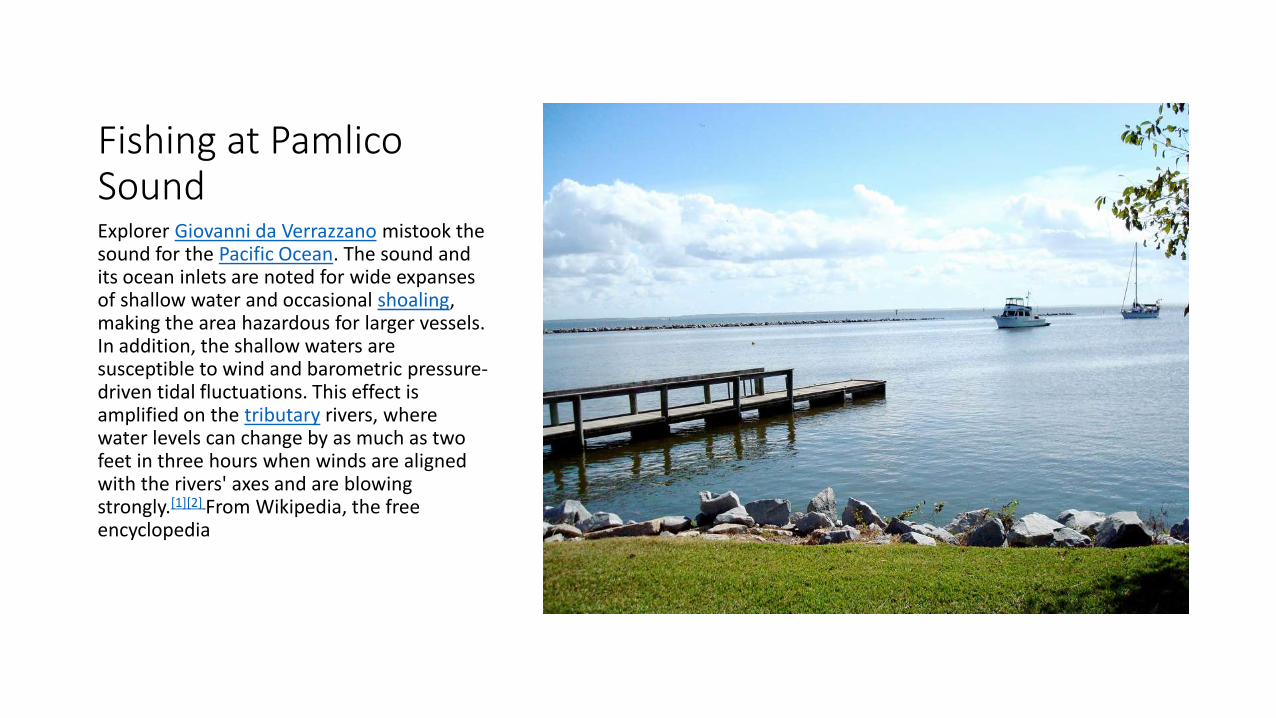
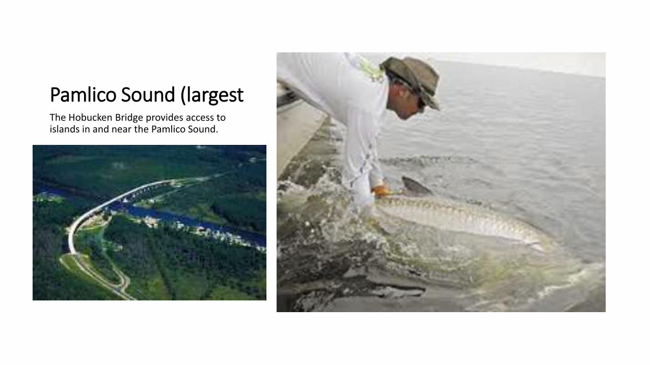
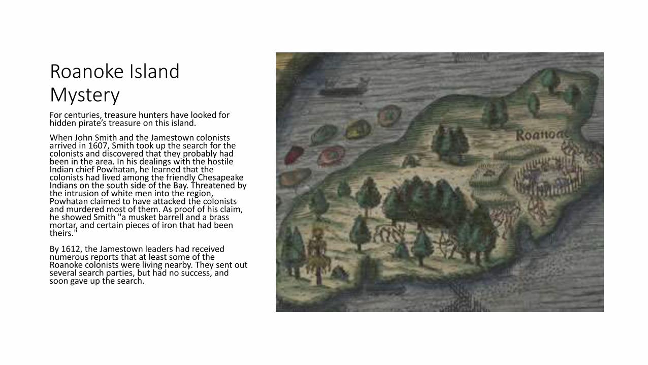
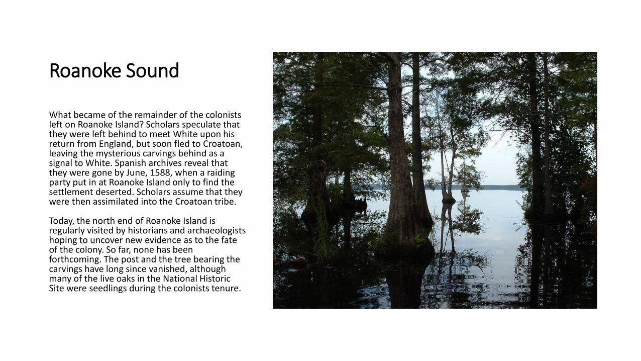
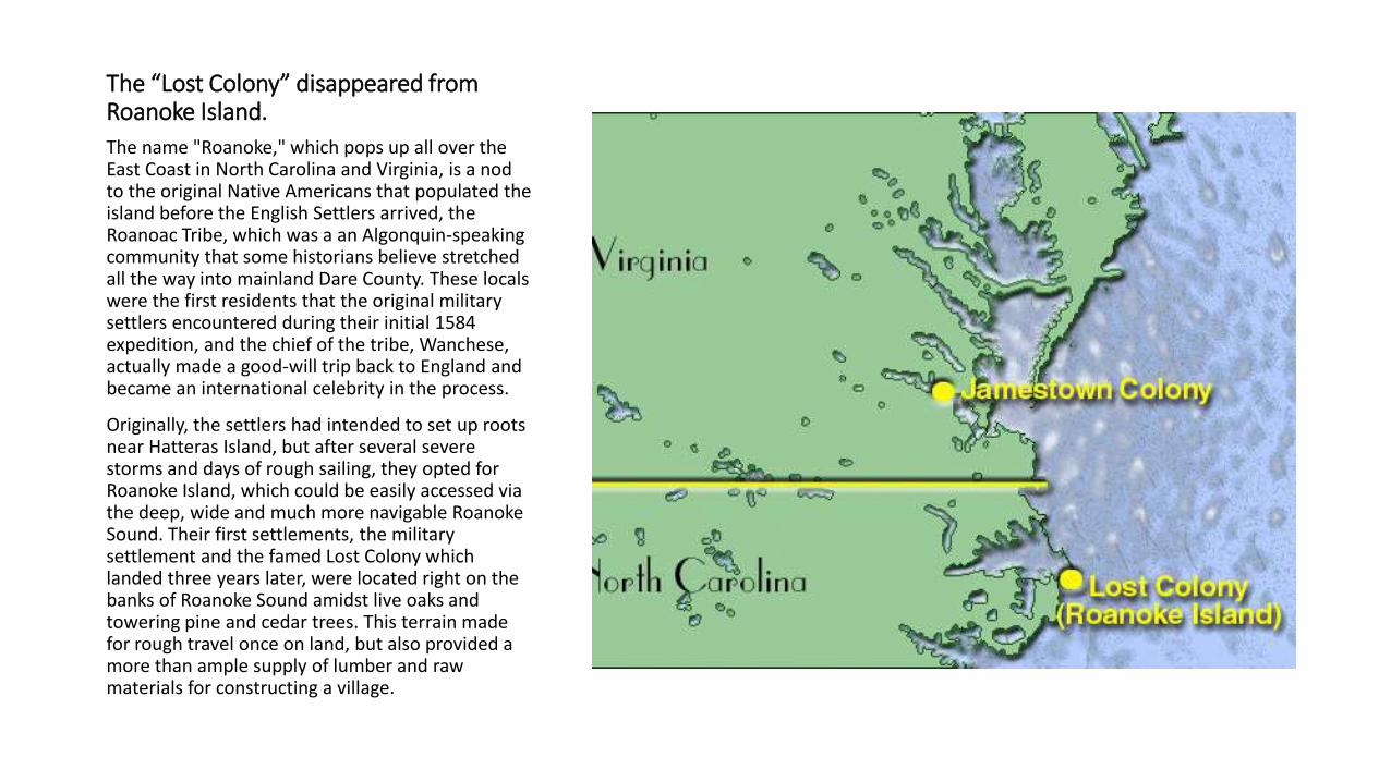
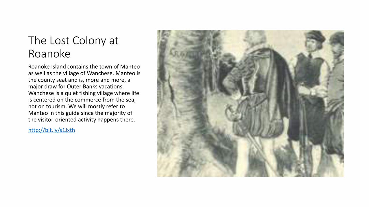
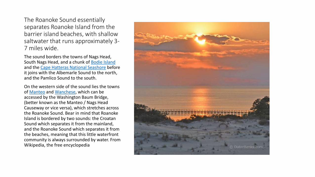
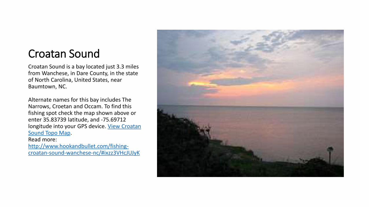
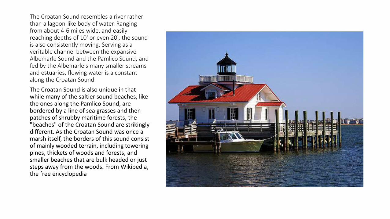
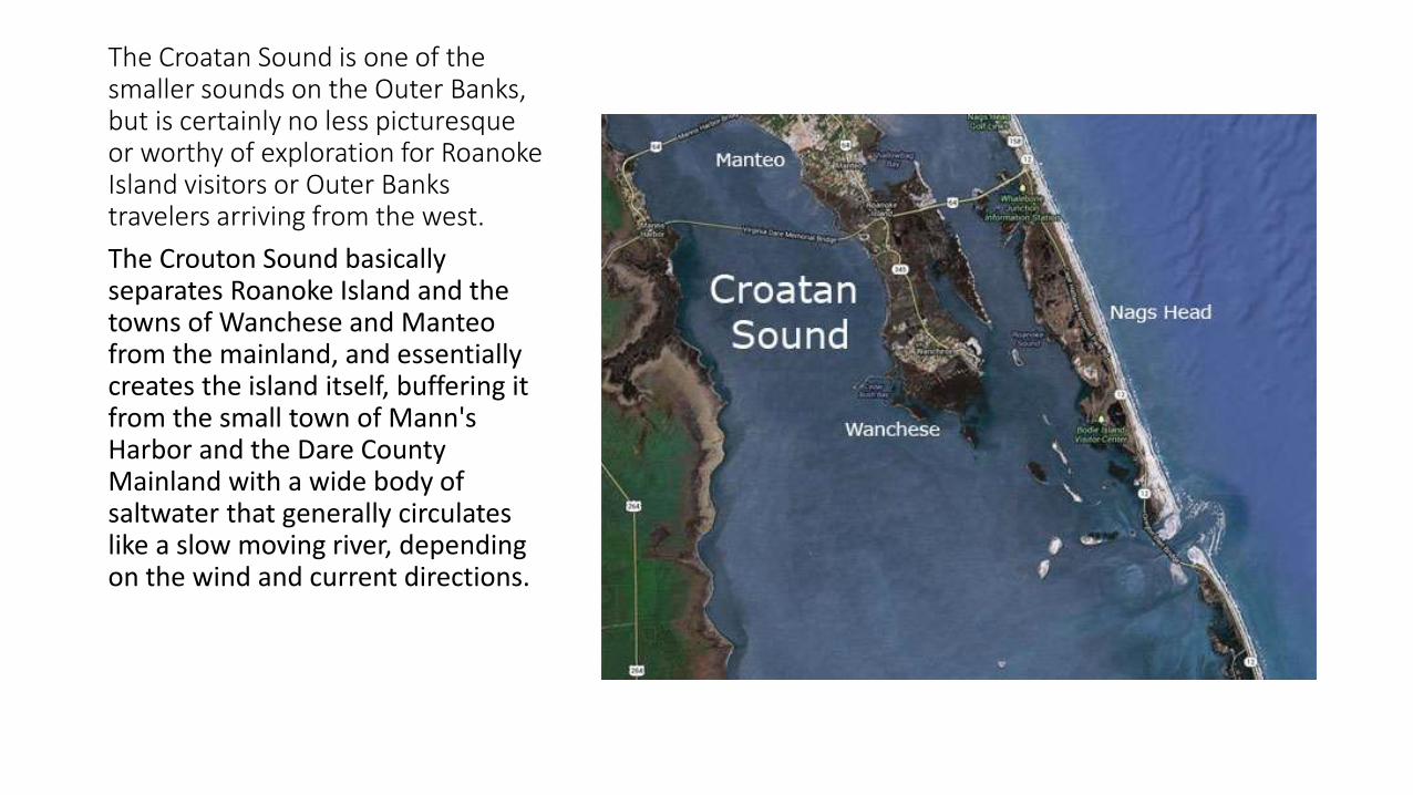
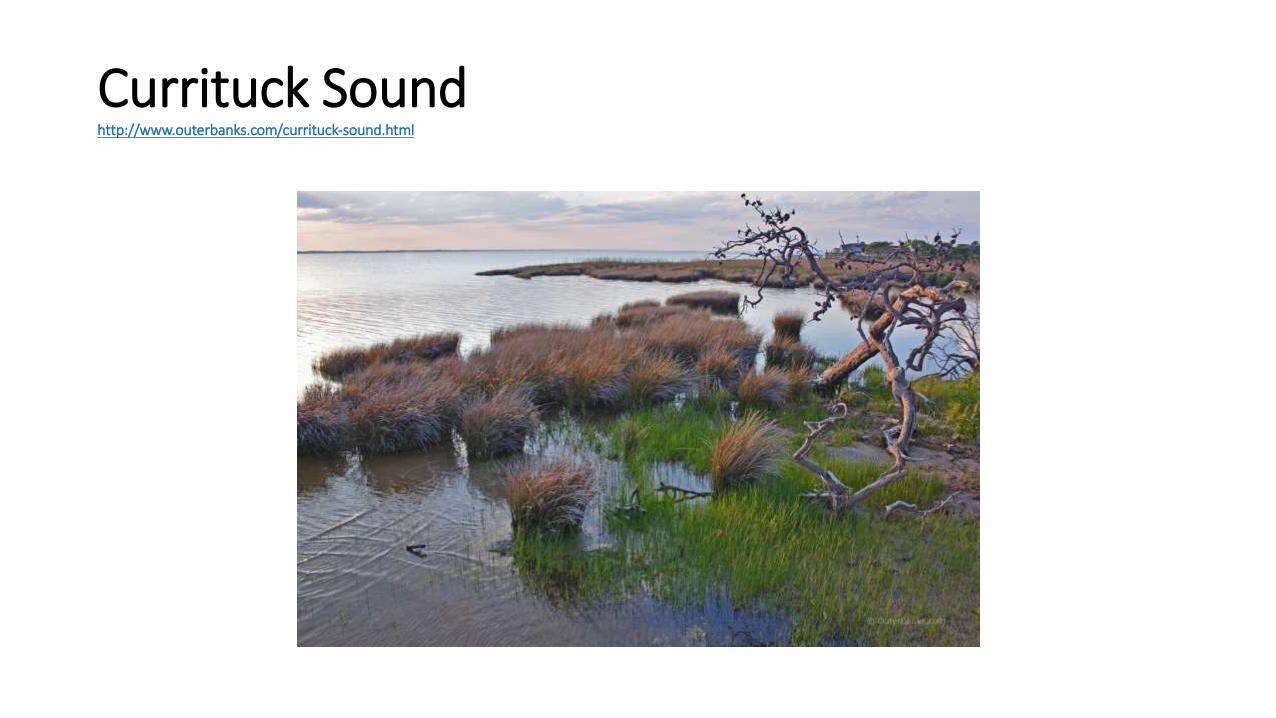
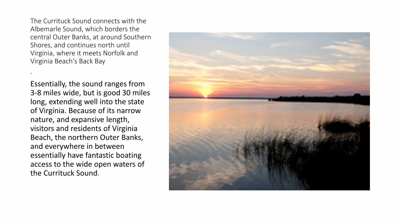
The Currituck Sound connects with the Albemarle Sound which borders the central Outer Banks at around Southern Shores and continues north until Virginia where it meets Norfolk and Virginia Beachs Back Bay
Essentially the sound ranges from 3-8 miles wide but is good 30 miles long extending well into the state of Virginia Because of its narrow nature and expansive length visitors and residents of Virginia Beach the northern Outer Banks and everywhere in between essentially have fantastic boating access to the wide open waters of the Currituck Sound
Currituck Sound
Currituck Sound is miles away from the nearest ocean inlet which has created a nearly-freshwater and quite shallow environment Even a rough ocean side gust will have minimal effect on the sound making it an ideal playground for casual kayakers jet-skiers parasailers windsurfers and even beginning kite boarders The waters here remain generally calm and somewhat protected from any stormy ocean conditions One of the most notable parcels of land within the Currituck Sound is Knotts Island which is home to the Mackay Island National Wildlife Refuge and is a veritable fully-functioning island community within the Currituck Sound with several hundred residents and gorgeous waterfront views around every turnhttpwwwouterbankscomcurrituck-soundhtml
The Currituck Sound connects with the Albemarle Sound which borders the central Outer Banks at around Southern Shores and continues north until Virginia where it meets Norfolk and Virginia Beachs Back Bay
bull Essentially the sound ranges from 3-8 miles wide but is good 30 miles long extending well into the state of Virginia Because of its narrow nature and expansive length visitors and residents of Virginia Beach the northern Outer Banks and everywhere in between essentially have fantastic boating access to the wide open waters of the Currituck Sound
bull As mentioned the Currituck Sound is miles away from the nearest ocean inlet which has created a nearly-freshwater and quite shallow environment Even a rough ocean side gust will have minimal effect on the sound The waters here remain generally calm and somewhat protected from any stormy ocean conditions
bull The gradual removal from the regular integration of ocean waters has also created a series of islands throughout the sound Most of these are unnamed parcels of marshlands with little ground to stand on and are best explored by a kayak or small skiff Though located just off the sound side coast of either the Currituck Banks or the mainland these regions are nevertheless tricky treks on foot with a bit of wading and sloshing through dense marshlands required for access
bull The only way to access Knotts Island is via the Knotts Island ferry (also known as the Currituck Sound ferry) which is free to all visitors and lasts just 45 minutes as it trucks 5 miles across the sound to the borders of Knotts Island The ferry runs five times a day from both the mainland and the borders of Knotts Island and is available seven days a week Outer Banks visitors who want an in-depth tour of the Mackay Island Refuge and a panoramic view of the sound will find no better way to discover this quietly undeveloped and relatively undiscovered portion of the Outer Banks than a day trip via the Knotts Island ferryhttpwwwouterbankscomcurrituck-soundhtml
What is the purpose of the NOAA research stationbull Scientists working in this station focus on research pertaining to the
population (organisms in the same place) community (different species living together) and habitats (homes of specific organisms) of this natural dynamic ecosystem What makes this ecosystem unlike others is that it represents a vital interface between fresh water and the ocean Up to 70 of the seafood harvested on the East Coast spends part of its life in the North Carolina estuary While it is influenced by tides floods animal migrations and a host of other biotic and abiotic factors water quality and human development impacts are the greatest threat to the health of the estuary Ironically the beauty of the area attracts damaging tourism and resort communities development which can endanger the ecosystem as a whole Only when we understand the impacts of humans presence can we hope to protect these resources vital to our food and fresh water needs httpwwwouterbankscom
Coast Guard Station Hobucken is located approximately 35 miles northeast of New Bern NC alongside the Atlantic Intracostal Waterway
The stations primary duties are Search andRescue and Law Enforcement StationHobucken runs approximately 100 SAR casesand 300 Law Enforcement boardings peryear
Coast Guard Station Hobucken 80 milesnorth of Base Ft Macon is located on 75acres of land in Pamlico County The town ofHobucken NC is approximately one milefrom the station Other Cities in the vicinityare New Bern (40 miles) Bayboro (12 miles)Aurora (14 miles) and Washington (45miles) httpwwwouterbankscom
httpwwwouterbankscom
Thanks to Outer Bankscom for information and photoshttpwwwouterbankscom
Thank you for viewingWe do not inherit the earth from our ancestors we borrow it from our children ~Native American Proverb
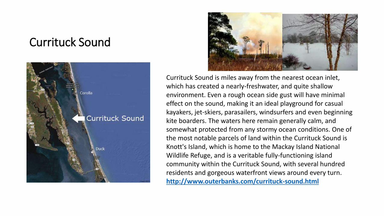
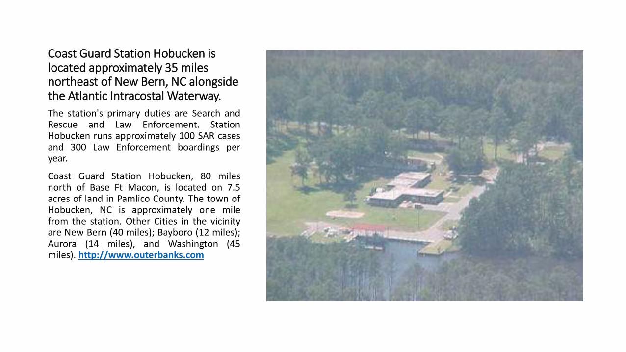
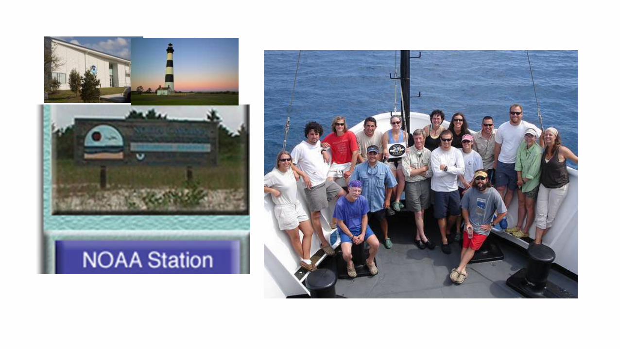
httpwwwouterbankscom
Thanks to Outer Bankscom for information and photoshttpwwwouterbankscom
Thank you for viewingWe do not inherit the earth from our ancestors we borrow it from our children ~Native American Proverb
Thanks to Outer Bankscom for information and photoshttpwwwouterbankscom
Thank you for viewingWe do not inherit the earth from our ancestors we borrow it from our children ~Native American Proverb

Thank you for viewingWe do not inherit the earth from our ancestors we borrow it from our children ~Native American Proverb