Embed Size (px)
Citation preview

Spatial Thinking
Thinking About
© 2009 Phil GersmehlMichigan Geographic Alliance
New York Center for Geographic Learning
1

Spatial Thinking
Eight ways
of thinking about locations,
conditions, and connections
2

Location
The idea of location is the “entrance ticket” to a geographic inquiry.
- Where is it ?
- Why is it there ?
- Why is that important ?3
Location
The conditions“right there”at a location
MovementPlace
The connectionsa location has
with other places
4

Location
MovementPlace
SpatialThinking
How the brain organizes information about locations,
their conditions, and connections.
5

We didn’t just think up
those 8 ideas over lunch one day.
They are based
on a huge amount
of neuroscience research
6

One important conclusion
from research in neuroscience
and developmental psychology:
1. The human brain appears to have
some specific structures that “do”
each kind of spatial thinking.
7

8

9

fMRI PET
TCMSDTI
microtomes
chemicallesions proximity
sensors
polarizedhemifields
10

Recent research (Three thousand studies since 1995)
shows that old ideas about“stages of development” (Piaget)
“cycles of learning” (Kolb) “left brain, right brain” (Edwards)
or “frames of mind” (Gardner)
are just that – old ideas.
11

shows that the human brain has several “regions”that do specific kinds of spatial thinking.
Compare one placewith another.
Find close-together places that have similar conditions.
Describe thenon-random
arrangements of features.
Identify smaller sub-areas
withinlarger areas.
Notice transitions. Do conditions change gradually or abruptly?
Discover correlations(features that
occur together).
Recent research (Three thousand studies since 1995)
Assess influences that a place has
on nearby places.
Identifyanalogous
places.
12

Two more conclusions
from research in neuroscience
and developmental psychology:
2. People are different – some people
are genetically or experientially predisposed
to use specific modes of spatial thinking.
13

Two more conclusions
from research in neuroscience
and developmental psychology:
2. People are different – some people
are genetically or experientially predisposed
to use specific modes of spatial thinking.
3. People can learn – an expert map readeruses more different modes of spatial thinking,and uses them more effectively, than a novice.
14

Remember – the “purpose” of
these various modesof spatial thinking
is to make it easierfor us to rememberfacts about places.
We’ve known thisfor a long time.
What’s the big deal ?15

Just this – the human brainhas specific “regions”
that are structuredto do each kind
of spatial thinking.
16

Important take home messagefor educators/administrators:
There are significant individual differencesin student inclination and ability to use
different modes of spatial thinking.
Scientific conclusion :
The human brain has a numberof separate, independent structures
that help us organize geographic information
17

Our goal is to design teaching materialsthat enable all students to improveall of their spatial-reasoning skills –
in geography, history, economics, earth science,even reading and math.
18

Spatial Thinking
Eight ways
of thinking about locations,
conditions, and connections
19

SpatialComparison comparing this place
to another one I already know
20

Are places the same or different?
Does one place have more or less than another place?
What places are higher (mountainous), larger, wetter,
drier, nicer, colder, safer?
SpatialComparison
21

22
Comparison
Which is bigger, the Upper Peninsula or the Lower Peninsula?
What is another way they are different?
Which city on average is colder – Ann Arbor or Marquette?

SpatialAura finding places that
have an influenceover this place
23

How does a big city influence nearby places?
How does a body of water influence nearby places?
SpatialAura
24

25
Aura
Why are there more highways around Detroit than Gaylord?
What kinds of businesses might grow up around a big city?
How does Lake Michigan influence weather on the west coast of Michigan?

SpatialTransition arranging places
in a sequence
26

How do conditions change as we move along a journey?
What comes earlier, and what comes later?
Is the change gradual, or is the change abrupt?
SpatialTransition
27

28
Transition
Based on this map, can you predict how the scenery would change as you
drive from Lansing north on US 127/I75 to Sault Ste. Marie?
What other physical changes might you see on this route?

SpatialHierarchy putting small places
Inside of large places
Moscow is inside Russia;
Russia is inside Eurasia.
29

Is a place a part of something larger?
What smaller pieces are inside a larger piece?
Is a smaller river part of (connected to) a larger river?
SpatialHierarchy
30

31
Michigan
Ingham County
Lansing
Midwest
hierarchy
Put the following places in order from inside to
outside.

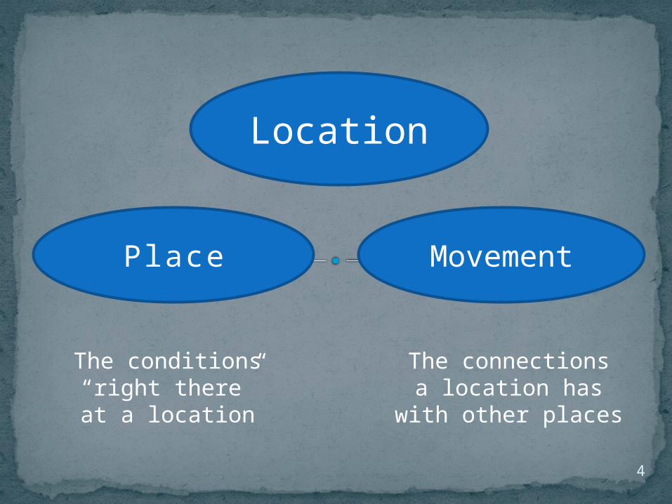
SpatialAnalogy
identifying placesin similar positions
Traverse City is to the Boardman River and Grand Traverse Bay
as Saginaw is to the Saginaw River and the Saginaw Bay
32
What features or conditions tend to occur in similar positions?
As a result, do they have other features in common?
SpatialAnalogy
33

34
Ads by Google
Lake Orion MoversLocal - Long Distance Moving Moving Company in Lake Orionwww.LakeOrionMovers.com
Work. Live. Michigan.Jobs. Internships. Cool Companies. Places to Live. People. News.MiPerfectJob.com
MichiganWant a career in Law Enforcement? Here's everything you need for freeEdu.PoliceLink.com/Academy
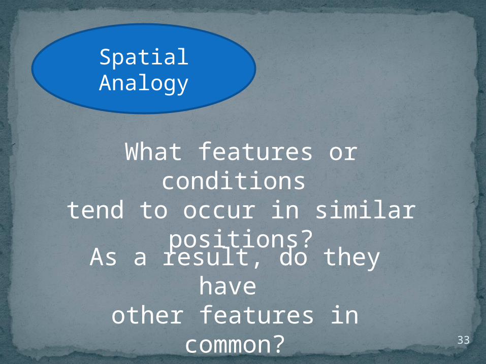
Michigan Elevation Map:This is a generalized topographic map of Michigan. It shows elevation trends across the state. Detailed topographic maps and aerial photos of Michigan are available in the Geology.com store. See our state high points map to learn about Mt. Arvon at 1,979 feet - the highest point in Michigan. The lowest point is Lake Erie at 571 feet.
Cadillac
Ludington
Lansing
Muskegon
Alpena
Manistee
Bay City
Analogy
Escanaba
What do these towns have in
common?
Why were they good places to put sawmills in the late 1800’s?
Which of these 4 additional towns would also be a
potential site for a sawmill in the late
1800’s?
SpatialAssociation
noting features thattend to occur together(in the same places)
35

SpatialAssociation
What features or conditions tend to occur together?
Why do they occur together?
36
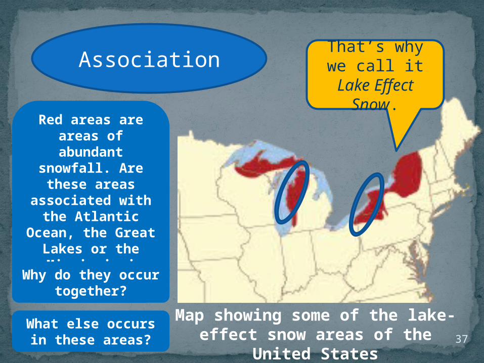
37
Map showing some of the lake-effect snow areas of the United States
Association That’s why we call it Lake
Effect Snow.
Red areas are areas of abundant
snowfall. Are these areas associated with the Atlantic Ocean, the Great
Lakes or the Mississippi River?
Why do they occur together?
What else occurs in these areas?

SpatialPattern noting alignments,
arcs, clusters, rings,and other arrangements
that are not random
38
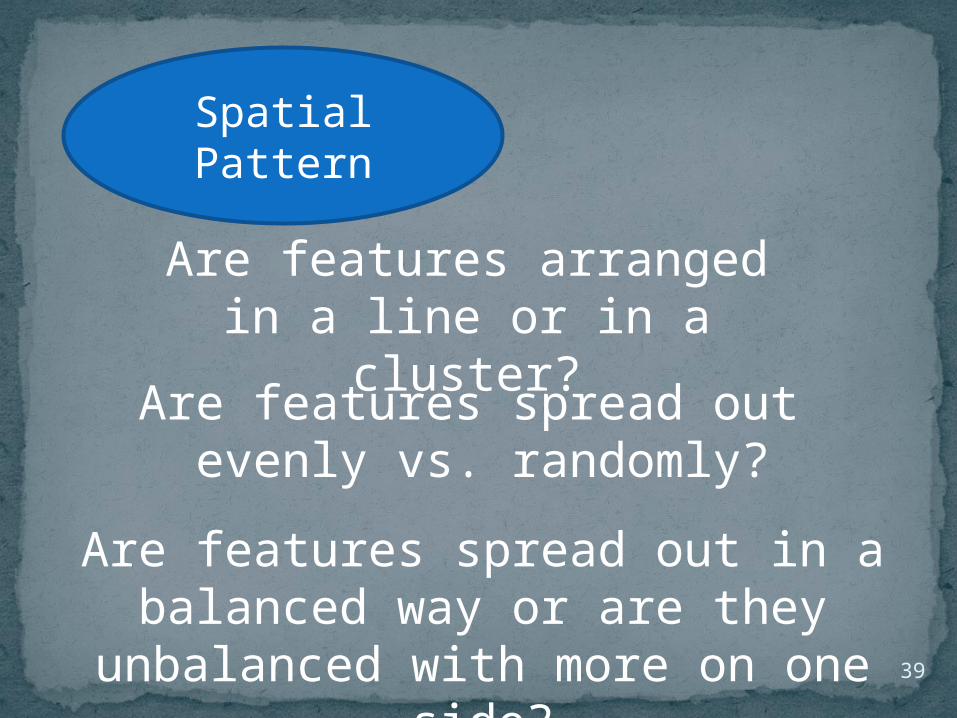
Are features arranged in a line or in a cluster?
Are features spread out evenly vs. randomly?
Are features spread out in a balanced way or are they unbalanced with more
on one side?
SpatialPattern
39

40
Pattern
Is there a pattern to the high areas of
Michigan?
Is the population pattern in Michigan
spread out or clustered?

SpatialRegion putting similar places
together in a group
41
What places are near each other and are alike in some way (have similar conditions)?
SpatialRegion
42

43
Region
Can you draw a mental line around a region of high land?
What human regions are
evident?