Embed Size (px)
Citation preview
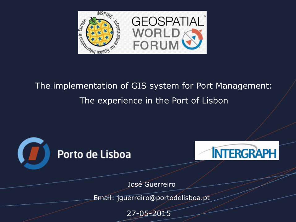
27-05-2015
The implementation of GIS system for Port Management:
The experience in the Port of Lisbon
José Guerreiro
Email: [email protected]
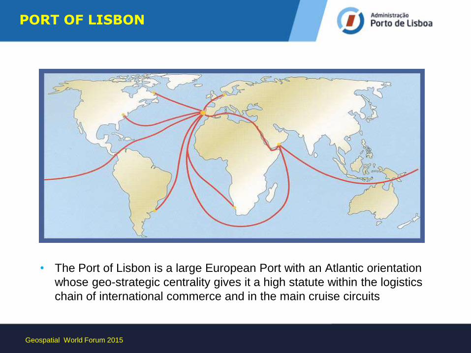
• The Port of Lisbon is a large European Port with an Atlantic orientation
whose geo-strategic centrality gives it a high statute within the logistics
chain of international commerce and in the main cruise circuits
PORT OF LISBON
Geospatial World Forum 2015
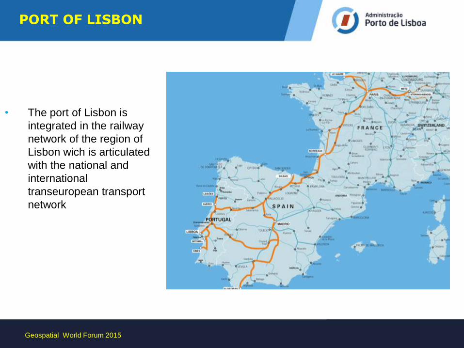
• The port of Lisbon is
integrated in the railway
network of the region of
Lisbon wich is articulated
with the national and
international
transeuropean transport
network
Geospatial World Forum 2015
PORT OF LISBON
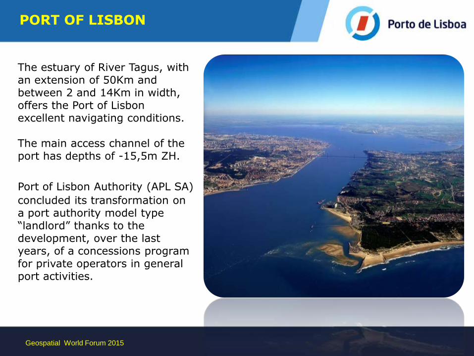
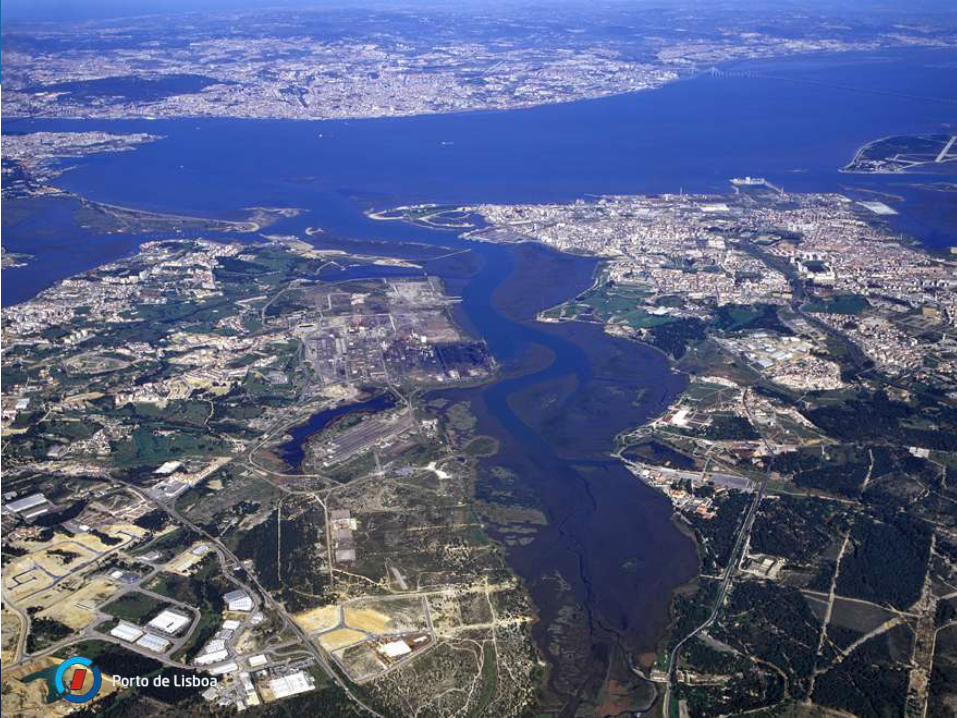
The estuary of River Tagus, with an extension of 50Km and between 2 and 14Km in width, offers the Port of Lisbon excellent navigating conditions. The main access channel of the port has depths of -15,5m ZH.
Port of Lisbon Authority (APL SA) concluded its transformation on a port authority model type “landlord” thanks to the development, over the last years, of a concessions program for private operators in general port activities.
Geospatial World Forum 2015
PORT OF LISBON
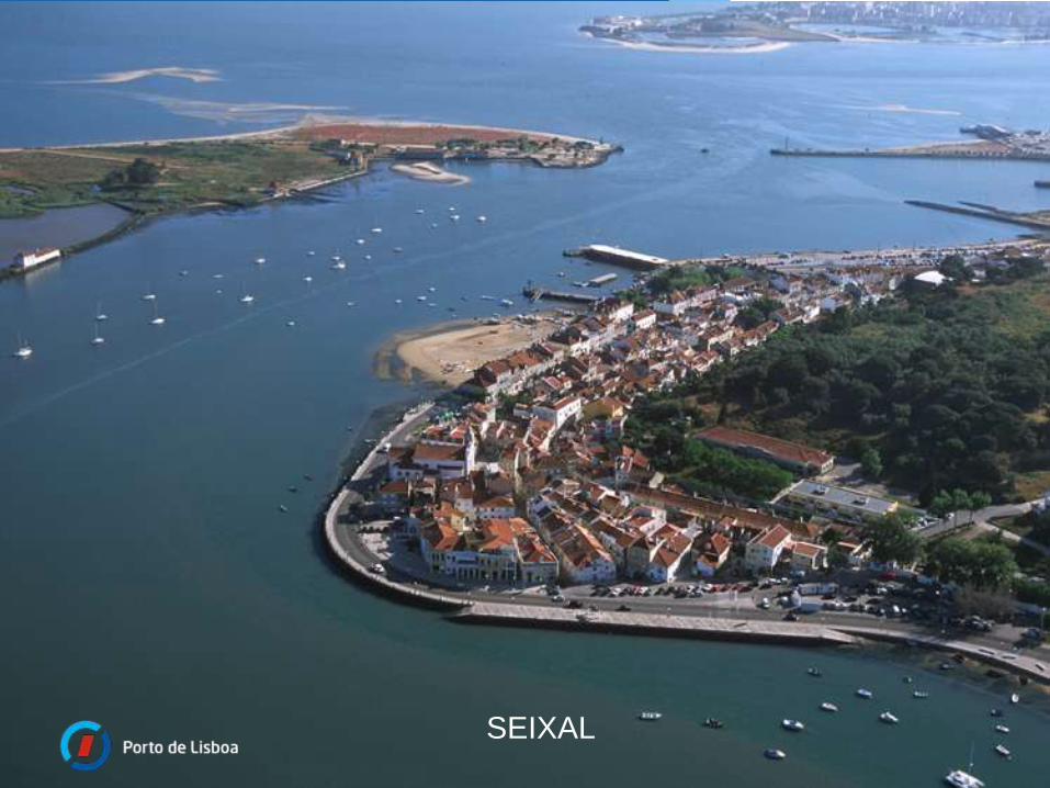
SEIXAL
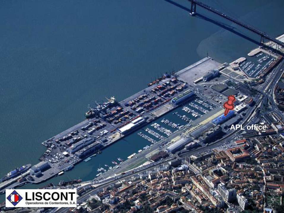
APL office
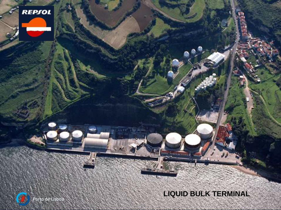
LIQUID BULK TERMINAL
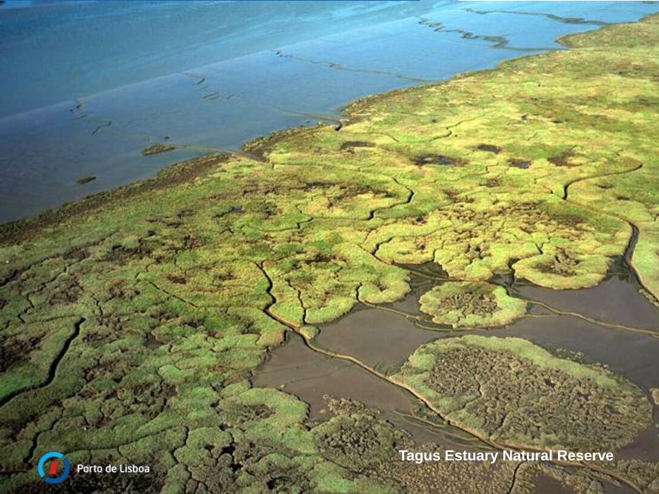
Tagus Estuary Natural Reserve
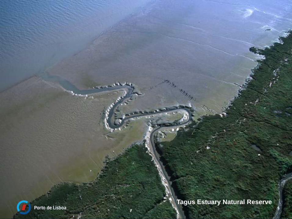
Tagus Estuary Natural Reserve
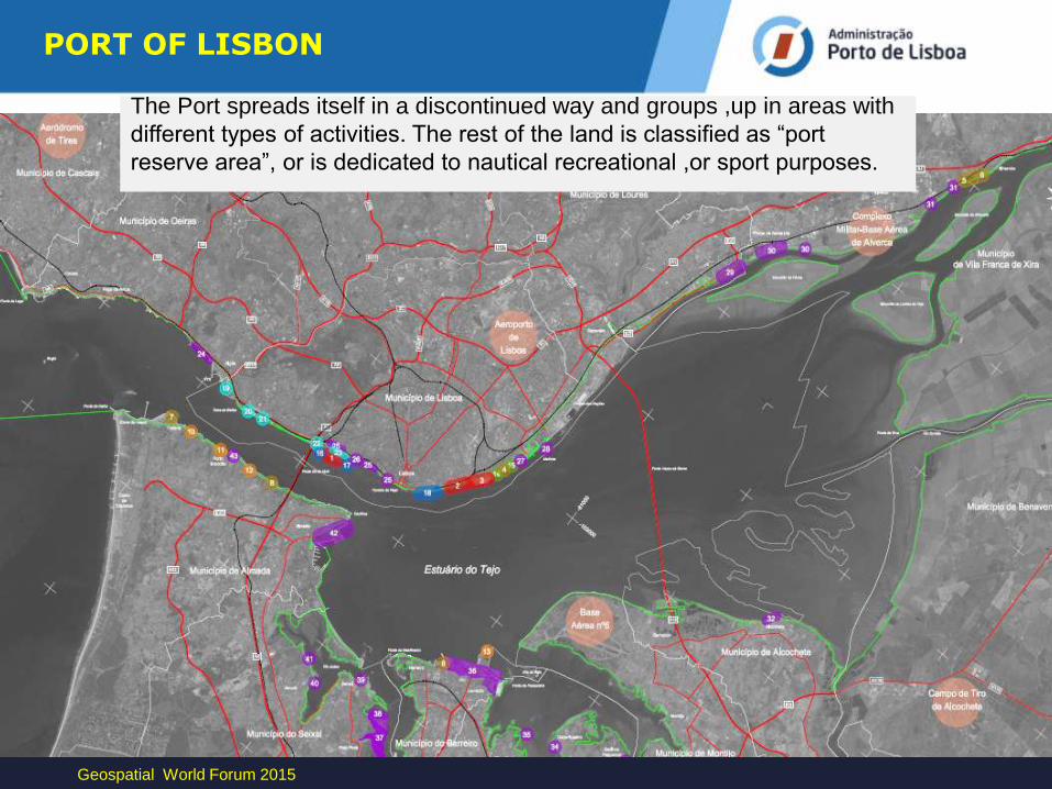
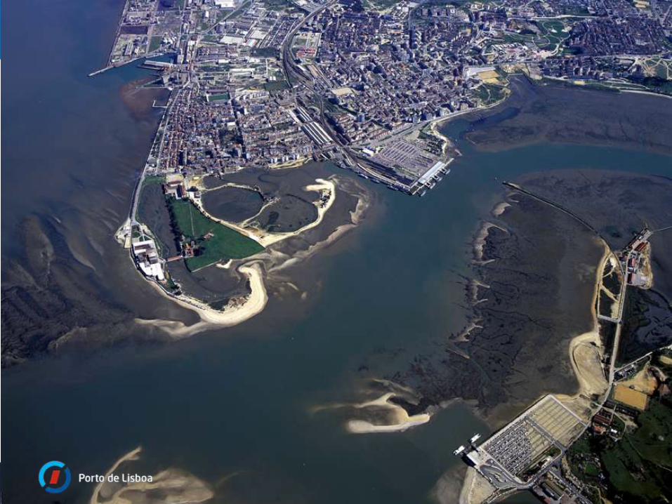
The Port spreads itself in a discontinued way and groups ,up in areas with
different types of activities. The rest of the land is classified as “port
reserve area”, or is dedicated to nautical recreational ,or sport purposes.
Geospatial World Forum 2015
PORT OF LISBON
Intergraph Geospatial 2013 - World Tour
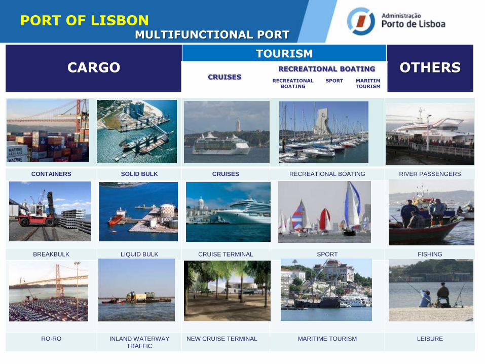
MULTIFUNCTIONAL PORT
Autorité Maritime TUTELLE
ADMINISTRATION PORTUAIRE
CARGO TOURISM
OTHERS CRUISES
RECREATIONAL BOATING
RECREATIONAL BOATING
SPORT MARITIM TOURISM
CONTAINERS SOLID BULK CRUISES RECREATIONAL BOATING RIVER PASSENGERS
BREAKBULK LIQUID BULK CRUISE TERMINAL SPORT FISHING
RO-RO INLAND WATERWAY
TRAFFIC
NEW CRUISE TERMINAL MARITIME TOURISM LEISURE
PORT OF LISBON
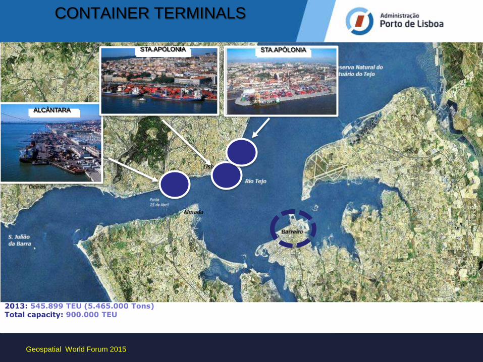
CONTAINER TERMINALS
TCA
TML TCSA
2013: 545.899 TEU (5.465.000 Tons) Total capacity: 900.000 TEU
ALCÂNTARA
STA.APÓLONIA STA.APÓLONIA
Geospatial World Forum 2015
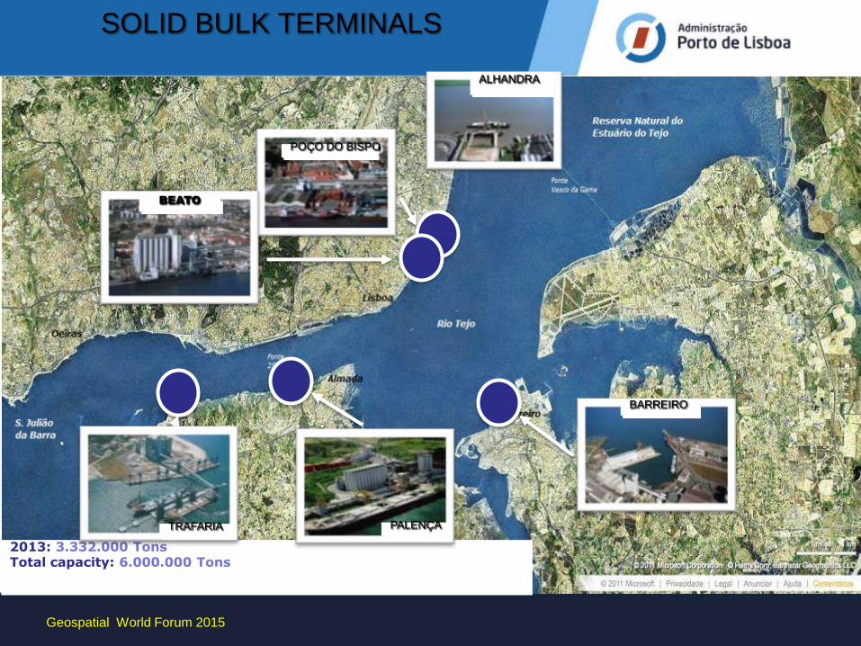
SOLID BULK TERMINALS
BARREIRO
ALHANDRA
BEATO
POÇO DO BISPO
2013: 3.332.000 Tons Total capacity: 6.000.000 Tons
TRAFARIA PALENÇA
Geospatial World Forum 2015
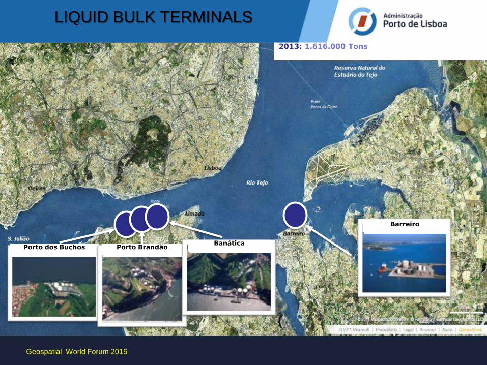
LIQUID BULK TERMINALS
2013: 1.616.000 Tons
Barreiro
Porto dos Buchos Porto Brandão Banática
Barreiro
Geospatial World Forum 2015
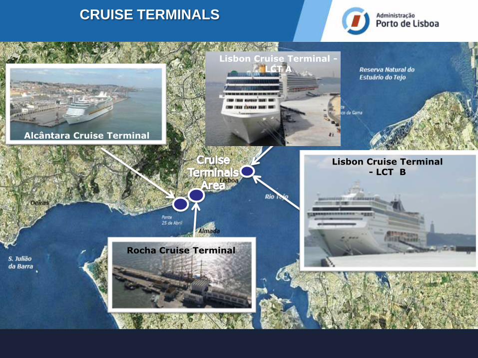
Lisbon Cruise Terminal - LCT B
Alcântara Cruise Terminal
CRUISE TERMINALS
Rocha Cruise Terminal
Lisbon Cruise Terminal - LCT A
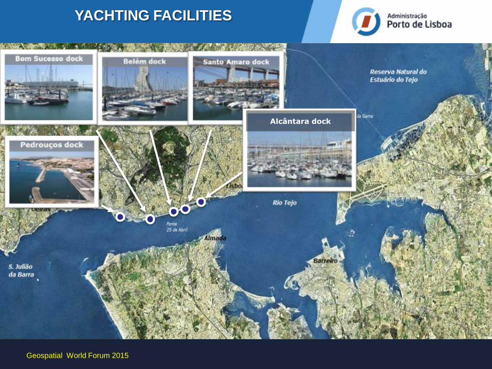
YACHTING FACILITIES
Alcântara dock
Geospatial World Forum 2015
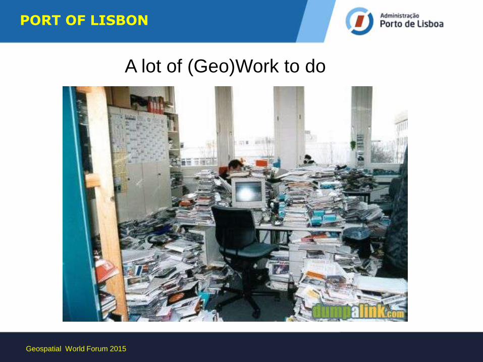
A lot of (Geo)Work to do
Geospatial World Forum 2015
PORT OF LISBON
Geospatial World Forum 2015
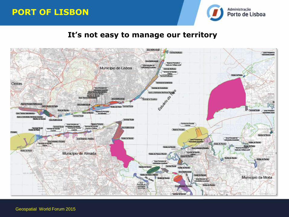
It’s not easy to manage our territory
Geospatial World Forum 2015
PORT OF LISBON
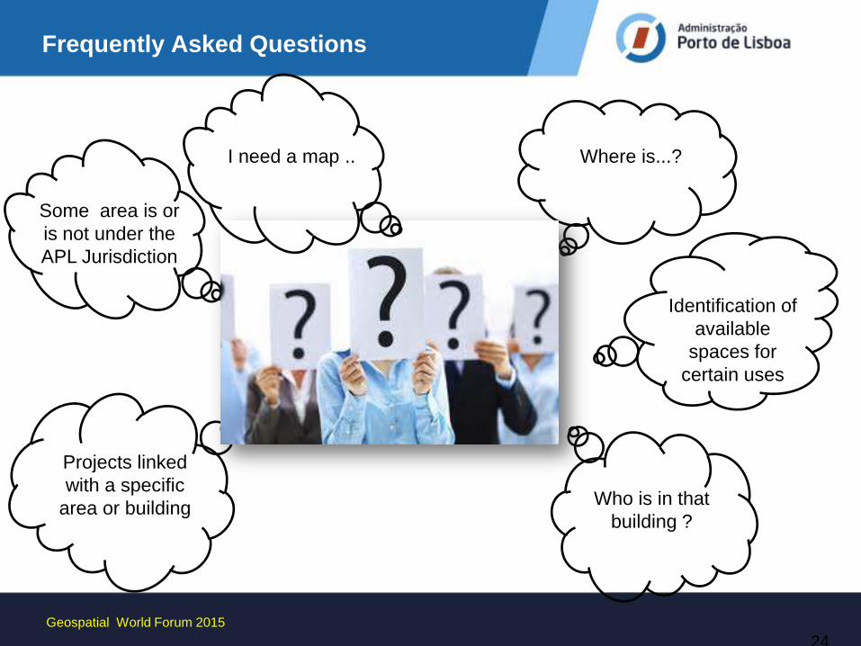
Frequently Asked Questions
Some area is or
is not under the
APL Jurisdiction
Where is...?
Who is in that
building ?
Projects linked
with a specific
area or building
Identification of
available
spaces for
certain uses
24
I need a map ..
Geospatial World Forum 2015
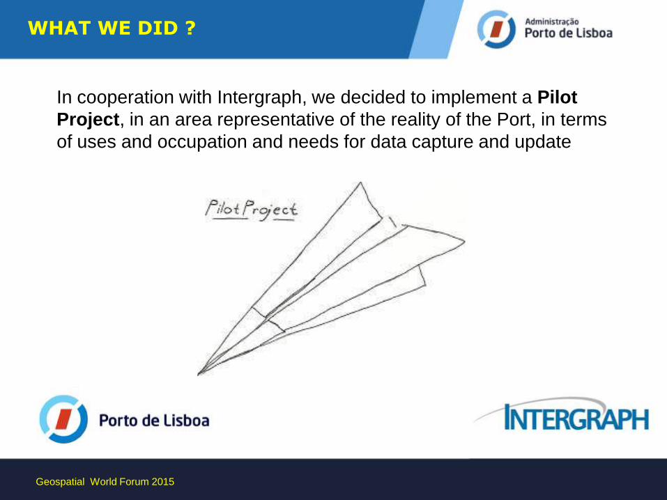
WHAT WE DID ?
In cooperation with Intergraph, we decided to implement a Pilot
Project, in an area representative of the reality of the Port, in terms
of uses and occupation and needs for data capture and update
Geospatial World Forum 2015
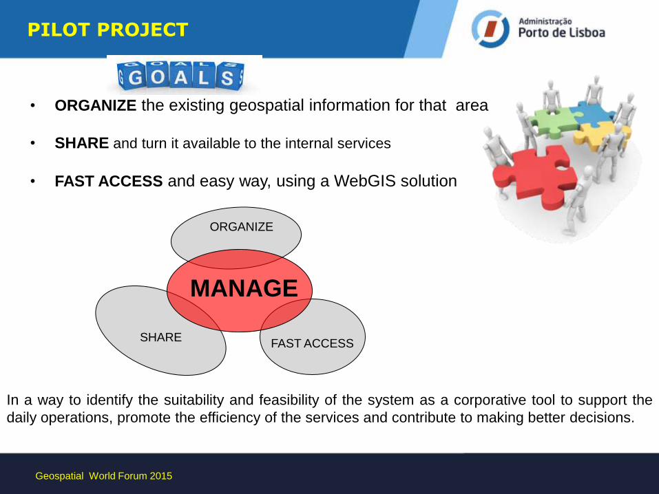
• ORGANIZE the existing geospatial information for that area
• SHARE and turn it available to the internal services
• FAST ACCESS and easy way, using a WebGIS solution
PILOT PROJECT
MANAGE
SHARE FAST ACCESS
ORGANIZE
In a way to identify the suitability and feasibility of the system as a corporative tool to support the
daily operations, promote the efficiency of the services and contribute to making better decisions.
Geospatial World Forum 2015
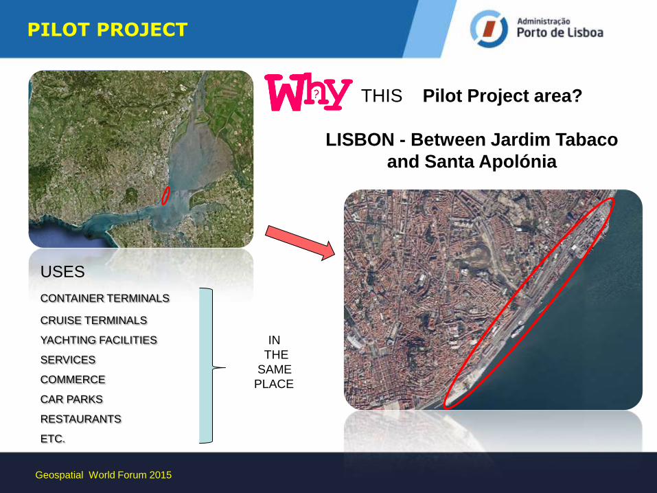
THIS Pilot Project area?
LISBON - Between Jardim Tabaco
and Santa Apolónia
USES
CONTAINER TERMINALS CRUISE TERMINALS
YACHTING FACILITIES
SERVICES
COMMERCE
CAR PARKS
RESTAURANTS
ETC.
Geospatial World Forum 2015
PILOT PROJECT
IN
THE
SAME
PLACE
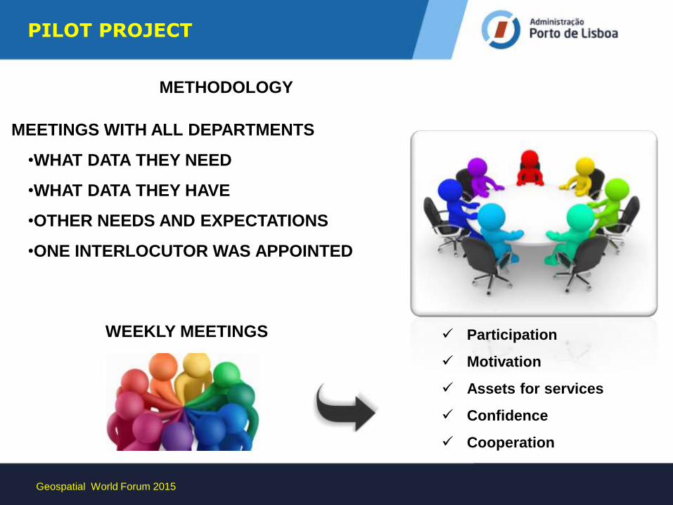
METHODOLOGY
MEETINGS WITH ALL DEPARTMENTS
•WHAT DATA THEY NEED
•WHAT DATA THEY HAVE
•OTHER NEEDS AND EXPECTATIONS
•ONE INTERLOCUTOR WAS APPOINTED
Participation
Motivation
Assets for services
Confidence
Cooperation
WEEKLY MEETINGS
Geospatial World Forum 2015
PILOT PROJECT
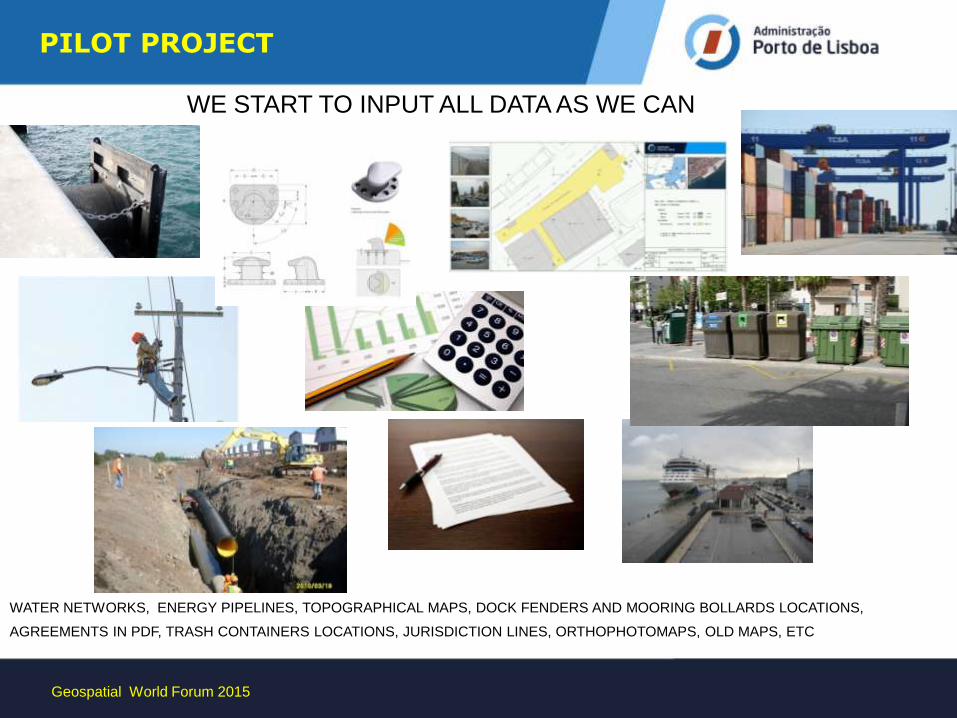
WATER NETWORKS, ENERGY PIPELINES, TOPOGRAPHICAL MAPS, DOCK FENDERS AND MOORING BOLLARDS LOCATIONS,
AGREEMENTS IN PDF, TRASH CONTAINERS LOCATIONS, JURISDICTION LINES, ORTHOPHOTOMAPS, OLD MAPS, ETC
WE START TO INPUT ALL DATA AS WE CAN
Geospatial World Forum 2015
PILOT PROJECT
AREA
Geospatial World Forum 2015
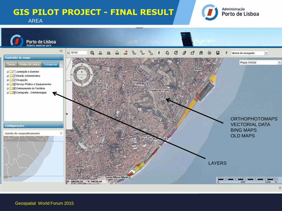
GIS PILOT PROJECT - FINAL RESULT
LAYERS
ORTHOPHOTOMAPS
VECTORIAL DATA
BING MAPS
OLD MAPS
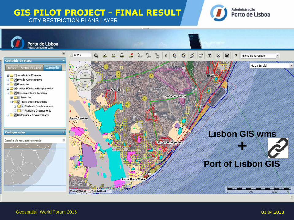
CITY RESTRICTION PLANS LAYER
03.04.2013 Geospatial World Forum 2015
Lisbon GIS wms
+ Port of Lisbon GIS
,
GIS PILOT PROJECT - FINAL RESULT
Geospatial World Forum 2015
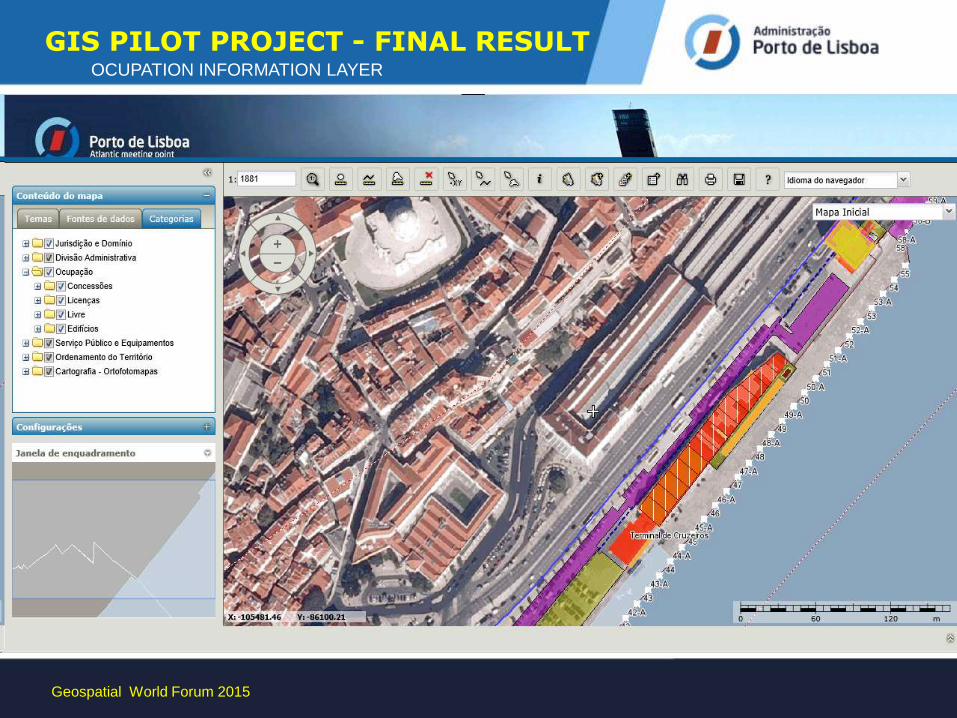
OCUPATION INFORMATION LAYER GIS PILOT PROJECT - FINAL RESULT
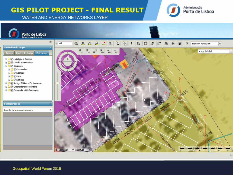
WATER AND ENERGY NETWORKS LAYER
Geospatial World Forum 2015
GIS PILOT PROJECT - FINAL RESULT
PROTÓTIPO
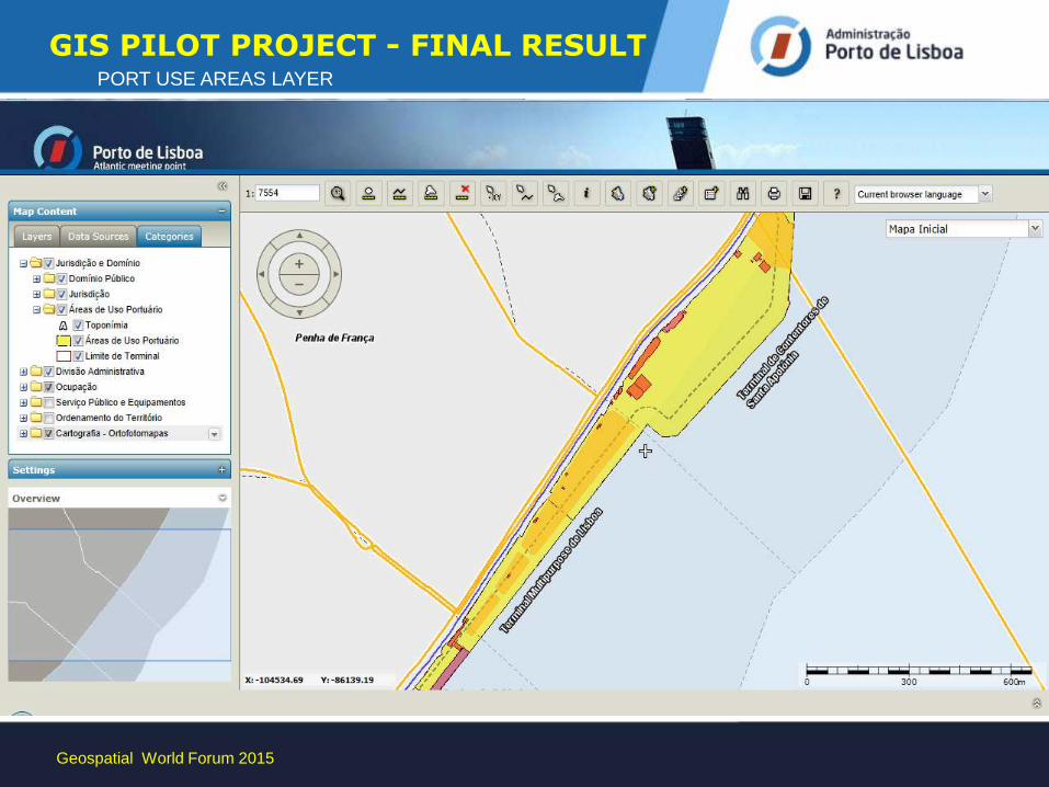
PORT USE AREAS LAYER
Geospatial World Forum 2015
GIS PILOT PROJECT - FINAL RESULT
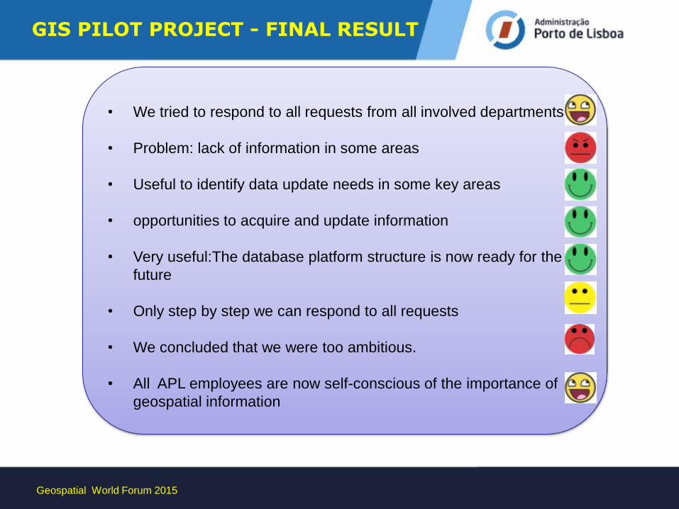
• We tried to respond to all requests from all involved departments
• Problem: lack of information in some areas
• Useful to identify data update needs in some key areas
• opportunities to acquire and update information
• Very useful:The database platform structure is now ready for the
future
• Only step by step we can respond to all requests
• We concluded that we were too ambitious.
• All APL employees are now self-conscious of the importance of
geospatial information
Geospatial World Forum 2015
GIS PILOT PROJECT - FINAL RESULT
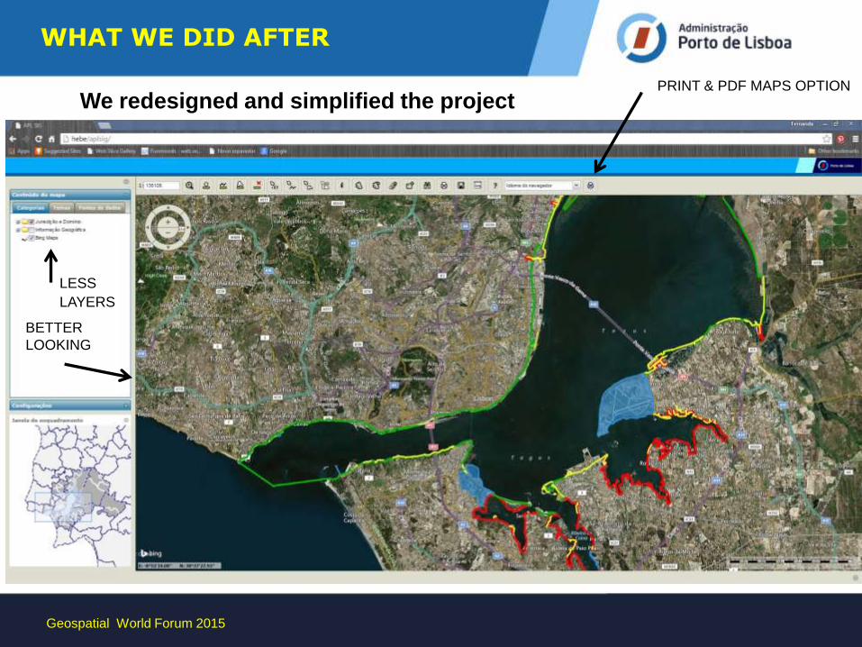
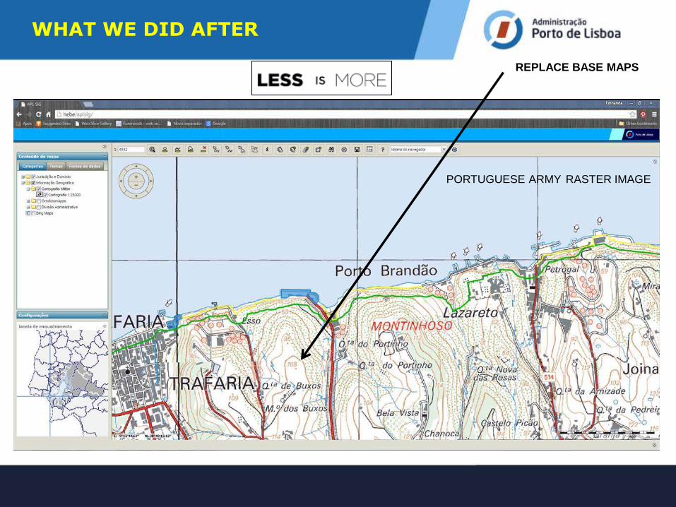
WHAT WE DID AFTER
We redesigned and simplified the project
Geospatial World Forum 2015
LESS LAYERS
PRINT & PDF MAPS OPTION
BETTER
LOOKING
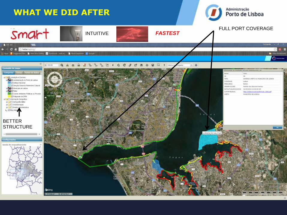
WHAT WE DID AFTER
BETTER
STRUCTURE
FULL PORT COVERAGE FASTEST INTUITIVE
WHAT WE DID AFTER
REPLACE BASE MAPS
PORTUGUESE ARMY RASTER IMAGE
Geospatial World Forum 2015
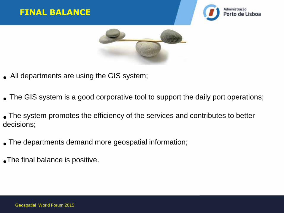
• All departments are using the GIS system;
• The GIS system is a good corporative tool to support the daily port operations;
• The system promotes the efficiency of the services and contributes to better
decisions;
• The departments demand more geospatial information;
•The final balance is positive.
FINAL BALANCE
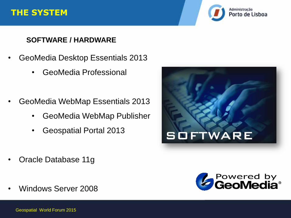
• GeoMedia Desktop Essentials 2013
• GeoMedia Professional
• GeoMedia WebMap Essentials 2013
• GeoMedia WebMap Publisher
• Geospatial Portal 2013
• Oracle Database 11g
• Windows Server 2008
THE SYSTEM
SOFTWARE / HARDWARE
Geospatial World Forum 2015
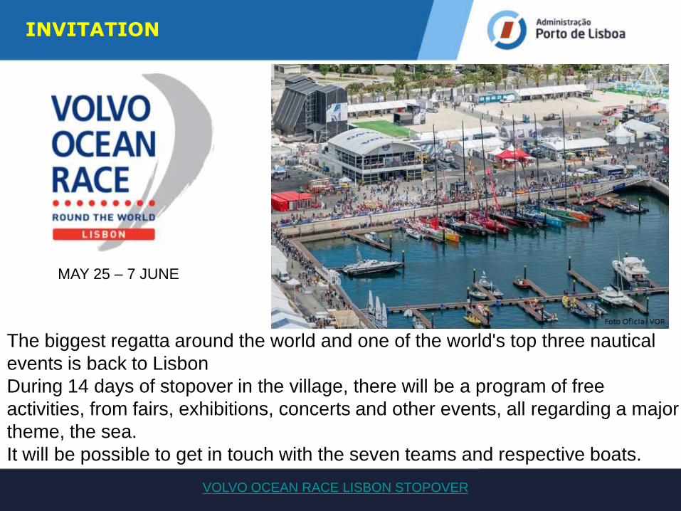
The biggest regatta around the world and one of the world's top three nautical
events is back to Lisbon
During 14 days of stopover in the village, there will be a program of free
activities, from fairs, exhibitions, concerts and other events, all regarding a major
theme, the sea.
It will be possible to get in touch with the seven teams and respective boats.
VOLVO OCEAN RACE LISBON STOPOVER
MAY 25 – 7 JUNE
INVITATION
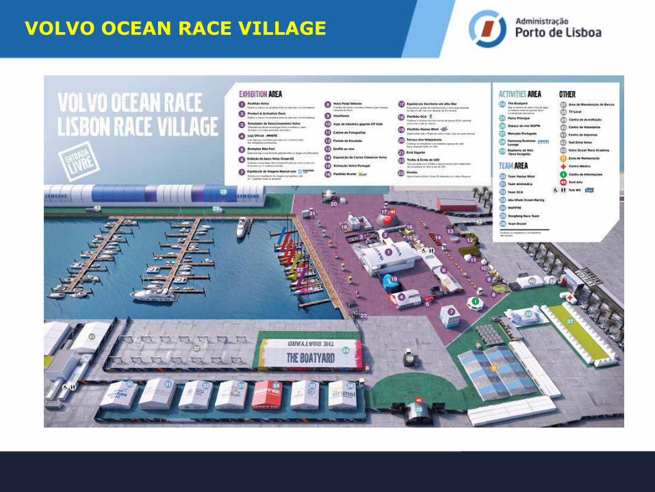
VOLVO OCEAN RACE VILLAGE
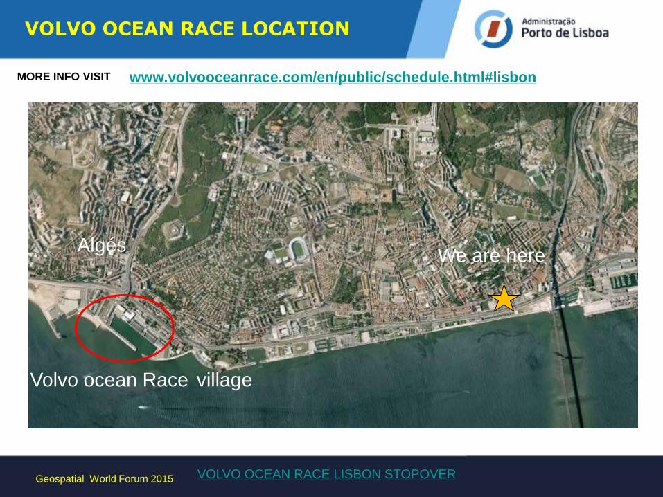
VOLVO OCEAN RACE LOCATION
Geospatial World Forum 2015 VOLVO OCEAN RACE LISBON STOPOVER
Volvo ocean Race village
We are here Algés
www.volvooceanrace.com/en/public/schedule.html#lisbon MORE INFO VISIT