Embed Size (px)
Citation preview
The Desert Sage ISSUE NO. 350
OUR 73RD SEASON
MARCH-APRIL 2014
http://angeles.sierraclub.org/dps/
The Desert Sage 2 March-April 2014
Hello, my fellow desert peak lovers! Hope everyone is enjoying the pleasant winter weather and climbing in the
great desert expanses! We are putting together some trips for the spring season and hope that many of you will be able to join us! See the Outings section for a listing of upcoming trips. There are a number of folks (Michael Gosnell, Kathy Rich, Paul Garry, Greg Gerlach, Gloria Miladin and Brian Smith) who are planning to finish the list soon, and these will be great fun! Thanks to those leaders who are putting together these trips-they are the backbone of our Section! Also, be sure to mark your calendars for the next DPS Banquet, which will be held on Sunday, May 18th. The location is going to be Luminarias Restaurant in Monterey Park (near California State University, Los Angeles). This venue is operated by the same company that we’ve worked with before at the Proud Bird Restaurant. Alas, we were informed in November of last year that the Proud Bird was closing. I understand, however, that Luminarias has an excellent location and we should be in for a great time there. Our speaker will be Andy Zdon, author of Desert Summits: A Hiking and Climbing Guide to California and Southern Nevada; please see the DPS banquet flyer in this issue of the Sage for more information and to sign up. On another (recurring) note, we still need to get all outings leaders and participants to help out in the process of updating the DPS peak guides. The changes that are found to the current DPS guides by folks doing trips should be forwarded to the Guidebook Editor so that the information can be incorporated into the 6th Edition of the Road and Peak Guide. Updating
the guide is an essential, though a never-ending process. Also, I would like to ask leaders of trips to send in write-ups for the Sage. You can always ask someone to do a write-up for the trip if you’re not comfortable in doing so. Also, we are in the process of seeking (through our Nominating Committee) new candidates to run for office on the Management Committee. If you know someone or would like to run yourself, please contact me or another member of the current Management Committee. We have three openings coming up, and we will need folks to fill them! Nominations are technically supposed to be completed by the February meeting; however, nominations can be received up to and including the March meeting. Let’s continue to have a safe and enjoyable climbing season-see Y’all on the mountain, trail or at the next DPS meeting and potluck-Sunday, March 9th at Tom Sumner’s home in Sylmar. Come join the fun!
CHAIR’S CORNER
by
Jim Fleming
THE NEXT SAGE SUBMISSION DEADLINE
IS APRIL 13, 2014
The Desert Sage is published six times a year by the Desert Peaks Section of the Angeles Chapter of the Sierra Club. Subscription to The Desert Sage is ten (10) dollars a year. See back cover for ordering details. The Desert Peaks Section’s Sage is the property of the Desert Peaks Section of the Angeles Chapter of the Sierra Club. All rights reserved.
The Desert Peaks Section maintains a website at:http://angeles.sierraclub.org/dps/
The DPS Management
Committee and membership thank Larry Hoak for his 6 years of service to
the DPS as Webmaster!!
The Desert Sage 3 March-April 2014
DESERT PEAKS SECTION LEADERSHIP, 2013 - 2014 SEASON
Chair Jim Fleming
538 Yarrow Drive Simi Valley, CA, 93065-7352
(805) 405-1726 [email protected]
Vice Chair / Outings / Safety
Brian Smith 2306 Walnut Avenue Venice, CA, 90291 (818) 898-2844
Program / Banquet Francesca Marcus 556 Oakdale Drive
Sierra Madre, CA, 91024 (626) 825-9037
Treasurer Pat Arredondo
13409 Stanbridge Ave Bellflower, CA, 90706-2341
(562) 867-6894 [email protected]
Secretary
Greg Gerlach 23933 Via Astuto
Murrieta, CA, 92562 (626) 484-2897
Archives Barbara Reber PO Box 1911
Newport Beach, CA 92659-0911 (949) 640-7821
Conservation Chair
Virgil Popescu 9751 Amanita Ave
Tujunga, CA, 91042-2914 (818) 951-3251
Guidebook Editor Open
Please contact any DPS Manage-ment Committee member
if you’re interested in becoming the next DPS Guidebook Editor
Mailer
Elaine Baldwin 3760 Ruthbar Drive
Hawthorne, CA, 90250-8473 (310) 675-4120
Membership Records Chair Ron Bartell
1556 21st Street Manhattan Beach, CA, 90266
(310) 546-1977 [email protected]
Merchandising
Gloria Miladin 11946 Downey Ave Downey, CA, 90242
(562) 861-2550 [email protected]
Mountain Records (Registers) Daryn Dodge 2618 Kline Ct
Davis, CA, 95618-7668 (530) 753-1095
Mountaineering Committee Chair
Brian Smith 2306 Walnut Avenue
Venice, CA, 90291 (818) 898-2844
Mountaineering Committee Ron Bartell
[email protected] Tina Bowman
Newsletter Editor (SAGE) Greg Gerlach
23933 Via Astuto Murrieta, CA, 92562
(626) 484-2897 [email protected]
Webmaster
Open Please contact any DPS Manage-
ment Committee member if you’re interested in becoming
the next DPS Webmaster
Elected Positions Appointed Positions
The Desert Peaks Section explores the desert mountain ranges of California and
the Southwest, stimulates the interest of Sierra Club membership in climbing these ranges and
aids in the conservation and preservation of desert wilderness areas.
Cover Photo Credit
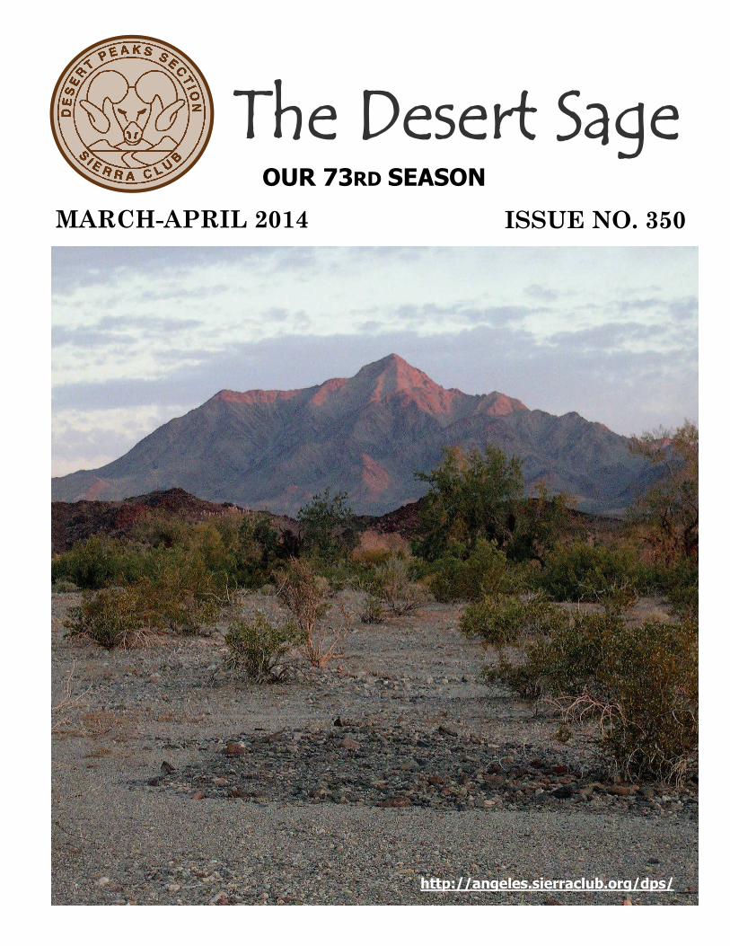
The photo is of Chuckwalla Mountain, which was taken by Alois Smrz on May 6, 2013 from the Little Chuckwalla Wilderness, which is located southeast of the peak.
The Desert Sage 4 March-April 2014
MARCH 1-2 SAT-SUN DPS Canyon Point and Brown Peak MARCH 1-2 SAT-SUN DPS Brown Peak and Smith Mountain MARCH 9 SUN DPS DPS Meeting and Potluck MARCH 29 SAT DPS Spectre Point MAR 29-30 SAT-SUN DPS, WTC, 20s & 30s Last Chance Mountain and Sandy Point MAR 29-30 SAT-SUN DPS Ibex Peak, Saddle Peak and Noon Peak APRIL 5-6 SAT-SUN DPS Moapa Peak and Virgin Peak APRIL 13 SUN DPS DPS Meeting and Potluck APRIL 19-20 SAT-SUN DPS Sentinel Peak APRIL 26-27 SAT-SUN DPS,SPS,LTC Sierra Snow Checkoff/Practice APRIL 26-27 SAT-SUN DPS Kingston Peak and Avawatz Mountain MAY 3-4 SAT-SUN DPS,WTC, 20s & 30s Eagle Mountain MAY 18 SUN DPS Desert Peaks Section Annual Banquet JUNE 7-8 SAT-SUN DPS Glass Mountain, Cone Peak and Wilfred Peak
TRIPS & EVENTS MARCH 2014 — JUNE 2014
MARCH 1-2 SAT-SUN DPS I: Canyon Point (5,890’) and Brown Peak (4,947’): Join us in Death Valley for climbs of two fairly easy peaks (drives not so easy – 4 wheel drive may be required). Saturday climb Canyon Point (3,100’ elevation gain, 5 miles), and then drive toward Brown to find a good camping spot for our usual great DPS potluck. Sunday climb Brown (2,000’ gain, 6.5 miles). Leader: Dave Perkins. Contact Ann Perkins (assistant leader) at [email protected] for trip details and with conditioning/experience information.
MARCH 1-2 SAT-SUN DPS I: Brown Peak (4,947’) and Smith Mountain (5,913’): Saturday climb Brown Peak, 6.5 miles round trip, 2,000’ gain. Sunday climb Smith Mountain, 5.5 miles round trip, 2,300’ gain. Car camp and optional potluck Saturday night. Send email or sase with resume, conditioning, carpool information to Leader: Tina Bowman ([email protected]). Co-Leaders: Barbee and Larry Tidball
MARCH 9 SUN DPS O: DPS Management Committee Meeting and Potluck: Join us at the home of Tom Sumner in Sylmar for the DPS Management Committee meeting at 4:30 pm and potluck at 6:00 pm. Please bring a beverage of your choice and a potluck item to share. RSVP to Tom Sumner at [email protected]
MARCH 29 SAT DPS I: Spectre Point (4,400’+): Strenuous Class 2 scramble to the high point of the Coxcomb Mountains in Joshua Tree National Park. Join leaders for this 2,700’ gain, 14 mile round trip adventure to one of the highlights of the park. This will be a long, rugged hike in steep, thorny terrain, so make sure to e-mail the leaders your recent conditioning and experience! Lug soled boots and adequate water (3-4 liters) recommended. Contact leader: Jim S. Fleming ([email protected]) or Co-leaders: Tina Bowman ([email protected]) or Paul Garry ([email protected]) for details.
(Continued on page 5)
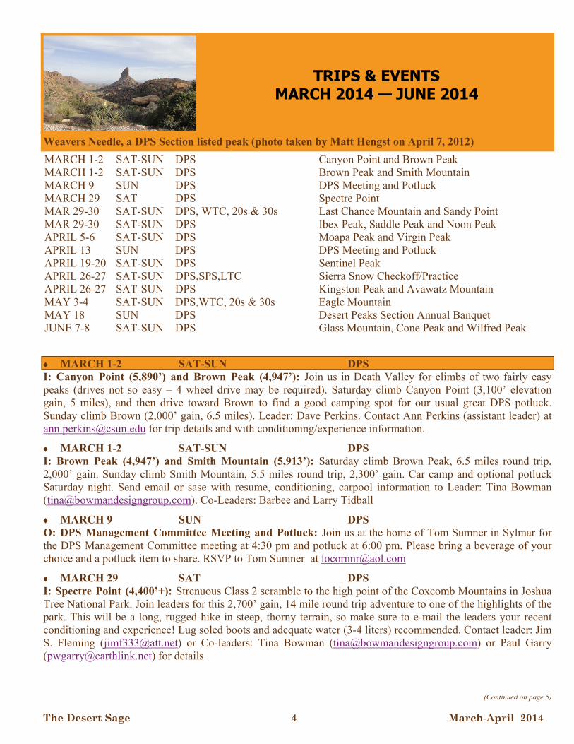
Weavers Needle, a DPS Section listed peak (photo taken by Matt Hengst on April 7, 2012)
The Desert Sage 5 March-April 2014
MARCH 29-30 SAT-SUN DPS, WTC, 20s & 30s SECTION I: Last Chance Mountain (8,456’) and Sandy Point (7,062’): Enjoy a beautiful cross-country, springtime day hike to Last Chance Mountain at the north end of Death Valley National Park. The hike will be 7 miles round-trip with approximately 2,300' gain. Optional car camp Friday and Saturday nights under a new moon near the entrance to the decommissioned Crater Mine. Sunday's hike to Sandy Point, which is an 11-mile round-trip with approximately 2,000' of gain, affords panoramic views of the Eureka Valley and snowcapped Eastern Sierra Nevada Mountains in the distance. Bring 10 essentials, 3 – 4 liters of water, and a pleasant demeanor. WTC, or similar experience & training, is encouraged. Send experience, current conditioning and contact information to Leader: Benjamin Bowes ([email protected]). Assistant: Will McWhinney.
MARCH 29-30 SAT-SUN DPS I: Ibex Peak (4,751’), Saddle Peak Hills Wilderness Highpoint (2,280’) and Noon Peak (4,237’): This is an exploratory trip to climb three California Wilderness Area highpoints. On Saturday, climb Ibex Peak in the Ibex Wilderness (5.5 miles, 1,750’), which shares a border with Death Valley National Park. That afternoon we’ll also have a short climb up to the high point in the Saddle Peak Hills Wilderness (2 miles, 430’). There should be time in the late afternoon to visit nearby Tecopa Hot Springs for those interested. Sunday we’ll climb the highpoint of the South Nopah Range Wilderness, Noon Peak, (aka Noon benchmark) (3 mi, 1,500’). High clearance vehicles recommended. Leaders: Daryn Dodge ([email protected]) and Kathy Rich ([email protected]).
APRIL 5-6 SAT-SUN DPS M/I: Moapa Peak (6,471 and Virgin Peak (8,071): Join us for two Las Vegas area peaks and a list finish for Michael Gosnell. Saturday, we’ll hike Moapa, class 3 with exposure and 6 miles RT, 3,400’ of gain. Afterward, we’ll drive to the 2-wheel drive trail head for Virgin Peak and car camp with a DPS-style potluck dinner. Sunday, we’ll hike Virgin Peak, no more than 10 miles RT and 3,800’ of gain. Afterwards, we’ll return for a short list finish celebration. Email Michael at [email protected] for trip details. Leaders: Doug Mantle, Tina Bowman and Rudy Fleck
APRIL 13 SUN DPS O: DPS Management Committee Meeting and Potluck: Join us at the home of Barbee and Larry Tidball in Long Beach for the DPS Management Committee meeting at 4:30 pm and potluck at 6:00 pm. Please bring a beverage of your choice and a potluck item to share. RSVP to Barbee and Larry Tidball at [email protected]
APRIL 19-20 SAT-SUN DPS I: Sentinel Peak (9,634’): Join us for a backpacking trip in Death Valley. On Saturday we will backpack up Surprise Canyon to Panamint City (roughly 6 miles, 4,000’). We will explore the ghost town of Panamint City and camp there Saturday night. Sunday we will climb Sentinel Peak and then pack up and hike back down Surprise Canyon (roughly 11 miles, 3,000’). Contact leader for details. Leader: Jen Blackie ([email protected]) Co-leader: Jack Kieffer
APRIL 26-27 SAT-SUN LTC, DPS, SPS M/E: Sierra Snow Checkoff/Practice: For M & E candidates wanting to check off leadership ratings and/or others who wish to practice new techniques. Restricted to Sierra Club members with some prior basic training with the ice axe. Email Sierra Club number, climbing resume, email address and phone number to Leader: Nile Sorenson ([email protected]). Co-leader: Doug Mantle. E, C, Mountaineering
APRIL 26-27 SAT-SUN DPS I: Kingston Peak (7,336’) and Avawatz Mountain (6,154’): Join us for a spring climb of these two relatively high peaks in San Bernardino County. Kingston is 3,800’ of gain, 9 miles, and Avawatz will probably be about 10 miles and 3,000’ elevation gain, due to some road washouts. 4 wheel drive may be
(Continued from page 4)
(Continued on page 6)
The Desert Sage 6 March-April 2014
required for some parts of the road in to Avawatz We’ll meet Saturday morning for the climb of Kingston, enjoy our usual excellent potluck on Saturday night, and climb Avawatz on Sunday. Depending on when we finish our Saturday climb, there will be a chance of a welcome soak in Tecopa Hot Springs. Leader: Dave Perkins. email Ann Perkins: [email protected] (assistant leader) with recent experience and conditioning.
MAY 3-4 SAT-SUN DPS, WTC, 20s & 30s SECTION I: Eagle Mountain (5,350’): Join us for an enjoyable cross-country backpack trip into the Eagle Mountains of Joshua Tree National Park. 12-mile round-trip with 2,400’ of gain. The Eagle Mountains are an appealing destination that mark the transition between Colorado Desert and higher-elevation Mojave Desert ecological zones. Desert saltbush, creosote bush and chola cactus of the low-elevation Colorado Desert give way to uniquely beautiful Joshua Trees as we hike to the peak of Eagle Mountain #1. Saturday we will hike 3.5 miles off-trail to dry camp area, set up camp and then hike 4.2 miles round-trip to summit. Return to camp for happy hour and good conversation. Sunday morning will begin at a leisurely hour to break camp. On the return hike we will visit historic Mastodon Mine and Cottonwood Spring. Bring 10 essentials, all water, and a pleasant demeanor. Wilderness Travel Course, or similar experience & training, is encouraged. Send experience, current conditioning and contact information to Leader: Benjamin Bowes ([email protected]). Assistant: Dwain Roque.
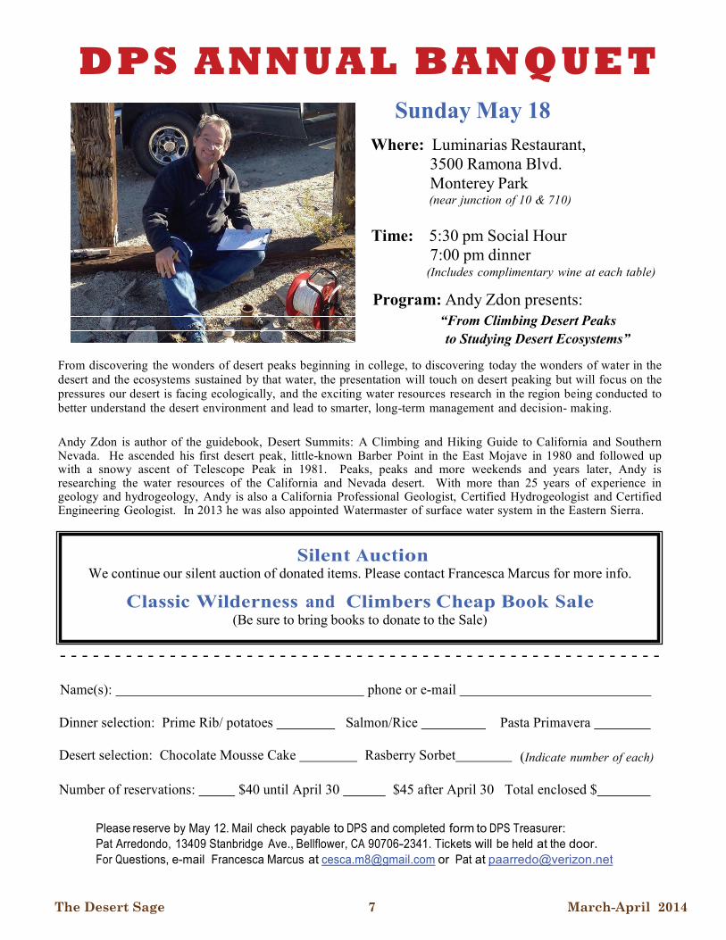
MAY 18 SUN DPS Desert Peaks Section Annual Banquet: Join your fellow desert explorers and friends for a wonderful evening at the Luminarias Restaurant in Monterey Park. This year’s speaker will be Andy Zdon, author of the classic book, “Desert Summits: A Hiking and Climbing Guide to California and Southern Nevada”, who will present “From Climbing Desert Peaks to Studying Desert Ecosystems”. Social Hour and No Host Bar starts at 5:30 pm, followed at 7:00 pm by dinner and the program. The evening will be capped off by awards. Please mark your calendars and come join the fun! For more information, or to sign up for the banquet, please see the banquet flyer in this issue of the Sage.
JUNE 7-8 SAT-SUN DPS I: Glass Mountain (11,140’), Cone Peak (10,152’) and Wilfred Peak (10,030’): Join us for a double list finish celebration for Kathy Rich and Greg Gerlach (and possibly others) on Glass Mountain (located south of Mammoth), with celebratory party afterwards at nearby Sawmill Meadows Campground. Saturday: easy climb of Glass Mountain (3 miles round trip and 1,900’ gain), adding its slightly lower north or south summits if desired. Sunday: option to climb two bonus peaks on Peakbagger.com’s non-Sierra 10K list – Cone and Wilfred Peaks (5 miles round trip and 2,000’ gain), located further south along Glass Mountain ridge. Great view of the Sierras and White Mountains from these summits. 2 wheel drive vehicles ok for Glass, 4 wheel drive required for Cone and Wilfred Peaks. Send e-mail to leaders: Daryn Dodge ([email protected]) or Kathy Rich ([email protected]). Co-leaders: Tina Bowman, Mat Kelliher, Gary Schenk and Barbee and Larry Tidball.
(Continued from page 5)
In order to participate on one of the Sierra Club's outings, you will need to sign a liability waiver. If you would like to read a copy of the waiver prior to the outing, please see http://sierraclub.org/outings/chapter/forms or call 415-977-5528.
In the interest of facilitating the logistics of some outings, it is customary that participants make carpooling arrangements. The Sierra Club does not have insurance for carpooling arrangements and assumes no liability for them. Carpooling, ride sharing or anything similar is strictly a private arrangement among the participants. Participants assume the risks associated with this travel. CST 2087766-40. Registration as a seller of travel does not constitute approval by the State of California.
The Desert Sage 7 March-April 2014
DPS AN N UAL B AN Q UET
Sunday May 18
Where: Luminarias Restaurant, 3500 Ramona Blvd. Monterey Park (near junction of 10 & 710)
Time: 5:30 pm Social Hour 7:00 pm dinner
(Includes complimentary wine at each table)
Program: Andy Zdon presents: “From Climbing Desert Peaks to Studying Desert Ecosystems”
From discovering the wonders of desert peaks beginning in college, to discovering today the wonders of water in the desert and the ecosystems sustained by that water, the presentation will touch on desert peaking but will focus on the pressures our desert is facing ecologically, and the exciting water resources research in the region being conducted to better understand the desert environment and lead to smarter, long-term management and decision- making.
Andy Zdon is author of the guidebook, Desert Summits: A Climbing and Hiking Guide to California and Southern Nevada. He ascended his first desert peak, little-known Barber Point in the East Mojave in 1980 and followed up with a snowy ascent of Telescope Peak in 1981. Peaks, peaks and more weekends and years later, Andy is researching the water resources of the California and Nevada desert. With more than 25 years of experience in geology and hydrogeology, Andy is also a California Professional Geologist, Certified Hydrogeologist and Certified Engineering Geologist. In 2013 he was also appointed Watermaster of surface water system in the Eastern Sierra.
Silent Auction We continue our silent auction of donated items. Please contact Francesca Marcus for more info.
Classic Wilderness and Climbers Cheap Book Sale (Be sure to bring books to donate to the Sale)
- - - - - - - - - - - - - - - - - - - - - - - - - - - - - - - - - - - - - - - - - - - - - - - - - - - - - - -
Name(s): phone or e-mail
Dinner selection: Prime Rib/ potatoes Salmon/Rice Pasta Primavera
Desert selection: Chocolate Mousse Cake Rasberry Sorbet (Indicate number of each)
Number of reservations: $40 until April 30 $45 after April 30 Total enclosed $
Please reserve by May 12. Mail check payable to DPS and completed form to DPS Treasurer: Pat Arredondo, 13409 Stanbridge Ave., Bellflower, CA 90706-2341. Tickets will be held at the door. For Questions, e-mail Francesca Marcus at [email protected] or Pat at [email protected]
The Desert Sage 8 March-April 2014
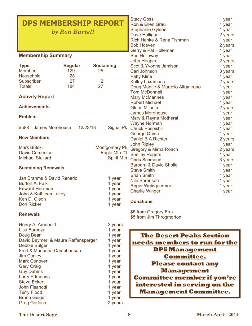
Membership Summary Type Regular Sustaining Member 129 25 Household 28 Subscriber 27 2 Totals: 184 27 Activity Report Achievements Emblem #588 James Morehouse 12/23/13 Signal Pk New Members Mark Butski Montgomery Pk David Comerzan Eagle Mtn #1 Michael Stallard Spirit Mtn Sustaining Renewals Jan Brahms & David Reneric 1 year Burton A. Falk 1 year Edward Herrman 1 year John & Kathleen Lakey 1 year Ken D. Olson 1 year Don Ricker 1 year Renewals Henry A. Arnebold 2 years Lisa Barboza 1 year Doug Bear 1 year David Beymer & Maura Raffensperger 1 year Debbie Bulger 1 year Fred & Marianna Camphausen 1 year Jim Conley 1 year Mark Conover 1 year Gary Craig 1 year Guy Dahms 1 year Larry Edmonds 1 year Steve Eckert 1 year John Fisanotti 1 year Terry Flood 1 year Bruno Geiger 1 year Greg Gerlach 2 years
Stacy Goss 1 year Ron & Ellen Grau 1 year Stephanie Gylden 1 year Dave Halligan 2 years Rich Henke & Rena Tishman 1 year Bob Hoeven 2 years Gerry & Pat Holleman 1 year Sue Holloway 1 year John Hooper 2 years Scot & Yvonne Jamison 1 year Carl Johnson 3 years Patty Kline 1 year Kelley Laxamana 2 years Doug Mantle & Marcelo Altamirano 1 year Tom McDonnell 1 year Mary McMannes 1 year Robert Michael 1 year Gloria Miladin 2 years James Morehouse 1 year Mary & Rayne Motheral 1 year Wayne Norman 1 year Chuck Pospishil 1 year George Quinn 1 year Daniel B A Richter 2 years John Ripley 1 year Gregory & Mirna Roach 2 years Shelley Rogers 1 year Chris Schmandt 3 years Barbara & David Sholle 1 year Steve Smith 1 year Brian Smith 1 year Nile Sorenson 1 year Roger Weingaertner 1 year Charlie Winger 1 year Donations $5 from Gregory Frux $5 from Jim Throgmorton
DPS MEMBERSHIP REPORT by Ron Bartell
The Desert Peaks Section needs members to run for the
DPS Management Committee.
Please contact any Management
Committee member if you’re interested in serving on the
Management Committee.

The Desert Sage 9 March-April 2014
DESERT SAGE - ELECTRONIC VERSION
You now have the option of receiving your Desert Sage via email. DPS members who have an email address on record have received or are receiving this Sage edition electronically via a link. For all other members/subscribers who do not have an email address, we will continue to send a hard copy Sage as usual. Any member/subscriber who is/has received this edition via a link and desires to continue to receive the Desert Sage in hardcopy format through the US Mail, should send an e-mail to the D P S M e m b e r s h i p C h a i r [email protected], or leave a message for Ron at (310) 546-1977 requesting continued mailing of a hard copy. If you take no action, the Desert Sage will only be sent electronically to members/subscribers with an email address on file.
Greetings, fellow desert climbers!
Usually March/April is the time desert flowers might be blooming in Anza-Borrego and Death Valley. It will be interesting to see what we find this year, given the lack of rain we have experienced so far this winter. Now is
also the time to start thinking about our more challenging desert ascents, since days are lengthening, but the air still remains cool. I am thinking about second routes on Rabbit and Martinez this spring.
Since the last Sage, I have received positive feedback from the Sierra Club Desert and Wilderness Committees on our plan to highlight California Wilderness areas in our Outings in support of the celebrations for the 20th anniversary of the passage of the Desert Protection Act. The year 2014, it seems, is a bumper anniversary year:
20 years - California Desert Protection Act.
30 years - California Wilderness Act.
100 years - John Muir's passing.
150 years - Yosemite Grant.
150 years - Establishment of the California State Park System.
So there is quite a lot to celebrate. I am pleased to see the trip to Ibex and Saddle Peak Hills Wilderness Areas in our Outings list as this actively demonstrates the section's support for these anniversary celebrations. It was also pointed out to me that President Clinton signed the Desert
Outing Chair by Brian Smith
Bill on Halloween of 1994, so the Sierra Club Desert and Wilderness Committee is looking for that date to be the climax of the year's wilderness activities. Since I hear we are going to have our Chili Cook-Off around Halloween time, perhaps we can choose a suitable wilderness location for it.
Continuing my theme on exploration, take a look at my article on an alternate route to Muddy Peak. It provides an easy, scenic alternative to the standard route from the north and perhaps should become an official "Route B". Finally, please keep supporting our monthly get-togethers. The next two are with Tom Sumner in March and Larry and Barbee Tidball in April.
See you out there! a
The Desert Sage 10 March-April 2014
TRIP REPORTS
Muddy Peak – at Last! by Brian S Smith
January 18-19, 2014
After 3 abortive attempts to drive the 4WD road through Buffington Pockets to Muddy Peak trailhead in 3 different vehicles, Gloria Miladin and I decided we should backpack the peak by driving as far as possible, then hiking in 6 miles to the trailhead with sleeping bags and water. That would make for a rugged 21 mile backpack, but at least we would have the peak. Our first attempt was in a RAV4, which failed on loose gravel with the wheels slipping. Then an AWD Subaru Outback handled the loose gravel, but did not have enough clearance to get over embedded, vertical boulders. Finally, we thought renting a Jeep Wrangler was the answer. Unfortunately it was a 2WD Jeep and it dug a hole in the gravel. We eventually pulled it out after an hour of digging and adding rocks to the hole, destroying an air mattress in the process. All this in the middle of the night. So backpacking seemed the only way. However, I was not looking forward to a 21 mile epic.
Fortunately, our Explorer-in-Chief, Ron Bartell came up with an alternate option – Lovell Wash from Lake Mead. If you Google Lovell Wash, you get a lot of information on how to get there and even a topo, which proved invaluable. The topo suggested following Lovell Wash to the Muddy Mountains – perhaps a distance of 7 miles to the saddle mentioned in the regular route description. We chose to leave for Las Vegas Saturday morning and without Friday night gridlock, we found ourselves in Henderson in well under 5 hours. After lunch in Henderson, it was only 7 miles down Lake Mead Parkway to the Lake Mead Recreation Area Entrance. We
had a good omen for our peak climb when we passed 2 bighorn by the side of the road within 2 miles of the entrance. The turn off for Lovell Wash is at Mile Post 16. It is signed Callville Wash and there is parking for several cars. Continue on the dirt road, turn left for Lovell Wash, rather than right for Bowl of Fire. It is about 2 miles to another parking area past some mineworkings. The road then descends to Lovell Wash, though there are no signs letting you know. Do not continue on the road, which climbs about 1,000’ to private land. If you want an afternoon hike through the spectacular Narrows, park in the Wash. If, like us, you want to minimize the hike to Muddy Peak, drive another mile to the Wilderness Boundary at the beginning of the Narrows. The elevation
here is 2,100’.
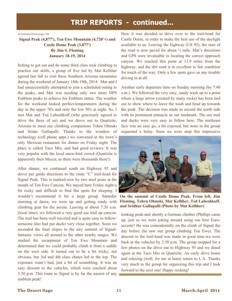
I cannot fully describe how spectacular the Narrows are. They are only 0.3 miles in length, but it is a perfect slot canyon with walls that seem to go up for 1000ft. You can hike with a hand on each wall. The terrain is easy with the odd 3 feet scramble over boulders, followed by sand and gravel. All too soon, it is over, but Lovell Wash continues as a broad wash bounded by 50 – 100’ cliffs.
Soon after the Narrows, the Wash swings right and then to a broad left arc. Here is a major junction of washes. Lovell Wash is the right turn, not the broader wash going straight on.
The topo is very useful here. Many people continue straight and have trouble regaining the route. From here, just follow the main wash as it passes impressive cliffs and hoodoos. It continues to be bounded by low cliffs until just under 3,000’, the wash widens into open desert meadows.
(Continued on page 11)
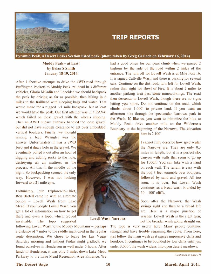
Pyramid Peak, a Desert Peaks Section listed peak (photo taken by Greg Gerlach on February 16, 2014)
Lovell Wash Narrows
The Desert Sage 11 March-April 2014
TRIP REPORTS - continued...
Signal Peak (4,877'), Ten Ewe Mountain (4,720'+) and Castle Dome Peak (3,877')
By Jim S. Fleming January 18-19, 2014
Itching to get out and do some third class rock climbing to practice our skills, a group of five led by Mat Kelliher agreed last fall to visit these Southern Arizona mountains during the weekend of January 18th-19th, 2014. Mat and I had unsuccessfully attempted to join a scheduled outing to the peaks, and Mat was needing only two more DPS Emblem peaks to achieve his Emblem status. The weather for the weekend looked perfect-temperatures during the day in the upper 70's and only the low 50's at night. So, I met Mat and Ted Lubeshkoff (who graciously agreed to drive the three of us) and we drove out to Quartzite, Arizona to meet our climbing companions Tohru Ohnuki and Sridar Gullapalli. Thanks to the wonders of technology (cell phone apps.) we convened at the town’s only Mexican restaurant for dinner on Friday night. The place is called Taco Mio, and had good reviews. It was very popular with the local snow-bird crowd (Quartzite is apparently their Mecca, as there were thousands there!).
After dinner, we continued south on Highway 95 and drove per guide directions to the route “C” trail-head for Signal Peak. This is marked now by two steel posts at the mouth of Ten Ewe Canyon. We stayed here Friday night-a bit rocky and difficult to find flat spots for sleeping. I wouldn’t recommend it for a large group. Saturday morning at dawn, we were up and getting ready with climbing gear for the ascent. Leaving at about 7:20 a.m. (local time), we followed a very good use trail up canyon. The trail has been well traveled and is quite easy to follow-someone also had put ducks very close together. Soon we ascended the final slopes to the airy summit of Signal-fantastic views all around to the other nearby ranges. We studied the escarpment of Ten Ewe Mountain and determined that we could probably climb it from a saddle on the west side. It turned out to be a bit tricky, not obvious, but 3rd and 4th class chutes led to the top. The exposure wasn’t bad, just a bit of scrambling. It was an easy descent to the vehicles, which were reached about 3:30 p.m. This route to Signal is by far the easiest of any emblem peak!
Now it was decided to drive over to the trail-head for Castle Dome, in order to make the best use of the daylight available to us. Leaving the highway (US 95), the start of the road is now paved for about ½ mile. Mat’s directions and GPS were invaluable in locating the correct approach canyon. We reached this point at 13.9 miles from the highway, and the dirt road is in excellent to fair condition for much of the way. Only a few spots gave us any trouble driving in at all.
Another early departure time on Sunday morning (by 7:40 a.m.). We followed the very easy, sandy wash up to a point where a large arrow (created by many rocks) has been laid out to show where to leave the wash and head up towards the peak. The decision was made to ascend the north side with its prominent pinnacle as our landmark. The use trail and ducks were very easy to follow here. The northeast face was an easy go, a bit exposed, but none in the group requested a belay. Soon we were atop this impressive
looking peak-and shortly a German climber (Phillip) came up, just as we were joking around using our best Euro-accents! He was coincidentally on the climb of Signal the day before (he saw our group climbing Ten Ewe). The descent to the trail-head was made in good time-we were back at the vehicles by 2:30 p.m. The group stopped for a few photos on the drive out to Highway 95 and we dined again at the Taco Mio in Quartzite. An early drive home and relaxing (well, for me at least) return to L.A. Thanks very much to the group for organizing this trip and I look
forward to the next one! Happy rocking!
(Continued from page 10)
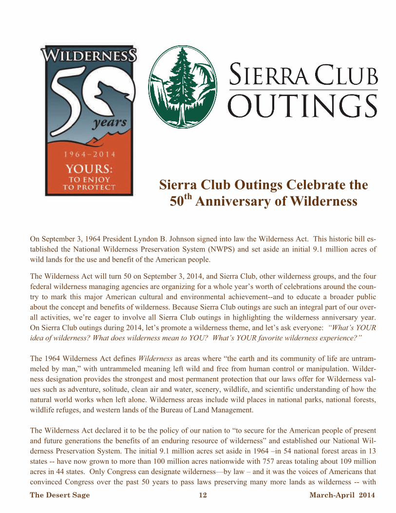
On the summit of Castle Dome Peak. From left, Jim Fleming, Tohru Ohnuki, Mat Kelliher, Ted Lubeshkoff, and Sridhar Gullapalli (Photo by Mat Kelliher)
The Desert Sage 12 March-April 2014
Sierra Club Outings Celebrate the 50th Anniversary of Wilderness
On September 3, 1964 President Lyndon B. Johnson signed into law the Wilderness Act. This historic bill es-tablished the National Wilderness Preservation System (NWPS) and set aside an initial 9.1 million acres of wild lands for the use and benefit of the American people.
The Wilderness Act will turn 50 on September 3, 2014, and Sierra Club, other wilderness groups, and the four federal wilderness managing agencies are organizing for a whole year’s worth of celebrations around the coun-try to mark this major American cultural and environmental achievement--and to educate a broader public about the concept and benefits of wilderness. Because Sierra Club outings are such an integral part of our over-all activities, we’re eager to involve all Sierra Club outings in highlighting the wilderness anniversary year. On Sierra Club outings during 2014, let’s promote a wilderness theme, and let’s ask everyone: “What’s YOUR idea of wilderness? What does wilderness mean to YOU? What’s YOUR favorite wilderness experience?” The 1964 Wilderness Act defines Wilderness as areas where “the earth and its community of life are untram-meled by man,” with untrammeled meaning left wild and free from human control or manipulation. Wilder-ness designation provides the strongest and most permanent protection that our laws offer for Wilderness val-ues such as adventure, solitude, clean air and water, scenery, wildlife, and scientific understanding of how the natural world works when left alone. Wilderness areas include wild places in national parks, national forests, wildlife refuges, and western lands of the Bureau of Land Management. The Wilderness Act declared it to be the policy of our nation to “to secure for the American people of present and future generations the benefits of an enduring resource of wilderness” and established our National Wil-derness Preservation System. The initial 9.1 million acres set aside in 1964 –in 54 national forest areas in 13 states -- have now grown to more than 100 million acres nationwide with 757 areas totaling about 109 million acres in 44 states. Only Congress can designate wilderness—by law – and it was the voices of Americans that convinced Congress over the past 50 years to pass laws preserving many more lands as wilderness -- with
The Desert Sage 13 March-April 2014
more to come. Sierra Club volunteers, and staff have been prominent in virtually all wilderness campaign over the years, and our outings program has helped acquaint many people with the values of wild lands deserving preservation. While Sierra Club began long before the Wilderness Act was signed, the basic principles underlying the Act are also the founding principles of the Sierra Club. From the beginning, Club leaders and members organized to preserve special natural places from the impacts of human development. And Sierra Club has played a big role in the national wilderness effort from the start. From 1949 through 1975 the Sierra Club hosted a series of 14 biennial wilderness conferences to discuss and determine how best to respond to the urgently felt need for permanent, legislated preservation of wild places. The need became clear after World War II. As Americans enjoyed new affluence and leisure, the agencies often bowed to the pressures of more demands for lumber and more places to recreate; administrative set asides for wild lands failed, and wilderness advocates realized that permanent, preservation by law was needed. The Club worked hard on getting the original 1964 bill passed and has been promoting preservation of wild places ever since. The Sierra Club’s outings program has long been in the forefront of drawing attention to protected places and places that need to be saved from development. We take people out to the places that need advocates. From John Muir on, we have known that people will speak up for the places they care about – and taking them there is a powerful way to get them to care. Sierra Club outings leaders and participants are among the most passion-ate supporters of keeping wild places reserved for nature. During 2014 all Sierra Club outings – whether na-tional, international, Chapter or Group, will be part of our celebrations of the 50th anniversary of the Wilder-ness Act by featuring a wilderness celebration theme. Chapter and Group outings during 2014 can really get the word out about wilderness values! , Our local out-ings around the country have the best potential to reach out to the public beyond our own members – especial-ly by seeking to include young people and diverse communities. Uniquely American, wilderness is a great social and environmental achievement in which our nation agrees to restrain in special wild places the normal trend toward development – so that nature can dominate here—forever. More information? Go to: http://www.wilderness50th.org/toolbox Or: http://www.wilderness.net/index.cfm?fuse=NWPS&sec=WhatIsWilderness Contact Vicky Hoover, Chair, Sierra Club 50th Anniversary of the Wilderness Act Team [email protected] (415)977-5527

The Desert Sage 14 March-April 2014
ARIZONA Chiricahua 87,700 Galiuro 76,317 Mazatzal 252,390 Sierra Ancha 20,850 Superstition 159,757 CALIFORNIA Caribou 20,546 Cucamonga 12,781 Domeland 93,781 Hoover 124,468 John Muir 651,992 Marble Mountain 241,744 Minarets (now Ansel Adams) 230,532 Mokelumne 99,248 San Gorgonio 56,722 San Jacinto 32,248 South Warner 70,614 Thousand Lakes 16,335 Yolla Bolly-Middle Eel 2,371 COLORADO La Garita 129,626 Maroon Bells- Snowmass 181,535 Mount Zirkel 159,935 Rawah 73,868 West Elk 176,412 IDAHO Selway-Bitterroot (&MT) 1,089,144 MINNESOTA Boundary Waters Canoe Area 810,087 MONTANA: Anaconda Pintler 158,615 Bob Marshall 1,009,356 Cabinet Mountains 94,272 Gates of the Mountains 28,562 Selway-Bitterroot (& Idaho) 251,443
NEVADA Jarbidge 111,087 NEW HAMPSHIRE Great Gulf 5,658 NEW MEXICO Gila 558,014 Pecos 223,333 San Pedro Parks 41,132 Wheeler Peak 18,897 White Mountain 48,266 NORTH CAROLINA Linville Gorge 11,786 Shining Rock 18,483 OREGON Diamond Peak 52,611 Eagle Cap 359,991 Gearhart Mountain 22,684 Kalmiopsis 180,095 Mountain Lakes 23,071 Mt Hood 63,177 Mt Washington 54,278 Strawberry Mountain 69,568 Three Sisters 281,190 WASHINGTON Glacier Peak 566,057 Goat Rocks Wilderness 108,096 Mt Adams 47,078 WYOMING Bridger 428,087 North Absaroka 350,488 Teton 585,238 Washakie Wilderness 704,274 (All these were Forest Service areas that the agen-cy had previously administratively designated as Primitive, Wild, or Wilderness Areas)
The 54 Wilderness Areas in 13 States Designated in the 1964 Wilderness Act.
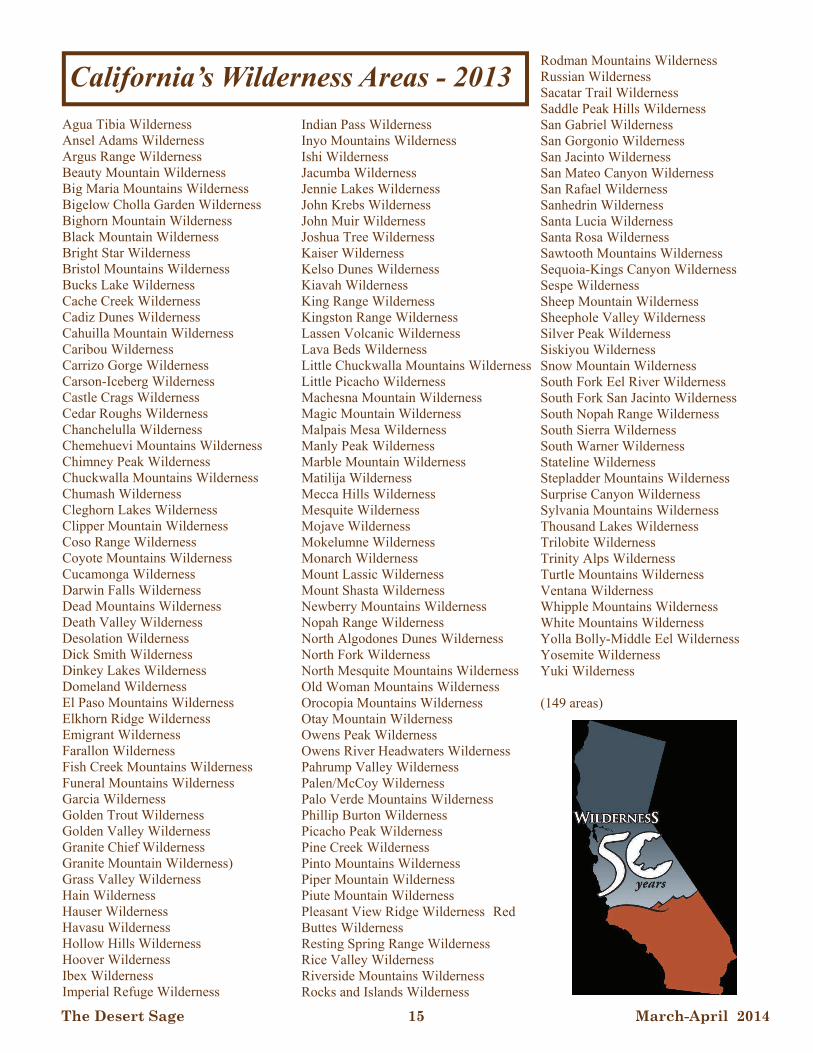
The Desert Sage 15 March-April 2014
Agua Tibia Wilderness Ansel Adams Wilderness Argus Range Wilderness Beauty Mountain Wilderness Big Maria Mountains Wilderness Bigelow Cholla Garden Wilderness Bighorn Mountain Wilderness Black Mountain Wilderness Bright Star Wilderness Bristol Mountains Wilderness Bucks Lake Wilderness Cache Creek Wilderness Cadiz Dunes Wilderness Cahuilla Mountain Wilderness Caribou Wilderness Carrizo Gorge Wilderness Carson-Iceberg Wilderness Castle Crags Wilderness Cedar Roughs Wilderness Chanchelulla Wilderness Chemehuevi Mountains Wilderness Chimney Peak Wilderness Chuckwalla Mountains Wilderness Chumash Wilderness Cleghorn Lakes Wilderness Clipper Mountain Wilderness Coso Range Wilderness Coyote Mountains Wilderness Cucamonga Wilderness Darwin Falls Wilderness Dead Mountains Wilderness Death Valley Wilderness Desolation Wilderness Dick Smith Wilderness Dinkey Lakes Wilderness Domeland Wilderness El Paso Mountains Wilderness Elkhorn Ridge Wilderness Emigrant Wilderness Farallon Wilderness Fish Creek Mountains Wilderness Funeral Mountains Wilderness Garcia Wilderness Golden Trout Wilderness Golden Valley Wilderness Granite Chief Wilderness Granite Mountain Wilderness) Grass Valley Wilderness Hain Wilderness Hauser Wilderness Havasu Wilderness Hollow Hills Wilderness Hoover Wilderness Ibex Wilderness Imperial Refuge Wilderness
Indian Pass Wilderness Inyo Mountains Wilderness Ishi Wilderness Jacumba Wilderness Jennie Lakes Wilderness John Krebs Wilderness John Muir Wilderness Joshua Tree Wilderness Kaiser Wilderness Kelso Dunes Wilderness Kiavah Wilderness King Range Wilderness Kingston Range Wilderness Lassen Volcanic Wilderness Lava Beds Wilderness Little Chuckwalla Mountains Wilderness Little Picacho Wilderness Machesna Mountain Wilderness Magic Mountain Wilderness Malpais Mesa Wilderness Manly Peak Wilderness Marble Mountain Wilderness Matilija Wilderness Mecca Hills Wilderness Mesquite Wilderness Mojave Wilderness Mokelumne Wilderness Monarch Wilderness Mount Lassic Wilderness Mount Shasta Wilderness Newberry Mountains Wilderness Nopah Range Wilderness North Algodones Dunes Wilderness North Fork Wilderness North Mesquite Mountains Wilderness Old Woman Mountains Wilderness Orocopia Mountains Wilderness Otay Mountain Wilderness Owens Peak Wilderness Owens River Headwaters Wilderness Pahrump Valley Wilderness Palen/McCoy Wilderness Palo Verde Mountains Wilderness Phillip Burton Wilderness Picacho Peak Wilderness Pine Creek Wilderness Pinto Mountains Wilderness Piper Mountain Wilderness Piute Mountain Wilderness Pleasant View Ridge Wilderness Red Buttes Wilderness Resting Spring Range Wilderness Rice Valley Wilderness Riverside Mountains Wilderness Rocks and Islands Wilderness
Rodman Mountains Wilderness Russian Wilderness Sacatar Trail Wilderness Saddle Peak Hills Wilderness San Gabriel Wilderness San Gorgonio Wilderness San Jacinto Wilderness San Mateo Canyon Wilderness San Rafael Wilderness Sanhedrin Wilderness Santa Lucia Wilderness Santa Rosa Wilderness Sawtooth Mountains Wilderness Sequoia-Kings Canyon Wilderness Sespe Wilderness Sheep Mountain Wilderness Sheephole Valley Wilderness Silver Peak Wilderness Siskiyou Wilderness Snow Mountain Wilderness South Fork Eel River Wilderness South Fork San Jacinto Wilderness South Nopah Range Wilderness South Sierra Wilderness South Warner Wilderness Stateline Wilderness Stepladder Mountains Wilderness Surprise Canyon Wilderness Sylvania Mountains Wilderness Thousand Lakes Wilderness Trilobite Wilderness Trinity Alps Wilderness Turtle Mountains Wilderness Ventana Wilderness Whipple Mountains Wilderness White Mountains Wilderness Yolla Bolly-Middle Eel Wilderness Yosemite Wilderness Yuki Wilderness (149 areas)
California’s Wilderness Areas - 2013
The Desert Sage 16 March-April 2014
RUBY DOME Let’s take a long drive to the northeast-ern corner of The List, to our most intensely glaciated peak. It’s true that Wheeler has a stupendous northeast cirque with a baby glacier at the bottom; but, overall, none of our ranges show such magnificent Sierra-like glaciation as the Rubies. This is not sur-prising, considering this is the northernmost peak; but there are at least two other factors in play, as we will see. The first factor in the Sierra-like quality of the northern Rubies is the bedrock. It’s high-grade metamorphic rock, mostly mar-bles and gneiss, the latter a hard grayish crystalline rock that can be quite granite-like. (Indeed, it is this rock that gave the range its name; beautiful red garnet crystals are typically found in some gneisses.) The metamorphics are intruded by true granites These rocks make up a “metamorphic core complex” that in some respects is not unlike the core of the Baboquivari Mountains far, far to the south which we looked at in the January-February 2014 issue of the Sage. What were the parent sedimentary rocks of these metamorphics, and how did they get so cooked? Amazingly, they are the Cambrian and Ordovician sedimentary rocks that make up the Wheeler Peak massif not far to the south, which we looked at a few months ago. Although not present in the immediate Lamoille Canyon-Ruby Dome area, geolo-gists have identified the same Prospect Mountain Quartzite that Wheeler Peak is made out of! But these rocks are only very lightly metamorphosed in the Snake Range. Why the drastic difference in a relatively short distance?
To understand this, we have to go back to a recurring theme; the subducting East Pa-cific (Farallon) Plate which, in the Mesozoic (Jurassic, etc.) generated the granites of Ba-ja, Tahquitz Rock, and the Sierra. It seems that, past the northern end of the SPS List, the Mesozoic continental margin made a big incursion eastward, so that the huge Idaho Batholith that occupies the central part of the State is the next expression of this “granite factory”. (Wait a minute, you say! There’s a lot of continent between between McCall and Coos Bay!) Yes; but this is rela-tively recent addition to the continent, either exotic terrains – the Seven Devils and Wal-lowa Mountains – island masses rafted in on the now-vanished plate and “sutured” to North America – or the vast expanses of rel-atively “new” basalt in eastern Oregon and Washington, the volcanic Cascades, and the mostly Tertiary (youngish) Oregon coast ranges. (The Mesozoic continental margin swings back west towards closer to the cur-rent coastline at about the latitude of Coeur d’Alene.) If you project a line from the northern tip of the Sierra to Idaho, and label it as more or less the continental margin, the northern Rubies were very close to this linear source of great heat and tectonism. More recent Ba-sin and Range faulting, and younger volcan-ism, have broken up and partially hidden this grand pattern between Susanville and Boise. (The southern Rubies, interestingly enough, have a geology that is transitional between the Snake Range and the Lamoille Canyon country.) The northern Rubies can be called a “resurgent” core complex because they have arisen from great depths – again, eerily sim-
(Continued on page 17)
THE ROCKS WE CLIMB by Bob Michael
The Desert Sage 17 March-April 2014
ilar to the Baboquivaris. For enough heat to cook up the mineral assemblage observed in the gneisses, the original sedimentary rocks would have had to be buried about 22 miles! (A quartz-rich shale will cook gnicely into a gneiss.) This was not only a deep structural trough, but adding to the overburden were thrust sheets of up to Cretaceous age coming in from the west in the Great Squeeze, just like the great thrusts we discussed for south-ern Nevada (Muddy, Charleston, etc.) I real-ize this implies an enormous removal of overburden and also a tremendous downwarping –followed by an equally colos-sal uplifting from the depths – to over plus 11,000 feet for Ruby Dome. Obviously, the relatively recent Basin and Range block faulting that gave us our modern map of Ne-vada had a big part to play, but still – +/- 24 vertical miles? This seems to be what the “sermons in stone’ tell us. (Don’t ask me! I wasn’t there at the time!) To complete the Sierra analogy, this suite of metamorphics is intruded by gran-ites ranging in age from Jurassic (Sierra/Baja/Idaho) up to as young as early Tertiary, well into the Age of Mammals. Finally, and far, far later, long after the Rubies were pretty much in their modern configuration, the master sculptor known as the Pleistocene ice age went to work to carve today’s Alpine landscape. And the Rubies were perfectly deployed for this work. Alt-hough uplifted on both sides, the more ex-treme uplift seems to have been on the east, giving a tilted block with a broad west flank, just like the Sierra – a perfect accumulation bed for snow. And, the range trends east of north, so this flank was perfectly positioned facing the storms coming in from the north-
west. The range has a topographic spur di-rected west from the Ruby Dome massif, forming sort of a “catcher’s mitt” to guide storms right into that area. The result? Mas-sive glaciation yielding magnificent Alpine peaks, the absolutely perfect U shape of up-per Lamoille Canyon, and one of the crown jewels of our List.
(Continued from page 16)
THE ROCKS WE CLIMB - continued… and TREASURER’S REPORT
INCOME Banquet Book Sales $42.00 Banquet Restaurant Refund $39.51 Banquet Silent Auction $194.00 Banquet Ticket Sales $2,028.00 Merchandise $409.00 Subscriptions $2,905.00 TOTAL INCOME $5,617.51 EXPENSES Bank Fee $3.50 Banquet Award $27.25 Banquet Deposit for 2013 $591.16 Banquet Deposit for 2014 $600.00 Banquet Payment $1620.76 Banquet Dinner(s) Refund $74.00 Donation to Charity $200.00 Postage for Merchandise Mailing $51.00 Sage Mailing $210.00 Sage Printing $1,106.16 Sales Tax $29.93 Subscription Reimbursement $20.00 TOTAL EXPENSES $4,533.76 CHECK BALANCE (12/30/13) $3,424.00 SAVINGS BALANCE (12/30/13) $501.04 TOTAL BALANCE (12/30/13) $3,925.04
TREASURER’S REPORT
by Pat Arredondo
DPS Account Summary from
January 1, 2013 to December 31, 2013
The Desert Sage 18 March-April 2014
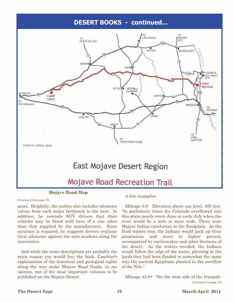
ON THE ROADS MOJAVE ROAD GUIDE: An Adventure Through Time (1999), Dennis G. Casebier GOLD ROAD TO LA PAZ: An Interpretive Guide to the Bradshaw Trail (1992), Delmer G. Ross FOR TOURISM & A GOOD NIGHT'S SLEEP: J. Win Wilson, Wilson Howell and the Beginnings of the Pines-to-Palms Highway (2012), Steve Lech MOJAVE ROAD GUIDE: An Adventure Through Time (1st edition, 1983; 2nd edition, 1986; 3rd edition, 1999; 4th Edition, March 2010), Dennis G. Casebier Dennis G. Casebier is a wonder. Why Desert Books hasn't previously reviewed at least one of his works is an even greater wonder. On October 11, 2008, in the small eastern Mojave town of Goffs, CA, upon the dedication of the new Dennis G. Casebier Library located there, Director John M. Fickewirth of the Mojave Desert Heritage and Cultural Association, described Casebier as follows: "Dennis' association with the East Mojave began when he arrived in 29 Palms to serve the Republic as a United States Marine. He fell in love with this wonderful land, a love that lasts to this day." "Many of us are fascinated by the desert. We come, enjoy its wonders, and leave. Dennis is different. He came—and he collected the artifacts of the desert. He gathered the historical documents, he traveled to the wastelands of Washington, D.C. to conduct research at the National Archives, he met with the old-timers—and sometimes their descendants—and let them
tell their stories. And most important he recorded and transcribed their oral histories." John M. Fickewirth added still more accolades, all of which can be found at: http://mojavedesertarchives.blogspot.com/2008/10/dedica tion-of-dennis-g-casebier-library.html. Casebier's excellent book, Mojave Road Guide, not his life, however, is the subject of this review. The history of the Mojave Road begins hundreds of years ago when it was used as a trade route between tribes living along the Colorado River and those living in coastal California. In 1776, guided by friendly Indians, the fearless Friar Pedro Garces became the first European to cross the Mojave Desert. Later, thanks to men such as John C. Fremont, Kit Carson, and Jedediah Smith, the trail morphed into the final section of the Old Spanish Trail, reaching from Santa Fe to San Gabriel. In the late 1850s, the route was developed as a wagon road, and during the Civil War, when Arizona was dependent on California for supplies of all kinds, the road was in constant use. The 1870s were a busy time, as well, as at the end of the Apache Wars in Arizona, tens of thousands head of sheep and cattle were driven to Arizona over the route. Railroads were eventually built--the Southern Pacific connected Barstow and Needles in 1883--after which the route fell into disuse and was finally abandoned Employing odometer readings and 16 detailed maps (supplemented with GPS information in the latest edition), Mojave Road Guide describes the 140.4 mile 4WD road leading from the western bank of the Colorado River, in the Fort Mojave Indian Reservation (0.0), to the ruins of Camp Cady (140.0), a few miles east of Barstow. Much of Casebier's route description relies on cairns which can move or disappear, thus keeping accurate track of one's odometer readings is a
(Continued on page 19)
DESERT BOOKS By Burton Falk
The Desert Sage 19 March-April 2014
must. Helpfully, the author also includes odometer values from each major landmark to the next. In addition, he reminds SUV drivers that their vehicles may be fitted with tires of a size other than that supplied by the manufacturer. Since accuracy is required, he suggests drivers evaluate their odometer against the mile markers along the interstates. And while the route descriptions are probably the main reason you would buy the book, Casebier's explanations of the historical and geological sights along the way make Mojave Road Guide, in my opinion, one of the most important volumes to be published on the Mojave Desert.
A few examples: Mileage 0.8 Elevation above sea level, 495 feet. "In prehistoric times the Colorado overflowed into this plain nearly every June or early July when the river would be a mile or more wide. There were Mojave Indian rancherias in the floodplain. As the flood waters rose, the Indians would pack up their possessions and move to higher ground, accompanied by rattlesnakes and other denizens of the desert. As the waters receded, the Indians would follow the edge of the water, planting in the lands that had been flooded in somewhat the same way the ancient Egyptians planted in the overflow of the Nile." Mileage 42.0+ "On the west side of the Ivanpah-
(Continued from page 18)
(Continued on page 20)
DESERT BOOKS - continued...
Mojave Road Map

The Desert Sage 20 March-April 2014
Lanfair Road, the Mojave Road passes over a hump, or berm. This is what is left of the roadbed of the old Nevada Southern Railway. This railroad was built north out of Goffs and up into the New York Mountains...in 1893. In 1894 it was reorganized as the California Eastern Railway and it operated under that name until after the turn of the century when Santa Fe bought the line." Abandoned in 1932, the line "was an important presence in this country, being of assistance to mining, cattle, and homesteading interests." Mileage 106.5, Shaw Pass Casebier describes an event which took place at this location in October 1867, when Army Surgeon, Dr. Merrill Shaw, while traveling to Fort Mojave in an open buggy, escorted by one soldier mounted on a mule, and carrying U.S. Mail, was killed in an Indian attack: "At the first fire, Dr. Shaw was hit by an arrow in the neck and the mule was shot out from under the escort rider. The soldier took refuge on the mail buggy, jettisoned the mail and Dr. Shaw's baggage, and...managed to escape to Soda Springs...Dr. Shaw died at Soda Springs that night and his remains are there to this day." Casebier is passionate about the Mojave Desert and is willing to share his fascination by making a tour of the Mojave Road a "positive and uplifting experience" for others. With that in mind, he reminds visitors to observe proper desert etiquette, including: "Stay on the road...Scenic quality is essential part of the (Mojave Road) experience...Random vehicle tracks in the backcountry spoil it. Don't kill anything unnecessarily, even a Mojave Green Rattlesnake. This is not a killing experience. 'Live and let live' on the Mojave Road. Most damage to historical and archeological sites on the desert comes in tiny increments. Ordinary people, with no malice of forethought, sometimes do little things they think don't matter...The cumulative effect is major...Take home your pictures, take home your memories, and take home the feeling that, as far as you are concerned, everything will be the same when you go back again." Bless you, Dennis Casebier
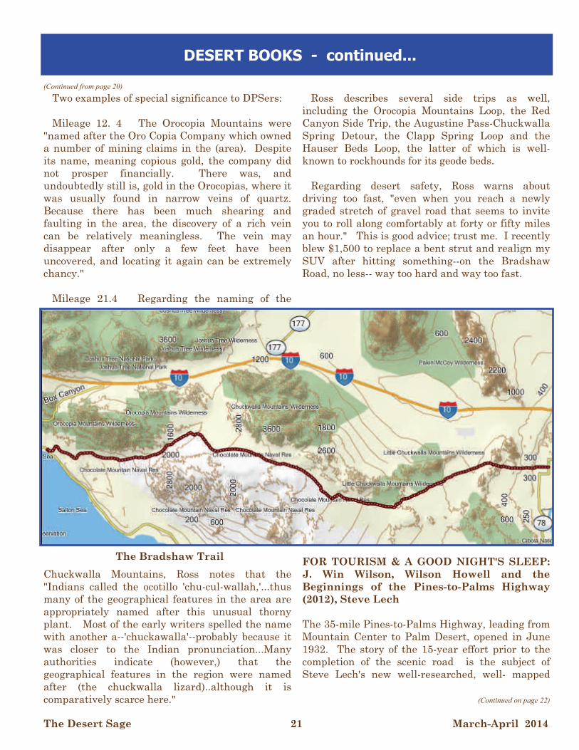
GOLD ROAD TO LA PAZ: An Interpretive Guide to the Bradshaw Trail (1992?), Delmer G. Ross If Dennis Casbier is the John Muir of desert road guides, Delmer G. Ross is the John Van Dyke. Indeed, although both men have produced excellent road guides, Casbier has the edge in terms of his passion for and long history with his subject matter. Casebier is the gold standard; Ross the silver. Ross opens his guide, Gold Road to La Paz, thanking Casebier for inspiring him to write the book and for helping him locate information and find several historical photographs which were used in its production. In his preface, Casebier responds by explaining that Dr. Delmer Ross is a history professor at La Sierra University, and that his specialty is transportation. He also informs us that Ross is handicapped, a result of polio contracted as a child when his parents were missionaries in Nicaragua. Ross, Casebier points out, "is one of many who would not be able to see desert backcountry if locked into wilderness...visited and used only by youths in perfect physical condition." The Gold Road, more commonly know as the Bradshaw Trail, was established by William David Bradshaw, an experienced miner and western guide, in May, 1862. His idea was to build a supply route from southern California to the new La Paz mining district located on the eastern banks of the Colorado River, a few miles north of present day I-10. Employing information gained from a Cahuilla Indian chief, Bradshaw's route breeched the almost unknown desert between the Orocopia and Chuckwalla mountains on the north and the Chocolate Mountains to the south, continuing on to the Colorado River a short distance northeast of present-day Blythe. Similar to Casebier, Ross employs odometer reading and detailed maps to describe the 101.0 mile route. And drawing on his own substantial research, he enlightens readers on natural and historical points of interest along the way.
(Continued from page 19)
(Continued on page 21)
DESERT BOOKS - continued...
The Desert Sage 21 March-April 2014
Two examples of special significance to DPSers: Mileage 12. 4 The Orocopia Mountains were "named after the Oro Copia Company which owned a number of mining claims in the (area). Despite its name, meaning copious gold, the company did not prosper financially. There was, and undoubtedly still is, gold in the Orocopias, where it was usually found in narrow veins of quartz. Because there has been much shearing and faulting in the area, the discovery of a rich vein can be relatively meaningless. The vein may disappear after only a few feet have been uncovered, and locating it again can be extremely chancy." Mileage 21.4 Regarding the naming of the
Chuckwalla Mountains, Ross notes that the "Indians called the ocotillo 'chu-cul-wallah,'...thus many of the geographical features in the area are appropriately named after this unusual thorny plant. Most of the early writers spelled the name with another a--'chuckawalla'--probably because it was closer to the Indian pronunciation...Many authorities indicate (however,) that the geographical features in the region were named after (the chuckwalla lizard)..although it is comparatively scarce here."
Ross describes several side trips as well, including the Orocopia Mountains Loop, the Red Canyon Side Trip, the Augustine Pass-Chuckwalla Spring Detour, the Clapp Spring Loop and the Hauser Beds Loop, the latter of which is well-known to rockhounds for its geode beds. Regarding desert safety, Ross warns about driving too fast, "even when you reach a newly graded stretch of gravel road that seems to invite you to roll along comfortably at forty or fifty miles an hour." This is good advice; trust me. I recently blew $1,500 to replace a bent strut and realign my SUV after hitting something--on the Bradshaw Road, no less-- way too hard and way too fast.
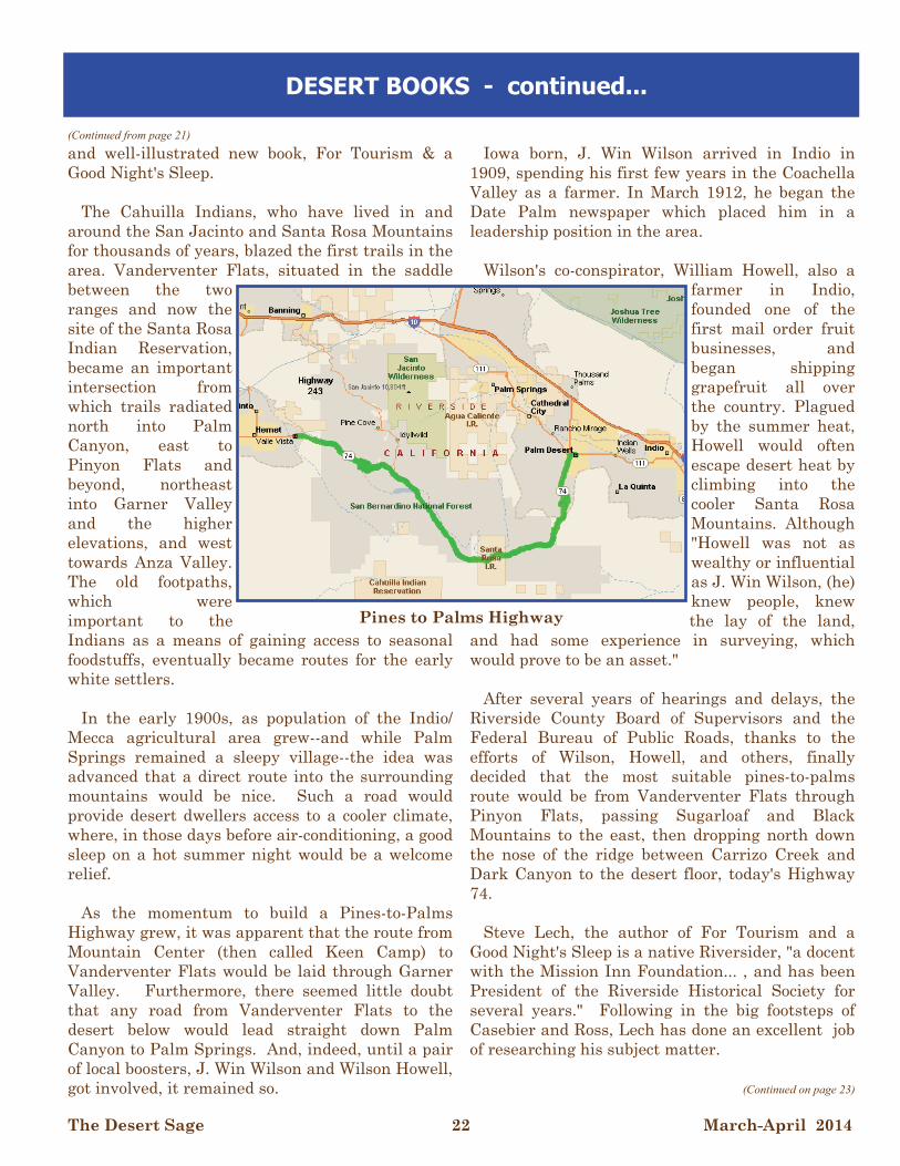
FOR TOURISM & A GOOD NIGHT'S SLEEP: J. Win Wilson, Wilson Howell and the Beginnings of the Pines-to-Palms Highway (2012), Steve Lech The 35-mile Pines-to-Palms Highway, leading from Mountain Center to Palm Desert, opened in June 1932. The story of the 15-year effort prior to the completion of the scenic road is the subject of Steve Lech's new well-researched, well- mapped
(Continued from page 20)
(Continued on page 22)
DESERT BOOKS - continued...
The Bradshaw Trail
The Desert Sage 22 March-April 2014
and well-illustrated new book, For Tourism & a Good Night's Sleep. The Cahuilla Indians, who have lived in and around the San Jacinto and Santa Rosa Mountains for thousands of years, blazed the first trails in the area. Vanderventer Flats, situated in the saddle between the two ranges and now the site of the Santa Rosa Indian Reservation, became an important intersection from which trails radiated north into Palm Canyon, east to Pinyon Flats and beyond, northeast into Garner Valley and the higher elevations, and west towards Anza Valley. The old footpaths, which were important to the Indians as a means of gaining access to seasonal foodstuffs, eventually became routes for the early white settlers. In the early 1900s, as population of the Indio/Mecca agricultural area grew--and while Palm Springs remained a sleepy village--the idea was advanced that a direct route into the surrounding mountains would be nice. Such a road would provide desert dwellers access to a cooler climate, where, in those days before air-conditioning, a good sleep on a hot summer night would be a welcome relief. As the momentum to build a Pines-to-Palms Highway grew, it was apparent that the route from Mountain Center (then called Keen Camp) to Vanderventer Flats would be laid through Garner Valley. Furthermore, there seemed little doubt that any road from Vanderventer Flats to the desert below would lead straight down Palm Canyon to Palm Springs. And, indeed, until a pair of local boosters, J. Win Wilson and Wilson Howell, got involved, it remained so.
Iowa born, J. Win Wilson arrived in Indio in 1909, spending his first few years in the Coachella Valley as a farmer. In March 1912, he began the Date Palm newspaper which placed him in a leadership position in the area. Wilson's co-conspirator, William Howell, also a
farmer in Indio, founded one of the first mail order fruit businesses, and began shipping grapefruit all over the country. Plagued by the summer heat, Howell would often escape desert heat by climbing into the cooler Santa Rosa Mountains. Although "Howell was not as wealthy or influential as J. Win Wilson, (he) knew people, knew the lay of the land,
and had some experience in surveying, which would prove to be an asset." After several years of hearings and delays, the Riverside County Board of Supervisors and the Federal Bureau of Public Roads, thanks to the efforts of Wilson, Howell, and others, finally decided that the most suitable pines-to-palms route would be from Vanderventer Flats through Pinyon Flats, passing Sugarloaf and Black Mountains to the east, then dropping north down the nose of the ridge between Carrizo Creek and Dark Canyon to the desert floor, today's Highway 74. Steve Lech, the author of For Tourism and a Good Night's Sleep is a native Riversider, "a docent with the Mission Inn Foundation... , and has been President of the Riverside Historical Society for several years." Following in the big footsteps of Casebier and Ross, Lech has done an excellent job of researching his subject matter.
(Continued from page 21)
(Continued on page 23)
DESERT BOOKS - continued...
Pines to Palms Highway
The Desert Sage 23 March-April 2014
Wrapping up, Lech comments that most drivers don't take the time to really enjoy the spectacular setting that is the Pines-to-Palms Highway. "Fewer still probably even know about the civic-mindedness and community pride that went into the lobbying for and construction of the highway. It is the author's hope that this book will help in some small way to change that."
More on Dennis Casebier and the Mojave Desert
What can be more ephemeral, more transitory, more anecdotal than the human memory? And when a pioneer of the East Mojave is gone, he or she takes his precious knowledge with him. There are letters, documents, journals, photos, artifacts, all the physical reminders of man's presence here. But, what was the experience? What was the feel and texture of life in this great land? It is from Dennis' thousands of pages of oral history that we know this. There is no other resource of the East Mojave comparable to this. Since Dennis published his first monograph 38 years ago, he has built an admirable "shelf" of authored books. Many of Dennis' books are the standard reference works on the subjects. His work for the Navy meant Casebier spent a third of his time in Washington, D.C. While there, he researched the East Mojave in the National Archives, combing through pension files and muster rolls: "The Army's muster rolls detail everyone who ever served here - what he looked like and what he'd been doing just before he enlisted." Casebier's research focused on the 1850s through the 1880s, and especially the Old Mojave Road, an ancestor of Route 66 that runs 15 miles north of Goffs. "Until 1883," he said, "the Old Mojave Road was the major route through this latitude for people
traveling between Prescott, Arizona, and the Port of Los Angeles." Over the course of 25 years, Casebier filled 50 reels of microfilm with records from the National Archives and the Library of Congress. In 1981, while still living in Corona, he founded the Friends of the Mojave Road with fellow devotees of that road and other back-country trails. Today the Friends boast 850 members, chiefly in California, Nevada and Arizona. "But the other day," Casebier said, "someone wrote from Switzerland requesting a (newsletter) subscription." Why do people join the Friends? "Because they think it matters to create something bigger than yourself." This "thing that matters" is the cultural center, built around the old Goffs schoolhouse on 113 acres bought by Casebier and his wife, Jo Ann, in 1989. The Cultural Center is home to the Mojave Desert Heritage & Cultural Association’s (MDHCA) 6,000 volumes of desert lore, 35,000 historical photographs and 600 oral histories. Of those oral histories, half were done by Casebier, and half by Harold and Lucile Weight of the late, great "Desert Magazine." "The Weights were doing oral histories a generation before I started," Casebier said. He also acknowledged the work of volunteers who transcribe recorded interviews. The center's purview stretches from Barstow to Las Vegas, Arizona and Twentynine Palms. "Vegas is just at the edge of our turf," Casebier said, "though if I heard of a 97-year-old with a clear mind who lived in Vegas in the '30s, I'd certainly interview them." He's even interviewed people younger than
(Continued from page 22)
(Continued on page 24)
DESERT BOOKS - continued...
The Desert Sage 24 March-April 2014
himself, "if they were significantly involved in a core business or in the highway itself." Any tips on collecting an oral history? "During the interview itself," Casebier said, "I talk as little as possible. Should scholars approach him, asking to read a transcript, Casebier first tries to discover their intentions. "Especially until someone passes on," he said, "I feel responsible for what they have told me." Sometimes friends or family suggest a really good interviewee. Then Casebier sends the prospect an MDHCA newsletter, "to let them see what we're up to." Dennis Casebier is an expert at oral histories. Dennis Casebier, executive director of the MDHCA, has interviewed 200 people who once lived in Lanfair Valley. Starting in 1910, the well-watered valley north of Goffs enjoyed a homesteading boom. But as will happen, bust followed. "Of 400 homesteads," Casebier says, "fewer than 200 'proved up.' The people I interview now have all left Lanfair Valley. "Oral histories take a lot of time," Casebier said, "so don't scrimp on equipment. I use a Bell & Howell recorder and standard-size 90-minute cassettes. A 60-minute tape is too short, a 120-minute tape too thin." Remarking that Nikon makes a lens especially for photographing photographs, Casebier urged the amateur historians to have their pictures of documents developed at a top-of-the-line photo lab. Because every interview subject leads to somebody else, Casebier maintains a computerized list of old-timers' names, addresses and phone numbers.
Every now and then, he prints it out and puts the most recent version in his car. "And I always carry a tape-recorder," he said. Although each subject contributes something of value, Casebier said, "You need to know more about the topic than any one person you interview." Citing a subject who remarked, "My grandfather lived in Blake, not Goffs," Casebier said, "In fact, Blake and Goffs are the same place. Briefly changed to Blake, the name was later changed back to Goffs." Potential for intimidation No matter how much you know, Casebier said, never correct the subject, for that will surely turn them off: "And don't flaunt your own knowledge of a topic." "Shut up and listen" In line with the above, Casebier said, if an older person gets a blank look, don't prompt them: "They are thinking, so let them think. "Make sure to tell the person why you are writing notes," Casebier said. "As it is, most of your questions will have been answered by the time a person stops talking." He also warned interviewers to watch for signs of fatigue, "for if the subject is tired, they won't give their top performance. In an exception to his "Maintain control" rule, Casebier lets veterans tell their war stories even if these have nothing to do with Lanfair Valley. "I try to get what I need first," he said, "but they deserve it.” "For veterans of World War II, I always ask, Where were you when the war ended? and What do you think of the atom bomb?”
(Continued from page 23)
(Continued on page 25)
DESERT BOOKS - continued...
The Desert Sage 25 March-April 2014
"A guy who'd fought at the Battle of the Bulge was on a troop ship, heading from Le Havre to the Pacific, when he got word of Hiroshima. I'd been good as dead, he said. Now I wasn't." Casebier added: "Always ask a vet what unit he served in. This will help historians who come after you." Dismissing family reunions as "having no value except as a chance to add to your old-timer list," Casebier stressed the importance of not allowing other people to interrupt a subject: "Be willing to say to an adult child, I'd like your mother to answer this." "Most of my people are elderly, simple folk," Casebier said, "and so I start with easy questions: What is your full name?” Back home from an interview, Casebier promptly duplicates the tapes. "Never transcribe from original tapes," he cautioned. To preserve homestead papers, postcards and other ephemera, Casebier brings a photocopier to each interview. He also solicits photos: best of all as gifts to the MDHCA, next best as loans. Barring that, he photographs pictures on site. In any event, Casebier said, "I organize the photos in the order that they'll be copied - and ask the person to talk about each one. Dennis has been collecting old photos, (he copies then returns them) manuscripts and memorabilia for a long time and is accumulating a wonderful museum which will soon be housed in Goffs Old Schoolhouse, which he owns and is rehabilitating. We were privileged to have a preview. He has written and published nearly 20 books and many articles about desert history.
(Continued from page 24)
DESERT BOOKS - continued… and HOLIDAY POTLUCK
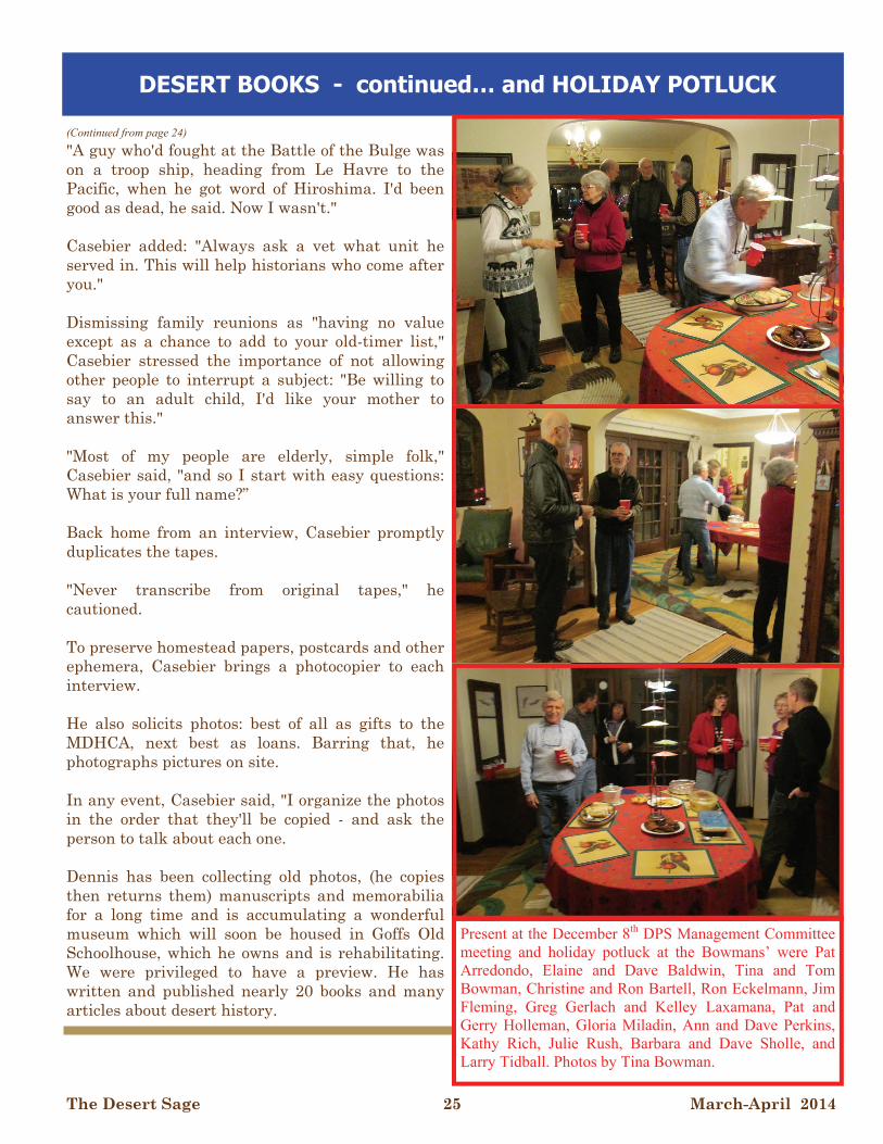
Present at the December 8th DPS Management Committee meeting and holiday potluck at the Bowmans’ were Pat Arredondo, Elaine and Dave Baldwin, Tina and Tom Bowman, Christine and Ron Bartell, Ron Eckelmann, Jim Fleming, Greg Gerlach and Kelley Laxamana, Pat and Gerry Holleman, Gloria Miladin, Ann and Dave Perkins, Kathy Rich, Julie Rush, Barbara and Dave Sholle, and Larry Tidball. Photos by Tina Bowman.
The Desert Sage 26 March-April 2014
Type Per Year Totals
Regular $10
Sustaining $20
Donation
W0451 Total:
DPS Subscriptions/Memberships:
# of Years
Name:
Address:
City: State: Zip:
Hm Phone: Wk Phone:
Fax: eMail:
SC #: Leader Status(Circle as appropriate): O I M E New Subscriber New Member (provide Sierra Club #) Name Change New Address New Home Phone New Work Phone New Fax New Email
Make Check Payable to Desert Peaks Section Send to:
Ron Bartell, DPS Membership Chair 1556 21st Street Manhattan Beach, CA, 90266
(310) 546-1977 (h) [email protected]
It costs ten dollars a year to subscribe to the SAGE. Anyone can subscribe to the SAGE, even if not a member of the DPS or the Sierra Club. To become a member of the DPS, you must (1) belong to the Sierra Club, (2) have climbed 6 of the 96 peaks on the DPS peaks list, and (3) subscribe to the SAGE. Non-members who subscribe to the SAGE are not allowed to vote in our elections. The subscription/membership year is for 6 issues, regardless of when payment is received. Only 1 subscription is required per household. When renewing your membership, please list all other DPS members who reside at your address to update their status. Subscriptions and donations are not tax deductible.
045
If you haven’t already done so, please consider renewing your Sage subscription. Dues are $10 per year and multiple year subscriptions are encouraged. If you feel even more compelled, the DPS offers a “sustaining” dues option ($20). Send your check made payable to “Desert Peaks Section” to :
Ron Bartell, 1556 21st Street, Manhattan Beach, CA, 90266
Include accurate address information. For your convenience, you may use the order form at the bottom of this page.
SUBSCRIPTION REMINDER
The Desert Sage 27 March-April 2014
Gloria Miladin, DPS Merchandiser 11946 Downey Ave Downey, CA, 90242
Grand Total: ______________
DPS Complete History and Lore CD ROM (price includes shipping)
$15
QUANTITY ITEM PRICE TOTAL
DPS Patch $3
Emblem Pin $12
List Finisher Pin $20
Desert Explorer Award Pin $12
DPS T-shirt (see item below) Tan w/black and gray print (S, M, L, XL)
$12
For T-shirt orders, add $3.50/1, $4/2 or more, per order for handling
$3.50 / $4
Mail order form and payment to: Make check payable to the Desert Peaks Section Questions: (562) 861-2550 (H) or [email protected]
Gloria Miladin, DPS Merchandiser 11946 Downey Ave Downey, CA, 90242
Grand Total: _____________
QUANTITY ITEM PRICE TOTAL
DPS Peaks List $1
Road and Peaks Guide (5th Edition) CD ROM version (price includes shipping)
$15
1 Year electronic Desert Sage subscription $10 regular / $20 sustaining
Mail order form and payment to: Make check payable to the Desert Peaks Section Questions: (562) 861-2550 (H) or [email protected]
Gloria Miladin, DPS Merchandiser 11946 Downey Ave Downey, CA, 90242
Grand Total: ______________
DPS Complete History and Lore CD ROM (price includes shipping)
$15
ORDERED BY:
SHIP TO: (IF DIFFERENT)
STREET: NAME:
CITY/ZIP: STREET:
PHONE: CITY/ZIP:
W0451
The Desert Sage 28 March-April 2014
DESERT PEAKS SECTION DPS NEWSLETTER - The Desert Sage is published six times a year by the Desert Peaks Section of the Angeles Chapter of the Sierra Club. Please note that the next submission deadline for the next SAGE is April 13, 2014.
SUBSCRIPTION/MEMBERSHIP: It costs ten dollars a year to subscribe to the SAGE. Anyone can subscribe to the SAGE, even if not a member of the DPS or the Sierra Club, by sending $10 to Membership Records Chair. Please note that a Sustaining membership/subscriptions is also available for $20. To become a member of the DPS, you must (1) belong to the Sierra Club, (2) have climbed 6 of the 96 peaks on the DPS peaks list, and (3) send $10 to Membership Records Chair for a SAGE subscription ($20 for Sustaining). Non-members who subscribe to the SAGE are not allowed to vote in the DPS elections. Renewals, subscriptions, and address changes should be sent to Membership Records Chair Ron Bartell, 1556 21st Street, Manhattan Beach, CA, 90266, or [email protected]. The subscription/membership year is for six issues, regardless of when payment is received.
EMBLEM STATUS AND GUIDES: To receive DPS emblem status you must climb 15 peaks on the list, five of which must be from the list of seven emblem peaks, and have belonged to the Section for one year. To work on the list you will probably want to buy from the Merchandiser (Gloria Miladin, 11946 Downey Ave, Downey, CA, 90242) the Desert Peaks Road and Peak Guide 5th Edition CDROM - $15. If you like to explore without much direction just purchase the DPS PEAKS LIST - $1 (enclose a self-addressed stamped envelope). Send completed peak and emblem lists to Membership Records Chair Ron Bartell, 1556 21st Street, Manhattan Beach, CA, 90266, or [email protected].
SAGE SUBMISSIONS: We welcome all articles, photographs and letters pertaining to outdoor activities of interest to Desert Peak Sections members. If you are a participant and know that the leaders are not going to submit a trip report, then feel free to submit one. Some submittals may be too long and space limitations and other considerations are factors in the decision to publish a submission. The editor may modify submittals in an attempt to increase clarity, decrease length, or correct typos but will hopefully not modify your meaning. Please note that digital documents and photographs are required for submissions to the Sage. Trip reports should include trip dates and identify trip participants and photos should indicate when and where the photo was taken, what it is of, who is in it, and who took it. Please email SAGE submissions to the editor no later than the second Sunday of even numbered months.
ADVERTISEMENTS: You can advertise private trips that are of interest to DPS members in the SAGE for free. Also, you can advertise in the SAGE to sell items; the cost is $3.00 per line.
EDITOR: Greg Gerlach, 23933 Via Astuto, Murrieta, CA 92562 Email: [email protected]
THE DESERT SAGE SIERRA CLUB, ANGELES CHAPTER 3435 WILSHIRE BLVD, SUITE 320 LOS ANGELES, CA 90010-1904 ADDRESS SERVICE REQUESTED
NON-PROFIT ORG U.S. POSTAGE PAID PERMIT NO. 36438 LOS ANGELES, CA


![[Clarinet_Institute] Miladin, Mario - 4 Movements for Clarinet and Bassoon](https://img.pdfslide.us/doc/110x75/5695cf001a28ab9b028c28b4/clarinetinstitute-miladin-mario-4-movements-for-clarinet-and-bassoon.jpg)