Embed Size (px)
Citation preview
SURVEY ASSISTANCE IN CIVIL AND INDUSTRIAL ENGINEERING WORKS
SURVEY ENGINEERING SERVICES
����������������� �����������������������
� ����������� ������������� ����������������� ����
� �������������������������������������� ����������������
� �� ���������������� ���
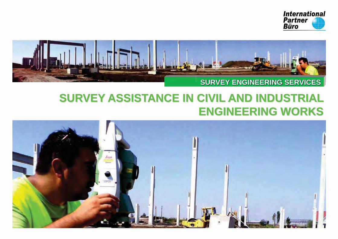
INTERNATIONAL PARTNER BÜRO SRL was established on 23 March 2007 and specializes in
Geodesy, Surveying Engineering, 3D Laser Scanning, UAV Photogrammetry, GIS and BIM.
International Partner Buro SRL is an innovative, serious company, offering a wide range of
topographic and geodetic services, encompassing a large and varied market.
We are one of the most representative companies of 3D laser scanning and surveying services in
Romania.
The focus is always on quality, which to us is the sum of many factors such as:
Professional training of engineers employed at International Partner Buro SRL through training
courses on new technologies, solutions and specialized software appeared on the market, and
deployed in our company.
Punctuality is what we are when the deadline arrives. Always trying to improve the efficiency of the
methods used for works to be executed in a project. This is seen by lower costs for our customers.
Accuracy refers to the survey tools that we use in the projects in which we participate, and their
keeping in the correct parameters. We always perform regular laboratory checks on the instruments.
I participate with employees of the management team at international exhibitions and INTERGEO in
order to obtain innovative information that I could apply to projects we have in progress and those we
will have in the future.
We also have our own methods of research and testing, that have resulted in improved accuracies
and lower execution time for different types of work.
International Partner Buro SRL is a friendly, customer-oriented company, that adds quality to all the
projects in which it is involved.
International Partner Buro SRL is the office (Buro) in which you find the ideal partner (Partner) to
perform quality topographic works not only in Romania, but also internationally.
We are committed to building companies, multinational corporations throughout the world but also to
state institutions and governments that need our specialists.
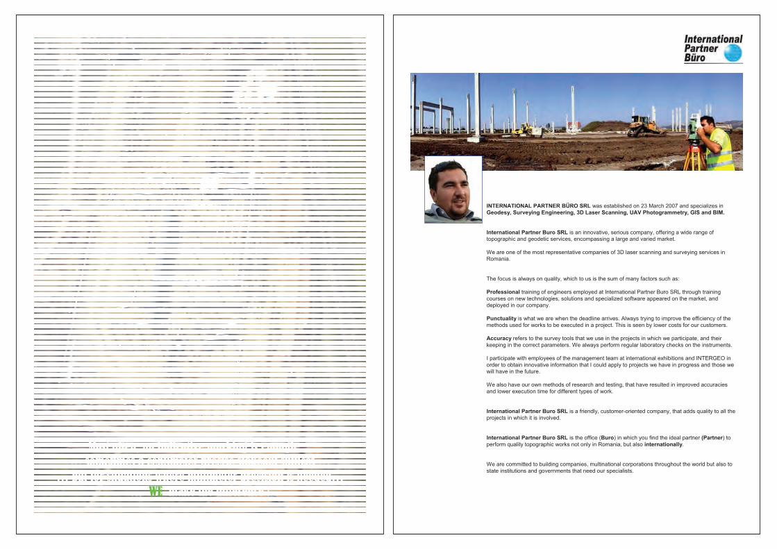
SURVEY ENGINEERING
Engineering surveys can be approached from two perspectives:
-Measurement of ground elements in order to lay them down on plans and maps;
-Transposition in field of various building execution projects;
Topography includes measurements that are performed in design purposes,
construction and operation of buildings.
Topographic and geodetic works precede, accompany and complete any construction
process, contributing to the smooth running by shortening the term of design and execution, and
through a better organization of the workplace.
The importance of topography grows with the mechanization of the construction
process grows and with the use of modern techniques and technologies.
SURVEY ENGINEERING SERVICESSURVEY ENGINEERING SERVICES
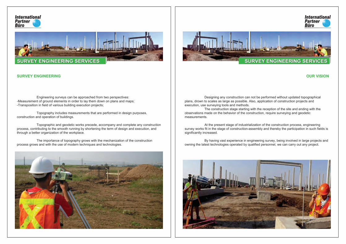
OUR VISION
Designing any construction can not be performed without updated topographical
plans, drown to scales as large as possible. Also, application of construction projects and
execution, use surveying tools and methods.
The construction stage starting with the reception of the site and ending with the
observations made on the behavior of the construction, require surveying and geodetic
measurements.
At the present stage of industrialization of the construction process, engineering
survey works fit in the stage of construction-assembly and thereby the participation in such fields is
significantly increased.
By having vast experience in engineering survey, being involved in large projects and
owning the latest technologies operated by qualified personnel, we can carry out any project.
SURVEY ENGINEERING SERVICESSURVEY ENGINEERING SERVICES
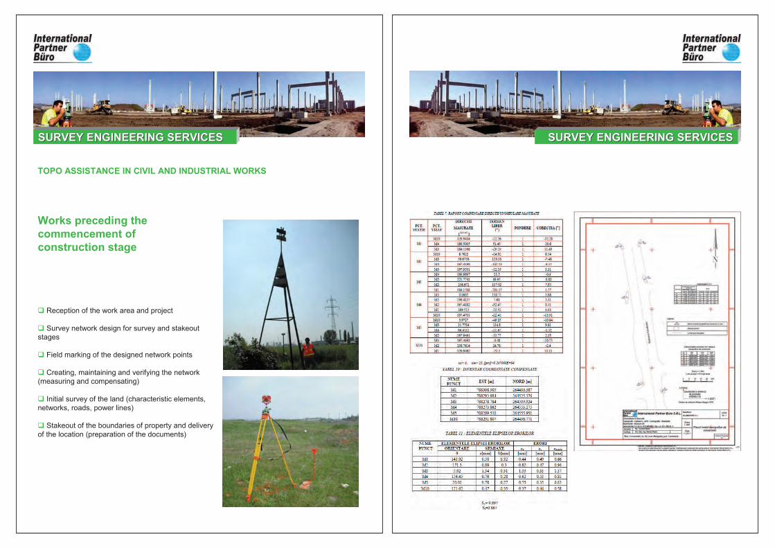
Works preceding the commencement of construction stage
� Reception of the work area and project
� Survey network design for survey and stakeout
stages
� Field marking of the designed network points
� Creating, maintaining and verifying the network
(measuring and compensating)
� Initial survey of the land (characteristic elements,
networks, roads, power lines)
� Stakeout of the boundaries of property and delivery
of the location (preparation of the documents)
TOPO ASSISTANCE IN CIVIL AND INDUSTRIAL WORKS
SURVEY ENGINEERING SERVICESSURVEY ENGINEERING SERVICES SURVEY ENGINEERING SERVICESSURVEY ENGINEERING SERVICES
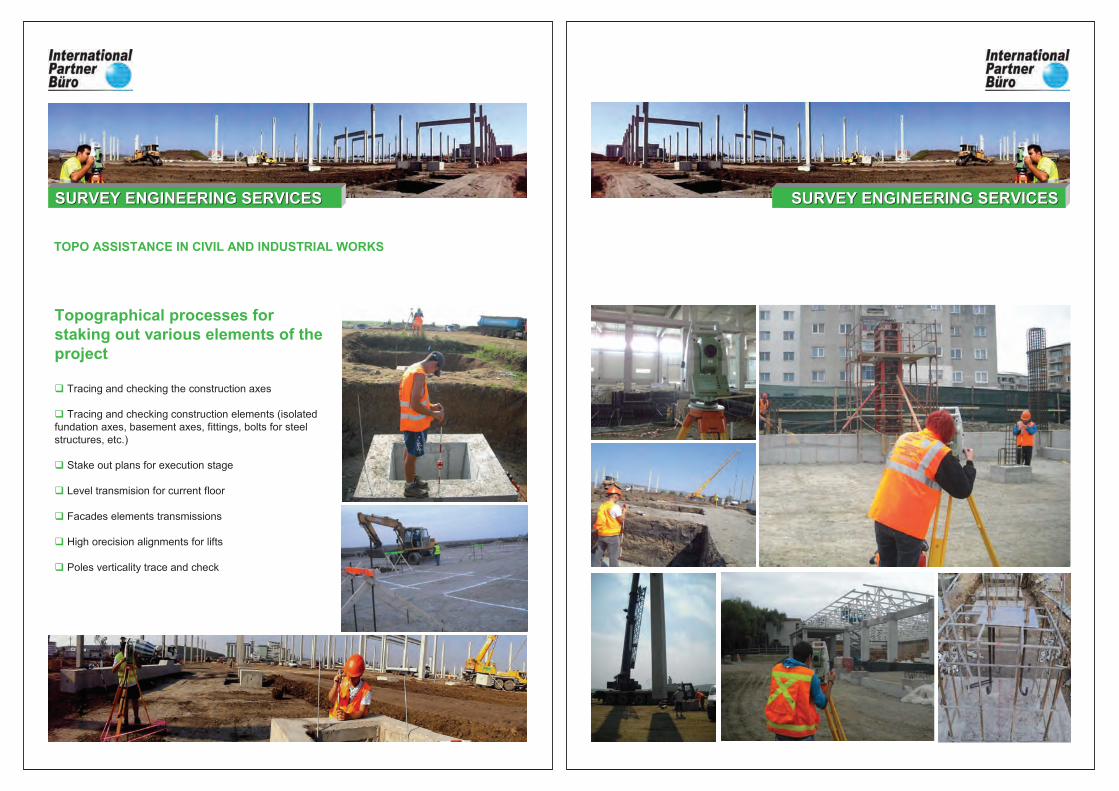
Topographical processes for staking out various elements of the project
� Tracing and checking the construction axes
� Tracing and checking construction elements (isolated
fundation axes, basement axes, fittings, bolts for steel
structures, etc.)
� Stake out plans for execution stage
� Level transmision for current floor
� Facades elements transmissions
� High orecision alignments for lifts
� Poles verticality trace and check
TOPO ASSISTANCE IN CIVIL AND INDUSTRIAL WORKS
SURVEY ENGINEERING SERVICESSURVEY ENGINEERING SERVICES ENGINEERING SURVEY SERVICESENGINEERING SURVEY SERVICESSURVEY ENGINEERING SERVICESSURVEY ENGINEERING SERVICES
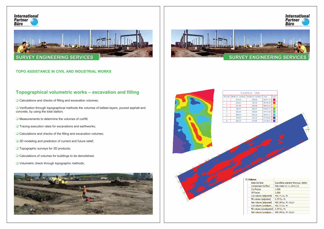
Topographical volumetric works – excavation and filling
� Calculations and checks of filling and excavation volumes;
� Verification through topographical methods the volumes of ballast layers, poured asphalt and
concrete, by using the total station;
� Measurements to determine the volumes of cut/fill;
� Tracing execution rates for excavations and earthworks;
� Calculations and checks of the filling and excavation volumes;
� 3D modeling and prediction of current and future relief;
� Topographic surveys for 3D products;
� Calculations of volumes for buildings to be demolished;
� Volumetric check through topographic methods;
TOPO ASSISTANCE IN CIVIL AND INDUSTRIAL WORKS
SURVEY ENGINEERING SERVICESSURVEY ENGINEERING SERVICES ENGINEERING SURVEY SERVICESENGINEERING SURVEY SERVICESSURVEY ENGINEERING SERVICESSURVEY ENGINEERING SERVICES
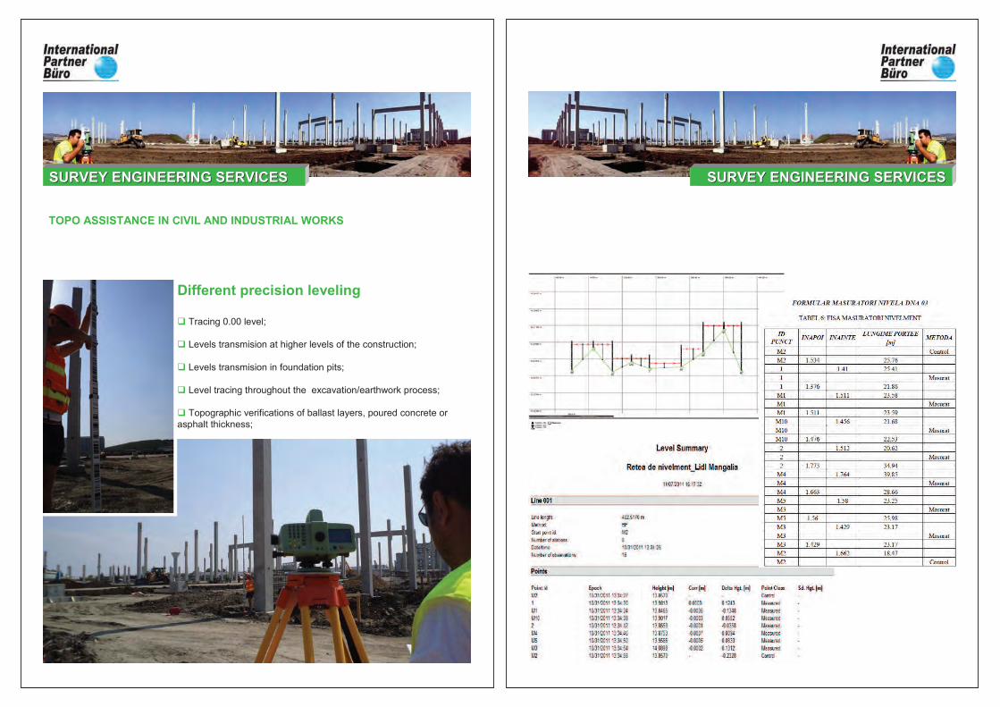
Different precision leveling
� Tracing 0.00 level;
� Levels transmision at higher levels of the construction;
� Levels transmision in foundation pits;
� Level tracing throughout the excavation/earthwork process;
� Topographic verifications of ballast layers, poured concrete or
asphalt thickness;
TOPO ASSISTANCE IN CIVIL AND INDUSTRIAL WORKS
SURVEY ENGINEERING SERVICESSURVEY ENGINEERING SERVICES ENGINEERING SURVEY SERVICESENGINEERING SURVEY SERVICESSURVEY ENGINEERING SERVICESSURVEY ENGINEERING SERVICES
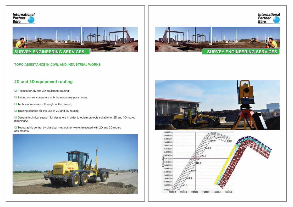
2D and 3D equipment routing
� Projects for 2D and 3D equipment routing;
� Setting control computers with the necesarry parameters;
� Technical assistance throughout the project;
� Training courses for the use of 2D and 3D routing;
� General technical support for designers in order to obtain projects suitable for 2D and 3D routed
machinary;
� Topographic control by classical methods for works executed with 2D and 3D routed
equipments;
TOPO ASSISTANCE IN CIVIL AND INDUSTRIAL WORKS
SURVEY ENGINEERING SERVICESSURVEY ENGINEERING SERVICES ENGINEERING SURVEY SERVICESENGINEERING SURVEY SERVICESSURVEY ENGINEERING SERVICESSURVEY ENGINEERING SERVICES
� Tracking behavior in the execution stage;
� Tracking behavior in the operational phase;
� Various technical and technological solutions;
� Networks for tracking the behavior of constructions;
� Study on accuracy in determining compaction through geometric leveling;
� Beam deformation (compression and bending);
� Monitoring buried walls throughout the excavation stage;
� Determining the stability of fixed points used in measurements of the displacement
vectors;
� Determining the stability of the planimetry and altimetry networks;
� Determination of displacement and deformation of buildings caused by subsidence of
the foundation soil (average compaction, relative subsidence inclination, overall relative
bending of foundation soles);
TRACKING CONSTRUCTION BEHAVIOUR
SURVEY ENGINEERING SERVICESSURVEY ENGINEERING SERVICES
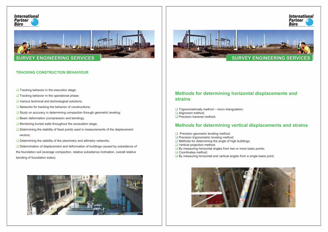
Methods for determining horizontal displacements and strains
� Trigonometrically method – micro triangulation;
� Alignment method;
� Precision traverse method;
Methods for determining vertical displacements and strains
� Precision geometric leveling method;
� Precision trigonometric leveling method;
� Methods for determining the angle of high buildings;
� Vertical projection method;
� By measuring horizontal angles from two or more basis points;
� Coordinates method;
� By measuring horizontal and vertical angles from a single basis point;
ENGINEERING SURVEY SERVICESENGINEERING SURVEY SERVICESSURVEY ENGINEERING SERVICESSURVEY ENGINEERING SERVICES
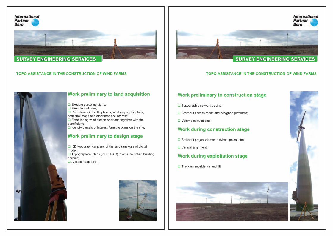
Work preliminary to land acquisition
� Execute parceling plans;
� Execute cadaster;
� Georeferencing orthophotos, wind maps, plot plans,
cadastral maps and other maps of interest;
� Establishing wind station positions together with the
beneficiary;
� Identify parcels of interest form the plans on the site;
Work preliminary to design stage
� 3D topographical plans of the land (analog and digital
model);
� Topographical plans (PUD, PAC) in order to obtain building
permits;
� Access roads plan;
TOPO ASSISTANCE IN THE CONSTRUCTION OF WIND FARMS
SURVEY ENGINEERING SERVICESSURVEY ENGINEERING SERVICES
Work preliminary to construction stage
� Topographic network tracing;
� Stakeout access roads and designed platforms;
� Volume calculations;
Work during construction stage
� Stakeout project elements (wires, poles, etc);
� Vertical alignment;
Work during exploitation stage
� Tracking subsidence and tilt;
TOPO ASSISTANCE IN THE CONSTRUCTION OF WIND FARMS
SURVEY ENGINEERING SERVICESSURVEY ENGINEERING SERVICES
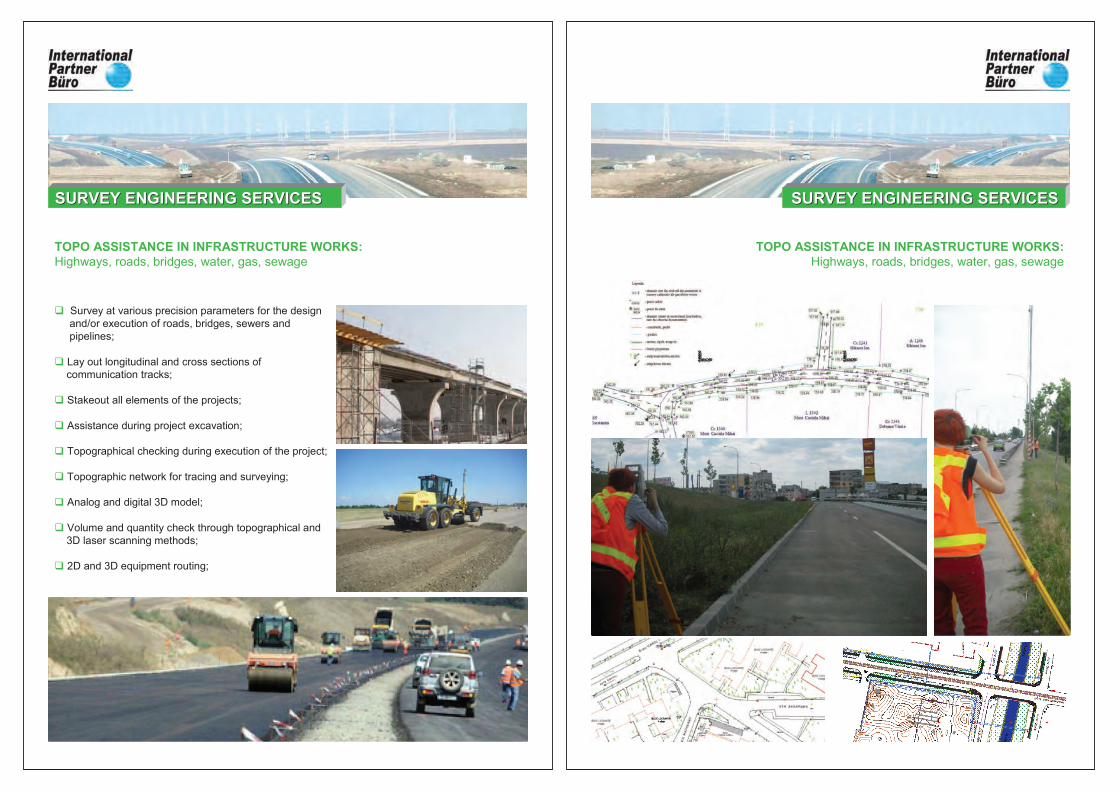
� Survey at various precision parameters for the design
and/or execution of roads, bridges, sewers and
pipelines;
� Lay out longitudinal and cross sections of
communication tracks;
� Stakeout all elements of the projects;
� Assistance during project excavation;
� Topographical checking during execution of the project;
� Topographic network for tracing and surveying;
� Analog and digital 3D model;
� Volume and quantity check through topographical and
3D laser scanning methods;
� 2D and 3D equipment routing;
TOPO ASSISTANCE IN INFRASTRUCTURE WORKS:Highways, roads, bridges, water, gas, sewage
SURVEY ENGINEERING SERVICESSURVEY ENGINEERING SERVICES
TOPO ASSISTANCE IN INFRASTRUCTURE WORKS:Highways, roads, bridges, water, gas, sewage
SURVEY ENGINEERING SERVICESSURVEY ENGINEERING SERVICES
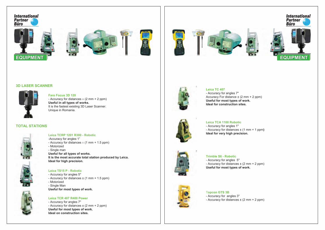
Leica TCRP 1201 R300 - Robotic-Accuracy for angles 1”
- Accuracy for distances ± (1 mm + 1.5 ppm)
- Motorized
- Single man
Useful for all types of works.It is the most accurate total station produced by Leica.Ideal for high precision.
Leica TCR 407 R400 Power- Accuracy for angles 7''
- Accuracy for distances ± (2 mm + 2 ppm)
Useful for most types of work.Ideal on construction sites.
Leica TS15 P - Robotic- Accuracy for angles 5''
- Accuracy for distances ± (1 mm + 1.5 ppm)
- Motorized
- Single Man
Useful for most types of work.
3D LASER SCANNER
TOTAL STATIONS
Faro Focus 3D 120- Accuracy for distances ± (2 mm + 2 ppm)
Useful in all types of works.It is the fastest existing 3D Laser Scanner.
Unique in Romania.
EQUIPMENTEQUIPMENT
Topcon GTS 3B- Accuracy for angles 3''
- Accuracy for distances ± (2 mm + 2 ppm)
Leica TCA 1100 Robotic- Accuracy for angles 1''
- Accuracy for distances ± (1 mm + 1 ppm)Ideal for very high precision.
Trimble S6 - Robotic- Accuracy for angles 5''
- Accuracy for distances ± (2 mm + 2 ppm)
Useful for most types of work.
Leica TC 407- Accuracy for angles 7''
Accuracy For distance ± (2 mm + 2 ppm)
Useful for most types of work.Ideal for construction sites.
EQUIPMENTEQUIPMENT
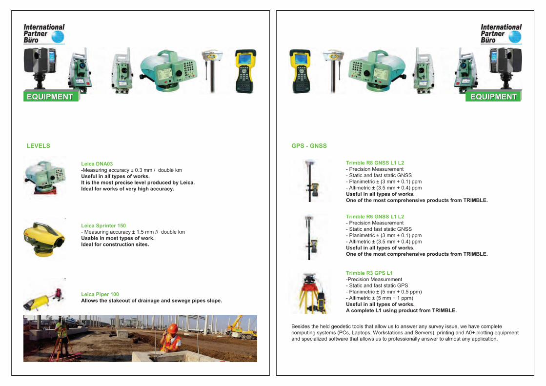
Leica DNA03-Measuring accuracy ± 0.3 mm / double km
Useful in all types of works.It is the most precise level produced by Leica.Ideal for works of very high accuracy.
Leica Sprinter 150- Measuring accuracy ± 1.5 mm // double km
Usable in most types of work.Ideal for construction sites.
Leica Piper 100Allows the stakeout of drainage and sewege pipes slope.
EQUIPMENTEQUIPMENT
LEVELS
Trimble R8 GNSS L1 L2 - Precision Measurement
- Static and fast static GNSS
- Planimetric ± (3 mm + 0.1) ppm
- Altimetric ± (3.5 mm + 0.4) ppm
Useful in all types of works.One of the most comprehensive products from TRIMBLE.
Trimble R3 GPS L1-Precision Measurement
- Static and fast static GPS
- Planimetric ± (5 mm + 0.5 ppm)
- Altimetric ± (5 mm + 1 ppm)
Useful in all types of works.A complete L1 using product from TRIMBLE.
Besides the held geodetic tools that allow us to answer any survey issue, we have complete
computing systems (PCs, Laptops, Workstations and Servers), printing and A0+ plotting equipment
and specialized software that allows us to professionally answer to almost any application.
Trimble R6 GNSS L1 L2 - Precision Measurement
- Static and fast static GNSS
- Planimetric ± (3 mm + 0.1) ppm
- Altimetric ± (3.5 mm + 0.4) ppm
Useful in all types of works.One of the most comprehensive products from TRIMBLE.
EQUIPMENTEQUIPMENT
GPS - GNSS

Militari Shopping CenterBucuresti, Sector 6B-dul Iuliu ManiuSurface Area: 197946 sq m
Built Area: 55060 sq m
Investment Value: 45 Mililion Euro
2008 - 2009
Underground Parking Lot Militari Shopping CenterBucuresti, Sector 6B-dul Iuliu ManiuSurface Area: 197946 sq m
Built Area: 16.000 sq m
Investment Value: 15 Million Euro
2009 - 2010
Combined Cycle Cogeneration - BraziPloiesti – BraziSurface Area: 116100 sq m
Power 860MW
Investment Value: 400 Million Euro
2009
Thermal Power Station equipped with 2 CAF of10GCAL/HGiurgiu2009
EXECUTED PROJECTS:CIVIL AND INDUSTRIAL WORKS ASSISTANCE
SURVEY ENGINEERING SERVICESSURVEY ENGINEERING SERVICES
Lufkin –Stage 1 + Stage 2Production Hall, Office BuildingPloiesti: Surface Area: 321649 sq m
Surface: 4688 sq m
Investment Value totala: 126 Million Euro
2010-2011
Praktiker - AdditionPloiestiSurface: 2076 sq m
Investment Value: 2.2 Million Euro
2011
Kaufland Turda - DepositCom. Mihai Viteazu, DNSurface Area: 394185 sq m
Built Area: 55 000 sq m
Investment Value: 30 Million Euro
2010-2011
Kaufland VasluiSurface Area: 19208 sq m
Built Area: 6234 sq m
Investment Value: 6 Million Euro
2010
EXECUTED PROJECTS:CIVIL AND INDUSTRIAL WORKS ASSISTANCE
SURVEY ENGINEERING SERVICESSURVEY ENGINEERING SERVICES
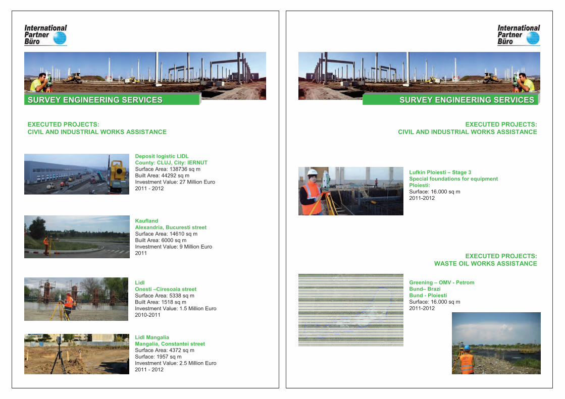
Deposit logistic LIDLCounty: CLUJ, City: IERNUTSurface Area: 138736 sq m
Built Area: 44292 sq m
Investment Value: 27 Million Euro
2011 - 2012
Lidl MangaliaMangalia, Constantei streetSurface Area: 4372 sq m
Surface: 1957 sq m
Investment Value: 2.5 Million Euro
2011 - 2012
KauflandAlexandria, Bucuresti streetSurface Area: 14610 sq m
Built Area: 6000 sq m
Investment Value: 9 Million Euro
2011
LidlOnesti –Ciresoaia streetSurface Area: 5338 sq m
Built Area: 1518 sq m
Investment Value: 1.5 Million Euro
2010-2011
EXECUTED PROJECTS:CIVIL AND INDUSTRIAL WORKS ASSISTANCE
SURVEY ENGINEERING SERVICESSURVEY ENGINEERING SERVICES
Lufkin Ploiesti – Stage 3Special foundations for equipmentPloiesti: Surface: 16.000 sq m
2011-2012
EXECUTED PROJECTS:WASTE OIL WORKS ASSISTANCE
Greening – OMV - PetromBund– BraziBund - PloiestiSurface: 16.000 sq m
2011-2012
EXECUTED PROJECTS:CIVIL AND INDUSTRIAL WORKS ASSISTANCE
SURVEY ENGINEERING SERVICESSURVEY ENGINEERING SERVICES
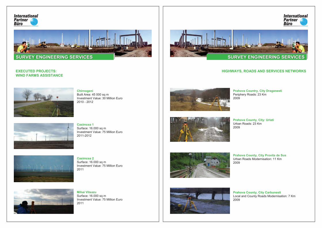
ChirnogeniBuilt Area: 45 000 sq m
Investment Value: 30 Million Euro
2010 - 2012
Casimcea 1Surface: 16.000 sq m
Investment Value: 75 Million Euro
2011-2012
Casimcea 2Surface: 16.000 sq m
Investment Value: 75 Million Euro
2011
Mihai ViteazuSurface: 16.000 sq m
Investment Value: 75 Million Euro
2011
EXECUTED PROJECTS:WIND FARMS ASSISTANCE
SURVEY ENGINEERING SERVICESSURVEY ENGINEERING SERVICES
Prahova Country, City DraganestiPeriphery Roads: 23 Km
2009
Prahova County, City: Urlati Urban Roads: 23 Km
2009
HIGHWAYS, ROADS AND SERVICES NETWORKS
Prahova County, City Provita de SusUrban Roads Modernisation: 11 Km
2009
Prahova County, City CarbunestiLocal and County Roads Modernisation: 7 Km
2009
SURVEY ENGINEERING SERVICESSURVEY ENGINEERING SERVICES
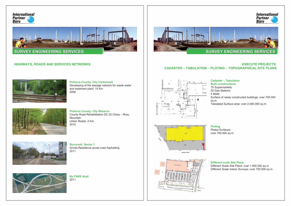
Prahova County, City CarbunestiDeveloping of the sewage network for waste water
and treatment plant: 15 Km
2009
Bucuresti, Sector 1Grivita Residence acces road Asphalting
2011
HIGHWAYS, ROADS AND SERVICES NETWORKS
By PASS Arad2011
Prahova County, City ManeciuCounty Road Rehabilitation DC 22 Cheia – Rosu
Mountain
Urban Roads: 4 Km
2010
SURVEY ENGINEERING SERVICESSURVEY ENGINEERING SERVICES
Cadaster – TabulationBuilt constructions75 Supermarkets
25 Gas Stations
4 Malls
Surface of newly constructed buildings: over 700.000
sq m
Tabulated Surface area: over 2.000.000 sq m
PlotingPloted Surfaces:
over 700.000 sq m
Different scale Site PlansDifferent Scale Site Plans: over 1.000.000 sq m
Different Scale Indoor Surveys: over 700.000 sq m
EXECUTE PROJECTS:CADASTER – TABULATION – PLOTING – TOPOGRAPHICAL SITE PLANS
SURVEY ENGINEERING SERVICESSURVEY ENGINEERING SERVICES
INTERNATIONAL PARTNER BÜRO S.R.L. covers complete
activities at national level in Romania, along with 3D Laser
Scanning and Engineering Survey in other countries, according to the requirements of our customers –multinational companies and governments.
Our tools, specialty software as well as highly trained employees are a guarantee for a successful
response to any surveying problem in Europe and throughout the world.
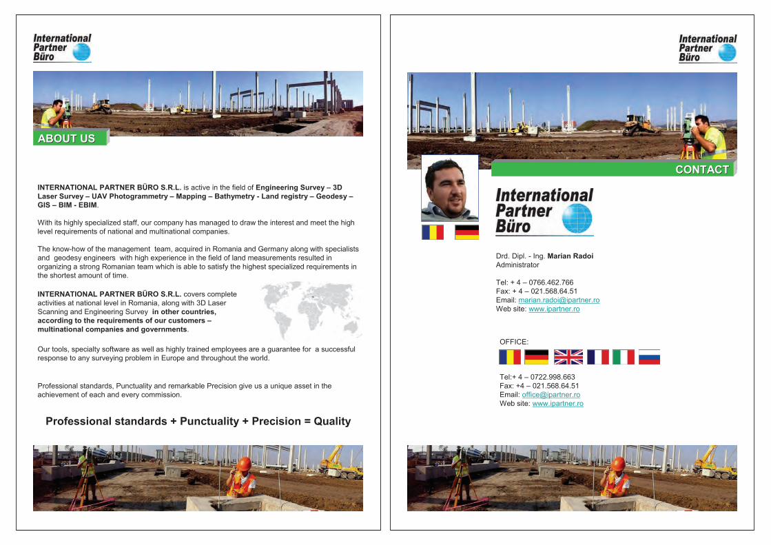
INTERNATIONAL PARTNER BÜRO S.R.L. is active in the field of Engineering Survey – 3D Laser Survey – UAV Photogrammetry – Mapping – Bathymetry - Land registry – Geodesy –GIS – BIM - EBIM.
With its highly specialized staff, our company has managed to draw the interest and meet the high
level requirements of national and multinational companies.
The know-how of the management team, acquired in Romania and Germany along with specialists
and geodesy engineers with high experience in the field of land measurements resulted in
organizing a strong Romanian team which is able to satisfy the highest specialized requirements in
the shortest amount of time.
Professional standards + Punctuality + Precision = Quality
Professional standards, Punctuality and remarkable Precision give us a unique asset in the
achievement of each and every commission.
ABOUT USABOUT US
Drd. Dipl. - Ing. Marian Radoi Administrator
Tel: + 4 – 0766.462.766
Fax: + 4 – 021.568.64.51
Email: [email protected]
Web site: www.ipartner.ro
OFFICE:
Tel:+ 4 – 0722.998.663
Fax: +4 – 021.568.64.51
Email: [email protected]
Web site: www.ipartner.ro
CONTACTCONTACT
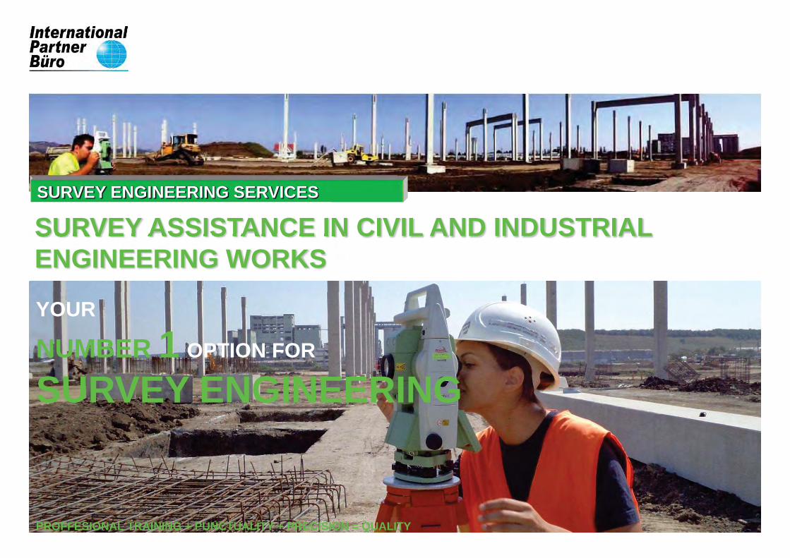
SURVEY ENGINEERING SERVICES
SURVEY ASSISTANCE IN CIVIL AND INDUSTRIAL ENGINEERING WORKS
YOUR
NUMBER 1 OPTION FOR
SURVEY ENGINEERING
PROFFESIONAL TRAINING + PUNCTUALITY + PRECISION = QUALITY