Embed Size (px)
Citation preview
Weather and Climate, Second Edition
© Oxford University Press Canada, 2017
Learning Goals After studying this chapter, students should be able to: 1. show how certain forces interact to produce the winds (pp. 249–256); 2. describe the airflow in high- and low-pressure systems, and explain how these motions create
weather (pp. 259–265); 3. explain the thermal wind concept (pp. 265–272); and 4. explain how differences in heating and cooling at the local scale can cause winds (pp. 272–276).
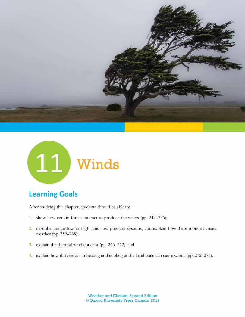
11 Winds
Weather and Climate, Second Edition
© Oxford University Press Canada, 2017
Summary 1. The pressure gradient force drives the wind. This force has a magnitude proportional to the
pressure gradient and is directed from high to low pressure.
2. The Coriolis force causes winds to be deflected to the right of their path in the northern hemi-sphere and to the left of their path in the southern hemisphere. The Coriolis force increases with latitude and wind speed.
3. The centripetal force, or acceleration, keeps the winds moving in a curved path by pulling toward the centre of rotation. This force has a magnitude proportional to the wind speed and inversely proportional to the radius of curvature.
4. The force of friction slows winds near Earth’s surface, so that wind speed increases with height. The effects of surface friction are carried upward by turbulence. Turbulence increases with rougher surfaces, faster winds, and greater instability. As turbulence increases, wind shear de-creases, and the effects of surface friction are carried higher above the surface. The depth of the atmosphere to which the effects of surface friction are transferred is referred to as the planetary boundary layer.
5. The geostrophic wind equation approximates the wind speed for straight flow above the plane-tary boundary layer. Without friction or curvature, the pressure gradient force is balanced by the Coriolis force, and the winds flow parallel to the isobars or contours.
6. The gradient wind equation approximates the wind speed for curved flow above the planetary boundary layer. The imbalance between the pressure gradient force and the Coriolis force keeps the air moving along a curved path by creating a centripetal force that pulls the air in toward the centre of rotation. For the same pressure gradient, gradient winds are faster around highs than they are around lows.
7. In areas of low pressure, air converges at the surface, rises, and diverges aloft. The rising air leads to the formation of clouds. If upper-level divergence is greater than surface convergence, the low will intensify. In areas of high pressure, air diverges at the surface, sinks from above, and converges aloft. The sinking air leads to clear skies. If upper-level convergence is greater than surface divergence, the high will intensify.
8. Horizontal temperature gradients create upper-air pressure gradients that change with height. As a result of horizontal temperature gradients, therefore, winds change with height. We can use the thermal wind concept to study the relationship between the change in winds with height in an atmospheric layer and the average temperature gradient of that layer. This concept helps provide us with an appreciation that the layers of the atmosphere work together as a system.
9. Differences in heating between land and water can cause land–sea breeze circulation systems. During the day, a thermal high forms over the cooler water, while a thermal low forms over the warmer land; this creates a sea breeze. At night, the pressure gradient is reversed, creating a land breeze.
10. Warming causes air to rise up slopes as a valley wind. Cooling causes air to sink down slopes as a mountain wind.
Weather and Climate, Second Edition
© Oxford University Press Canada, 2017
Key Terms Anticyclone An area of high pressure around which winds blow clockwise in the northern hemi-sphere and counterclockwise in the southern hemisphere. (p. 259)
Backing Rotating counterclockwise with height. (p. 270)
Baroclinic The atmospheric condition in which isotherms cross isobars. (p. 266)
Barotropic The atmospheric condition in which isotherms parallel isobars. (p. 266)
Centripetal force The net force, directed toward the centre of rotation, that acts on a rotating object. (p. 249)
Coriolis force An apparent force, resulting from the rotation of Earth, that causes objects moving freely above Earth’s surface to appear to be deflected from a straight-line path, relative to Earth’s surface. (p. 249)
Cyclone An area of low pressure around which winds blow counterclockwise in the northern hemi-sphere and clockwise in the southern hemisphere. (p. 259)
Eddies Irregular whirling motions that characterize turbulent flow. (p. 255)
Eddy viscosity Large-scale resistance to flow due to the random, irregular motions associated with turbulence. (p. 255)
Friction The force that resists motion whenever objects move, or try to move, relative to each other. (p. 249)
Geostrophic wind A wind, depicted on a weather map as blowing parallel to straight isobars or height contours, that develops when the pressure gradient force is balanced by the Coriolis force. (p. 257)
Gradient wind A wind, depicted on a weather map as flowing parallel to curved isobars or height con-tours, that develops when the pressure gradient force and the Coriolis force are unbalanced. (p. 259)
Laminar flow A type of flow in which layers of the fluid flow over each other with no disruption between the layers. (p. 255)
Land breeze A breeze that flows from the land to the ocean at night. (p. 272)
Mesoscale A scale of a few kilometres to a few hundred kilometres. (p. 272)
Molecular viscosity Small-scale resistance to flow due to the random motions of molecules in laminar flow. (p. 255)
Momentum The product of mass and velocity. (p. 254)
Mountain wind Air blowing downslope. Also known as katabatic winds. (p. 274)
Planetary boundary layer The layer of air closest to the surface that is influenced by friction from the surface. (p. 255)
Ridge An elongated area of high pressure. (p. 261)
Sea breeze A breeze that flows from the ocean to the land during the day. (p. 272)
Thermal wind The change in geostrophic wind with height due to the horizontal variation of temper-ature. (p. 264)
Trough An elongated area of low pressure. (p. 261)
Weather and Climate, Second Edition
© Oxford University Press Canada, 2017
Valley wind Air blowing upslope. Also known as anabatic winds. (p. 274)
Vector A concept used to represent phenomena that have both speed and direction. (p. 263)
Veering Rotating clockwise with height. (p. 270)
Viscosity Resistance to flow. (p. 254)
Wind The mostly horizontal movement of air relative to Earth’s surface. (p. 249)
Key Equations Pressure gradient force
PGF = − 1
ρ(
∆P
∆x)
Coriolis force
CF = fcV
Centripetal force
CLF =V2
R
Geostrophic wind speed (pressure)
Vg = − (1
ρfc) (
∆P
∆x)
Geostrophic wind speed (height)
Vg = − (g
fc) (
∆z
∆x)
Winds around a cyclone
Vgr = Vg − (1
fc) (
Vgr2
R)
Winds around an anticyclone
Vgr = Vg + (1
fc) (
Vgr2
R)
Answers to Selected Review Questions (p. 278) 1. What determines the magnitude and direction of the pressure gradient force?
The magnitude of the pressure gradient force is determined by the pressure gradient over a dis-tance. The direction of the force is from regions of high pressure to regions of low pressure.
Weather and Climate, Second Edition
© Oxford University Press Canada, 2017
3. In what direction does the centripetal force act? What determines the magnitude of this force?
The centripetal force acts toward the centre of rotation, continually pulling in toward that centre. The centripetal force is proportional to the wind speed and inversely proportional to the radius of curvature.
5. Why does the effect of surface friction extend upward into the atmosphere? What factors
determine the depth of the atmosphere that will be influenced by surface friction?
The effect of surface friction extends upward into the atmosphere because of turbulence. Wind speed, surface roughness, and atmospheric stability determine the depth of the atmosphere that will be influenced by surface friction.
7. Why are gradient winds faster around high-pressure areas than they are around low-
pressure areas?
Gradient winds flow faster around high-pressure areas because the Coriolis force must be greater than the pressure gradient force to maintain curving flow.
9. How do convergence and divergence lead to vertical motions? Describe the patterns of
convergence, divergence, and vertical motions in high- and low-pressure systems.
As air flows inward toward the centre of a low, it causes convergence at the surface and forces air to rise. As air flows outward away from the centre of a high, surface air will diverge and air from above will sink to fill the void. In high-pressure systems, divergence occurs at the surface, convergence occurs aloft, and air sinks. In low-pressure systems, convergence occurs at the sur-face, divergence occurs aloft, and air rises.
11. How do temperature gradients produce upper-level pressure gradients? Why do such
pressure gradients increase with height?
The temperature gradient causes pressure surfaces to slope upward from an area of cold air to an area of warmer air. This creates a pressure gradient where the direction is from areas of warm air to areas of cold air. The pressure gradients increase with height because pressure decreases more slowly with height in warm air than it does in cold air.
13. How do land–sea breeze circulation systems develop? How do valley and mountain
winds develop?
Land–sea breeze circulation systems develop due to temperature differences between land and water. During the day, a thermal high-pressure system develops over the colder water and a thermal low-pressure system develops over the warmer land. This creates a sea breeze. At night, the pressure gradient is reversed, creating a land breeze.
Valley and mountain winds develop due to temperature differences that result from varia-tions in terrain. During the day, air along the slopes will warm making pressure slightly lower along the slopes. The warm, less dense air will rise up the mountainside as a valley wind. At
Weather and Climate, Second Edition
© Oxford University Press Canada, 2017
night, the air along the mountain slopes cools. This cooling reverses the pressure gradient, caus-ing cold, dense air to drain down the slope as a mountain wind.
Answers to Selected Problems (p. 279) 1. Calculate the Coriolis parameter, fc, for a) 10° latitude and b) 80° latitude.
fc = 2 Ω sin φ a) fc = 2 (7.27 × 10⁻⁵ s–1) (sin 10°)
= 2.5 × 10⁻⁵ s–1
b) fc = 2 (7.27 × 10⁻⁵ s–1) (sin 80°)
= 1.4 × 10⁻⁴ s–1
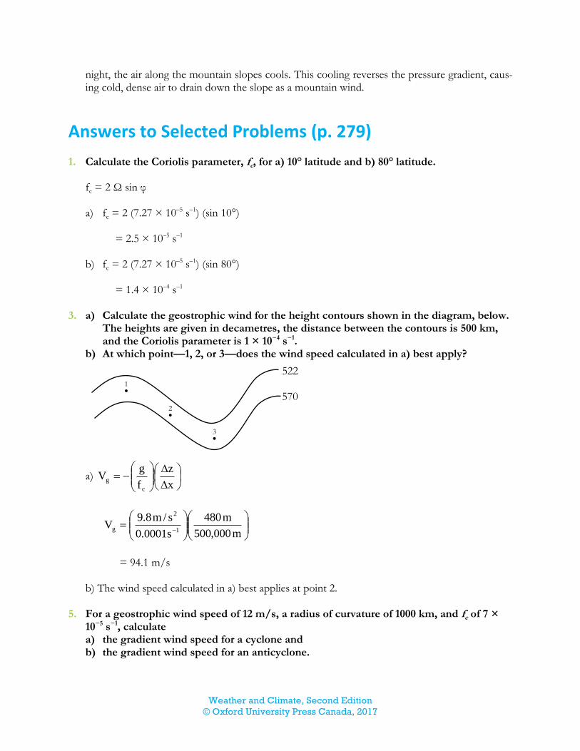
3. a) Calculate the geostrophic wind for the height contours shown in the diagram, below.
The heights are given in decametres, the distance between the contours is 500 km, and the Coriolis parameter is 1 × 10⁻⁴ s−1.
b) At which point—1, 2, or 3—does the wind speed calculated in a) best apply?
a)
x
z
f
gV
c
g
m000,500
m480
s0001.0
s/m8.9V
1
2
g
= 94.1 m/s
b) The wind speed calculated in a) best applies at point 2.
5. For a geostrophic wind speed of 12 m/s, a radius of curvature of 1000 km, and fc of 7 ×
10−5 s−1, calculate a) the gradient wind speed for a cyclone and b) the gradient wind speed for an anticyclone.
1
522
570
2
3
Weather and Climate, Second Edition
© Oxford University Press Canada, 2017
R
V
f
1VV
2
gr
c
ggr
Solve for Vgr using the quadratic formula.
Rf
V411
V2V
c
g
g
gr
a) Use a positive radius of curvature for cyclonic flow:
m000,000,100007.0
s/m12411
s/m122Vgr
= 10.4 m/s
b) Use a negative radius of curvature for anticyclonic flow:
m000,000,100007.0
s/m12411
s/m122Vgr
= 15.4 m/s
7. Calculate the magnitude of the thermal wind for a change in thickness of 380 m over
1000 km. The Coriolis parameter is 1 × 10⁻⁴ s−1.
VT =
x
h
f
g
c
VT =
m000,000,1
m380
s101
s/m8.914
2
= 37.2 m/s
Study Questions For suggested answers, see below. 1. What is the relationship between wind shear and turbulence?
Weather and Climate, Second Edition
© Oxford University Press Canada, 2017
2. How does an imbalance of forces keep a gradient wind moving in a curved path around a low
pressure area? 3. What is the relationship between the locations of upper-air ridges and troughs and the locations
of surface highs and surface lows? 4. How does terrain influence the angle at which winds flow across isobars? 5. Why is the thermal wind not an actual wind? What does the thermal wind relationship state about
the difference between the geostrophic wind at the top and bottom of an atmospheric layer?
Additional Problems For answers, see below. 1. a) Calculate the pressure gradient force that results from a pressure gradient of 0.4 kPa/250
km. Use a value of 1.14 kg/m3 for the density of air. b) If this force acted for one half hour, what would be the wind speed? 2. Determine the Coriolis force for a wind speed of 7.3 m/s at 42° latitude. 3. Calculate the centripetal force for winds with a speed of 11.2 m/s at 725 km from the centre of
a low-pressure system. 4. a) Calculate the geostrophic wind speed if the pressure changes 3.1 kPa over a distance of 1050
km at latitude 65° and a height of 7 km in the atmosphere. At this height, air density is about 0.6 kg/m3.
b) At the same latitude, the height of the 500 hPa surface increases 30 m over a distance of 200 km. Calculate the geostrophic wind speed in this case.
5. What would the geostrophic wind speed be at 14° latitude for a pressure gradient of 2.8 kPa
over a distance of 900 km? The air density is 0.8 kg/m3. 6. For a geostrophic wind speed of 6.2 m/s at 57° latitude and a radius of curvature of 350 km,
calculate the gradient wind speed around a) a cyclone and b) an anticyclone. 7. Calculate the magnitude of the thermal wind for a change in thickness of 410 m over 1100 km.
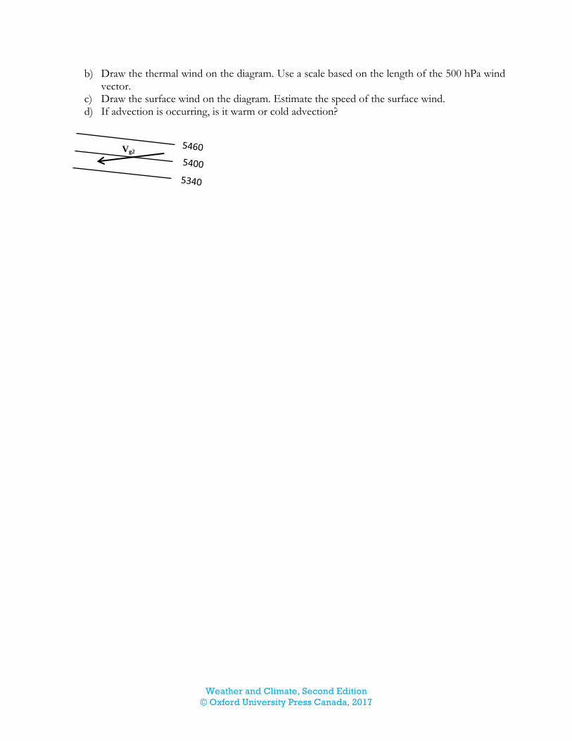
The Coriolis parameter is 0.8 × 10⁻⁴ s–1. 8. The diagram below shows thickness contours, in metres, on the 500 hPa chart. The distance be-
tween the three contour lines is 650 km. The 500 hPa wind vector is drawn on the diagram; its speed is 28 m/s. a) Calculate the magnitude of the thermal wind at 33° latitude.
Weather and Climate, Second Edition
© Oxford University Press Canada, 2017
b) Draw the thermal wind on the diagram. Use a scale based on the length of the 500 hPa wind vector.
c) Draw the surface wind on the diagram. Estimate the speed of the surface wind. d) If advection is occurring, is it warm or cold advection?
Vg2
Weather and Climate, Second Edition
© Oxford University Press Canada, 2017
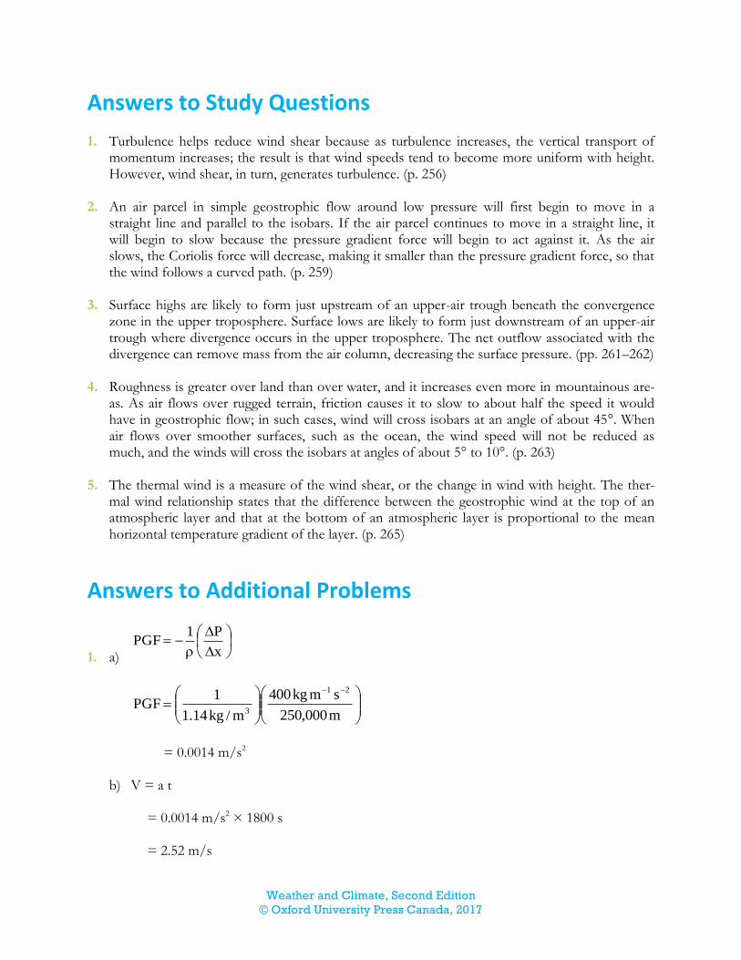
Answers to Study Questions 1. Turbulence helps reduce wind shear because as turbulence increases, the vertical transport of
momentum increases; the result is that wind speeds tend to become more uniform with height. However, wind shear, in turn, generates turbulence. (p. 256)
2. An air parcel in simple geostrophic flow around low pressure will first begin to move in a
straight line and parallel to the isobars. If the air parcel continues to move in a straight line, it will begin to slow because the pressure gradient force will begin to act against it. As the air slows, the Coriolis force will decrease, making it smaller than the pressure gradient force, so that the wind follows a curved path. (p. 259)
3. Surface highs are likely to form just upstream of an upper-air trough beneath the convergence
zone in the upper troposphere. Surface lows are likely to form just downstream of an upper-air trough where divergence occurs in the upper troposphere. The net outflow associated with the divergence can remove mass from the air column, decreasing the surface pressure. (pp. 261–262)
4. Roughness is greater over land than over water, and it increases even more in mountainous are-
as. As air flows over rugged terrain, friction causes it to slow to about half the speed it would have in geostrophic flow; in such cases, wind will cross isobars at an angle of about 45°. When air flows over smoother surfaces, such as the ocean, the wind speed will not be reduced as much, and the winds will cross the isobars at angles of about 5° to 10°. (p. 263)
5. The thermal wind is a measure of the wind shear, or the change in wind with height. The ther-
mal wind relationship states that the difference between the geostrophic wind at the top of an atmospheric layer and that at the bottom of an atmospheric layer is proportional to the mean horizontal temperature gradient of the layer. (p. 265)
Answers to Additional Problems
1. a)
x
P1PGF
m000,250
smkg400
m/kg14.1
1PGF
21
3
= 0.0014 m/s2
b) V = a t
= 0.0014 m/s2 × 1800 s = 2.52 m/s

Weather and Climate, Second Edition
© Oxford University Press Canada, 2017
2. CF = fc V
= 2 (7.27 × 10⁻⁵ s–1) (sin 42°) (7.3 m/s) = 7.1 × 10⁻⁴ m/s
3. CLF = R
V 2
=
m000,725
s/m2.112
= 0.00017 m/s2
4. a) Calculate the Coriolis parameter:
fc = 2 Ω sin φ fc = 2 (7.27 × 10⁻⁵ s–1) (sin 65°) fc = 0.00013 s–1
x
P
f
1V
c
g
Vg =
km1050
kPa1.3
s00013.0m/kg6.0
113
= 37.9 m/s
b) Vg =
x
z
f
g
c
Vg =
m000,200
m30
s00013.0
s/m8.91
2
= 11.3 m/s
5. Calculate the Coriolis parameter:
fc = 2 Ω sin φ
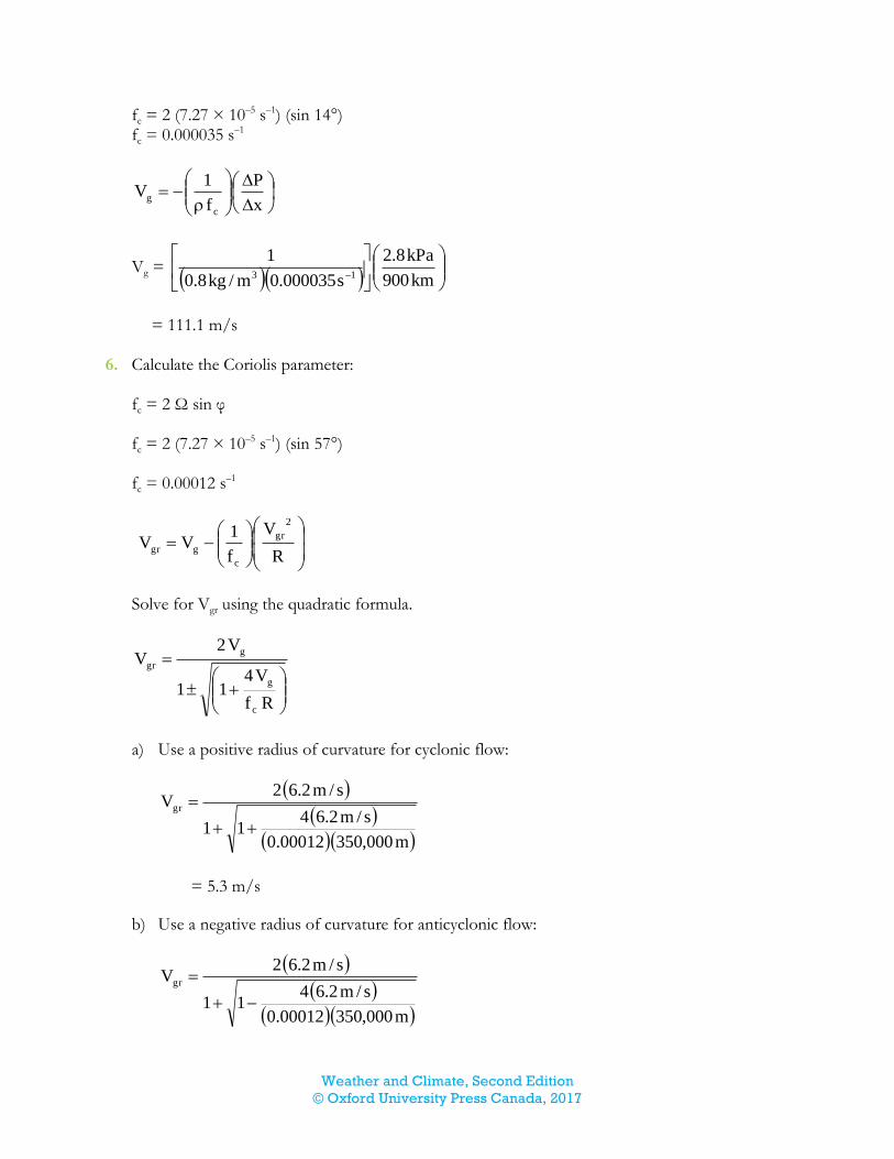
Weather and Climate, Second Edition
© Oxford University Press Canada, 2017
fc = 2 (7.27 × 10⁻⁵ s–1) (sin 14°) fc = 0.000035 s–1
x
P
f
1V
c
g
Vg =
km900
kPa8.2
s000035.0m/kg8.0
113
= 111.1 m/s
6. Calculate the Coriolis parameter:
fc = 2 Ω sin φ fc = 2 (7.27 × 10⁻⁵ s–1) (sin 57°) fc = 0.00012 s–1
R
V
f
1VV
2
gr
c
ggr
Solve for Vgr using the quadratic formula.
Rf
V411
V2V
c
g
g
gr
a) Use a positive radius of curvature for cyclonic flow:
m000,35000012.0
s/m2.6411
s/m2.62Vgr
= 5.3 m/s
b) Use a negative radius of curvature for anticyclonic flow:
m000,35000012.0
s/m2.6411
s/m2.62Vgr
Weather and Climate, Second Edition
© Oxford University Press Canada, 2017
= 7.6 m/s
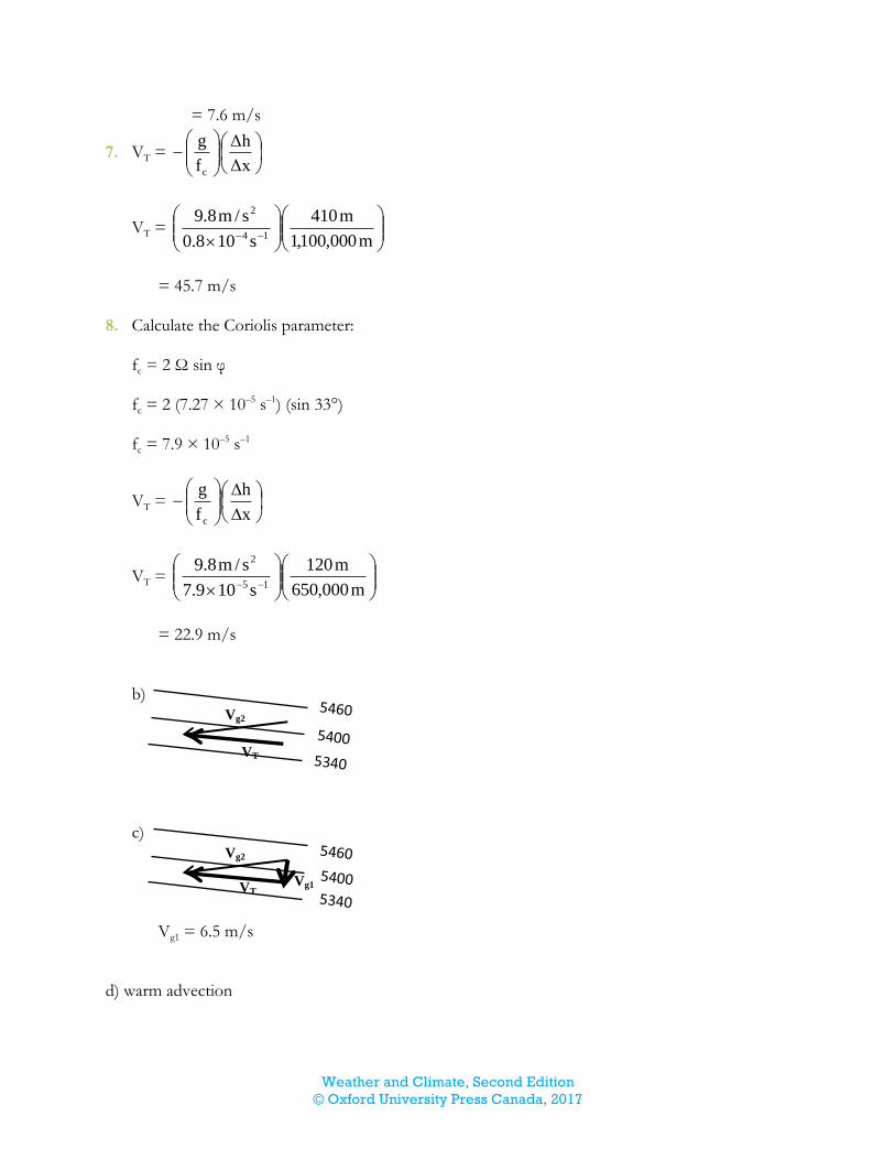
7. VT =
Δx
Δh
f
g
c
VT =
m000,100,1
m410
s108.0
s/m8.914
2
= 45.7 m/s
8. Calculate the Coriolis parameter:
fc = 2 Ω sin φ fc = 2 (7.27 × 10⁻⁵ s–1) (sin 33°) fc = 7.9 × 10⁻⁵ s–1
VT =
x
h
f
g
c
VT =
m000,650
m120
s109.7
s/m8.915
2
= 22.9 m/s
b) c)
Vg1 = 6.5 m/s
d) warm advection
Vg2
VT
Vg2
VT Vg1