Embed Size (px)
Citation preview
. . . . . .. . . .
. . . . . . . . . .
GREDELL Engineering Resources, Inc.
Sikeston Board of Municipal Utilities
Sikeston Power Station Fly Ash Pond
Structural Stability Assessment
Prepared for:
Sikeston Power Station 1551 West Wakefield Avenue Sikeston, MO 63801
April 2018
1505 East High Street Jefferson City, Missouri 65101 Telephone (573) 659-9078 Facsimile (573) 659-9079
TOC-1
Sikeston Board of Municipal Utilities Sikeston Power Station
Fly Ash Pond Structural Stability Assessment
April 2018
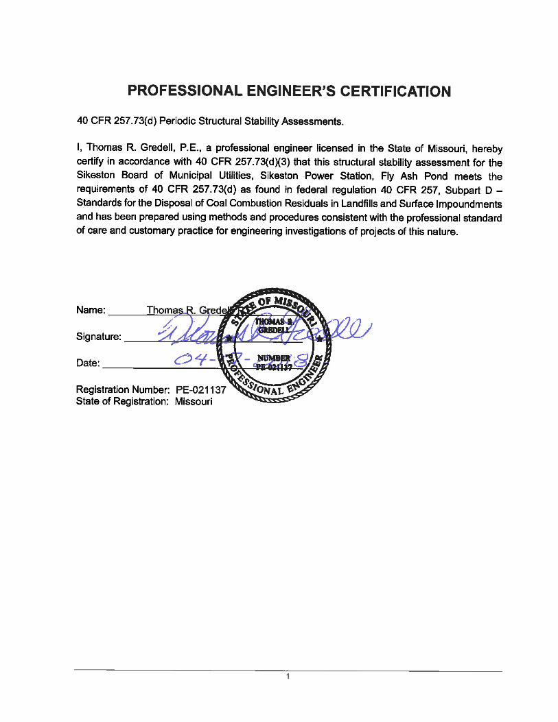
Table of Contents PROFESSIONAL ENGINEER’S CERTIFICATION ...................................................................... 1
1.0 INTRODUCTION .................................................................................................................. 2
1.1 40 CFR §257.73(d) Periodic Structural Stability Assessment ..................................... 2
2.0 FLY ASH POND DESCRIPTION ......................................................................................... 4
3.0 STRUCTURAL STABILITY ASSESSMENT ....................................................................... 5
3.1 Foundations and Abutments ....................................................................................... 5
3.2 Slope Protection .......................................................................................................... 5
3.3 Berm Stability .............................................................................................................. 5
3.4 Maximum Vegetation Height Requirement .................................................................. 7
3.5 Spillway Design and Capacity ..................................................................................... 7
3.6 Structural Integrity of Hydraulic Structures .................................................................. 8
3.6.1 Identified Hydraulic Structures .................................................................................... 8
3.6.2 Structural Integrity of Identified Hydraulic Structures .................................................. 8
3.7 Downstream Inundation and Sudden Drawdown ........................................................ 9
3.8 Miscellaneous Assessed Site Features ..................................................................... 10
4.0 RECOMMENDED CORRECTIVE MEASURES SUMMARY ............................................. 10
5.0 MISCELLANEOUS REQUIREMENTS .............................................................................. 12
6.0 REFERENCES ................................................................................................................... 13
List of Appendices Appendix A Figures
Sikeston Board of Municipal Utilities Sikeston Power Station Fly Ash Pond
Structural Stability Assessment April 2018
2
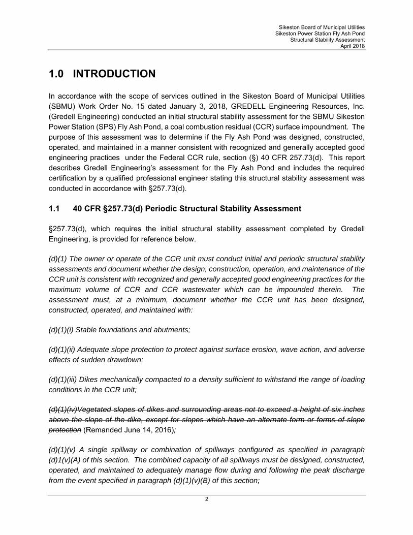
1.0 INTRODUCTION
In accordance with the scope of services outlined in the Sikeston Board of Municipal Utilities (SBMU) Work Order No. 15 dated January 3, 2018, GREDELL Engineering Resources, Inc. (Gredell Engineering) conducted an initial structural stability assessment for the SBMU Sikeston Power Station (SPS) Fly Ash Pond, a coal combustion residual (CCR) surface impoundment. The purpose of this assessment was to determine if the Fly Ash Pond was designed, constructed, operated, and maintained in a manner consistent with recognized and generally accepted good engineering practices under the Federal CCR rule, section (§) 40 CFR 257.73(d). This report describes Gredell Engineering’s assessment for the Fly Ash Pond and includes the required certification by a qualified professional engineer stating this structural stability assessment was conducted in accordance with §257.73(d).
1.1 40 CFR §257.73(d) Periodic Structural Stability Assessment
§257.73(d), which requires the initial structural stability assessment completed by Gredell Engineering, is provided for reference below.
(d)(1) The owner or operate of the CCR unit must conduct initial and periodic structural stability assessments and document whether the design, construction, operation, and maintenance of the CCR unit is consistent with recognized and generally accepted good engineering practices for the maximum volume of CCR and CCR wastewater which can be impounded therein. The assessment must, at a minimum, document whether the CCR unit has been designed, constructed, operated, and maintained with:
(d)(1)(i) Stable foundations and abutments;
(d)(1)(ii) Adequate slope protection to protect against surface erosion, wave action, and adverse effects of sudden drawdown;
(d)(1)(iii) Dikes mechanically compacted to a density sufficient to withstand the range of loading conditions in the CCR unit;
(d)(1)(iv)Vegetated slopes of dikes and surrounding areas not to exceed a height of six inches above the slope of the dike, except for slopes which have an alternate form or forms of slope protection (Remanded June 14, 2016);
(d)(1)(v) A single spillway or combination of spillways configured as specified in paragraph (d)1(v)(A) of this section. The combined capacity of all spillways must be designed, constructed, operated, and maintained to adequately manage flow during and following the peak discharge from the event specified in paragraph (d)(1)(v)(B) of this section;
Sikeston Board of Municipal Utilities Sikeston Power Station Fly Ash Pond
Structural Stability Assessment April 2018
3
(d)(1)(v)(A) All spillways must be either: (1) of non-erodible construction and designed to carry sustained flows; or (2) Earth- or grass-lined and designed to carry short-term, infrequent flows at non-erosive velocities where sustained flows are not expected.;
(d)(1)(v)(B) The combined capacity of all spillways must adequately manage flow during and following the peak discharge from a: (1) Probable maximum flood (PMF) for a high hazard potential CCR surface impoundment; or (2) 1000-year flood for a significant hazard potential CCR surface impoundment; or (3) 100-year flood for a low hazard potential CCR surface impoundment;
(d)(1)(vi) Hydraulic structures underlying the base of the CCR unit or passing through the dike of the CCR unit that maintain structural integrity and are free of significant deterioration, deformation, distortion, bedding deficiencies, sedimentation, and debris which may negatively affect the operation of the hydraulic structure;
(d)(1)(vii) For CCR units with downstream slopes which can be inundated by the pool of an adjacent water body, such as a river, stream or lake, downstream slopes that maintain structural stability during low pool of the adjacent water body or sudden drawdown of the adjacent water body;
(d)(2) The periodic assessment described in paragraph (d)(1) of this section must identify any structural stability deficiencies associated with the CCR unit in addition to recommending corrective measures. If a deficiency or a release is identified during the periodic assessment, the owner or operator unit must remedy the deficiency or release as soon as feasible and prepare documentation detailing the corrective measures taken;
(d)(3) The owner or operator of the CCR unit must obtain a certification from a qualified professional engineer stating that the initial assessment and each subsequent periodic assessment was conducted in accordance with the requirements of this section.
Sikeston Board of Municipal Utilities Sikeston Power Station Fly Ash Pond
Structural Stability Assessment April 2018
4
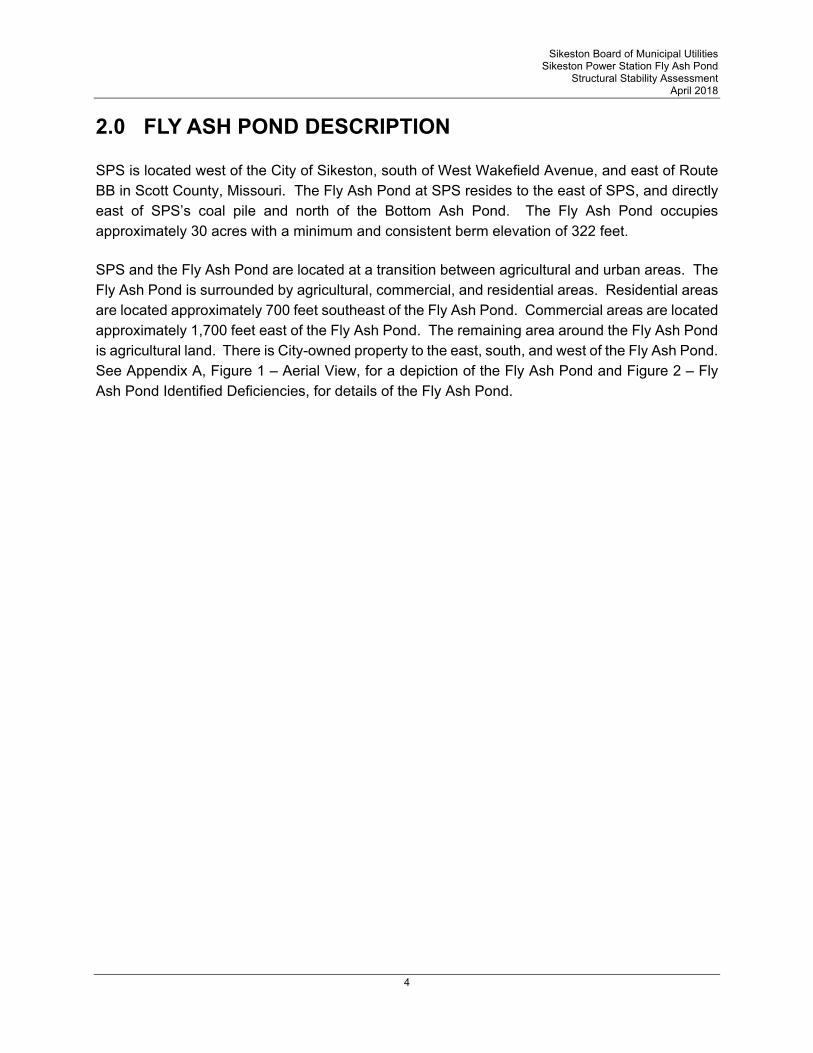
2.0 FLY ASH POND DESCRIPTION
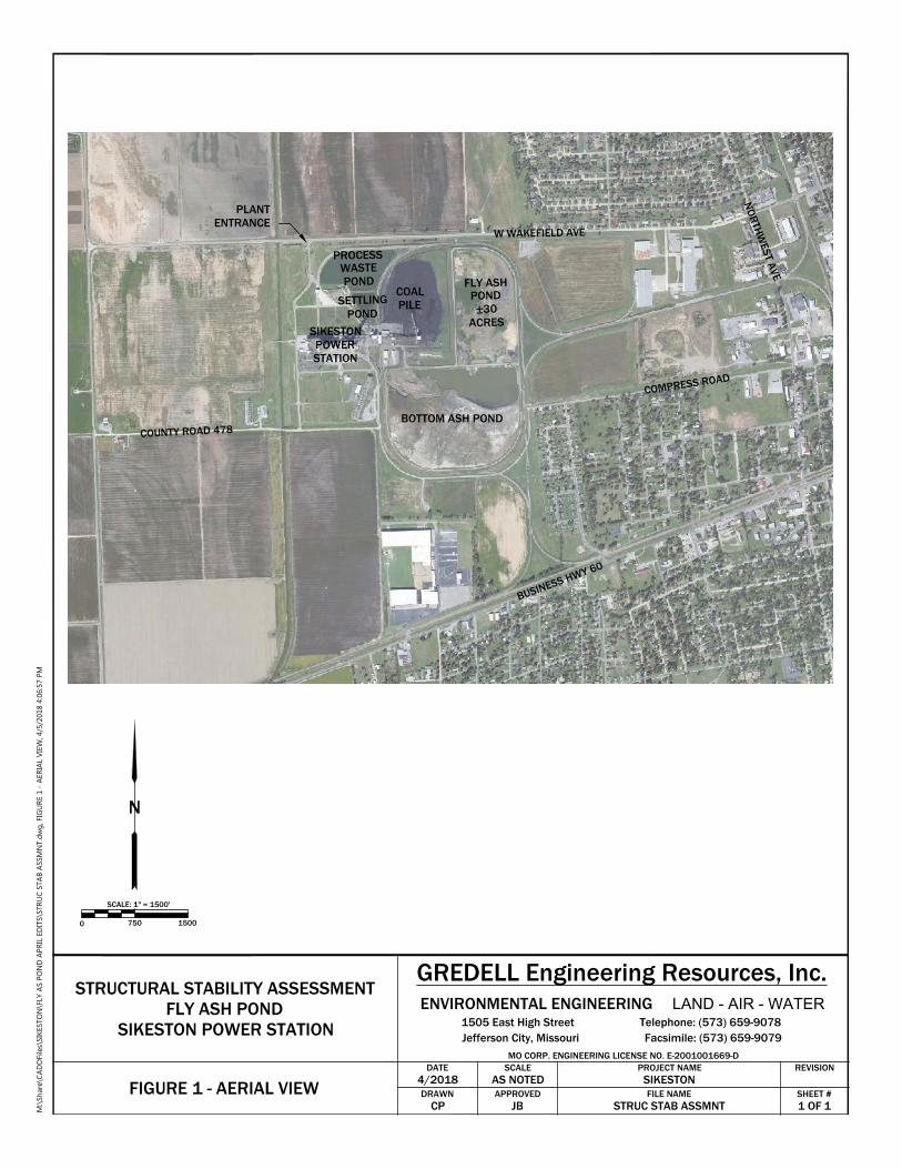
SPS is located west of the City of Sikeston, south of West Wakefield Avenue, and east of Route BB in Scott County, Missouri. The Fly Ash Pond at SPS resides to the east of SPS, and directly east of SPS’s coal pile and north of the Bottom Ash Pond. The Fly Ash Pond occupies approximately 30 acres with a minimum and consistent berm elevation of 322 feet.
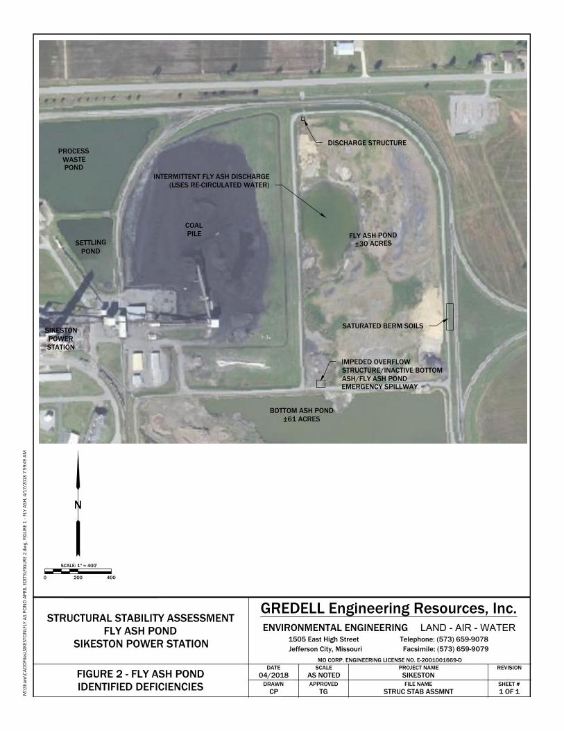
SPS and the Fly Ash Pond are located at a transition between agricultural and urban areas. The Fly Ash Pond is surrounded by agricultural, commercial, and residential areas. Residential areas are located approximately 700 feet southeast of the Fly Ash Pond. Commercial areas are located approximately 1,700 feet east of the Fly Ash Pond. The remaining area around the Fly Ash Pond is agricultural land. There is City-owned property to the east, south, and west of the Fly Ash Pond. See Appendix A, Figure 1 – Aerial View, for a depiction of the Fly Ash Pond and Figure 2 – Fly Ash Pond Identified Deficiencies, for details of the Fly Ash Pond.
Sikeston Board of Municipal Utilities Sikeston Power Station Fly Ash Pond
Structural Stability Assessment April 2018
5
3.0 STRUCTURAL STABILITY ASSESSMENT
The Federal CCR Rule requires an initial and periodic structural stability assessment for existing CCR surface impoundments. Periodic structural stability assessments shall be conducted every five years. Structural stability assessments must document whether the design, construction, operation, and maintenance of the CCR surface impoundment is consistent with recognized and generally accepted good engineering practices.
3.1 Foundations and Abutments
The foundation soils for the Fly Ash Pond consist of existing soils or fills compacted to support the finished construction of the Fly Ash Pond. Topsoil and soil with unsuitable material was stripped to a minimum depth of 6 inches. The stripped surface was further excavated or filled to the desired grades. The foundation soils beneath the berms of the Fly Ash Pond consist of silty sand (SM) and fine to medium course sand (SP) (Geotechnology 2011).
The foundation soils where designed to be compacted in accordance with the construction specifications to a 95 percent (%) maximum density at optimum moisture for silty sands and 70% relative density for sands prior to the construction of any features of the Fly Ash Pond. The construction specifications may be found in the Sikeston Board of Municipal Utilities, Sikeston Power Station, Fly Ash Pond, History of Construction, Appendix C – Historical Construction Specifications.
No deficiencies were found during the assessment of the foundations and abutments of the Fly Ash Pond, therefore, no corrective measures are recommended.
3.2 Slope Protection
The Fly Ash Pond has sufficient slope protection on the interior and exterior slopes to protect against various methods of erosion which may cause detrimental effects to the berms of the Fly Ash Pond. The interior slopes of the bottom ash are protected from surface erosion and wave action by vegetative growth. Additionally, aerial photography obtained by Surdex Corporation on May 06, 2016 depicts rip-rap along the interior slopes to an observed water line elevation of 315 feet. The exterior slopes of the Bottom Ash Pond berms are protected from erosion by a thick, consistent grass vegetative cover.
No deficiencies were found during the assessment of the slope protection measures for the Fly Ash Pond, therefore, no corrective measures are recommended.
3.3 Berm Stability
The berms of the Fly Ash Pond were constructed on top of the prepared foundation soils. The berm fill material consists of fine sands and silty sands (SP and SM) (Geotechnology 2011). The
Sikeston Board of Municipal Utilities Sikeston Power Station Fly Ash Pond
Structural Stability Assessment April 2018
6
berm fill materials were designed to be placed and compacted in accordance with the construction specifications to 70 percent relative density. The berms were constructed with 2 horizontal to 1 vertical slopes (2H:1V). The design finished top elevation of the berms was 322 feet. A recent aerial topographic survey shows that the berm has a consistent elevation that ranges between 322.3 and 322.6.
A global stability evaluation was conducted by Geotechnology in 2011 on the Fly Ash Pond berms provide information on the stability of the berms for decision making purposes. The evaluation included four borings in the berms of the Fly Ash Pond. The standard penetration tests for the borings equates to an average N value of 22 which correlates to a medium-dense compaction for the berm material. An N value of 22 indicates the berms were mechanically compacted during construction.
The global stability evaluation, assessed a range of loading conditions in the Fly Ash Pond. The evaluation was conducted for steady state seepage at normal pool (elevation 315.5 feet), steady state seepage at maximum pool (elevation 317 feet), and pseudo-static conductions for seismic loading (elevation 315.5 feet). The calculated factors of safety for each condition were determined to be 1.6 (steady state, normal pool) and 1.5 (steady state, maximum pool), and 1.2 (pseudo-static, normal pool) (Geotechnology 2011). A factor of safety less than 1 would indicate an unstable condition in the berms.
Based on the available geotechnical data and analyses of the Fly Ash Pond, it is determined the berms of the Fly Ash Pond were mechanically compacted to a density sufficient to withstand the range of loading conditions in the CCR unit. Additionally, no evidence has been found or observed that leads Gredell Engineering to believe the specifications were not followed.
A visual inspection of the berms of the Fly Ash Pond identified a small area of saturated soil along the southeastern berm of the Fly Ash Pond and north of the Bottom Ash Pond. The wet ground conditions were observed to begin approximately midway on the exterior slope of the berm (approximate elevation of 314 feet) and continued to the toe of the exterior slope of the berm. The type of grass vegetation was visually observed to change along a horizontal line along the exterior slope of the berm that generally matched the beginning of the wet conditions.
The presence of hydric plants indicate that the wet condition of the soil may be the result of seepage through the southeastern berm from the Fly Ash Pond. However, no visible flow was observed and stability analysis of critical sections of Fly Ash Pond berms by Reitz & Jens, as a sub-consultant to Gredell Engineering, reportedly exceed the minimum Factors of Safety required by the CCR rule.
Based on the observations and rationale described above, the wet, saturated soil condition is identified as a deficiency under the rule. Consistent with recognized and generally accepted good engineering practices, it is recommended corrective measures be undertaken by SBMU to further
Sikeston Board of Municipal Utilities Sikeston Power Station Fly Ash Pond
Structural Stability Assessment April 2018
7
evaluate the potential seepage through the northern berm of the Bottom Ash Pond. The evaluation should recommend appropriate corrective measures to stabilize and/or repair the northern berm of the Bottom Ash Pond. At a minimum, corrective measures should be taken to improve the conditions for future routine maintenance (i.e., mowing) and observation.
3.4 Maximum Vegetation Height Requirement
The maximum vegetative height requirement specified in §257.73(d)(1)(iv) was remanded with vacatur by the United States Court of Appeals for the District of Columbia Circuit on June 14, 2016. Therefore, the Fly Ash Pond is not currently subject to this requirement.
3.5 Spillway Design and Capacity
The Fly Ash Pond was constructed with an outlet structure in the northwest corner of pond with discharge pipes through the Fly Ash Pond’s northern and western berms. The outlet structure consisted of a concrete structure with the water level controlled by stop logs. The overflow water can be diverted to the Process Waste Pond through Outlet #2.
Outlet #1 is a 24-inch steel pipe which discharges from an approximate 6-feet by 17-feet concrete fault. The discharge from the concrete vault is through a 24-inch steel pipe which discharges onto an 18-inch rip rap lined, 6-foot flat bottom ditch prior to the stormwater ditch along West Wakefield Avenue. The overall length of Outlet #1 is 62 feet.
Outlet #2 is a 24-inch corrugated metal pipe (CMP) (inlet and discharge elevations of 316.75 feet and 307.0 feet) with an overall length of 916 feet. Outlet #2 discharges onto a 10-foot wide concrete spillway into the Process Waste Pond.
The hazard potential classification for the Fly Ash Pond was determined by modeling a worst-case probable scenario breach of the Fly Ash Pond Berms and its resulting flood waters impact on the surrounding land using HydroCAD. Based on the HydroCAD model, the Fly Ash Pond at SPS was classified as Low. As stated above, §257.73(d)(1)(v)(B)(2) requires the inflow design flood for CCR surface impoundments with low hazard potential classifications to be the 100-year flood (Gredell Engineering Resources, 2018a). The 100-year flood is the volume of runoff generated by the 100 year rainfall event for a given location. The 100-year, 24 hour rainfall event was modeled to determine if the existing Fly Ash Pond and its associated discharge structures are negatively impacted by the discharge from the Fly Ash Pond. From the National Oceanic and Atmospheric Administration (NOAA) Atlas 14, Volume 8, Version 2, the 100-year, 24-hour precipitation event for Sikeston, Missouri is 8.44 inches of rainfall.
The peak discharge from the 100-year flood was determined to be 146 cubic feet per second (CFS) with a total influent volume of 715,373 ft3 (5.4 MG). During the peak flow of the 100-year 24-hour storm event, the maximum elevation from the influents was determined to be 320.1 feet,
Sikeston Board of Municipal Utilities Sikeston Power Station Fly Ash Pond
Structural Stability Assessment April 2018
8
which is 1.9 feet below the top of the Fly Ash Pond berms (elevation 322 feet). Also during the peak flow the remaining storage capacity of the Fly Ash pond was determined to be approximately 638,000 ft3. Therefore, the Fly Ash Pond has adequate hydrologic and hydraulic capacity to manage flow during and following the peak discharge from the inflow design flood, as required by §257.73(d)(1)(v) (Gredell Engineering Resources, 2018b).
One hydraulic deficiencies were found during the assessment of the Fly Ash Pond. The emergency spillway between the Bottom Ash Pond and the Fly Ash Pond was found to be deficient due to excess fly ash at the discharge of the 30-inch corrugated metal pipe impeding the flow path between the two ponds. Consistent with recognized and generally accepted good engineering practices, it is recommended corrective measures be taken to either remove the accumulated CCR from the discharge end of the overflow structure, or construct an alternate overflow structure (i.e., emergency spillway) capable of adequately managing flow during and following the peak discharge from the design flood event.
3.6 Structural Integrity of Hydraulic Structures
As stated above, §257.73(d)(1)(vi) requires the structural integrity of hydraulic structures passing through or beneath a CCR surface impoundment to be maintained in a manner to prevent conditions which negatively affect the operation of the hydraulic structure.
3.6.1 Identified Hydraulic Structures
The Fly Ash Pond has three hydraulic structures pass through the berms, but no hydraulic structures passing beneath the CCR surface impoundment. Hydraulic structures passing through the berms of the Fly Ash Pond Include:
Outlet Structure #1: 24-inch steel pipe passing through the northern berm to a ditch adjacent to West Wakefield Avenue (approximate 316.42 feet invert elevation) is permanently closed.
Outlet Structure #2: 24-inch corrugated metal pipe passing through the western berm of the Fly Ash Pond, discharging into the Process Waste Pond (approximate 316.75 feet invert elevation) is closed, but it is understood that it is capable to be opened.
Emergency Spillway: 30-inch corrugated metal pipe passing through the southern berm of the Fly ash Pond, discharging stormwater to the Bottom Ash Pond is impeded by built up CCR material.
3.6.2 Structural Integrity of Identified Hydraulic Structures
A visual inspection was conducted of each hydraulic structure passing through or beneath the berms of the Fly Ash Pond, where visible, for structural integrity, significant deterioration and
Sikeston Board of Municipal Utilities Sikeston Power Station Fly Ash Pond
Structural Stability Assessment April 2018
9
deformation, distortion, bedding deficiencies, sedimentation, and debris which may negatively impact the operation of the hydraulic structure. The results of the visual inspection are described below.
Outlet Structure #1: The inlet of the 24-inch steel pipe was not identified due to the valve being closed. The inoperable overflow structure is not determined to be a deficiency because the active discharge structure adequately manages flow during and following the peak discharge from the design flood event (the 100-year flood).
Outlet Structure #2: The concrete discharge structure serving the 24-inch steel and CMP pipes appeared in good condition with no visual signs of deterioration. The inlet of the 24-inch CMP pipe was behind a closed valve and therefore, not directly observed. The control valve serving the discharge was observed to be in poor condition and was reported to have not been recently operated per plant personnel.
Emergency spillway: The 30-inch CMP between the Fly Ash Pond and Bottom Ash Pond is not used due to the adequate hydraulic capacity of the Fly Ash Pond. The emergency spillway needs maintenance to remove accumulated CCR in the event it is desired to use the structure in the future. The CMP is in good condition and serves as an interior overflow.
Consistent with recognized and generally accepted good engineering practices, it is recommended corrective measures be taken to address the deficiencies identified in the hydraulic structures passing through or beneath the berms of the Bottom Ash Pond. The identified deficiencies and recommended corrective measures are as follows:
Generally accepted good engineering practices for surface impoundments typically include secondary discharge structures or spillways in the event a surface impoundment’s active spillway is deemed inoperable. Accordingly, it is recommended corrective measures be taken to remove the obstructions to the inlet end of the pipe in the inactive Fly Ash Pond to render it operative. Alternatively, design and install a broad crested weir emergency spillway in the Fly Ash Pond berm at least 100 feet west of the inoperable structure.
3.7 Downstream Inundation and Sudden Drawdown
As stated above, §257.73(d)(1)(vii) requires the structural integrity of the CCR unit must be maintained during low pool of the adjacent water body or sudden drawdown of the adjacent water body. The Fly Ash Pond berms are not subject to inundation by an adjacent water body in accordance with the Federal Emergency Management Agency (FEMA) Floodplain Map (FM) 29201C0315D. Therefore, the structural integrity of the Fly Ash Pond was not assessed for low pool or sudden drawdown of an adjacent water body.
Sikeston Board of Municipal Utilities Sikeston Power Station Fly Ash Pond
Structural Stability Assessment April 2018
10
3.8 Miscellaneous Assessed Site Features
There is one site feature is present in or near the Fly Ash Pond to be assessed for impact on the structural stability of the Fly Ash Pond. Electrical manholes were identified on the southern berm of the Fly Ash Pond. The manholes are reported by SBMU personnel to support the original power supply that powered the original scrubber sludge pump station located in the northeast corner of the Bottom Ash Pond. The electrical manholes and the associated electrical conduit run parallel to the centerline of the berm, do not pass through the berm and therefore are not found to be detrimental to the structural integrity of the Fly Ash Pond Berms.
4.0 RECOMMENDED CORRECTIVE MEASURES SUMMARY
As stated above, §257.73(d)(2) pertaining to CCR surface impoundments states each periodic assessment must identify any structural stability deficiencies associated with the CCR surface impoundment and recommend corrective measures. A summary of the identified deficiencies and recommended corrective measures are provided below:
A small area of wet/saturated soil was identified along the exterior of the eastern berm of the Fly Ash Pond. The wet area was observed a few feet above the toe of the exterior slope of the berm above the railroad track. The small area was manifested as a patch of hydrophilic plants (e.g., cattails). Therefore, Gredell Engineering has identified this condition as a potential CCR rule deficiency.
Gredell Engineering recommends further investigation of the wet area along the eastern berm of the Fly Ash Pond. If the wet area is confirmed to be caused by seepage from the Fly Ash Pond, corrective measures will be necessary to remediate this condition. An evaluation should be made that recommends appropriate corrective measures to stabilize and/or repair the eastern berm of the Fly Ash Pond.
Gredell Engineering recommends repair of Outlet Structure #2 valves. The valves should be operable for future large rainfall events.
Although not identified as a CCR rule deficiency, generally accepted engineering practices for surface impoundments typically include secondary discharge structures or spillways to be used in cases of excessive flow or in the event a surface impoundment’s active spillway is rendered inoperable. Currently, the Fly Ash Pond has no emergency discharge structures. The overflow structure between the Bottom Ash Pond and the Fly Ash Pond is currently inoperable due to excess CCR accumulation at the discharge and lack of exercise of the valve. The inoperable overflow structure was not determined to be a deficiency because Gredell Engineering’s hydrologic and hydraulic evaluation determined that the no discharge structure is required to manage the anticipated flow during, and following, the peak discharge from the design flood event (the 100-year flood). However, consistent with generally accepted engineering practices, it is

Sikeston Board of Municipal Utilities Sikeston Power Station Fly Ash Pond
Structural Stability Assessment April 2018
11
recommended that measures be taken to either: 1) render the existing secondary overflow structure operable (this would involve removing the obstructions to the discharge end of the pipe in the inactive Fly Ash Pond); or 2) to construct an alternative, secondary overflow structure (an alternate, secondary overflow structure could be the installation of a broad crested weir spillway in the Fly Ash Pond berm at least 100 feet south of northwest outlet structure.
Sikeston Board of Municipal Utilities Sikeston Power Station Fly Ash Pond
Structural Stability Assessment April 2018
12
5.0 MISCELLANEOUS REQUIREMENTS
Section 257.73(g) states that SBMU must comply with:
The recordkeeping requirements specified in 257.105(f);
The notification requirements specified in 257.106(f); and,
The Internet requirements specified in 257.107(f).
Sikeston Board of Municipal Utilities Sikeston Power Station Fly Ash Pond
Structural Stability Assessment April 2018
13
6.0 REFERENCES
Geotechnology Inc., 2011. “Global Stability Evaluation Fly Ash and Bottom Ash Ponds Sikeston Power Station Sikeston, Missouri.”
Gredell Engineering Resources, Inc., 2018a. “Sikeston Board of Municipal Utilities Sikeston Power Station Bottom Ash Pond Hazard Potential Classification Assessment.”
Gredell Engineering Resources, Inc., 2018b. “Sikeston Board of Municipal Utilities Sikeston Power Station Bottom Ash Pond Inflow Design Flood Control System Plan.”
Gredell Engineering Resources, Inc., 2018c. “Sikeston Board of Municipal Utilities Sikeston Power Station Bottom Ash Pond History of Construction.”
Gredell Engineering Resources, Inc. January 2018. “2017 Initial Annual P.E. Inspection of Fly Ash Pond.”
Sikeston Board of Municipal Utilities, 2015. “Sikeston Power Station Missouri State Operating Permit, MO-0095575.”

APPENDIX A
Figures
BUSINESS HWY 60
W WAKEFIELD AVE
NORTHWEST AVE
BOTTOM ASH POND
PLANTENTRANCE
COALPILE
COUNTY ROAD 478
SIKESTONPOWERSTATION
FLY ASHPOND±30
ACRES
PROCESSWASTEPOND
COMPRESS ROAD
SETTLINGPOND
N
0
SCALE: 1" =
1500750
1500'
DATE
DRAWN
SCALE
APPROVED
PROJECT NAME REVISION
SHEET #FILE NAME
GREDELL Engineering Resources, Inc.ENVIRONMENTAL ENGINEERING LAND - AIR - WATER
1505 East High Street Telephone: (573) 659-9078Jefferson City, Missouri Facsimile: (573) 659-9079
MO CORP. ENGINEERING LICENSE NO. E-2001001669-D
OF
STRUCTURAL STABILITY ASSESSMENTFLY ASH POND
SIKESTON POWER STATION
FIGURE 1 - AERIAL VIEW 4/2018 SIKESTON
1
AS NOTED
CP JB STRUC STAB ASSMNT 1
M:\Sh
are\C
AD
DFiles\SIK
ESTO
N\FLY
A
S P
ON
D A
PR
IL ED
ITS\STR
UC
STA
B A
SSM
NT.d
wg
, FIG
UR
E 1 - A
ER
IA
L V
IEW
, 4/5/2018 4:06:57 P
M
BOTTOM ASH POND±61 ACRES
COALPILE
SIKESTONPOWERSTATION
FLY ASH POND±30 ACRES
PROCESSWASTEPOND
SETTLINGPOND
IMPEDED OVERFLOWSTRUCTURE/INACTIVE BOTTOMASH/FLY ASH PONDEMERGENCY SPILLWAY
SATURATED BERM SOILS
DISCHARGE STRUCTURE
INTERMITTENT FLY ASH DISCHARGE(USES RE-CIRCULATED WATER)
N
0
SCALE: 1" =
400200
400'
DATE
DRAWN
SCALE
APPROVED
PROJECT NAME REVISION
SHEET #FILE NAME
GREDELL Engineering Resources, Inc.ENVIRONMENTAL ENGINEERING LAND - AIR - WATER
1505 East High Street Telephone: (573) 659-9078Jefferson City, Missouri Facsimile: (573) 659-9079
MO CORP. ENGINEERING LICENSE NO. E-2001001669-D
OF
STRUCTURAL STABILITY ASSESSMENTFLY ASH POND
SIKESTON POWER STATION
FIGURE 2 - FLY ASH PONDIDENTIFIED DEFICIENCIES
04/2018 SIKESTON
1
AS NOTED
CP TG STRUC STAB ASSMNT 1
M:\Sh
are\C
AD
DFiles\SIK
ESTO
N\FLY
A
S P
ON
D A
PR
IL ED
ITS\FIG
UR
E 2.d
wg
, FIG
UR
E 1 - FLY
A
SH
, 4/17/2018 7:59:49 A
M