Embed Size (px)
Citation preview

StratoSat™ Platforms for Earth Science Applications
Presentation at
IGARSS 2002: Earth Science Vision Special Session
25 June 2002
by
Matthew Kuperus Heun (GAC)Co-authors
Alexey Pankine, Kim Aaron, Kerry Nock (GAC)Warren Wiscombe (NASA/GSFC)
Bob Mahan (Va Tech)Wenying Su (NASA/LaRC)
Global Aerospace
Corporation

Stratospheric Satellites for Earth Science Applications
GAC/NASA/VaTech 2 MKH–25 June 2002
Global Aerospace
Corporation
Topics
• StratoSat™ Platform
• Science Applications
• Simulations of StratoSat™ Constellations
• Summary

Stratospheric Satellites for Earth Science Applications
GAC/NASA/VaTech 3 MKH–25 June 2002
Global Aerospace
Corporation
STRATOSAT™ PLATFORM

Stratospheric Satellites for Earth Science Applications
GAC/NASA/VaTech 4 MKH–25 June 2002
Global Aerospace
CorporationSTRATOSAT™ PLATFORM
SCHEMATICStratoSat™ Flight System
SystemElements
Gondola
StratoSail¨TCS
SciencePod
35 km Altitude
Dropsonde
Balloon
20 km Altitude
Stratospheric Satellites for Earth Science Applications
GAC/NASA/VaTech 5 MKH–25 June 2002
Global Aerospace
Corporation
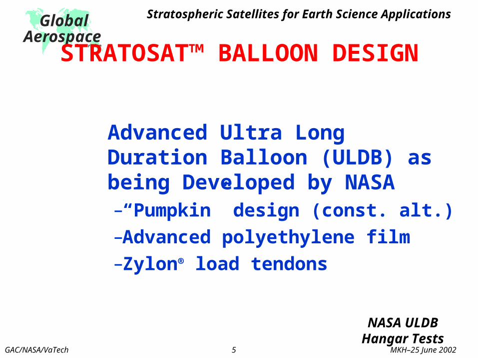
Advanced Ultra Long Duration Balloon (ULDB) as being Developed by NASA–“Pumpkin” design (const. alt.)–Advanced polyethylene film–Zylon® load tendons
Advanced Ultra Long Duration Balloon (ULDB) as being Developed by NASA–“Pumpkin” design (const. alt.)–Advanced polyethylene film–Zylon® load tendons
STRATOSAT™ BALLOON DESIGNSTRATOSAT™ BALLOON DESIGN
NASA ULDBHangar TestsNASA ULDBHangar Tests

Stratospheric Satellites for Earth Science Applications
GAC/NASA/VaTech 6 MKH–25 June 2002
Global Aerospace
Corporation Successful June 2000Sub-scale ULDB Test

Stratospheric Satellites for Earth Science Applications
GAC/NASA/VaTech 7 MKH–25 June 2002
Global Aerospace
Corporation STRATOSAIL® TCS FEATURES
Passively exploits natural wind conditions
Operates day and night Wide range of control
directions Lightweight, <100 kg No consumables Very low power
Relative Wind at Wing
Lateral ForceComponent
Drag ForceComponent
ResultantForce
TCSWingAngle of Attack
Radio-Controlled Dynamically-scaled Model (1:4) Tested in Natural Winds Suspended From Tethered Blimp,
April 2001

STRATOSAIL® TCS ROLL OUTMarch 16, 2002
STRATOSAIL® TCS ROLL OUTMarch 16, 2002
Wing AssemblyWing Assembly
Winch TestbedWinch Testbed

Stratospheric Satellites for Earth Science Applications
GAC/NASA/VaTech 9 MKH–25 June 2002
Global Aerospace
Corporation
SCIENCE APPLICATIONS

Stratospheric Satellites for Earth Science Applications
GAC/NASA/VaTech 10 MKH–25 June 2002
Global Aerospace
Corporation VECTOR MAGNETIC FIELD
• ESE QuestionWhat are the motions of the Earth’s interior?
• MeasurementMagnetic field gradient
• Advantages– Cover oceans and
remote areas
– Increased range
– Eliminate ionospheric noise

Stratospheric Satellites for Earth Science Applications
GAC/NASA/VaTech 11 MKH–25 June 2002
Global Aerospace
Corporation
RADIATIVE FLUXES AT TOA
• ESE QuestionWhat trends in solar radiation are driving global climate?
• MeasurementRadiative fluxes at TOA
• AdvantagesNo radiance-to-flux conversion
Obtain “ground truth”
Observe ERB dynamics

Stratospheric Satellites for Earth Science Applications
GAC/NASA/VaTech 12 MKH–25 June 2002
Global Aerospace
Corporation ATMOSPHERIC CHEMISTRY• ESE Question
How is stratospheric ozone changing?
• MeasurementsRemote and in-situ measurements of vertical profiles of temperature, pressure, ozone, water vapor, and tracer elements
• AdvantagesNo other known method can characterize “trop-strat” exchange and tropical pipe boundaries

Stratospheric Satellites for Earth Science Applications
GAC/NASA/VaTech 13 MKH–25 June 2002
Global Aerospace
Corporation
SIMULATIONS OFSTRATOSAT™ CONSTELLATIONS

Stratospheric Satellites for Earth Science Applications
GAC/NASA/VaTech 14 MKH–25 June 2002
Global Aerospace
Corporation IMPORTANCE OF CONSTELLATIONS
• Multiple platforms provide unprecedented observing opportunities– Coordinated measurements– Adaptive observing capabilities– Global coverage at TOA
• Reduce unit cost of individual platforms
• Expand thinking about stratospheric in-situ observations

Stratospheric Satellites for Earth Science Applications
GAC/NASA/VaTech 15 MKH–25 June 2002
Global Aerospace
Corporation
HEMISPHERIC CONSTELLATION
LegendRed = balloon positionYellow = 2° elevation angle view zoneGreen = zone overlap
• 383 platforms (35 km)• StratoSail® TCS (20 km)• Control
– “Flock of Birds”
– 15° to pole
– Maintain uniform coverage
• 1 year• 173,000x real time• UKMO data
A simulation movie wasincluded here with the original
presentation.

Stratospheric Satellites for Earth Science Applications
GAC/NASA/VaTech 16 MKH–25 June 2002
Global Aerospace
Corporation ADAPTIVE CONSTELLATION
• 100 platforms (35 km)• StratoSail® TCS (20 km)• 4 Targets
(Natural Disasters)• Control
– “Flock of Birds”– ±20° latitude – Maintain Latitude– Overfly target
• 1 year • 350,000x real time• UKMO data Legend
Red = balloon positionYellow = 2° elevation angle view zoneGreen = zone overlap
A simulation movie wasincluded here with the original
presentation.

Stratospheric Satellites for Earth Science Applications
GAC/NASA/VaTech 17 MKH–25 June 2002
Global Aerospace
Corporation
SUMMARY• NASA’s ESE would benefit tremendously from long-
duration, autonomously coordinated, in-situ measurements in the stratosphere
• StratoSat™ platforms can contribute to Earth science vision
• Development of platform architecture could revolutionize Earth science by answering fundamental questions about– Atmospheric chemistry
– Earth radiation balance
– Geomagnetism

Stratospheric Satellites for Earth Science Applications
GAC/NASA/VaTech 18 MKH–25 June 2002
Global Aerospace
Corporation