Embed Size (px)
Citation preview
Implementing an APDM 5.0 Geodatabasefor Pipeline Integrity Management ESRI Petroleum User Group 2011
Strategies for Implementing and APDM 5.0 Geodatabase for Pipeline Integrity Management
Jimmy Milhoan – Enogex/OGEPeter Veenstra – Eagle Information Mapping
April 2011
Implementing an APDM 5.0 Geodatabasefor Pipeline Integrity Management ESRI Petroleum User Group 2011
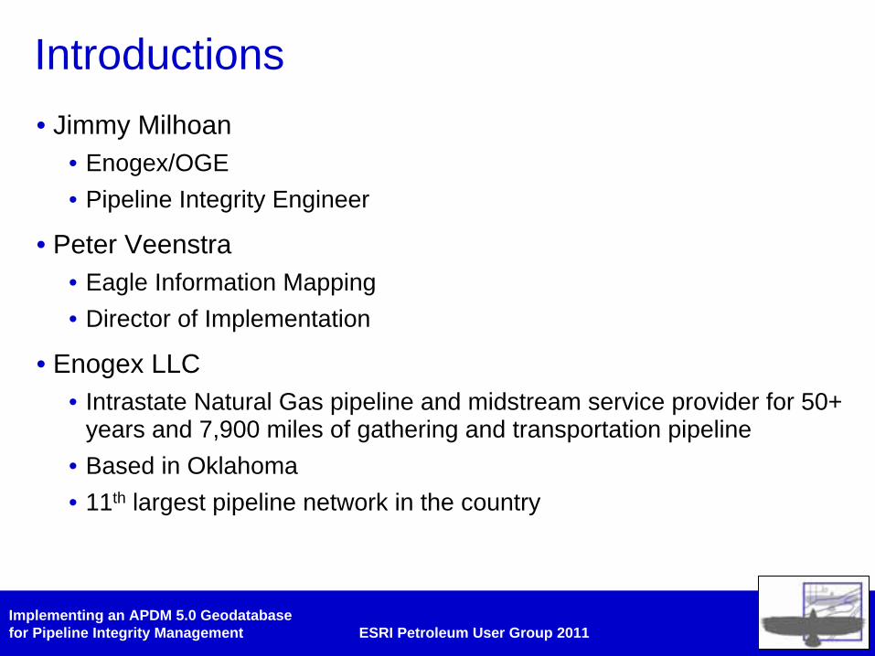
Introductions• Jimmy Milhoan
• Enogex/OGE• Pipeline Integrity Engineer
• Peter Veenstra• Eagle Information Mapping• Director of Implementation
• Enogex LLC• Intrastate Natural Gas pipeline and midstream service provider for 50+
years and 7,900 miles of gathering and transportation pipeline• Based in Oklahoma• 11th largest pipeline network in the country
Implementing an APDM 5.0 Geodatabasefor Pipeline Integrity Management ESRI Petroleum User Group 2011
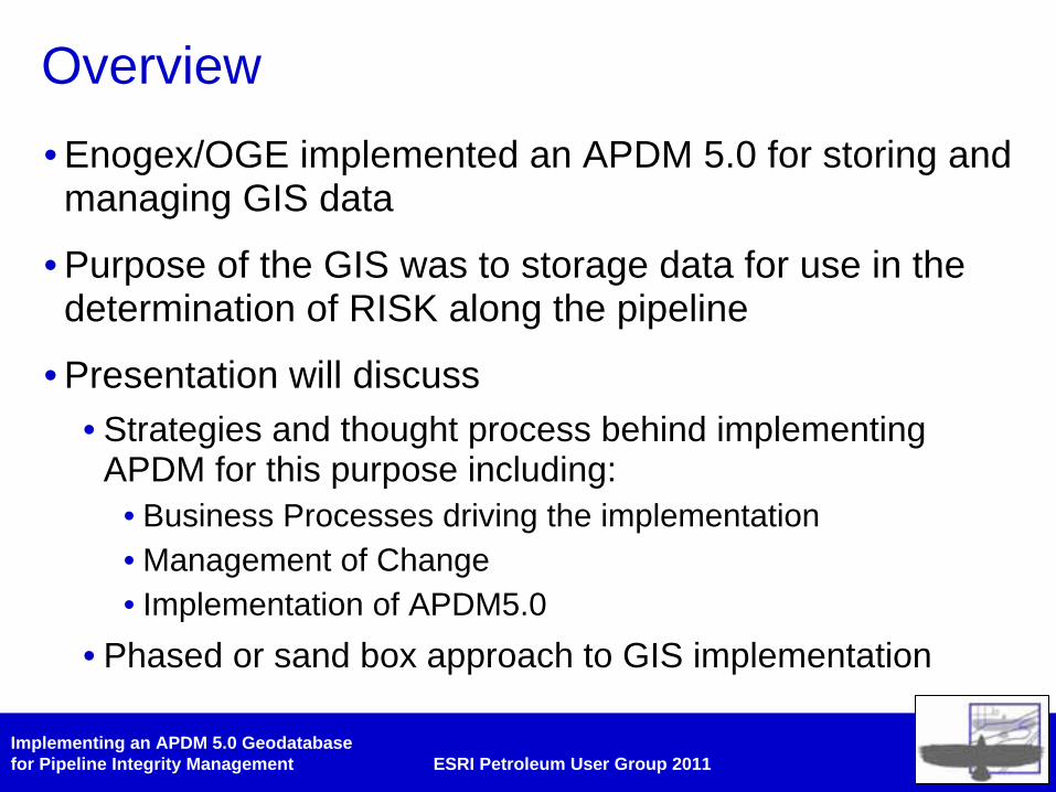
Overview• Enogex/OGE implemented an APDM 5.0 for storing and managing GIS data
• Purpose of the GIS was to storage data for use in the determination of RISK along the pipeline
• Presentation will discuss• Strategies and thought process behind implementing
APDM for this purpose including:• Business Processes driving the implementation• Management of Change• Implementation of APDM5.0
• Phased or sand box approach to GIS implementation
Implementing an APDM 5.0 Geodatabasefor Pipeline Integrity Management ESRI Petroleum User Group 2011
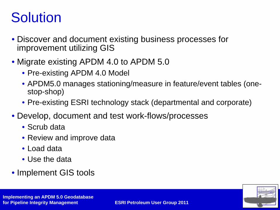
Solution• Discover and document existing business processes for
improvement utilizing GIS• Migrate existing APDM 4.0 to APDM 5.0
• Pre-existing APDM 4.0 Model• APDM5.0 manages stationing/measure in feature/event tables (one-
stop-shop)• Pre-existing ESRI technology stack (departmental and corporate)
• Develop, document and test work-flows/processes• Scrub data• Review and improve data• Load data• Use the data
• Implement GIS tools
Implementing an APDM 5.0 Geodatabasefor Pipeline Integrity Management ESRI Petroleum User Group 2011
Business Process Discovery• Discovery workshop was conducted focusing on two most
important business process/drivers• Calculation of RISK• ILI data loading
• “As-Is” processes were documented
• “To-Be” processes were developed utilizing GIS technology (where appropriate) to improve and stream-line work
• Critical step in the process• What drives the business?• How will the data model be modified to support the drivers?
Implementing an APDM 5.0 Geodatabasefor Pipeline Integrity Management ESRI Petroleum User Group 2011
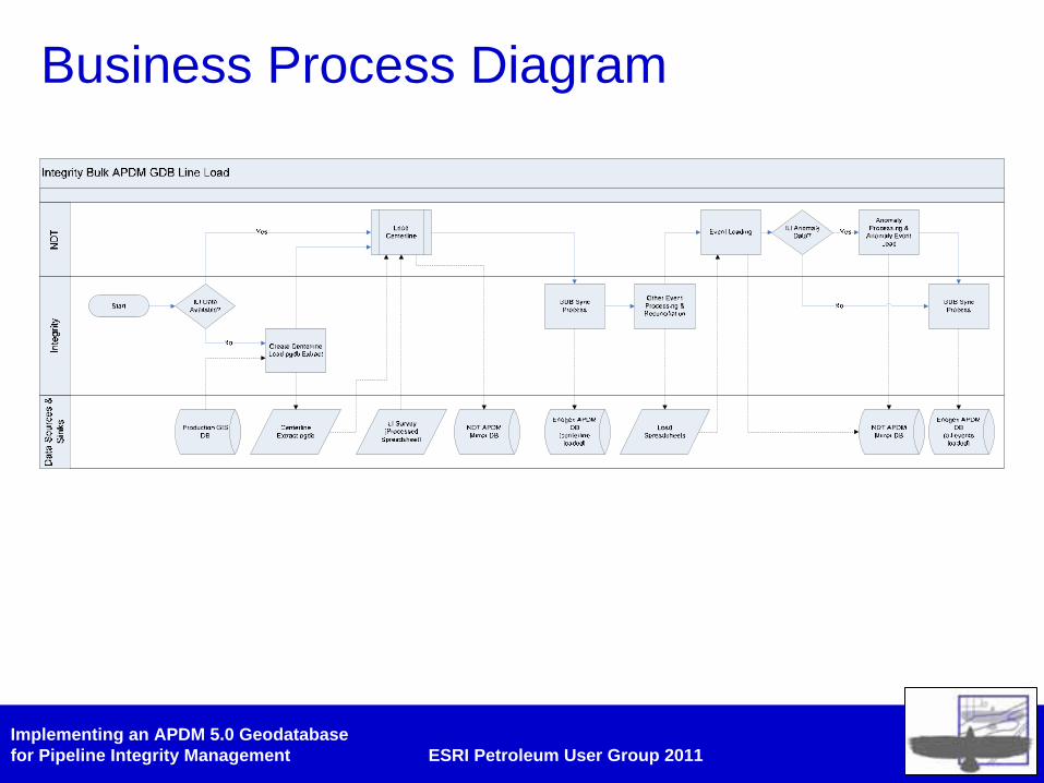
Business Process Diagram
Implementing an APDM 5.0 Geodatabasefor Pipeline Integrity Management ESRI Petroleum User Group 2011
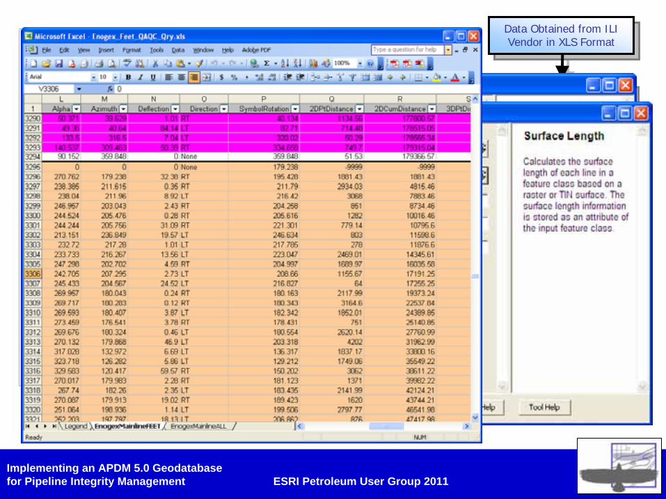
Business Process Load ILI Data – (Update and Improve Centerline)
• “As-Is”• Data was obtained from ILI vendor in XLS• Previous line in APDM was deleted (no history)• New line was imported using XY XLS from smart pig• Stationing was derived as 2D distance• Event data was plotted and stored
• Improvements• Duplicate control points filtered out using a Python script • Stationing WOW’s identified using Python script• Real 3D stationing calculated using ArcToolbox Tools• “De-activate” previous line and delete from GIS (with Archiving
turned on!)• Use PDMT data load for loading
• Centerline (LineLoop, StationSeries, ControlPoint)• Activities• Features and Anomalies
• Validate and review data (manually at first, then via alignment sheets)
Data Obtained from ILI Vendor in XLS Format
Data Obtained from ILI Vendor in XLS Format
Previous line in APDM Deleted
Previous line in APDM Deleted
New Line Imported using XY and M
New Line Imported using XY and M
Stationing derived using 2D distance (no M
or QA)
Stationing derived using 2D distance (no M
or QA)
APDMAPDM
Event Data Plotted/LoadedEvent Data Plotted/Loaded
Implementing an APDM 5.0 Geodatabasefor Pipeline Integrity Management ESRI Petroleum User Group 2011
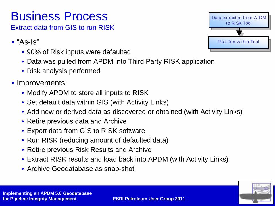
Business Process Extract data from GIS to run RISK
• “As-Is”• 90% of Risk inputs were defaulted• Data was pulled from APDM into Third Party RISK application• Risk analysis performed
• Improvements• Modify APDM to store all inputs to RISK• Set default data within GIS (with Activity Links)• Add new or derived data as discovered or obtained (with Activity Links)• Retire previous data and Archive• Export data from GIS to RISK software• Run RISK (reducing amount of defaulted data)• Retire previous Risk Results and Archive• Extract RISK results and load back into APDM (with Activity Links)• Archive Geodatabase as snap-shot
Data extracted from APDM to RISK Tool
Data extracted from APDM to RISK Tool
Risk Run within ToolRisk Run within Tool
Implementing an APDM 5.0 Geodatabasefor Pipeline Integrity Management ESRI Petroleum User Group 2011
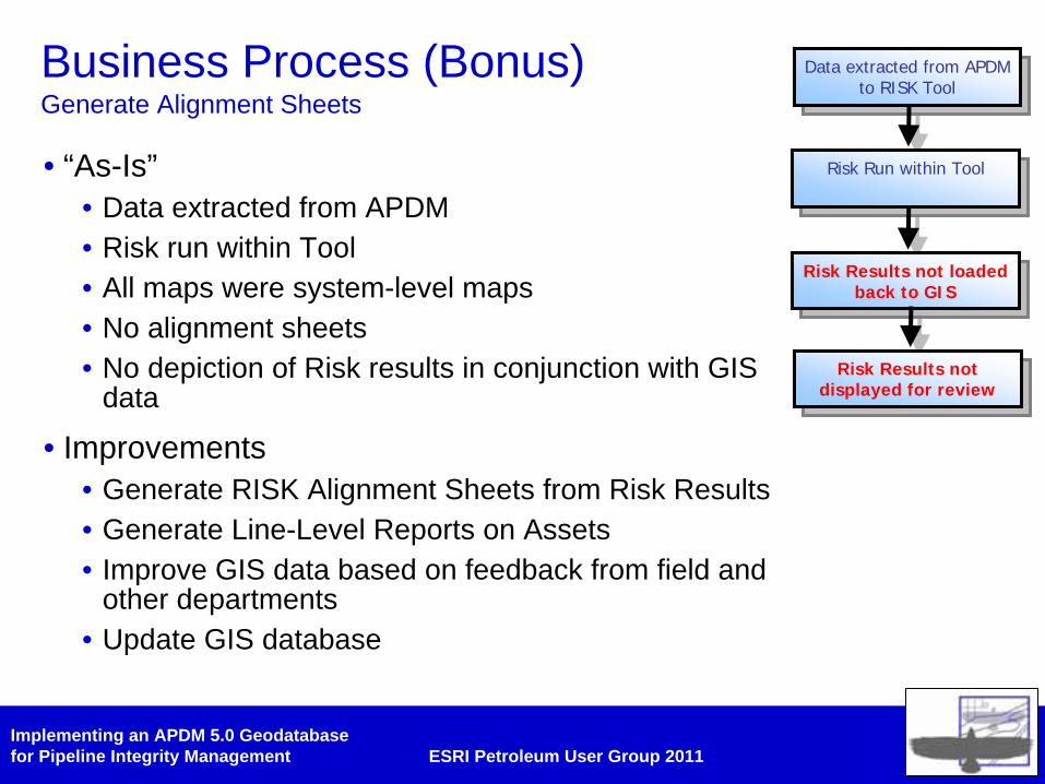
Business Process (Bonus) Generate Alignment Sheets
• “As-Is”• Data extracted from APDM• Risk run within Tool• All maps were system-level maps• No alignment sheets• No depiction of Risk results in conjunction with GIS
data
• Improvements• Generate RISK Alignment Sheets from Risk Results• Generate Line-Level Reports on Assets• Improve GIS data based on feedback from field and
other departments• Update GIS database
Data extracted from APDM to RISK Tool
Data extracted from APDM to RISK Tool
Risk Run within ToolRisk Run within Tool
Risk Results not loaded back to GIS
Risk Results not loaded back to GIS
Risk Results not displayed for review
Risk Results not displayed for review
Implementing an APDM 5.0 Geodatabasefor Pipeline Integrity Management ESRI Petroleum User Group 2011
Implementing an APDM 5.0 Geodatabasefor Pipeline Integrity Management ESRI Petroleum User Group 2011
Ancillary Benefits• Data quality through feed-back loop
• Integrity Engineers were forced to understand the data model through the context of the underlying business process
• Clients forced to think about their data and focus on loading and understand the process of loading data for input to RISK only.
• Increased confidence in data for reporting and GIS-based investigation of threats-of-concern
• RISK results and pipeline condition could easily be conveyed to stake-holders
• RISK results were visualized within the context of each line
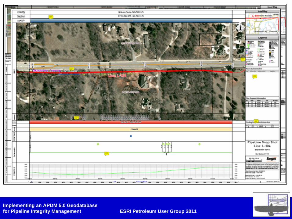
• Request for ‘Snap-Shot’ alignment sheet for field use (preliminary dig-sheet)
Implementing an APDM 5.0 Geodatabasefor Pipeline Integrity Management ESRI Petroleum User Group 2011
Data Model Strategies (APDM5.0)• Only implement what you need
• Activities and Activity Extender Tables (Object Classes)
• RiskFactor Feature Class
• LineOperationalUse Feature Class
• Management of Change
Implementing an APDM 5.0 Geodatabasefor Pipeline Integrity Management ESRI Petroleum User Group 2011
Data Model Strategies (I) Only use what you need …
• APDM is a template• Core (Cookie-Cutter)• Concrete (Optional Classes)• Essentially addititive
• Visio UML is the data model• Turn off inheritance (remove umbrella arrow)• Classes are not implemented via the case tool
wizard• Class remain for future happiness
Implementing an APDM 5.0 Geodatabasefor Pipeline Integrity Management ESRI Petroleum User Group 2011
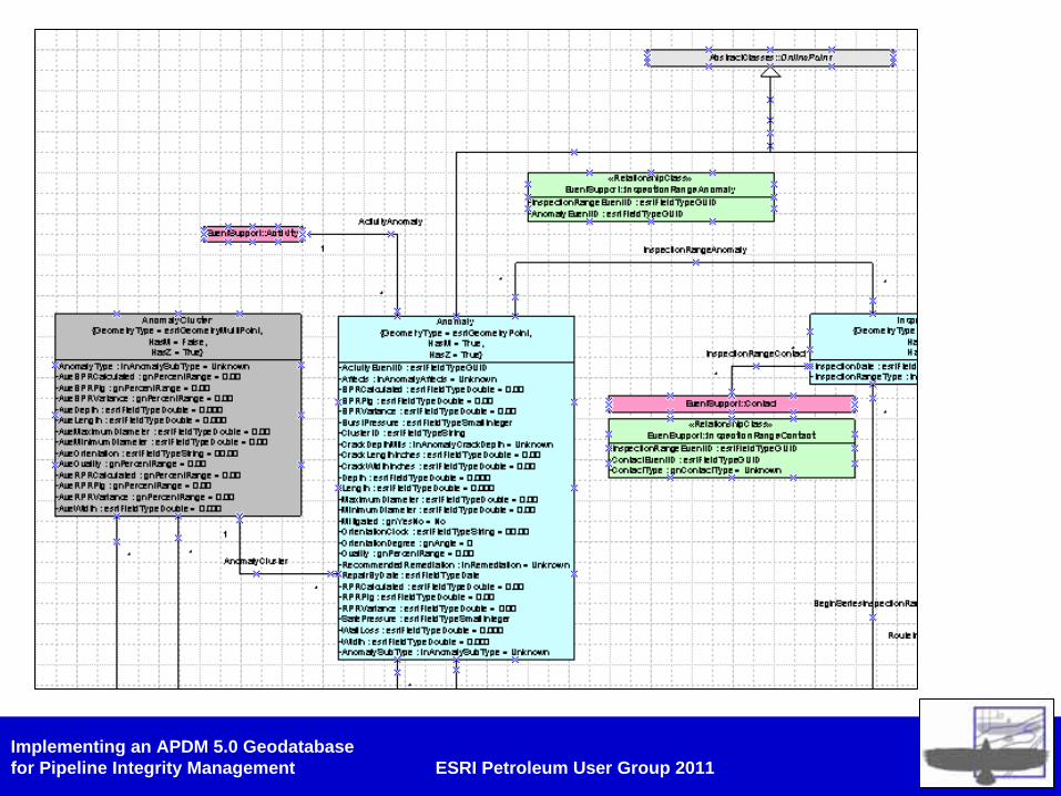
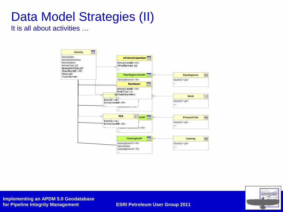
Data Model Strategies (II) It is all about activities …
• Activities• Audit tables are ‘activity link’ tables• Designed to track ‘life-of-pipe’ events• Can be used to store history or comments• Link records in separate tables under one ‘event’
• Direct-relate to Activity• Good for ‘conditions’ or ‘results’ or ‘events’
• Activity Extender Table• Additional meta-data for activities
Implementing an APDM 5.0 Geodatabasefor Pipeline Integrity Management ESRI Petroleum User Group 2011
Data Model Strategies (II) It is all about activities …
EventID <pk>
PipeSegment
EventID <pk>
Weld
EventID <pk>
PressureTest
EventID <pk>
Coating
ActivityEventID <fk>ActivityDatePipeSegmentEventID <fk>...
PipeSegmentAudit
ActivityEventID <fk>ActivityDateWeldEventID <fk>...
WeldAudit
ActivityEventID <fk>ActivityDatePressureTestEventID <fk>...
PressureTestAudit
ActivityEventID <fk>ActivityDateCoatingEventID <fk>...
CoatingAudit
ActivityDateActivityDescriptionActivityNameActivityType (d)
Activity
Implementing an APDM 5.0 Geodatabasefor Pipeline Integrity Management ESRI Petroleum User Group 2011
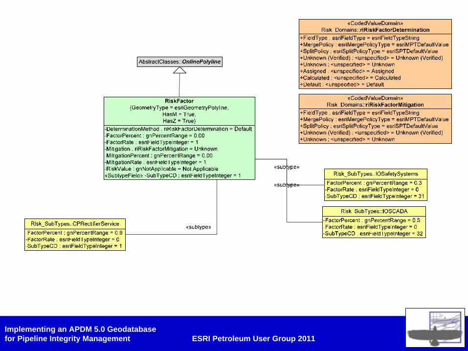
Data Model Strategies (III) Risky Business…
• RiskFactor• Allows storage of inputs to RISK that do not belong in
other feature classes• Reduces the amount of relationships• Utilizes sub-types
• Linear Feature Class• Has sub-type• Has one or more string, integer and double fields• Has domains describing conditions• Can store RISK factors
Implementing an APDM 5.0 Geodatabasefor Pipeline Integrity Management ESRI Petroleum User Group 2011
Implementing an APDM 5.0 Geodatabasefor Pipeline Integrity Management ESRI Petroleum User Group 2011
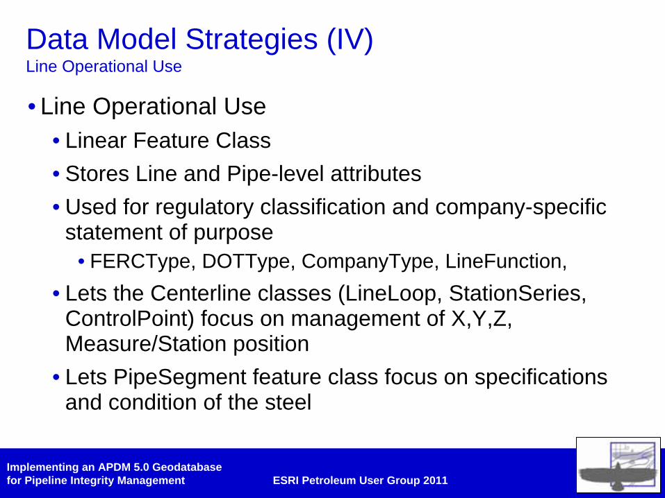
Data Model Strategies (IV) Line Operational Use
• Line Operational Use• Linear Feature Class• Stores Line and Pipe-level attributes• Used for regulatory classification and company-specific
statement of purpose• FERCType, DOTType, CompanyType, LineFunction,
• Lets the Centerline classes (LineLoop, StationSeries, ControlPoint) focus on management of X,Y,Z, Measure/Station position
• Lets PipeSegment feature class focus on specifications and condition of the steel
Implementing an APDM 5.0 Geodatabasefor Pipeline Integrity Management ESRI Petroleum User Group 2011
Management of Change
• Activities• Track what happens to the pipeline, when and where• Plan what should happen to the pipeline, when and where• Identify the ‘delta’s’
• In-line History• OperationalStatus, Status, HistoricalState,
EffectiveTo/FromDate
• Archiving and Versioning
• Schema Updates and Modifications
Implementing an APDM 5.0 Geodatabasefor Pipeline Integrity Management ESRI Petroleum User Group 2011
Management of Change Archiving
• Archiving is a Geodatabase function
• Archiving creates a set of “_H” tables within the geodatabase
• Changes to the database are recorded each time a version is posted to default
• Only records the delta’s the default version
• Must be implemented with a versioning strategy that makes sense
• Can take a ‘snap-shot’ of the database
Implementing an APDM 5.0 Geodatabasefor Pipeline Integrity Management ESRI Petroleum User Group 2011
Management of Change Versioning
• Daily Post
• Weekly Post
Implementing an APDM 5.0 Geodatabasefor Pipeline Integrity Management ESRI Petroleum User Group 2011
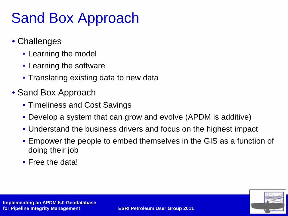
Sand Box Approach• Challenges
• Learning the model• Learning the software• Translating existing data to new data
• Sand Box Approach• Timeliness and Cost Savings• Develop a system that can grow and evolve (APDM is additive)• Understand the business drivers and focus on the highest impact• Empower the people to embed themselves in the GIS as a function of
doing their job• Free the data!
Implementing an APDM 5.0 Geodatabasefor Pipeline Integrity Management ESRI Petroleum User Group 2011
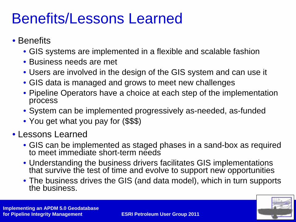
Benefits/Lessons Learned• Benefits
• GIS systems are implemented in a flexible and scalable fashion• Business needs are met• Users are involved in the design of the GIS system and can use it• GIS data is managed and grows to meet new challenges• Pipeline Operators have a choice at each step of the implementation
process• System can be implemented progressively as-needed, as-funded• You get what you pay for ($$$)
• Lessons Learned• GIS can be implemented as staged phases in a sand-box as required
to meet immediate short-term needs• Understanding the business drivers facilitates GIS implementations
that survive the test of time and evolve to support new opportunities• The business drives the GIS (and data model), which in turn supports
the business.
Implementing an APDM 5.0 Geodatabasefor Pipeline Integrity Management ESRI Petroleum User Group 2011
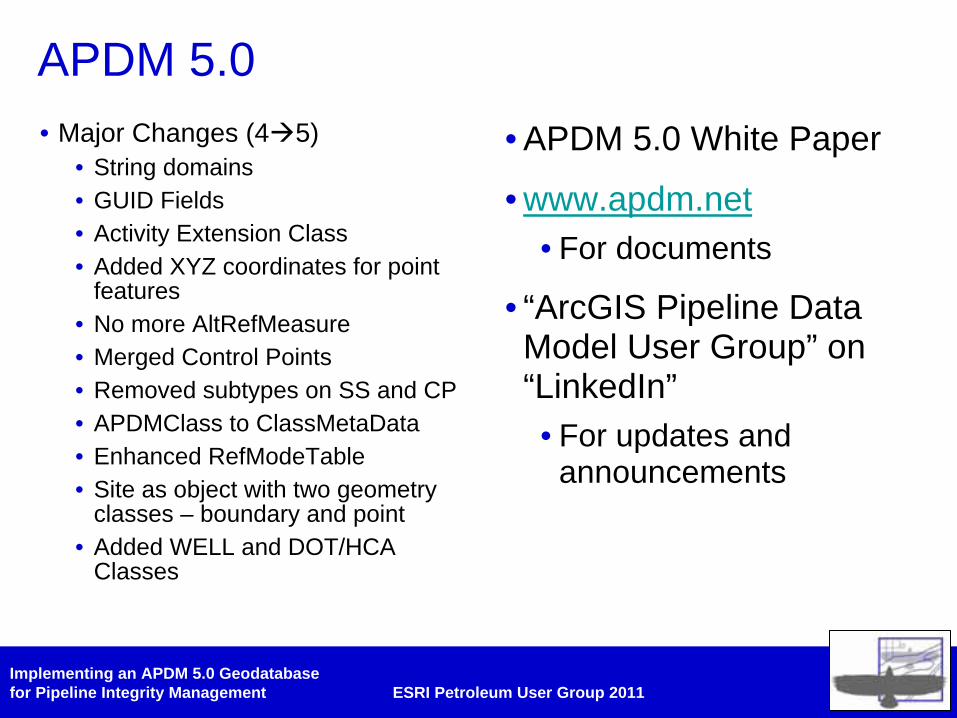
APDM 5.0• Major Changes (4 5)
• String domains• GUID Fields• Activity Extension Class• Added XYZ coordinates for point
features• No more AltRefMeasure• Merged Control Points• Removed subtypes on SS and CP• APDMClass to ClassMetaData• Enhanced RefModeTable• Site as object with two geometry
classes – boundary and point• Added WELL and DOT/HCA
Classes
• APDM 5.0 White Paper
• www.apdm.net• For documents
• “ArcGIS Pipeline Data Model User Group” on “LinkedIn”• For updates and
announcements

Implementing an APDM 5.0 Geodatabasefor Pipeline Integrity Management ESRI Petroleum User Group 2011
Implementing an APDM 5.0 Geodatabasefor Pipeline Integrity Management ESRI Petroleum User Group 2011
Management of Change Schema Management
Implementing an APDM 5.0 Geodatabasefor Pipeline Integrity Management ESRI Petroleum User Group 2011
Implementing an APDM 5.0 Geodatabasefor Pipeline Integrity Management ESRI Petroleum User Group 2011
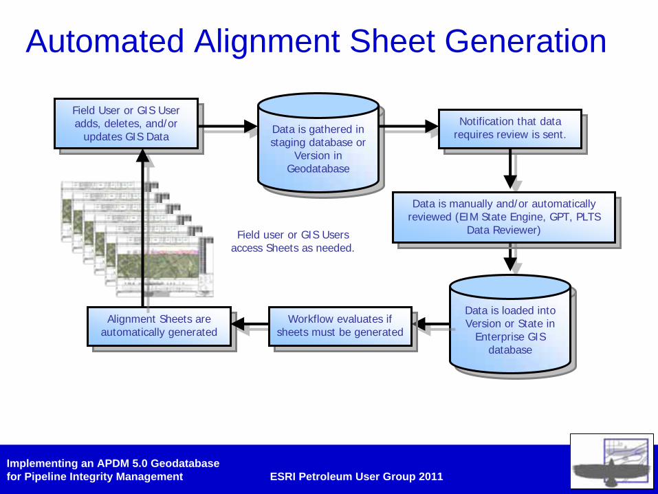
Automated Alignment Sheet Generation
Field User or GIS User adds, deletes, and/or
updates GIS Data
Field User or GIS User adds, deletes, and/or
updates GIS Data Data is gathered in staging database or
Version in Geodatabase
Data is gathered in staging database or
Version in Geodatabase
Notification that data requires review is sent.
Notification that data requires review is sent.
Data is loaded into Version or State in
Enterprise GIS database
Data is loaded into Version or State in
Enterprise GIS database
Alignment Sheets are automatically generated
Alignment Sheets are automatically generated
Workflow evaluates if sheets must be generated
Workflow evaluates if sheets must be generated
Field user or GIS Usersaccess Sheets as needed.
Data is manually and/or automatically reviewed (EIM State Engine, GPT, PLTS
Data Reviewer)
Data is manually and/or automatically reviewed (EIM State Engine, GPT, PLTS
Data Reviewer)