Embed Size (px)
Citation preview
State of Nevada Views on the Proposed Caliente Rail Corridor
Bob HalsteadFred Dilger
State of Nevada Agency for Nuclear ProjectsPresentation to
U.S. Nuclear Waste Technical Review BoardCaliente, NV
February 10, 2005
Additional documentation available athttp://www.state.nv.us/nucwaste/trans.htm
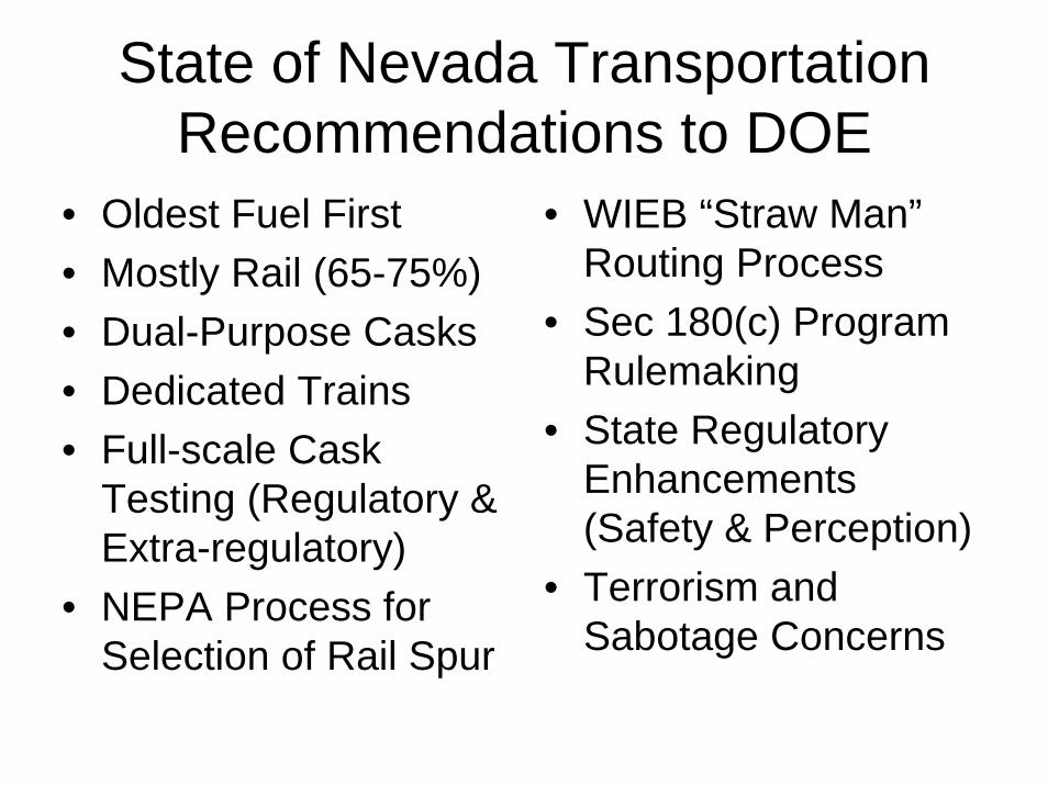
State of Nevada Transportation Recommendations to DOE
• Oldest Fuel First• Mostly Rail (65-75%)• Dual-Purpose Casks• Dedicated Trains• Full-scale Cask
Testing (Regulatory & Extra-regulatory)
• NEPA Process for Selection of Rail Spur
• WIEB “Straw Man” Routing Process
• Sec 180(c) Program Rulemaking
• State Regulatory Enhancements (Safety & Perception)
• Terrorism and Sabotage Concerns
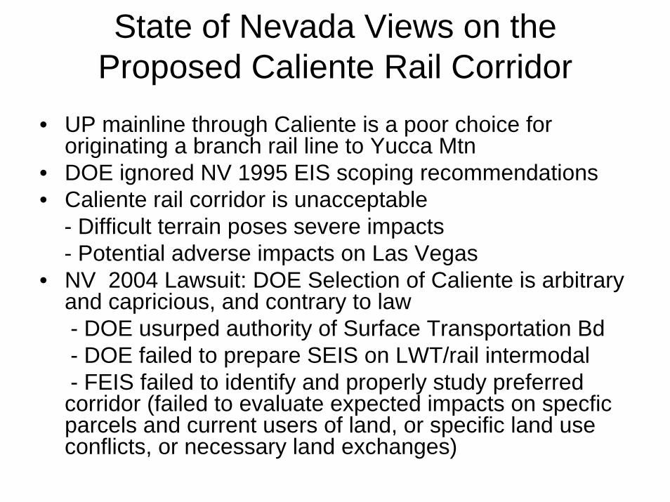
State of Nevada Views on the Proposed Caliente Rail Corridor
• UP mainline through Caliente is a poor choice for originating a branch rail line to Yucca Mtn
• DOE ignored NV 1995 EIS scoping recommendations • Caliente rail corridor is unacceptable
- Difficult terrain poses severe impacts- Potential adverse impacts on Las Vegas
• NV 2004 Lawsuit: DOE Selection of Caliente is arbitrary and capricious, and contrary to law- DOE usurped authority of Surface Transportation Bd- DOE failed to prepare SEIS on LWT/rail intermodal - FEIS failed to identify and properly study preferred corridor (failed to evaluate expected impacts on specficparcels and current users of land, or specific land use conflicts, or necessary land exchanges)
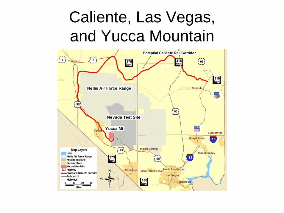
Caliente, Las Vegas, and Yucca Mountain
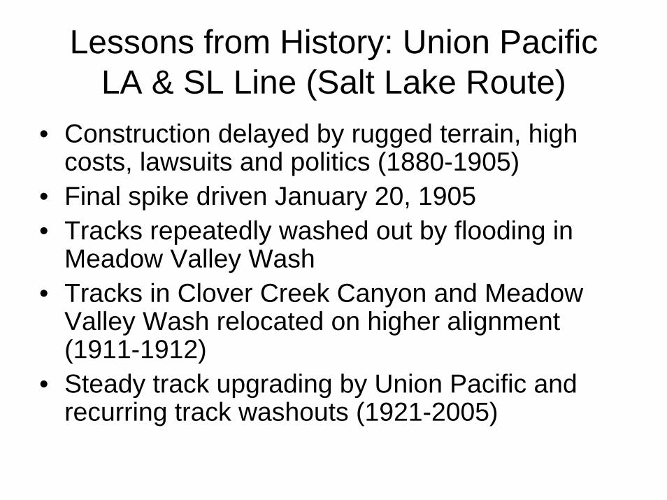
Lessons from History: Union Pacific LA & SL Line (Salt Lake Route)
• Construction delayed by rugged terrain, high costs, lawsuits and politics (1880-1905)
• Final spike driven January 20, 1905 • Tracks repeatedly washed out by flooding in
Meadow Valley Wash• Tracks in Clover Creek Canyon and Meadow
Valley Wash relocated on higher alignment (1911-1912)
• Steady track upgrading by Union Pacific and recurring track washouts (1921-2005)
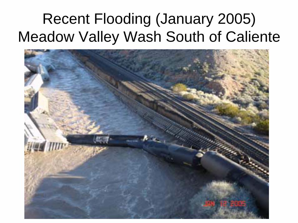
Recent Flooding (January 2005)Meadow Valley Wash South of Caliente
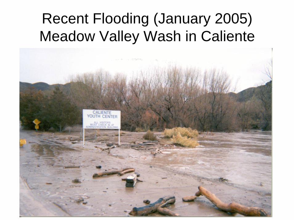
Recent Flooding (January 2005)Meadow Valley Wash in Caliente
UP Route Characteristics & Concerns(Uvada, MP 501.1; Caliente, MP 459.8; Moapa, MP 383.5)
• “The 118-mile study corridor traverses very rugged terrain. The route is confined within the canyon walls of Clover Creek and Meadow Valley Wash. The route exhibits a high degree of curvature as it descends 4,300 ft. from the high plateau at the Utah border to the desert floor beyond the southern end of the study area [Moapa].” (UNR, 1991, p. 25)
• Track equipped with high quality materials and maintained in good to excellent condition
• Steep grades and tight curves require speed restrictions, especially for westbound trains on the downgrade
• 15 tunnels, 107 bridges, 66 culverts• Numerous rockfall areas and flood areas• Updated accident study needed
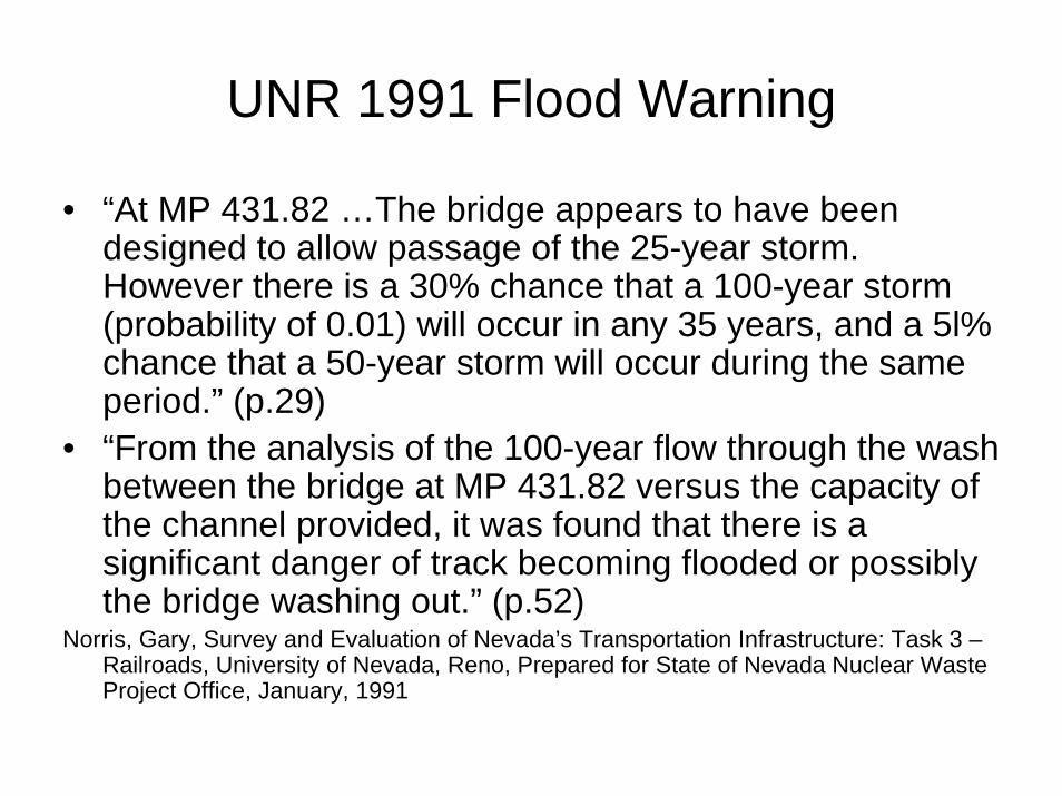
UNR 1991 Flood Warning
• “At MP 431.82 …The bridge appears to have been designed to allow passage of the 25-year storm. However there is a 30% chance that a 100-year storm (probability of 0.01) will occur in any 35 years, and a 5l% chance that a 50-year storm will occur during the same period.” (p.29)
• “From the analysis of the 100-year flow through the wash between the bridge at MP 431.82 versus the capacity of the channel provided, it was found that there is a significant danger of track becoming flooded or possibly the bridge washing out.” (p.52)
Norris, Gary, Survey and Evaluation of Nevada’s Transportation Infrastructure: Task 3 –Railroads, University of Nevada, Reno, Prepared for State of Nevada Nuclear Waste Project Office, January, 1991
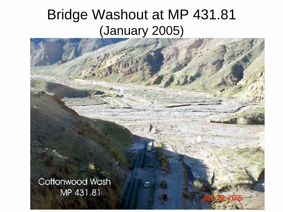
Bridge Washout at MP 431.81(January 2005)
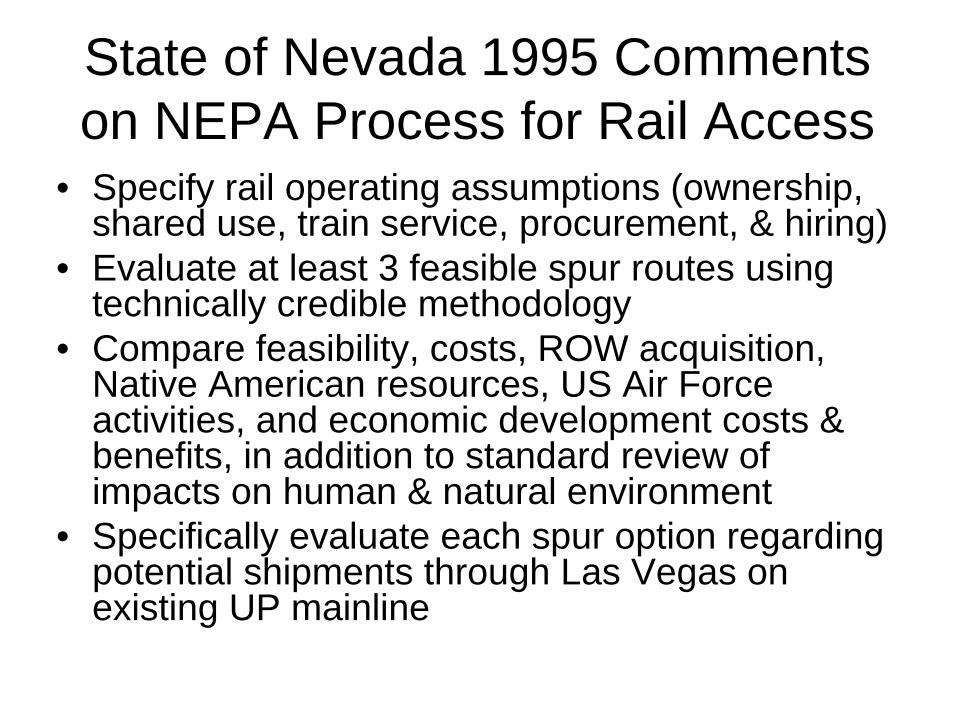
State of Nevada 1995 Comments on NEPA Process for Rail Access
• Specify rail operating assumptions (ownership, shared use, train service, procurement, & hiring)
• Evaluate at least 3 feasible spur routes using technically credible methodology
• Compare feasibility, costs, ROW acquisition, Native American resources, US Air Force activities, and economic development costs & benefits, in addition to standard review of impacts on human & natural environment
• Specifically evaluate each spur option regarding potential shipments through Las Vegas on existing UP mainline
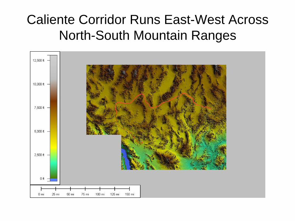
Caliente Corridor Runs East-West Across North-South Mountain Ranges
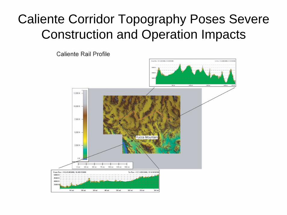
Caliente Corridor Topography Poses Severe Construction and Operation Impacts
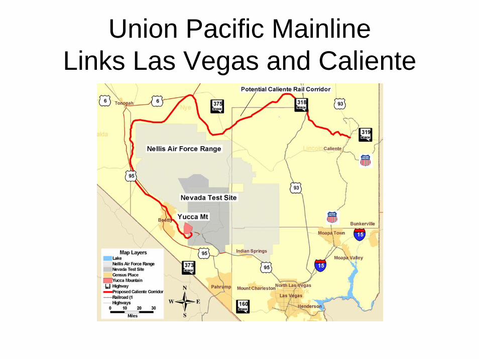
Union Pacific MainlineLinks Las Vegas and Caliente
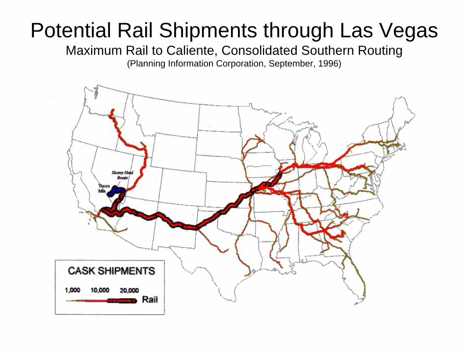
Potential Rail Shipments through Las Vegas Maximum Rail to Caliente, Consolidated Southern Routing
(Planning Information Corporation, September, 1996)
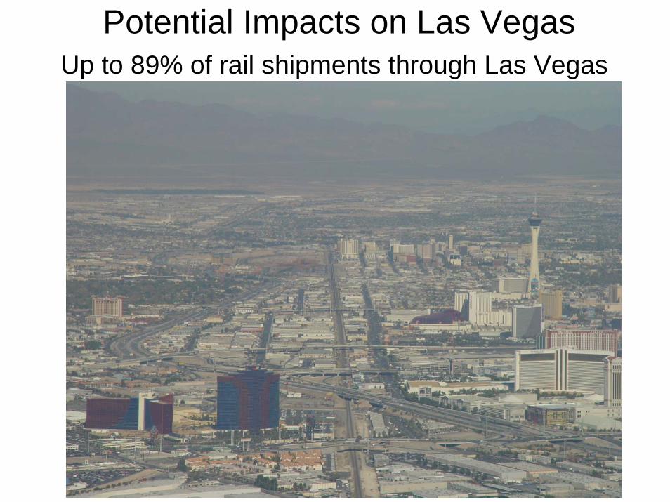
Potential Impacts on Las VegasUp to 89% of rail shipments through Las Vegas
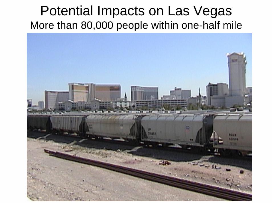
Potential Impacts on Las VegasMore than 80,000 people within one-half mile
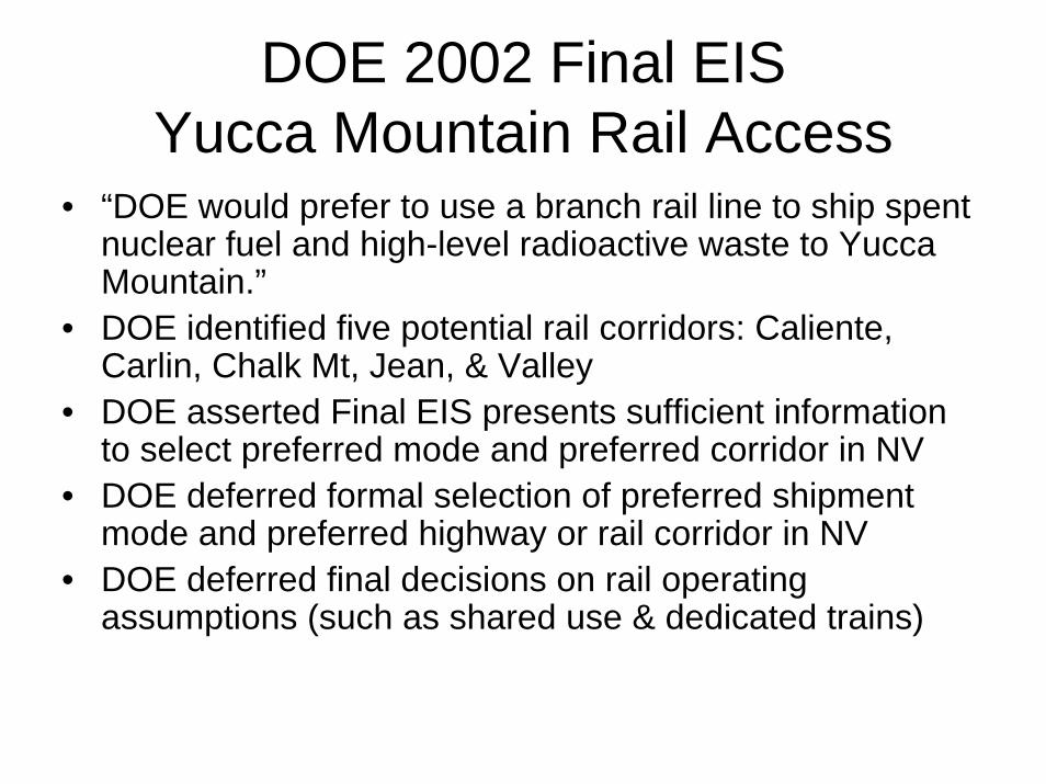
DOE 2002 Final EIS Yucca Mountain Rail Access
• “DOE would prefer to use a branch rail line to ship spent nuclear fuel and high-level radioactive waste to Yucca Mountain.”
• DOE identified five potential rail corridors: Caliente, Carlin, Chalk Mt, Jean, & Valley
• DOE asserted Final EIS presents sufficient information to select preferred mode and preferred corridor in NV
• DOE deferred formal selection of preferred shipment mode and preferred highway or rail corridor in NV
• DOE deferred final decisions on rail operating assumptions (such as shared use & dedicated trains)
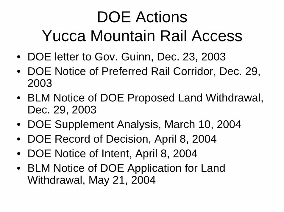
DOE Actions Yucca Mountain Rail Access
• DOE letter to Gov. Guinn, Dec. 23, 2003• DOE Notice of Preferred Rail Corridor, Dec. 29,
2003• BLM Notice of DOE Proposed Land Withdrawal,
Dec. 29, 2003• DOE Supplement Analysis, March 10, 2004• DOE Record of Decision, April 8, 2004• DOE Notice of Intent, April 8, 2004• BLM Notice of DOE Application for Land
Withdrawal, May 21, 2004
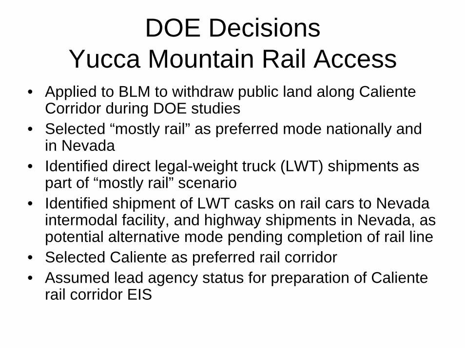
DOE Decisions Yucca Mountain Rail Access
• Applied to BLM to withdraw public land along CalienteCorridor during DOE studies
• Selected “mostly rail” as preferred mode nationally and in Nevada
• Identified direct legal-weight truck (LWT) shipments as part of “mostly rail” scenario
• Identified shipment of LWT casks on rail cars to Nevada intermodal facility, and highway shipments in Nevada, as potential alternative mode pending completion of rail line
• Selected Caliente as preferred rail corridor• Assumed lead agency status for preparation of Caliente
rail corridor EIS
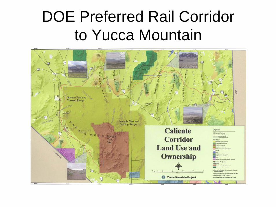
DOE Preferred Rail Corridor to Yucca Mountain
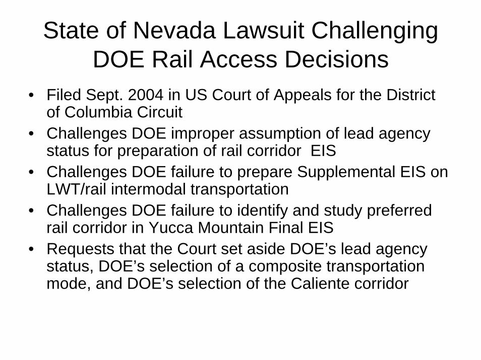
State of Nevada Lawsuit Challenging DOE Rail Access Decisions
• Filed Sept. 2004 in US Court of Appeals for the District of Columbia Circuit
• Challenges DOE improper assumption of lead agency status for preparation of rail corridor EIS
• Challenges DOE failure to prepare Supplemental EIS on LWT/rail intermodal transportation
• Challenges DOE failure to identify and study preferred rail corridor in Yucca Mountain Final EIS
• Requests that the Court set aside DOE’s lead agency status, DOE’s selection of a composite transportation mode, and DOE’s selection of the Caliente corridor
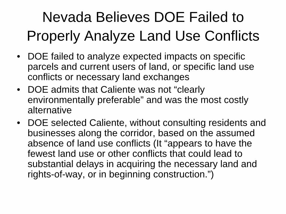
Nevada Believes DOE Failed to Properly Analyze Land Use Conflicts
• DOE failed to analyze expected impacts on specific parcels and current users of land, or specific land use conflicts or necessary land exchanges
• DOE admits that Caliente was not “clearly environmentally preferable” and was the most costly alternative
• DOE selected Caliente, without consulting residents and businesses along the corridor, based on the assumed absence of land use conflicts (It “appears to have the fewest land use or other conflicts that could lead to substantial delays in acquiring the necessary land and rights-of-way, or in beginning construction.”)
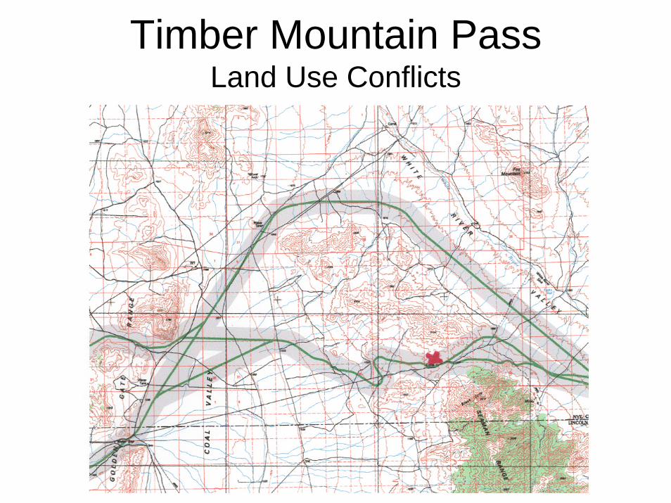
Timber Mountain PassLand Use Conflicts
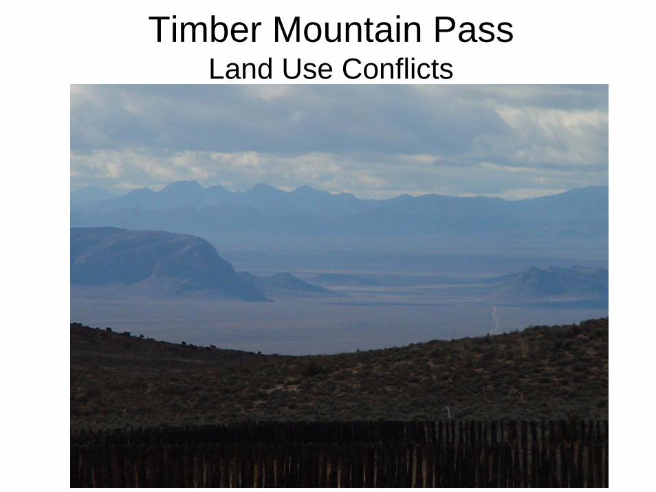
Timber Mountain PassLand Use Conflicts
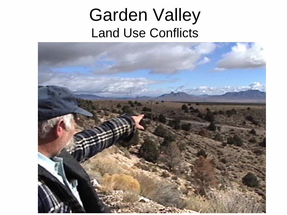
Garden ValleyLand Use Conflicts
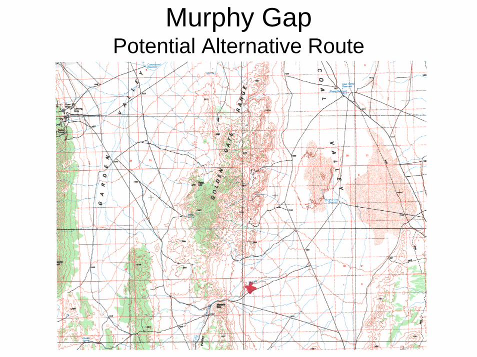
Murphy GapPotential Alternative Route
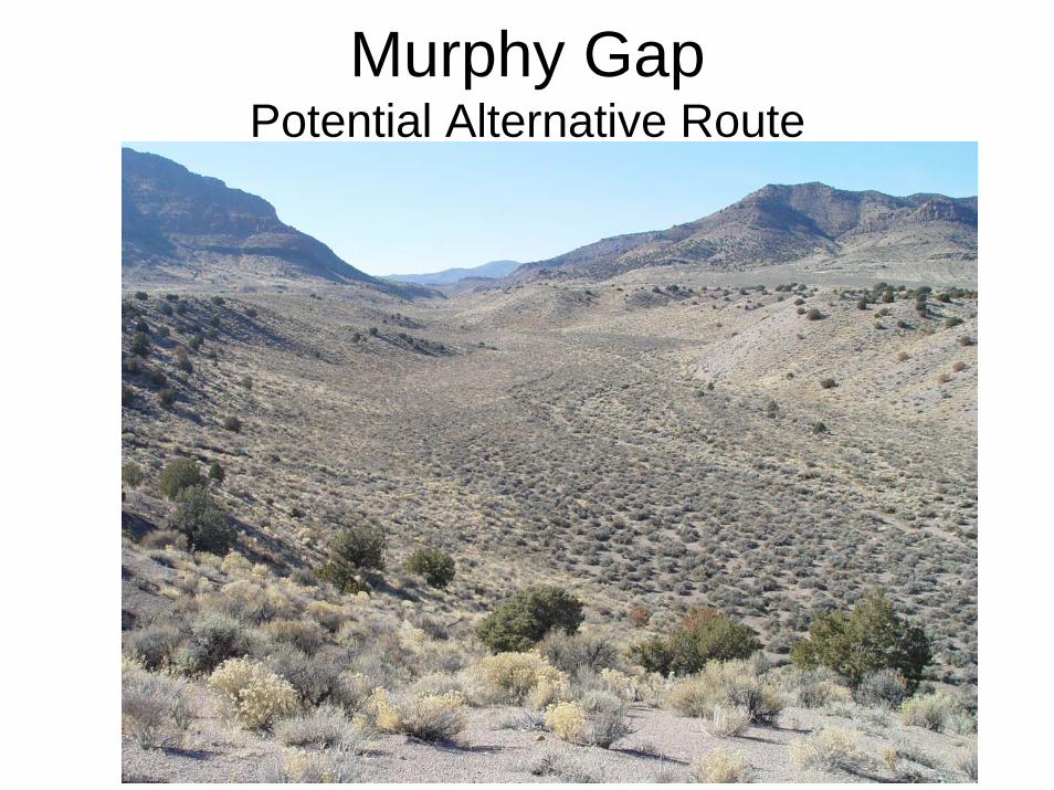
Murphy GapPotential Alternative Route
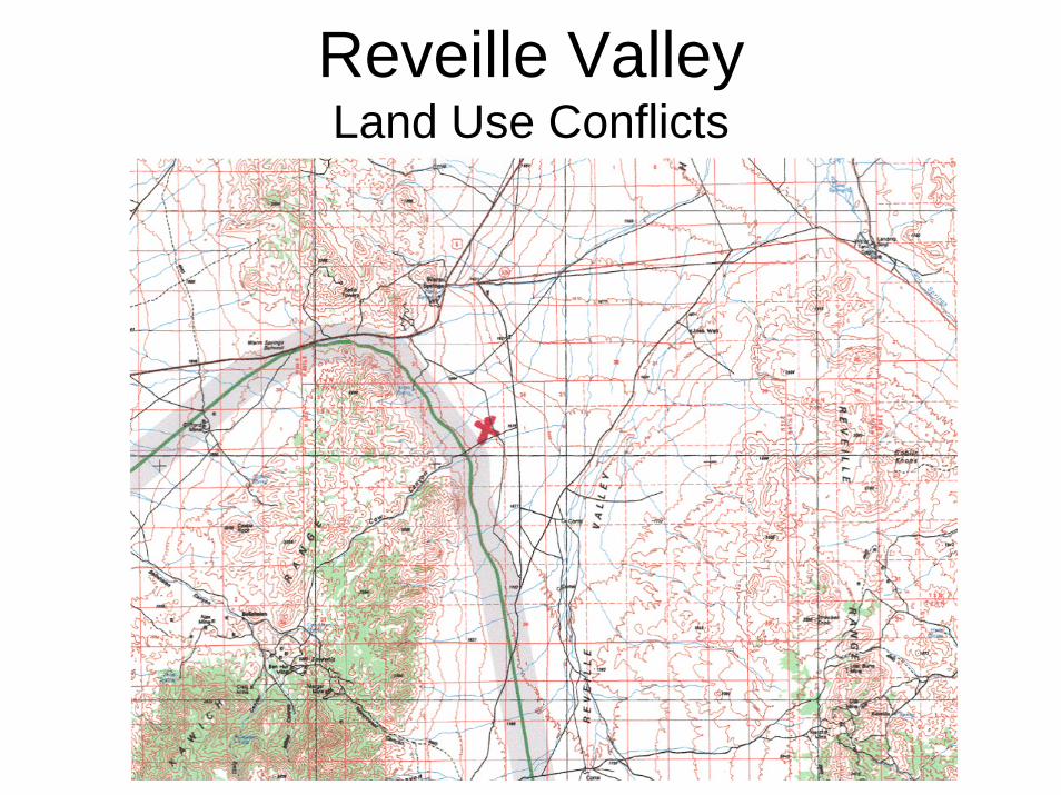
Reveille ValleyLand Use Conflicts
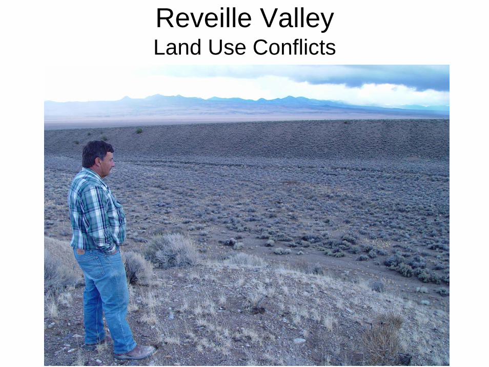
Reveille ValleyLand Use Conflicts
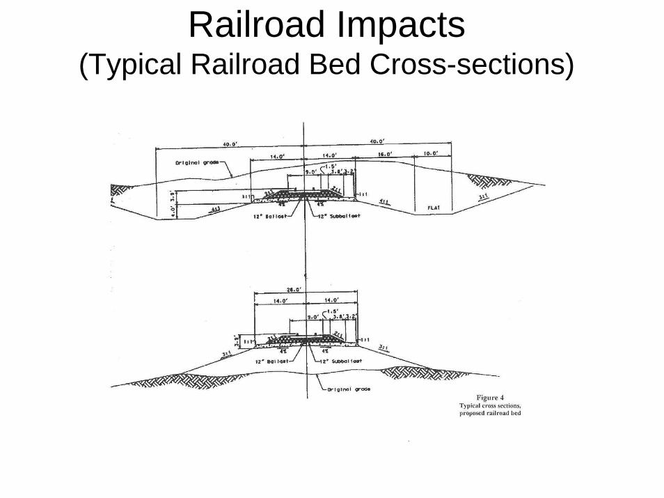
Railroad Impacts(Typical Railroad Bed Cross-sections)
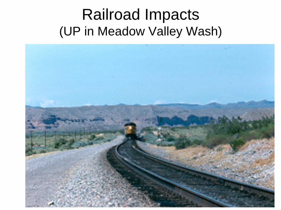
Railroad Impacts(UP in Meadow Valley Wash)
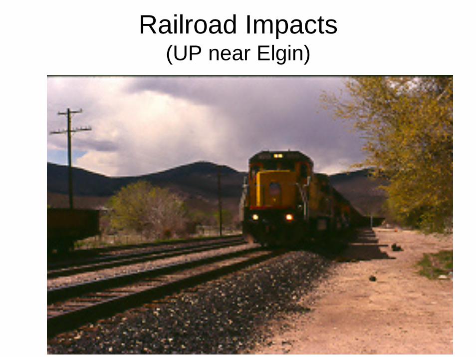
Railroad Impacts(UP near Elgin)
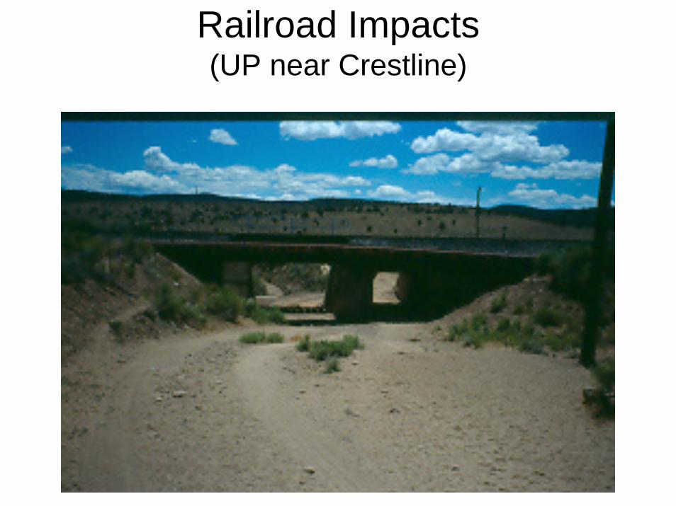
Railroad Impacts(UP near Crestline)
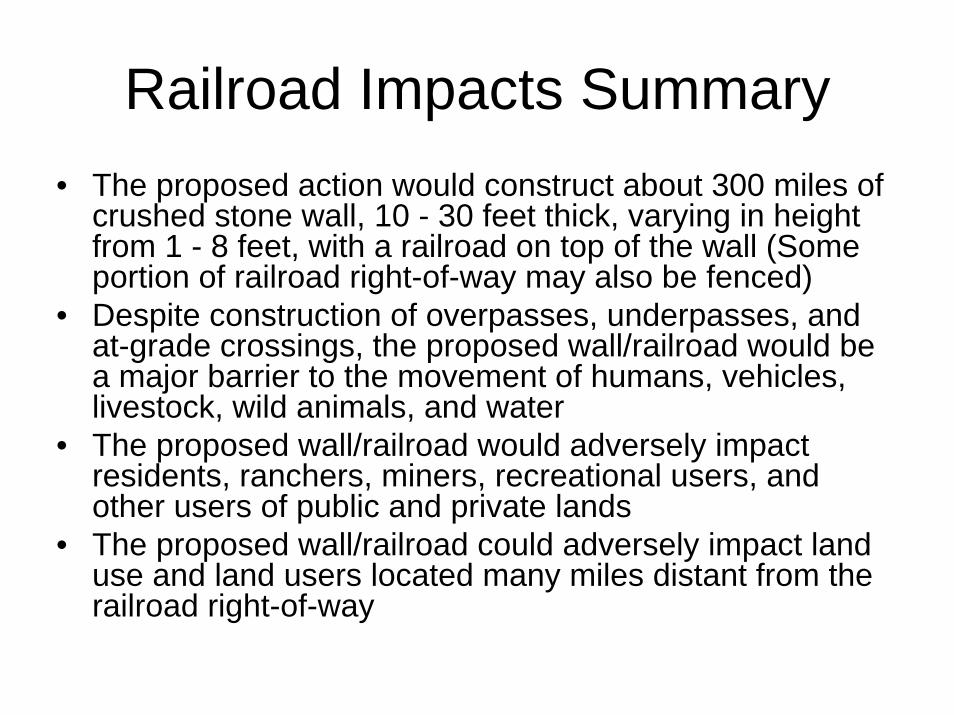
Railroad Impacts Summary• The proposed action would construct about 300 miles of
crushed stone wall, 10 - 30 feet thick, varying in height from 1 - 8 feet, with a railroad on top of the wall (Some portion of railroad right-of-way may also be fenced)
• Despite construction of overpasses, underpasses, and at-grade crossings, the proposed wall/railroad would be a major barrier to the movement of humans, vehicles, livestock, wild animals, and water
• The proposed wall/railroad would adversely impact residents, ranchers, miners, recreational users, and other users of public and private lands
• The proposed wall/railroad could adversely impact land use and land users located many miles distant from the railroad right-of-way