Embed Size (px)
Citation preview

Single base RTK solutions obtained individually with Galileo and BeiDou as well as in combination with other fully operational GNSS
Viktor Mihoković, Luka Zalović, Danijel Šugar
Presented at th
e FIG Congress 2018,
May 6-11, 2018 in
Ista
nbul, Turkey
Outline:• Introduction• Current status of the GNSSes• Real Time Kinematic (RTK)• Geodetic Network Establishment (CROPOS)• RTK measurements
• GNSS receivers & equipment• Mission planning• Accuracy & Precision estimation
• Conclusions
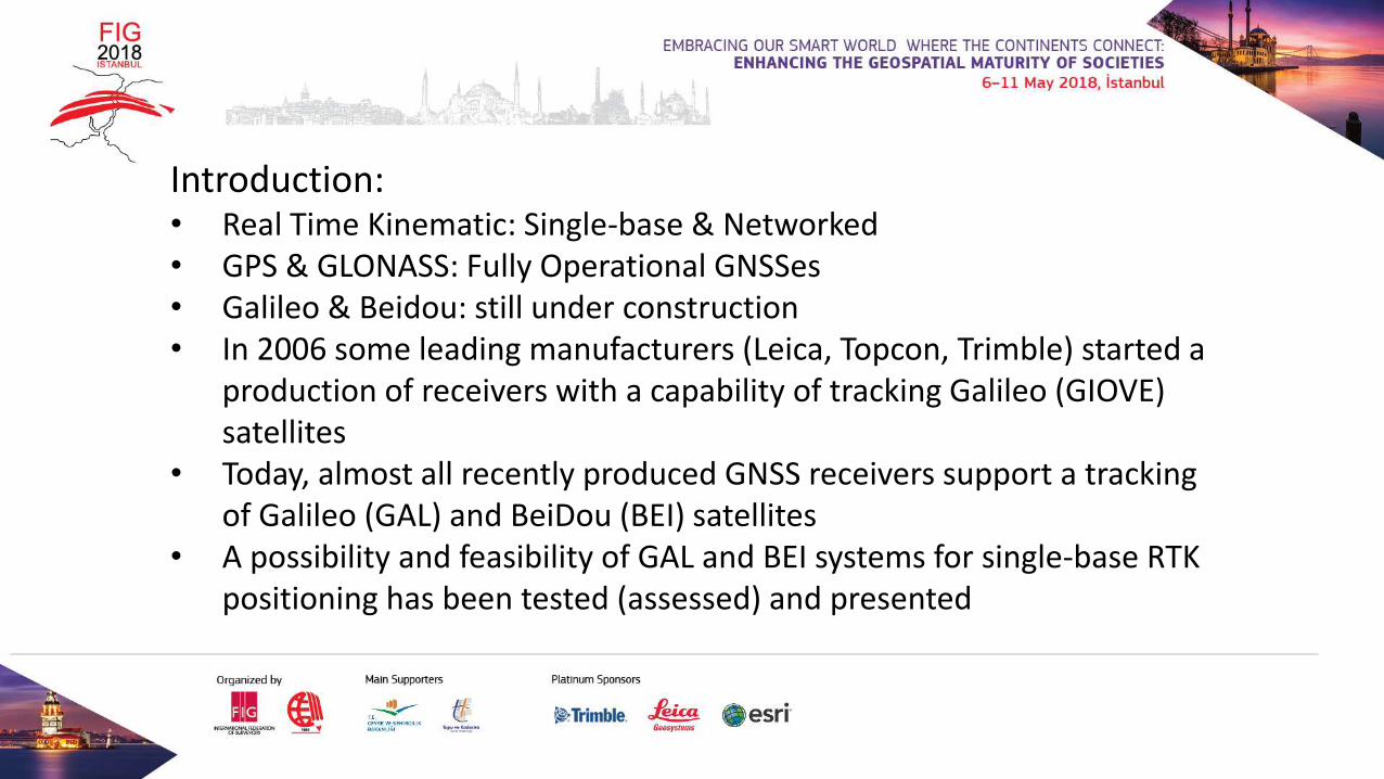
Introduction:• Real Time Kinematic: Single-base & Networked• GPS & GLONASS: Fully Operational GNSSes• Galileo & Beidou: still under construction• In 2006 some leading manufacturers (Leica, Topcon, Trimble) started a
production of receivers with a capability of tracking Galileo (GIOVE) satellites
• Today, almost all recently produced GNSS receivers support a tracking of Galileo (GAL) and BeiDou (BEI) satellites
• A possibility and feasibility of GAL and BEI systems for single-base RTK positioning has been tested (assessed) and presented
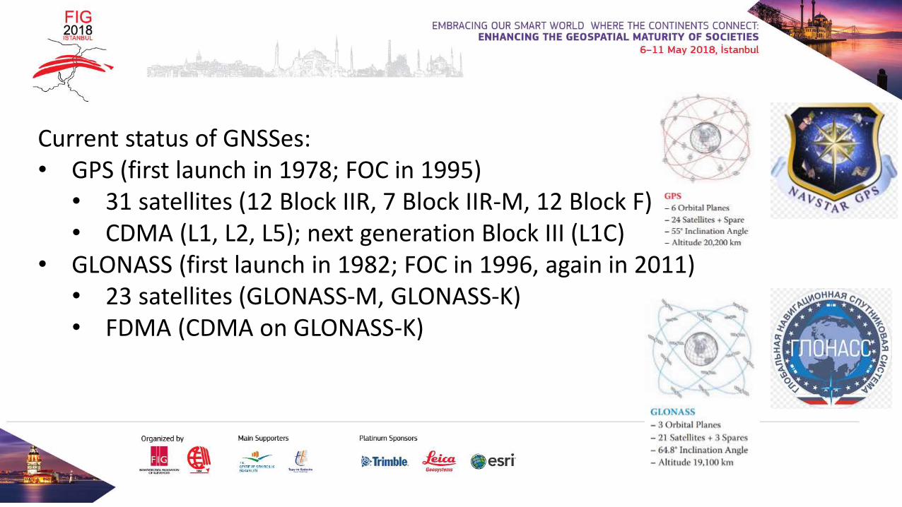
Current status of GNSSes:• GPS (first launch in 1978; FOC in 1995)
• 31 satellites (12 Block IIR, 7 Block IIR-M, 12 Block F)• CDMA (L1, L2, L5); next generation Block III (L1C)
• GLONASS (first launch in 1982; FOC in 1996, again in 2011)• 23 satellites (GLONASS-M, GLONASS-K)• FDMA (CDMA on GLONASS-K)
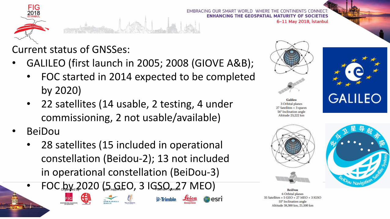
Current status of GNSSes:• GALILEO (first launch in 2005; 2008 (GIOVE A&B);
• FOC started in 2014 expected to be completedby 2020)
• 22 satellites (14 usable, 2 testing, 4 under commissioning, 2 not usable/available)
• BeiDou • 28 satellites (15 included in operational
constellation (Beidou-2); 13 not includedin operational constellation (BeiDou-3)
• FOC by 2020 (5 GEO, 3 IGSO, 27 MEO)
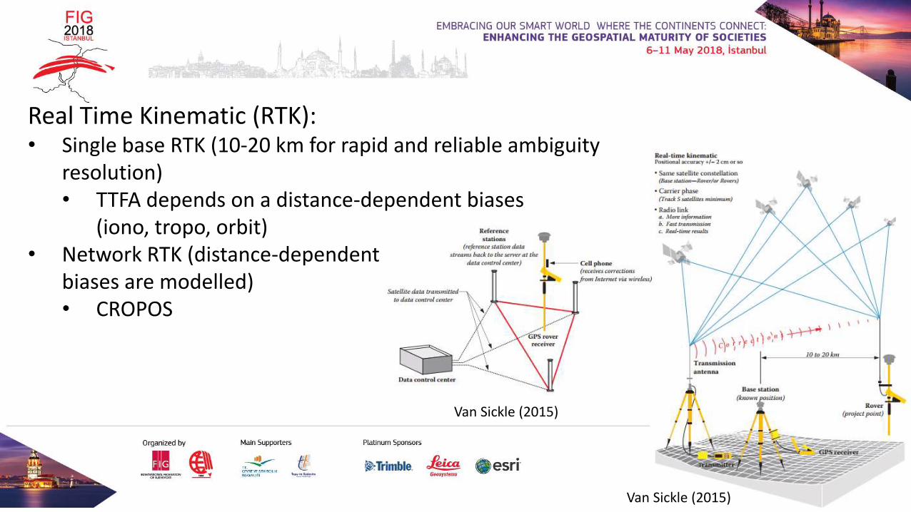
Real Time Kinematic (RTK):• Single base RTK (10-20 km for rapid and reliable ambiguity
resolution)• TTFA depends on a distance-dependent biases
(iono, tropo, orbit)• Network RTK (distance-dependent
biases are modelled)• CROPOS
Van Sickle (2015)
Van Sickle (2015)
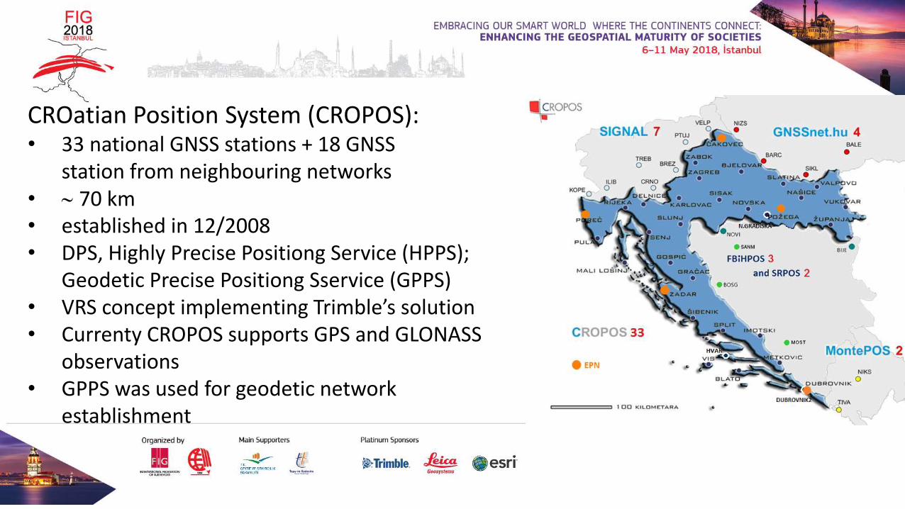
CROatian Position System (CROPOS):• 33 national GNSS stations + 18 GNSS
station from neighbouring networks• 70 km• established in 12/2008• DPS, Highly Precise Positiong Service (HPPS);
Geodetic Precise Positiong Sservice (GPPS)• VRS concept implementing Trimble’s solution• Currenty CROPOS supports GPS and GLONASS
observations• GPPS was used for geodetic network
establishment
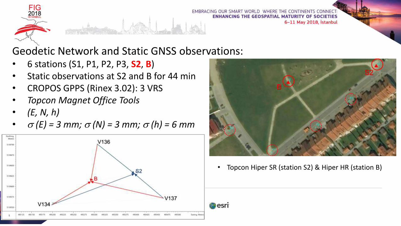
Geodetic Network and Static GNSS observations:• 6 stations (S1, P1, P2, P3, S2, B)• Static observations at S2 and B for 44 min• CROPOS GPPS (Rinex 3.02): 3 VRS• Topcon Magnet Office Tools• (E, N, h) • (E) = 3 mm; (N) = 3 mm; (h) = 6 mm
• Topcon Hiper SR (station S2) & Hiper HR (station B)
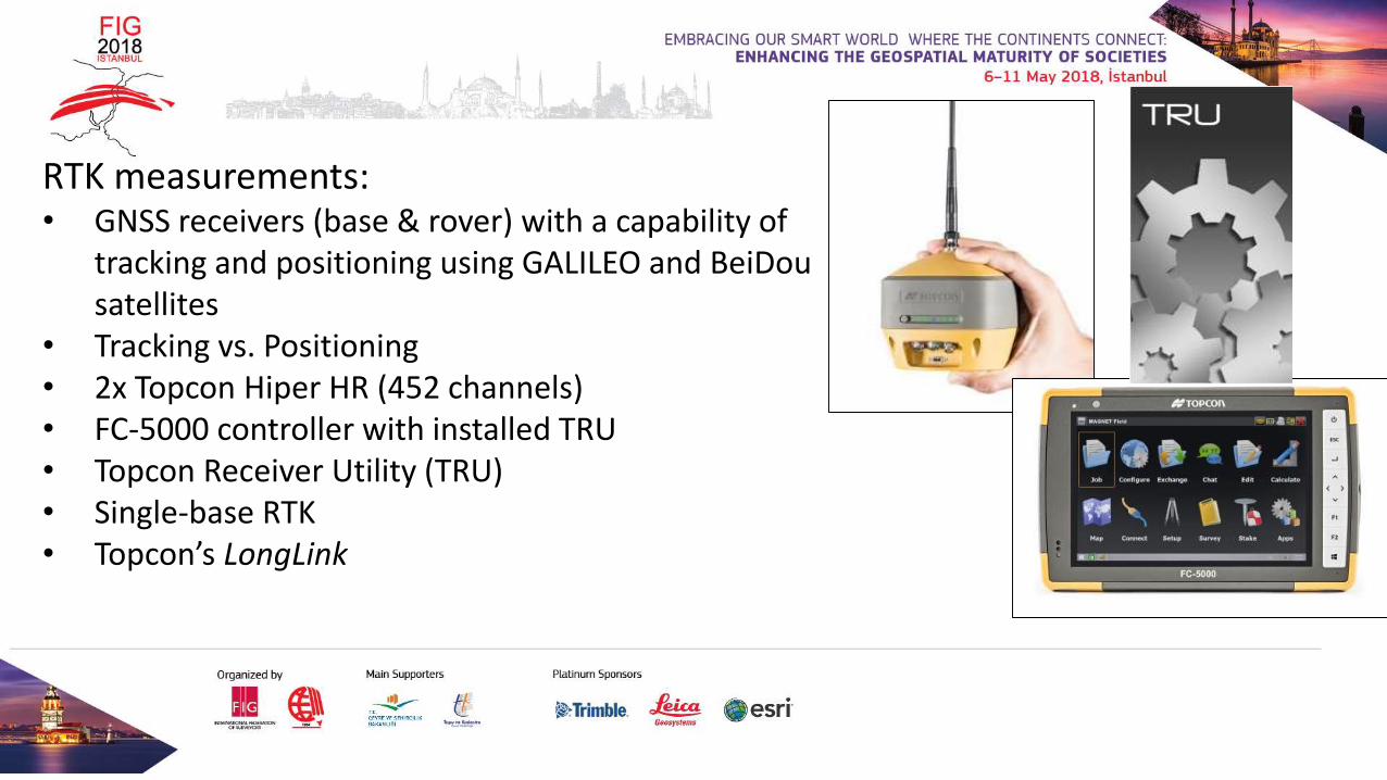
RTK measurements:• GNSS receivers (base & rover) with a capability of
tracking and positioning using GALILEO and BeiDousatellites
• Tracking vs. Positioning• 2x Topcon Hiper HR (452 channels)• FC-5000 controller with installed TRU• Topcon Receiver Utility (TRU)• Single-base RTK• Topcon’s LongLink
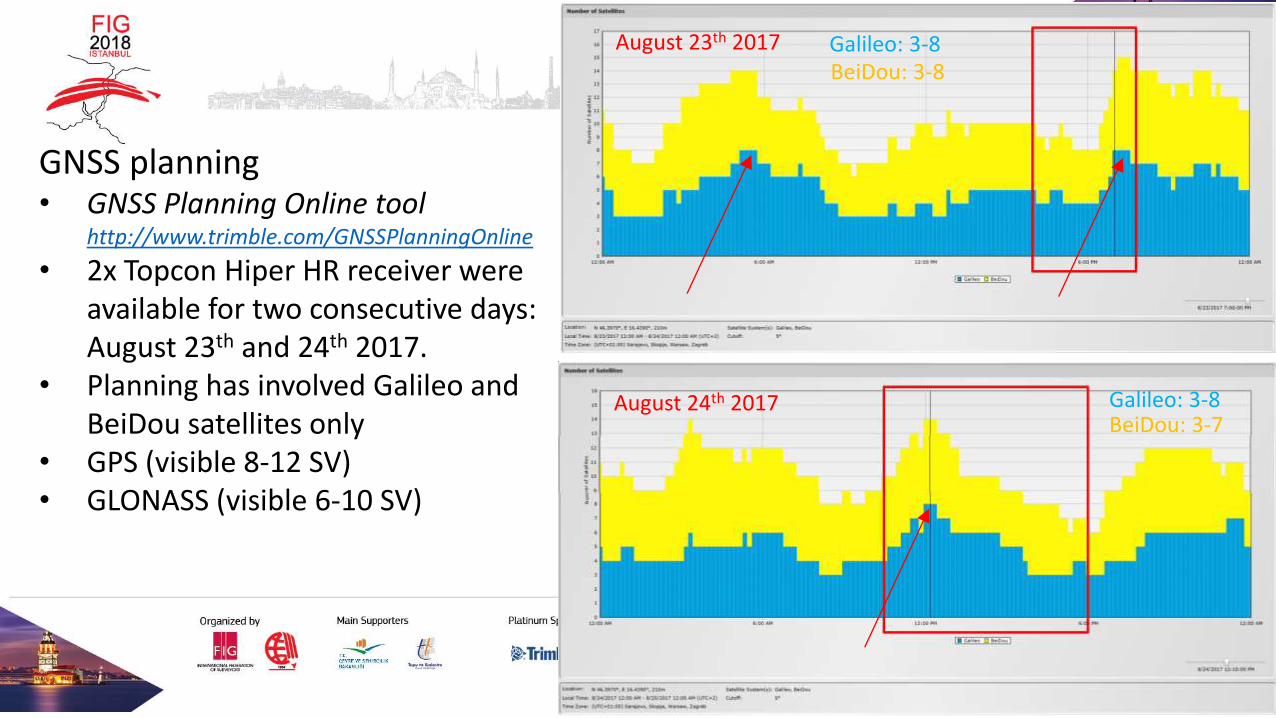
GNSS planning• GNSS Planning Online tool
http://www.trimble.com/GNSSPlanningOnline
• 2x Topcon Hiper HR receiver wereavailable for two consecutive days:August 23th and 24th 2017.
• Planning has involved Galileo andBeiDou satellites only
• GPS (visible 8-12 SV)• GLONASS (visible 6-10 SV)
August 23th 2017 Galileo: 3-8BeiDou: 3-8
August 24th 2017 Galileo: 3-8BeiDou: 3-7
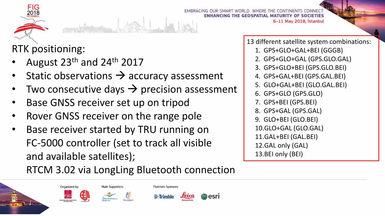
RTK positioning:• August 23th and 24th 2017• Static observations→ accuracy assessment• Two consecutive days→ precision assessment• Base GNSS receiver set up on tripod• Rover GNSS receiver on the range pole• Base receiver started by TRU running on
FC-5000 controller (set to track all visibleand available satellites); RTCM 3.02 via LongLing Bluetooth connection
13 different satellite system combinations:1. GPS+GLO+GAL+BEI (GGGB)2. GPS+GLO+GAL (GPS.GLO.GAL)3. GPS+GLO+BEI (GPS.GLO.BEI)4. GPS+GAL+BEI (GPS.GAL.BEI)5. GLO+GAL+BEI (GLO.GAL.BEI)6. GPS+GLO (GPS.GLO)7. GPS+BEI (GPS.BEI)8. GPS+GAL (GPS.GAL)9. GLO+BEI (GLO.BEI)10.GLO+GAL (GLO.GAL)11.GAL+BEI (GAL.BEI)12.GAL only (GAL)13.BEI only (BEI)
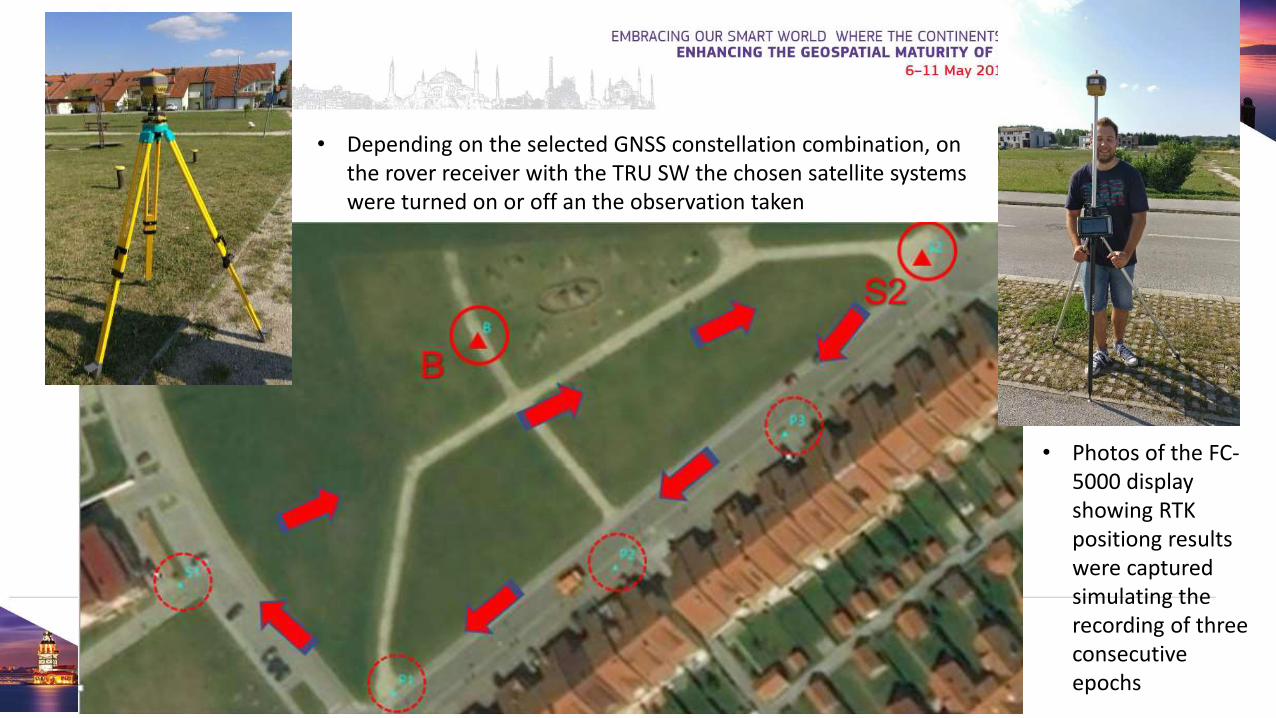
• Depending on the selected GNSS constellation combination, on the rover receiver with the TRU SW the chosen satellite systems were turned on or off an the observation taken
• Photos of the FC-5000 display showing RTK positiong resultswere capturedsimulating therecording of threeconsecutiveepochs
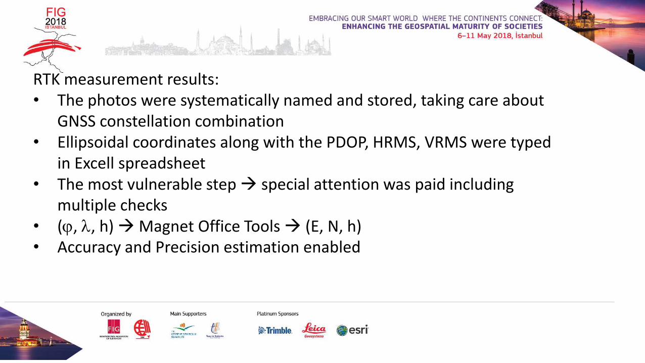
RTK measurement results:• The photos were systematically named and stored, taking care about
GNSS constellation combination• Ellipsoidal coordinates along with the PDOP, HRMS, VRMS were typed
in Excell spreadsheet• The most vulnerable step→ special attention was paid including
multiple checks• (, , h) →Magnet Office Tools→ (E, N, h) • Accuracy and Precision estimation enabled
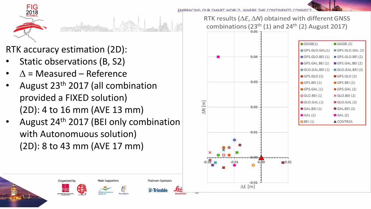
RTK accuracy estimation (2D):• Static observations (B, S2)• = Measured – Reference• August 23th 2017 (all combination
provided a FIXED solution)(2D): 4 to 16 mm (AVE 13 mm)
• August 24th 2017 (BEI only combinationwith Autonomuous solution)(2D): 8 to 43 mm (AVE 17 mm)
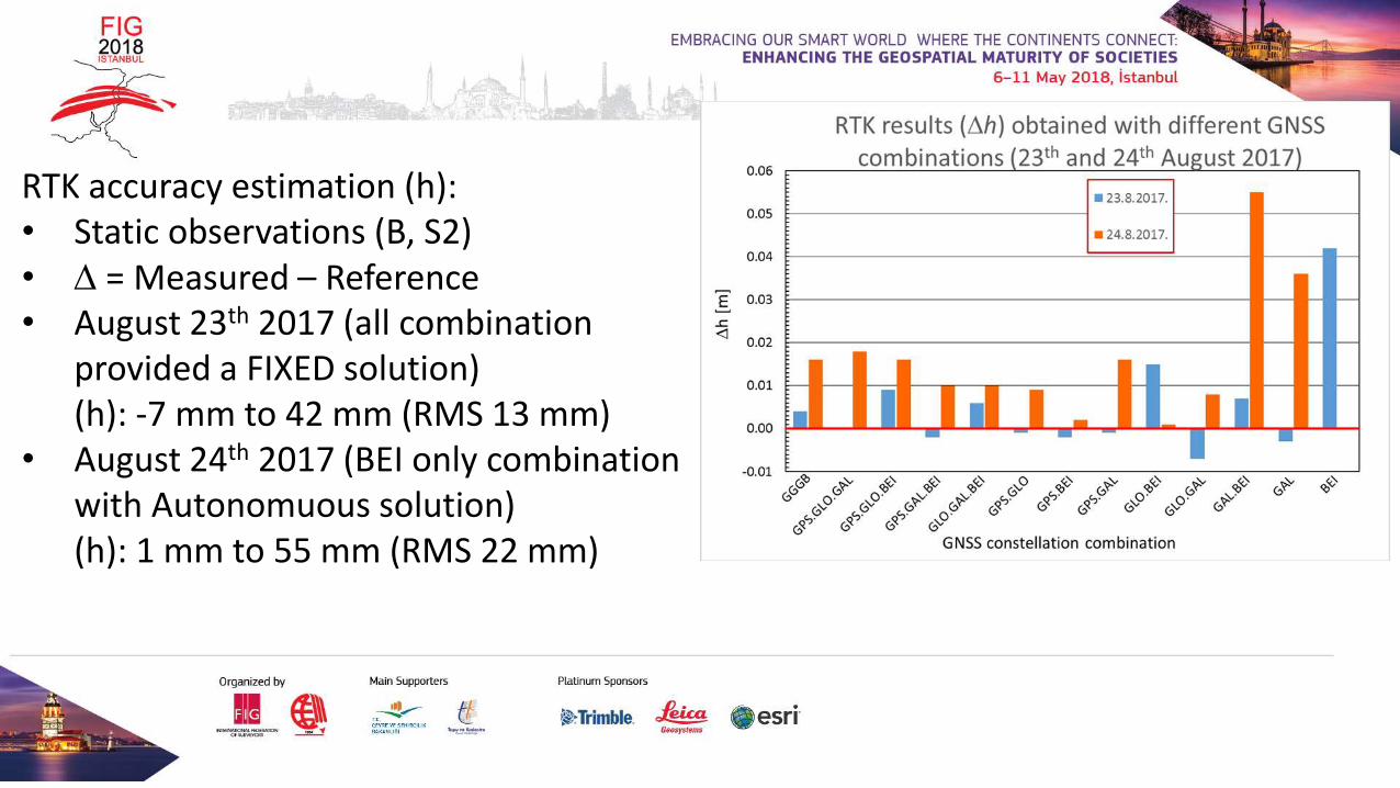
RTK accuracy estimation (h):• Static observations (B, S2)• = Measured – Reference• August 23th 2017 (all combination
provided a FIXED solution)(h): -7 mm to 42 mm (RMS 13 mm)
• August 24th 2017 (BEI only combinationwith Autonomuous solution)(h): 1 mm to 55 mm (RMS 22 mm)
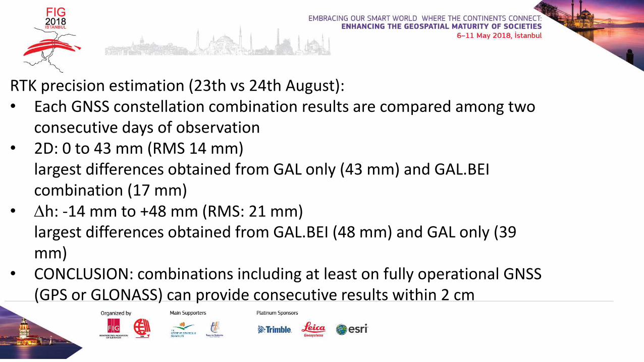
RTK precision estimation (23th vs 24th August):• Each GNSS constellation combination results are compared among two
consecutive days of observation• 2D: 0 to 43 mm (RMS 14 mm)
largest differences obtained from GAL only (43 mm) and GAL.BEI combination (17 mm)
• h: -14 mm to +48 mm (RMS: 21 mm)largest differences obtained from GAL.BEI (48 mm) and GAL only (39 mm)
• CONCLUSION: combinations including at least on fully operational GNSS (GPS or GLONASS) can provide consecutive results within 2 cm
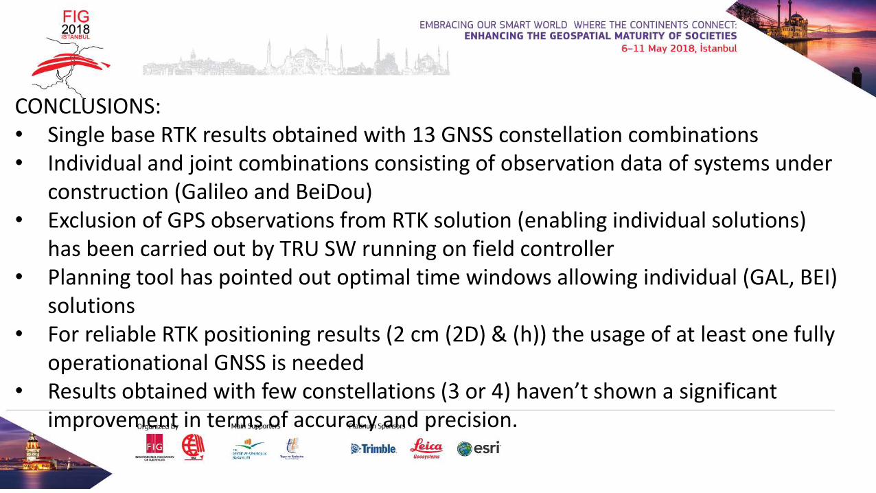
CONCLUSIONS:• Single base RTK results obtained with 13 GNSS constellation combinations• Individual and joint combinations consisting of observation data of systems under
construction (Galileo and BeiDou)• Exclusion of GPS observations from RTK solution (enabling individual solutions)
has been carried out by TRU SW running on field controller• Planning tool has pointed out optimal time windows allowing individual (GAL, BEI)
solutions• For reliable RTK positioning results (2 cm (2D) & (h)) the usage of at least one fully
operationational GNSS is needed• Results obtained with few constellations (3 or 4) haven’t shown a significant
improvement in terms of accuracy and precision.

REMARK:• This paper has been compiled from the students’ publication rewarded with the
Dean’s Awards of the Faculty of Geodesy for the academic year 2016/2017.

Single base RTK solutions obtained individually with Galileo and BeiDou as well as in combination with other fully operational GNSS
Viktor Mihoković, Luka Zalović, Danijel Šugar