Embed Size (px)
Citation preview

Topcon –SokkiaMass Data Scanning

Sokkia Topcon Canada - About Us
Topcon – Sokkia: 1 company 2 brands.
Factory representation for Sokkia & Topcon products for surveying and
engineering
Provide customer-focused instrument and services solutions for traditional
surveying and Mass Point Collection & Analysis
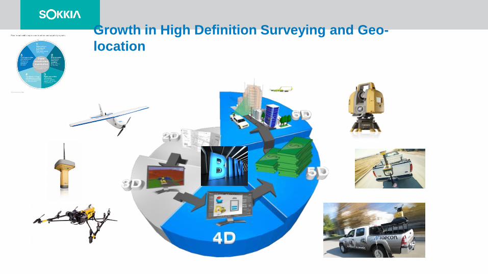
Growth in High Definition Surveying and Geo-
location
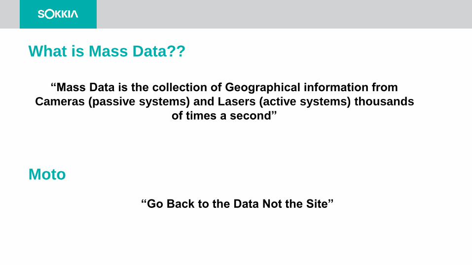
What is Mass Data??
“Mass Data is the collection of Geographical information from
Cameras (passive systems) and Lasers (active systems) thousands
of times a second”
Moto
“Go Back to the Data Not the Site”
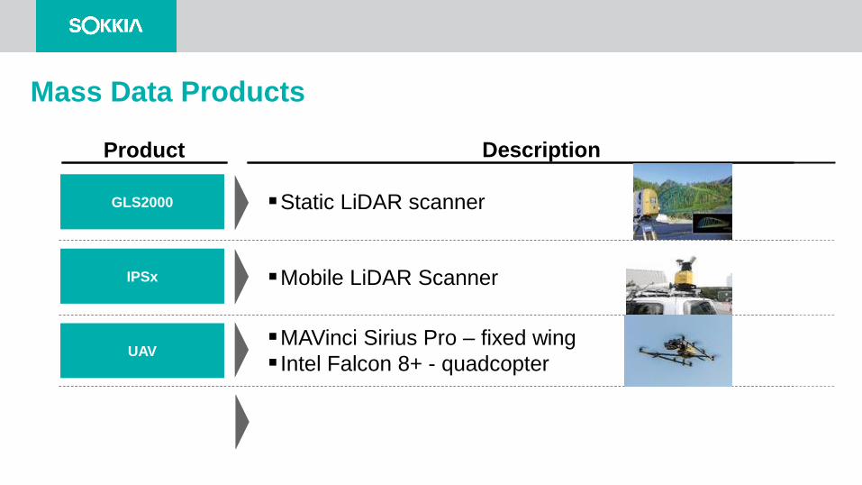
GLS2000 Static LiDAR scanner
IPSx
UAV
Mobile LiDAR Scanner
MAVinci Sirius Pro – fixed wing
Intel Falcon 8+ - quadcopter
Mass Data Products
Product Description
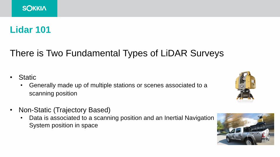
Lidar 101
There is Two Fundamental Types of LiDAR Surveys
• Static• Generally made up of multiple stations or scenes associated to a
scanning position
• Non-Static (Trajectory Based) • Data is associated to a scanning position and an Inertial Navigation
System position in space
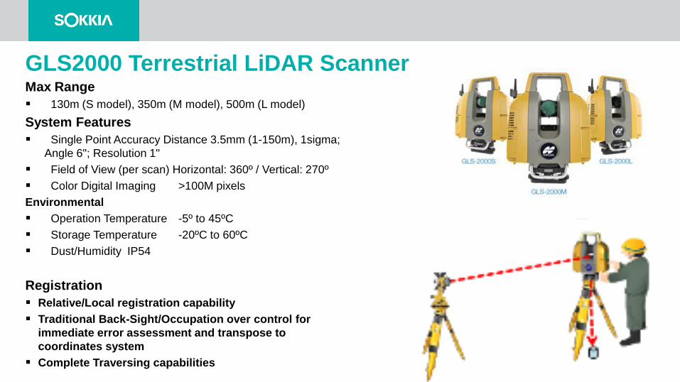
GLS2000 Terrestrial LiDAR ScannerMax Range
130m (S model), 350m (M model), 500m (L model)
System Features
Single Point Accuracy Distance 3.5mm (1-150m), 1sigma;
Angle 6"; Resolution 1"
Field of View (per scan) Horizontal: 360º / Vertical: 270º
Color Digital Imaging >100M pixels
Environmental
Operation Temperature -5º to 45ºC
Storage Temperature -20ºC to 60ºC
Dust/Humidity IP54
Registration
Relative/Local registration capability
Traditional Back-Sight/Occupation over control for
immediate error assessment and transpose to
coordinates system
Complete Traversing capabilities
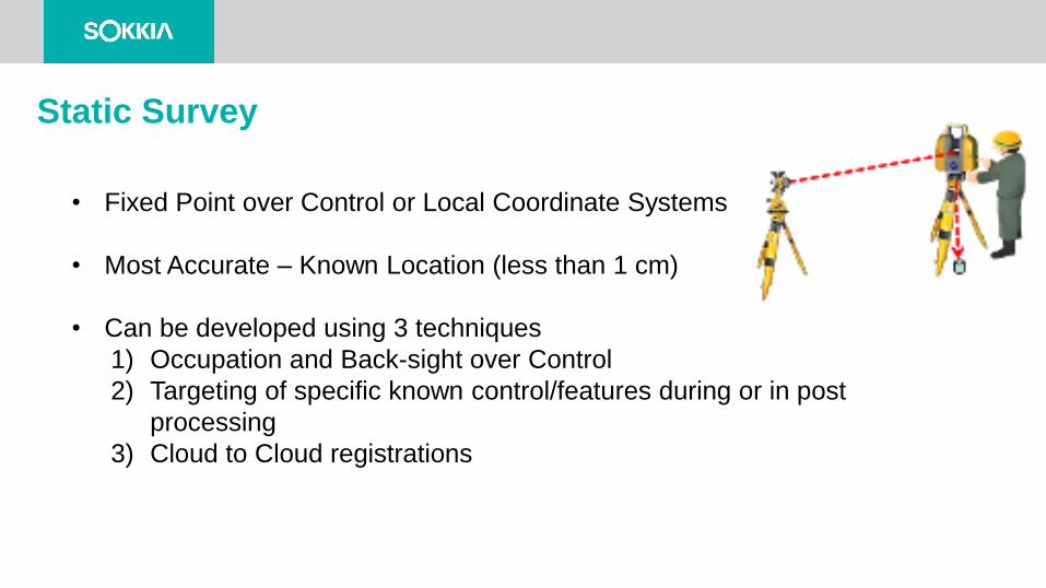
Static Survey
• Fixed Point over Control or Local Coordinate Systems
• Most Accurate – Known Location (less than 1 cm)
• Can be developed using 3 techniques
1) Occupation and Back-sight over Control
2) Targeting of specific known control/features during or in post
processing
3) Cloud to Cloud registrations
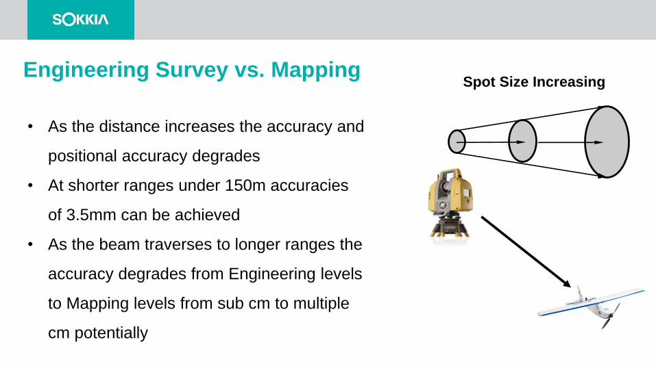
Engineering Survey vs. Mapping
• As the distance increases the accuracy and
positional accuracy degrades
• At shorter ranges under 150m accuracies
of 3.5mm can be achieved
• As the beam traverses to longer ranges the
accuracy degrades from Engineering levels
to Mapping levels from sub cm to multiple
cm potentially
Spot Size Increasing
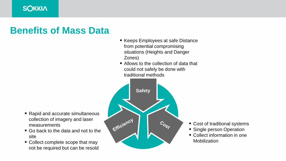
Keeps Employees at safe Distance
from potential compromising
situations (Heights and Danger
Zones)
Allows to the collection of data that
could not safely be done with
traditional methods
Cost of traditional systems
Single person Operation
Collect information in one
Mobilization
Rapid and accurate simultaneous
collection of imagery and laser
measurements
Go back to the data and not to the
site
Collect complete scope that may
not be required but can be resold
Safety
Benefits of Mass Data
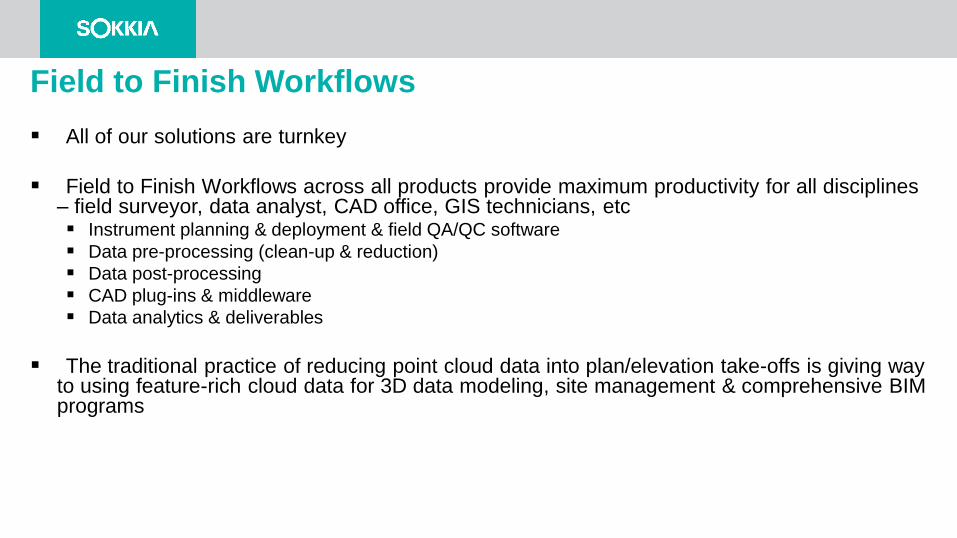
Field to Finish Workflows
All of our solutions are turnkey
Field to Finish Workflows across all products provide maximum productivity for all disciplines – field surveyor, data analyst, CAD office, GIS technicians, etc Instrument planning & deployment & field QA/QC software
Data pre-processing (clean-up & reduction)
Data post-processing
CAD plug-ins & middleware
Data analytics & deliverables
The traditional practice of reducing point cloud data into plan/elevation take-offs is giving way to using feature-rich cloud data for 3D data modeling, site management & comprehensive BIM programs
Multiple
Platforms
and
Deliverables
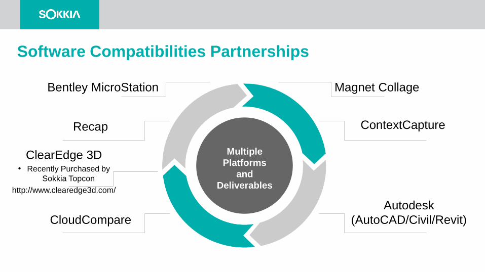
ContextCapture
Autodesk
(AutoCAD/Civil/Revit)CloudCompare
Recap
Software Compatibilities Partnerships
Magnet CollageBentley MicroStation
ClearEdge 3D• Recently Purchased by
Sokkia Topcon
http://www.clearedge3d.com/
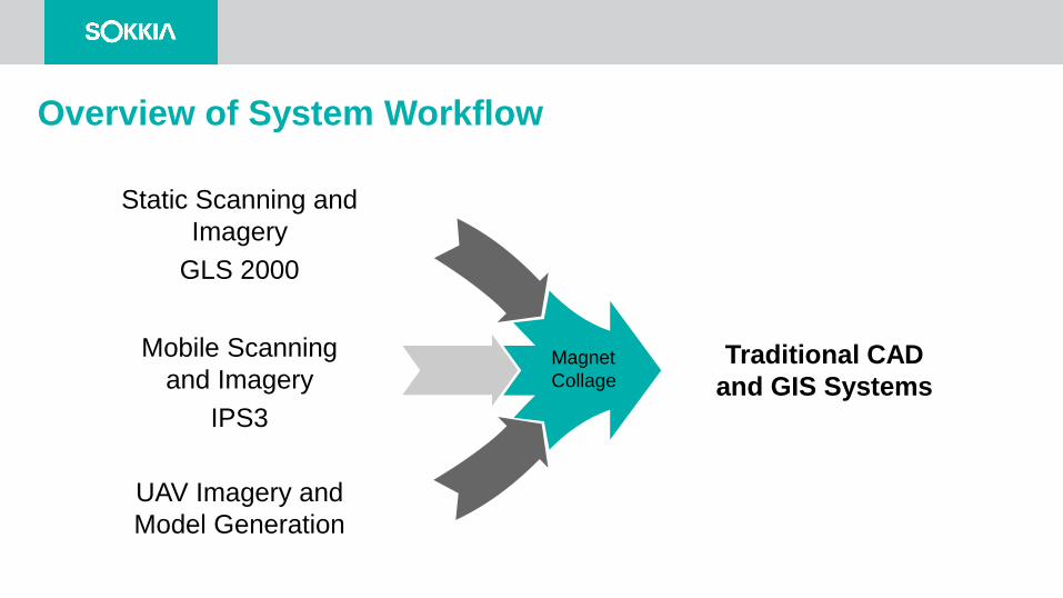
UAV Imagery and
Model Generation
Traditional CAD
and GIS Systems
Static Scanning and
Imagery
GLS 2000
Mobile Scanning
and Imagery
IPS3
Overview of System Workflow
Magnet
Collage
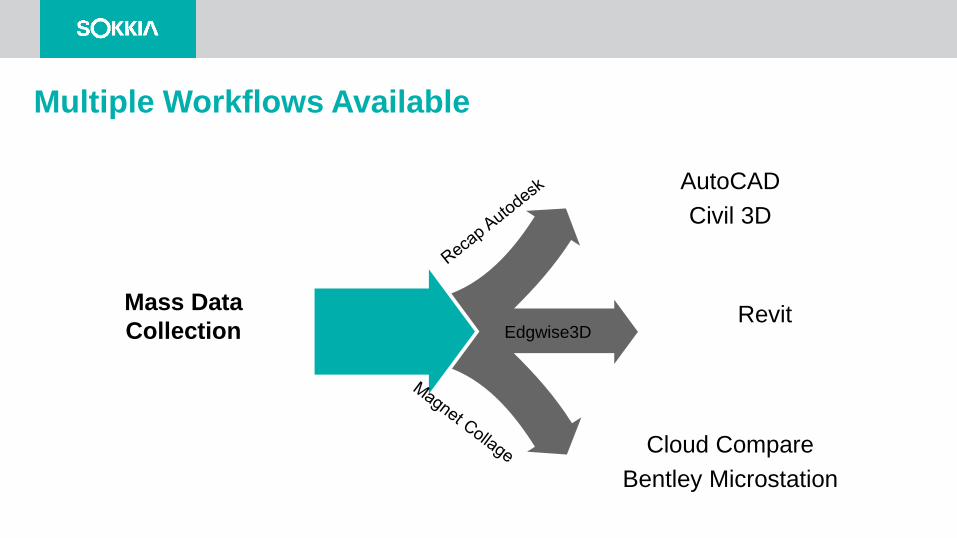
Cloud Compare
Bentley Microstation
Mass Data
Collection
AutoCAD
Civil 3D
Revit
Multiple Workflows Available
Edgwise3D
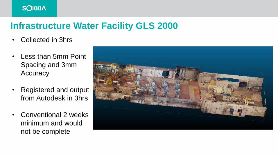
Infrastructure Water Facility GLS 2000
• Collected in 3hrs
• Less than 5mm Point
Spacing and 3mm
Accuracy
• Registered and output
from Autodesk in 3hrs
• Conventional 2 weeks
minimum and would
not be complete
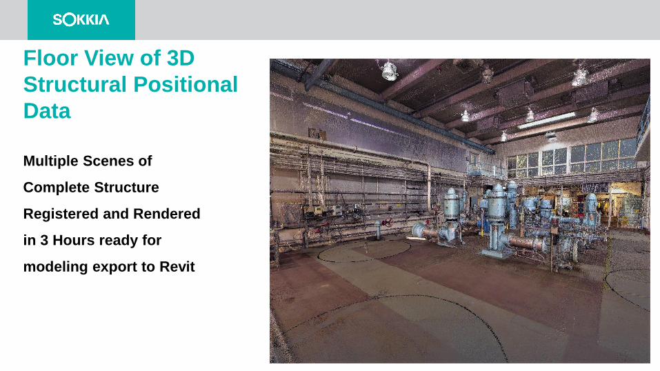
Floor View of 3D
Structural Positional
Data
Multiple Scenes of
Complete Structure
Registered and Rendered
in 3 Hours ready for
modeling export to Revit
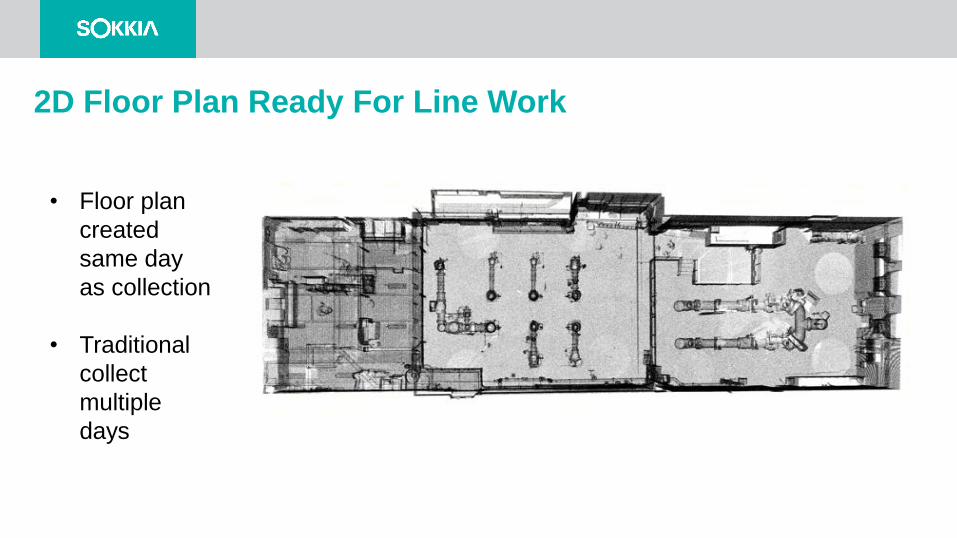
2D Floor Plan Ready For Line Work
• Floor plan
created
same day
as collection
• Traditional
collect
multiple
days
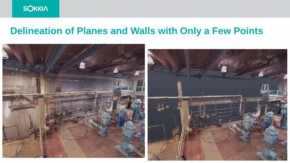
Delineation of Planes and Walls with Only a Few Points
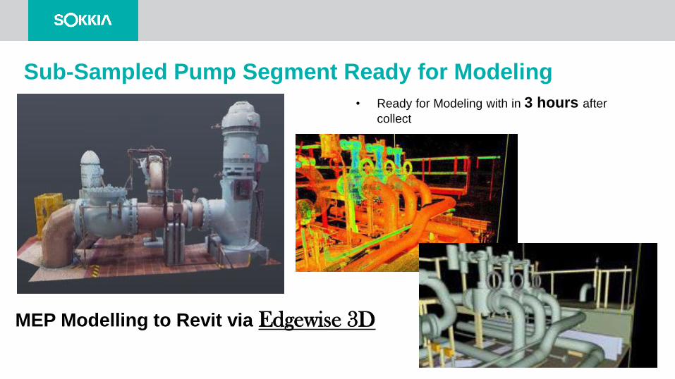
Sub-Sampled Pump Segment Ready for Modeling
• Ready for Modeling with in 3 hours after
collect
MEP Modelling to Revit via Edgewise 3D
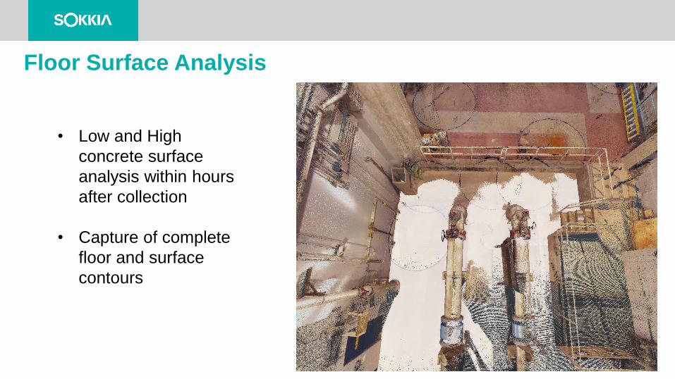
Floor Surface Analysis
• Low and High
concrete surface
analysis within hours
after collection
• Capture of complete
floor and surface
contours
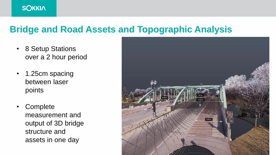
Bridge and Road Assets and Topographic Analysis
• 8 Setup Stations
over a 2 hour period
• 1.25cm spacing
between laser
points
• Complete
measurement and
output of 3D bridge
structure and
assets in one day
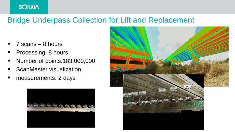
Bridge Underpass Collection for Lift and Replacement
7 scans – 8 hours
Processing: 8 hours
Number of points:183,000,000
ScanMaster visualization
measurements: 2 days
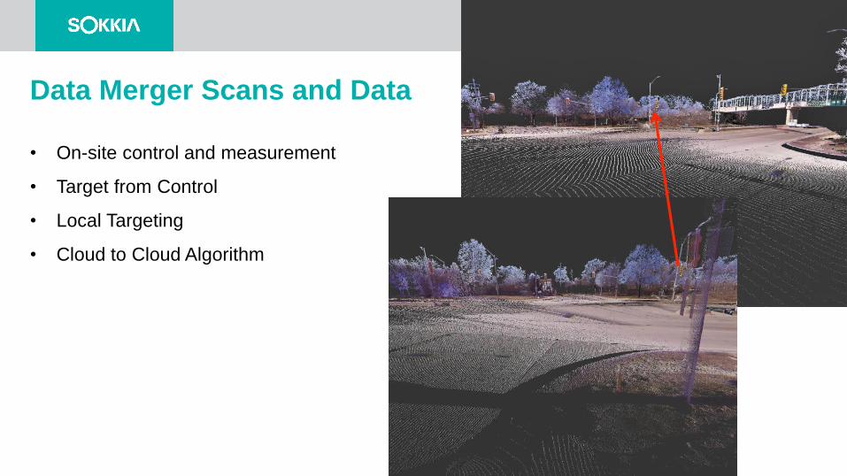
Data Merger Scans and Data
• On-site control and measurement
• Target from Control
• Local Targeting
• Cloud to Cloud Algorithm
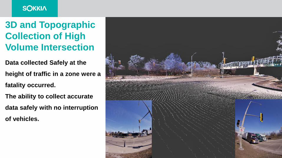
3D and Topographic
Collection of High
Volume Intersection
Data collected Safely at the
height of traffic in a zone were a
fatality occurred.
The ability to collect accurate
data safely with no interruption
of vehicles.
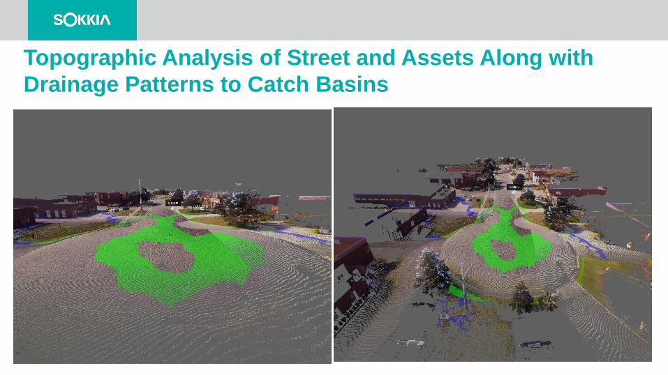
Topographic Analysis of Street and Assets Along with
Drainage Patterns to Catch Basins
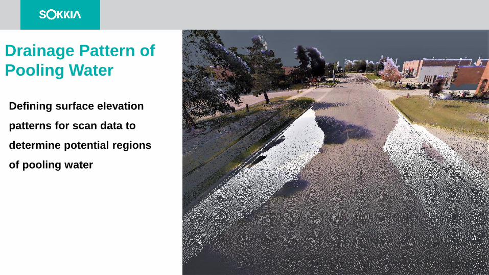
Drainage Pattern of
Pooling Water
Defining surface elevation
patterns for scan data to
determine potential regions
of pooling water
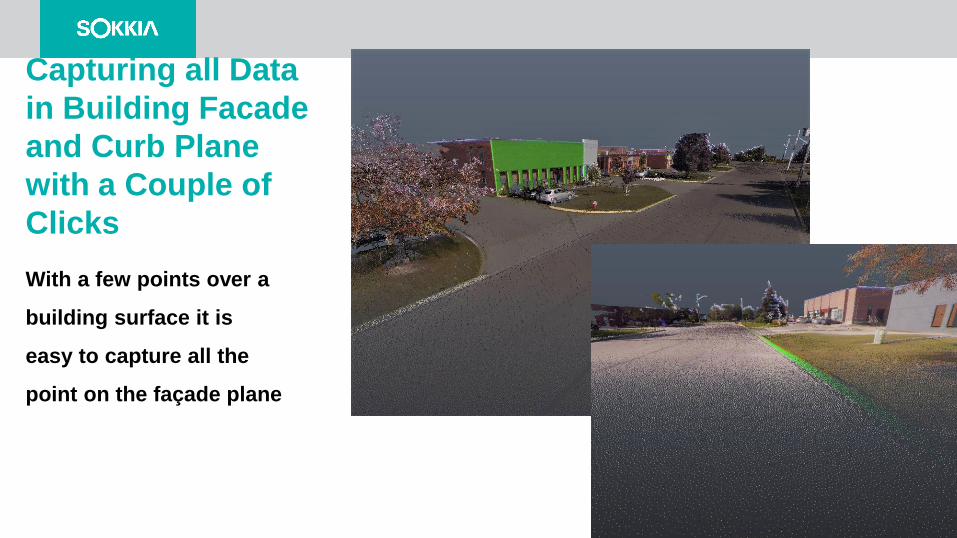
Capturing all Data
in Building Facade
and Curb Plane
with a Couple of
Clicks
With a few points over a
building surface it is
easy to capture all the
point on the façade plane
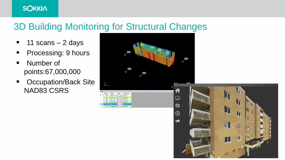
3D Building Monitoring for Structural Changes
11 scans – 2 days
Processing: 9 hours
Number of
points:67,000,000
Occupation/Back Site
NAD83 CSRS
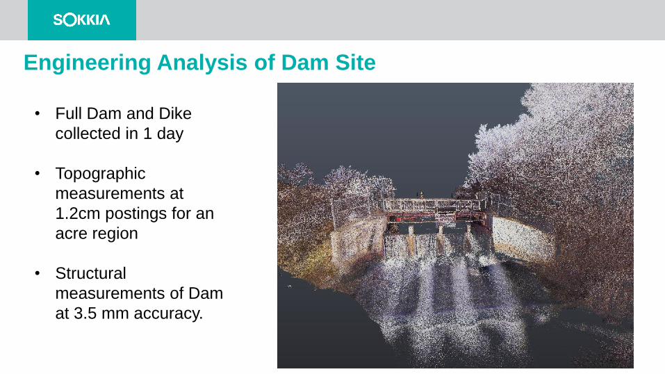
Engineering Analysis of Dam Site
• Full Dam and Dike
collected in 1 day
• Topographic
measurements at
1.2cm postings for an
acre region
• Structural
measurements of Dam
at 3.5 mm accuracy.
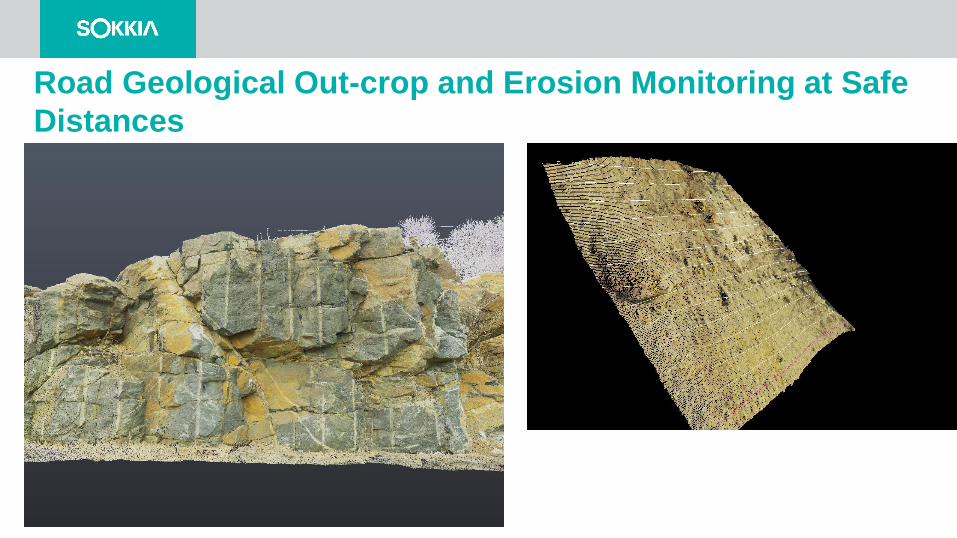
Road Geological Out-crop and Erosion Monitoring at Safe
Distances
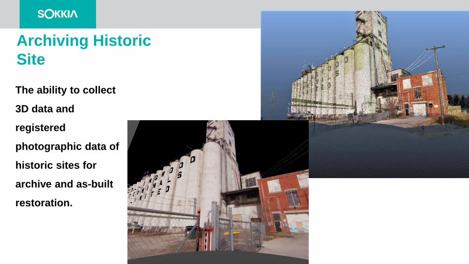
Archiving Historic
Site
The ability to collect
3D data and
registered
photographic data of
historic sites for
archive and as-built
restoration.

Thank You