Embed Size (px)
Citation preview
APPENDIX Q – SUPPLEMENTAL SITE INVESTIGATION TECHNICAL MEMORANDUM SAMPLE Supplemental Site Investigation Technical Memorandum [Site Designation] [Site Address or Major Cross Streets] [City], California [Zip Code] [Site Code] Prepared for: [School District] [District Office Address] [City], California [Zip Code] Prepared by: [Consultant Company] [Office Address] [City], California [Zip Code] [Date of Report]
APP Q SSI Tech Memo v3_0.doc 6/25/08 ii
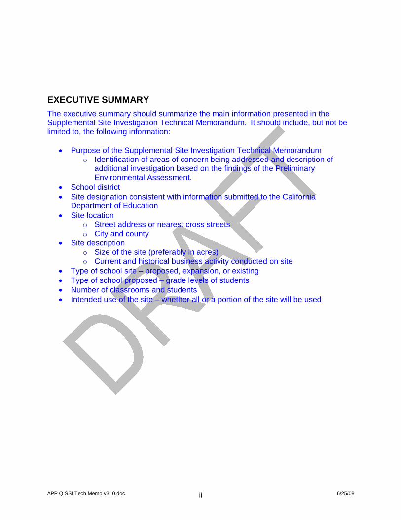
EXECUTIVE SUMMARY The executive summary should summarize the main information presented in the Supplemental Site Investigation Technical Memorandum. It should include, but not be limited to, the following information:
Purpose of the Supplemental Site Investigation Technical Memorandum o Identification of areas of concern being addressed and description of
additional investigation based on the findings of the Preliminary Environmental Assessment.
School district Site designation consistent with information submitted to the California
Department of Education Site location
o Street address or nearest cross streets o City and county
Site description o Size of the site (preferably in acres) o Current and historical business activity conducted on site
Type of school site – proposed, expansion, or existing Type of school proposed – grade levels of students Number of classrooms and students Intended use of the site – whether all or a portion of the site will be used
APP Q SSI Tech Memo v3_0.doc 6/25/08 iii
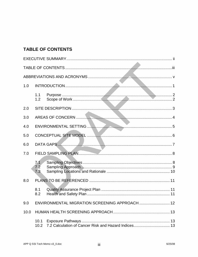
TABLE OF CONTENTS
EXECUTIVE SUMMARY................................................................................................. ii
TABLE OF CONTENTS ..................................................................................................iii
ABBREVIATIONS AND ACRONYMS ............................................................................. v
1.0 INTRODUCTION.................................................................................................. 1
1.1 Purpose ..................................................................................................... 2 1.2 Scope of Work ........................................................................................... 2
2.0 SITE DESCRIPTION ............................................................................................ 3
3.0 AREAS OF CONCERN ........................................................................................ 4
4.0 ENVIRONMENTAL SETTING .............................................................................. 5
5.0 CONCEPTUAL SITE MODEL .............................................................................. 6
6.0 DATA GAPS......................................................................................................... 7
7.0 FIELD SAMPLING PLAN...................................................................................... 8
7.1 Sampling Objectives .................................................................................. 8 7.2 Sampling Approach.................................................................................... 9 7.3 Sampling Locations and Rationale .......................................................... 10
8.0 PLANS TO BE REFERENCED .......................................................................... 11
8.1 Quality Assurance Project Plan ............................................................... 11 8.2 Health and Safety Plan ............................................................................ 11
9.0 ENVIRONMENTAL MIGRATION SCREENING APPROACH ............................ 12
10.0 HUMAN HEALTH SCREENING APPROACH.................................................... 13
10.1 Exposure Pathways ................................................................................. 13 10.2 7.2 Calculation of Cancer Risk and Hazard Indices................................. 13
APP Q SSI Tech Memo v3_0.doc 6/25/08 iv
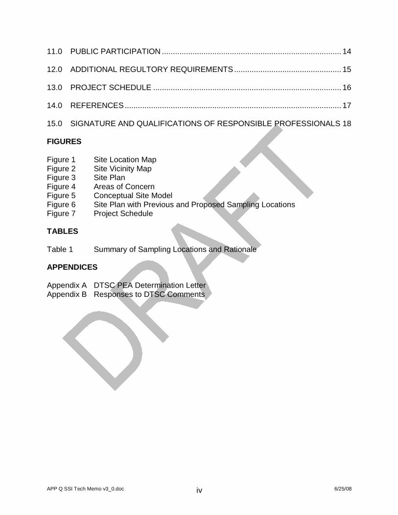
11.0 PUBLIC PARTICIPATION .................................................................................. 14
12.0 ADDITIONAL REGULTORY REQUIREMENTS................................................. 15
13.0 PROJECT SCHEDULE ...................................................................................... 16
14.0 REFERENCES................................................................................................... 17
15.0 SIGNATURE AND QUALIFICATIONS OF RESPONSIBLE PROFESSIONALS 18
FIGURES Figure 1 Site Location Map Figure 2 Site Vicinity Map Figure 3 Site Plan Figure 4 Areas of Concern Figure 5 Conceptual Site Model Figure 6 Site Plan with Previous and Proposed Sampling Locations Figure 7 Project Schedule TABLES Table 1 Summary of Sampling Locations and Rationale APPENDICES Appendix A DTSC PEA Determination Letter Appendix B Responses to DTSC Comments

APP Q SSI Tech Memo v3_0.doc 6/25/08 v
ABBREVIATIONS AND ACRONYMS Abbreviation or acronym
Description
APP Q SSI Tech Memo v3_0.doc 1 6/25/08
1.0 INTRODUCTION The introduction should introduce the site, present the organization of the report, and include the following information:
School district Site designation consistent with information submitted to the California
Department of Education Site location
o Street address or nearest cross streets o City and county
Type of school site – proposed, expansion, or existing Type of school proposed – grade levels of students Number of classrooms and students Intended use of the site – whether all or a portion of the site will be used Proposed disposition of existing structures Proposed source of potable and non-potable water supply
The introduction should also identify the areas of concern that lead to the recommendation for further action and the reason for preparing a Supplemental Site Investigation (SSI) Technical Memorandum which may include:
A PEA Report was submitted for DTSC review and approval and DTSC provided a determination that a further action is required to address a release or threatened release of hazardous material or the presence of a naturally occurring hazardous material, which would pose a threat to public health or the environment under unrestricted land use. Provide the date of the determination letter and include a copy of the letter in Appendix A.
An SSI Technical Memorandum is being submitted in lieu of a formal SSI Workplan based on consultation with DTSC. Sampling during the SSI will be similar to the PEA and DTSC-approved the Field Sampling Plan, Quality Assurance Project Plan, Health and Safety Plan, and Investigation-Derived Waste Management Plan in the PEA Workplan.
This section should briefly address the SSI scoping meeting, participants, and discussion.
APP Q SSI Tech Memo v3_0.doc 2 6/25/08
1.1 PURPOSE This section should state the purpose of the SSI Technical Memorandum, part of the third step of the environmental review process for school sites, with respect to areas of concern identified for the site. These objectives should include, at a minimum:
Determine the horizontal and vertical extent of contamination encountered during the PEA.
Evaluate potential threat(s) to public health and the environment posed by chemicals of concern.
Evaluate whether remedial action is required. This section may also include other objectives or reasons as requested by the school district.
1.2 SCOPE OF WORK The scope of work should provide a detailed scope of services conducted for the PEA, including assumptions, limitations and exceptions, special terms and conditions, and user reliance. This section should list the DTSC requirements or guidance complied with to meet the objectives of the SSI Technical Memorandum.
APP Q SSI Tech Memo v3_0.doc 3 6/25/08
2.0 SITE DESCRIPTION This section should include the following school site designation and location information:
School site designation consistent with information submitted to CDE. Other site designations used historically. United States Environmental Protection Agency (U.S. EPA) identification
number, if assigned. DTSC EnviroStor database number, if assigned. Street address or nearest cross streets, city or nearest community, county, state,
zip code School district Size of the site (preferably in acres) Assessor’s parcel number Township, range, section, and principal meridian Geographic coordinates (longitude and latitude) State Senate and Assembly districts
This section should also a summary of current and historical activities, and a brief summary of the environmental assessments or investigations leading up to the SSI. This section can reference the PEA Report for more details, but enough information should be provided to ascertain the areas of concern and associated chemicals of concern, update the conceptual site model, identify data gaps, and justify the sampling proposed.
APP Q SSI Tech Memo v3_0.doc 4 6/25/08
3.0 AREAS OF CONCERN This section should summarize the following findings of the PEA conducted to address RECs identified in the Phase I (or after review of information consistent with a Phase I):
Nature and extent of contamination, determined thus far, based on sampling. Fate and transport based on the environmental migration screening evaluation. Human health risk based on the human health screening evaluation.
Based on these findings, the areas of concern (AOCs) and associated chemicals of concern should be identified. For each AOC, following information should be presented:
Chemicals of concern Extent to which the AOC has been characterized horizontally and vertically Media impacted
APP Q SSI Tech Memo v3_0.doc 5 6/25/08
4.0 ENVIRONMENTAL SETTING As part of the Phase I (or review of information consistent with a Phase I), information should have been collected regarding the site’s environmental characteristics. This section should include a summary of the following information:
Topographic, geologic, and hydrogeologic features associated with the site and surrounding areas.
Potential pathways (soil, groundwater, surface water, and air) of contaminant migration and environmental conditions which would influence the fate and transport of contaminants from the source of contamination through identified potential exposure pathways to the exposed individual or environmental receptor.
This section can reference the PEA Report for more details, but enough information should be provided to update the conceptual site model, identify data gaps, and justify the sampling proposed.
APP Q SSI Tech Memo v3_0.doc 6 6/25/08
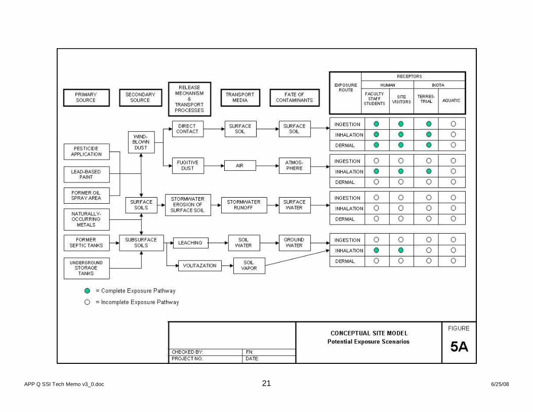
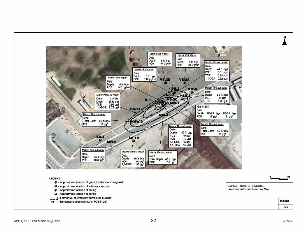
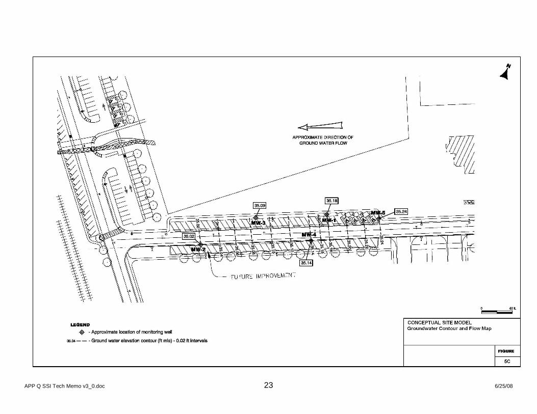
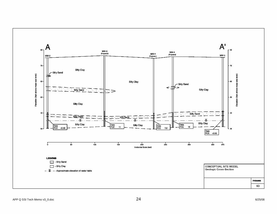
5.0 CONCEPTUAL SITE MODEL The conceptual site model (CSM) from the PEA Report should be updated to include the results of the PEA investigation. The CSM should include a narrative and graphical description of site characteristics, and should provide a foundation for understanding a site. The CSM integrates the areas of concern and chemicals of potential concern with the environmental setting at the site. The CSM should identify potential contamination sources and link them to potential receptors through release mechanisms, potential pathways, and exposure routes. The CSM should incorporate all essential features of the topographic, geologic, and hydrogeologic systems at the site. The degree of detail and accuracy of the CSM will vary according to the site setting and contaminant type(s). For simpler sites, the CSM may only include a discussion of areas of concern, a figure showing potential exposure scenarios (Figure 5A) and a site plan. For more advanced sites (e.g., sites with NOA or impacts to groundwater), a more detailed CSM will be necessary and may also include figures such as groundwater flow maps, iso-concentration drawings, geologic cross-sections, and detailed geologic maps of the surface and subsurface. Examples of such figures are included in Figures 5B through 5D. The CSM is an iterative process. The initial CSM is used to develop the Field Sampling Plan (FSP) which is designed to determine the source of contamination, evaluate the migration potential and assess the exposure potential. As data gaps are identified and additional data is collected, the CSM should be revised. The resulting final CSM should be detailed enough to meet the characterization objectives, and provide enough information to make appropriate regulatory decisions.
APP Q SSI Tech Memo v3_0.doc 7 6/25/08
6.0 DATA GAPS Based on the conceptual site model, data gaps should be identified. Data gaps are missing information necessary to form conclusions and recommendations for the site that will ultimately lead to a regulatory decision. These data gaps should be used to form the objectives for and direct sampling activities.
APP Q SSI Tech Memo v3_0.doc 8 6/25/08
7.0 FIELD SAMPLING PLAN To use an SSI Technical Memorandum, sampling during should be covered by a site-specific DTSC-approved the Field Sampling Plan. As a result this section should update the sampling objectives then provide any additions or modifications to information provided in the Field Sampling Plan of the PEA Technical Memorandum or Workplan to conduct sampling for this SSI Technical Memorandum. This section should also provide information for the Field Sampling Plan being referenced, including a description of location in the PEA Technical Memorandum or Workplan, title of the PEA Technical Memorandum or Workplan, author, date prepared, and date of the associated DTSC determination letter.
7.1 SAMPLING OBJECTIVES The sampling objectives should be developed based on the updated conceptual site model, identified data gaps, and data quality objectives (DQOs) process described in the Guidance on Systematic Planning using the Data Quality Objectives Process (QA/G-4) (U.S. EPA 2006a). The DQO process is used to ensure that the data collected is of sufficient quality and quantity to support defensible decision-making while utilizing resources effectively. This process will result in a data collection design or sampling strategy that meets the sampling objectives. The DQO process includes the following steps:
1. State the problem – Concisely describe the problem to be studied. 2. Identify the decision – Identify the questions the investigation will attempt to
resolve and actions that may result. 3. Identify inputs to the decision – Identify the information needed and the
measurements needed to resolve the decision statement. Inputs to the decision should be based on the areas of concern and associated chemicals of concern. These inputs should include the sampling media, concentration of target analytes on site, appropriate analytical methods, and screening levels derived from a human health screening evaluation and an environmental migration screening evaluation.
4. Define the study boundaries – Specify the time periods and spatial area to which decisions will apply. Determine when and where the data should be collected. This step includes the following activities:
a. Specify characteristics that define the population of interest. b. Define the spatial boundary of the decision statement. The spatial
boundary typically coincides with site boundaries and may be defined by depth. Then, the population should be divided into strata that generally coincide with the area associated with area of concern.
APP Q SSI Tech Memo v3_0.doc 9 6/25/08
c. Determine the temporal boundary of the problem. The timeframe to which the decision applies can be correlated to the human health screening evaluation (exposure duration) and the environmental migration screening evaluation. Select the most appropriate time frame to collect data considering such factors as weather, temperature, humidity, precipitation, sunlight, and wind. For example, soil gas samples are affected by precipitation and methane concentrations in soil are affected by soil moisture.
d. Define the scale of decision making. Generally, decisions should be made based on areas associated with recognized environmental conditions.
e. Identify practical constraints on data collection such as site access issues or weather conditions.
5. Develop a decision rule – Define the parameter of interest, specify the action level, and integrate the previous steps into a single statement that describes the logical basis for choosing among alternative actions.
6. Specify tolerable limits on decision errors – Define the tolerable decision error rates based on consideration of the consequences of making an incorrect decision.
7. Optimize the design – evaluate information from the previous steps and general alternative data collection designs. Choose the most resource-effective design that meets all DQOs.
7.2 SAMPLING APPROACH This section should describe sampling strategy to be used, justification for use, and any regulations or guidance followed. The following sample types are typically used on school sites:
Judgmental: Samples are collected from the portion(s) of the site most likely to be contaminated or collected to evaluate the extent or patterns of the onsite contaminant(s).
Random: Random sampling involves collection of samples in a nonsystematic fashion from the entire site or a specific portion of the site.
Systematic: Systematic sampling involves collection of samples based on a grid or a pattern which has been previously established.
A combination of these or other sample types may be the best approach depending on type of contamination, size of the site, and level of information desired. This section should identify the media to be sampled based on the DQOs for the investigation and may include the following:
Geophysical survey Soil gas Soil matrix Groundwater Surface water
APP Q SSI Tech Memo v3_0.doc 10 6/25/08
Sediment Air Background
The media to be sampled should be consistent with a PEA Technical Memorandum or Workplan for the site.
7.3 SAMPLING LOCATIONS AND RATIONALE This section should present the sampling locations and rationale. Sampling locations should be presented on a site plan as Figure 4. The site plan should be of sufficient detail to clearly show sampling locations relative to the associated recognized environmental condition. Sampling locations, depths, designation, rationale, and analyses should be identified in Table 1.
APP Q SSI Tech Memo v3_0.doc 11 6/25/08
8.0 PLANS TO BE REFERENCED To reduce the duplication of submittals to DTSC of previously approved documents, the following plans can be included by reference to the approved PEA Workplan or Report in the TM.
8.1 QUALITY ASSURANCE PROJECT PLAN If the activities described herein are consistent with and covered by a Quality Assurance Project Plan (QAPP) with a PEA Technical Memorandum or Workplan approved by DTSC, this section should state that the quality assurance procedures specified in a DTSC-approve QAPP will be followed. This section should also provide information for the QAPP being referenced, including a description of the location in the PEA Technical Memorandum or Workplan, title of the PEA Technical Memorandum or Workplan, author, date prepared, and date of the associated DTSC determination letter. This section should also describe any additions or modifications to information provided in the referenced QAPP.
8.2 HEALTH AND SAFETY PLAN If the activities described herein are consistent with and covered by a site-specific Health and Safety Plan (HASP) submitted with a PEA Technical Memorandum or Workplan approved by DTSC, this section should state that the health and safety procedures specified in a DTSC-approved site-specific HASP will be followed. This section should also provide information for the HASP being referenced, including a description of the location in the PEA Technical Memorandum or Workplan, title of the PEA Technical Memorandum or Workplan, author, date prepared, and date of the associated DTSC determination letter. This section should also describe any additions or modifications to information provided in the referenced HASP.
APP Q SSI Tech Memo v3_0.doc 12 6/25/08
9.0 ENVIRONMENTAL MIGRATION SCREENING APPROACH This section should discuss how the environmental migration screening evaluation will be conducted to evaluate potential impact to groundwater and surface water. The evaluation should utilize tools such as U.S. EPA soil screening values [Reference], criteria developed by the Regional Water Quality Control Boards, leaching models, or leachability tests. Sampling results, contaminant characteristics, and the CSM should be evaluated together to determine the environmental fate and transport of contaminants. Selection of tools should consider the most conservative criteria. If surface water may be impacted, an ecological screening evaluation may be necessary.
APP Q SSI Tech Memo v3_0.doc 13 6/25/08
10.0 HUMAN HEALTH SCREENING APPROACH [Section being prepared by Human and Ecological Risk]
10.1 EXPOSURE PATHWAYS
10.2 7.2 CALCULATION OF CANCER RISK AND HAZARD INDICES
APP Q SSI Tech Memo v3_0.doc 14 6/25/08
11.0 PUBLIC PARTICIPATION Public participation activities during the SSI should be described here and may include the following:
If significant time has elapsed since previous field activities were conducted (e.g. PEA sampling), a fact sheet for SSI field activities may be helpful to keep the public informed.
If it is reasonably anticipated that a response action will be required for the site, the school district can begin an assessment of community outreach activities conducted to date to help prepare for public participation activities during a response action.
APP Q SSI Tech Memo v3_0.doc 15 6/25/08
12.0 ADDITIONAL REGULTORY REQUIREMENTS This section should identify and discuss additional regulatory requirements applicable to the activities described herein, such as:
Local fire department requirements Local building department requirements Regional or Local boring permits Other federal, state, or local requirements Contacting the appropriate regional notification center (e.g. Underground Service
Alert, DigAlert, 1-800-227-2600, 811) prior to conducting any excavation (including grading, trenching, digging, ditching, drilling, auguring, tunneling, scraping, cable or pipe plowing, and driving) pursuant to Government Code sections 4216 through 4216.9.
APP Q SSI Tech Memo v3_0.doc 16 6/25/08
13.0 PROJECT SCHEDULE In order that all parties understand the objectives, tasks, and milestones of the project, a conceptual schedule should be discussed during the SSI scoping meeting. The schedule should consider school district needs and DTSC review timeframes. This section should include a schedule based on discussions during the SSI scoping meeting. At a minimum, the schedule should include tasks from submittal of the SSI Technical Memorandum through DTSC approval of the SSI Report. Schedules should be updated periodically in consultation with DTSC and may be modified based on site specific issues.
APP Q SSI Tech Memo v3_0.doc 17 6/25/08
14.0 REFERENCES The report shall include a references section to identify published referenced sources relied upon in preparing the SSI Technical Memorandum. Each referenced source shall be adequately annotated to facilitate retrieval by another party. DTSC. 2006b. Data Validation Memorandum, Summary of the Level II Data Validation
for Advanced Technology Report ATV5796, dated April 25, 2006.” May 2, 2006. DTSC. 2000. Draft Site Specific Health and Safety Plan Guidance Document for Site
Assessment/Investigation, Site Mitigation Projects, Hazardous Waste Site Work Closure, Post Closure, and Operation and Maintenance Activities. December 2000.
United States Environmental Protection Agency (U.S. EPA). 1992. Guide to
Management of Investigation-Derived Wastes, Quick Reference Fact Sheet. Office of Solid Waste and Emergency Response. Publication 9345.3-03FS. January 1992.
APP Q SSI Tech Memo v3_0.doc 18 6/25/08
15.0 SIGNATURE AND QUALIFICATIONS OF RESPONSIBLE PROFESSIONALS
The following requirements exist for specific work that may be conducted during environmental assessments, investigations, or cleanup of school sites:
All engineering work shall be conducted in compliance with the Professional Engineers Act (Bus. & Prof. Code, § 6700 et seq.) and Rules of the Board for Professional Engineers and Land Surveyors (Cal. Code Regs., tit. 16, § 400 et seq.).
All geologic work shall be conducted in compliance with the Geologist and Geophysicist Act (Bus. & Prof. Code, § 7800 et seq.) and Rules of the Board for Geologists and Geophysicists (Cal. Code Regs., tit. 16, § 3000 et seq.).
Contractors engaging in removal or remedial actions must be a licensed hazardous substance contractor with the Contractors’ State License Board (Bus. & Prof. Code § 7058.7).
APP Q SSI Tech Memo v3_0.doc 19 6/25/08
FIGURE 1 SITE LOCATION MAP This map should include a north area, be to scale, and show the general location of the site relative to its surrounding area, including major highways, surface water bodies, land use, sensitive populations, and critical habitats. FIGURE 2 SITE VICINITY MAP This map should include a north arrow, be to scale, and be of sufficient detail to show adjacent property uses. FIGURE 3 SITE PLAN This plan should include a north arrow, and be to scale, and be of sufficient detail to show significant site features, including site boundaries, land use, paved areas, structures, drainage patterns, areas of known or suspected environmental conditions, and recognized environmental conditions. FIGURE 4 AREAS OF CONCERN The areas of concern should be clearly shown overlaid onto the site plan. FIGURE 5 CONCEPTUAL SITE MODEL Examples of figures used to show the conceptual site model of the site may include, but are not limited to, the following:
Figure 5A – Potential Exposure Scenarios Figure 5B – Iso-concentration Contour Map Figure 5C – Groundwater Elevation Contour and Flow Map Figure 5D – Geologic Cross-Section
Use of these figures will depend on the complexity of the site. FIGURE 6 SITE PLAN WITH PREVIOUS AND PROPOSED SAMPLING LOCATIONS This figure should show the previous samples collected and the associated analytical results. This figure should also show the samples to be collected overlaid onto the Site Plan. The figure should clearly show the sampling locations relative to the areas of concern. The sample locations, depths, and matrix should be clearly presented. FIGURE 7 PROJECT SCHEDULE

APP Q SSI Tech Memo v3_0.doc 20 6/25/08
This figure should include the project schedule. At a minimum, the schedule should include tasks from submittal of the SSI Technical Memorandum through DTSC approval of the SSI Report.
APP Q SSI Tech Memo v3_0.doc 21 6/25/08
APP Q SSI Tech Memo v3_0.doc 22 6/25/08
APP Q SSI Tech Memo v3_0.doc 23 6/25/08
APP Q SSI Tech Memo v3_0.doc 24 6/25/08

APP Q SSI Tech Memo v3_0.doc 25 6/25/08
TABLE 1 SUMMARY OF SAMPLING LOCATIONS AND RATIONALE Copy Table 1 from Appendix C – Phase I Addendum.
APP Q SSI Tech Memo v3_0.doc 26 6/25/08
APPENDICES APPENDIX A DTSC PEA DETERMINATION LETTER If DTSC provided a determination letter that an SSI is required based on review and approval of a PEA Report, it should be provided here and referenced in the text. APPENDIX B RESPONSES TO DTSC COMMENTS A response to DTSC comments should be prepared as a table. The table should restate each comment and provide the associated response. Each response should clearly state the proposed revisions and reference the location in the text that will be revised.