Embed Size (px)
Citation preview
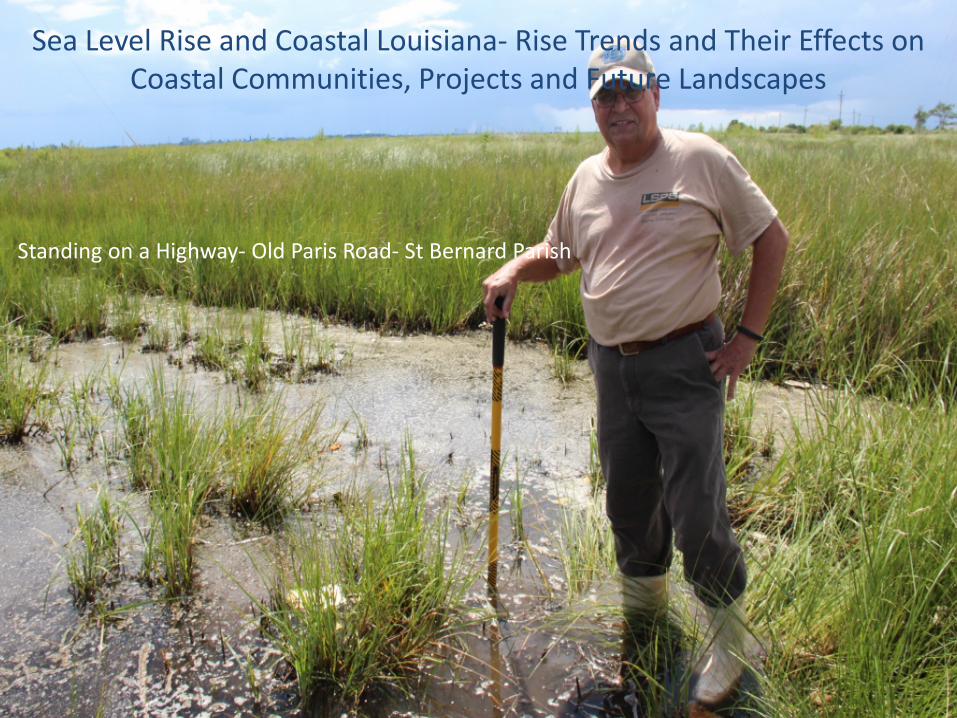
Sea Level Rise and Coastal Louisiana- Rise Trends and Their Effects on Coastal Communities, Projects and Future Landscapes
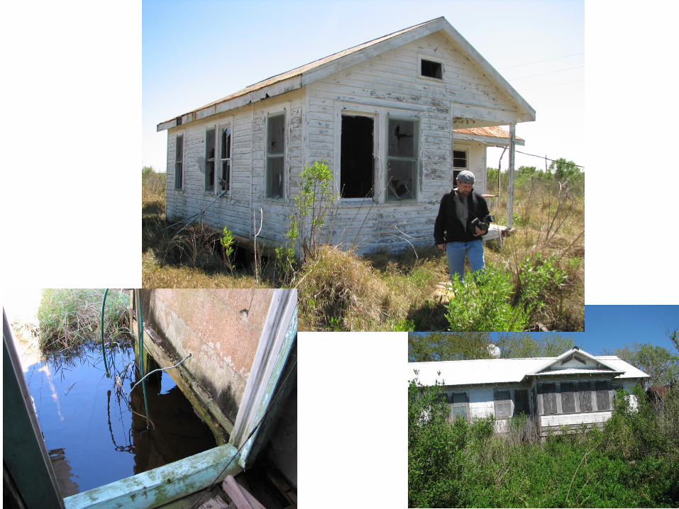
Standing on a Highway- Old Paris Road- St Bernard Parish
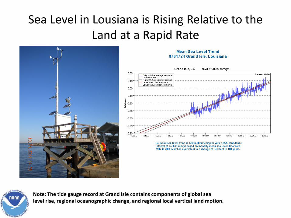
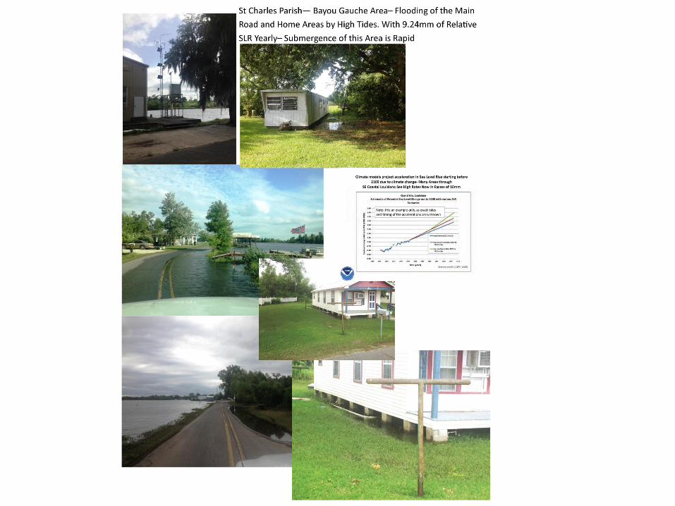
Sea Level in Lousiana is Rising Relative to the Land at a Rapid Rate
Note: The tide gauge record at Grand Isle contains components of global sea level rise, regional oceanographic change, and regional local vertical land motion.

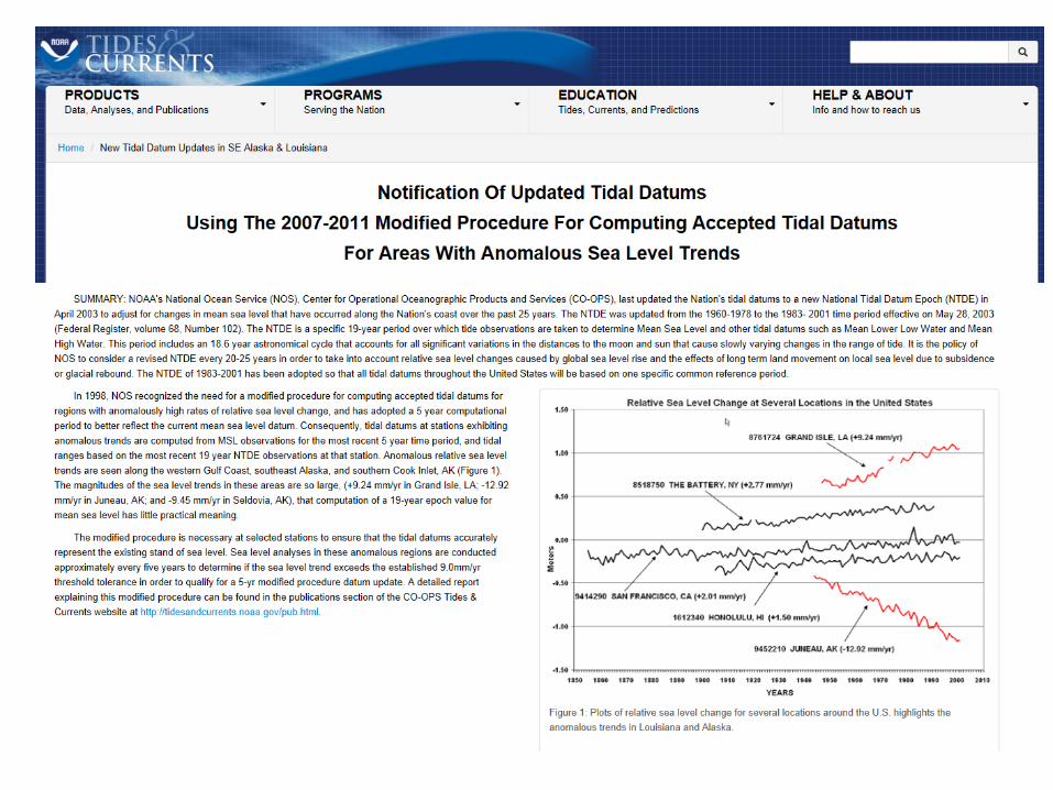
NOAA’s Resources in the Measuring and Reporting of Sea Level Rise Trends is a National Effort Joined into an International Collaboration
to Observe and Report on Sea Level Trends
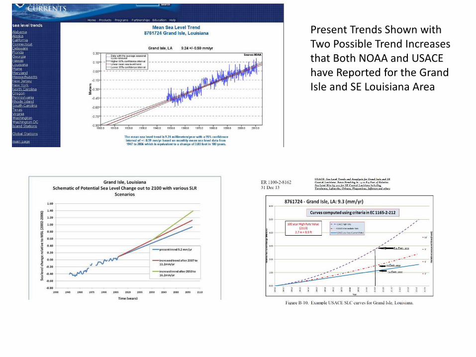
Present Trends Shown with Two Possible Trend Increases that Both NOAA and USACE have Reported for the Grand Isle and SE Louisiana Area
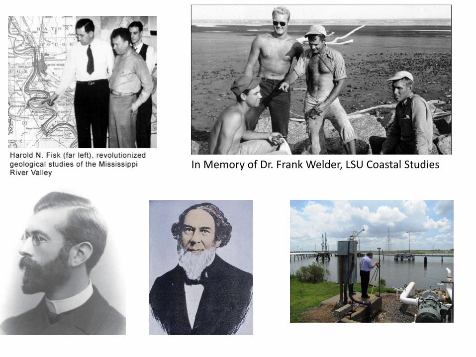
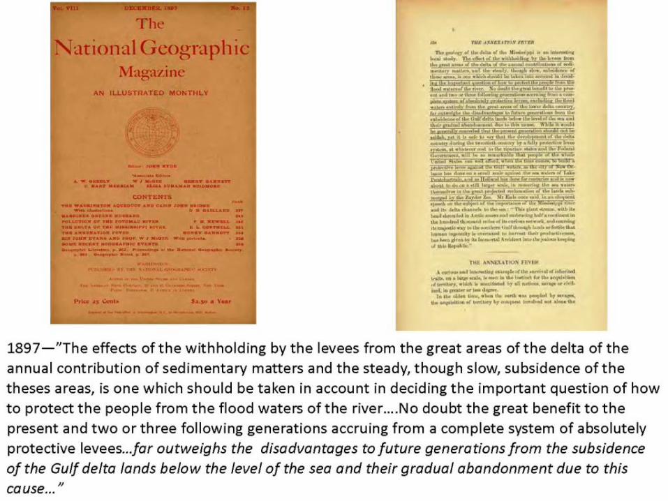
In Memory of Dr. Frank Welder, LSU Coastal Studies
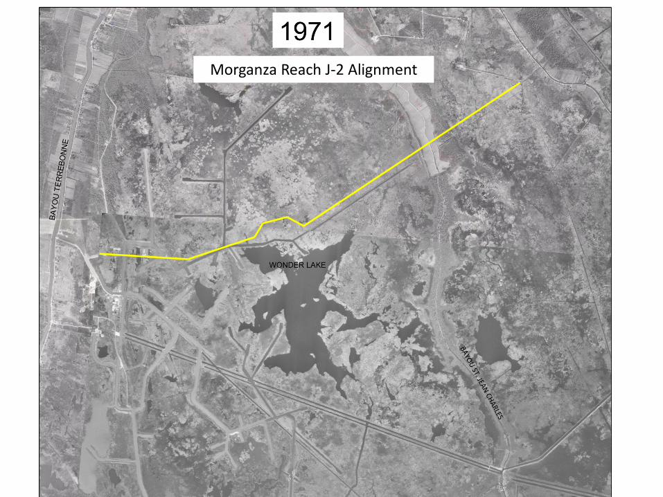
Morganza Reach J-2 Alignment
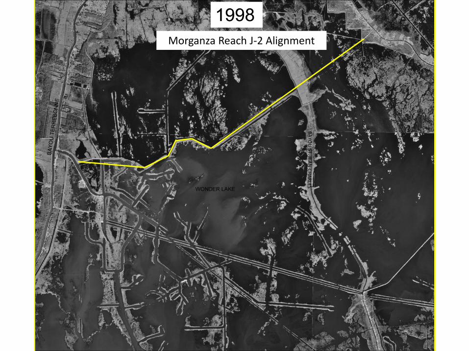
Morganza Reach J-2 Alignment
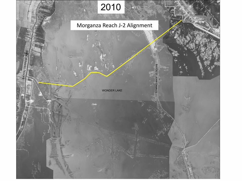
Morganza Reach J-2 Alignment
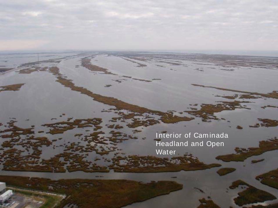
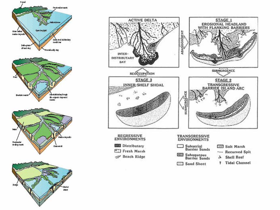
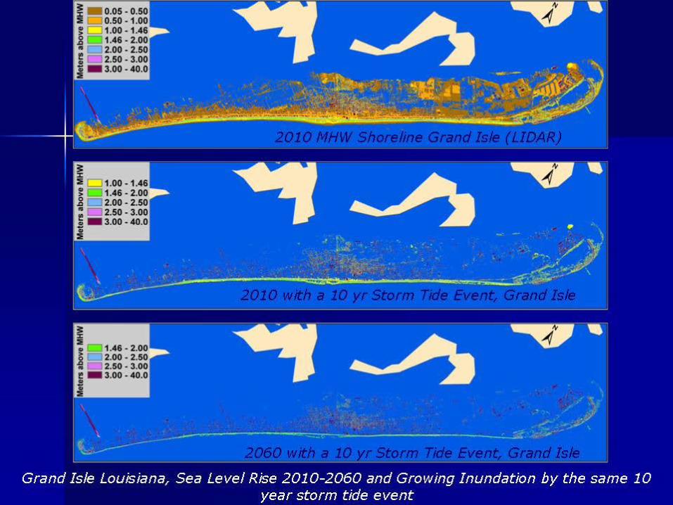
Interior of Caminada Headland and Open Water
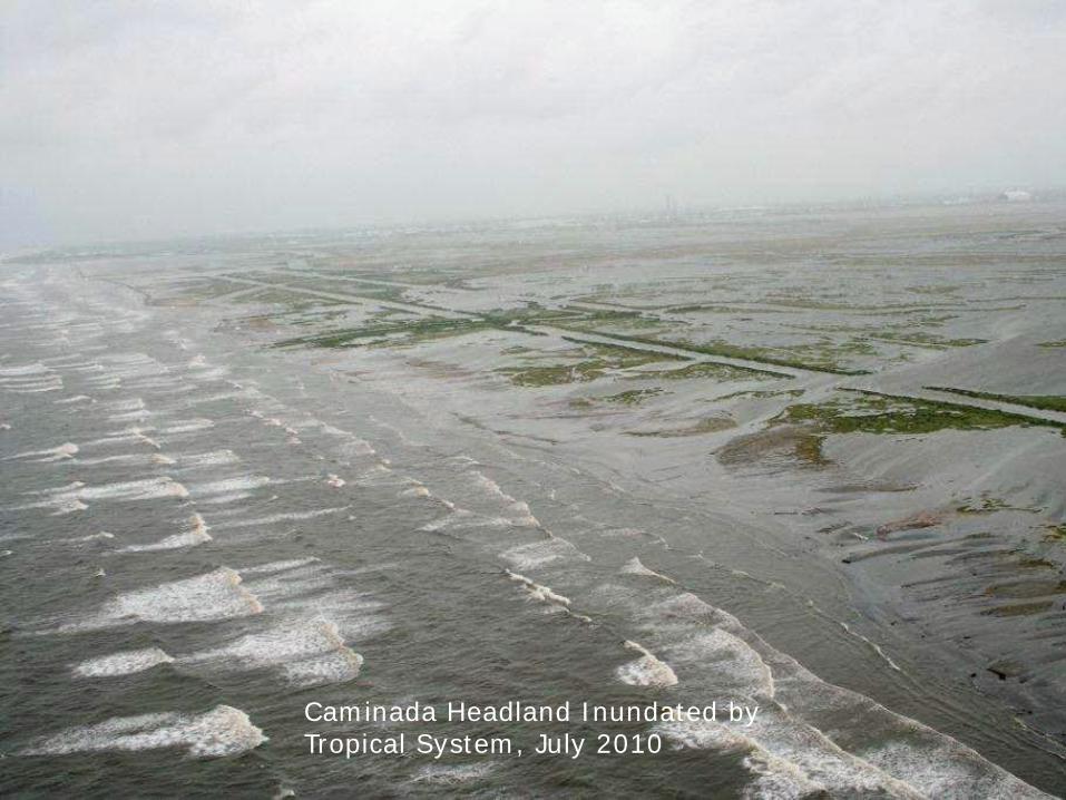
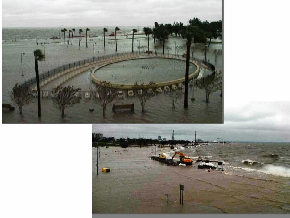
Caminada Headland Inundated by Tropical System, July 2010
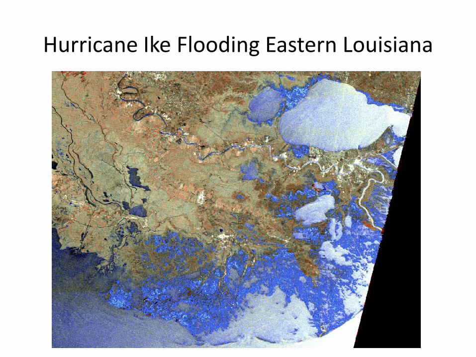
Hurricane Ike Flooding Eastern Louisiana
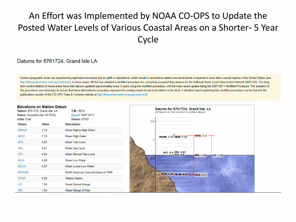
An Effort was Implemented by NOAA CO-OPS to Update the Posted Water Levels of Various Coastal Areas on a Shorter- 5 Year
Cycle

Posting of Adjusted Values to Mean Sea Level Occurred Last Week by NOAA CO-OPS for the Time Period 2007-2011
• The Adjustment was 1.32 inches for the Station and a Listing of Subordinate Stations with Coverage across SE Coastal Louisiana
• This Adjustment in just a Five Year Period is in Response to the Large Shifts in Such a Short Timeframe for a Coastal Area that has Such Low Coastal Elevation Profiles
• Continued Updates on a Five Year Cycle is Planned in the Future
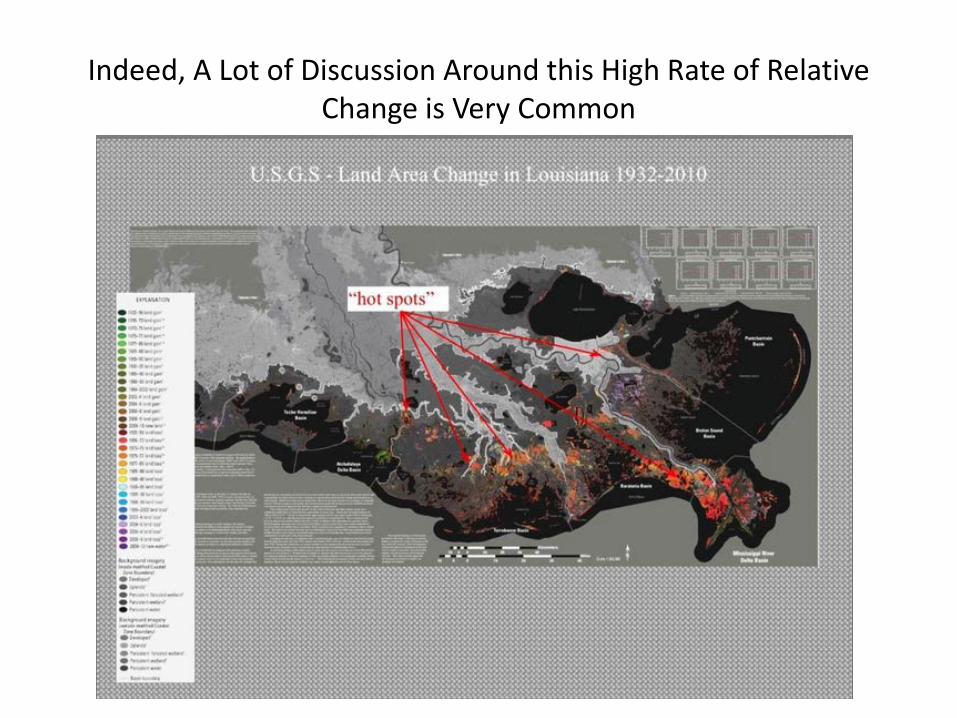
Indeed, A Lot of Discussion Around this High Rate of Relative Change is Very Common
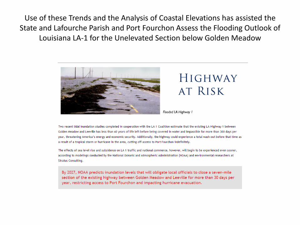
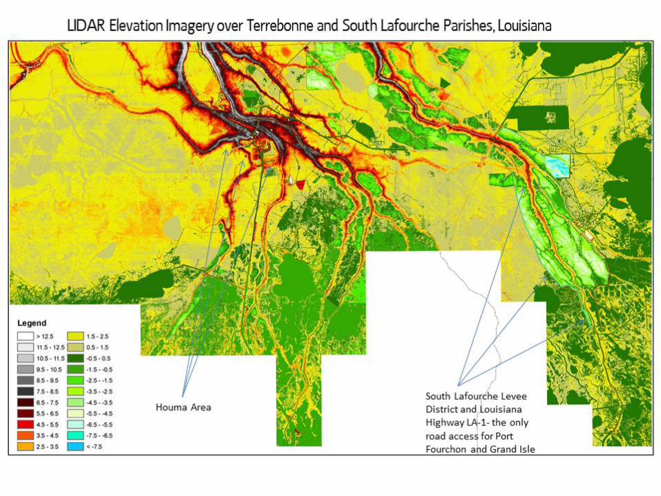
Use of these Trends and the Analysis of Coastal Elevations has assisted the State and Lafourche Parish and Port Fourchon Assess the Flooding Outlook of
Louisiana LA-1 for the Unelevated Section below Golden Meadow

Impact of Rising Water Level Values Being Updated by NOAA on Critical Infrastructure- Louisiana Highway LA-1 – The Only Road Access to Port Fourchon and Grand Isle
Increasing Rate of Flooding and Closures of Louisiana LA-1 South of Golden Meadow as Water Levels Rise
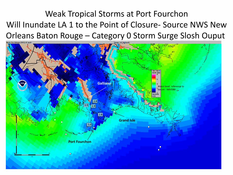
NWS SLOSH storm surge model
Weak Tropical Storms at Port Fourchon Will Inundate LA 1 to the Point of Closure- Source NWS New Orleans Baton Rouge – Category 0 Storm Surge Slosh Ouput.
Grand Isle
Port Fourchon
Galliano Water level reference to datum - NAVD88
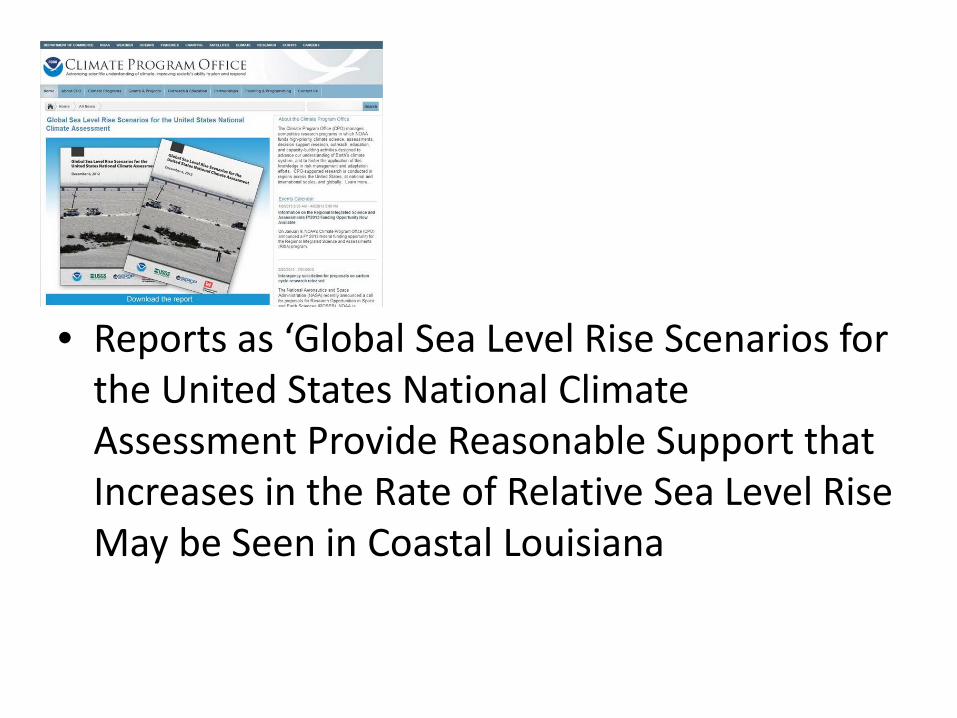
• Reports as ‘Global Sea Level Rise Scenarios for the United States National Climate Assessment Provide Reasonable Support that Increases in the Rate of Relative Sea Level Rise May be Seen in Coastal Louisiana
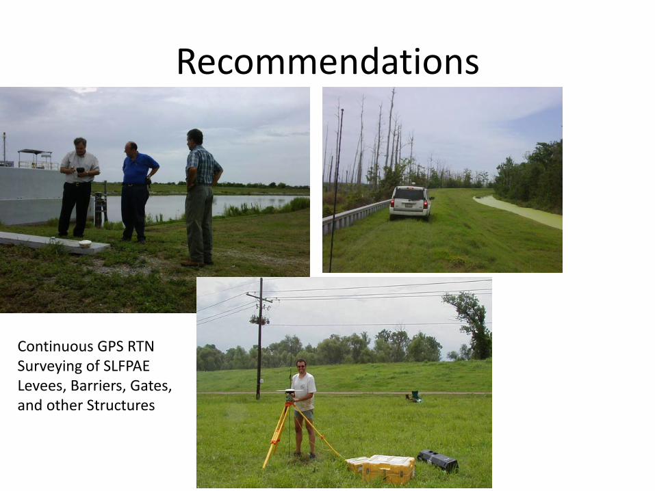
Recommendations
Continuous GPS RTN Surveying of SLFPAE Levees, Barriers, Gates, and other Structures
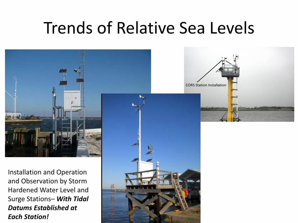
Trends of Relative Sea Levels
Installation and Operation and Observation by Storm Hardened Water Level and Surge Stations– With Tidal Datums Established at Each Station!


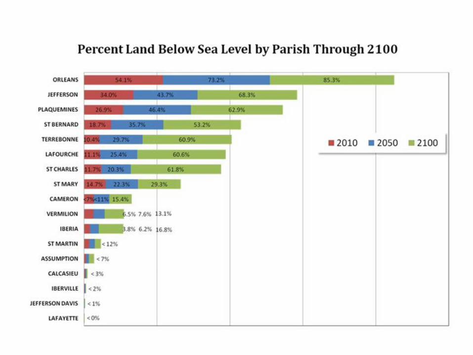
![2012 Louisiana Coastal Master Plan [1]](https://img.pdfslide.us/doc/110x75/553390a94a79599f5e8b497e/2012-louisiana-coastal-master-plan-1.jpg)