Embed Size (px)
Citation preview
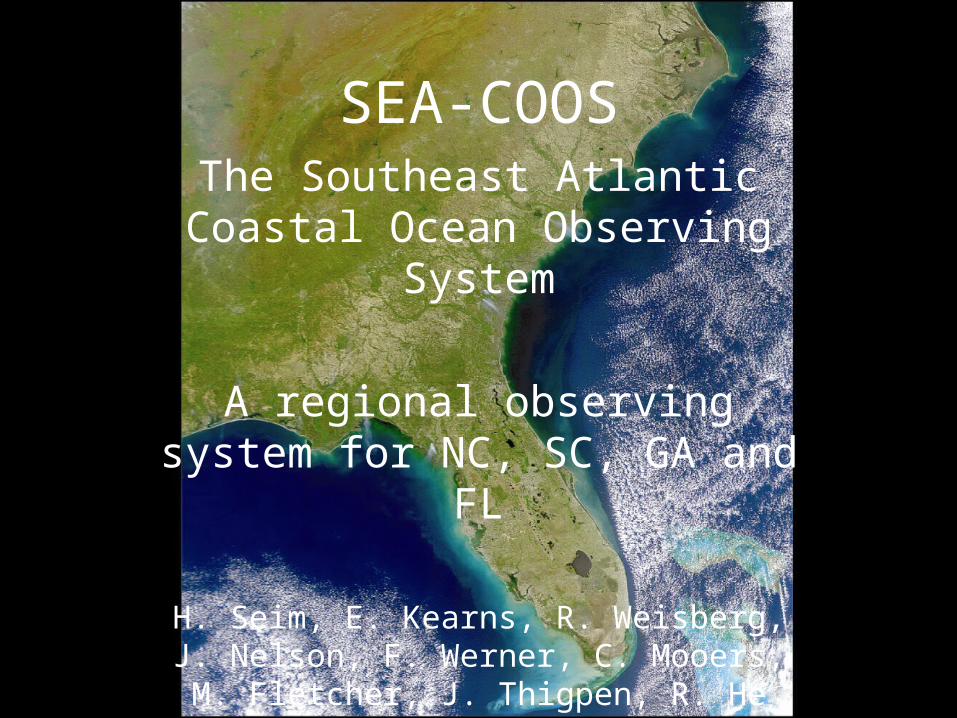
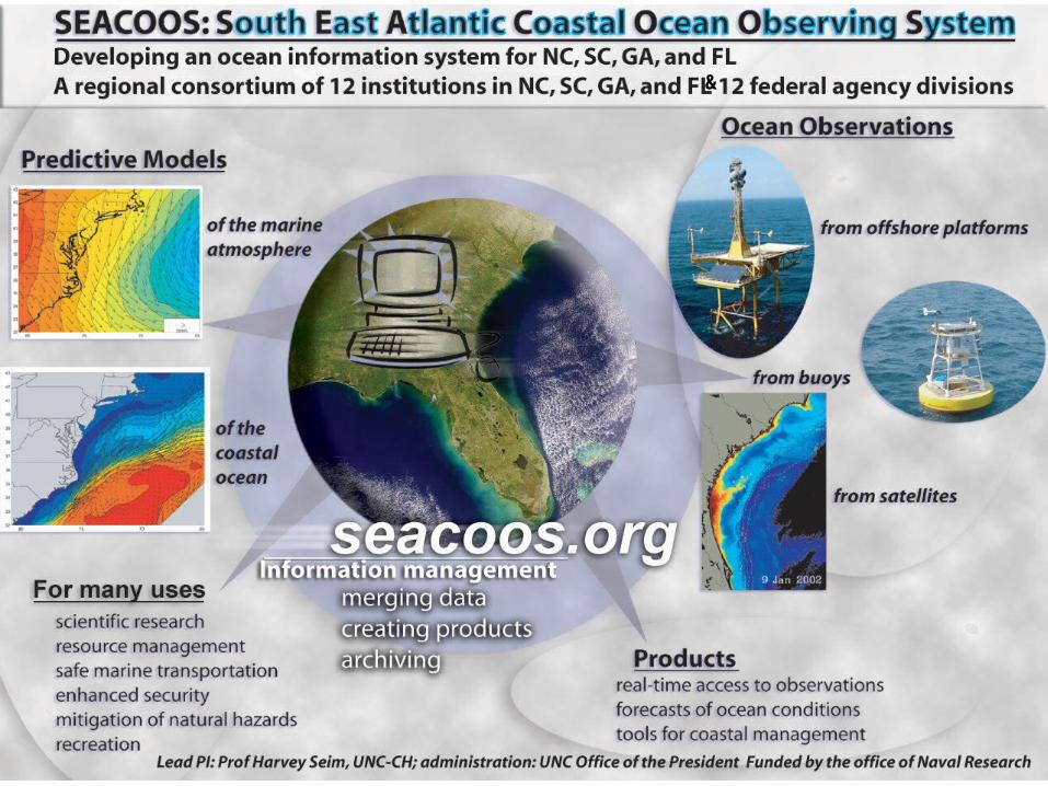
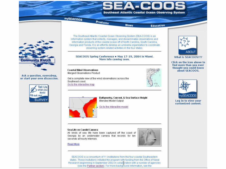
SEA-COOSThe Southeast Atlantic
Coastal Ocean Observing System
A regional observing system for NC, SC, GA and FL
H. Seim, E. Kearns, R. Weisberg, J. Nelson, F. Werner, C. Mooers, M.
Fletcher, J. Thigpen, R. He
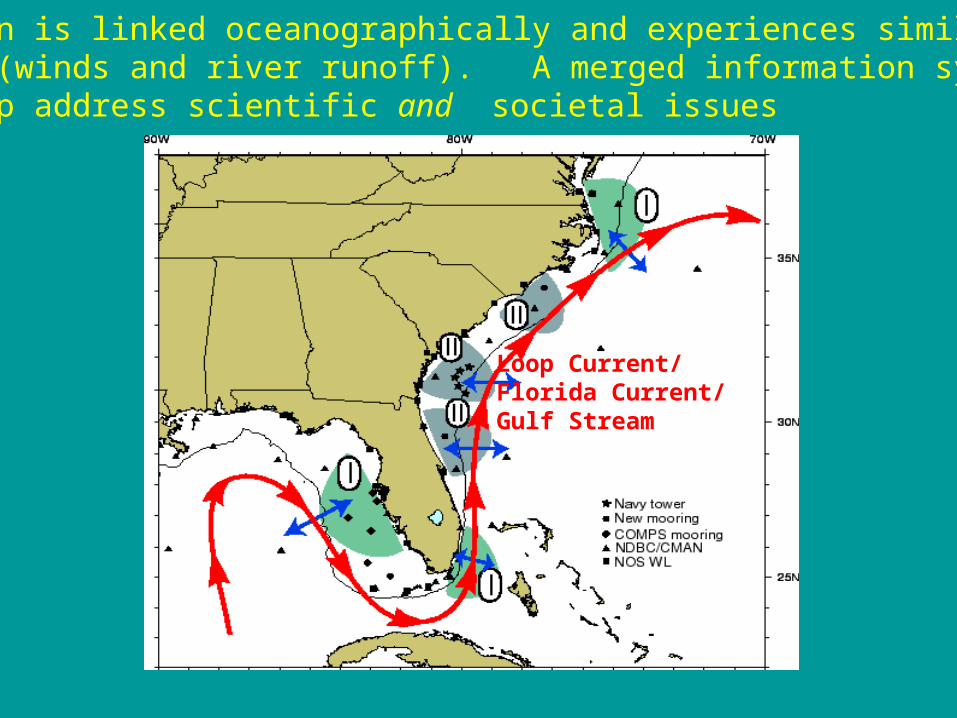
SE region is linked oceanographically and experiences similar forcing (winds and river runoff). A merged information system will help address scientific and societal issues
Loop Current/Florida Current/Gulf Stream
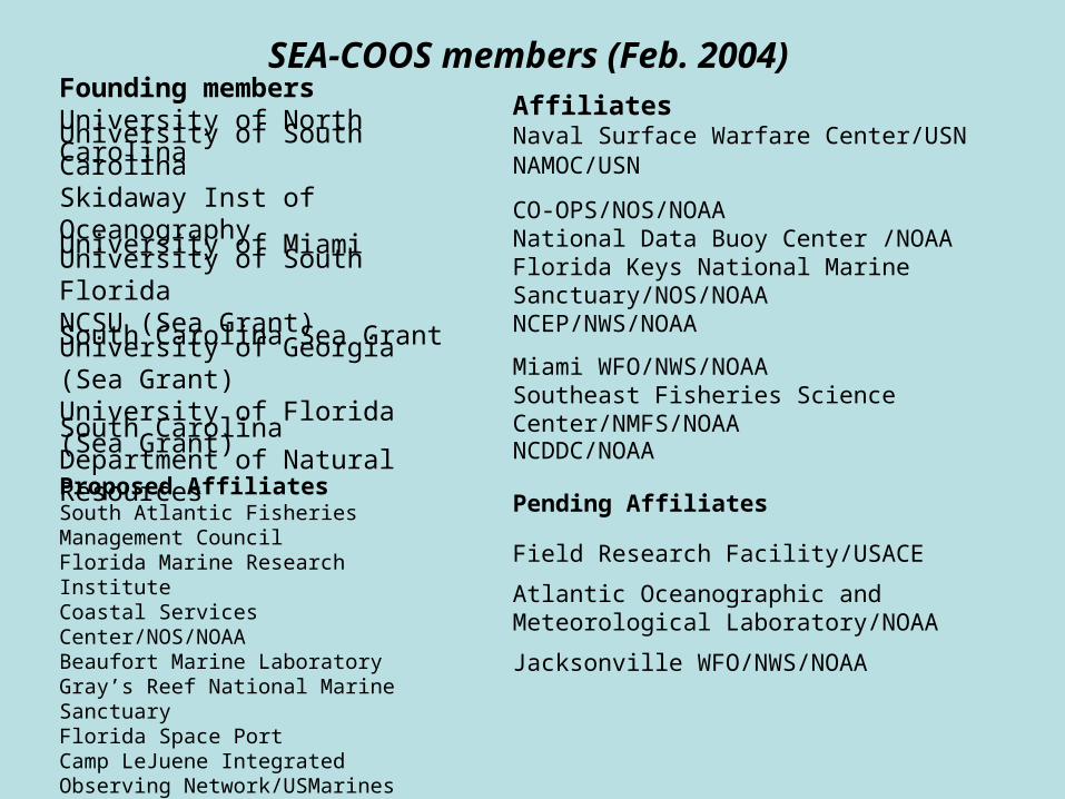
SEA-COOS members (Feb. 2004)Founding membersUniversity of North Carolina
AffiliatesNaval Surface Warfare Center/USN
University of South CarolinaSkidaway Inst of Oceanography
NAMOC/USN
University of MiamiCO-OPS/NOS/NOAANational Data Buoy Center /NOAAFlorida Keys National Marine Sanctuary/NOS/NOAANCEP/NWS/NOAA
University of South FloridaNCSU (Sea Grant)
South Carolina Sea GrantUniversity of Georgia (Sea Grant)University of Florida (Sea Grant)
Miami WFO/NWS/NOAASoutheast Fisheries Science Center/NMFS/NOAA
South Carolina Department of Natural Resources
NCDDC/NOAA
Pending AffiliatesProposed AffiliatesSouth Atlantic Fisheries Management CouncilFlorida Marine Research InstituteCoastal Services Center/NOS/NOAABeaufort Marine LaboratoryGray’s Reef National Marine SanctuaryFlorida Space PortCamp LeJuene Integrated Observing Network/USMarinesSeaKeys
Field Research Facility/USACE Atlantic Oceanographic and Meteorological Laboratory/NOAA
Jacksonville WFO/NWS/NOAA
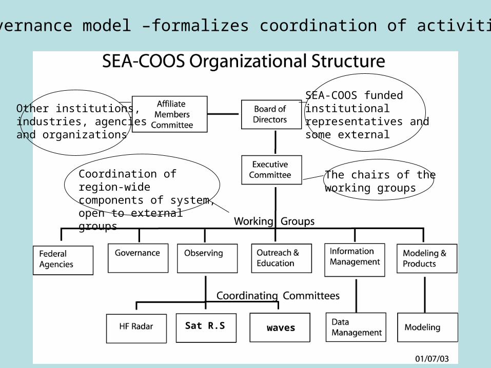
The chairs of theworking groups
SEA-COOS fundedinstitutionalrepresentatives andsome external
Other institutions,industries, agenciesand organizations
Coordination of region-wide components of system, open to external groups
Governance model –formalizes coordination of activities
Sat R.S waves
&
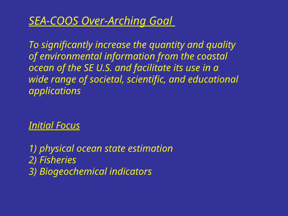
SEA-COOS Over-Arching Goal
To significantly increase the quantity and quality of environmental information from the coastal ocean of the SE U.S. and facilitate its use in a wide range of societal, scientific, and educational applications
Initial Focus
1)physical ocean state estimation2)Fisheries 3)Biogeochemical indicators
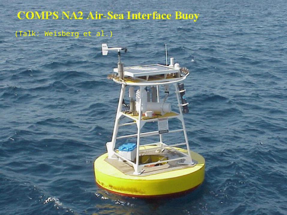
(Talk: Weisberg et al.)
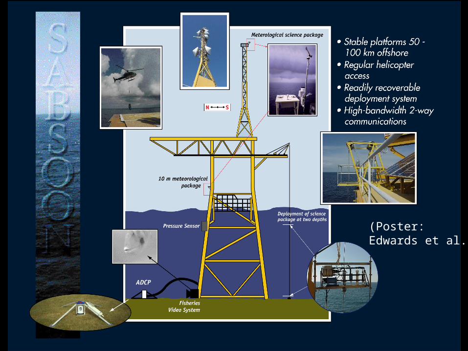
(Poster: Edwards et al.)
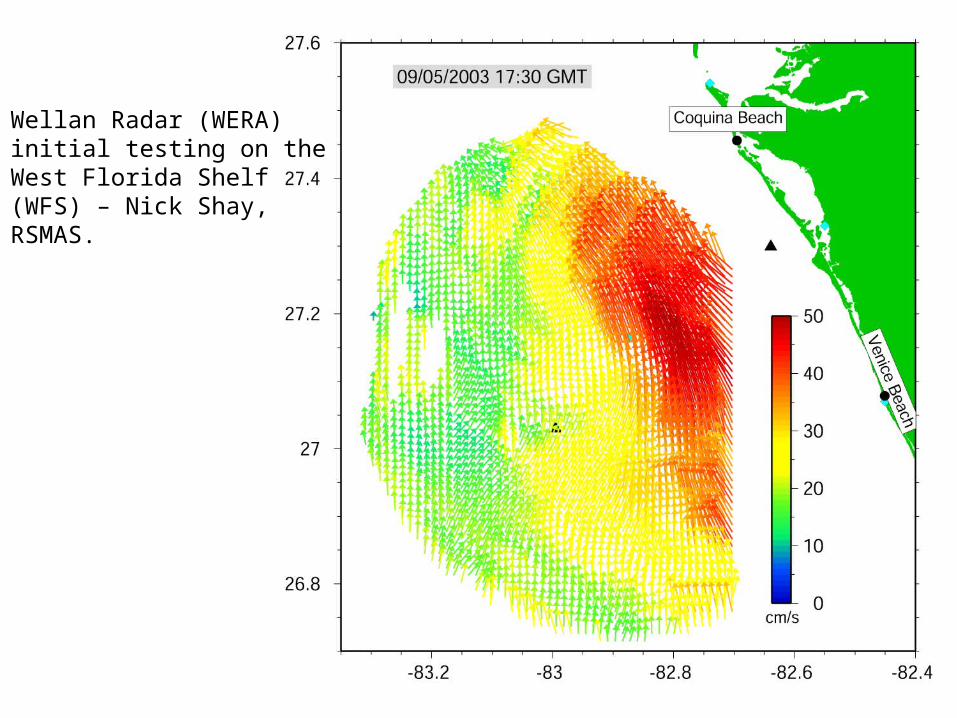
Wellan Radar (WERA)initial testing on the West Florida Shelf (WFS) – Nick Shay,RSMAS.
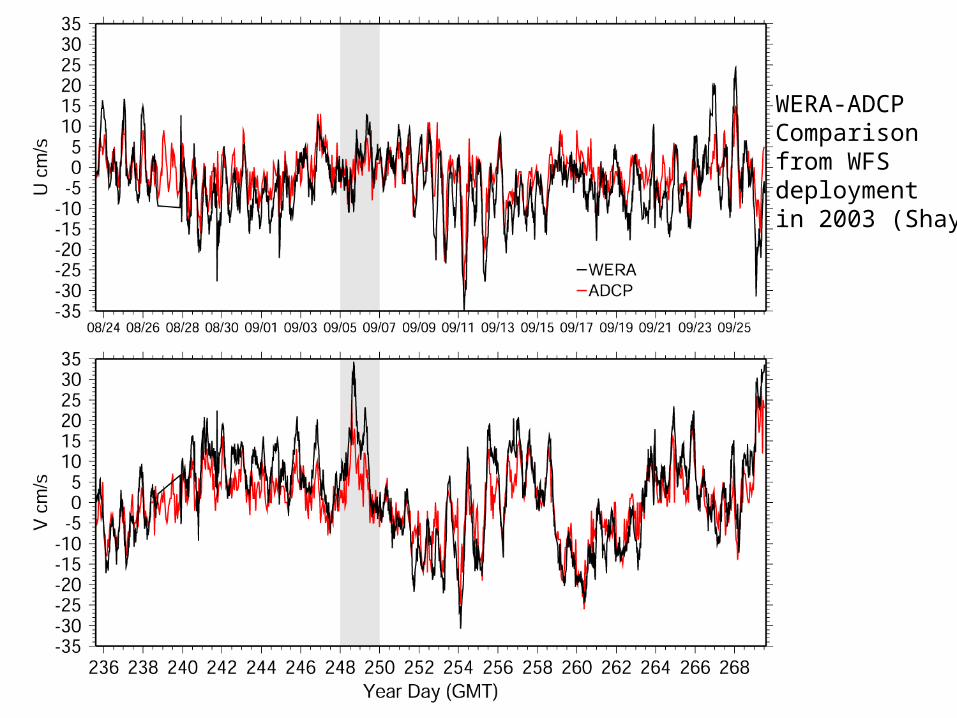
WERA-ADCPComparisonfrom WFSdeploymentin 2003 (Shay)
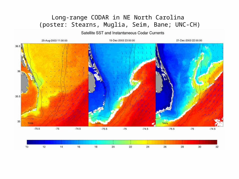
Long-range CODAR in NE North Carolina (poster: Stearns, Muglia, Seim, Bane; UNC-CH)
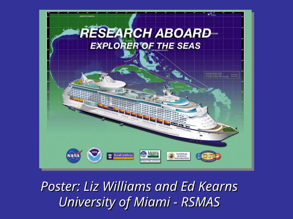
Poster: Liz Williams and Ed KearnsPoster: Liz Williams and Ed KearnsUniversity of Miami - RSMASUniversity of Miami - RSMAS

Products portal – GIS-like but open-source and browser independent
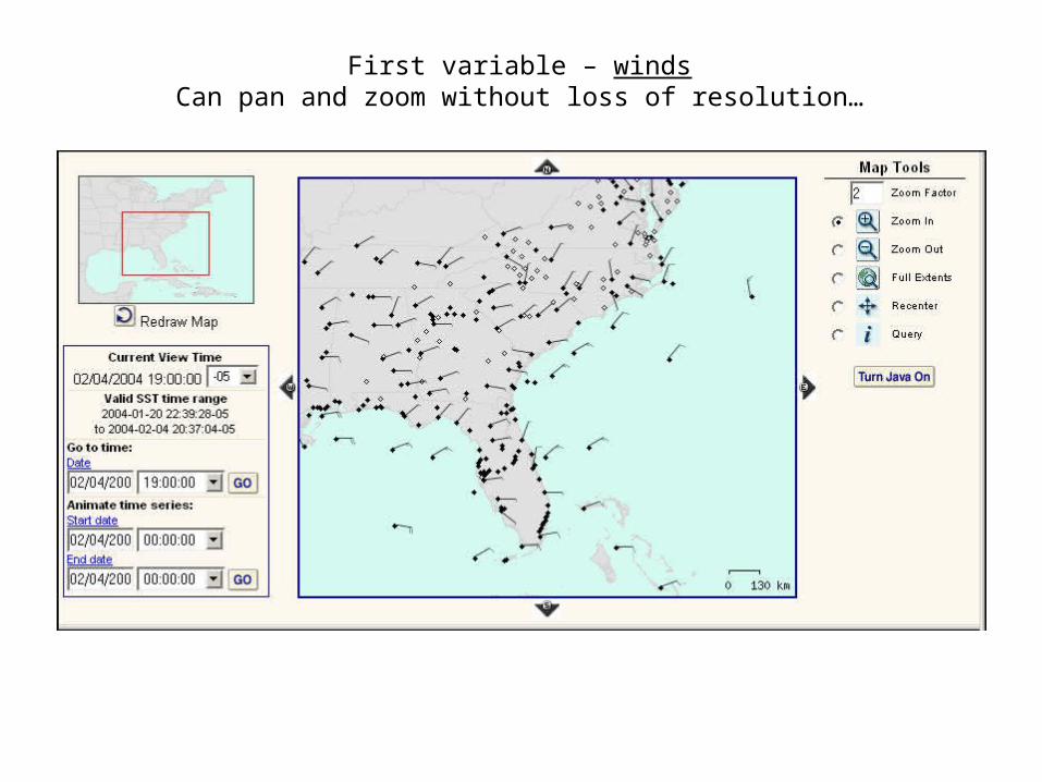
First variable – windsCan pan and zoom without loss of resolution…
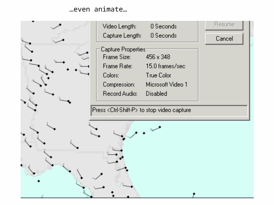
…even animate…
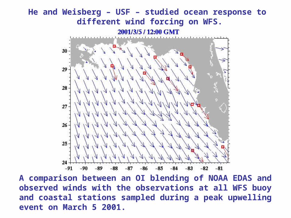
A comparison between an OI blending of NOAA EDAS and observed winds with the observations at all WFS buoy and coastal stations sampled during a peak upwelling event on March 5 2001.
He and Weisberg – USF – studied ocean response to different wind forcing on WFS.
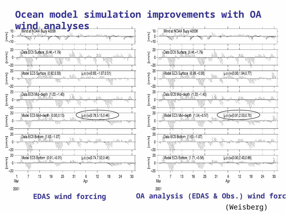
EDAS wind forcing OA analysis (EDAS & Obs.) wind forcing
Ocean model simulation improvements with OA wind analyses
(Weisberg)
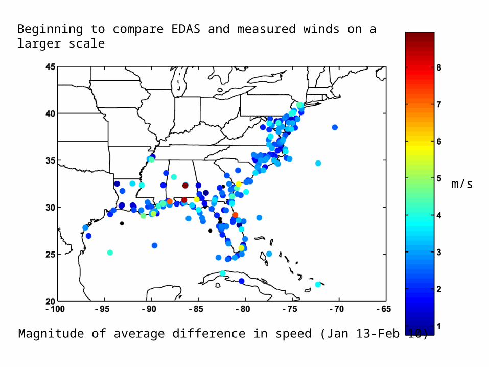
Beginning to compare EDAS and measured winds on a larger scale
Magnitude of average difference in speed (Jan 13-Feb 10)
m/s
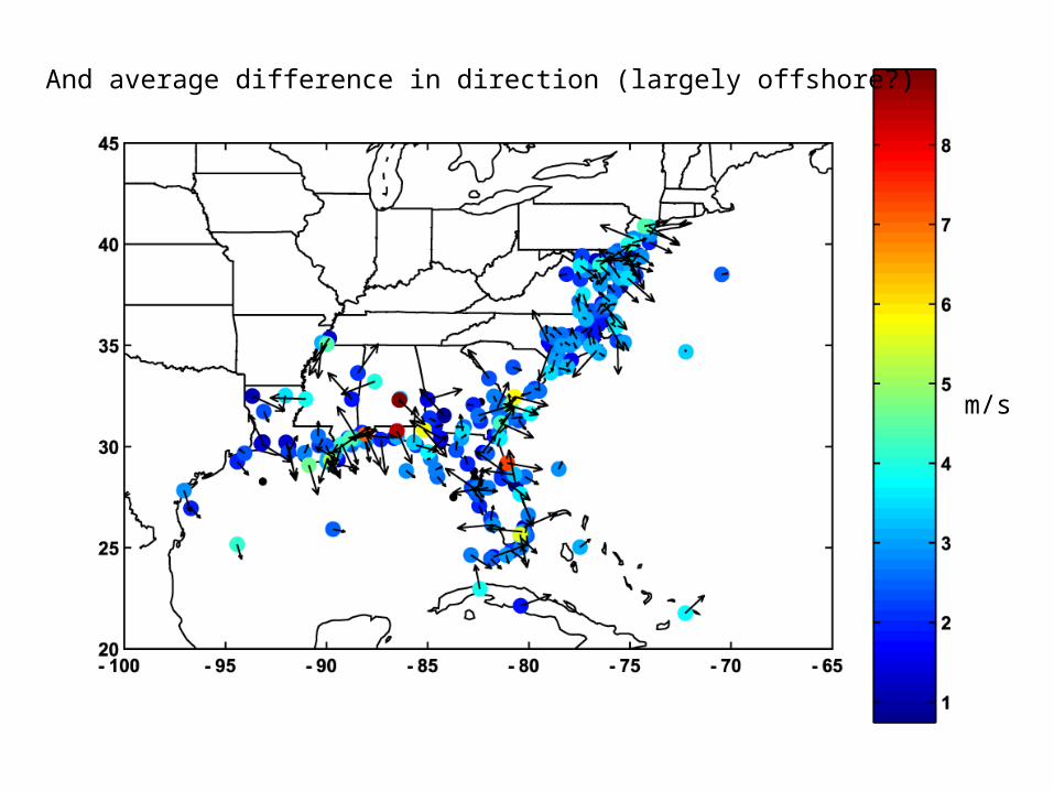
And average difference in direction (largely offshore?)
m/s
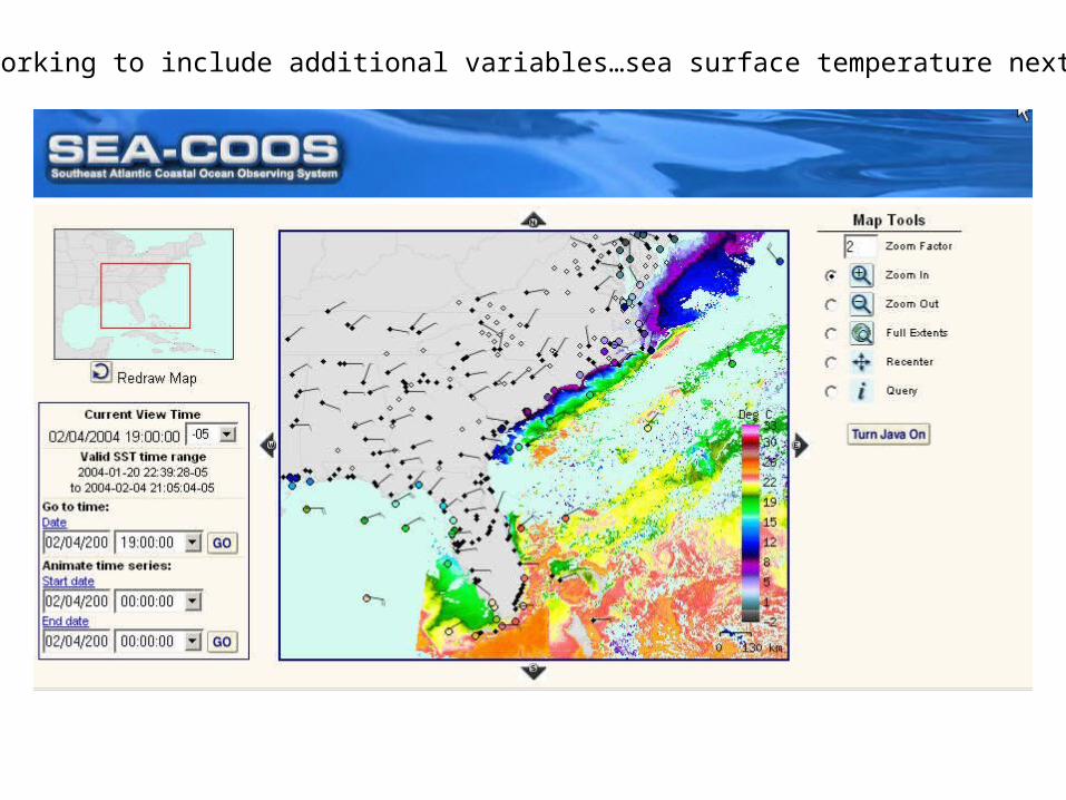
Now working to include additional variables…sea surface temperature next
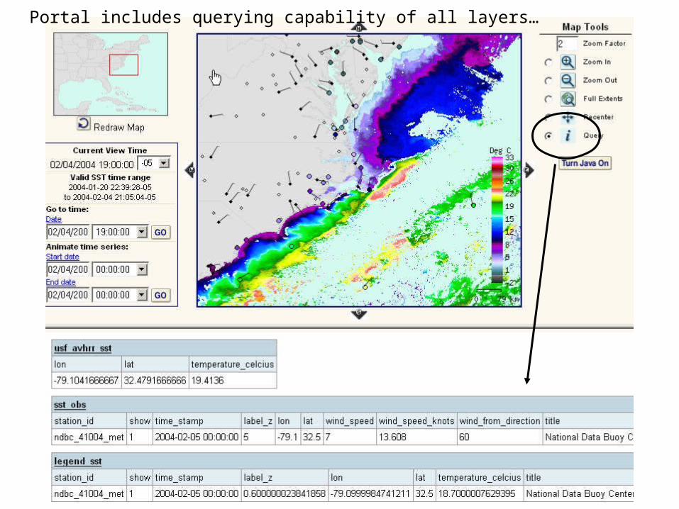
Portal includes querying capability of all layers…
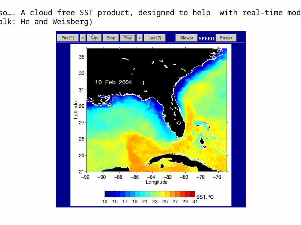
Also…. A cloud free SST product, designed to help with real-time modeling(Talk: He and Weisberg)
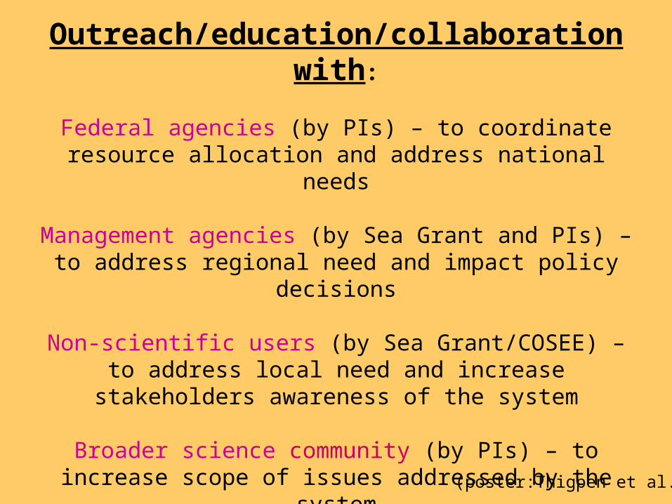
Outreach/education/collaboration with:
Federal agencies (by PIs) – to coordinate resource allocation and address national needs
Management agencies (by Sea Grant and PIs) – to address regional need and impact policy decisions
Non-scientific users (by Sea Grant/COSEE) – to address local need and increase stakeholders
awareness of the system
Broader science community (by PIs) – to increase scope of issues addressed by the system
Private industry (by all) – to develop products and consider components that can be transitioned
(poster:Thigpen et al.)
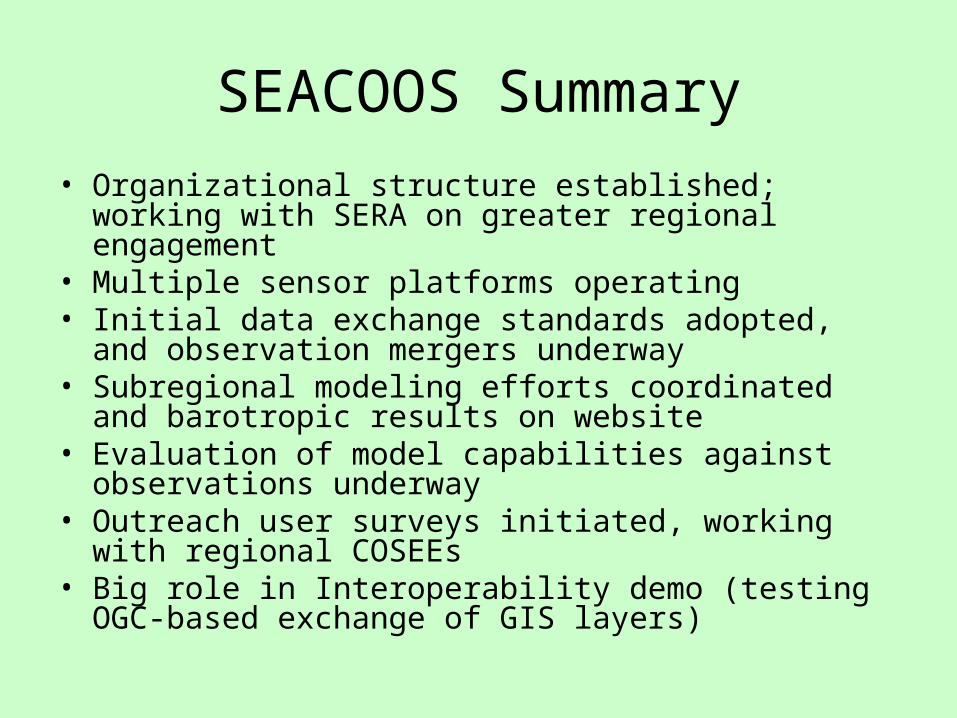
SEACOOS Summary
• Organizational structure established; working with SERA on greater regional engagement
• Multiple sensor platforms operating• Initial data exchange standards adopted, and
observation mergers underway• Subregional modeling efforts coordinated and barotropic
results on website• Evaluation of model capabilities against observations
underway• Outreach user surveys initiated, working with regional
COSEEs• Big role in Interoperability demo (testing OGC-based
exchange of GIS layers)