Embed Size (px)
Citation preview
F in a l
Revegetation Plan and Compensation for Impacts to
Native Vegetation Communities Condition of Certification BIO-10
Rice Solar Energy Project (09-AFC-10C)
Submitted to the:
California Energy Commission
Submitted by:
With Technical Assistance by:
Sacramento, California
October 2011
EY072009005SAC/419368/112000004 iii
Contents
Section Page
1 Introduction ......................................................................................................................... 1-1 1.1 Plan Purpose ............................................................................................................... 1-1 1.2 California Energy Commission Conditions of Certification ............................... 1-1
2 Study Area ........................................................................................................................... 2-1
2.1 Project Location .......................................................................................................... 2-1 2.2 Project Description .................................................................................................... 2-1 2.3 Project Construction and Schedule ......................................................................... 2-3 2.4 Regional Overview .................................................................................................... 2-3 2.5 Habitat and Vegetation Communities .................................................................... 2-5
2.5.1 Creosote Bush Scrub ..................................................................................... 2-5 2.5.2 White Bursage Scrub .................................................................................... 2-6 2.5.3 Smoke Tree Woodland ................................................................................. 2-6
2.6 Temporarily Disturbed Impact Areas ..................................................................... 2-6 3 Plan Details .......................................................................................................................... 3-1
3.1 Pre-Construction Measures ...................................................................................... 3-1 3.1.1 Surface Disturbance ...................................................................................... 3-1 3.1.2 Salvage and Replant Cacti, Yucca, Ocotillo, and Sensitive Species ....... 3-1 3.1.3 Topsoil Salvage ............................................................................................. 3-6
3.2 Post-Construction Measures .................................................................................... 3-7 3.2.1 Surface Recontouring ................................................................................... 3-7 3.2.2 Soil Decompaction ........................................................................................ 3-7 3.2.3 Topsoil Replacement .................................................................................... 3-7 3.2.4 Vertical Mulch ............................................................................................... 3-8 3.2.5 Seed and Nursery Stock Sources ................................................................ 3-8 3.2.6 Seed Collection Guidelines .......................................................................... 3-9 3.2.7 Seeding Techniques .................................................................................... 3-10 3.2.8 Fencing and Signage .................................................................................. 3-11 3.2.9 Control of Exotic Species ........................................................................... 3-11
4 Compliance .......................................................................................................................... 4-1
4.1 Success Criteria .......................................................................................................... 4-1 4.2 Contingency Mitigation Measures .......................................................................... 4-1 4.3 Replacement Requirement ....................................................................................... 4-1
5 Monitoring and Reporting ................................................................................................ 5-1
5.1 Monitoring Program ................................................................................................. 5-1 5.2 Monitoring Technique .............................................................................................. 5-1
5.2.1 Parameters ..................................................................................................... 5-1 5.2.2 Minimum Sample Size ................................................................................. 5-2
CONTENTS, CONTINUED
iv EY072009005SAC/419368/112000004
5.3 Verification Report .................................................................................................... 5-3 5.4 Annual Revegetation Activities Report .................................................................. 5-3
6 References ............................................................................................................................ 6-1 Appendix
Restoration Monitoring Form (Sample Data Sheet)
Figures
1-1 Project Location 1-2 Site Location 3-1 Mitigation Area Schematic for the RSEP Gen Tie Line
Tables
2-1 Project Construction Schedule 2-2 Summary of Project Disturbance Acreage by Vegetation Type 3-1 Potential Post-Construction Restoration Seed Mix List for the Sonoran Creosote
Bush Scrub 3-2 Potential Post-Construction Restoration Seed Mix List for the Sonoran Desert Dry
Wash Woodland
EY072009005SAC/419368/112000004 V
Acronyms and Abbreviations
AFC Application for Certification
BLM U.S. Bureau of Land Management
Caltrans California Department of Transportation
CDFG California Department of Fish and Game
CEC California Energy Commission
CNPS California Native Plant Society
COC Condition of Certification
CPM Compliance Project Manager
CSP concentrating solar power
GPS global positioning system
kV kilovolt
MW megawatt
MWh megawatt hours
NECO Northern and Eastern Colorado Desert Coordinated Management Plan
PEP potassium excreting potential
Reveg Plan Revegetation Plan and Compensation for Impacts to Native Vegetation Communities
RSE Rice Solar Energy, LLC
RSEP Rice Solar Energy Project
SR State Route
Western Western Area Power Administration
EY072009005SAC/419368/112000004 1-1
SECTION 1
Introduction
This Revegetation Plan and Compensation for Impacts to Native Vegetation Communities (Reveg Plan) for the Rice Solar Energy Project (RSEP) is a project-specific program intended to reduce the impacts of project construction to native vegetation communities in all project areas subject to temporary disturbance. Figure 1-1 is the Project Vicinity Map and Figure 1-2 is the Site Location Map.
1.1 Plan Purpose This document provides a plan to address the impacts of construction to native vegetation communities and address temporary loss of habitat and the increased risk of establishing non-native invasive plant species in the disturbance areas. This plan is being provided in compliance with California Energy Commission (CEC) Condition of Certification (COC) BIO-10 for the RSEP (09-Application for Certification [AFC]-10C), which will be constructed by Rice Solar Energy, LLC, (RSE) a wholly owned subsidiary of SolarReserve, LLC.
The primary purpose of this plan is to propose a strategy to restore disturbed project areas to pre-project grade and to revegetate these areas with the purpose of minimizing soil erosion and vulnerability to weed invasion. These measures described in this plan, in conjunction with other COCs (BIO-1, BIO-2, BIO-3, BIO-4, BIO-5, BIO-6, BIO-7, BIO-8, and BIO-11), will reduce significant direct and indirect construction impacts to native plant communities to less-than-significant levels. In conjunction with COCs BIO-1 through BIO-9 and other COCs, implementation of the measures in this plan will minimize impacts to wildlife species.
1.2 California Energy Commission Conditions of Certification The full text of BIO-10, which this plan addresses, is as follows:
BIO-10 Revegetation Plan and Compensation for Impacts to Native Vegetation Communities
The project owner will provide restoration/compensation for impacts to native vegetation communities and develop and implement a Revegetation Plan for all areas subject to temporary (albeit long-term) project disturbance, including, but not limited to linear features and berms of detention or debris basins, to the extent permitted by stormwater control requirements (see, Construction Impacts to Vegetation). Upon completion of construction, all temporarily disturbed areas, including the logistics/lay down areas; all gen tie line tower sites, pull sites, and similar areas will be restored to pre- project grade and revegetated to minimize soil erosion and vulnerability to weed invasion. Other temporarily disturbed areas within the project area will include, but will not be limited to, all areas where underground infrastructure was installed, temporary access roads, construction work temporary lay-down areas, and construction equipment staging areas. The following

SECTION 1: INTRODUCTION
1-2 EY072009005SAC/419368/112000004
measures will be implemented for the revegetation effort areas not subject to the facility Landscape Plan. These measures will include:
1. Plan Details. The revegetation plan will include at minimum: (a) locations and details for top soil storage; (b) methods to salvage and replant cacti, yucca, or other species described in BIO-12, or to plant out nursery stock of these species onto revegetation sites; (c) seed collection guidelines; (d) a schematic depicting the mitigation area; (e) time of year that the planting will occur and the methodology of the planting; (f) a description of the irrigation methodology if used; (g) measures to control exotic vegetation on site; (h) success criteria relating to soil conditions and weed abundance; and (i) a detailed monitoring program. All habitats dominated by non-native species prior to project disturbance will be revegetated using appropriate native species. This plan will also contain contingency measures for failed restoration efforts (efforts not meeting success criteria).
2. Topsoil Salvage. Topsoil will be stockpiled from the project site for use in revegetation of the disturbed soils. The topsoil excavated will be segregated, kept intact, and protected, under conditions shown to sustain seed bank viability. The upper 1 inch of topsoil, which contains the seed bank, will be scraped and stockpiled for use as the top-dressing for the revegetation area. An additional 6 to 8 inches of soil below the top 1 inch of soil will also be scraped and separately stockpiled for use in revegetation areas. Topsoil will be replaced in its original vertical orientation following ground disturbance, ensuring the integrity of the top one inch in particular. All other elements of soil stockpiling will be conducted as described on pages 39-40 of Rehabilitation of Disturbed Lands in California (Newton and Claassen, 2003).
3. Seed and Nursery Stock. Only seed or potted nursery stock of locally occurring native species will be used for revegetation. Seeds will contain a mix of short-lived early pioneer species such as native annuals and perennials and subshrubs. Seeding and planting will be conducted as described in Chapter 5 of Rehabilitation of Disturbed Lands in California (Newton and Claassen, 2003). A list of plant species suitable for Colorado Desert region revegetation projects, including recommended seed treatments, are included in Appendix A-9 of the same report. The list of plants observed during the special-status plant surveys of the project area can also be used as a guide to site-specific plant selection for revegetation. In conformance with BLM policy, the project owner will include salvaged or nursery stock yucca (all species), and cacti (excluding cholla species, genus Cylindropuntia), in revegetation plans and implementation affecting BLM lands, as described in BIO-12.
4. Monitoring Requirement and Success Criteria. Post-seeding and planting monitoring will be yearly and will continue for a period of no less than two years or until the defined success criteria are achieved. If the criteria have not been met, the project owner is responsible for replacement planting to achieve these requirements or other remedial action as agreed to by the CPM in consultation with BLM and Western. Replacement seeding or planting will be monitored and evaluated by the same criteria as required for original revegetation plantings. Remediation activities (e.g., additional planting, removal of non-native invasive species, or erosion control) will be taken during the 2-year period if necessary to ensure the success of the restoration effort. If the mitigation fails to meet the established performance criteria after the 2-year maintenance and
EY072009005SAC/419368/112000004 1-3
monitoring period, monitoring and remedial activities will extend beyond the 2-year period until the criteria are met or unless otherwise specified by the CPM in consultation with BLM and Western. The following performance standards must be met by the end of monitoring year two:
• At least 80 percent of the species observed within the temporarily disturbed areas will be native species that naturally occur in desert scrub habitats
• Cover and density of non-native plant species within the temporarily disturbed areas will be no greater than in comparable surrounding lands that have not been disturbed by the project.
5. Replacement. If a fire occurs in a revegetation area within the 2-year monitoring period, the owner will be responsible for a one-time replacement. If a second fire occurs, no replanting is required, unless the fire is caused by the owner’s activity (e.g., as determined by BLM or other firefighting agency investigation).
Verification: All mitigation measures and their implementation methods will be included in the BRMIMP and implemented.
Within 90 days after completion of each year of project construction, the project owner will provide to the CPM verification of the total vegetation acreage subject to temporary and permanent disturbance and a written report identifying which items of the Revegetation Plan have been completed, a summary of all modifications to mitigation measures made during the project’s construction phase, and which items are still outstanding. To monitor and evaluate the success of the revegetation, the project owner will submit annual reports of the revegetation, including the status of the site, percent cover of native and exotics, and any remedial actions conducted by the owner, to the CPM and BLM.
On January 31 of each year following construction until the completion of the revegetation monitoring specified in the Revegetation Plan, the Designated Biologist will provide a report to the CPM that includes: a summary of revegetation activities for the year, a discussion of whether revegetation performance standards for the year were met, and recommendations for revegetation remedial action, if warranted, that are planned for the upcoming year.
FIGURE 1-1PROJECT LOCATIONRICE SOLAR ENERGY PROJECTRIVERSIDE COUNTY, CALIFORNIA
SAC\\ZION\SACGIS\PROJ\SOLARPROJECTS\SOLARRESERVE_377714\MAPFILES\PROJECTVICINITY.MXD MHASKELL 10/5/2009 11:47:46
C A L I F O R N I AC A L I F O R N I A
A R I Z O N AA R I Z O N A
Iron Mountain Pumping Plant
Vidal Junction
Parker
PROJECT SITE
95
95
95
10
10
IMPERIAL
SAN BERNARDINO
RIVERSIDE
LakeHavasu City
Blythe
010 5
Miles
LEGEND
PROJECT SITE
COUNTY BOUNDARIES
FIGURE 1-2SITE LOCATIONRICE SOLAR ENERGY PROJECTRIVERSIDE COUNTY, CALIFORNIA
P:\SOLARPROJECTS\SOLARRESERVE_377714\MAPFILES\SITELOCATIONMAP.MXD GPERDEW 6/29/2011 4:27:37 PM
West Riverside M
ountains
Blyt
he-M
idla
nd R
d
Riverside Mountains
!
RICE (TOWNSITE)
Rice Valley
Colorado River Aqueduct
801-070-003 801-070-004
801-070-005
801-070-006
Atchison Topeka Santa Fe R
ailroad
Arizona-California Railroad
T 02.0ST 01.0S
R 20.0E
R 21.0E
R 21.0E
R 22.0E
R 23.0E
R 22.0E
A¡E
0 10.5
Miles
$
LEGENDTRANSMISSION LINE ACCESS ROADGENERATOR TIE-LINEPARKER-BLYTHE TRANSMISSION LINE
PUBLC LAND SURVEY SECTIONS
OWNERSHIP PROPERTYPROJECT FENCELINE BOUNDARYPROJECT PARCEL BOUNDARYPROPOSED SUBSTATIONPOWER BLOCK/RECEIVER
This map was compiled from various scale source data and maps and is intended for use as only an approximate representation of actual locations.
EY072009005SAC/419368/112000004 2-1
SECTION 2
Study Area
2.1 Project Location The RSEP site is a privately owned parcel located in eastern Riverside County. The site is adjacent to State Route (SR) 62, which parallels a portion of the Arizona-California Railroad and the Colorado River Aqueduct, near the junction of SR 62 and Blythe-Midland Road, and near the sparse remains of the abandoned town of Rice, California. The nearest occupied residence is approximately 15 miles northeast at the rural crossroads community of Vidal Junction, California. The nearest town is Parker, Arizona, is approximately 32 miles east. A small permanent residential settlement is located at the Metropolitan Water District of Southern California’s Iron Mountain Pumping Plant, approximately 17 miles west (Figure 1-1).
The RSEP is located within a larger, 3,324-acre, privately owned holding (the ownership property). This holding includes portions of Section 24 and 25, Township 1 South, Range 20 East; and all of Sections 19, 20, 29 and 30, Township 1 South, Range 21 East, San Bernardino Base and Meridian. Within the ownership property, the RSEP is sited within a new square-shaped parcel (the project parcel) that is approximately 2,560-acre parcel. These are Township 1 South, Range 20 East, Sections 19, 20, 29, and 30. Within this project parcel, a 1,410-acre project area will be fenced and will contain the administration building area, heliostat field with power block, and evaporation pond areas (collectively, the project site or facility site) (Figure 1-2). Areas outside the facility site but within the project parcel will not be fenced, developed, or disturbed as part of the RSEP.
2.2 Project Description RSE, a wholly owned subsidiary of SolarReserve, LLC, proposes to construct, own, and operate the RSEP. The RSEP will be capable of producing approximately 450,000 megawatt hours (MWh) of renewable solar energy annually, with a nominal net generating capacity of 150 megawatts (MW).
The facility will use concentrating solar power (CSP) technology, with a central receiver tower and an integrated thermal storage system. The RSEP’s technology generates power from sunlight by focusing energy from a field of sun-tracking mirrors called heliostats onto a central receiver. Liquid salt,1
1 The salt is a mixture of sodium nitrate (a common ingredient in fertilizer) and potassium nitrate (a fertilizer and food additive). These mineral products will be mixed onsite as received directly from mines in solid crystallized form and used without additives or further processing other than mixing and heating.
which has viscosity and appearance similar to water when melted, is circulated through tubes in the receiver, collecting the energy gathered from the sun. The heated salt is then routed to an insulated storage tank where it can be stored with minimal energy losses. When electricity is to be generated, the hot salt is routed to heat exchangers (a steam generation system). The steam is then used to generate electricity in a

SECTION 2: STUDY AREA
2-2 EY072009005SAC/419368/112000004
conventional steam turbine cycle. After exiting the steam generation system, the salt is sent to the cold salt thermal storage tank, and the cycle is repeated. The salt storage technology was demonstrated successfully at the U.S. Department of Energy–sponsored 10-MW Solar Two project near Barstow, California, in the 1990s.
The RSEP design incorporates the following principal elements:
• Heliostat field with up to 17,500 solar-tracking heliostats, each approximately 24 feet tall by 28 feet wide, arranged in a circular array that will reflect and concentrate the sun’s energy onto a tower-mounted receiver. A 1,410-acre project area will be fenced and will contain the administration area, heliostat field, administration area, and evaporation ponds.
• A concrete central tower approximately 540 feet tall, upon which is mounted a receiver approximately 100 feet tall topped with a small maintenance crane, for an overall structure height of 653 feet.
• A liquid salt storage system featuring insulated “hot” and “cold” salt storage tanks.
• A steam turbine generator system rated at 150 MW (net).
• A 20-cell air-cooled condenser (ACC) to provide water-free cooling and condensing of the steam turbine exhaust
• A 10-mile, 230-kilovolt (kV) gen tie-line to connect the RSEP with the existing Western Parker-Blythe transmission line. (The new tie-line has been routed along existing dirt roads for approximately 5.4 miles and will require minimal construction of approximately 4.6 miles of single-lane dirt access road for construction and inspection. A new interconnection substation [approximately 3 acres in size] for the tie-in to Western’s system will be constructed adjacent to the existing transmission line. The gen tie-line will cross land managed by the BLM.)
• Two onsite water wells to provide water for heliostat washing, steam-cycle makeup, and other process uses in an amount not expected to exceed 180 acre-feet per year.
• Three lined evaporation ponds of approximately 5 acres each to capture all process wastewater discharge from the project’s water treatment system, process blowdown, and stormwater drainage from within equipment areas.
• Stormwater drainage features to channelize offsite stormwater flows from upstream of the project site, diverting offsite stormwater around the project site, and rejoining the natural flow channels to the south of the property.
• Two emergency diesel generators and associated equipment to supply emergency backup power for the safe shut-down and protection of vital equipment and facilities.
• Onsite fire protection facilities, which consist of two sets of electric-motor-driven and diesel-engine-driven fire pumps and related fire detection and protection equipment.
• Various buildings for plant control room, administration offices, maintenance and storage, and crew comfort facilities.
SECTION 2: STUDY AREA
EY072009005SAC/419368/112000004 2-3
• Physical security systems, including fencing, closed-circuit television, and other means to protect against unwanted entry consistent with electric utility and Department of Homeland Security requirements.
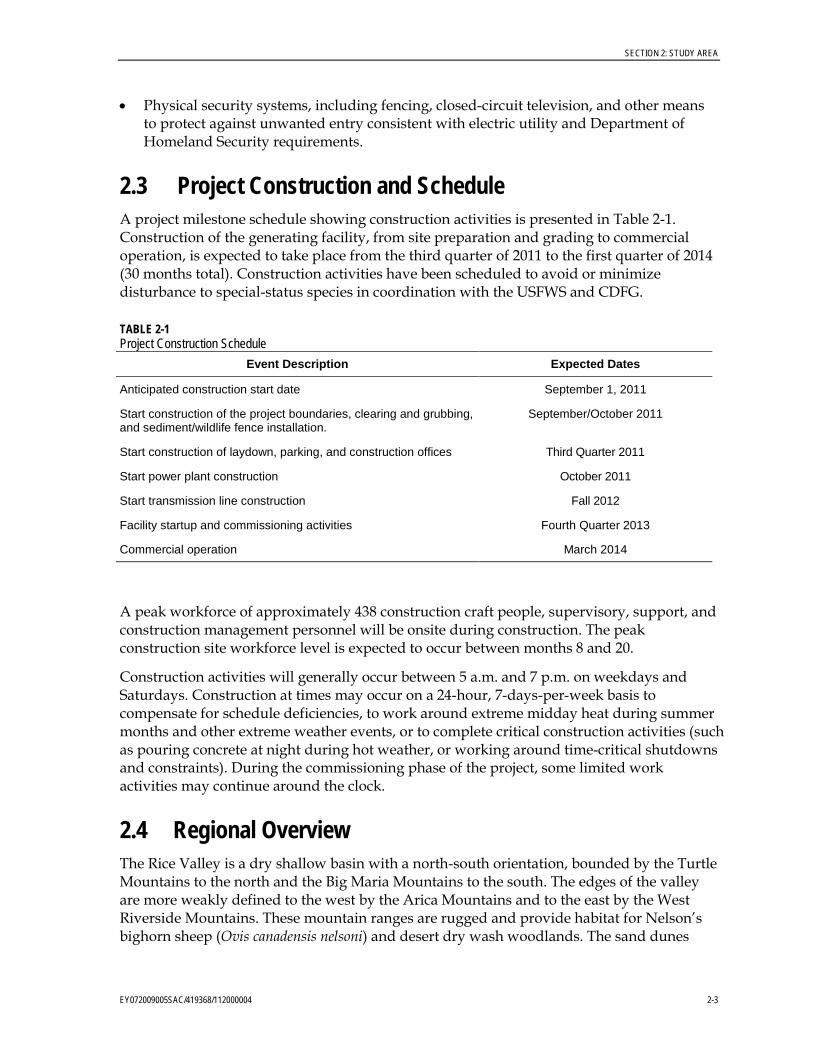
2.3 Project Construction and Schedule A project milestone schedule showing construction activities is presented in Table 2-1. Construction of the generating facility, from site preparation and grading to commercial operation, is expected to take place from the third quarter of 2011 to the first quarter of 2014 (30 months total). Construction activities have been scheduled to avoid or minimize disturbance to special-status species in coordination with the USFWS and CDFG.
TABLE 2-1 Project Construction Schedule
Event Description Expected Dates
Anticipated construction start date September 1, 2011
Start construction of the project boundaries, clearing and grubbing, and sediment/wildlife fence installation.
September/October 2011
Start construction of laydown, parking, and construction offices Third Quarter 2011
Start power plant construction October 2011
Start transmission line construction Fall 2012
Facility startup and commissioning activities Fourth Quarter 2013
Commercial operation March 2014
A peak workforce of approximately 438 construction craft people, supervisory, support, and construction management personnel will be onsite during construction. The peak construction site workforce level is expected to occur between months 8 and 20.
Construction activities will generally occur between 5 a.m. and 7 p.m. on weekdays and Saturdays. Construction at times may occur on a 24-hour, 7-days-per-week basis to compensate for schedule deficiencies, to work around extreme midday heat during summer months and other extreme weather events, or to complete critical construction activities (such as pouring concrete at night during hot weather, or working around time-critical shutdowns and constraints). During the commissioning phase of the project, some limited work activities may continue around the clock.
2.4 Regional Overview The Rice Valley is a dry shallow basin with a north-south orientation, bounded by the Turtle Mountains to the north and the Big Maria Mountains to the south. The edges of the valley are more weakly defined to the west by the Arica Mountains and to the east by the West Riverside Mountains. These mountain ranges are rugged and provide habitat for Nelson’s bighorn sheep (Ovis canadensis nelsoni) and desert dry wash woodlands. The sand dunes

SECTION 2: STUDY AREA
2-4 EY072009005SAC/419368/112000004
along the southern end of the valley are nest site opportunities for golden eagles (Aquila chrysaetos) and prairie falcons (Falco mexicanus). The valley is dominated by a creosote scrub community interrupted by part of a large sand sheet that stretches from Cadiz to Ward Valley.
The rugged mountain areas, lowland valleys, and dunes with diverse topographical features provide a habitat for a variety of plant and animal species. The lack of CNDDB records in the area, in particular for the desert tortoise (Gopherus agassizii), is likely because of lack of studies in this area. Dune areas are often occupied by rare and endemic plant and animal species. Because of the limited resources and limited recent development pressure in the Rice Valley, much of the local focus has likely been on the surrounding Desert Wildlife Management Areas (DWMA) and Wildlife Management Areas (WMA).
Although considered within the West Basin of the Colorado River, which drains primarily into the Salton Sea Trough, Rice Valley is a sink within no broader hydrological connectivity. Rice Valley has a small watershed and lacks any major washes. Although it is a sink, there are no perennial surface water sources and there is no evidence that a lake ever formed in the Valley during wetter climatic periods (BLM, 2007).
Current activity is primarily concentrated on the north end of the valley, evident by the heavily disturbed east-west linear corridor composed of the Colorado River Aqueduct, the Arizona-California Railroad, and SR 62. These three parallel features present a major north-south barrier to wildlife passage and interrupt local hydrology.
The community of Rice, the Rice Airfield, and the Camp Rice infantry and artillery training camp were also located along this corridor. Today these long-abandoned sites are more evident from aerial photos than on the ground. At least 50 years of volunteer plant revegetation now provide relatively sparse-to-moderate vegetative cover of these areas. Most of the Rice Valley was likely used for military training exercises in the early 1940s. Also, an Army-Air Force exercise called Joint Exercise Desert Strike took place in this area in 1964.
General Patton’s soldiers are credited with one of the few historical records of banded gila monster (Heloderma suspectum cinctum) in California from a capture in the Granite Mountains in the adjacent valley to the west (CNDDB, 2009). The Rice Valley dunes are relatively shallow and do not appear to have held much appeal to off-road enthusiasts. This was even before the BLM closed the Rice Valley Dunes Off-Highway Recreation Area part of the Northern and Eastern Colorado Desert Coordinated Management Plan (NECO), partly because of a lack of use. As with much of the area, local mining activities date back to the late 1800s. Some of these abandoned mines in the local mountains likely provide cavity habitat for bat species.
Other than the development in the northern part of the valley and ephemeral domestic sheep grazing, today the use of Rice Valley by humans appears to be light. Much of the valley is now contained within the Rice Valley Wilderness Area, but, according to the BLM, the valley presents few recreational opportunities other than spring season wildflower viewing because of the lack of water, sparse vegetation, and mostly level topography (BLM, 2007).
SECTION 2: STUDY AREA
EY072009005SAC/419368/112000004 2-5
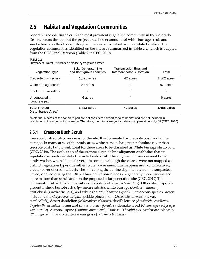
2.5 Habitat and Vegetation Communities Sonoran Creosote Bush Scrub, the most prevalent vegetation community in the Colorado Desert, occurs throughout the project area. Lesser amounts of white bursage scrub and smoke tree woodland occur, along with areas of disturbed or unvegetated surface. The vegetation communities identified on the site are summarized in Table 2-2, which is adapted from the CEC Final Decision (Table 2 in CEC, 2010).
TABLE 2-2 Summary of Project Disturbance Acreage by Vegetation Typea
Vegetation Type Solar Generator Site
and Contiguous Facilities Transmission lines and
Interconnector Substation Total
Creosote bush scrub 1,320 acres 42 acres 1,362 acres
White bursage scrub 87 acres 0 87 acres
Smoke tree woodland 0 0 0
Unvegetated (concrete pad)
6 acres 0 6 acres
Total Project Disturbance Areaa
1,413 acres 42 acres 1,455 acres
a Note that 6 acres of the concrete pad are not considered desert tortoise habitat and are not included in calculations of compensation acreage. Therefore, the total acreage for habitat compensation is 1,448 (CEC, 2010).
2.5.1 Creosote Bush Scrub Creosote bush scrub covers most of the site. It is dominated by creosote bush and white bursage. In many areas of the study area, white bursage has greater absolute cover than creosote bush, but not sufficient for these areas to be classified as White bursage shrub land (CEC, 2010). The evaluation of the proposed gen tie line alignment establishes that its vegetation is predominately Creosote Bush Scrub. The alignment crosses several broad sandy washes where blue palo verde is common, though these areas were not mapped as distinct vegetation types due either to the 5-acre minimum mapping unit, or to relatively greater cover of creosote bush. The soils along the tie-line alignment were not compacted, paved, or oiled during the 1940s. Thus, native shrublands are generally more diverse and more mature than shrublands on the proposed solar generation site (CEC, 2010).The dominant shrub in this community is creosote bush (Larrea tridentata). Other shrub species present include burrobrush (Hymenoclea salsola), white bursage (Ambrosia dumosa), brittlebush (Encelia farinosa), and white rhatany (Krameria grayi). Herbaceous species present include white Calycoseris wrightii, pebble pincushion (Chaenactis carphoclinia var. carphoclinia), desert dandelion (Malacothrix glabrata), devil’s lettuce (Amsinckia tessellata), Cryptantha nevadensis, mustard (Brassica tournefortii), rattlesnake weed (Chamaesyce polycarpa var. hirtella), Arizona lupine (Lupinus arizonicus), Camissonia boothii ssp. condensata, plantain (Plantago ovata), and Mediterranean grass (Schismus barbatus).
SECTION 2: STUDY AREA
2-6 EY072009005SAC/419368/112000004
2.5.2 White Bursage Scrub White bursage (Ambrosia dumosa)scrub covers approximately 87 acres in the northwestern portion of the proposed solar generator site (CEC, 2010). Portions of it are within the footprint of the solar generation facility.
2.5.3 Smoke Tree Woodland Smoke tree woodland covers just over 5 acres adjacent to the solar generator site. It is characterized by the presence of smoke tree (Psorothamnus spinosus), although smaller shrubs may have greater cover. In the project area, burrobrush cover is approximately equal to smoke tree cover in this woodland. Blue palo verde (Parkinsonia florida) is also present in the tree layer and white bursage and creosote bush are present in the shrub layer. The nonnative, invasive annual, Sahara mustard (Brassica tournefortii), is common in the herb layer. This community is ranked by CDFG as a special-status vegetation type, with state rarity ranking of S3 (CEC, 2010). This vegetation type may provide nesting habitat to some avian species. Although no disturbance in the smoke tree woodland vegetation community is planned, it is addressed in this Plan for the unforeseen event of disturbance occurring.
2.6 Temporarily Disturbed Impact Areas The acreage of disturbance areas is presented in Table 2-2. The temporary disturbance areas include the following:
• Linear features and linear project facilities
• Berms of detention or debris basins, to the extent permitted by stormwater control requirements
• Logistics areas
• Gen tie-line tower sites
• Pull sites
• Areas where underground infrastructure was installed
• Temporary access roads
• Construction work temporary lay-down areas
• Construction equipment staging areas

EY072009005SAC/419368/112000004 3-1
SECTION 3
Plan Details
The measures described in this section will be applied to all temporarily disturbed areas described in Section 2.6, which will be restored to pre-project grade and revegetated to minimize soil erosion and vulnerability to weed invasion. This does not include areas subject to the facility Landscape Plan.
3.1 Pre-Construction Measures The measures described in the following subsections will be taken before construction activities occur in the temporary disturbance areas. Post-construction measures are described in subsection under Section 3.2.
3.1.1 Surface Disturbance Within areas that will be temporarily disturbed, to the extent possible, shrubs will be crushed rather than bladed or excavated.
3.1.2 Salvage and Replant Cacti, Yucca, Ocotillo, and Sensitive Species In compliance with BLM policy, yucca and cactus plants (excluding cholla species, genus Cylindropuntia) on portions of the gen tie line right-of-way that are subject to disturbance (tower locations, gen tie line laydown areas, and pull and tensioning sites) and are located on public lands will be salvaged and transplanted to undisturbed sites within the project. Additionally, Harwood’s milk-vetch (Astragalus insularis var. harwoodii) or any other California Native Plant Society (CNPS) List 1 or List 2 plants (excluding chaparral sand-verbena) located within the project area or within 250 feet of its boundaries will be salvaged and replanted. One CNPS List 4 species, Utah cynanchum (Cynanchum utahense), is reported on the project site, at the interconnector substation location. COC BIO-12 requires additional measures related to avoidance and minimization, which are detailed in the “Special Status Plant Impact Avoidance and Minimization Plan,” a separate document.
For the purposes of this document, transplanting means the salvage and replanting of materials within the site. Out planting means the planting of containerized nursery stock.
3.1.2.1 Transplanting Location Salvaged plants on portions of the gen tie line right-of-way that are subject to disturbance (tower locations, gen tie line laydown areas, and pull and tensioning sites) and are located on public lands will be transplanted onto public lands adjacent to and as near as is feasible to the salvage location, along the gen tie line. A schematic of transplanting locations along the mitigation area is provided as Figure 3-1 for the generator tie-line.
SECTION 3: PLAN DETAILS
3-2 EY072009005SAC/419368/112000004
3.1.2.2 Timing of Transplanting The preferred season for planting will be in the fall. The rationale is that this follows the rainy monsoon season, which increases available soil moisture. Fall is also after the summer period of greatest heat stress for plants. The fall planting season allows time for growth and re-establishment for transplants before the cool season of lower growth rates. At low and moderate elevations, transplanting should take place in California immediately after the first major storm (late fall—October or November). The soil profile should be wet throughout, with winter storms soon to follow (Newton and Claassen, 2003). Seeding at this time of year allows the seed to take advantage of late fall/winter rains.
3.1.2.3 General Transplanting Principles Damage to the root system of transplanted plants is a major factor in plant mortality. While some damage is inevitable, practices should aim to reduce root disturbance and damage. When feasible, the soil surrounding the root system should be moved with the plant. This may not be practical if the soil is too friable. In some cases, a tree spade is effective in moving large specimens. However, succulents, such as cactus, yuccas ocotillo species, can be moved without moving the surrounding soil and successfully replanted.
The following measures help to increase survival:
1. Conduct transplanting while plants are dormant.
2. Reduce the canopy size of non-succulents by pruning prior to transplanting.
3. Keep the root ball intact to the extent possible.
4. Keep soil and roots moist while moving, unless succulent roots will be callused before planting.
5. Replant or heal-in as soon as feasible, but in less than a week.
6. Form a soil depressions or collection basins around each plant to increase the infiltration of precipitation and irrigation water.
7. Irrigate after planting to thoroughly watered-in at the new location.
8. If the plant is large, stake the plant and install support
9. Protect the plant from browsing, where this is a significant factor.
10. Transplant to similar microhabitat as original occurrence.
11. If applicable, transplant in same orientation as original occurrence.
3.1.2.4 Suitability Plants of various growth habits are suited to different salvage strategies. Annual plants are poor candidates for transplanting; seed collection and re-seeding are more appropriate. Woody perennials are suitable for transplanting, especially if the root ball can be kept intact. Succulents are less dependent on root structure and survive well with bare root transplants.
The sensitive plants expected to be transplanted under this plan are succulents and the perennial vine (Utah cynanchum). The annual herb (Harwood’s milk-vetch) will be
SECTION 3: PLAN DETAILS
EY072009005SAC/419368/112000004 3-3
conserved by collecting seed from the current population. If other sensitive plant species are discovered within 250 feet of the right-of-way or project impact areas, the suitability of each for various conservation procedures will be evaluated at the time.
3.1.2.5 Vertical Mulch For temporarily disturbed areas requiring blading, dead brush, in addition to the topsoil, will be stockpiled and redistributed evenly over the temporarily disturbed areas after project completion.
3.1.2.6 General Plant Salvage Each plant to be salvaged will be assigned a unique identification number and tagged on the north side of the plant. Global positioning system (GPS) coordinates will be recorded at each removal location and recorded to document the source of each salvaged plant. The optimal time at which plant salvage should occur is between March and November and when nighttime temperatures do not fall below 60 degrees Fahrenheit.
3.1.2.7 Salvage, Stockpiling, and Final Transplanting of Cacti, Yucca, and Ocotillo The salvaging contractor or a qualified biologist will identify on site within the transmission line right-of-way (ROW) with flagging tape all cacti, yucca, and ocotillo that are subject for removal and will mark the north orientation for all cacti and yucca to be transplanted. The following plants will be salvaged:
1. All yucca plants less than 10 feet in height 2. All cactus plants, except cholla (members of the genus Cylindropuntia)
Yucca plants greater than 10 feet in height will not be salvaged but instead may be used as vertical mulch and spread over the surface of the restored areas to prevent possible trespass. Salvage operations are subject to COCs intended to protect special-status biological resources. Prior to any salvage operation, a qualified biologist will clear the area of nesting birds, sensitive plants, or animals.
3.1.2.8 Cactus Salvage Procedures 1. Digging to remove cactus plants should be by hand and done carefully to not damage
roots.
2. The salvage contractor will begin the digging no closer than 6 inches and about four times the width of the above-ground stems from the base of the cactus to avoid damaging the roots.
3. The contractor will excavate cacti with a shovel just below the root depth of the plant, generally 4 to 8 inches below the soil surface.
4. The contractor will lift cacti out of their original locations with a sling or other device suitable to avoid damaging the spines and the vertical segments of multi-branched cacti.
5. The contractor will trim damaged roots, as necessary, using scissors disinfected in a 10 percent bleach solution. Undamaged roots will not be trimmed.
SECTION 3: PLAN DETAILS
3-4 EY072009005SAC/419368/112000004
6. The contractor will apply fungicide or sulfur to roots in order to decrease the risk of infection and to improve callusing. (Examples of fungicides: Benalate, Captan, and Maneb).
7. Disinfect cutting tools by dipping in the bleach solution after each plant trimming.
8. Dry the roots of cactus plants for 3 days to 2 weeks under 30 percent shade or with a loose cloth wrapped or draped over the plant.
9. Watering will occur two times per week during plant maintenance and establishment in the summer and three times per month in the winter.
3.1.2.9 Yucca Salvage Procedures No yucca plants were identified in the gen tie line footprint or 250-foot buffer. However, the following techniques will be implemented if any yucca plants are identified in these areas:
1. Yucca plants taller than 2 feet will be salvaged with mechanized equipment (e.g., a front-end loader).
2. Yucca plants taller than 6 feet should be transplanted by a professional contractor experienced in transplanting large yucca plants.
3. To the extent practical, yucca plants growing in clusters will be kept together in a single unit to reduce root damage. The integrity of the clusters can be better maintained by bundling the cluster with rope or straps and moving the cluster with a front-end loader, tree spade, or other piece of heavy lifting equipment.
4. The contractor will apply fungicide or sulfur to roots to decrease the risk of infection. (Examples of fungicides are Benalate, Captan, and Maneb).
5. If yucca plants are not replanted on the same day that they are salvaged, then stockpiling procedures will be implemented. If plants cannot be replanted on the same day, then the plants will be heeled-in in a temporary disturbance area. Heeling-in consists of placing plants in a temporary planning trench approximately 18 inches deep and covering the roots with enough soil to keep them moist.
6. If multiple parallel trenches are needed, then trenches will be spaced to allow heavy equipment to access each large plant (taller than 2 feet). Trenches will be watered thoroughly prior to transplanting to remove all air pockets. Soil will be formed into a catchment basin or trench around plants to hold water.
7. The leaves of stockpiled yucca plants will be shaded under 30 percent shade, or a loose cloth will be wrapped or draped over the plant.
8. Watering will occur two times per week during plant maintenance and establishment in the summer and will occur two times per month during the winter.
3.1.2.10 Ocotillo Transplanting 1. Perform transplanting year–round, but the greatest success is achieved during March
through May.
2. Transplant to the original growing depth and in the original directional orientation.

SECTION 3: PLAN DETAILS
EY072009005SAC/419368/112000004 3-5
3. Select locations with well-drained sandy or gravelly loam soils with light to moderate amounts of organic content to favor root development of these desert plants.
4. Place large stones over the root area (2-4 inches from the trunk), or stake plants to reduce toppling and windfalls.
5. Select sunny, open, unrestricted locations and those where surface water does not collect.
6. Expect some period of transplant shock during the reestablishment period up to 1 year.
7. Most yuccas and agaves can be dug, and the injured and diseased roots can be pruned off and transplanted immediately or held in shaded, open-air storage for a few days to allow root cuts to heal.
8. Do not apply crown pruning treatments.
9. Do not apply fertilizer to newly transplanted plants.
10. Fertilize with a well-balanced plant food in light to moderate amounts to stimulate plant growth and vigor. Apply fertilizer evenly to the soil surface over the rooting area and water it into the soil with an early summer irrigation. (Kelly and Grumbles, 2009).
3.1.2.11 Staking Large Plants Staking plants taller than 5 feet in height after transplanting will be implemented. A loose loop of padded material that will not cut into the epidermis will cover the line around the plant. Attach lines to two or more supporting stakes. Supports will be maintained for 3 to 6 months, depending on soil and plant re-establishment. Stakes will be removed when the plant has developed new growth and is stable in the ground.
3.1.2.12 Final Planting Arrangement 1. All salvaged plant material will be arranged in the replanting area in a random or in a
natural-looking pattern. Plants will be replanted at their original soil depth and orientation in similar microhabitat as original occurrence.
2. Cactus plants (excluding cholla) will be planted in holes two to three times the width of the canopy.
3. Large single-stem yucca plants will be planted into holes at least 2 feet deep and 2 feet wide.
4. Clusters or multiple-stem plantings will be sized to accommodate the cluster.
5. The salvaged plants will be planted and the soil tamped by hand or with the handle of a shovel around the plant so that there are no air pockets around the roots. Each will be watered in to bring the planting material to field capacity.
6. The leaves or cladodes will be shaded with a loose cloth wrapped or draped over the plant or on a support. The shade cloth can be removed when the plants show signs of establishment and growth, which may take up to 1 year.
SECTION 3: PLAN DETAILS
3-6 EY072009005SAC/419368/112000004
3.1.2.13 Irrigation and Maintenance The establishment phase (the first, and perhaps, the second growing season) for containers, transplants, and cuttings is when most mortality occurs, much of it caused by inadequate soil-moisture. To aid plants, supplemental water is often applied during the establishment phase. Watering basins are usually formed around the plant to direct water to the new plant and to aid in infiltration of water near the root system. The frequency and amount of water is determined by sampling the soil throughout the site and by observing the plant responses. The goal is to add enough water to aid in establishment without making the plants dependent upon the additional watering in the long-term (Newton and Claassen, 2003).
Irrigation will be applied to transplanted cactus plants, yucca and ocotillo plants, and any other transplanted sensitive plants at the time of transplanting as follows:
1. Plants will be watered-in at the time of planting to remove air pockets and to moisten soil. Watering will occur again after the first 15 days. For the first month, watering will occur two times per week during plant maintenance and establishment in the summer and two times per month in the winter.
2. During the first year, summer watering will occur every 2 to 3 weeks, unless there is more than 1 inch of rain in the interim.
3. Winter watering will occur one time every month.
4. To reduce labor associated with hand-watering, humectants (that is, polyacrylamide or other hygroscopic compounds) may be used in the planting soil or at the soil surface.
In addition to watering, the establishment phase activities will include removal of exotic plants and trash, installation of herbivore exclosures (if needed), and other activities to increase survivorship. These will include site control measures, such as vertical mulching and the posting of signs stating that this it is a re-seeded area and asking the public to not disturb it. Maintenance will replace the signs as needed, until they are no longer needed.
3.1.3 Topsoil Salvage Topsoil on portions of the gen tie line right-of-way that are subject to disturbance (tower locations, gen tie line laydown areas, and pull and tensioning sites) and are located on public lands will be stockpiled from the project site for use in revegetation of the disturbed soils. The topsoil excavated will be segregated in windrows, kept intact, and protected, under conditions shown to sustain seed bank viability. The upper 1 inch of topsoil, which contains the seed bank, will be scraped and stockpiled for use as the top-dressing for the revegetation area. An additional 6 to 8 inches of soil below the top 1 inch of soil will also be scraped and separately stockpiled for use in revegetation areas. Topsoil will be replaced in its original vertical orientation following ground disturbance, ensuring the integrity of the top 1 inch in particular.
1. Salvaged topsoil will be harvested, stored in windrows, and reapplied at a later date. Salvage operations will be conducted when the soil materials are in air-dried condition.
2. The upper 1 inch of topsoil will be segregated, kept intact, and protected, under conditions shown to sustain seed bank viability.
SECTION 3: PLAN DETAILS
EY072009005SAC/419368/112000004 3-7
3. Stockpiles will be no deeper than 1 yard.
4. An additional 6 to 8 inches of soil below the top 1 inch of soil will also be scraped and separately stockpiled for use in revegetation areas. Topsoil will be replaced in its original vertical orientation following ground disturbance, ensuring the integrity of the top one inch in particular.
Topsoil will be placed on the designated areas before erosion control materials are applied. The topsoil will be spread to a uniform depth of not less than 6 inches and compacted or stabilized in a manner that retains the material in place on the slopes. The topsoil will not be compacted or stabilized to the degree that the topsoil is not maintained as a viable growing medium (Newton and Claassen, 2003).
3.2 Post-Construction Measures The measures described below will be applied after construction operation in the temporary disturbance areas have ceased. Within temporary disturbance areas, all materials and equipment will be cleared when the project is complete. Requirements for ROW restoration may include activities such as removal of material used to build temporary access roads and removal of structures for erosion and sediment control.
3.2.1 Surface Recontouring Upon completion of construction, all temporarily disturbed areas (including the logistics/laydown areas), all gen tie line tower sites, pull sites, and similar areas will be restored to pre-project grade. Recontouring will be accomplished by appropriate earthmoving equipment.
3.2.2 Soil Decompaction Following construction, soils may be compacted as a result of equipment traffic and material storage. Compaction can reduce the ability of water to enter the soil and inhibit root growth of plants; therefore, decompaction may be necessary for successful natural recruitment. To stabilize the surface, the soils will be decompacted and then recompacted to a density approximating the soil density of undisturbed soils in a nearby reference site.
Compacted soils in temporarily disturbed areas will be treated through ripping, tillage, or pitting, and the soil surface will be left sufficiently “rough” after surface soil placement to provide micro sites for seed germination and to reduce soil movement.
3.2.3 Topsoil Replacement After construction activities have ceased in temporary disturbance areas from which topsoil has been salvaged, as described in Section 3.1.2, topsoil will be replaced in its original vertical orientation, ensuring the integrity of the top 1 inch in particular (BIO-10) and compacted or stabilized in a manner that retains the material in place on any slopes (Section 3.1.3). The topsoil shall not be compacted or stabilized to the degree that the topsoil is not maintained as a viable growing medium (Newton and Claassen, 2003).
SECTION 3: PLAN DETAILS
3-8 EY072009005SAC/419368/112000004
3.2.4 Vertical Mulch For temporarily disturbed areas requiring blading, dead brush and topsoil will be stockpiled and redistributed evenly over the temporarily disturbed areas after project completion. Some of the stockpiled dead brush will be used for vertical mulching within the temporarily disturbed areas. Vertical mulching is the arranging of dead and grubbed plant materials (shrubs, cacti, grasses, etc.) in the ground or over the surface to reduce visibility of disturbed areas. This is especially important to reduce future trespassing. Vertical mulch also reduces wind speed near the surface and increases the accumulation of blowing soil and plant litter, which provides sites for plant establishment. Any cacti or ocotillo plants that were beyond the suitable range for transplanting can be installed as vertical mulch on the ROW.
3.2.5 Seed and Nursery Stock Sources Only seed or potted nursery stock of locally occurring native species will be used for revegetation (see Section 1.2). Additionally seed mixes may contain Harwood’s milk-vetch (Astragalus insularis var. harwoodii) or any other CNPS List 1 or List 2 plants (excluding chaparral sand-verbena) located within the project area or within 250 feet of its boundaries that is not suitable for transplanting (see Section 3.1.2.4). One CNPS List 4 species, Utah cynanchum (Cynanchum utahense), is reported on the project site, at the interconnector substation location. Seeds mixes will contain a mix of short-lived early pioneer species such as native annuals and perennials and sub-shrubs.
A plant palette and sample seed mix is presented for each plant community in Table 3-1 and Table 3-2. The term Plant Palette means the list of native species that will be included in a revegetation plan. One seed mix is for the Sonoran Creosote Bush Scrub vegetation community and the other mix is for the Sonoran Desert Dry Wash Woodland vegetation community. The species and the seeding rates are selected to quickly establish native colonizing species on disturbed sites and move the community development on a trajectory toward a natural community. Species were selected that compete with non-native grasses and provide establishment microsites for native species. Some plants were included because they also provide appropriate wildlife nutrition, specifically high PEP (potassium excreting potential) for desert tortoise. The collected seed will be analyzed for live seed content and other parameters to ensure viability. This palette can be modified using species available on or near the site.
TABLE 3-1 Potential Post-Construction Restoration Seed Mix List for the Sonoran Creosote Bush Scrub
Common Name Scientific Name Pounds per Acre
Shrubs
Burro bush Ambrosia dumosa 1.5
Brittle bush Encelia farinosa 1
Cheesebush Hymenoclea salsola 2
Creosote Larrea tridentata 0.5
Grasses
Galleta grass Pleuraphis rigida 2

SECTION 3: PLAN DETAILS
EY072009005SAC/419368/112000004 3-9
TABLE 3-1 Potential Post-Construction Restoration Seed Mix List for the Sonoran Creosote Bush Scrub
Common Name Scientific Name Pounds per Acre
Forbs
Arizona lupine Lupinus arizonicus 1
Desert sunflower Geraea canescens 1
Indian wheat Plantago ovata 1
Total 10
TABLE 3-2 Potential Post-Construction Restoration Seed Mix List for the Sonoran Desert Dry Wash Woodland
Common Name Scientific Name Pounds per Acre
Phreatophytes
Catclaw acacia Acacia greggii 0.5
Palo verde Cercidium floridium 0.5
Ironwood Olneya tesota 0.5
Shrubs
Burro bush Ambrosia dumosa 1
Brittle bush Encelia farinosa 1
Cheesebush Hymenoclea salsola 2
Creosote Larrea tridentata 0.5
Grasses
Galleta grass Pleuraphis rigida 2
Forbs
Arizona lupine Lupinus arizonicus 1
Indian wheat Plantago ovata 1
Total 10
3.2.6 Seed Collection Guidelines Seed collected from plants that will be destroyed by construction will be unrestricted. Seed collections from plants in the 250-foot buffer area and plants in surrounding undisturbed areas will be made according to the following guidelines:
1. Seed will not be collected from areas designated as wilderness under the provisions of the Wilderness Act of 1964.
2. Seed collection will be implemented as soon as appropriate permissions from the BLM are obtained, and will continue until adequate seed has been acquired for site revegetation, or until revegetation is complete.
SECTION 3: PLAN DETAILS
3-10 EY072009005SAC/419368/112000004
3. The potential for inbreeding will be reduced by collecting seed from a large number (50 to 100) of widely spaced (100 meters) individuals, rather than from a few closely related plants.
4. The potential for genetic contamination will be reduced by avoiding donor plants growing nearby exotic species of closely related taxa.
5. Seed of local origin will be collected at elevations and in vegetation similar to that at the RSEP site. Seed may be collected directly from the RSEP project area before site disturbance, if conditions are suitable. Seed collection will be from sources occurring within 50 miles of the site to ensure that local ecotypes adapted to local climate, soil, and other site conditions are employed. Bulk seed can be collected by direct harvest from plants, underneath shrubs, and from windblown debris caught in depressions and washes; areas near roadsides or invasive plants would be avoided.
6. To avoid overharvest of a specific area, no more than 40 percent of seeding plants in a collection area will be harvested. Each collection area will be visited as frequently as necessary during the seed production period of the year, staying within these specified parameters. The only exception will be for seed collections within the RSEP construction areas planned for vegetation clearing within a 2-year period following seed collection. At these locations, there will be no limits on harvest because vegetation will be removed during construction.
7. Access to collection areas will be via open, well-traveled routes, or on foot, with no cross-county vehicle travel.
8. Contractor will collect mature seed from healthy, robust stands. To increase genetic diversity, collect no more than 10 percent by weight of each collection from an individual plant.
9. Collectors will make separate-species collections of seed, emphasizing native plants on the seed mix palette with sufficiently mature seed are present.
10. Collectors will record site characterization and track seed lots, including collection date, collection location, elevation, dominant species at location, stand conditions, test data, bulk weight, and net weight (as pure live seed).
11. Contractor will not collect from areas with noxious weeds present, unless collected directly from native plants in the area.
3.2.7 Seeding Techniques Reseeding will include the use of BLM-approved methods and mixtures. Seeding will be coordinated with other restoration activities to occur as soon after seedbed preparation as possible. Because hydroseeding requires subsequent watering or rainfall, drill seeding, broadcast seeding, and other methods will be considered in coordination with BLM.
All seeding methods have drawbacks. For example, drill seeding can result in rows when germination occurs and may not appear natural.
Hydroseeding and hydromulching require the use of a large tank truck, mounted with hydraulic nozzles that spray the slurries onto the site. This method of seeding is commonly
SECTION 3: PLAN DETAILS
EY072009005SAC/419368/112000004 3-11
used by the California Department of Transportation (Caltrans) and should only be used in areas with an adequate amount of moisture to promote germination (that is, at least 12 inches (30 cm) per year) (Newton and Claassen, 2003). The natural rainfall in the project area is unlikely to sustain hydroseeding. Average annual precipitation ranges from 3 inches to 8 inches west of the Rice Valley. The RWD indicates that average annual precipitation in the project area, based on the gauging station at Blythe, is 3.55 inches (CEC, 2010).
A rangeland drill places the seed at a specified depth in small furrows in the soil, resulting in the plants being lined up in rows—a very unnatural looking arrangement. Rangeland drills are not common in California, but are very common in the Midwest. Drills cannot be used on slopes steeper than 3:1 (H:V) and require good access, with adequate room for maneuvering (Newton and Claassen, 2003). The temporary disturbance areas along the BLM right-of-way will generally be small, such as pull sites and temporary laydown areas, where maneuvering a seed drill would be difficult. However, this seeding technique may be employed as an option.
Broadcast seeding is an appropriate method for the area. Seed will be broadcast using manually operated cyclone-type bucket spreaders, mechanical seed spreaders, blowers, or rubber-tired all-terrain vehicles equipped with mechanical broadcast spreaders. Seed in the spreader hoppers will be mixed to discourage separation of the component seed types. Where broadcast seeding is employed, seeded areas will be raked or harrowed to cover the seed.
3.2.8 Fencing and Signage Temporarily disturbed areas (e.g., the material laydown yard) may need to be fenced and/or signed to protect the site from further disturbance. All areas prepared for natural recruitment will have signs installed at regular intervals to deter vehicular travel from these areas. RSE will be responsible for providing and installing restoration signs, Carsonite signs, and/or t-posts as needed.
3.2.9 Control of Exotic Species The opportunity exists for exotic species to establish on the site after the revegetation process is completed. The use of appropriate native species at adequate density will increase competition with non-native species and increase the likelihood of establishing native species on the site. Applications of vegetation treatments to reduce non-native plants species will be subject to the measures and practices described in the Weed Management Plan prepared in compliance with COC BIO-11.
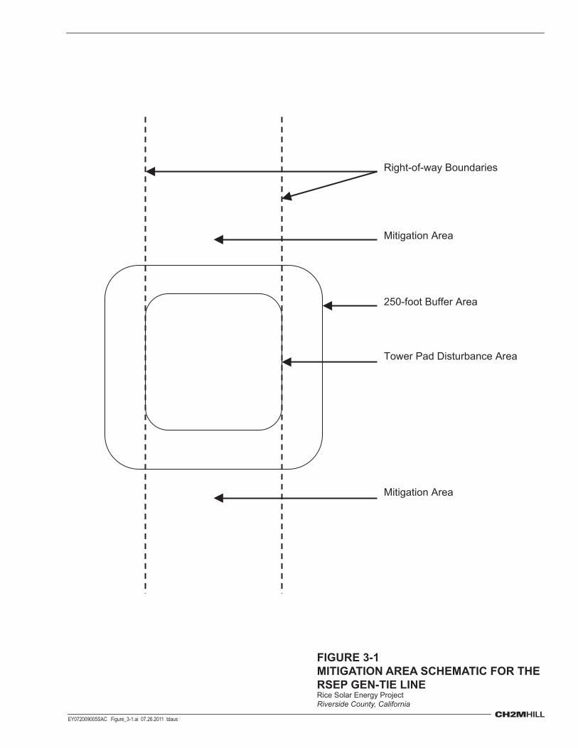
Right-of-way Boundaries
Tower Pad Disturbance Area
Mitigation Area
Mitigation Area
250-foot Buffer Area
FIGURE 3-1MITIGATION AREA SCHEMATIC FOR THE RSEP GEN-TIE LINERice Solar Energy ProjectRiverside County, California
EY072009005SAC Figure_3-1.ai 07.26.2011 tdaus

EY072009005SAC/419368/112000004 4-1
SECTION 4
Compliance
4.1 Success Criteria Post-seeding and planting monitoring will be yearly and will continue for a period of no less than 2 years or until the defined success criteria are achieved. The following performance standards must be met by the end of monitoring year two:
1. At least 80 percent of the species observed within the temporarily disturbed areas will be native species that naturally occur in desert scrub habitats
2. Cover and density of non-native plant species within the temporarily disturbed areas will be no greater than in comparable surrounding lands that have not been disturbed by the project
Criteria will be considered fulfilled if the monitoring data estimates the relevant parameter to be within the 80 percent confidence interval (Newton and Claassen, 2003, pp. 89-92).
4.2 Contingency Mitigation Measures If the criteria have not been met, the project owner is responsible for replacement planting to achieve these requirements or other remedial action as agreed to by the CPM in consultation with BLM and Western. Replacement seeding or planting will be monitored and evaluated by the same criteria as required for original revegetation plantings. Remediation activities (such as additional planting, removal of non-native invasive species, or erosion control) will be taken during the 2-year period if necessary to ensure the success of the restoration effort. If the mitigation fails to meet the established performance criteria after the 2-year maintenance and monitoring period, monitoring and remedial activities will extend beyond the 2-year period until the criteria are met or unless otherwise specified by the CPM in consultation with BLM and Western.
4.3 Replacement Requirement If a fire occurs in a revegetation area within the 2-year monitoring period, the owner will be responsible for a one-time replacement. If a second fire occurs, no replanting is required, unless the fire is caused by the owner’s activity (as determined by BLM or other firefighting agency investigation).

EY072009005SAC/419368/112000004 5-1
SECTION 5
Monitoring and Reporting
5.1 Monitoring Program Post-seeding and transplanting monitoring will be yearly and will continue for a period of no less than 2 years or until the defined success criteria are achieved. Initial monitoring during the establishment period will coincide with watering and maintenance activities. Adjustments to watering, trash removal, and exotic plant control will be guided by the monitoring observations.
5.2 Monitoring Technique The following sections describe the data collection, monitoring and statistical analysis techniques that will be used.
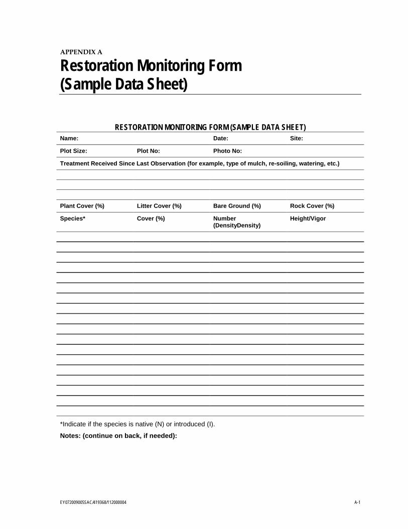
5.2.1 Parameters The Success Criteria (Section 4.1) are based on percent species richness and cover and density relative to adjacent reference sites. Appendix A contains a sample data form. The text BIO-10 containing the success criteria is quoted below.
“The following performance standards must be met by the end of the second monitoring year two:
• At least 80 percent of the species observed within the temporarily disturbed areas will be native species that naturally occur in desert scrub habitats
• Cover and density of non-native plant species within the temporarily disturbed areas will be no greater than in comparable surrounding lands that have not been disturbed by the project.”
Percent Species Richness = (N/T) x 100, where N = number of native species and T = total number of species. For example if 10 native species (N) are observed and 12 total species (T) are observed, then 10/12 x 100 = 83.3 percent, and the first success standard of 80 percent is fulfilled for that sample.
Cover will be measured by a point-intercept or line-intercept technique, depending on the vegetation type. Percent cover = N/T x 100 where N = number of points or length of line that intercept native vegetation and T = total number of points or total length of line recorded. For example, if the sample in the revegetated area records 50 point intercepts of non-native (N) plants and 200 total (T) points, then 50/200 x 100 = 25 percent. If the reference areas sample records 50 or more non-native plant intercepts or of 200 total points, then the non-native cover success criterion will be fulfilled for that sample.
SECTION 5: MONITORING AND REPORTING
5-2 EY072009005SAC/419368/112000004
Density is the number of plants per unit of area, N/A where N = number of non-native plants and A = area. If the number of non-native plants in an area is greater in the revegetated area than in the reference area, then the density criterion will be fulfilled for that sample. The size of the area sampled will be small, perhaps 1 square meter for small plants, and large, perhaps 40 square meters, for large or sparse vegetation.
Soil density is the measure of soil sample dry mass per unit volume. Samples from the treated area will be compared samples from reference sites.
Statistics calculated for each parameter will be sample size, mean (average) value, range of values, variance, and 80 percent confidence interval. For example, if the average cover is 75 percent and the confidence interval is ±12, the sample estimate of the mean, 75 percent, has greater than 80 percent probability of coming from a population with a true population mean cover of 80 percent (Newton and Claassen, 2003, pp. 89 to 90).
5.2.2 Minimum Sample Size The reliability of the statistical criteria described in the preceding section depends on the variance of the sample, which is more reliable when the sample size is increased. Minimum sample size can be calculated by either of two methods. Both are described by Newton and Claassen (2003, chapter 6).
The iterative process to estimate the variance is based on taking an initial number of samples to estimate the population variance and then using that estimate to calculate the minimum sample size to meet the desired level of precision and probability of correctly estimating the mean of the parameter. The formula for this process is:
𝑁(𝑚𝑖𝑛) = �𝑡(.20(2),(∞)) ∙ 𝑠
𝛿�2
= �1.2816 ∙ 𝑠
0.2 ∙ �̅��2
N(min) is the minimum sample size. The variable “s” represents the standard deviation of the mean. The value 1.28 is the critical value of the t distribution for the two-tailed 80 percent confidence level (𝑡(.20(2),(∞)) = 1.2816). The denominator δ represents the precision desired. In this case, it is within 20 percent of the mean in either direction (Zar, 1999, p. 105). Feasibility consideration may require modification of this precision standard if the sample size needed is impractical.
For example, if the mean (�̿�) is 9.87 and the variance (s2) is calculated to be 38.38, and the standard deviation (s) is 6.20. A sample size of 16 will produce an estimate of the mean within ± 1.97 of the population mean, 80 percent of the time.
The alternative method is an iterative method that plots the cumulative parameter of progressively larger sampling plots. The minimum sample size is usually estimated as the point where the slope of the curve levels off. However, this sample size selection is guided by the size, cost, time available, and ease of measuring the parameter (Newton and Claassen, 2003, p. 89).
SECTION 5: MONITORING AND REPORTING
EY072009005SAC/419368/112000004 5-3
5.3 Verification Report Within 90 days after completion of each year of project construction, the project owner will provide to the CPM, verification of the total vegetation acreage subject to temporary and permanent disturbance and a written report identifying which items of the Revegetation Plan have been completed, a summary of all modifications to mitigation measures made during the project’s construction phase, and which items are still outstanding. To monitor and evaluate the success of the revegetation, the project owner will submit annual reports of the revegetation, including the status of the site, percent cover of native and exotics, and any remedial actions conducted by the owner to the CPM and BLM.
5.4 Annual Revegetation Activities Report On January 31 of each year following construction until the completion of the revegetation monitoring specified in the Revegetation Plan, the Designated Biologist will provide a report to the CPM that includes a summary of revegetation activities for the year, a discussion of whether revegetation performance standards for the year were met, and recommendations for revegetation remedial action, if warranted, that are planned for the upcoming year.
EY072009005SAC/419368/112000004 6-1
SECTION 6
References
Bureau of Land Management (BLM). 2007. Environmental Assessment, Issuance of 10-Year Grazing Lease for the Rice Valley Allotment. CA-660-EA06-55. Palm Springs South Coast Field Office. Palm Springs, CA.
California Energy Commission (CEC). 2010. Rice Solar Energy Project Commission Decision. December 2010. CEC-800-2010-019 CMF, Docket Number 09-AFC-10.
California Department of Fish and Game (CDFG). 2009. California Natural Diversity Database (CNDDB) Biogeographic Data Branch, Department of Fish and Game. Version 3.1.1. Sacramento, CA.
Kelly, Jack, and Rob Gumbles. 2009. Cactus, Agave, Yucca and Ocotillo. Cooperative Extension, College of Agriculture & Life Sciences, The University of Arizona. Publication AZ1225.
Newton, Gail A., and V.P. Claassen. 2003. Rehabilitation of Disturbed Lands in California: A Manual for Decision-Making. California Department of Conservation and California Geological Survey.
Zar, Jarrold H. 1999. Biostatistical Analysis. 4th ed. Prentice-Hall, Upper Saddle River, New Jersey. 438 pp.

Appendix A Restoration Monitoring Form
(Sample Data Sheet)
EY072009005SAC/419368/112000004 A-1
APPENDIX A
Restoration Monitoring Form (Sample Data Sheet)
RESTORATION MONITORING FORM (SAMPLE DATA SHEET) Name: Date: Site:
Plot Size: Plot No: Photo No:
Treatment Received Since Last Observation (for example, type of mulch, re-soiling, watering, etc.)
Plant Cover (%) Litter Cover (%) Bare Ground (%) Rock Cover (%)
Species* Cover (%) Number (DensityDensity)
Height/Vigor
*Indicate if the species is native (N) or introduced (I).
Notes: (continue on back, if needed):