Embed Size (px)
DESCRIPTION
Putting Space and Place Together: GIS for Upper Elementary and Middle School Classrooms. Dr. Mike Charles Pacific University Forest Grove, Oregon. GIS-Geographic Information System. Digital maps with multiple layers A map built from a database Wikipedia’s definition. - PowerPoint PPT Presentation
Citation preview
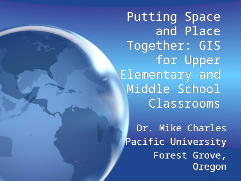
Putting Space and Place Together: GIS
for Upper Elementary and
Middle School Classrooms
Putting Space and Place Together: GIS
for Upper Elementary and
Middle School Classrooms
Dr. Mike CharlesPacific University
Forest Grove, Oregon
Dr. Mike CharlesPacific University
Forest Grove, Oregon
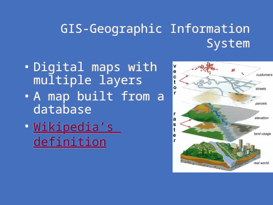
GIS-Geographic Information SystemGIS-Geographic Information System
• Digital maps with multiple layers
• A map built from a database
• Wikipedia’s definition
• Digital maps with multiple layers
• A map built from a database
• Wikipedia’s definition
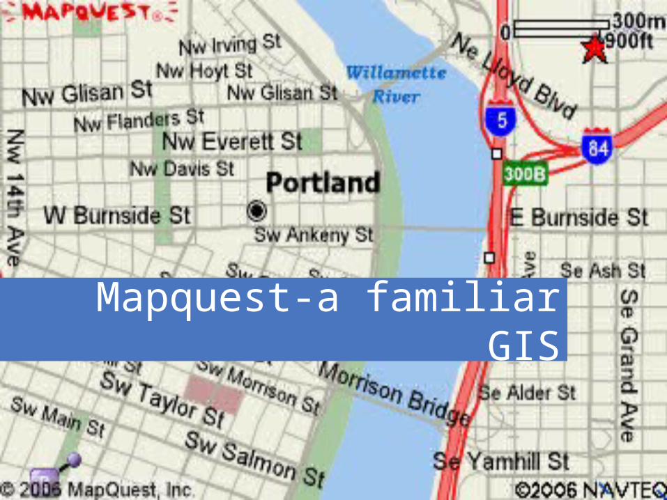
Mapquest-a familiar GISMapquest-a familiar GIS
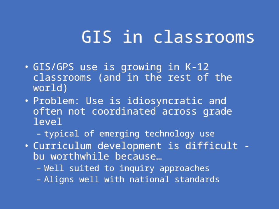
GIS in classroomsGIS in classrooms
• GIS/GPS use is growing in K-12 classrooms (and in the rest of the world)
• Problem: Use is idiosyncratic and often not coordinated across grade level – typical of emerging technology use
• Curriculum development is difficult - bu worthwhile because…– Well suited to inquiry approaches– Aligns well with national standards
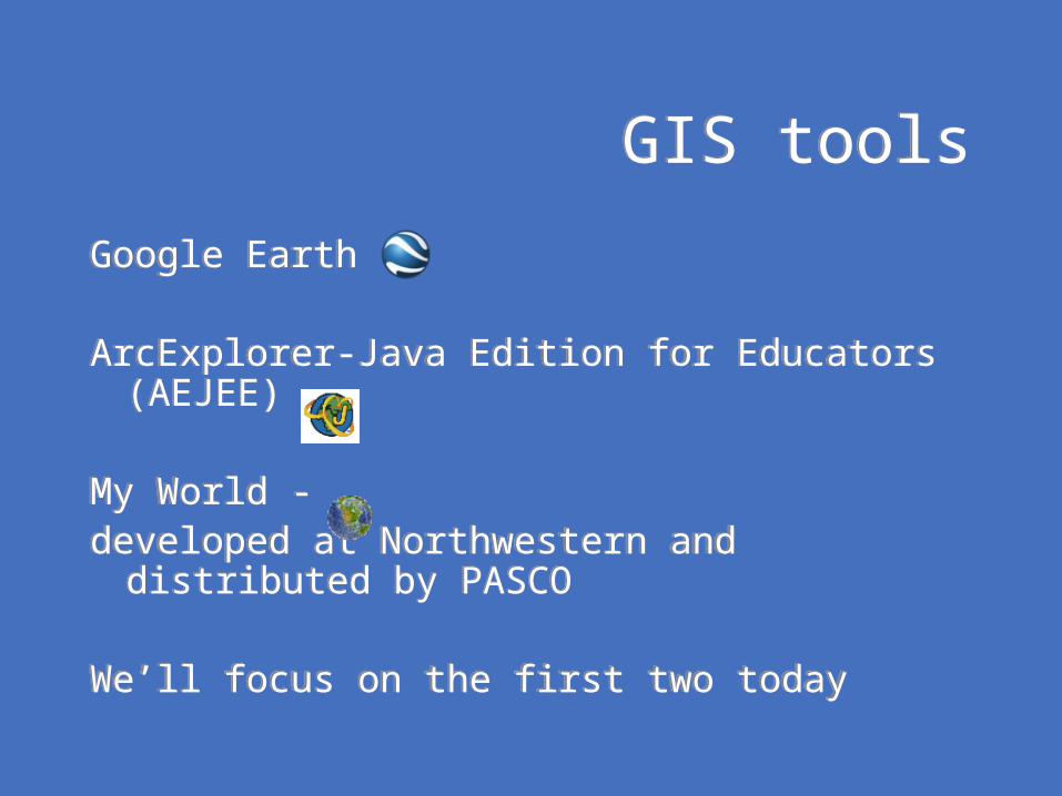
Google Earth
ArcExplorer-Java Edition for Educators (AEJEE)
My World - developed at Northwestern and distributed
by PASCO
We’ll focus on the first two today
Google Earth
ArcExplorer-Java Edition for Educators (AEJEE)
My World - developed at Northwestern and distributed
by PASCO
We’ll focus on the first two today
GIS toolsGIS tools
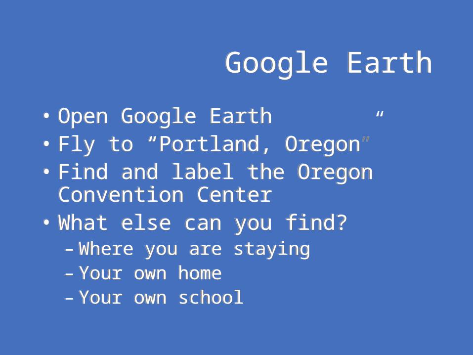
Google EarthGoogle Earth
• Open Google Earth• Fly to “Portland, Oregon”• Find and label the Oregon
Convention Center• What else can you find?
– Where you are staying– Your own home– Your own school
• Open Google Earth• Fly to “Portland, Oregon”• Find and label the Oregon
Convention Center• What else can you find?
– Where you are staying– Your own home– Your own school
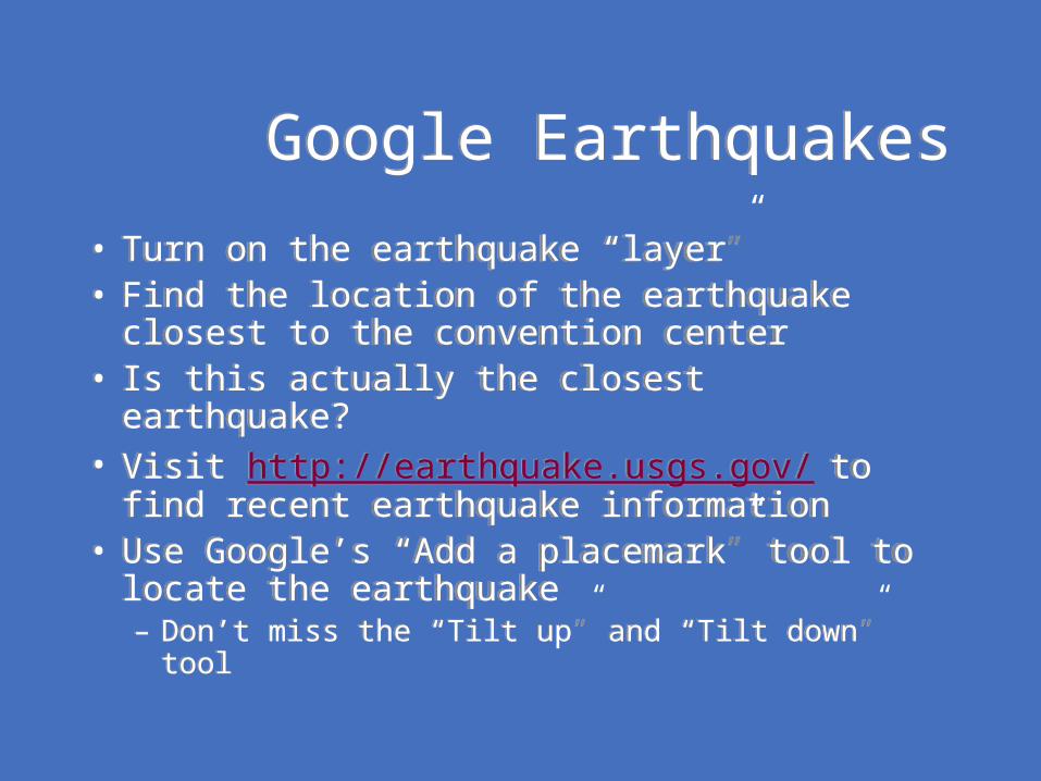
Google EarthquakesGoogle Earthquakes
• Turn on the earthquake “layer”• Find the location of the earthquake
closest to the convention center• Is this actually the closest earthquake?• Visit http://earthquake.usgs.gov/ to find
recent earthquake information• Use Google’s “Add a placemark” tool to
locate the earthquake– Don’t miss the “Tilt up” and “Tilt down” tool
DiscussionDiscussion
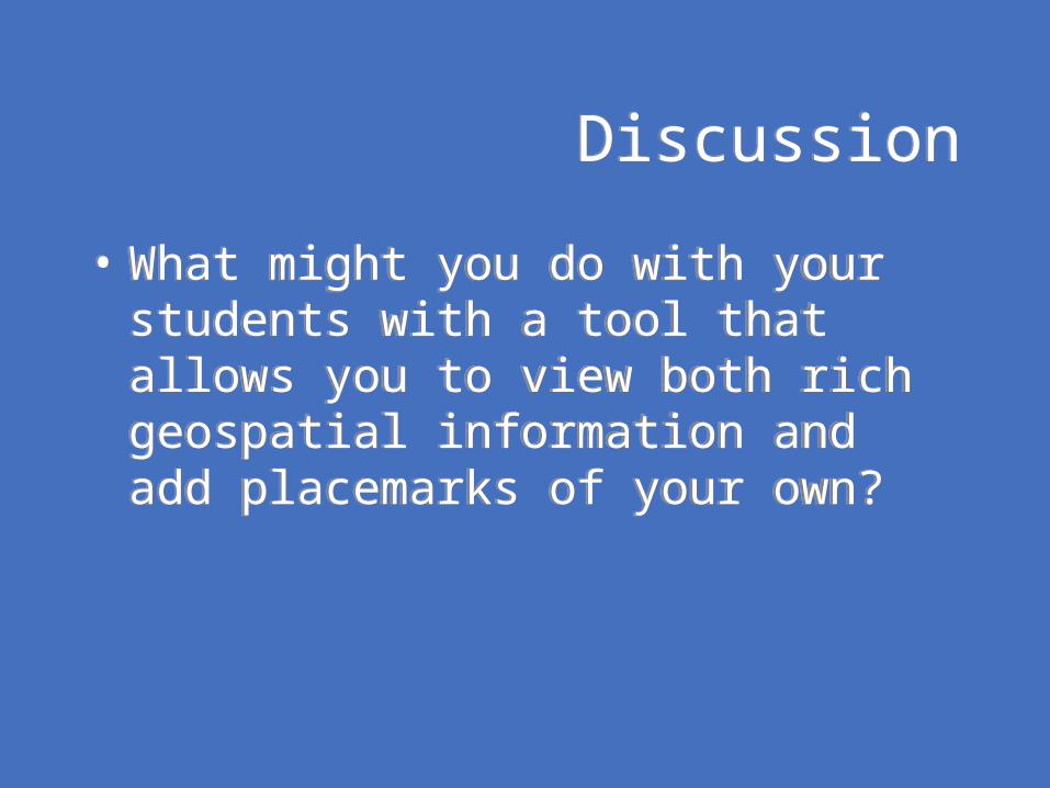
• What might you do with your students with a tool that allows you to view both rich geospatial information and add placemarks of your own?
• What might you do with your students with a tool that allows you to view both rich geospatial information and add placemarks of your own?
Google Earth-potential problems
Google Earth-potential problems
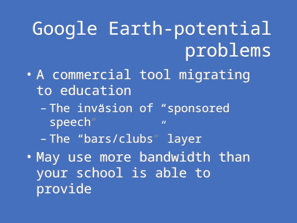
• A commercial tool migrating to education– The invasion of “sponsored speech”– The “bars/clubs” layer
• May use more bandwidth than your school is able to provide
• A commercial tool migrating to education– The invasion of “sponsored speech”– The “bars/clubs” layer
• May use more bandwidth than your school is able to provide
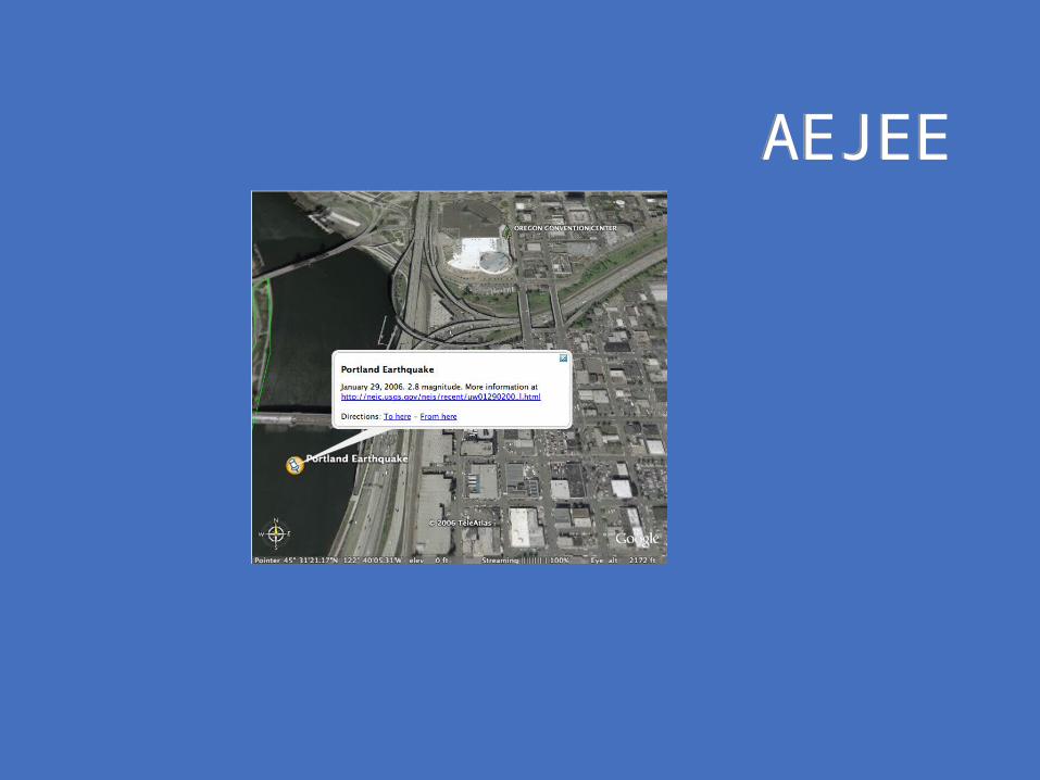
AEJEEAEJEE
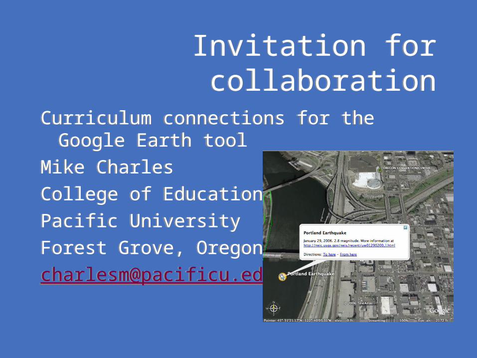
Invitation for collaborationInvitation for collaboration
Curriculum connections for the Google Earth tool
Mike CharlesCollege of EducationPacific UniversityForest Grove, [email protected]
Curriculum connections for the Google Earth tool
Mike CharlesCollege of EducationPacific UniversityForest Grove, [email protected]
Potential GIS benefitsPotential GIS benefits
• Attracts visual learners to studying science, social studies, mathematics and technology
• Can promote higher-order thinking skills• Facilitates the use of real data• Lets students connect with local spaces
and places (local data is available)
• Attracts visual learners to studying science, social studies, mathematics and technology
• Can promote higher-order thinking skills• Facilitates the use of real data• Lets students connect with local spaces
and places (local data is available)