Embed Size (px)
Citation preview
Principles of Satellite Remote Sensing
Yaroslav Mashtakov
Junior Researcher
Keldysh Institute of Applied Mathematics
Contents
• Introduction
• History of Remote Sensing
• Modern Instruments
• Means of Remote Sensing
• Problems
2
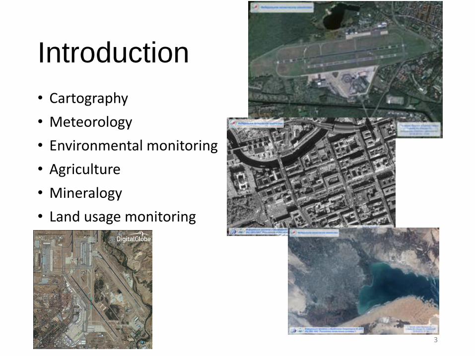
Introduction
• Cartography
• Meteorology
• Environmental monitoring
• Agriculture
• Mineralogy
• Land usage monitoring
3
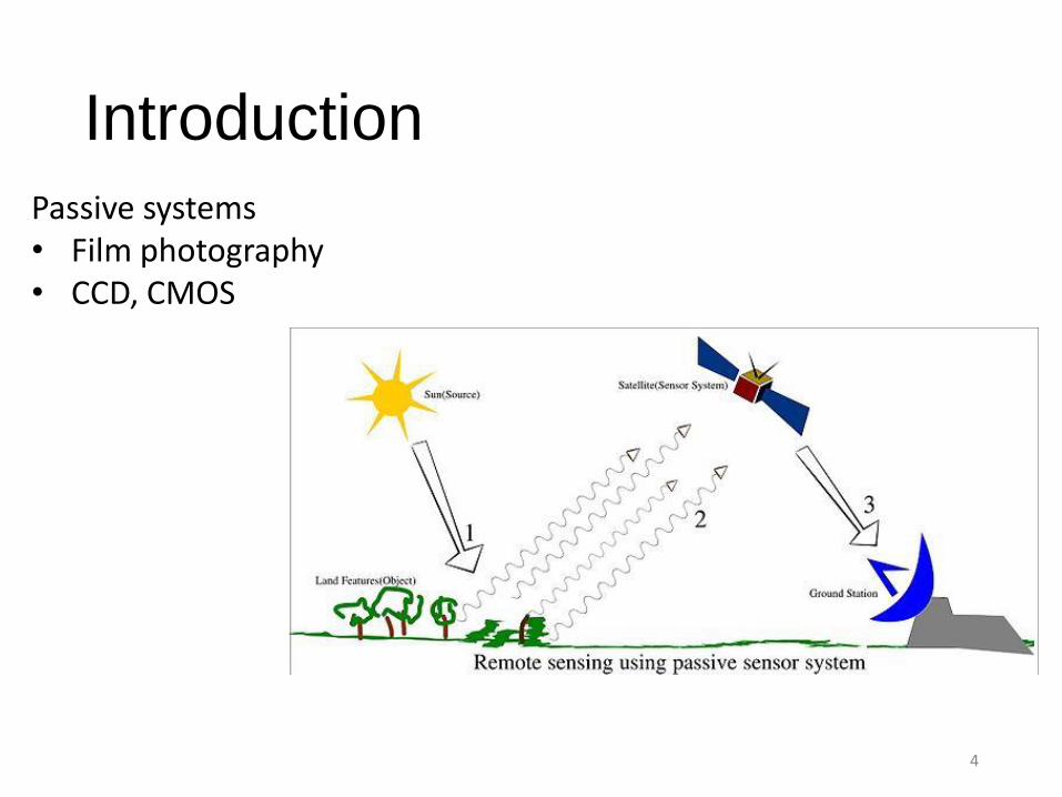
Introduction
4
Passive systems• Film photography• CCD, CMOS
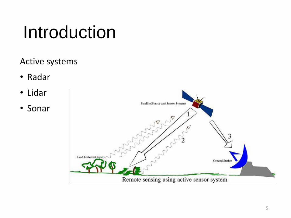
Introduction
Active systems
• Radar
• Lidar
• Sonar
5
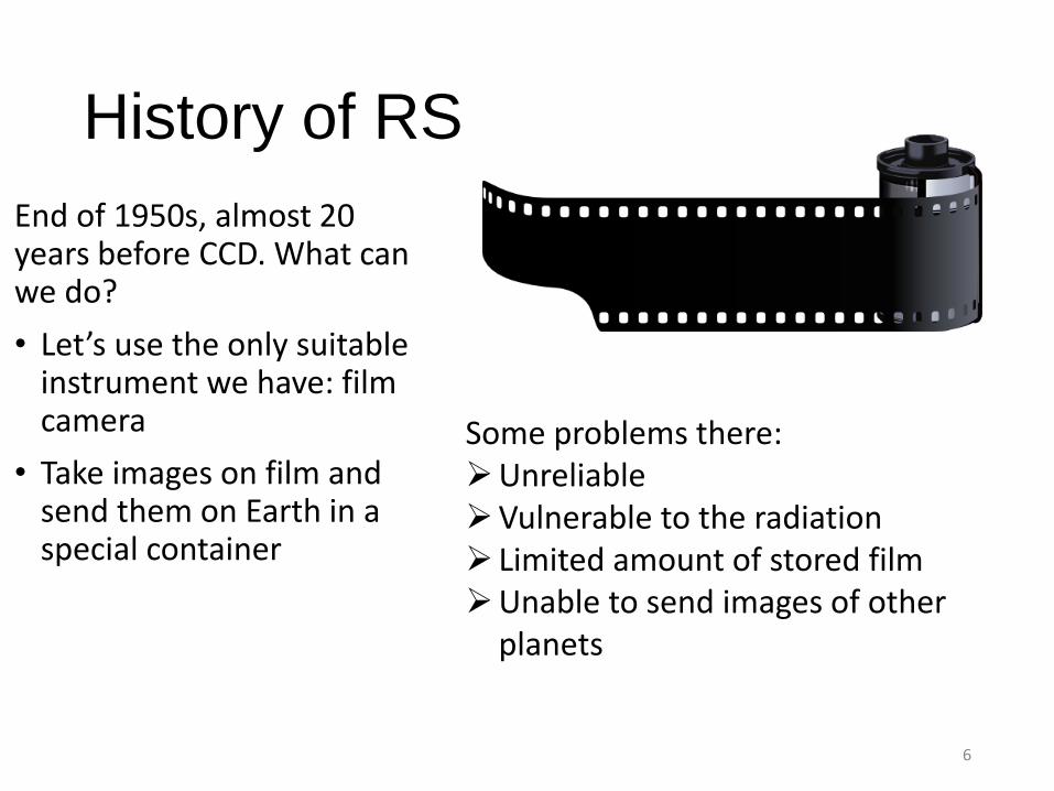
History of RS
End of 1950s, almost 20 years before CCD. What can we do?
• Let’s use the only suitable instrument we have: film camera
• Take images on film and send them on Earth in a special container
6
Some problems there:UnreliableVulnerable to the radiation Limited amount of stored filmUnable to send images of other
planets
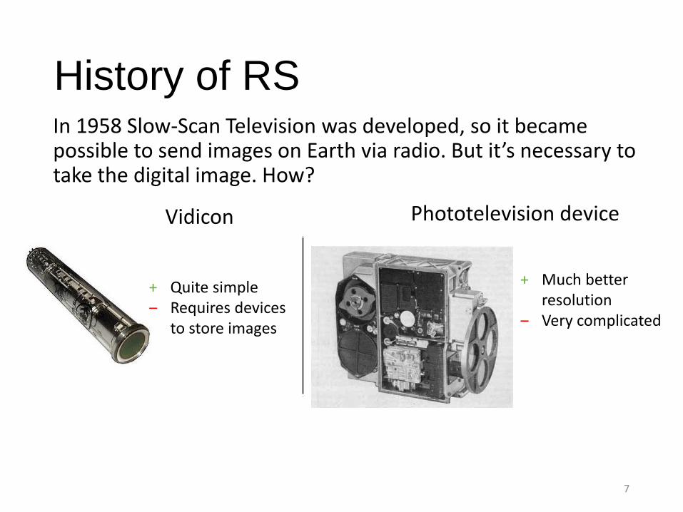
History of RSIn 1958 Slow-Scan Television was developed, so it became possible to send images on Earth via radio. But it’s necessary to take the digital image. How?
7
Vidicon Phototelevision device
+ Quite simple ‒ Requires devices
to store images
+ Much better resolution
‒ Very complicated
History of RS
8
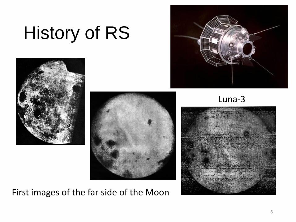
Luna-3
First images of the far side of the Moon
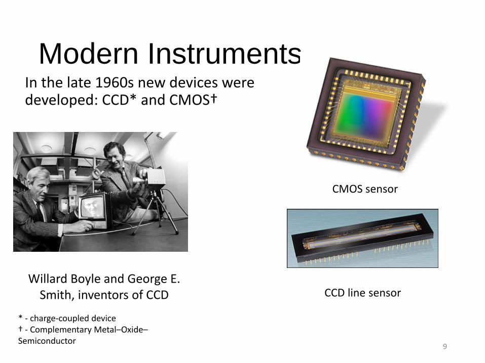
Modern InstrumentsIn the late 1960s new devices were developed: CCD* and CMOS†
9
Willard Boyle and George E. Smith, inventors of CCD
CMOS sensor
CCD line sensor
* - charge-coupled device† - Complementary Metal–Oxide–Semiconductor
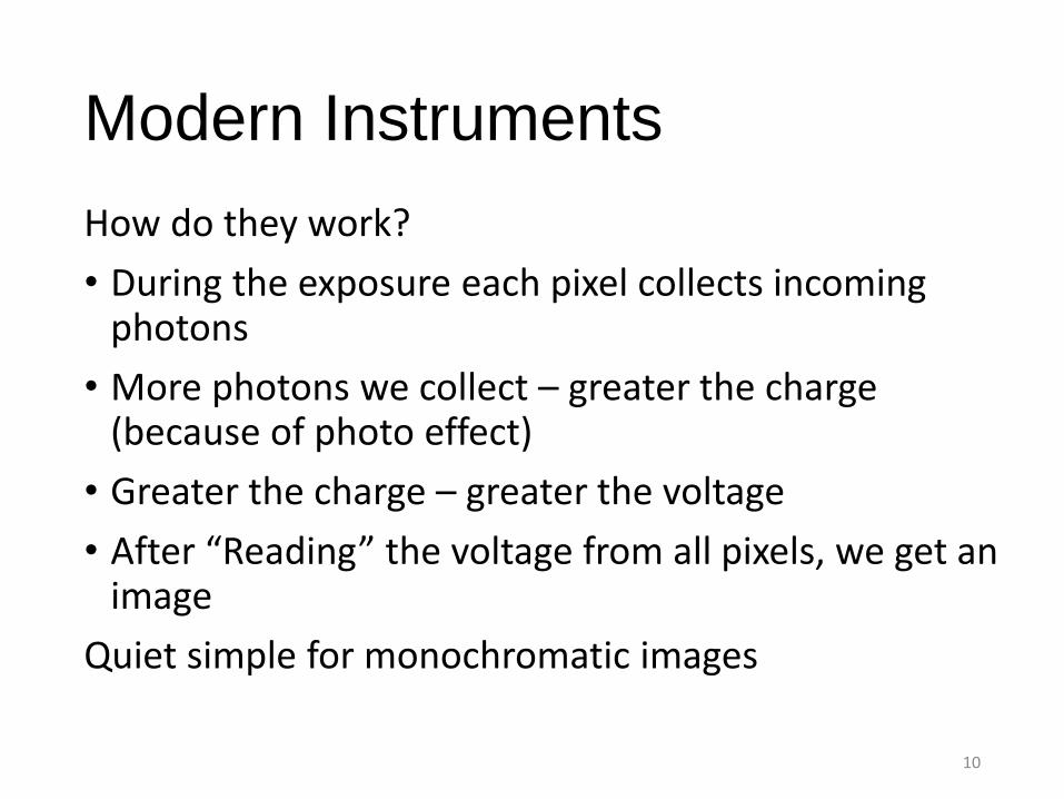
Modern Instruments
How do they work?
• During the exposure each pixel collects incoming photons
• More photons we collect – greater the charge (because of photo effect)
• Greater the charge – greater the voltage
• After “Reading” the voltage from all pixels, we get an image
Quiet simple for monochromatic images
10
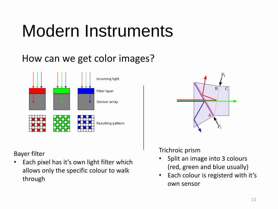
Modern Instruments
How can we get color images?
11
Trichroic prism• Split an image into 3 colours
(red, green and blue usually)• Each colour is registerd with it’s
own sensor
Bayer filter• Each pixel has it’s own light filter which
allows only the specific colour to walk through
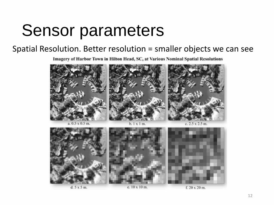
Sensor parametersSpatial Resolution. Better resolution = smaller objects we can see
12
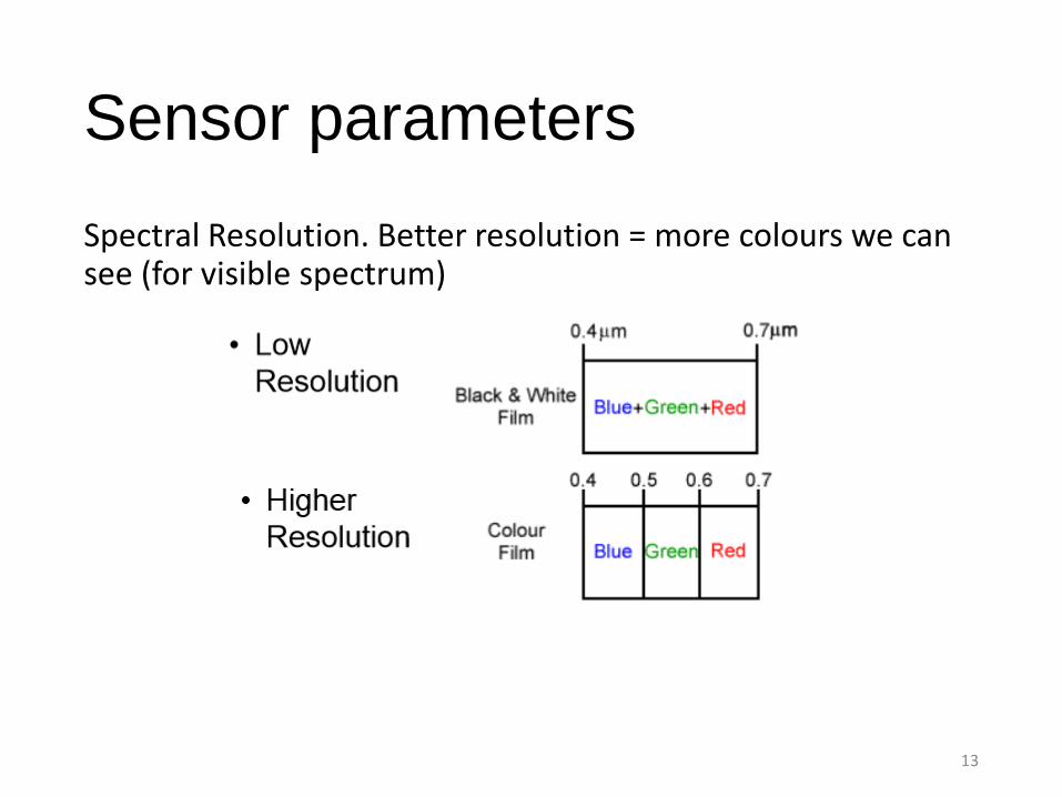
Sensor parameters
Spectral Resolution. Better resolution = more colours we can see (for visible spectrum)
13
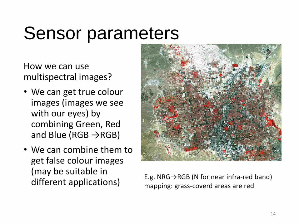
Sensor parameters
How we can use multispectral images?
• We can get true colourimages (images we see with our eyes) by combining Green, Red and Blue (RGB →RGB)
• We can combine them to get false colour images (may be suitable in different applications)
14
E.g. NRG→RGB (N for near infra-red band) mapping: grass-coverd areas are red
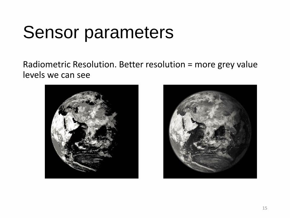
Sensor parameters
Radiometric Resolution. Better resolution = more grey value levels we can see
15
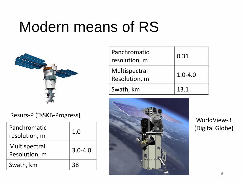
Modern means of RS
Resurs-P (TsSKB-Progress)
Panchromatic resolution, m
1.0
Multispectral Resolution, m
3.0-4.0
Swath, km 38
Panchromatic resolution, m
0.31
Multispectral Resolution, m
1.0-4.0
Swath, km 13.1
WorldView-3(Digital Globe)
16
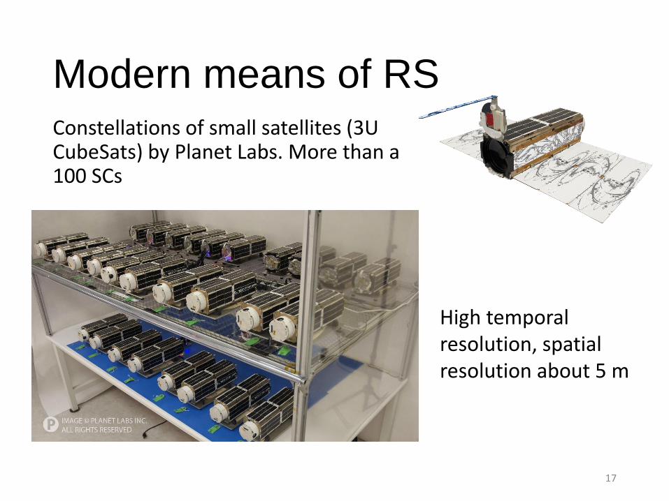
Modern means of RSConstellations of small satellites (3U CubeSats) by Planet Labs. More than a 100 SCs
17
High temporal resolution, spatial resolution about 5 m
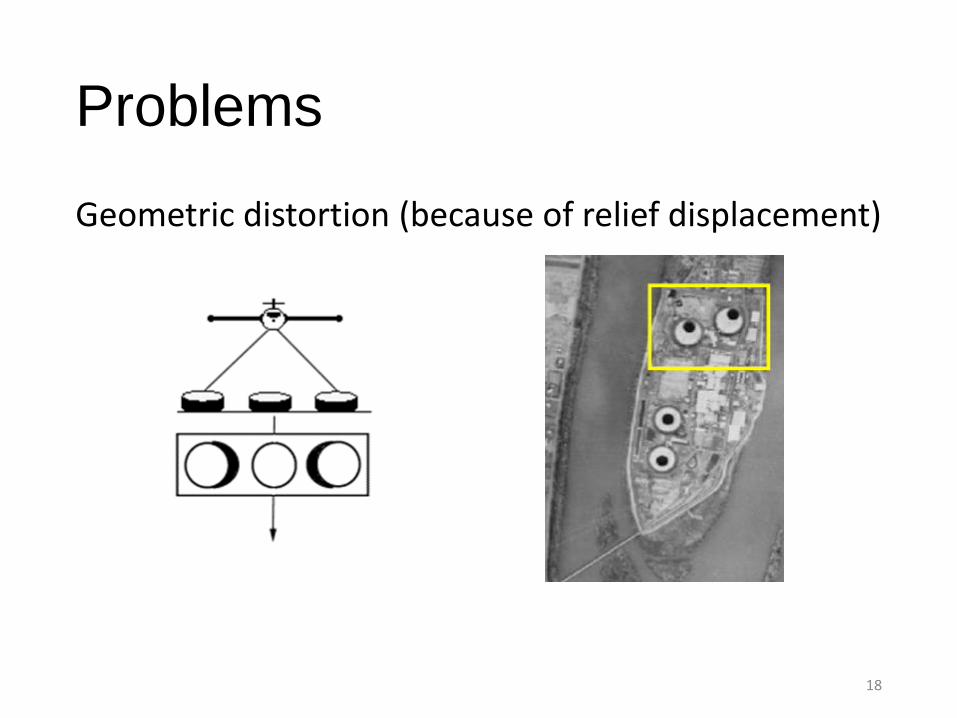
Problems
Geometric distortion (because of relief displacement)
18
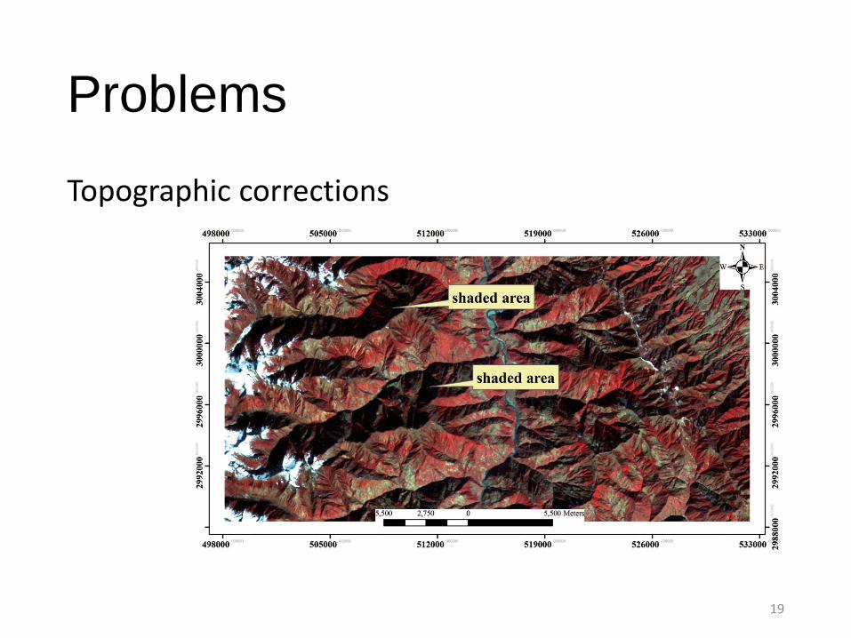
Problems
Topographic corrections
19
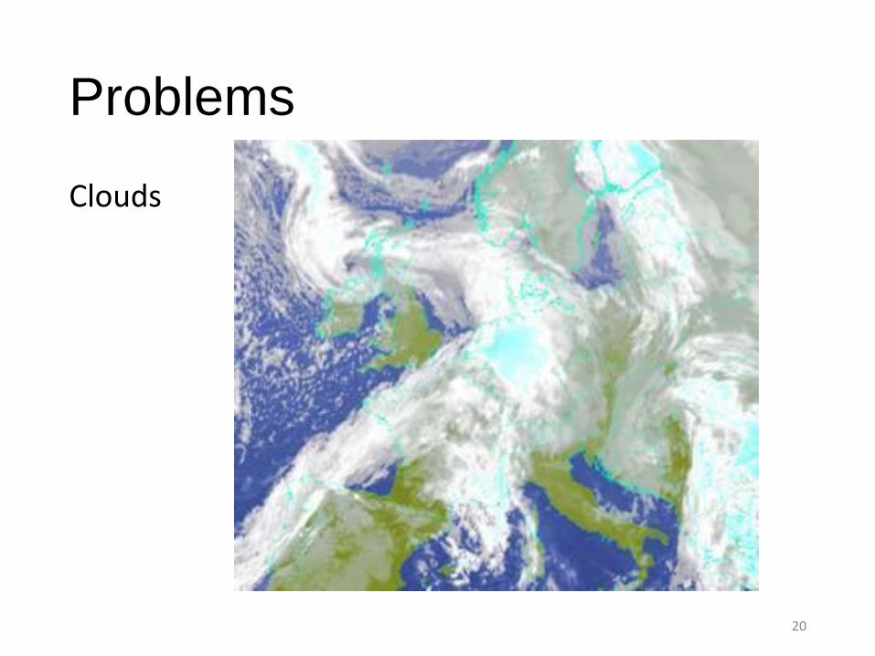
Problems
Clouds
20
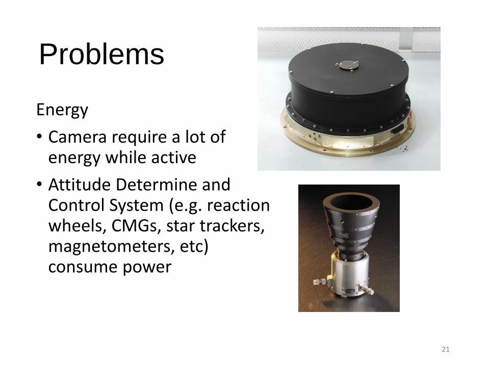
Problems
Energy
• Camera require a lot of energy while active
• Attitude Determine and Control System (e.g. reaction wheels, CMGs, star trackers, magnetometers, etc) consume power
21
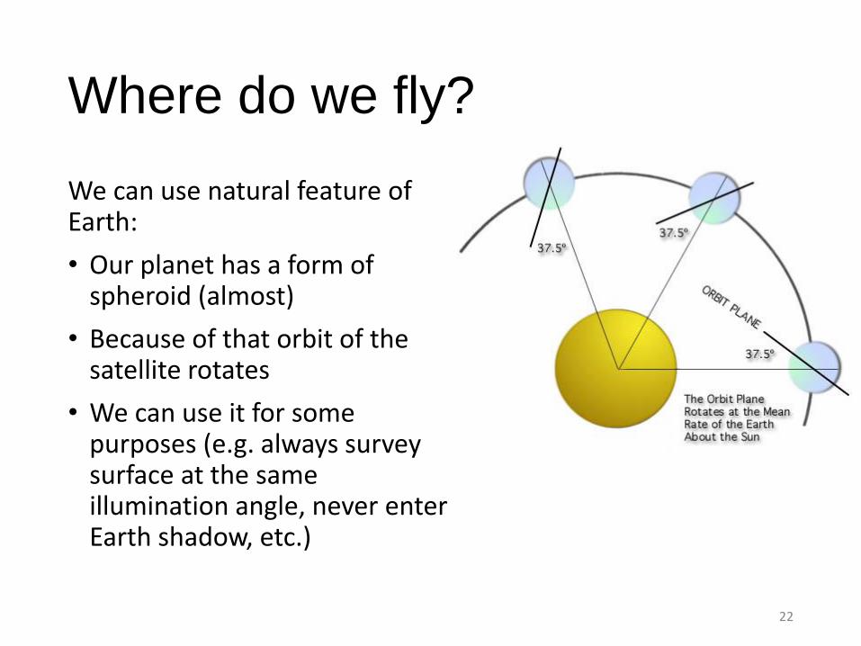
Where do we fly?
We can use natural feature of Earth:
• Our planet has a form of spheroid (almost)
• Because of that orbit of the satellite rotates
• We can use it for some purposes (e.g. always survey surface at the same illumination angle, never enter Earth shadow, etc.)
22