Embed Size (px)
Citation preview

Prentice Hall
EARTH SCIENCE
Tarbuck Lutgens
Chapter
16 The Dynamic Ocean
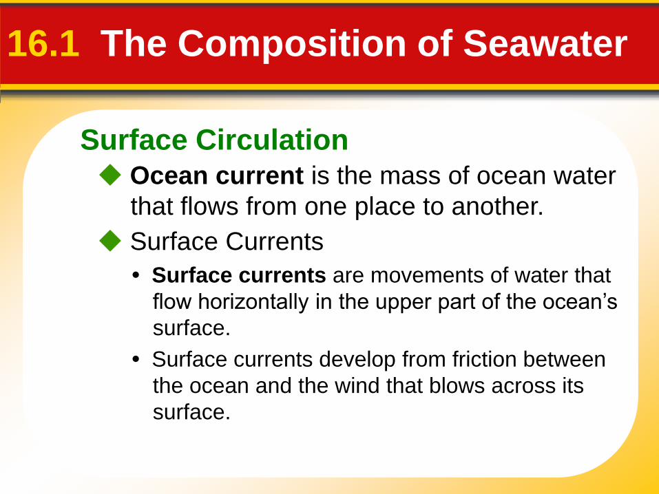
Surface Circulation
16.1 The Composition of Seawater
Ocean current is the mass of ocean water
that flows from one place to another.
Surface Currents
• Surface currents are movements of water that
flow horizontally in the upper part of the ocean’s
surface.
• Surface currents develop from friction between
the ocean and the wind that blows across its
surface.
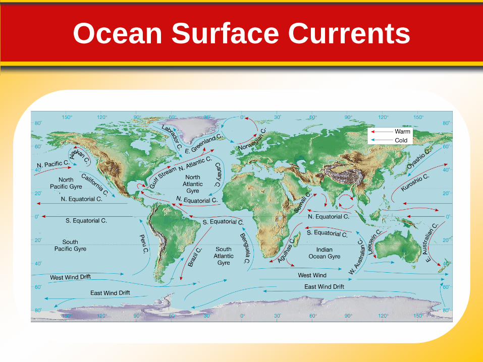
Ocean Surface Currents
Surface Circulation Gyres
16.1 The Composition of Seawater
• Gyres are huge circular-moving current systems
that dominate the surfaces of the oceans.
• The Coriolis effect is the deflection of currents
away from their original course as a result of
Earth’s rotation.
Surface Circulation Ocean Currents and Climate
16.1 The Composition of Seawater
• When currents from low-latitude regions move
into higher latitudes, they transfer heat from
warmer to cooler areas on Earth.
• As cold water currents travel toward the equator,
they help moderate the warm temperatures of
adjacent land areas.
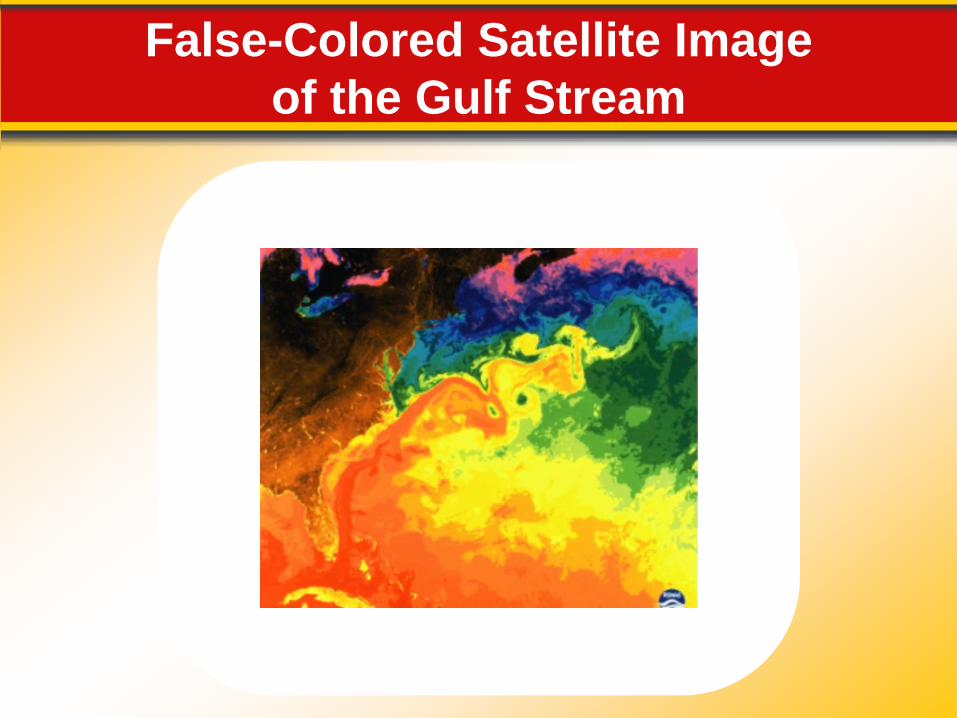
False-Colored Satellite Image
of the Gulf Stream
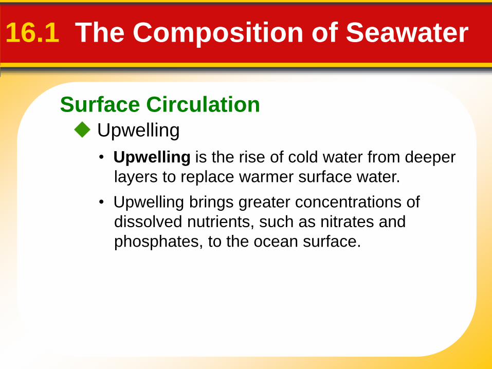
Surface Circulation Upwelling
16.1 The Composition of Seawater
• Upwelling is the rise of cold water from deeper
layers to replace warmer surface water.
• Upwelling brings greater concentrations of
dissolved nutrients, such as nitrates and
phosphates, to the ocean surface.
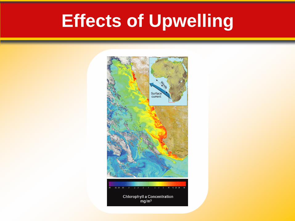
Effects of Upwelling
Deep-Ocean Circulation Density Currents
16.1 The Composition of Seawater
• Density currents are vertical currents of ocean
water that result from density differences among
water masses.
• An increase in seawater density can be caused
by a decrease in temperature or an increase in
salinity.
Deep-Ocean Circulation High Latitudes
16.1 The Composition of Seawater
• Most water involved in deep-ocean currents
begins in high latitudes at the surface.
Evaporation
• Density currents can also result from increased
salinity of ocean water due to evaporation.
Deep-Ocean Circulation A Conveyor Belt
16.1 The Composition of Seawater
• In a simplified model, ocean circulation is similar
to a conveyor belt that travels from the Atlantic
Ocean, through the Indian and Pacific Oceans,
and back again.
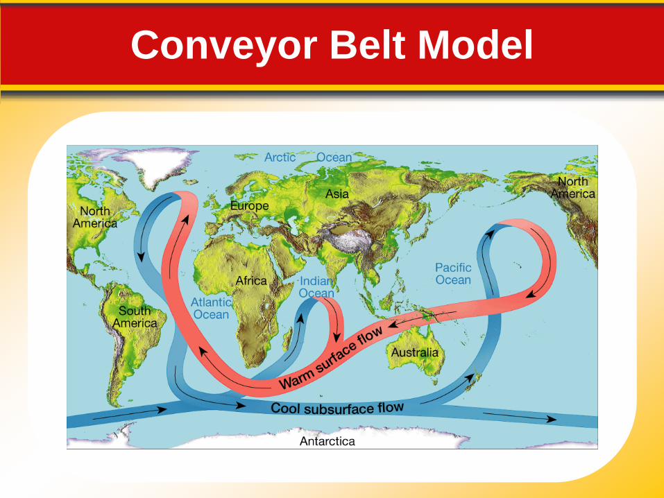
Conveyor Belt Model
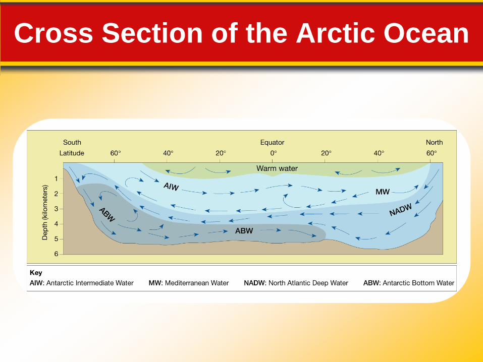
Cross Section of the Arctic Ocean
Waves Wave Characteristics
16.2 Waves and Tides
• Most ocean waves obtain their energy and
motion from the wind.
• The wave height is the vertical distance
between the trough and crest.
• The wavelength is the horizontal distance
between two successive crests or two
successive troughs.
Waves Wave Characteristics
16.2 Waves and Tides
• The wave period is the time it takes one full
wave—one wavelength—to pass a fixed
position.
• The height, length, and period that are
eventually achieved by a wave depend on three
factors: (1) wind speed, (2) length of time the
wind has blown, and (3) fetch.
• Fetch is the distance that the wind has traveled
across open water.
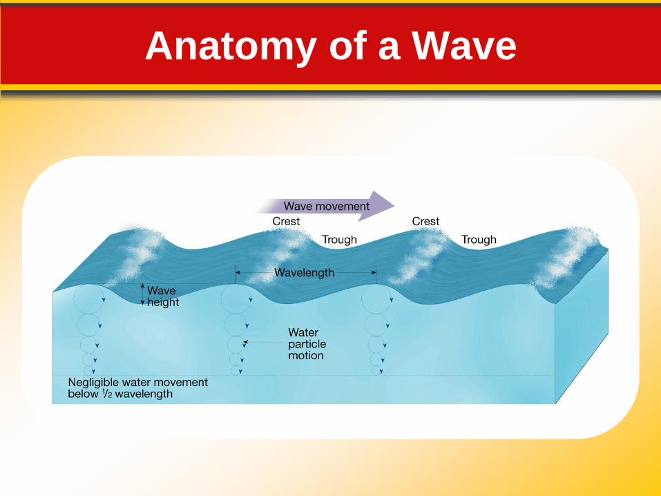
Anatomy of a Wave
Waves Wave Motion
16.2 Waves and Tides
• Circular orbital motion allows energy to move
forward through the water while the individual
water particles that transmit the wave move
around in a circle.
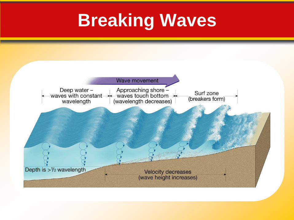
Waves Breaking Waves
16.2 Waves and Tides
• Changes occur as a wave moves onto shore.
• As the waves touch bottom, wave speed
decreases. The decrease in wave speed results
in a decrease in wavelength and an increase in
wave height.
Breaking Waves
Tides
Ocean tides result from the gravitational
attraction exerted upon Earth by the moon
and, to a lesser extent, by the sun.
16.2 Waves and Tides
Tides are daily changes in the elevation of
the ocean surface.
Tide-Causing Forces
• The force that produces tides is gravity.
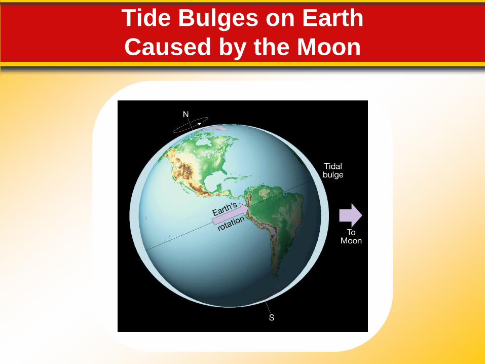
Tide Bulges on Earth
Caused by the Moon
Tides Tide Cycle
16.2 Waves and Tides
• Spring tides are tides that have the greatest
tidal range due to the alignment of the Earth–
moon–sun system.
• Tidal range is the difference in height between
successive high and low tides.
• Neap tides are tides that have the lowest tidal
range, occurring near the times of the first-
quarter and third-quarter phases of the moon.
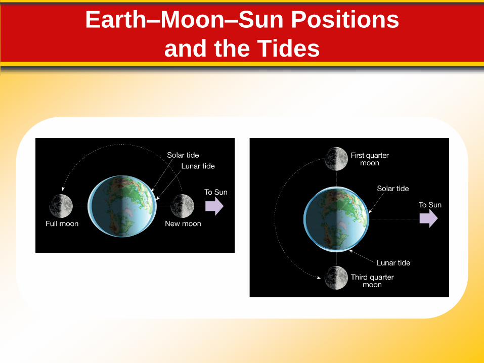
Earth–Moon–Sun Positions
and the Tides
Tides Tidal Patterns
16.2 Waves and Tides
• Three main tidal patterns exist worldwide:
diurnal tides, semidiurnal tides, and mixed tides.
Forces Acting on the Shoreline A beach is the accumulation of sediment
found along the shore of a lake or ocean.
16.3 Shoreline Processes and Features
Waves along the shoreline are constantly
eroding, transporting, and depositing
sediment. Many types of shoreline features
can result from this activity.
Forces Acting on the Shoreline Wave Impact
16.3 Shoreline Processes and Features
• The impact of large, high-energy waves against
the shore can be awesome in its violence. Each
breaking wave may hurl thousands of tons of
water against the land, sometimes causing the
ground to tremble.
Abrasion
• Abrasion is the sawing and grinding action of
rock fragments in the water.
• Abrasion is probably more intense in the surf
zone than in any other environment.
Forces Acting on the Shoreline Wave Refraction
16.3 Shoreline Processes and Features
• Wave refraction is the bending of waves, and it
plays an important part in the shoreline process.
• Because of refraction, wave energy is
concentrated against the sides and ends of
headlands that project into the water, whereas
wave action is weakened in bays.
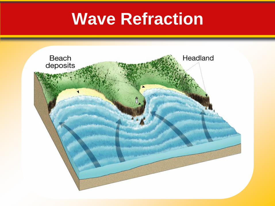
Wave Refraction
Forces Acting on the Shoreline Longshore Transport
16.3 Shoreline Processes and Features
• A longshore current is a near-shore current that
flows parallel to the shore.
• Turbulence allows longshore currents to easily
move fine suspended sand and to roll larger
sand and gravel particles along the bottom.
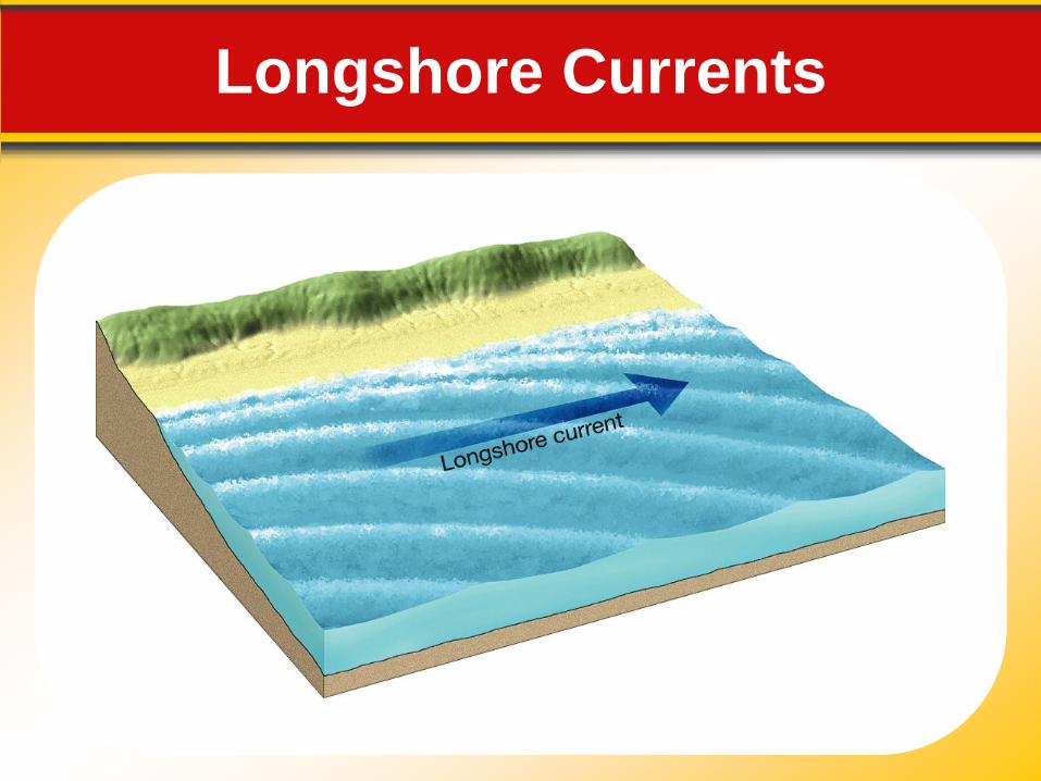
Longshore Currents
Erosional Features Shoreline features that originate primarily
from the work of erosion are called
erosional features. Sediment that is
transported along the shore and deposited
in areas where energy is low produces
depositional features.
16.3 Shoreline Processes and Features
Erosional Features Wave-Cut Cliffs and Platforms
16.3 Shoreline Processes and Features
• Wave-cut cliffs result from the cutting action of
the surf against the base of coastal land. A flat,
bench-like, wave-cut platform forms in front of
the wave-cut cliff.
Sea Arches and Sea Stacks
• When two caves on opposite sides of a
headland unite, a sea arch results. Eventually,
the arch falls in, leaving an isolated remnant, or
sea stack, on the wave-cut platform.
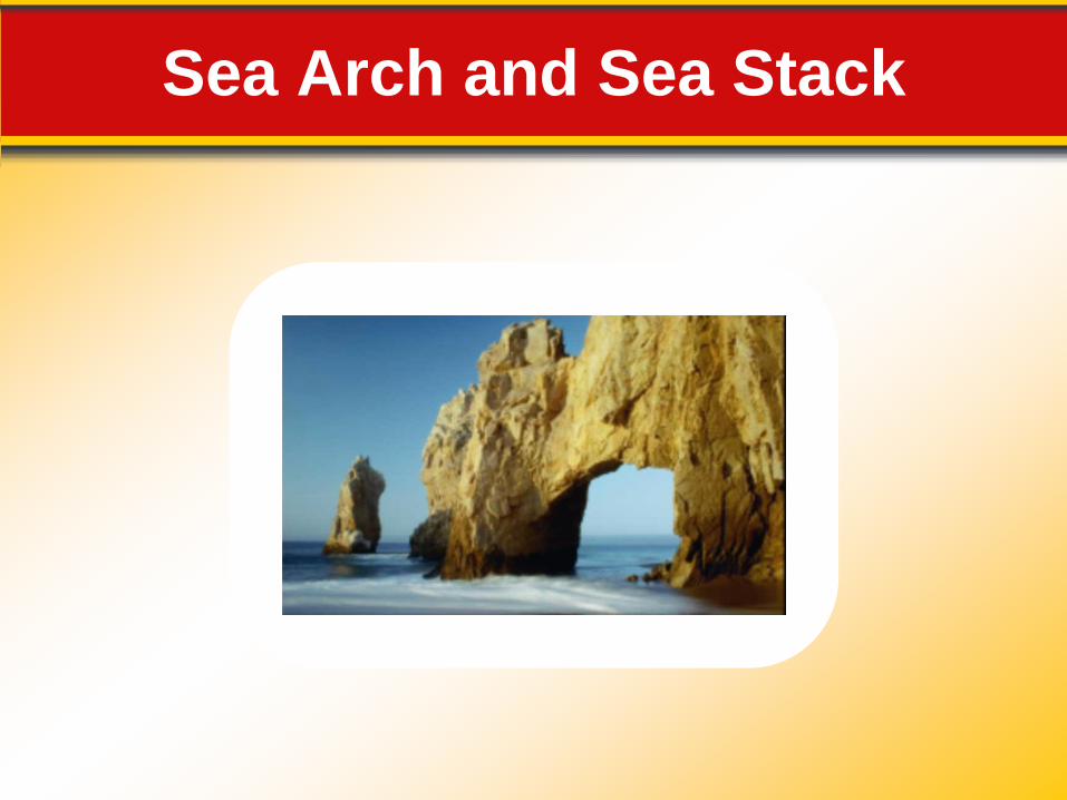
Sea Arch and Sea Stack
Depositional Features Spits, Bars, and Tombolos
16.3 Shoreline Processes and Features
• Where longshore currents and other surf zone
currents are active, several features related to
the movement of sediment along the shore may
develop.
- A spit is an elongated ridge of sand that projects
from the land into the mouth of an adjacent bay.
- A baymouth bar is a sandbar that completely
crosses a bay.
- A tombolo is a ridge of sand that connects an
island to the mainland or to another island.
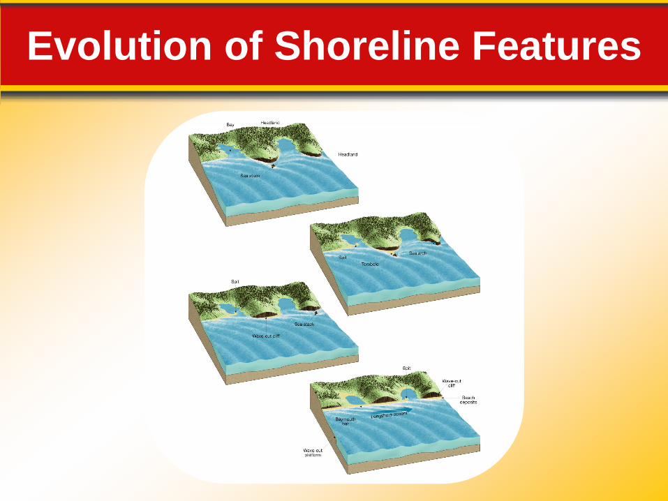
Evolution of Shoreline Features
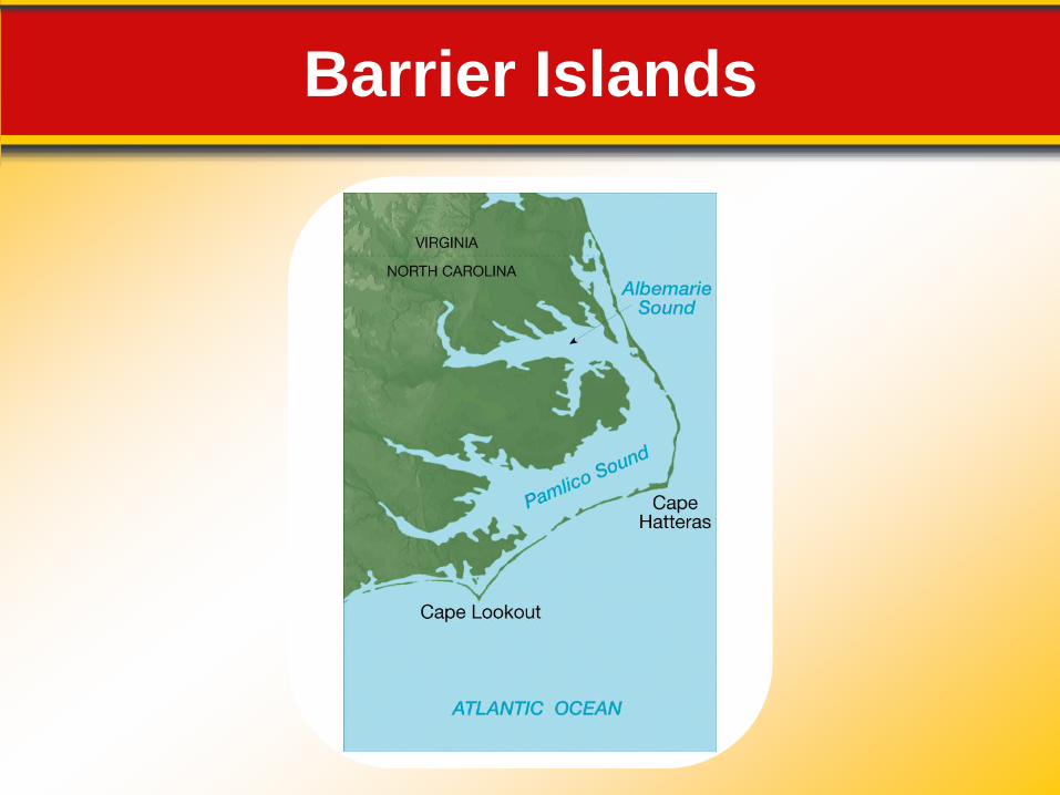
Depositional Features Barrier Islands
16.3 Shoreline Processes and Features
• Barrier islands are narrow sandbars parallel to,
but separate from, the coast at distances from 3
to 30 kilometers offshore.
Barrier Islands
Stabilizing the Shore Protective Structures
16.3 Shoreline Processes and Features
• Groins, breakwaters, and seawalls are some
structures built to protect a coast from erosion or
to prevent the movement of sand along a beach.
Beach Nourishment
• Beach nourishment is the addition of large
quantities of sand to the beach system.
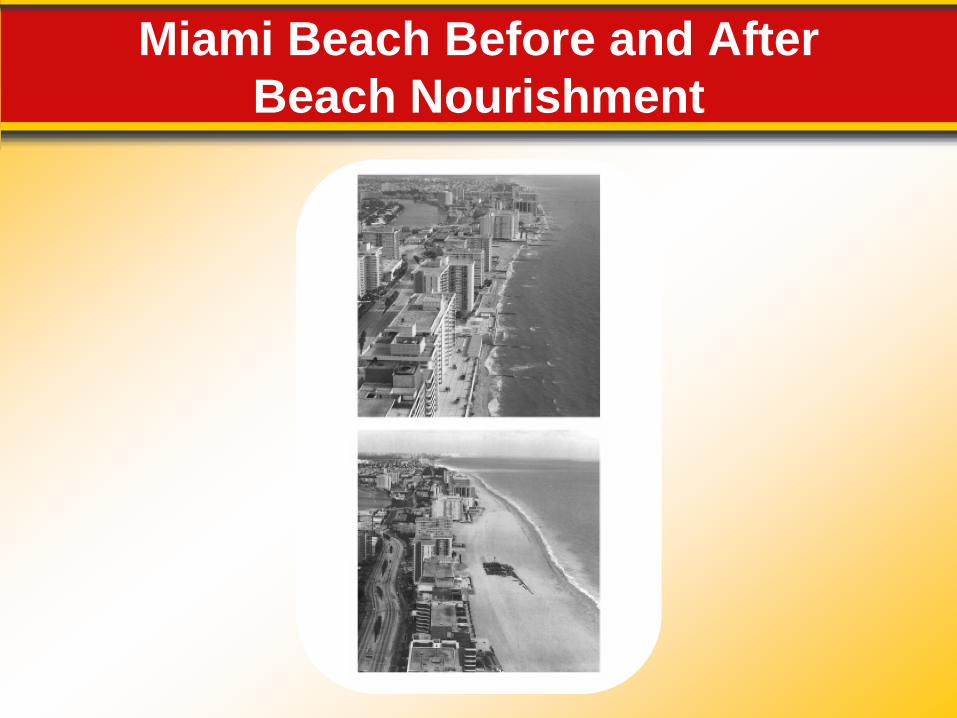
Miami Beach Before and After
Beach Nourishment