Embed Size (px)
Citation preview
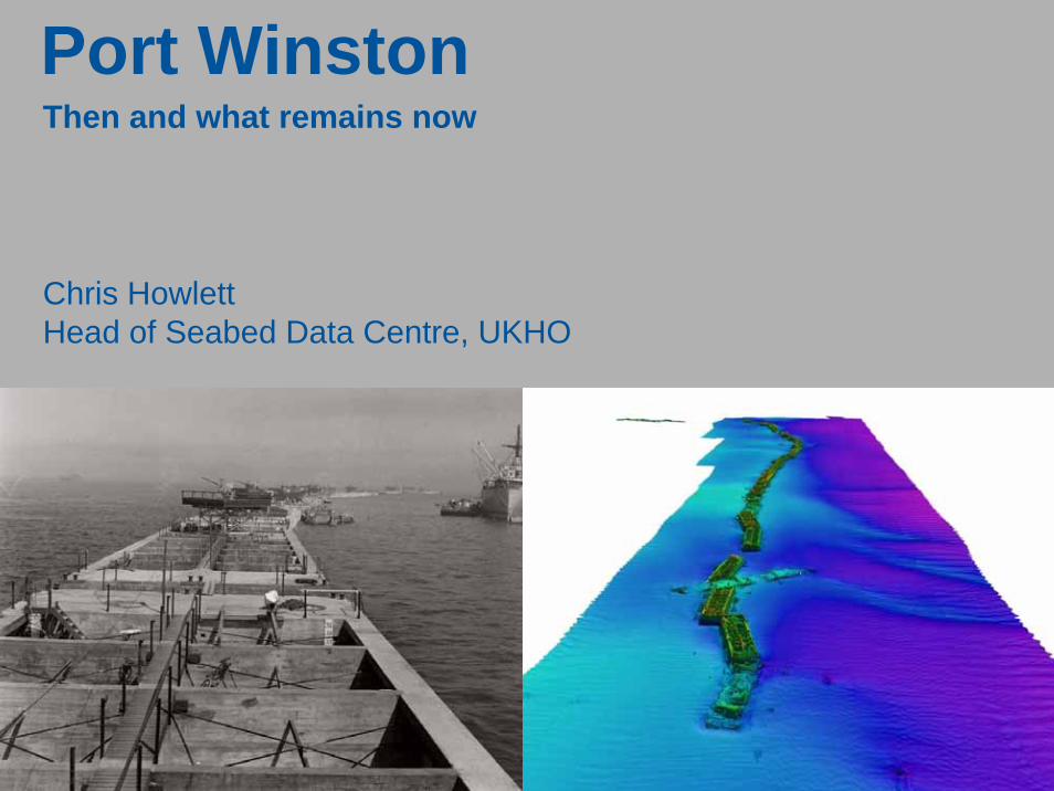
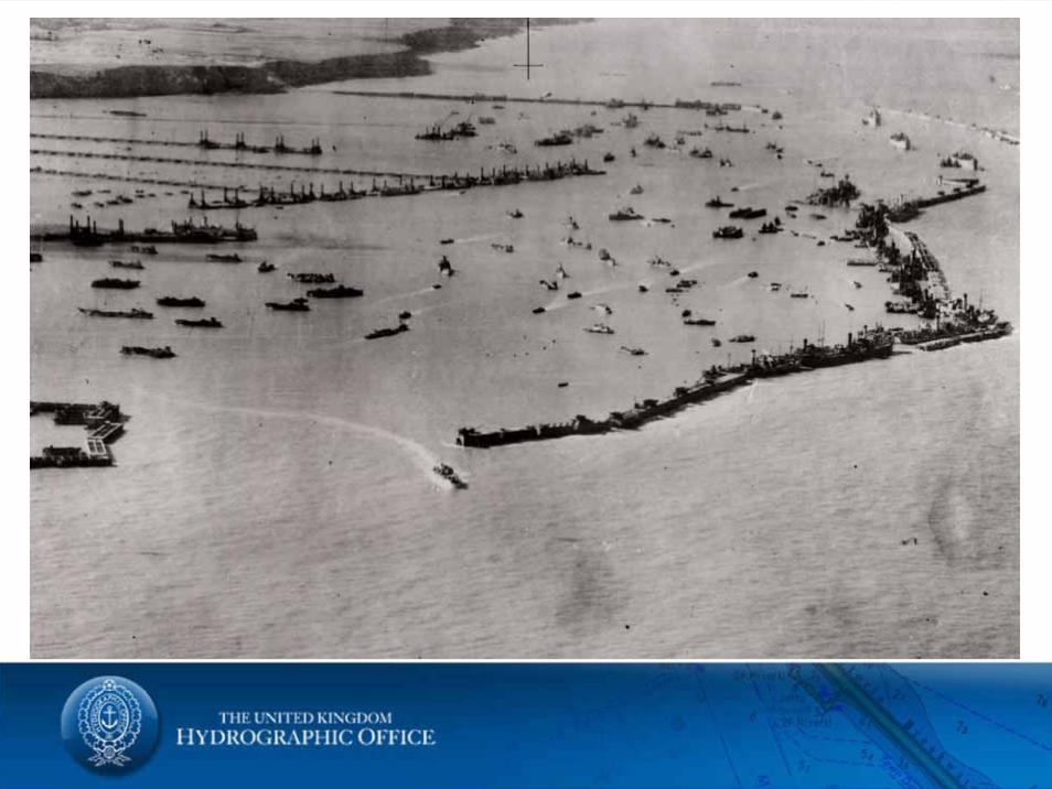
Port WinstonThen and what remains now
Chris HowlettHead of Seabed Data Centre, UKHO
Mulberry HarboursWhy were they used?What were they?What is left today?
Tides Installation of tide gauge
The SurveyAccommodation, Logistics, Equipment
Mulberry Harbour
Early Plans
Almost as soon as the British Expeditionary Force (BEF) had beenforcibly ejected from France via the beaches of Dunkirk, and still with the very real threat of a German invasion hanging over Britain, a small part of the British Army was considering (a bit unrealistically) how it might regain access to the continent.
An army on the offence needed huge quantities of stores. During WWI French ports were available but now, with all of France under German rule ports would need to be captured and probably repaired as any retreating army would attempt to make them un-useable.
In early 1941, to tackle this problem, the Army set up a small team of engineers known as Transportation 5 (Tn5) who were tasked with developing means to rapidly repair damaged ports.
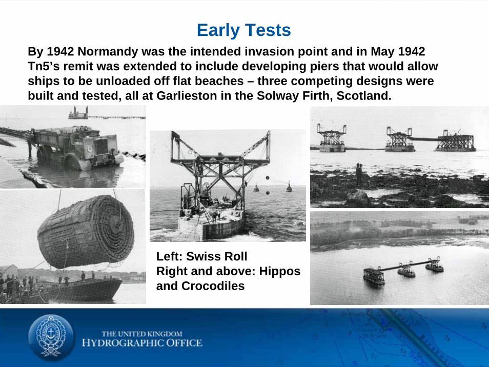
Early TestsBy 1942 Normandy was the intended invasion point and in May 1942Tn5’s remit was extended to include developing piers that would allow ships to be unloaded off flat beaches – three competing designs were built and tested, all at Garlieston in the Solway Firth, Scotland.
Left: Swiss RollRight and above: Hippos and Crocodiles
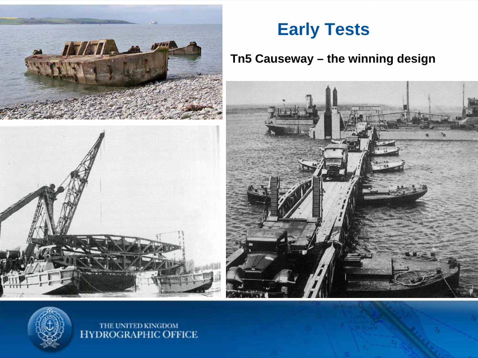
Early TestsTn5 Causeway – the winning design
Early Plans
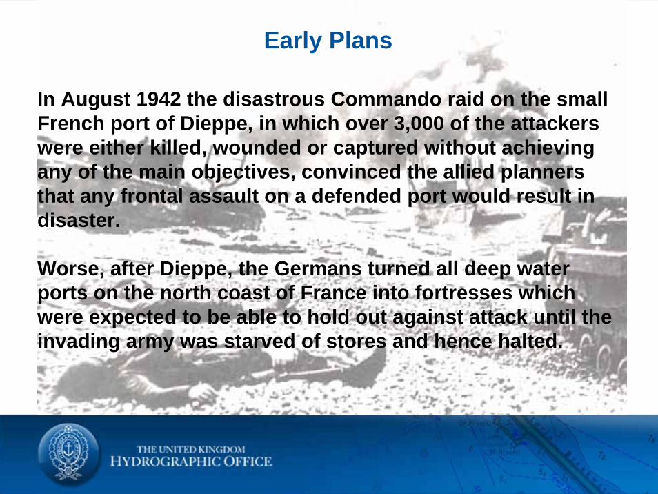
In August 1942 the disastrous Commando raid on the small French port of Dieppe, in which over 3,000 of the attackers were either killed, wounded or captured without achieving any of the main objectives, convinced the allied planners that any frontal assault on a defended port would result in disaster.
Worse, after Dieppe, the Germans turned all deep water ports on the north coast of France into fortresses which were expected to be able to hold out against attack until the invading army was starved of stores and hence halted.
Early Plans
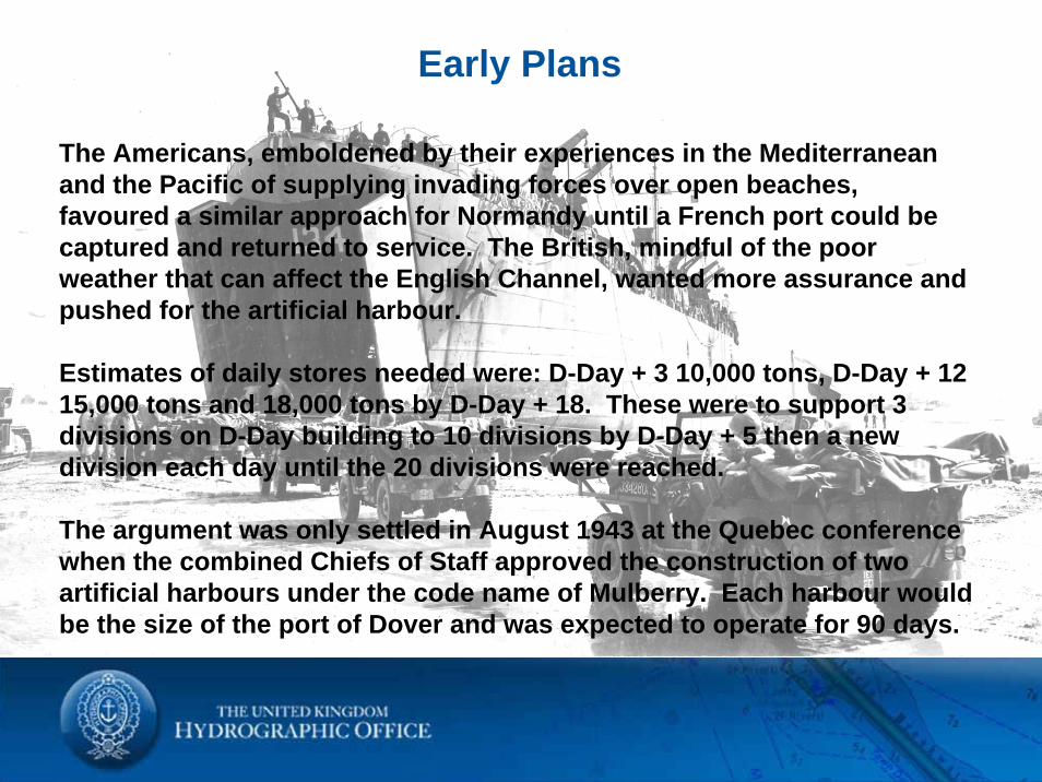
The Americans, emboldened by their experiences in the Mediterranean and the Pacific of supplying invading forces over open beaches, favoured a similar approach for Normandy until a French port could be captured and returned to service. The British, mindful of the poor weather that can affect the English Channel, wanted more assurance and pushed for the artificial harbour.
Estimates of daily stores needed were: D-Day + 3 10,000 tons, D-Day + 12 15,000 tons and 18,000 tons by D-Day + 18. These were to support 3 divisions on D-Day building to 10 divisions by D-Day + 5 then a new division each day until the 20 divisions were reached.
The argument was only settled in August 1943 at the Quebec conference when the combined Chiefs of Staff approved the construction of two artificial harbours under the code name of Mulberry. Each harbour would be the size of the port of Dover and was expected to operate for 90 days.
Construction
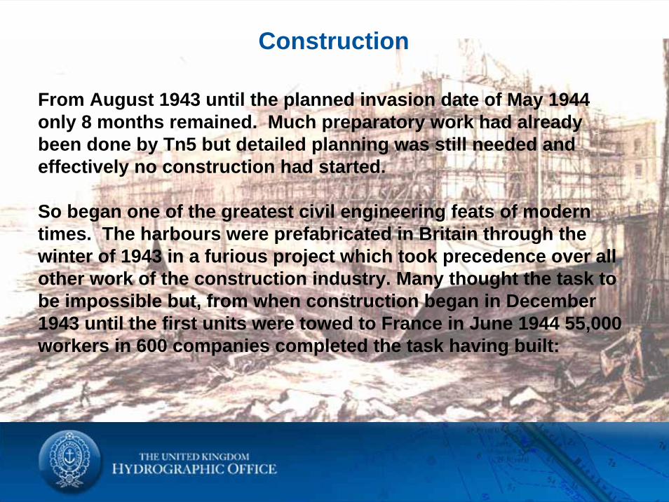
From August 1943 until the planned invasion date of May 1944 only 8 months remained. Much preparatory work had already been done by Tn5 but detailed planning was still needed and effectively no construction had started.
So began one of the greatest civil engineering feats of modern times. The harbours were prefabricated in Britain through the winter of 1943 in a furious project which took precedence over all other work of the construction industry. Many thought the task to be impossible but, from when construction began in December 1943 until the first units were towed to France in June 1944 55,000 workers in 600 companies completed the task having built:
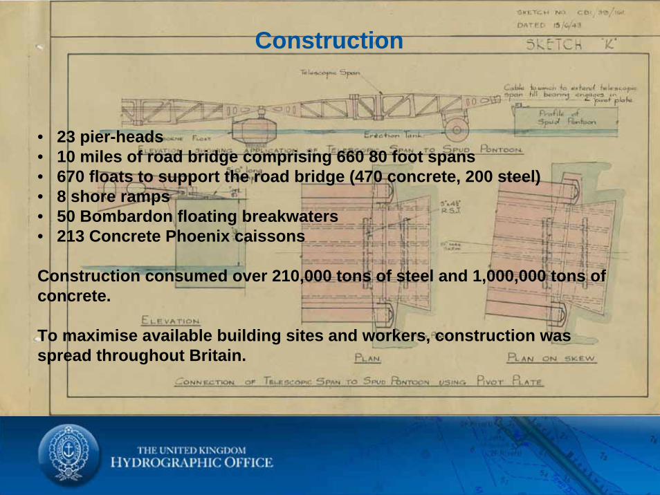
Construction
• 23 pier-heads• 10 miles of road bridge comprising 660 80 foot spans • 670 floats to support the road bridge (470 concrete, 200 steel)• 8 shore ramps • 50 Bombardon floating breakwaters• 213 Concrete Phoenix caissons
Construction consumed over 210,000 tons of steel and 1,000,000 tons of concrete.
To maximise available building sites and workers, construction was spread throughout Britain.
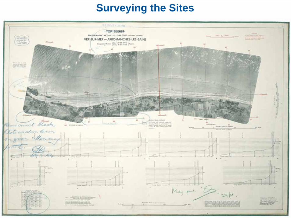
Surveying the Sites
Surveying the Sites
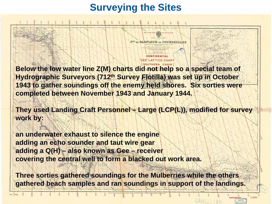
Below the low water line Z(M) charts did not help so a special team of Hydrographic Surveyors (712th Survey Flotilla) was set up in October 1943 to gather soundings off the enemy held shores. Six sorties were completed between November 1943 and January 1944.
They used Landing Craft Personnel – Large (LCP(L)), modified for survey work by:
an underwater exhaust to silence the engineadding an echo sounder and taut wire gearadding a Q(H) – also known as Gee – receivercovering the central well to form a blacked out work area.
Three sorties gathered soundings for the Mulberries while the others gathered beach samples and ran soundings in support of the landings.

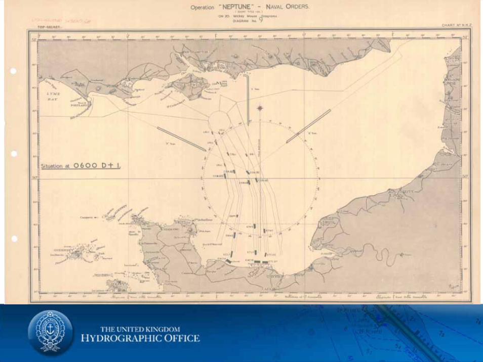
Operations KJF (26/27 November 1943) and Bellpush Charlie (30/31 January 1944)
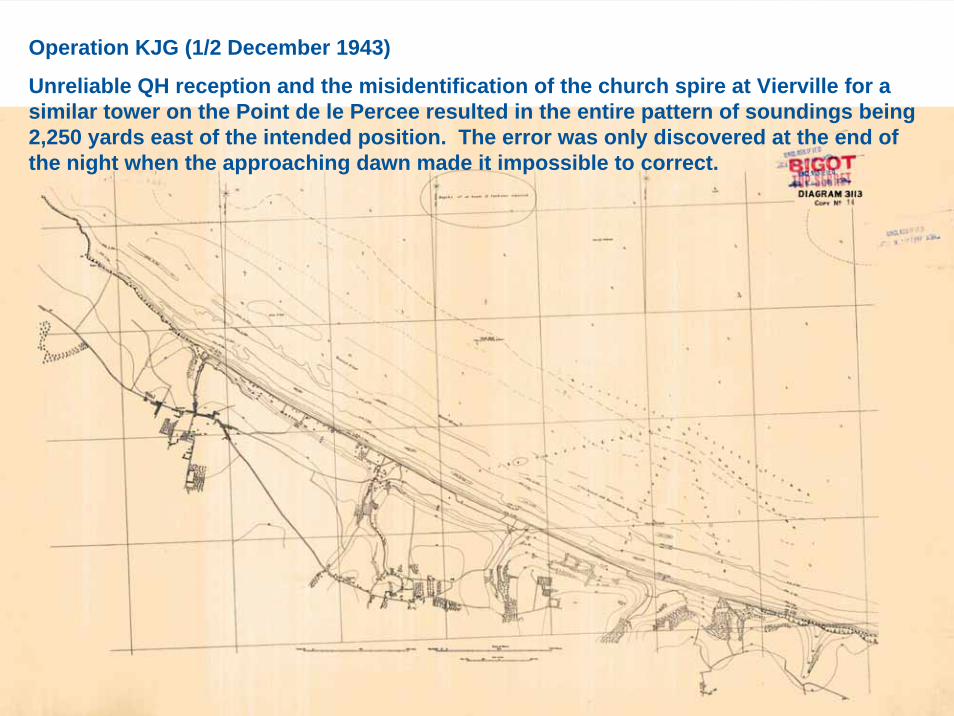
Operation KJG (1/2 December 1943)
Unreliable QH reception and the misidentification of the church spire at Vierville for a similar tower on the Point de le Percee resulted in the entire pattern of soundings being 2,250 yards east of the intended position. The error was only discovered at the end of the night when the approaching dawn made it impossible to correct.
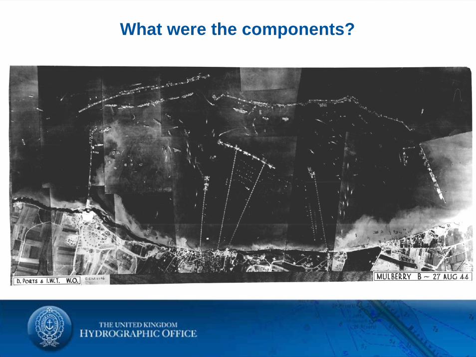
What were the components?
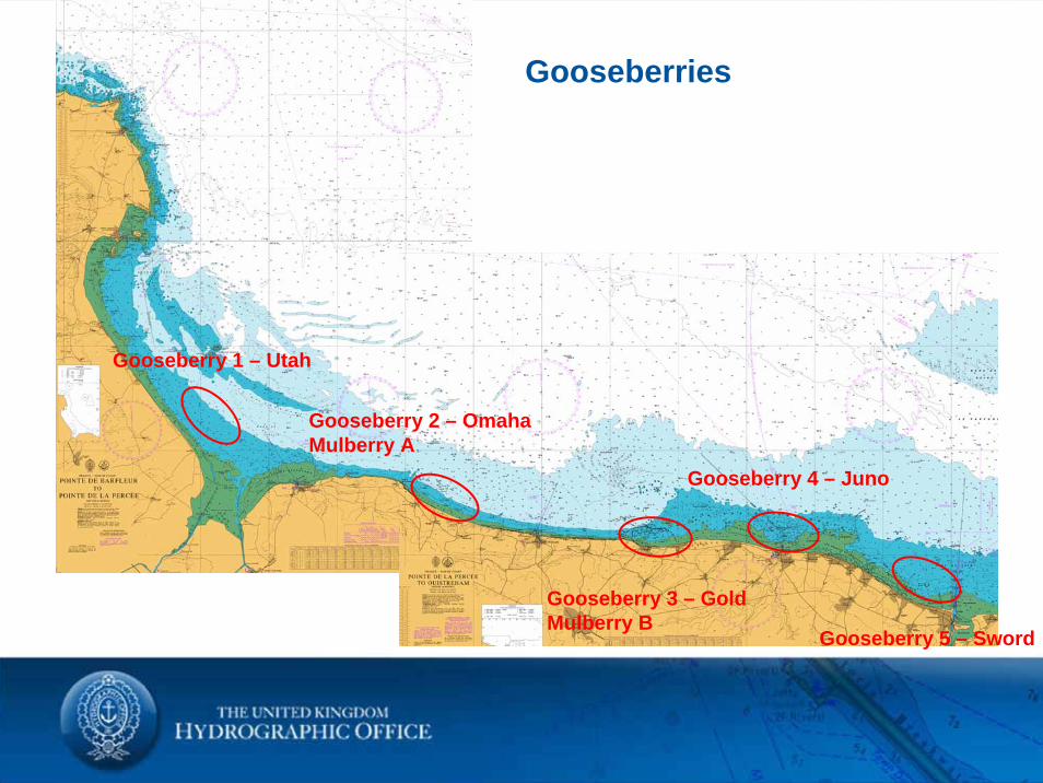
Gooseberry 1 – Utah
Gooseberry 2 – OmahaMulberry A
Gooseberry 3 – GoldMulberry B
Gooseberry 4 – Juno
Gooseberry 5 – Sword
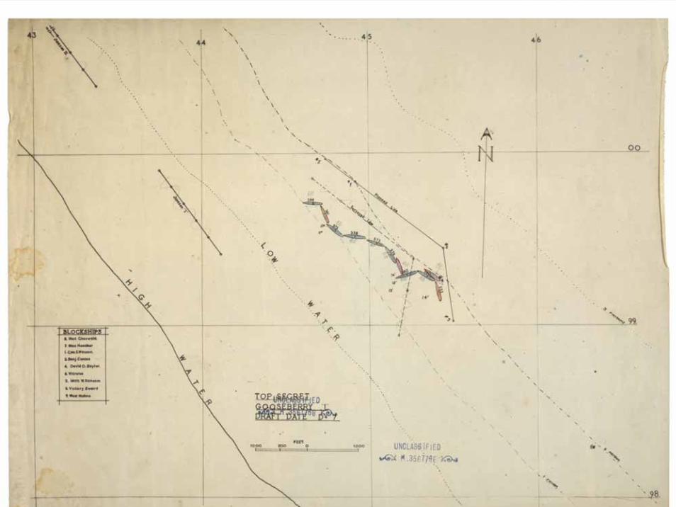
Gooseberries
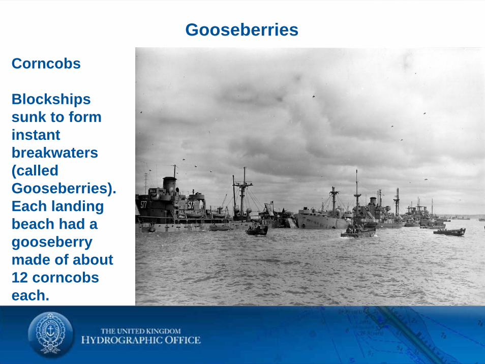
Gooseberries
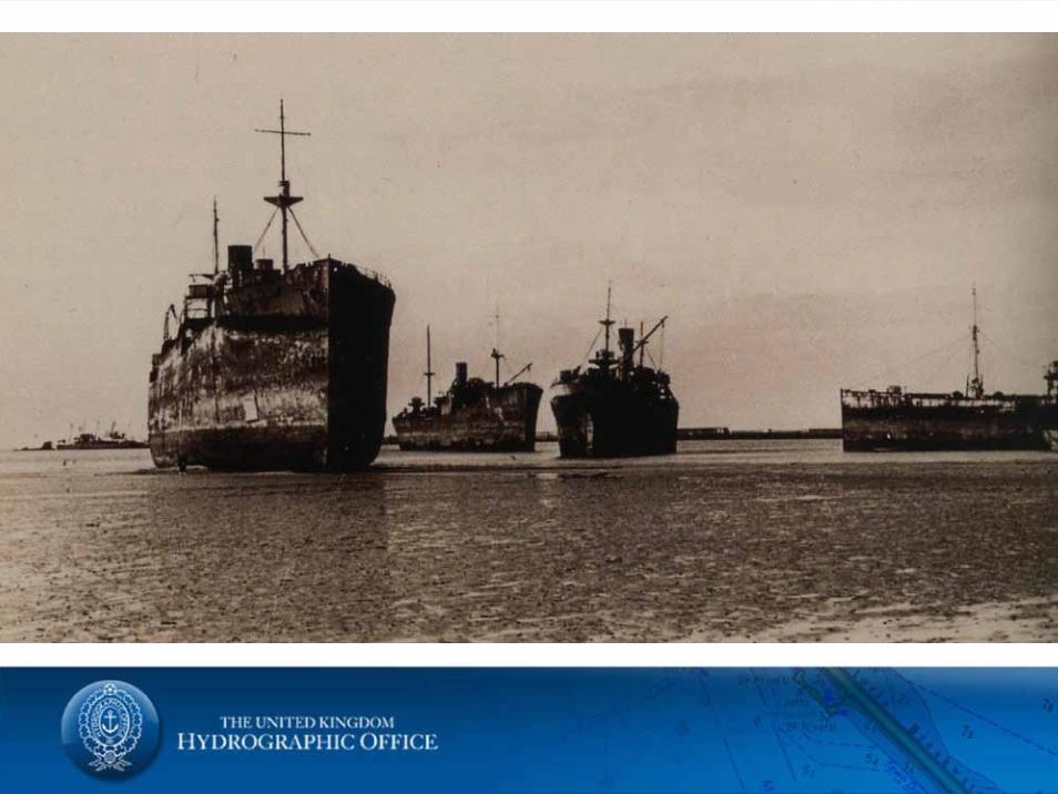
Corncobs
Blockshipssunk to form instant breakwaters (called Gooseberries). Each landing beach had a gooseberry made of about 12 corncobs each.
What were they?
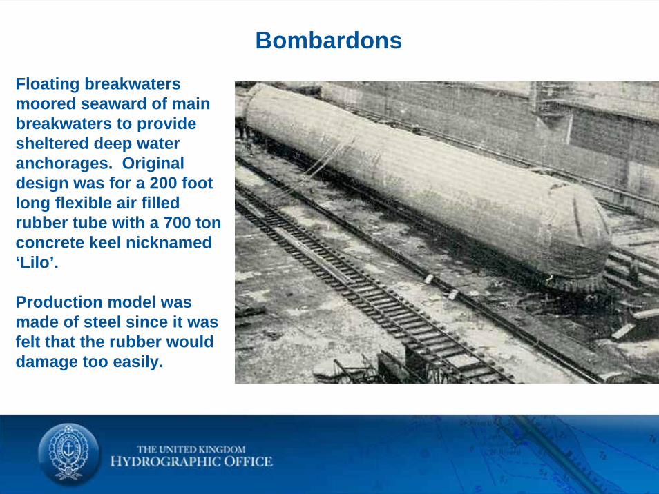
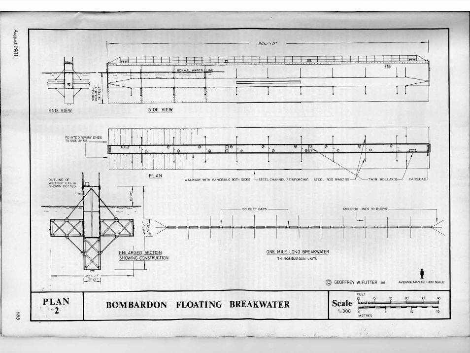
BombardonsFloating breakwaters moored seaward of main breakwaters to provide sheltered deep water anchorages. Original design was for a 200 foot long flexible air filled rubber tube with a 700 ton concrete keel nicknamed ‘Lilo’.
Production model was made of steel since it was felt that the rubber would damage too easily.
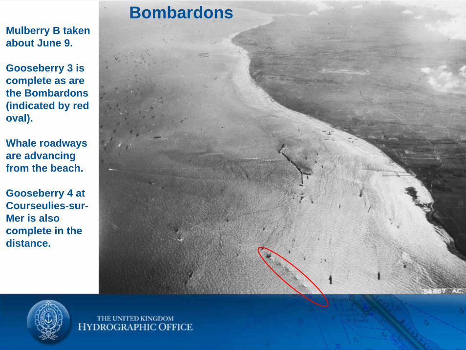
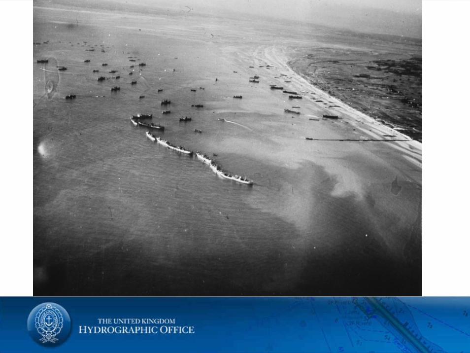
BombardonsMulberry B taken about June 9.
Gooseberry 3 is complete as are the Bombardons (indicated by red oval).
Whale roadways are advancing from the beach.
Gooseberry 4 at Courseulies-sur-Mer is also complete in the distance.
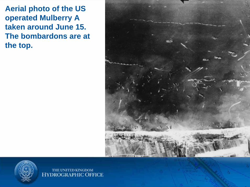
Aerial photo of the US operated Mulberry A taken around June 15. The bombardons are at the top.
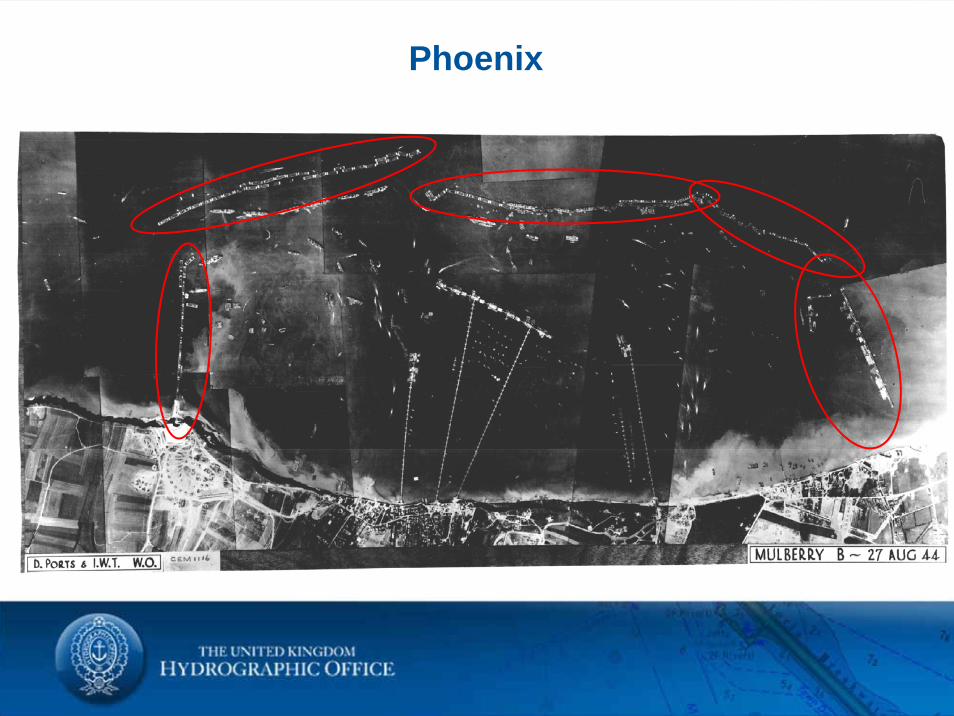
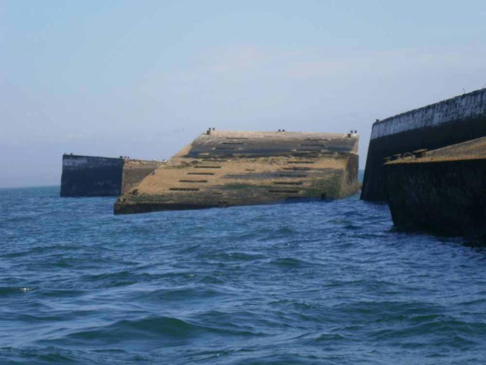
Phoenix
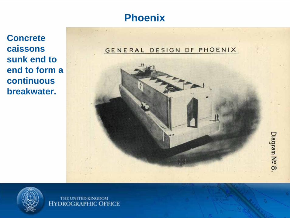
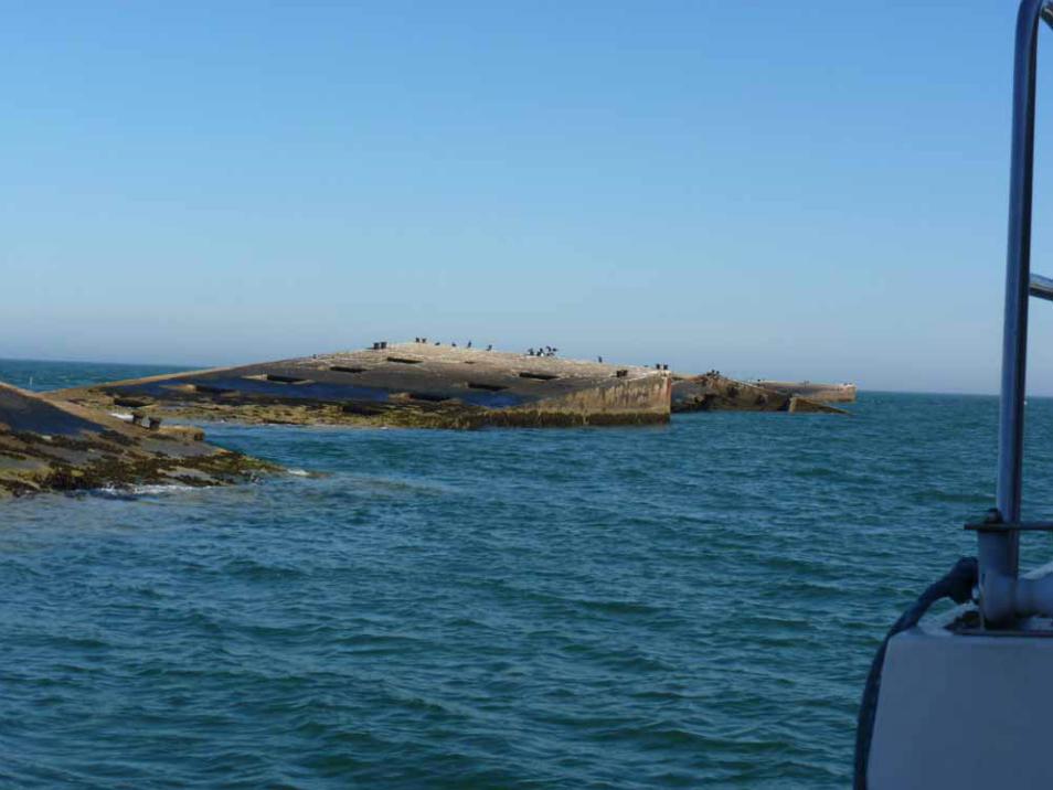
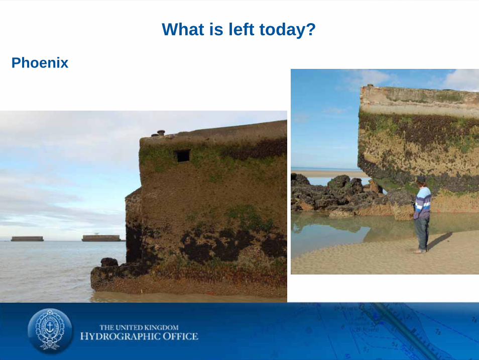
Phoenix
Concrete caissons sunk end to end to form a continuous breakwater.
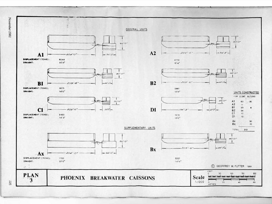
What were they?
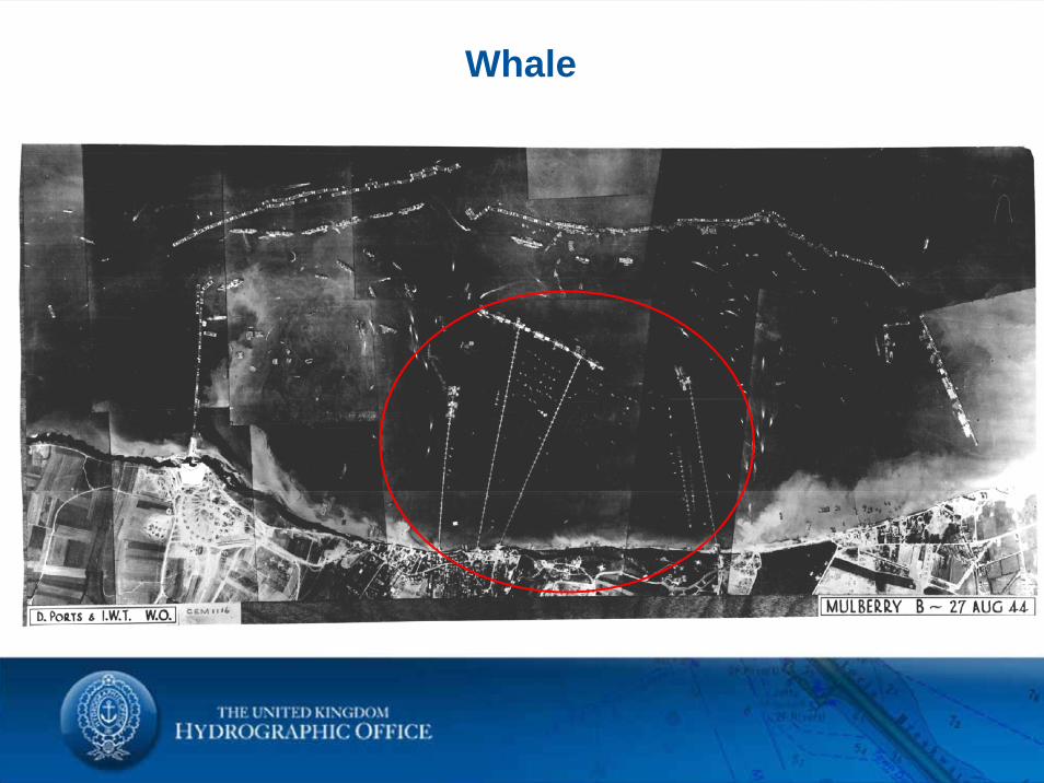
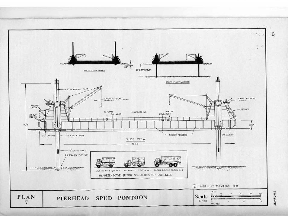
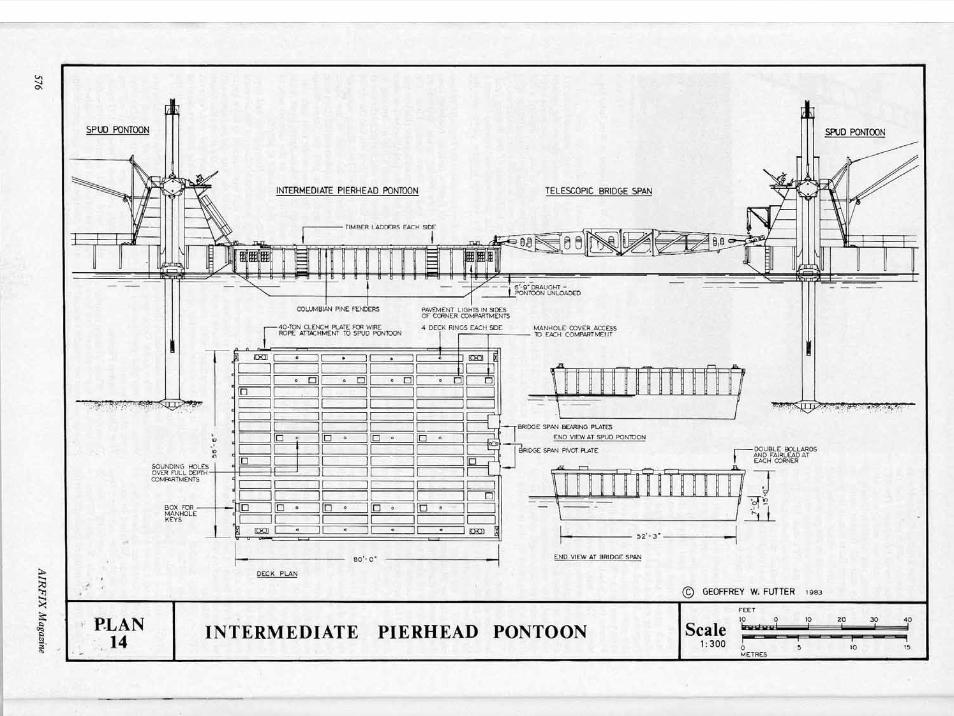
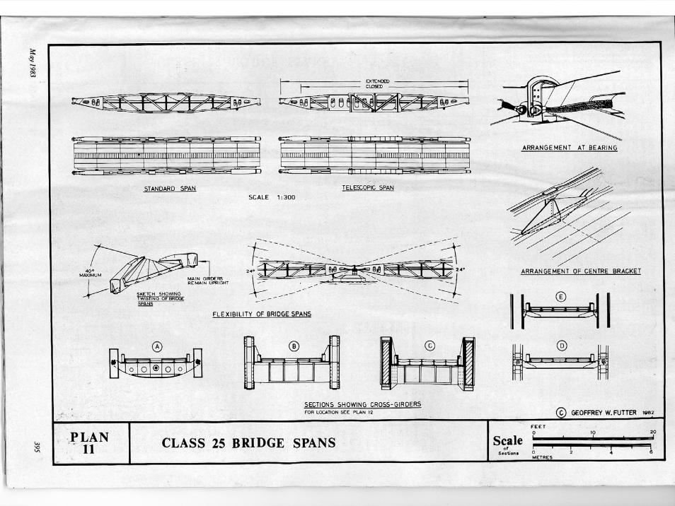
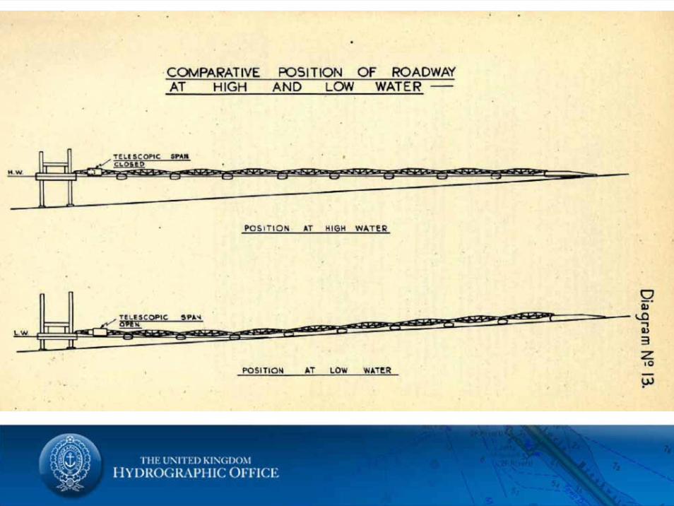
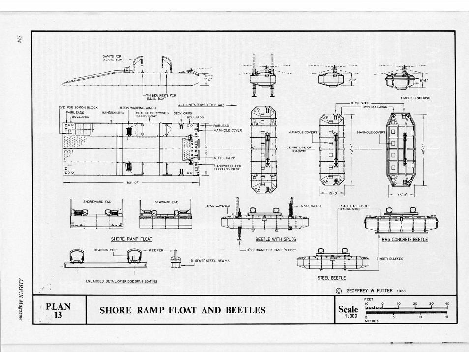
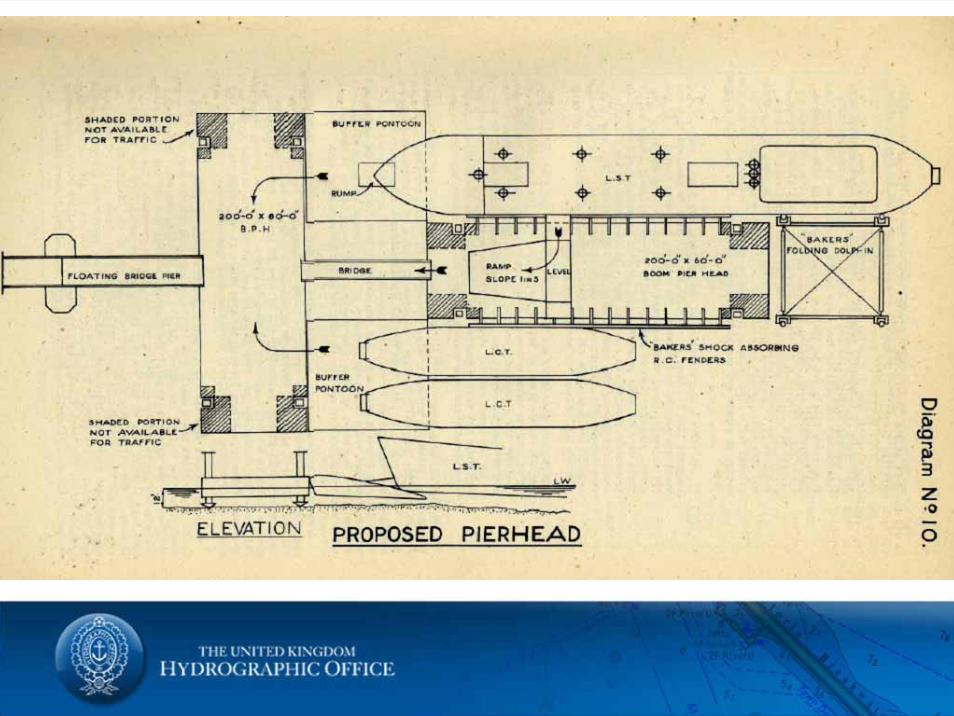
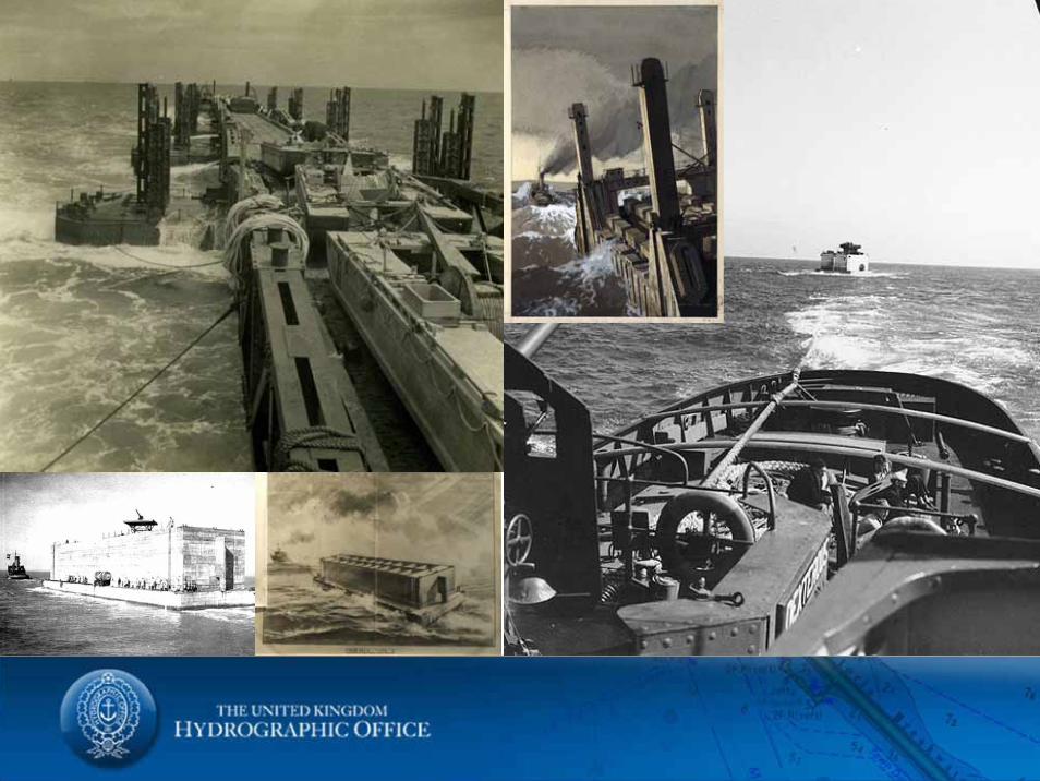
Whale
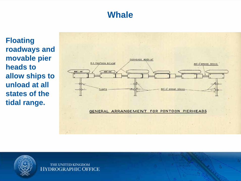
Whale
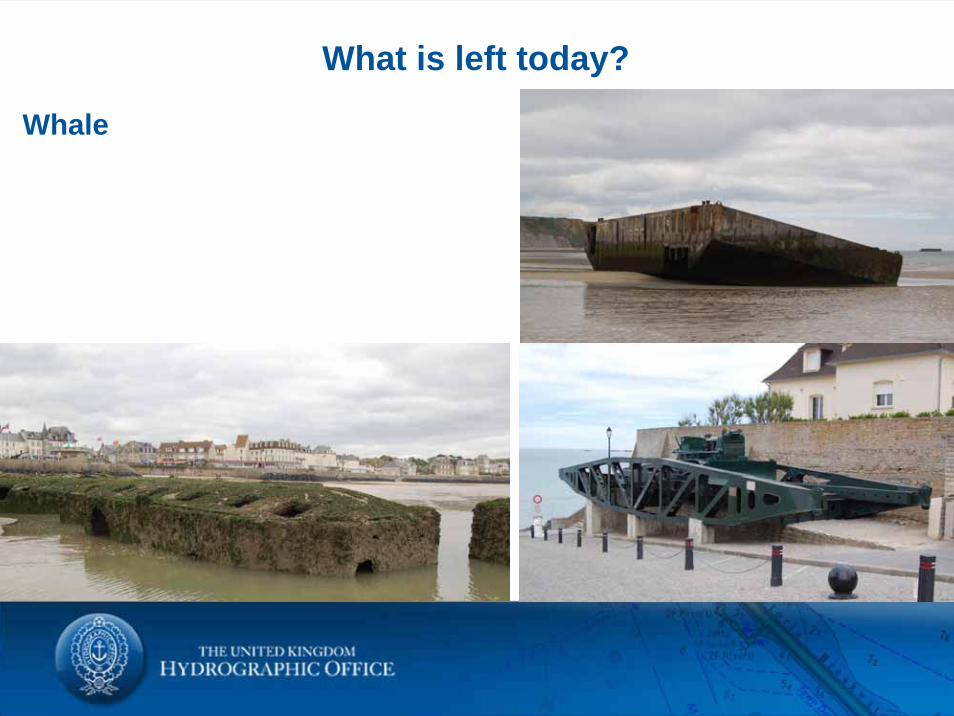
Floating roadways and movable pier heads to allow ships to unload at all states of the tidal range.
What were they?
What were they?
What were they?
What were they?
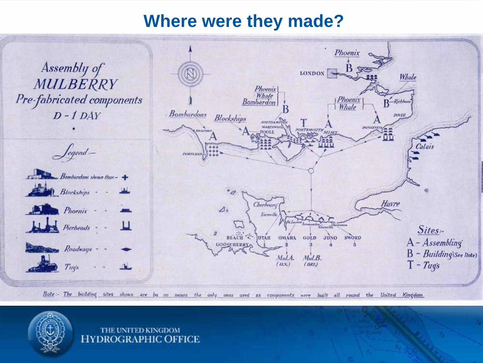
Where were they made?
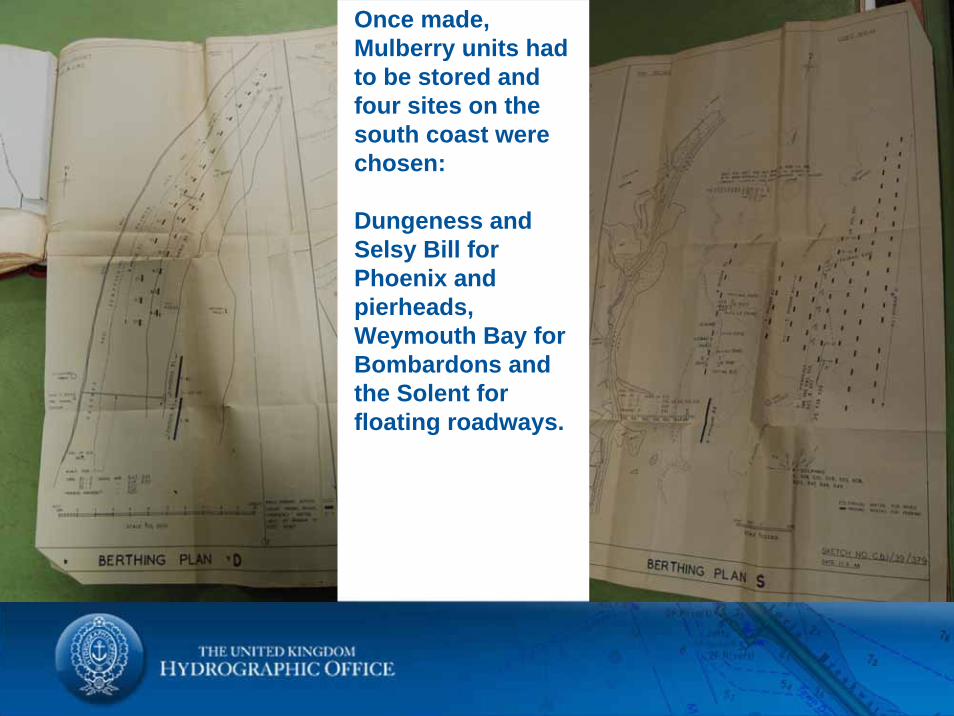
Once made, Mulberry units had to be stored and four sites on the south coast were chosen:
Dungeness and Selsy Bill for Phoenix and pierheads, Weymouth Bay for Bombardons and the Solent for floating roadways.
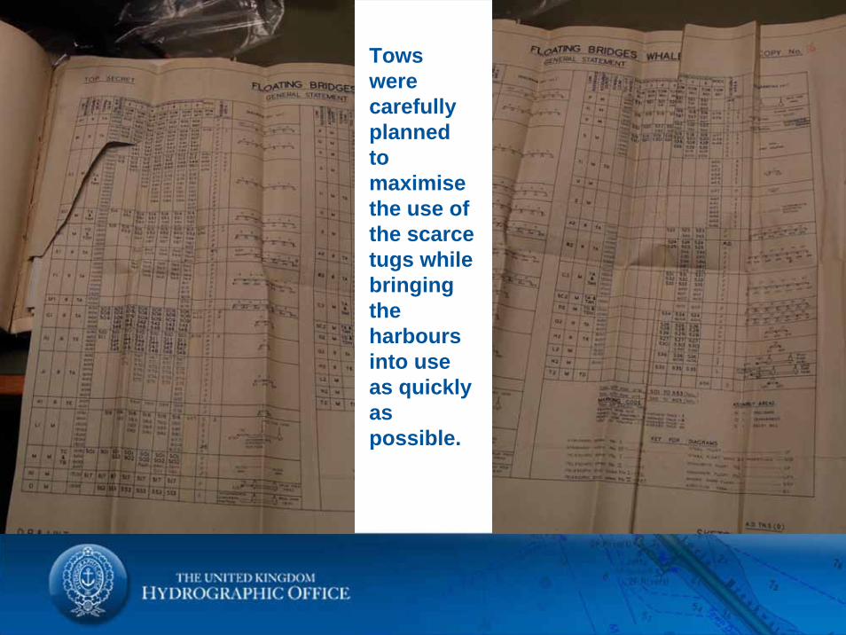
Tows were carefully planned to maximise the use of the scarce tugs while bringing the harbours into use as quickly as possible.
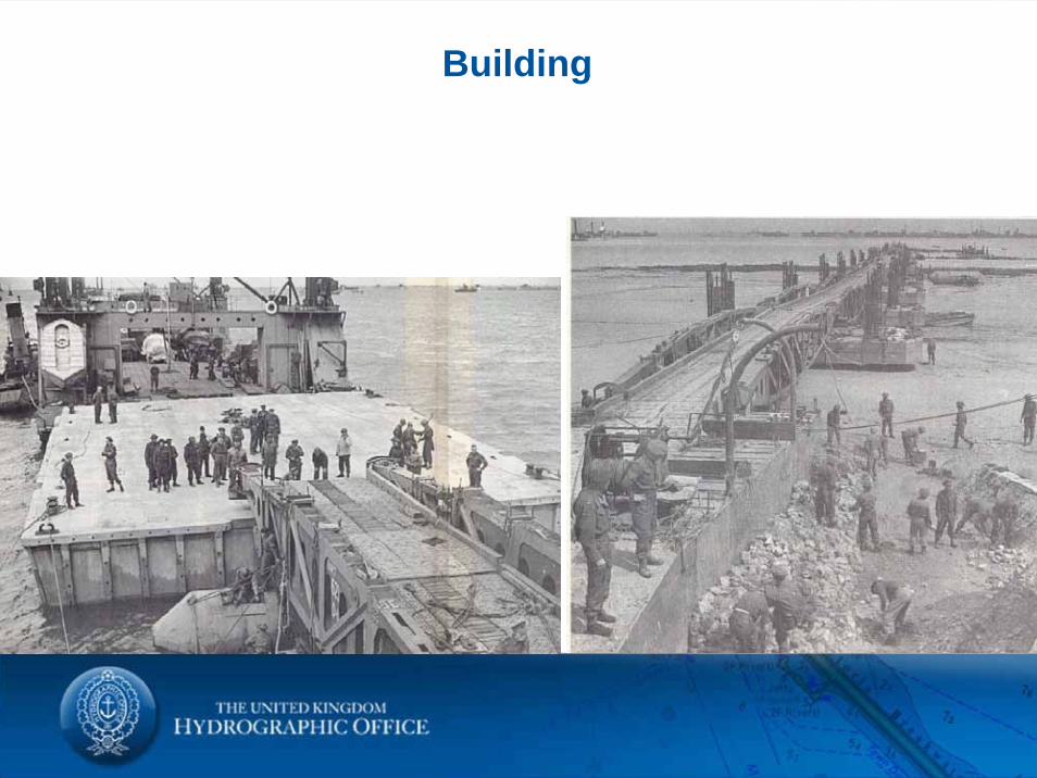
Building
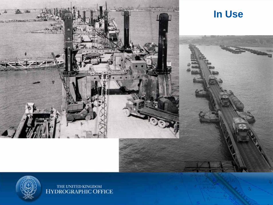
What were they? In Use
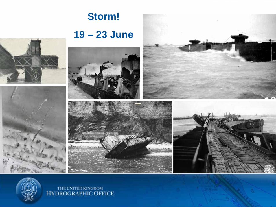
Storm!
19 – 23 June

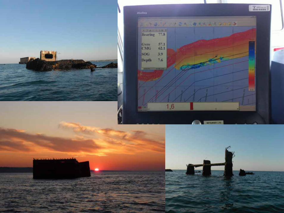
What is left today?
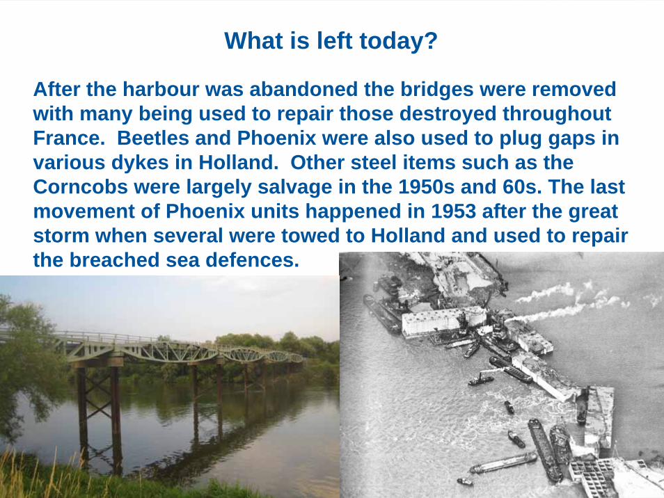
After the harbour was abandoned the bridges were removed with many being used to repair those destroyed throughout France. Beetles and Phoenix were also used to plug gaps in various dykes in Holland. Other steel items such as the Corncobs were largely salvage in the 1950s and 60s. The last movement of Phoenix units happened in 1953 after the great storm when several were towed to Holland and used to repair the breached sea defences.
What is left today?
Phoenix
What is left today?
Whale
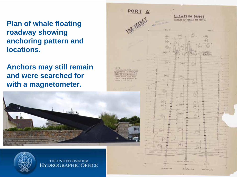
Plan of whale floating roadway showing anchoring pattern and locations.
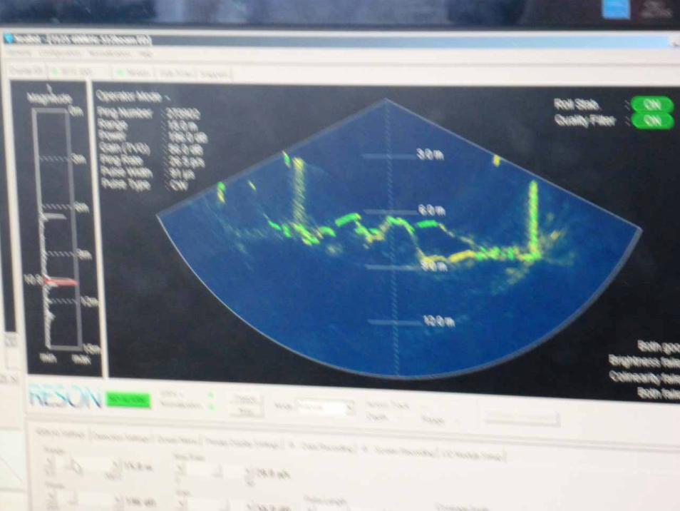
Anchors may still remain and were searched for with a magnetometer.
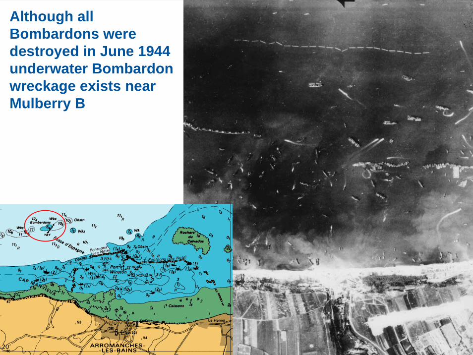
Although all Bombardons were destroyed in June 1944 underwater Bombardon wreckage exists near Mulberry B
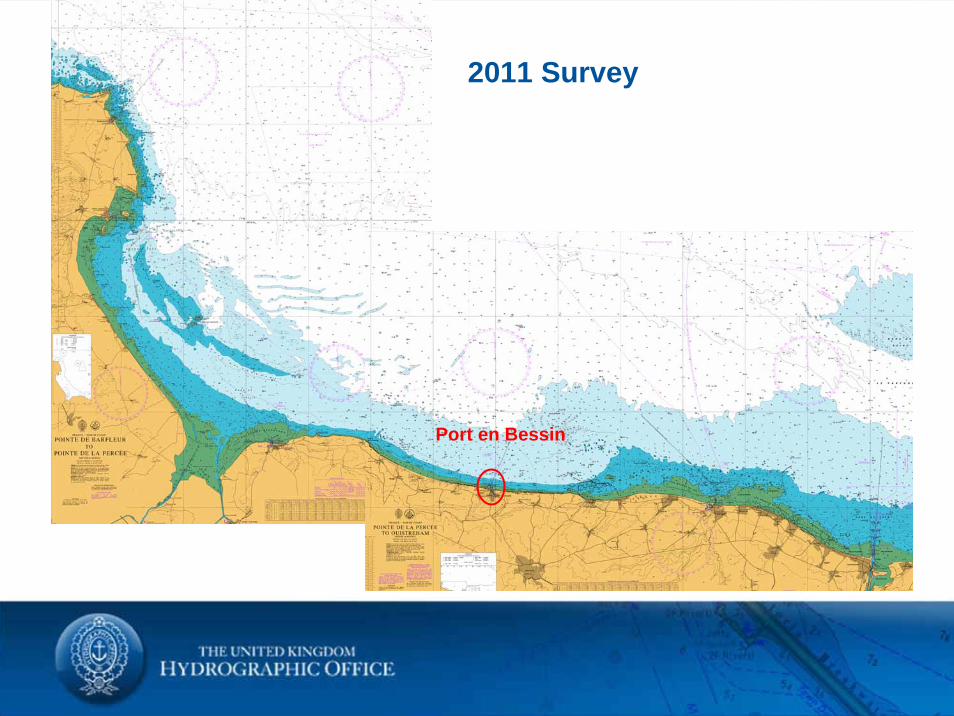
Port en Bessin
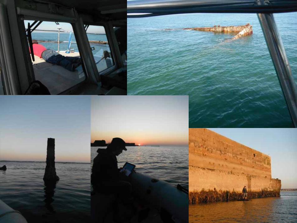
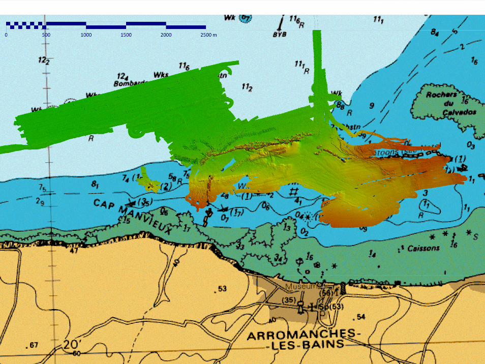
2011 Survey
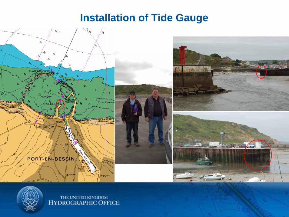
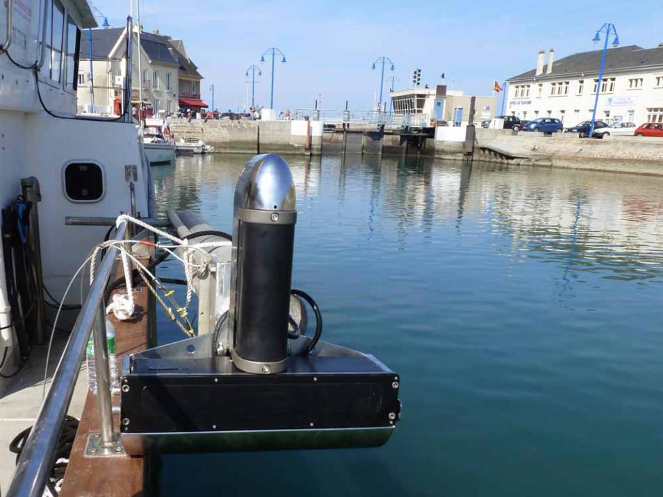
Installation of Tide Gauge
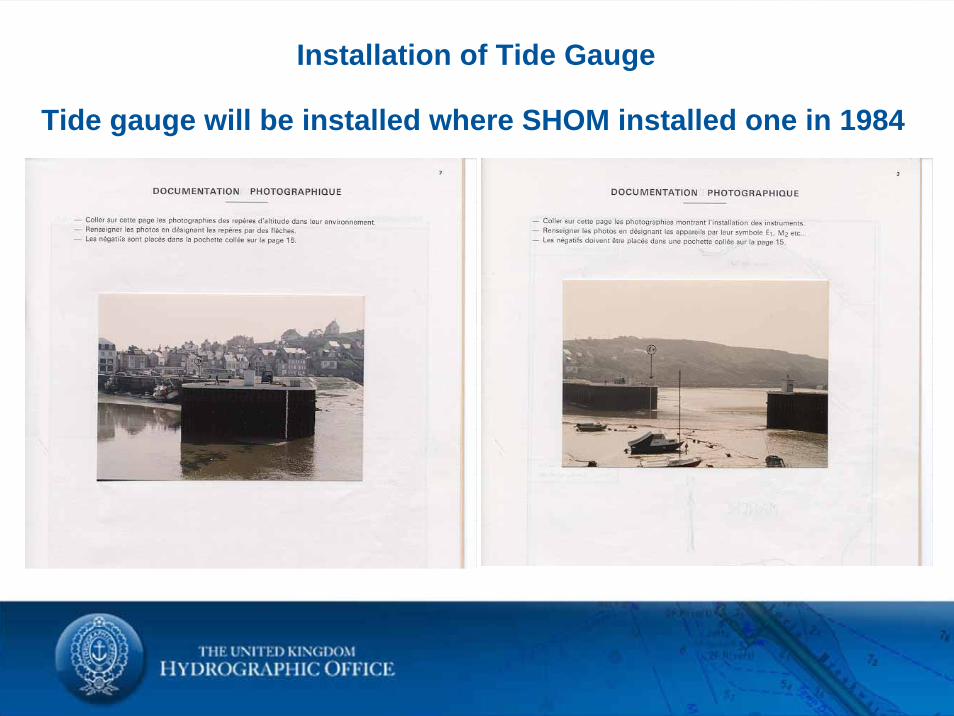
Tide gauge will be installed where SHOM installed one in 1984
Installation of Tide Gauge
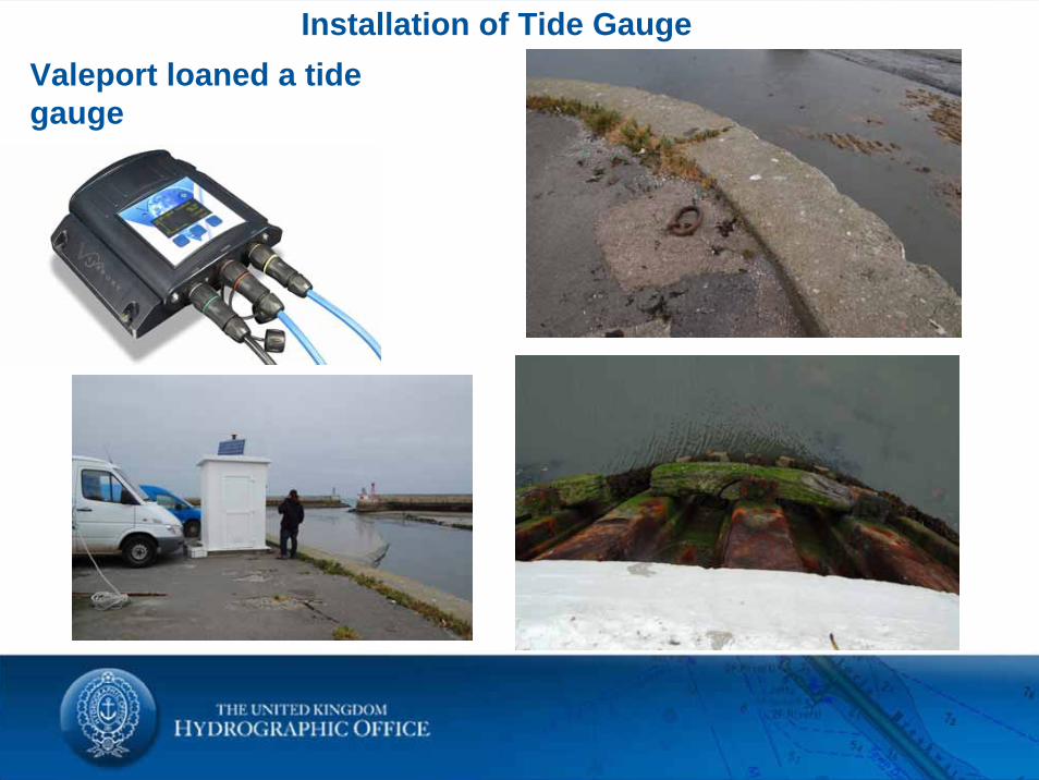
Installation of Tide GaugeValeport loaned a tide gauge
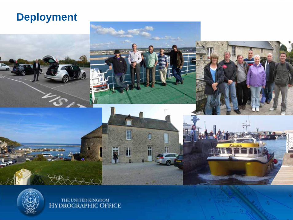
Deployment
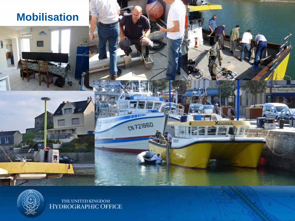
Mobilisation
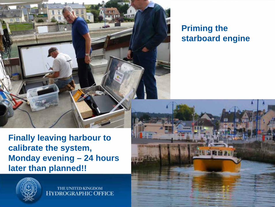
Priming the starboard engine
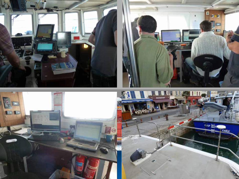
Finally leaving harbour to calibrate the system, Monday evening – 24 hours later than planned!!
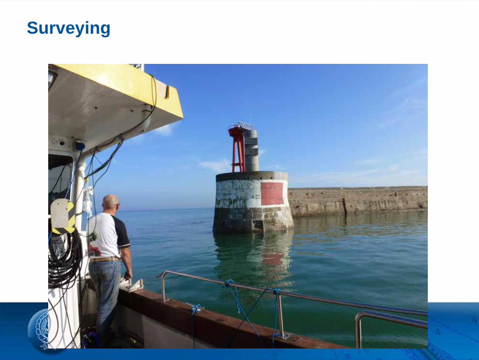
Surveying