Embed Size (px)
DESCRIPTION
US IOOS®: A Partnership for Lives and Livelihoods. Our Planet is Changing. We need advanced tools to understand and monitor our oceans, coasts and Great Lakes . Zdenka Willis Director, US IOOS Program Office. U.S. IOOS ® : Program Overview. WHO. WHAT. Observations Data Management - PowerPoint PPT Presentation
Citation preview
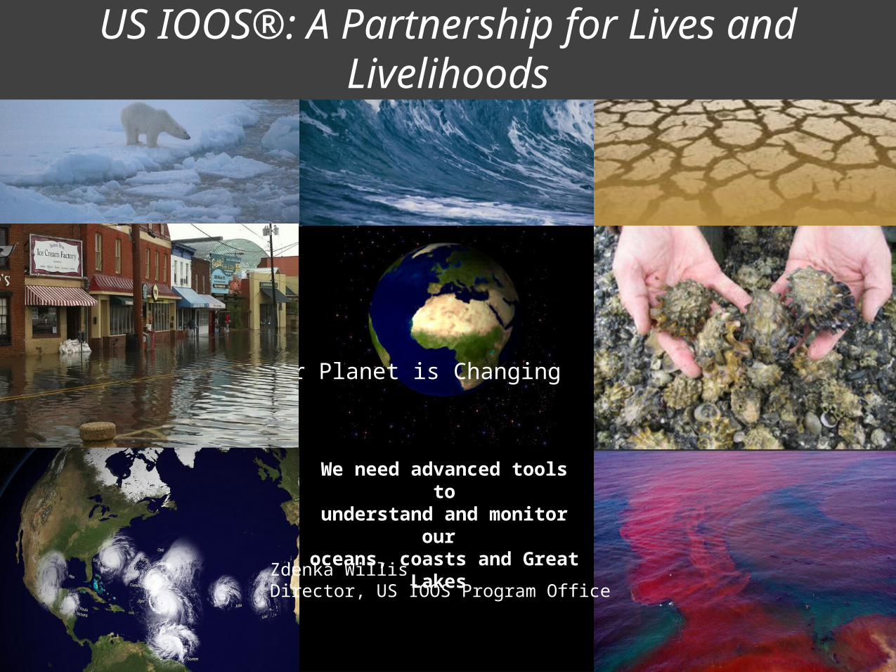
Our Planet is Changing
We need advanced tools tounderstand and monitor our
oceans, coasts and Great Lakes
Zdenka WillisDirector, US IOOS Program Office
US IOOS®: A Partnership for Lives and Livelihoods
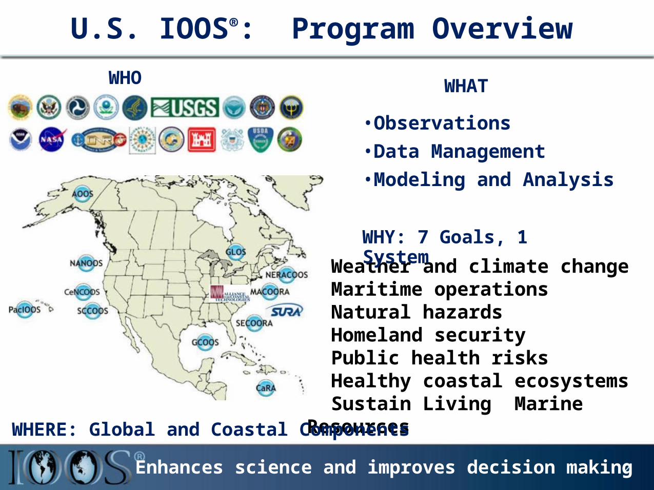
U.S. IOOS®: Program Overview
12
WHO
2Enhances science and improves decision making
Weather and climate changeMaritime operationsNatural hazardsHomeland security Public health risks Healthy coastal ecosystemsSustain Living Marine Resources
WHAT
•Observations•Data Management•Modeling and Analysis
WHY: 7 Goals, 1 System
WHERE: Global and Coastal Components
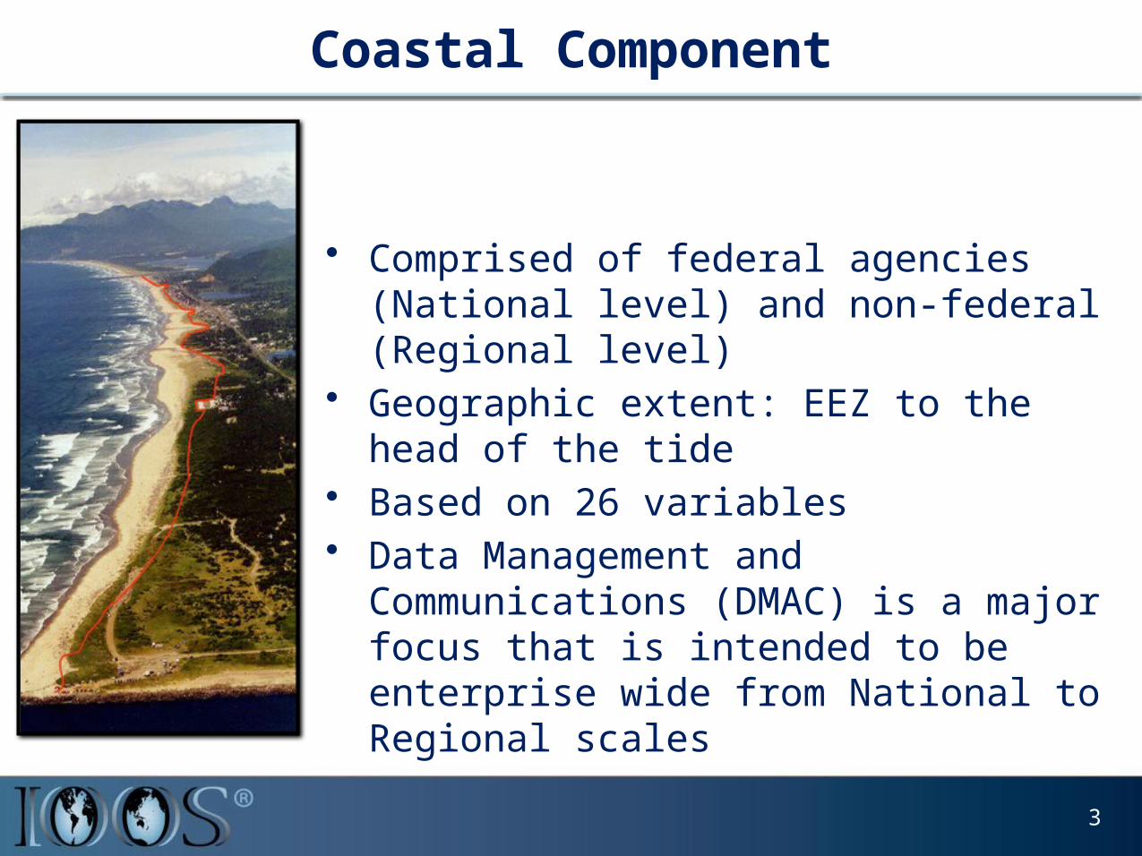
Coastal Component
• Comprised of federal agencies (National level) and non-federal (Regional level)
• Geographic extent: EEZ to the head of the tide• Based on 26 variables• Data Management and Communications
(DMAC) is a major focus that is intended to be enterprise wide from National to Regional scales
3
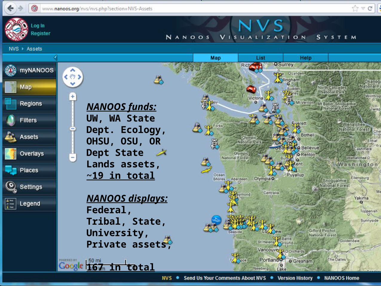
NANOOS funds:UW, WA State Dept. Ecology, OHSU, OSU, OR Dept State Lands assets, ~19 in total
NANOOS displays:Federal, Tribal, State, University, Private assets, 167 in total
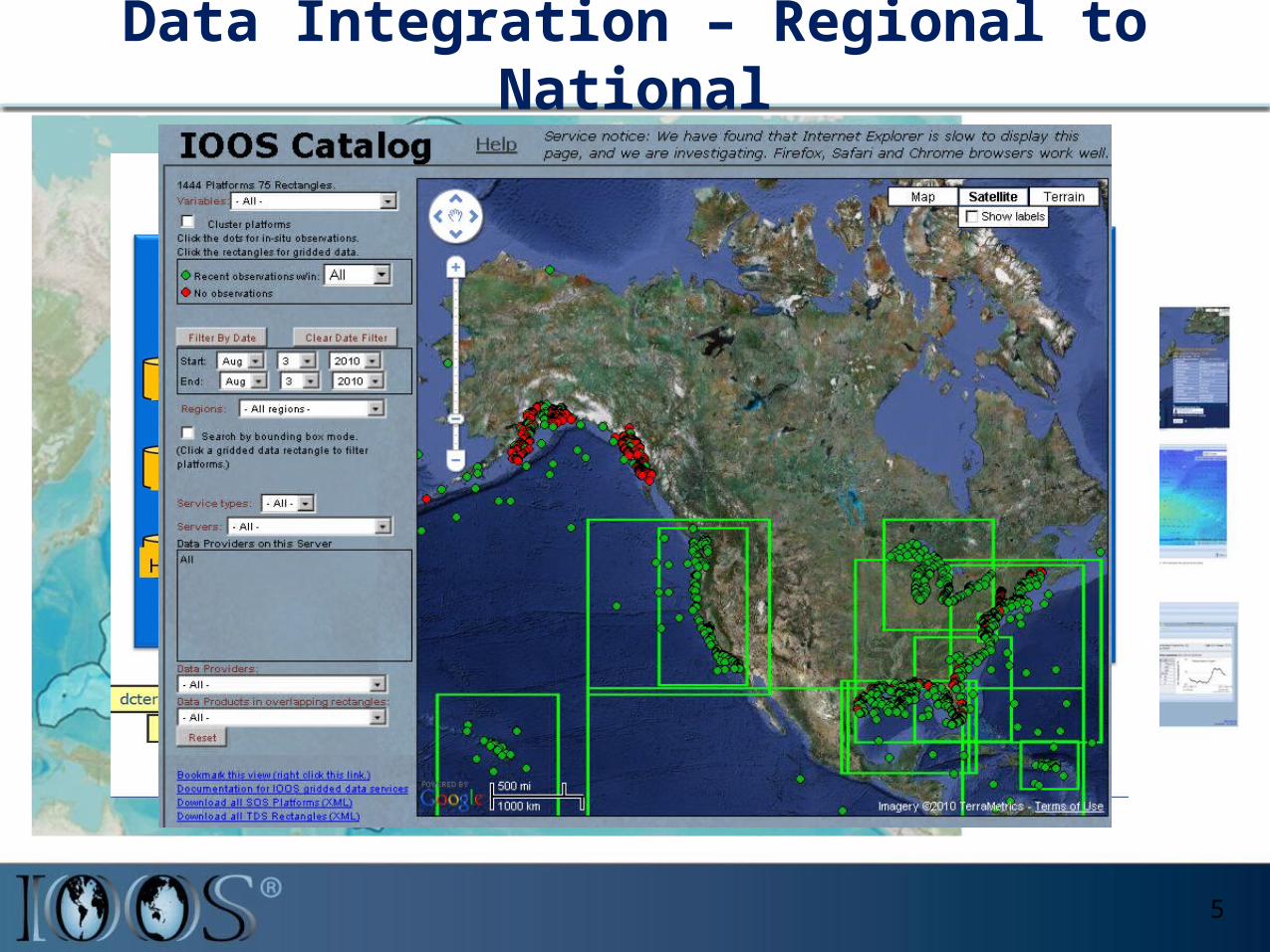
Data Integration – Regional to National
5
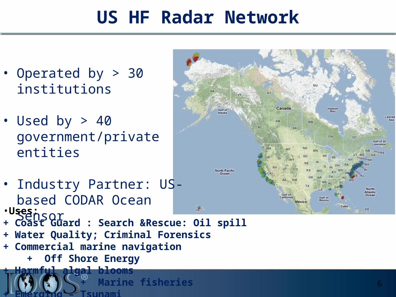
US HF Radar Network
6
• Operated by > 30 institutions • Used by > 40
government/private entities
• Industry Partner: US-based CODAR Ocean Sensor
• Uses: + Coast Guard : Search &Rescue: Oil spill + Water Quality; Criminal Forensics+ Commercial marine navigation + Off Shore Energy+ Harmful algal blooms + Marine fisheries+ Emerging – Tsunami
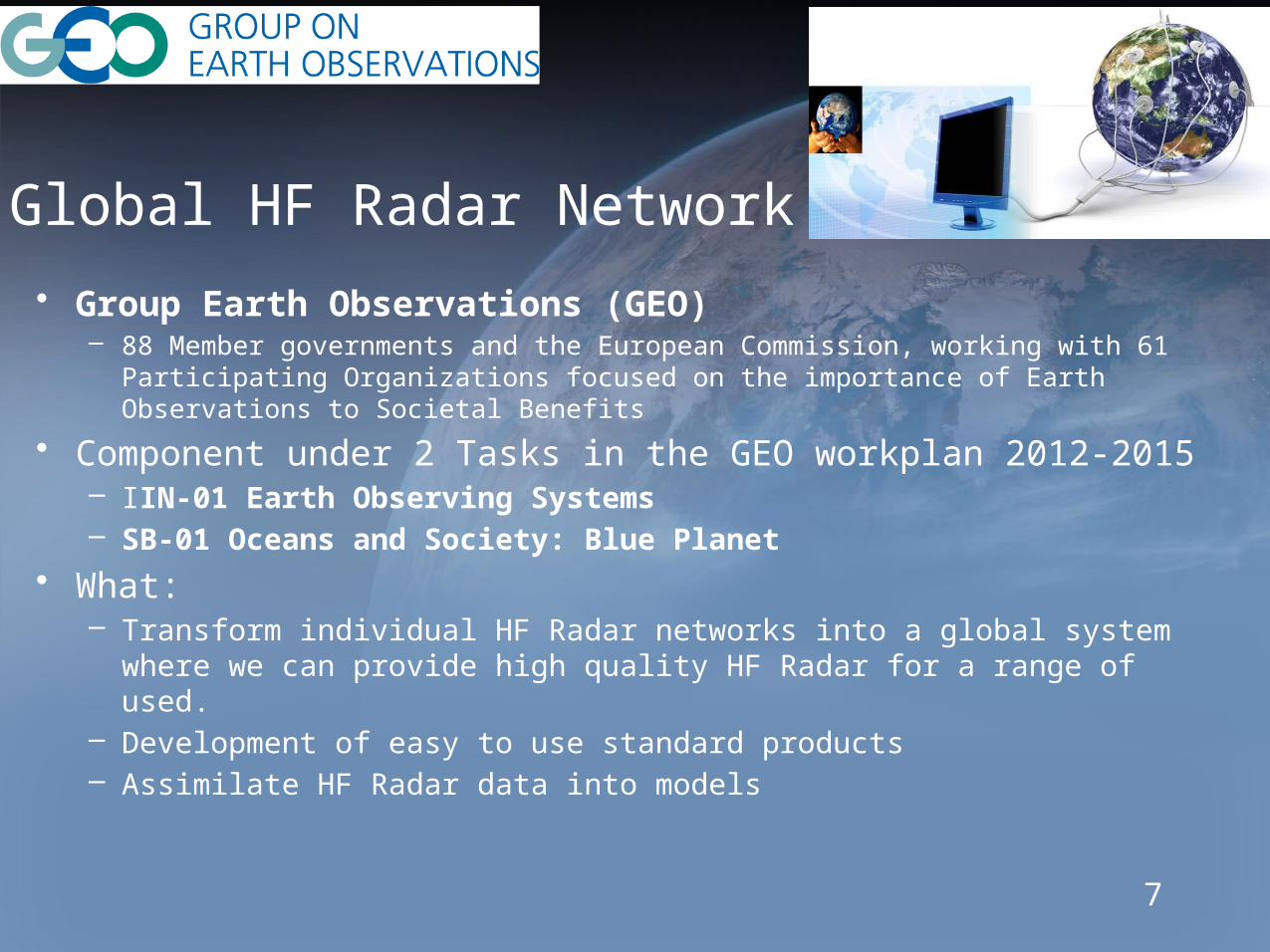
Global HF Radar Network• Group Earth Observations (GEO)
– 88 Member governments and the European Commission, working with 61 Participating Organizations focused on the importance of Earth Observations to Societal Benefits
• Component under 2 Tasks in the GEO workplan 2012-2015– IIN-01 Earth Observing Systems– SB-01 Oceans and Society: Blue Planet
• What: – Transform individual HF Radar networks into a global system where we can
provide high quality HF Radar for a range of used. – Development of easy to use standard products– Assimilate HF Radar data into models
7
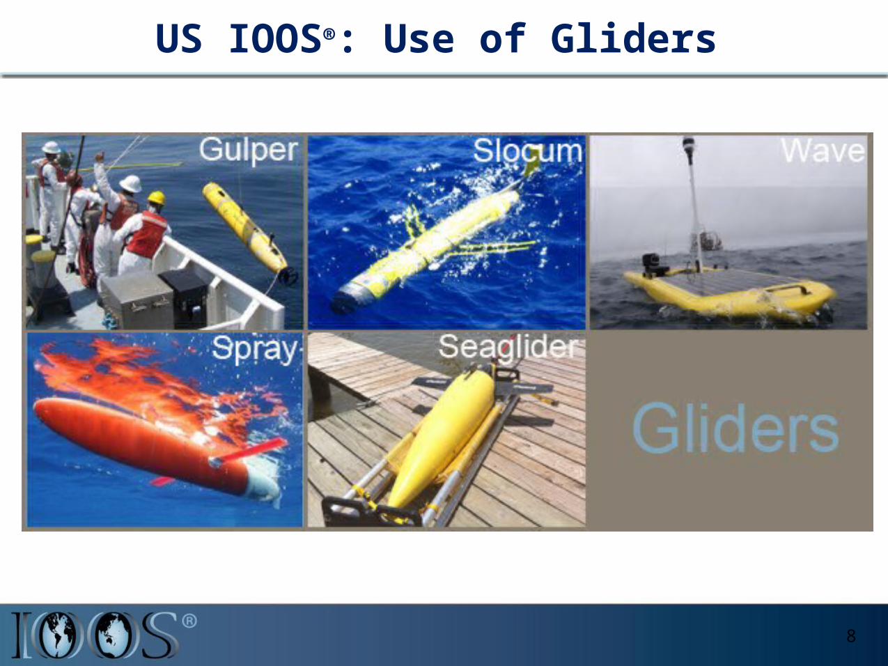
US IOOS®: Use of Gliders
8
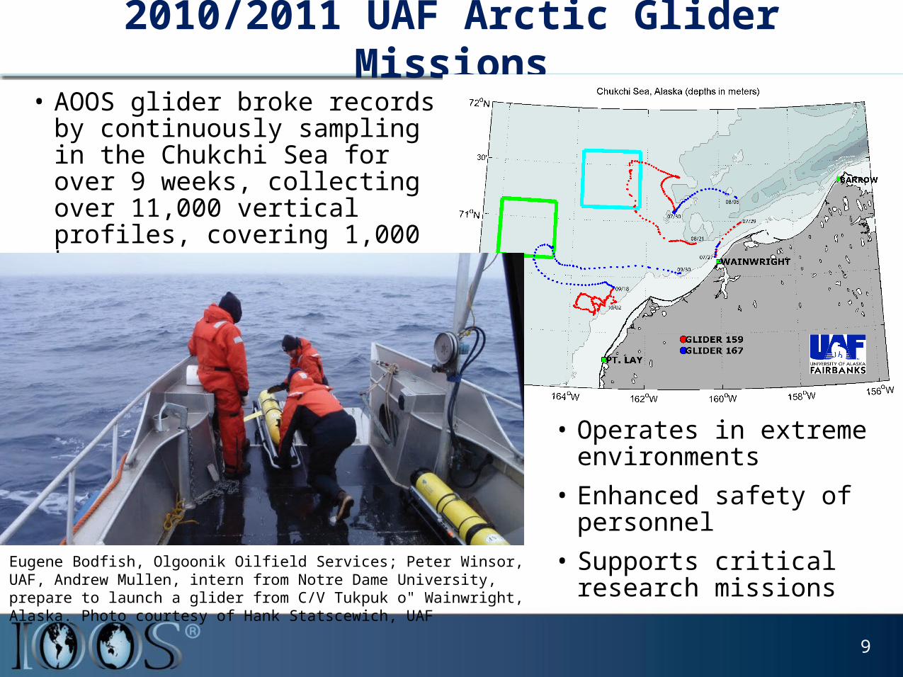
2010/2011 UAF Arctic Glider Missions• AOOS glider broke records by
continuously sampling in the Chukchi Sea for over 9 weeks, collecting over 11,000 vertical profiles, covering 1,000 km.
9
• Operates in extreme environments
• Enhanced safety of personnel
• Supports critical research missions
Eugene Bodfish, Olgoonik Oilfield Services; Peter Winsor, UAF, Andrew Mullen, intern from Notre Dame University, prepare to launch a glider from C/V Tukpuk o" Wainwright, Alaska. Photo courtesy of Hank Statscewich, UAF
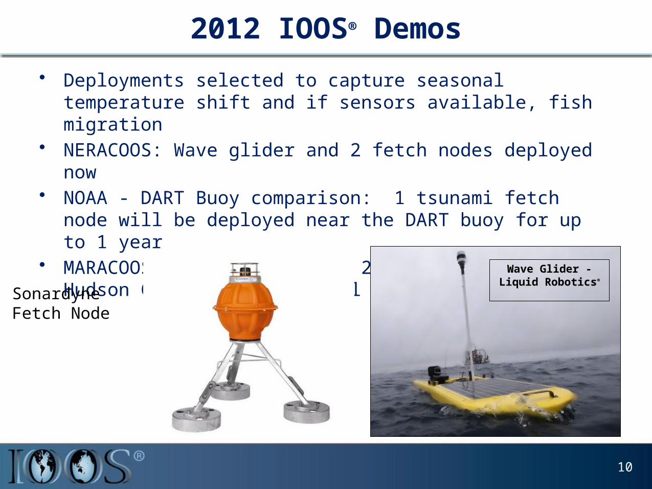
2012 IOOS® Demos• Deployments selected to capture seasonal temperature shift and if
sensors available, fish migration• NERACOOS: Wave glider and 2 fetch nodes deployed now• NOAA - DART Buoy comparison: 1 tsunami fetch node will be deployed
near the DART buoy for up to 1 year • MARACOOS: Wave glider and 2 fetch nodes along Hudson Canyon shelf
in Fall 2012
Wave Glider - Liquid Robotics®
SonardyneFetch Node
10
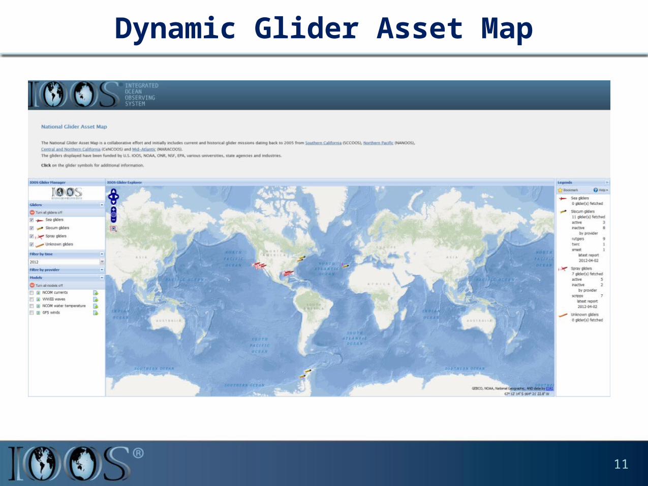
Dynamic Glider Asset Map
11
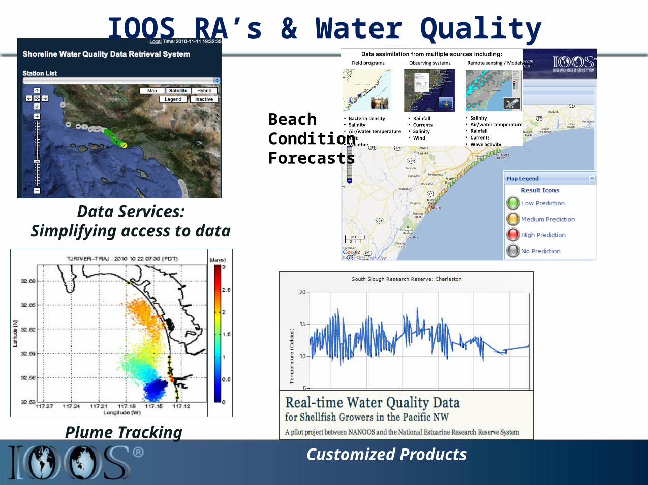
Plume Tracking
Data Services:Simplifying access to data
Customized Products
IOOS RA’s & Water Quality
Beach Condition Forecasts
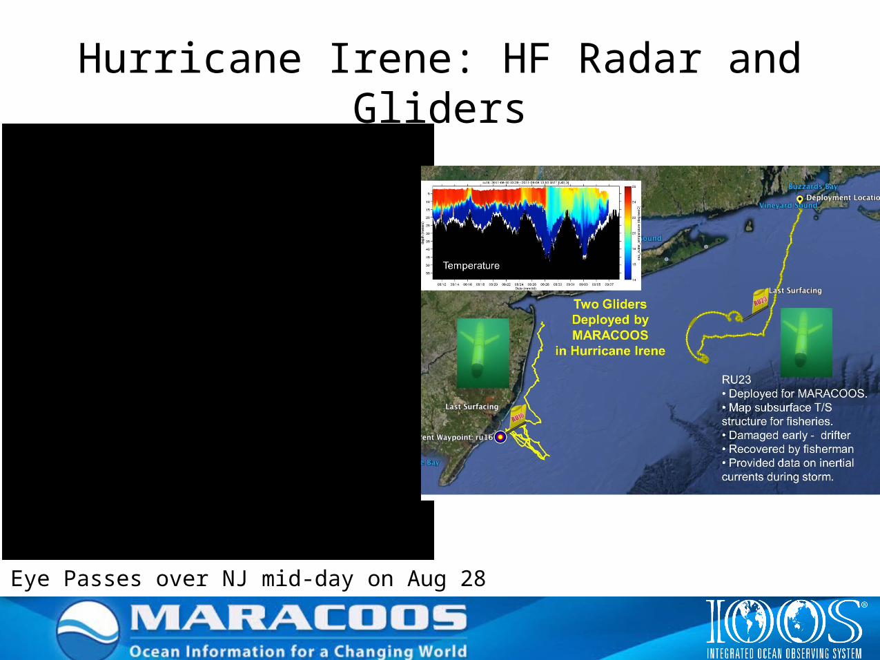
Eye Passes over NJ mid-day on Aug 28
Hurricane Irene: HF Radar and Gliders
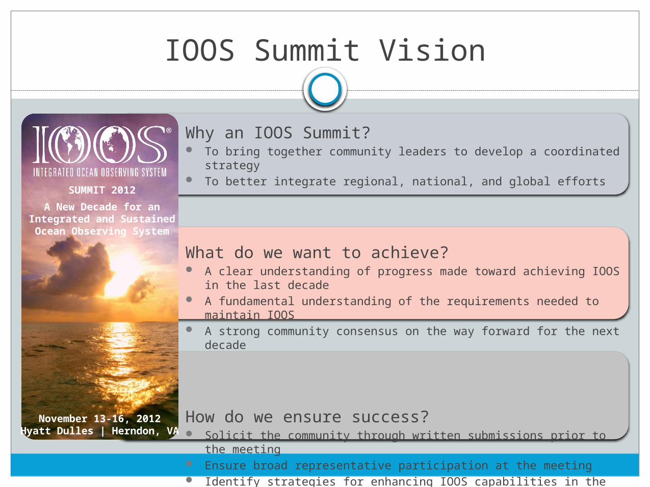
IOOS Summit Vision
Why an IOOS Summit? To bring together community leaders to develop a coordinated strategy To better integrate regional, national, and global efforts
What do we want to achieve? A clear understanding of progress made toward achieving IOOS in the last decade A fundamental understanding of the requirements needed to maintain IOOS A strong community consensus on the way forward for the next decade
How do we ensure success? Solicit the community through written submissions prior to the meeting Ensure broad representative participation at the meeting Identify strategies for enhancing IOOS capabilities in the next decade
A New Decade for anIntegrated and SustainedOcean Observing System
SUMMIT 2012
November 13-16, 2012Hyatt Dulles | Herndon, VA
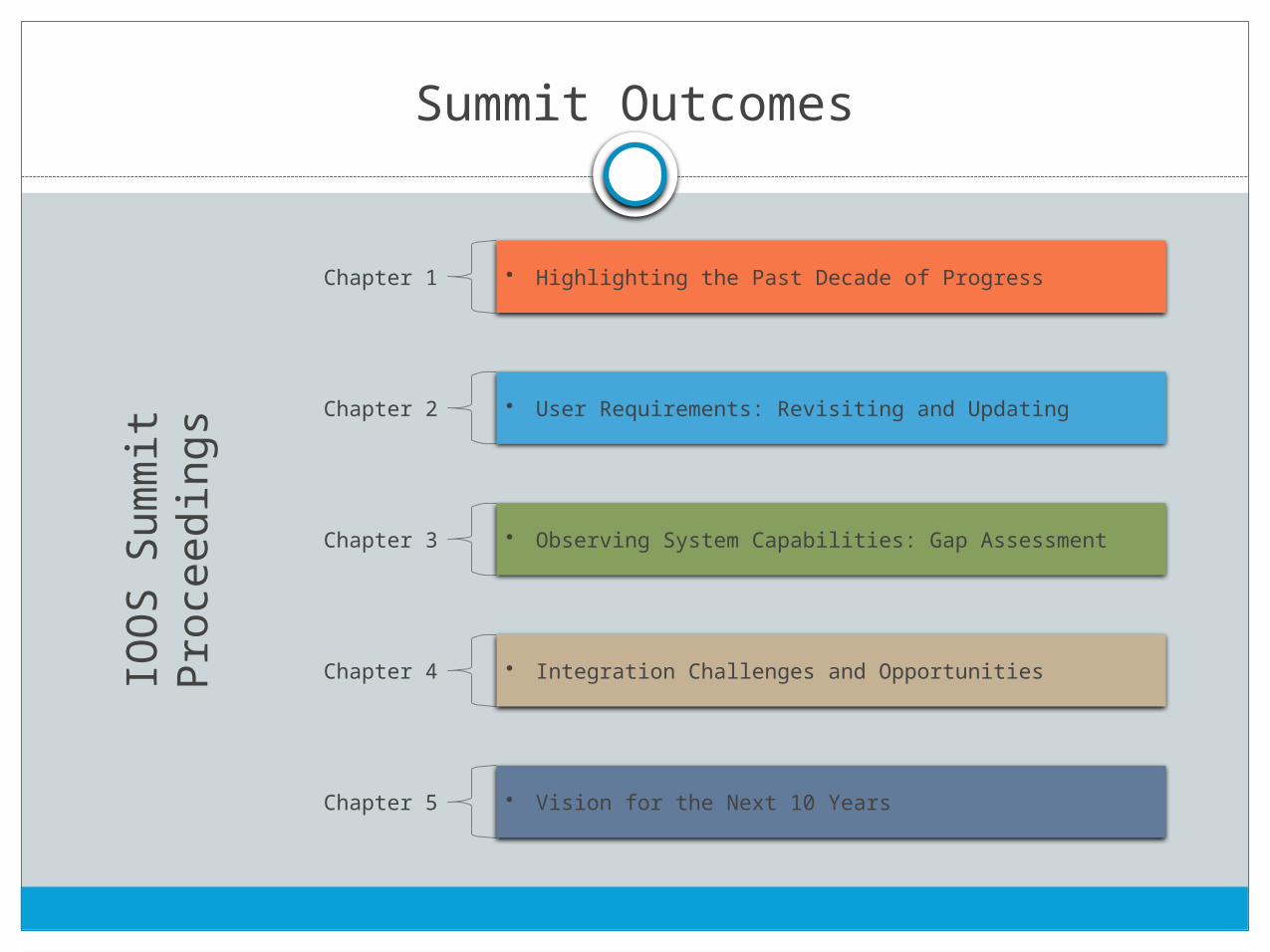
Summit Outcomes
Chapter 1 • Highlighting the Past Decade of Progress
Chapter 2 • User Requirements: Revisiting and Updating
Chapter 3 • Observing System Capabilities: Gap Assessment
Chapter 4 • Integration Challenges and Opportunities
Chapter 5 • Vision for the Next 10 Years
IOO
S Su
mm
it Pr
ocee
ding
s
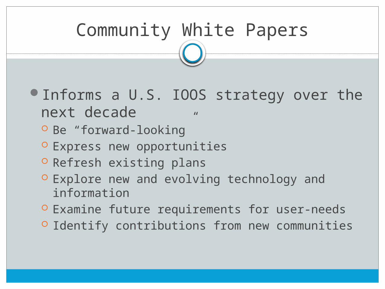
Community White Papers
Informs a U.S. IOOS strategy over the next decade Be “forward-looking” Express new opportunities Refresh existing plans Explore new and evolving technology and information Examine future requirements for user-needs Identify contributions from new communities
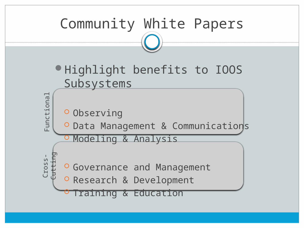
Community White PapersFu
nctio
nal
Cros
s-Cu
tting
Highlight benefits to IOOS Subsystems
Observing Data Management & Communications Modeling & Analysis
Governance and Management Research & Development Training & Education
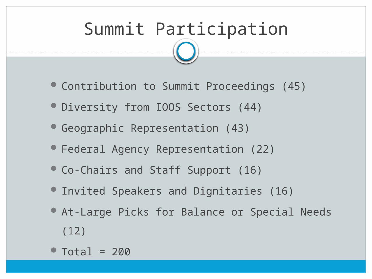
Summit Participation
Contribution to Summit Proceedings (45)
Diversity from IOOS Sectors (44)
Geographic Representation (43)
Federal Agency Representation (22)
Co-Chairs and Staff Support (16)
Invited Speakers and Dignitaries (16)
At-Large Picks for Balance or Special Needs (12)
Total = 200
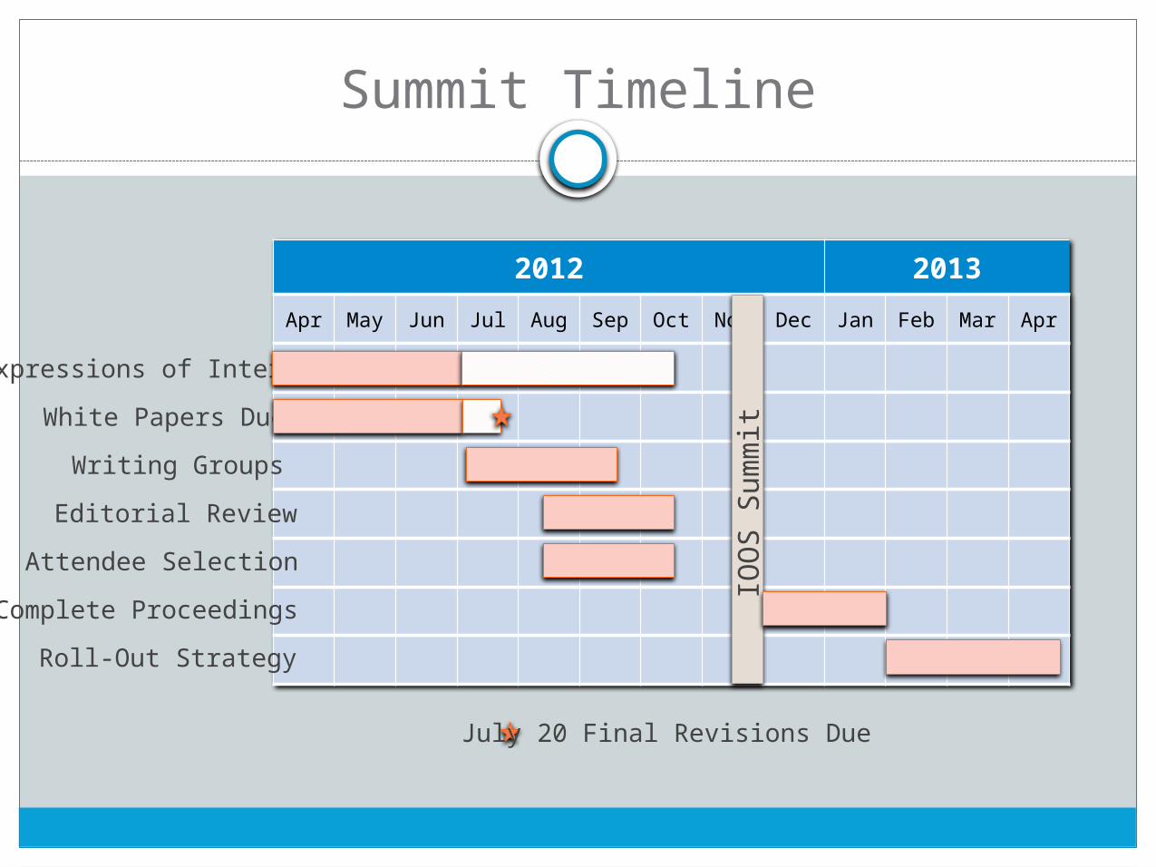
Summit Timeline
2012 2013Apr Ma
y Jun Jul Aug
Sep Oct No
vDec Jan Feb Ma
r Apr
White Papers DueWriting Groups
Editorial ReviewAttendee Selection
Complete ProceedingsRoll-Out Strategy
IOOS
Sum
mit
Expressions of Interest
July 20 Final Revisions Due
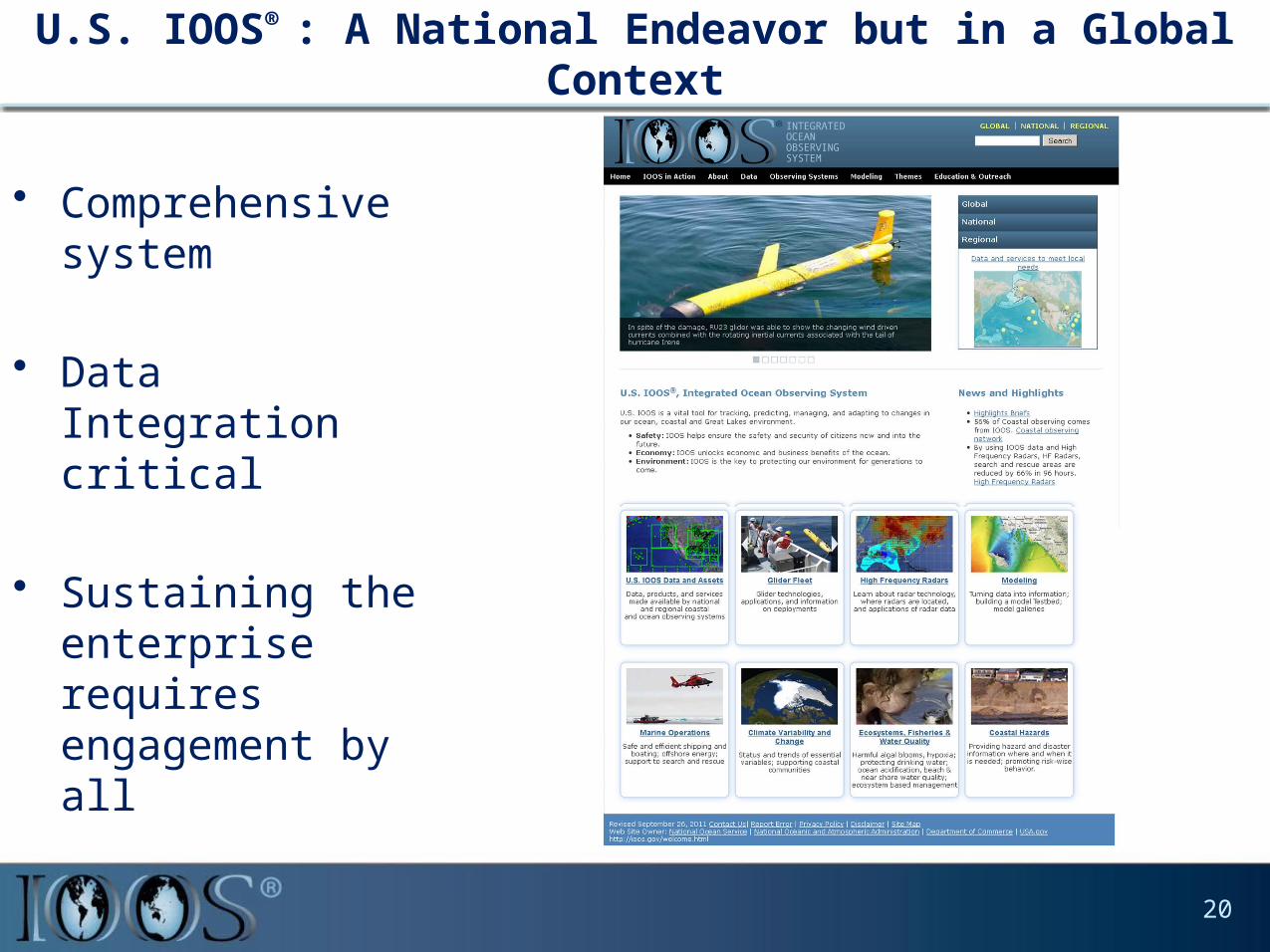
U.S. IOOS® : A National Endeavor but in a Global Context
• Comprehensive system
• Data Integration critical
• Sustaining the enterprise requires engagement by all
20